-
Earthquake Casualties and Damage - Figures received on 24/08/2021
Département: Map showing earthquake damage and casualties with numbers from the Haitian Civil Protection General Directorate (DGPC). Figures were received on 24 Aug 2021. -

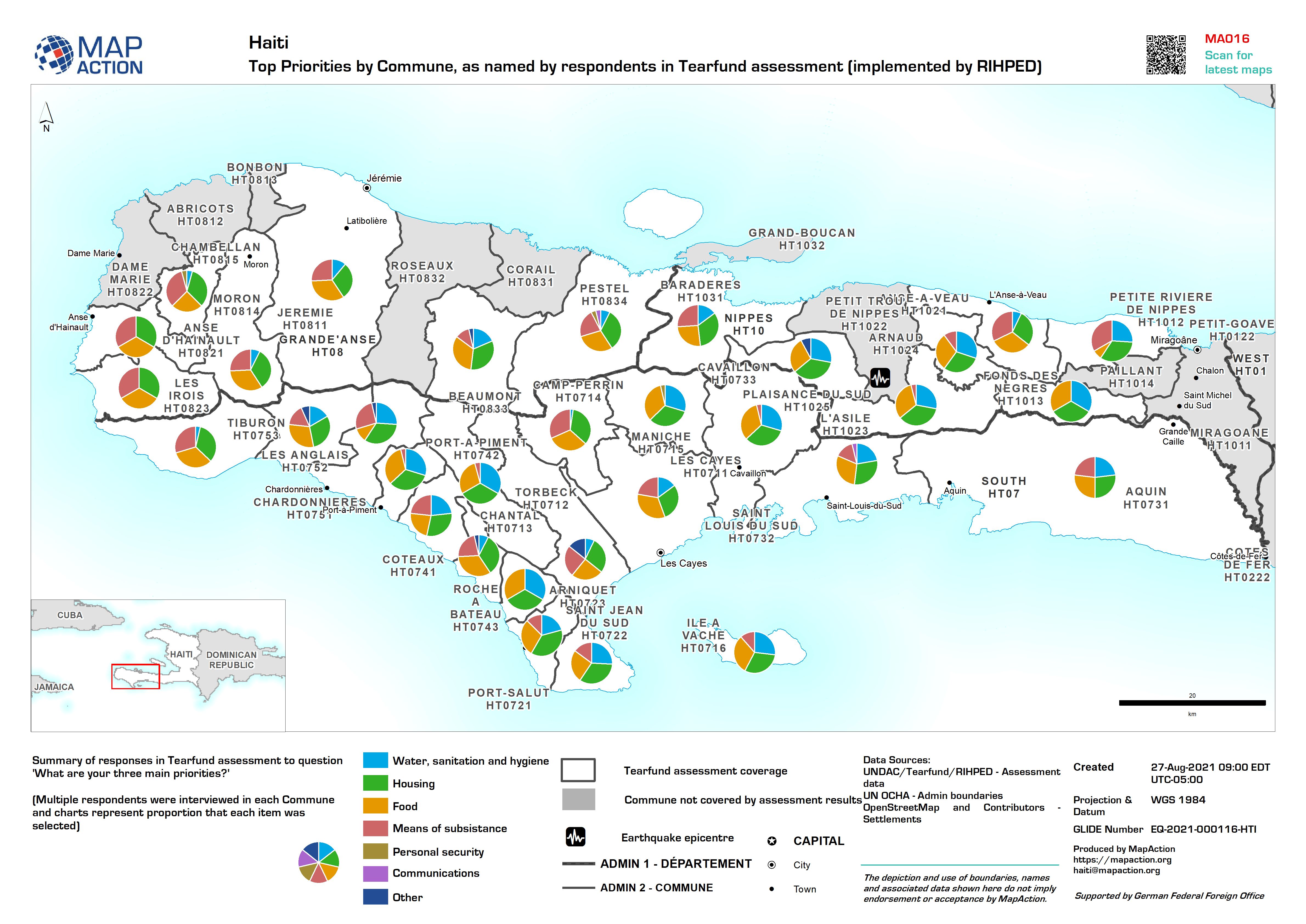
Top Priorities by Commune, as named by respondents in Tearfund assessment (im...
Summary of responses in Tearfund assessment to question 'What are your three main priorities?' (Multiple respondents were interviewed in each Commune and charts represent... -

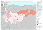
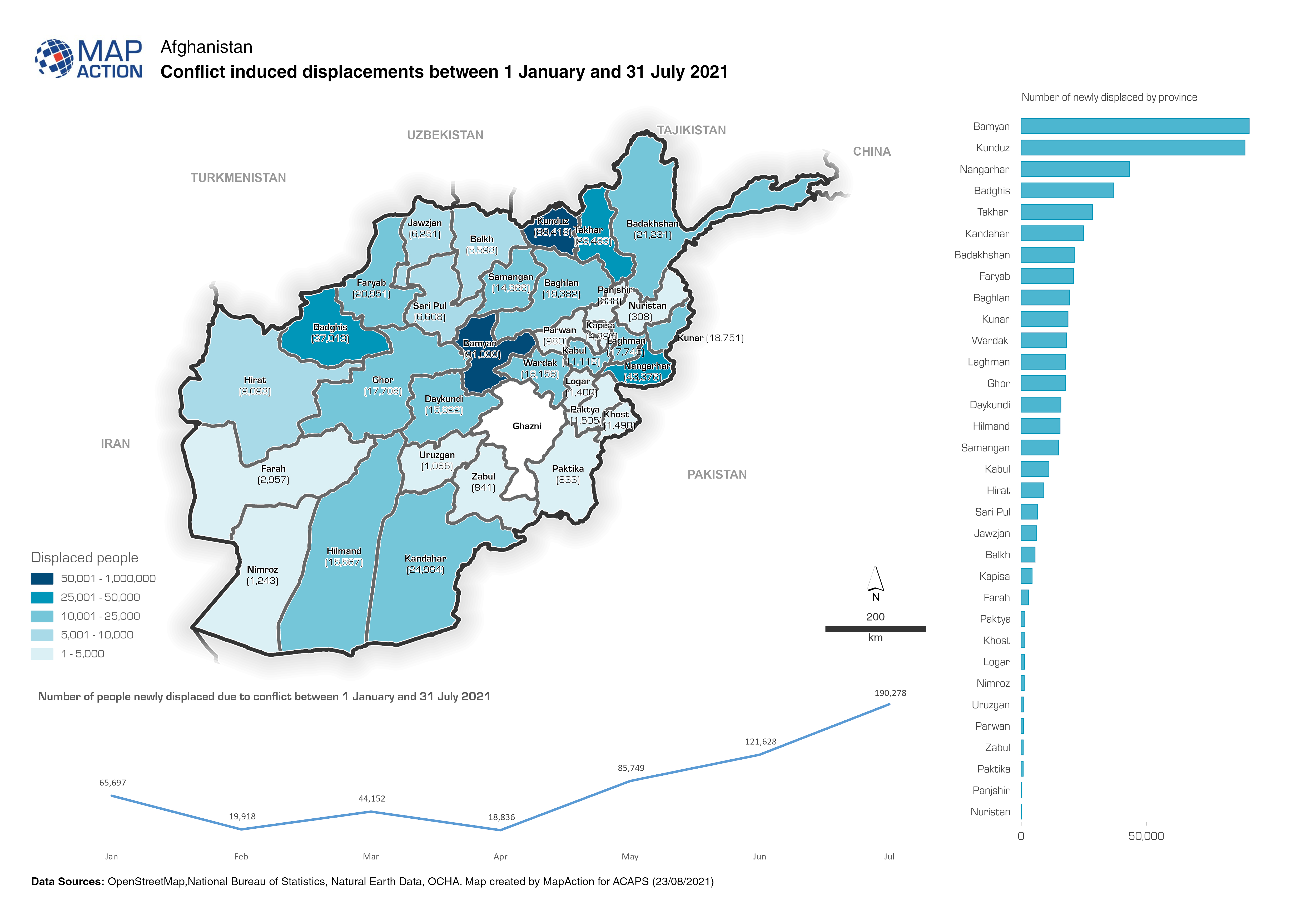
Afghanistan: Conflict induced displacements between 1 January and 31 July 2021
Map shows the number of people newly displaced due to conflict between 1 January and 31 July 2021 -

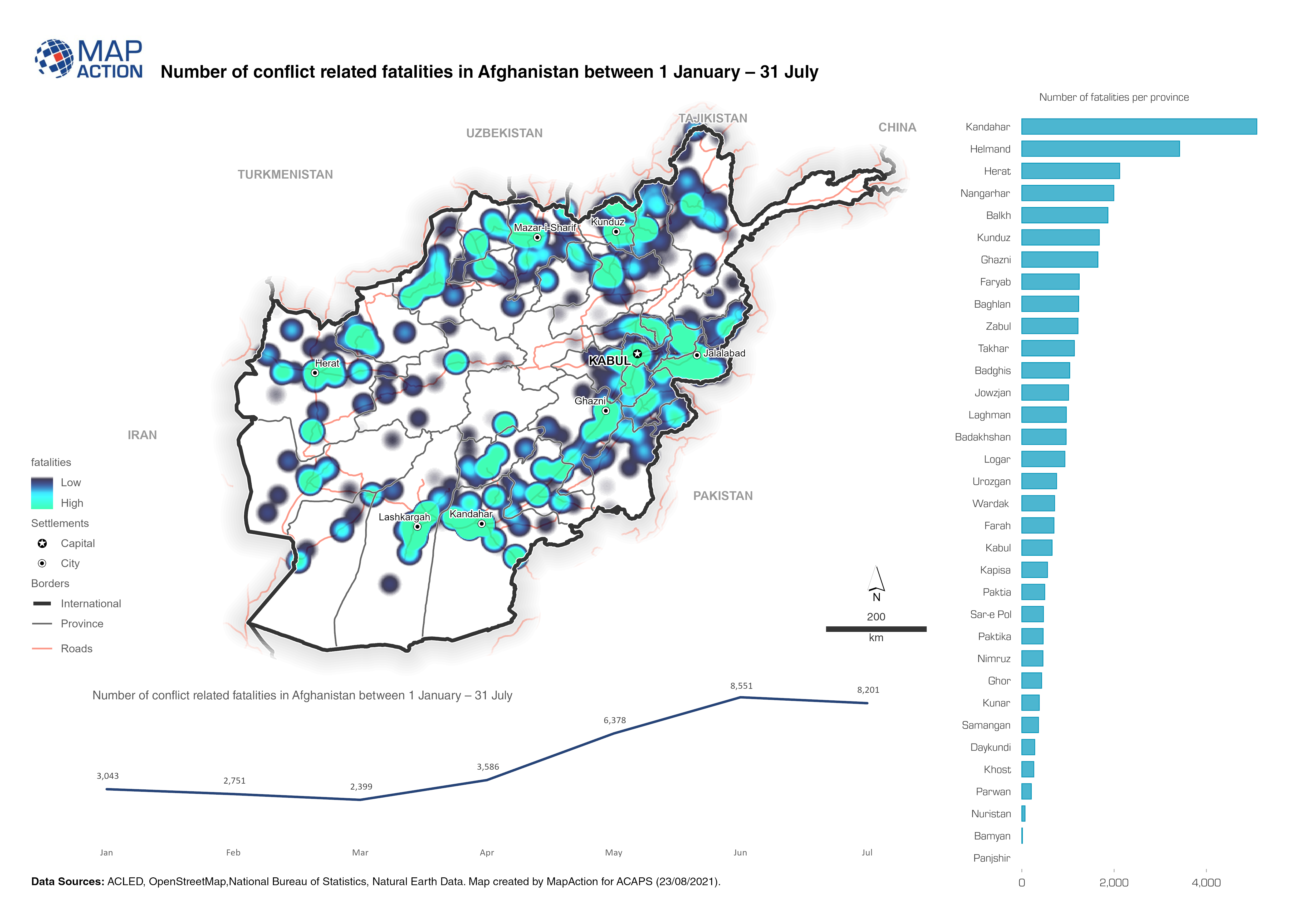
Afghanistan: Number of fatalities per event type (1 January to 31 July 2021)
The map provides an overview of different security related incidents and fatalities. -
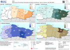
Iraq: Tracking change in numbers of IDPs (August 2018 to August 2020)
Maps show the number of displaced people and the change between years. -

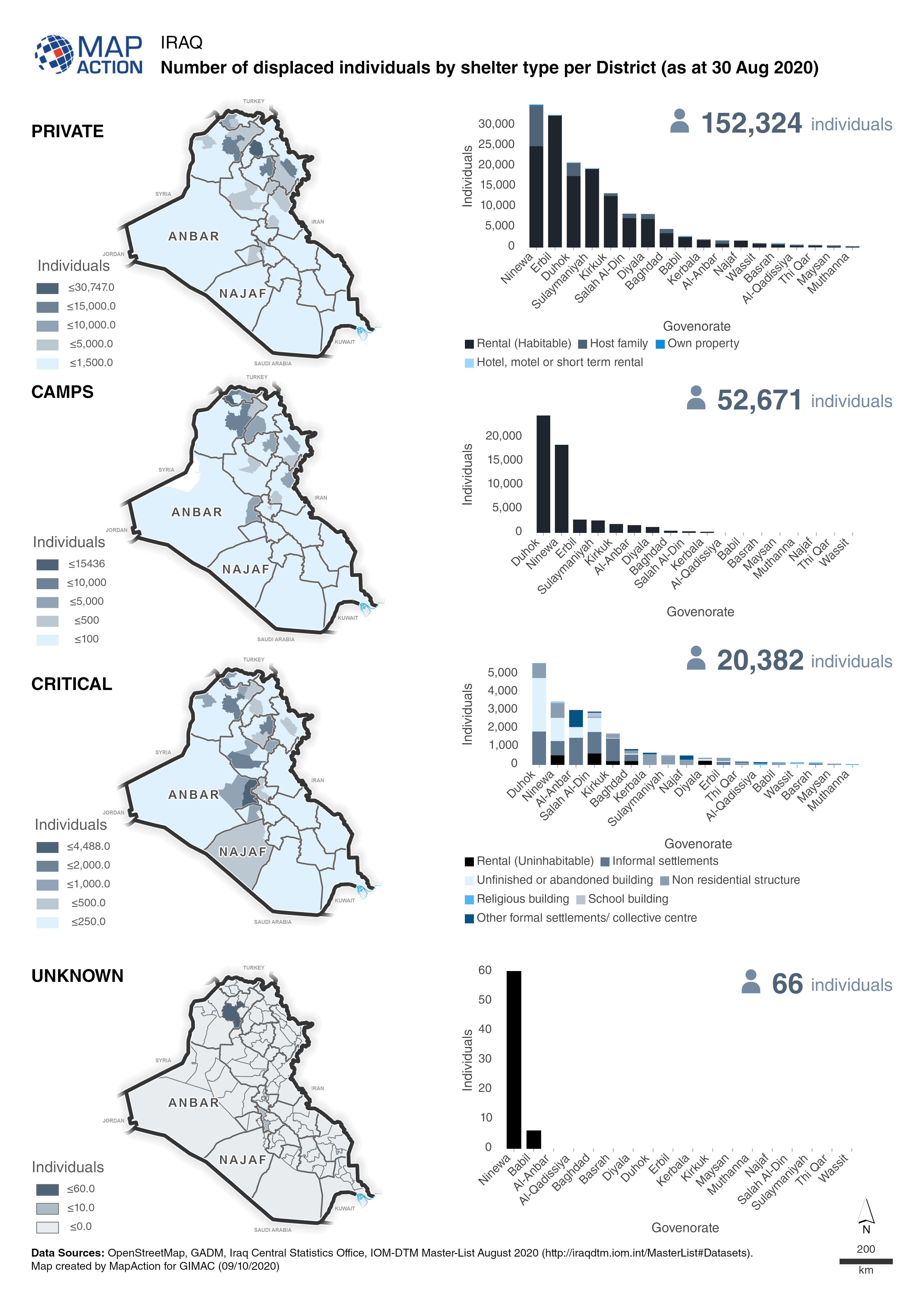
Iraq: Number of displaced individuals by shelter type per district (as at 30 ...
Maps and charts show a breakdown of the number displaced individuals in private accomodation, camps, critical shelters or unknown. -
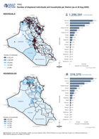
Iraq: Number of displaced individuals and households per district (as at 30 A...
Map shows the number of displaced individuals and households per district in Iraq. -

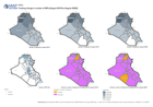
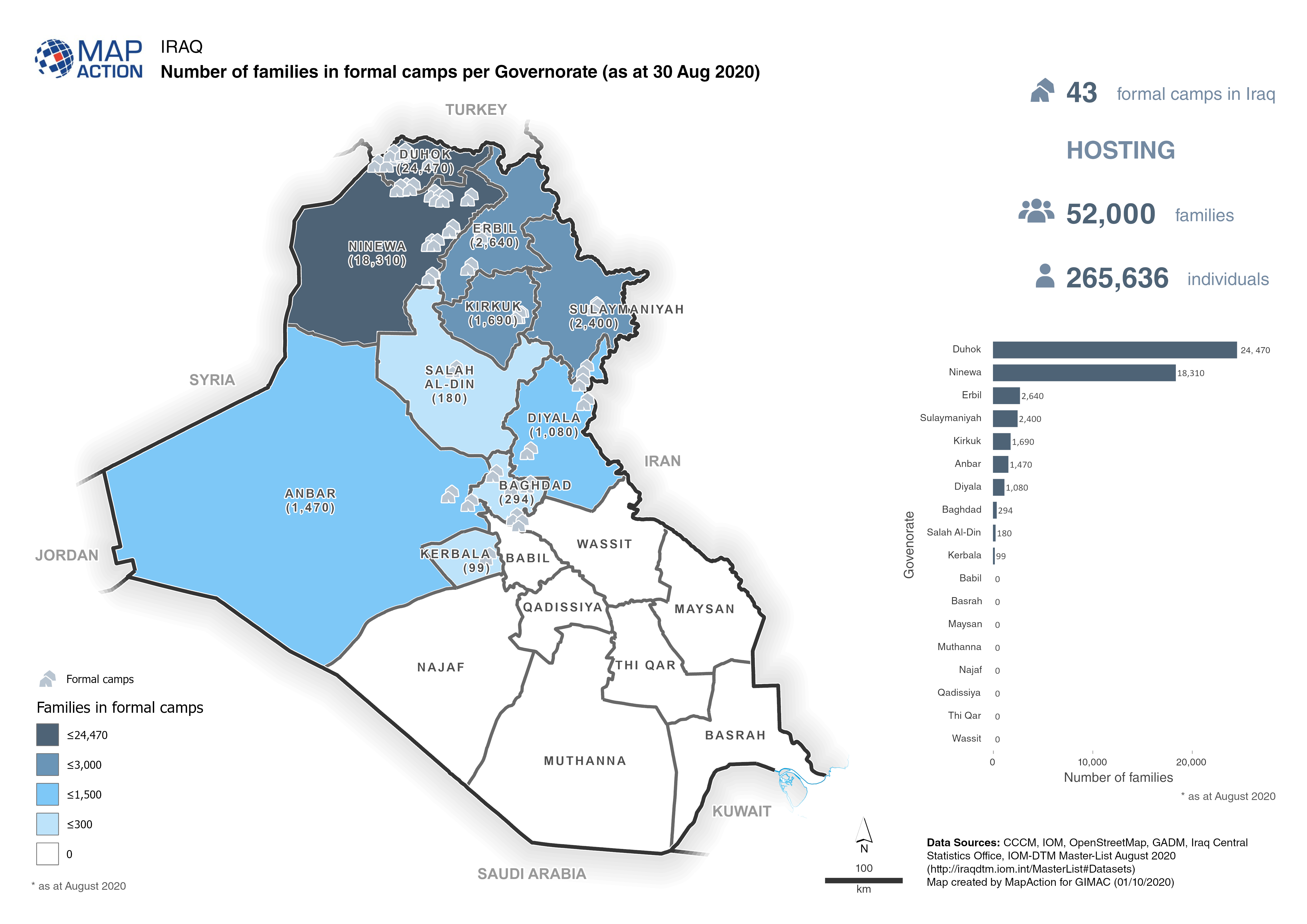
Iraq: Number of families in formal camps per Governorate (as at 30 Aug 2020)
Map shows the number of families and the locations of formal camps in Iraq. -
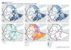
Ethiopia: Tracking change in numbers of IDPs (January 2018 to January 2020)
Maps show the number of displaced people and the change between years. -

Population Distribution, Density, Households affected and Humanitarian Assist...
Map shows the population distribution across the regions of Guyana as well as the population density per km2. The left map shows the affected households per regions while the... -
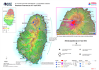
Situational Overview (as of 21 April 2021)
Map shows the situational overview of the current events and activities as a result of the ongoing eruption of the La Soufrière volcano. -

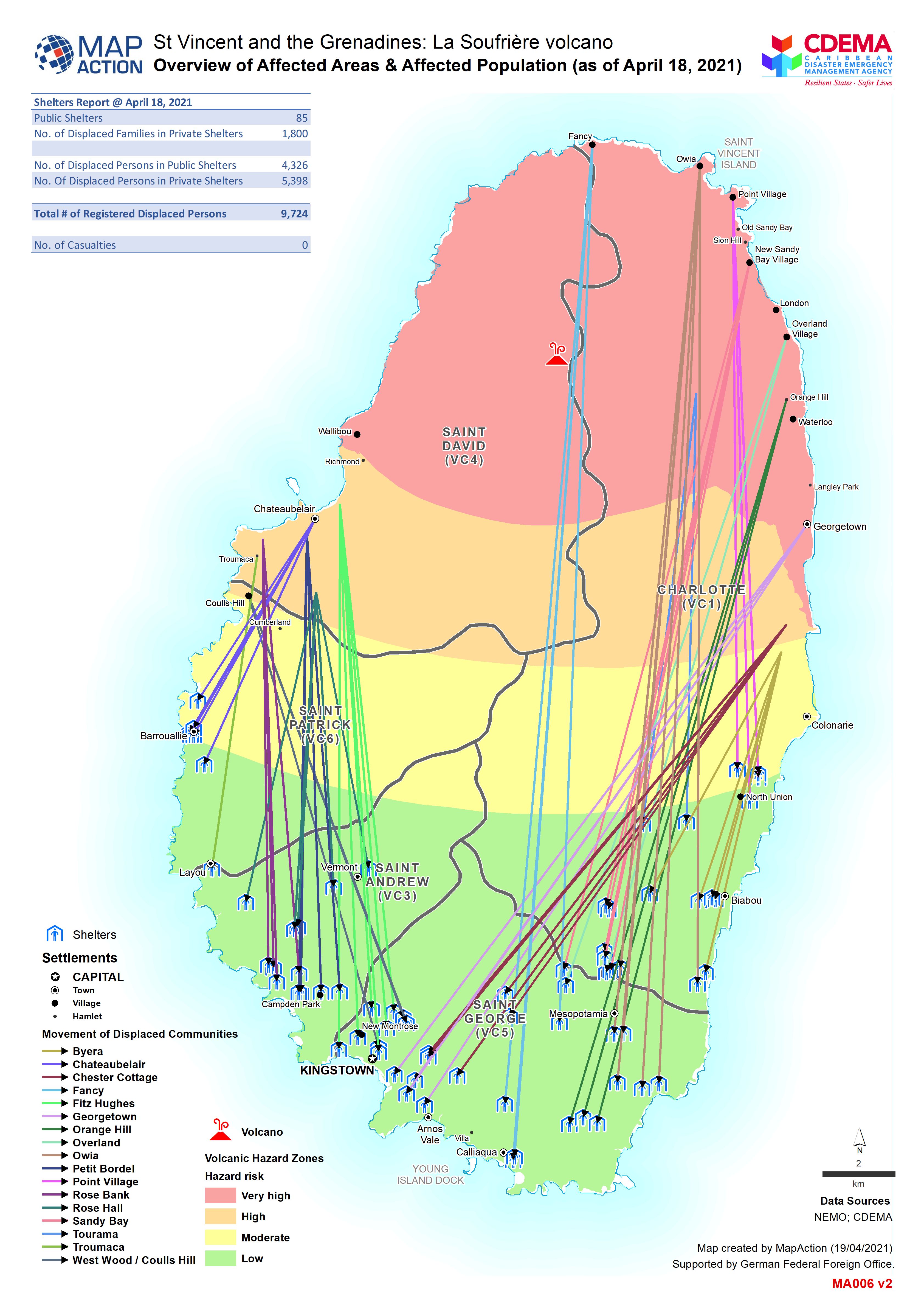
Overview of Affected Areas & Affected Population (as of 18 Apr 2021)
Map shows movement of displaced persons from affected communities. -

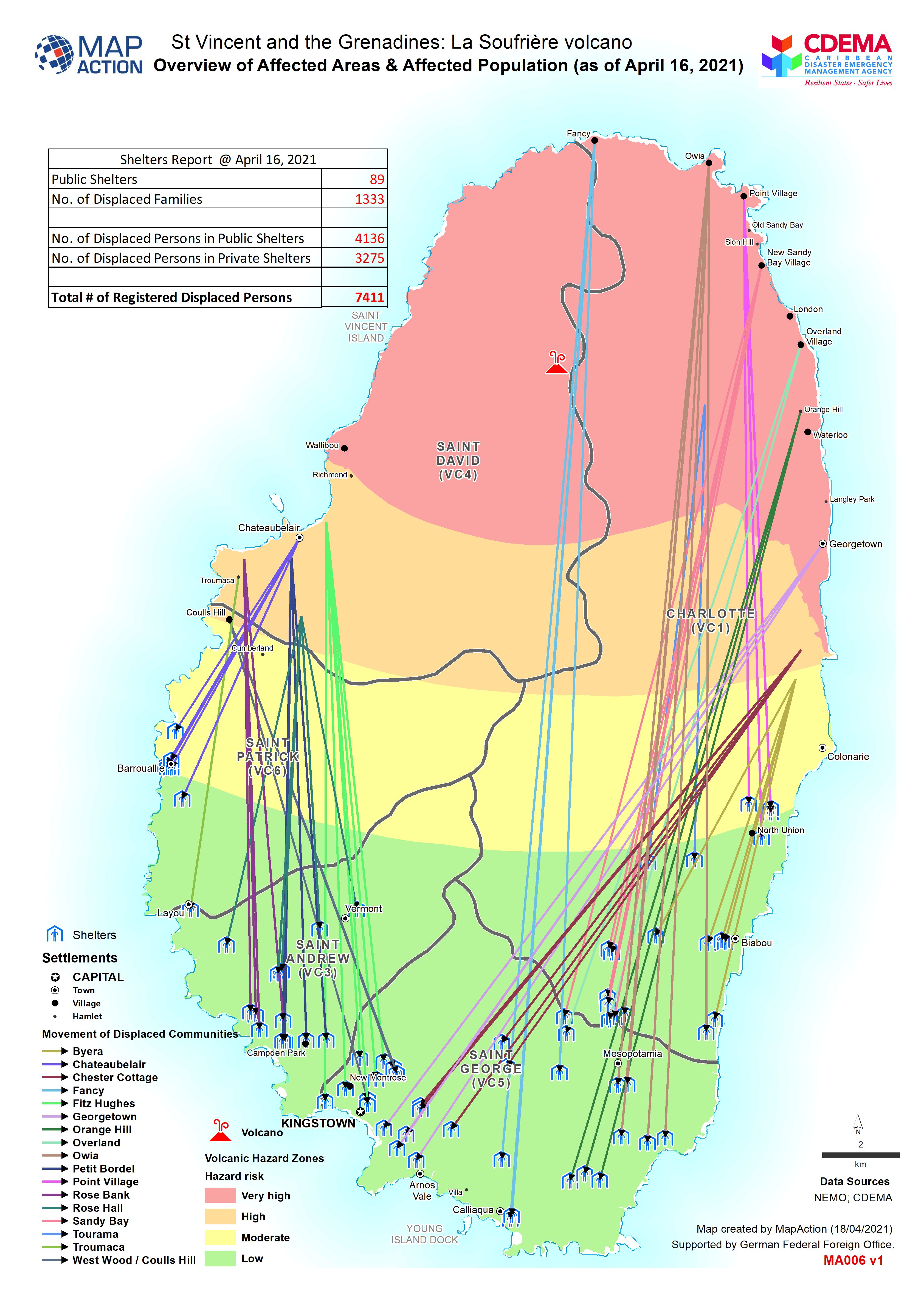
Overview of Affected Areas & Affected Population (as of April 16, 2021)
Map shows movement of displaced persons from affected communities. -
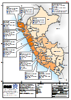
Peru: Emergencia por Temporada de Lluvias - Personas Damnificadas por Departa...
El mapa muestra la afectacion por la temporada de lluvias, diciembre 2016 a marzo 2017. Provincias en 12 departamentos han sido declaradas en Estato de Emergencia. Actualizado... -
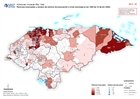
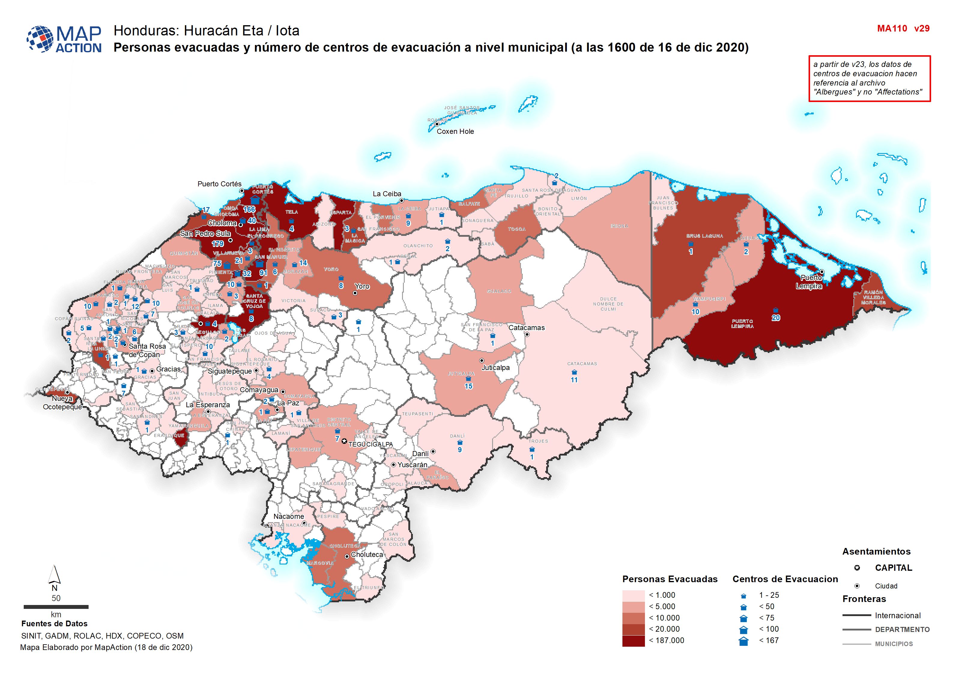
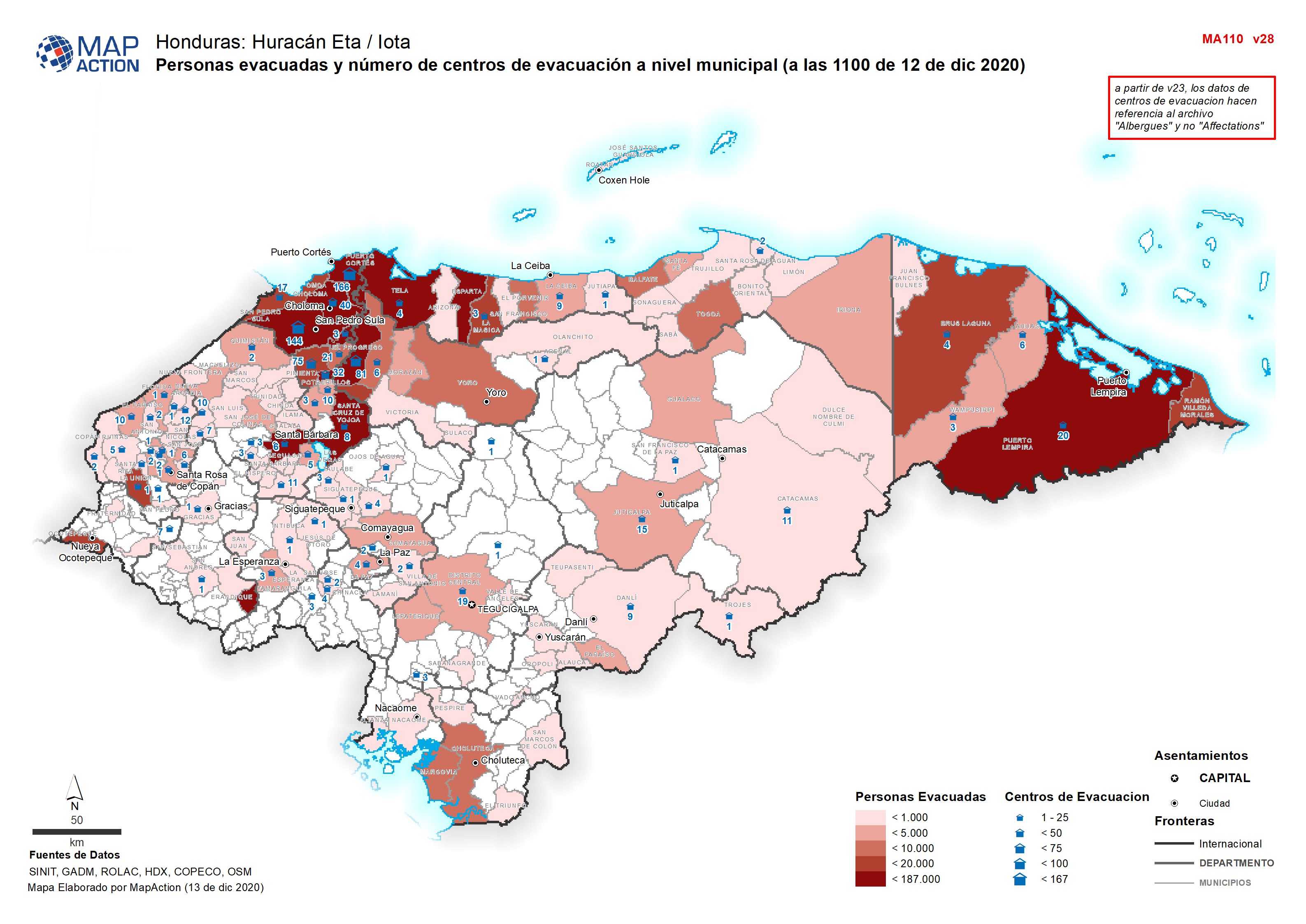
Personas evacuadas y número de centros de evacuación a nivel municipal (a las...
Personas evacuadas y número de centros de evacuación a nivel municipal (a 03 Diciembre 2020 -

Presencia humanitaria: quién hace qué, dónde en cada municipio. Departmento: ...
Mapbook shows who is delivering Sector activities, per Municipality in Honduras. Population density, number of shelters and occupants per Municipality -

Personas evacuadas y número de centros de evacuación a nivel municipal (a las...
Personas evacuadas y número de centros de evacuación a nivel municipal (a 03 Diciembre 2020 -
Presencia humanitaria: quién hace qué, dónde en cada municipio por department...
Mapbook shows who is delivering Sector activities, per Municipality in Honduras. Population density, number of shelters and occupants per Municipality -

Presencia humanitaria: quién hace qué, dónde en cada municipio, por departmen...
Mapbook shows the number of reported activities per Sector, and who is delivering them, per Municipality in Honduras. Critical and High priority response areas are also shown,... -

Presencia humanitaria: quién hace qué, dónde en cada municipio por department...
Mapbook shows who is delivering Sector activities, per Municipality in Honduras. Population density, number of shelters and occupants per Municipality