-

Guatemala: Personas fallecidas y desaparecidas por Municipio en Izabal (al 27...
Personas fallecidas y desaparecidas por Municipio en Izabal (al 27 Nov 2020) -
Guatemala: Personas fallecidas y desaparecidas por Municipio en Alta Verapaz ...
Personas fallecidas y desaparecidas por Municipio en Alta Verapaz (al 27 Nov 2020) -
Guatemala: Personas evacuadas y personas en albergues por Municipio en Izabal...
Personas evacuadas y personas en albergues por Municipio en Izabal (al 27 Nov 2020) -
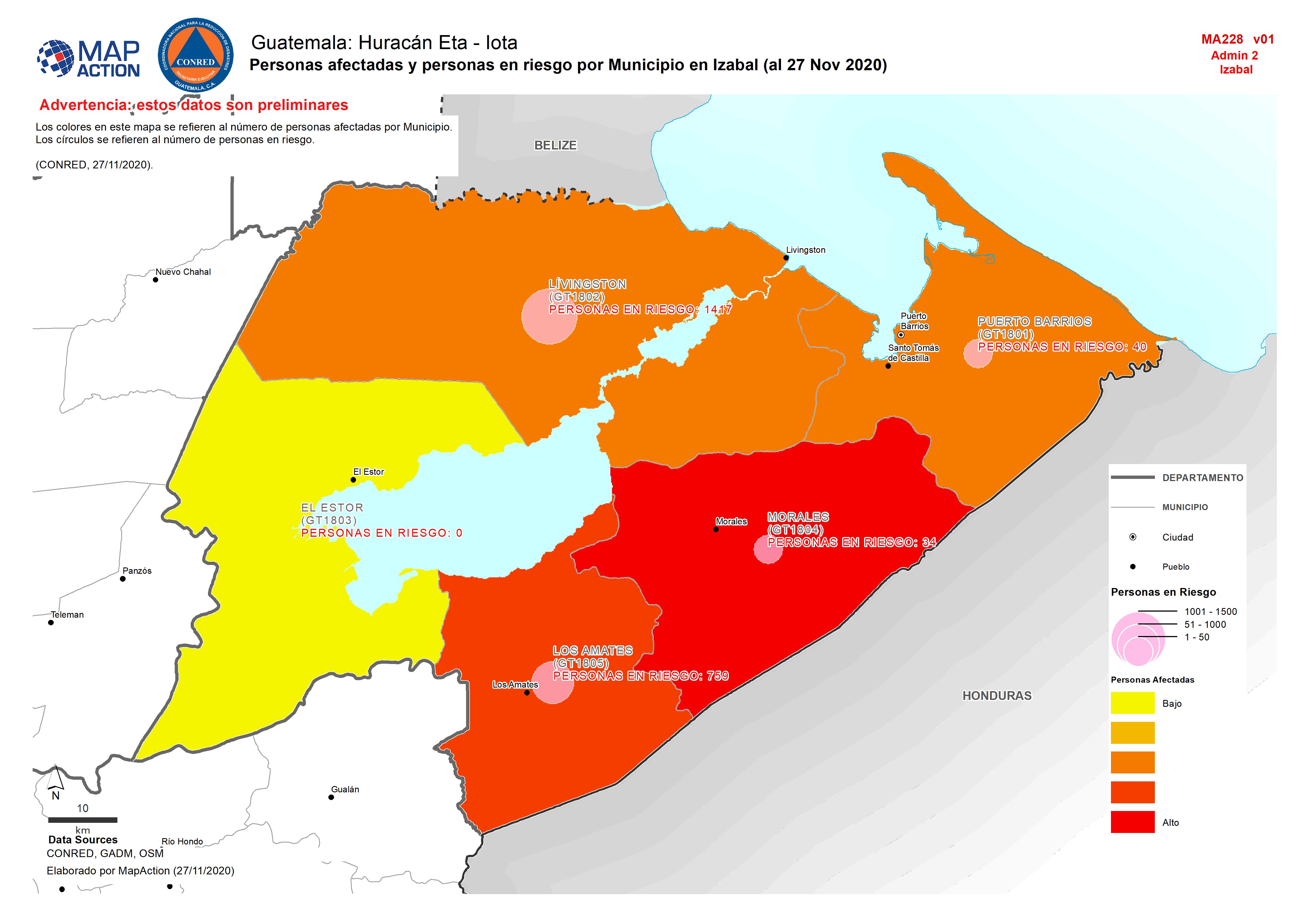
Guatemala: Personas afectadas y personas en riesgo por Municipio en Izabal (a...
Personas afectadas y personas en riesgo por Municipio en Izabal (al 27 Nov 2020) -
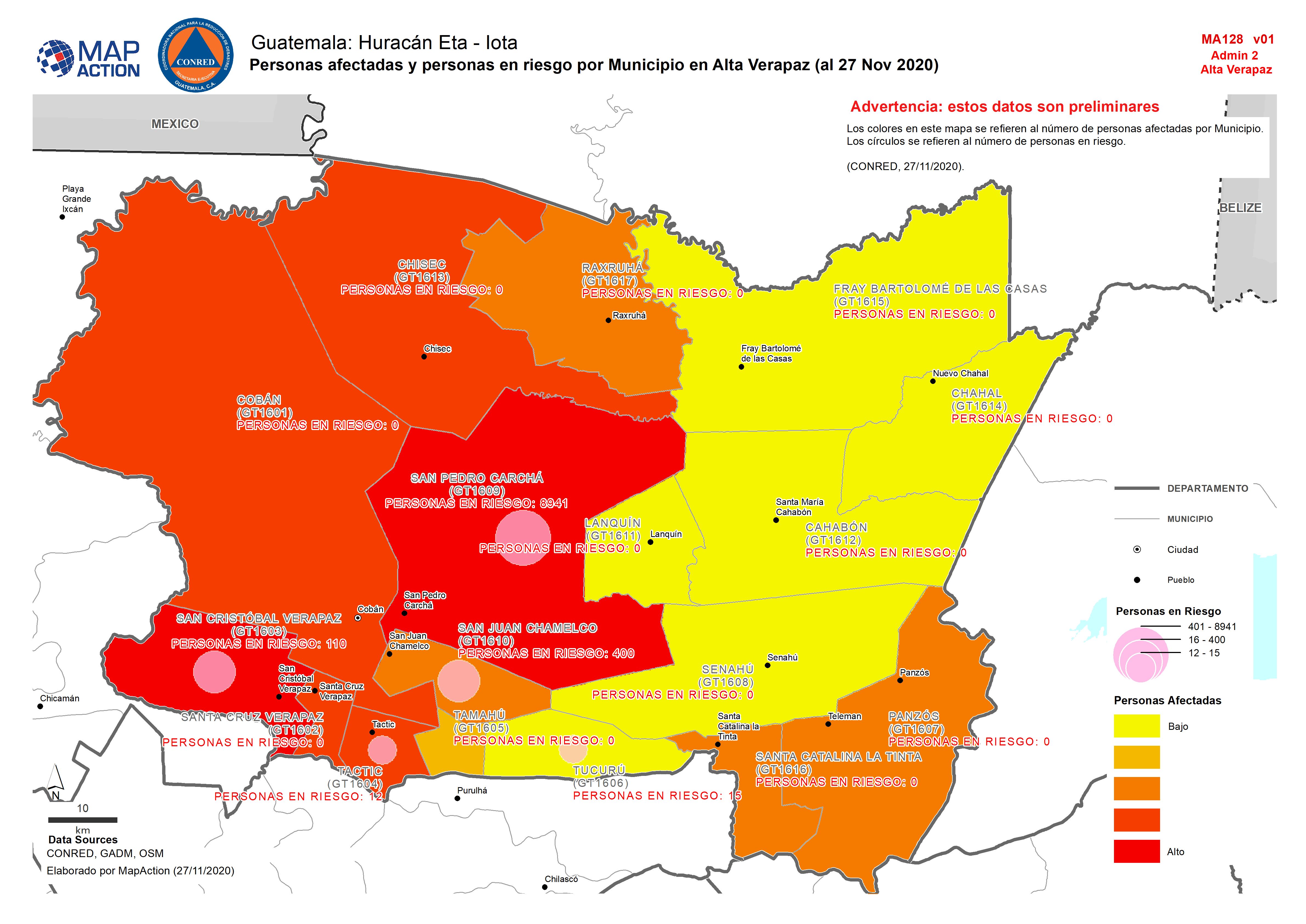
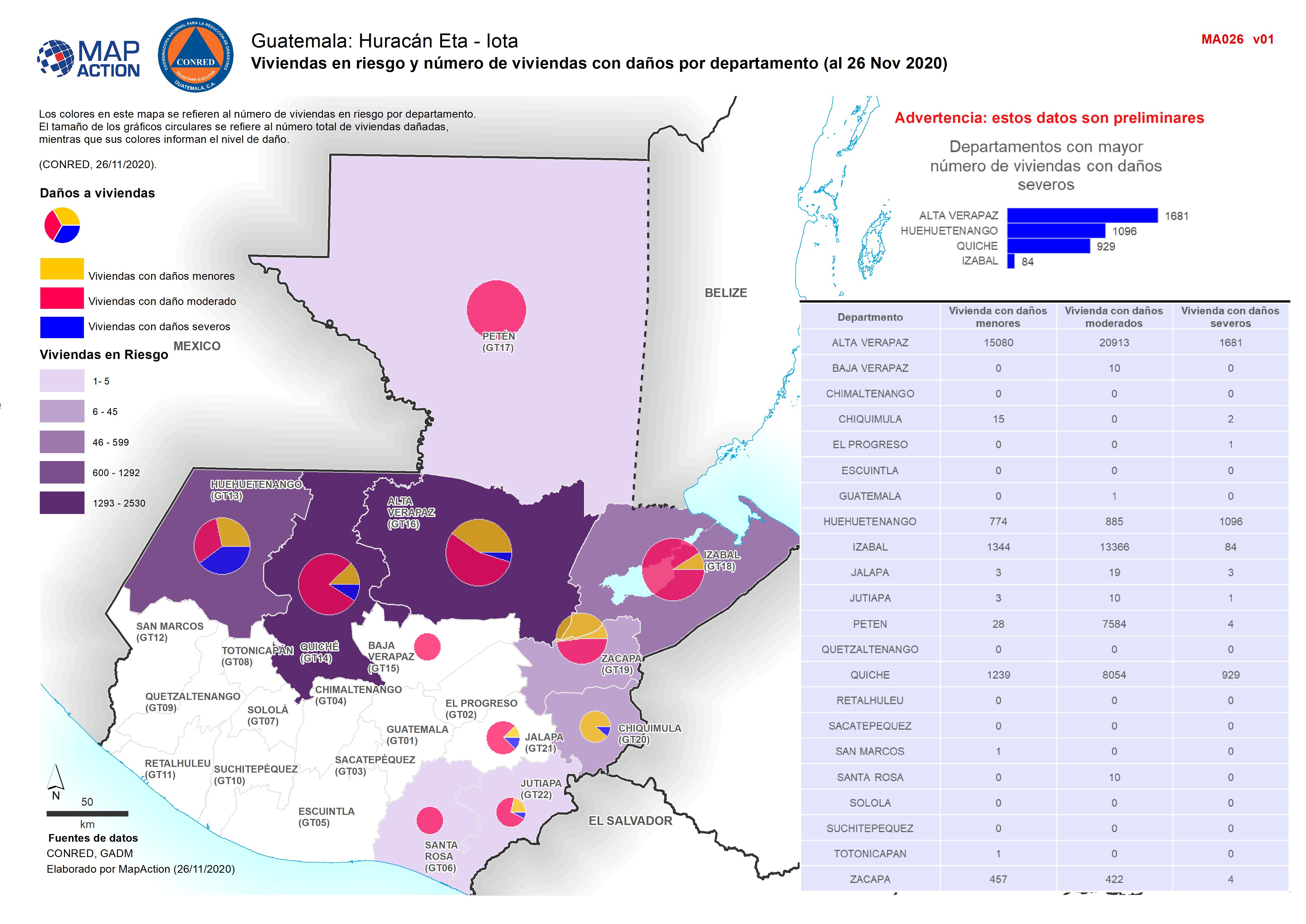
Guatemala: Personas afectadas y personas en riesgo por Municipio en Alta Vera...
Map shows the number of reported activities per Sector per Department in Honduras. Critical and High priority response areas are also shown. -

Guatemala: Personas afectadas y personas en riesgo por departamento (al 26 No...
Map shows the number of reported activities per Sector per Department in Honduras. Critical and High priority response areas are also shown. -

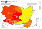
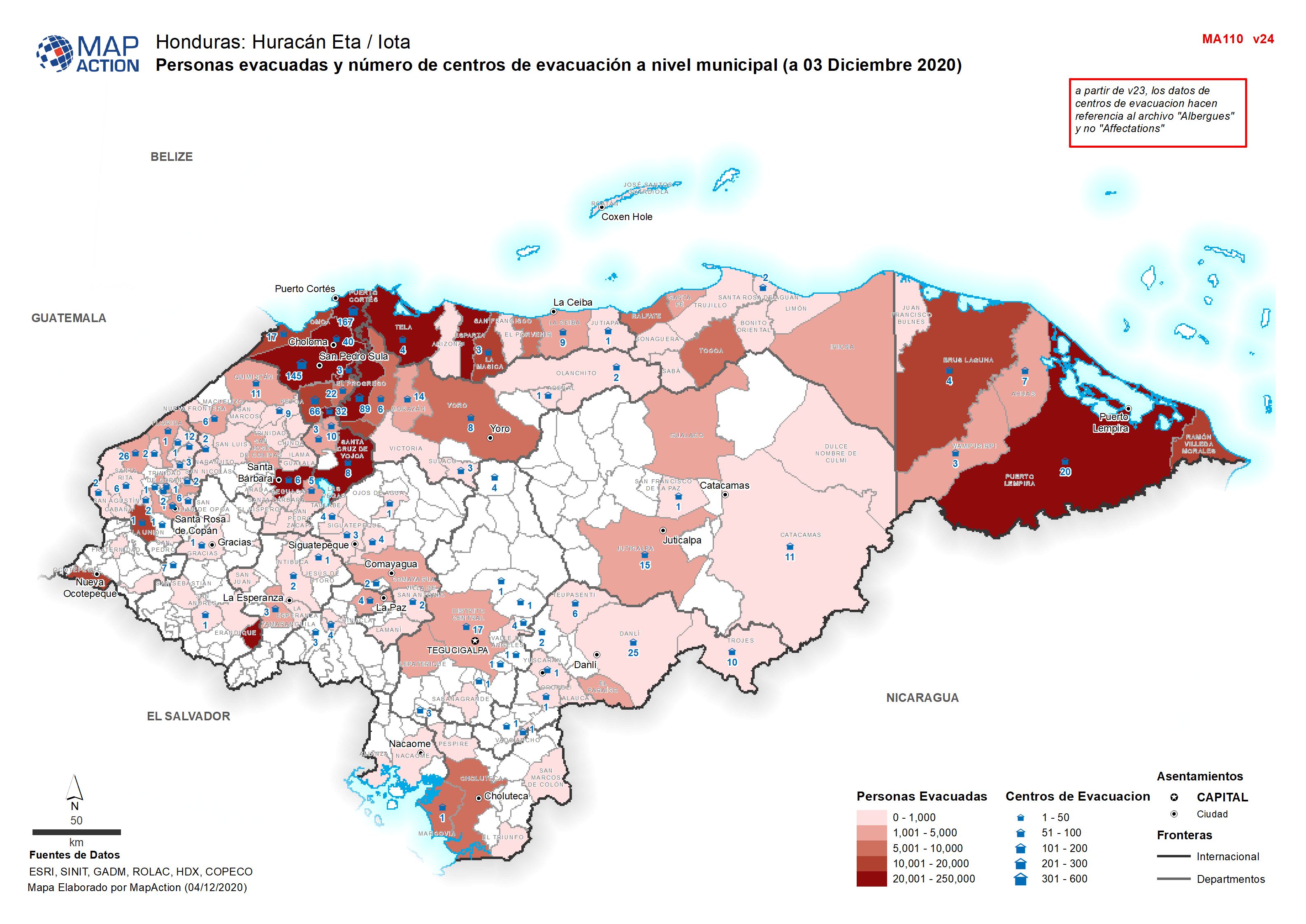
Personas evacuadas y número de centros de evacuación a nivel municipal (a 4 d...
Personas evacuadas y número de centros de evacuación a nivel municipal (a 03 Diciembre 2020 -

Personas evacuadas y número de centros de evacuación a nivel municipal (a 03 ...
Personas evacuadas y número de centros de evacuación a nivel municipal (a 03 Diciembre 2020 -

Personas evacuadas y número de centros de evacuación a nivel municipal (a 02 ...
Personas evacuadas y número de centros de evacuación a nivel municipal (a 02 Diciembre 2020 -

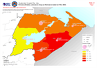
Población afectada (%) por municipio como porcentaje de la población (a 02 Di...
Población afectada (%) por municipio como porcentaje de la población(a 02 Diciembre 2020) -

Guatemala: Affected houses by department (26 November 2020)
Map shows the number of reported activities per Sector per Department in Guatemala. Critical and High priority response areas are also shown. -

Guatemala: Persons evacuated and in shelter (26 November 2020)
Map shows the number of reported activities per Sector per Department in Guatemala. Critical and High priority response areas are also shown. -

Guatemala: Persons deceased, injured and missing (26th November 2020)
Map shows the number of reported activities per Sector per Department in Guatemala. Critical and High priority response areas are also shown. -

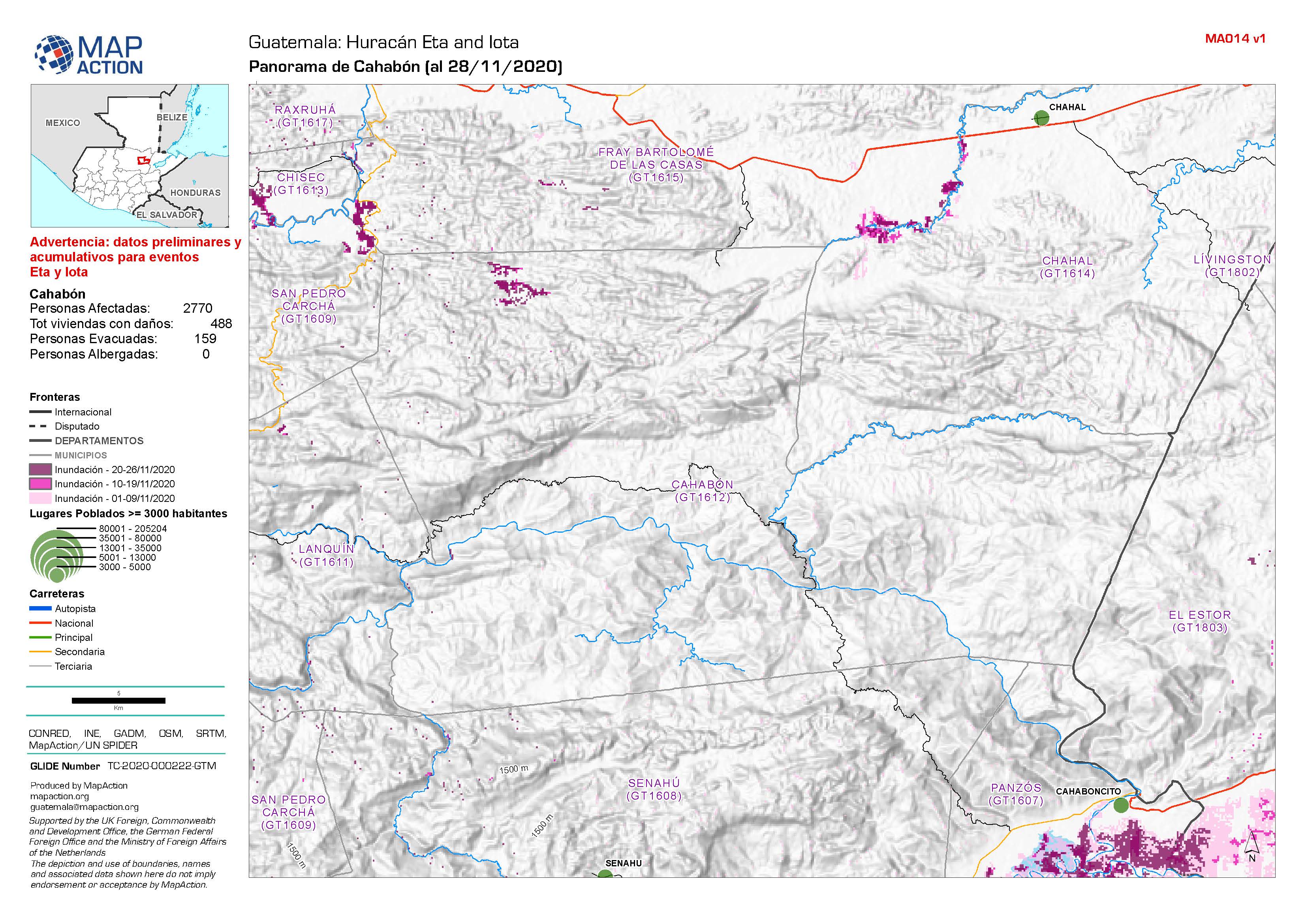
Guatemala: Panorama de Municipios (al 28/11/2020)
Flood extent between 1st and 26th November at municipality level (map series) / Areas inundados entre el 1 y el 26 de noviembre a nivel municipal (serie de mapas) -

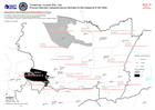
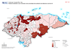
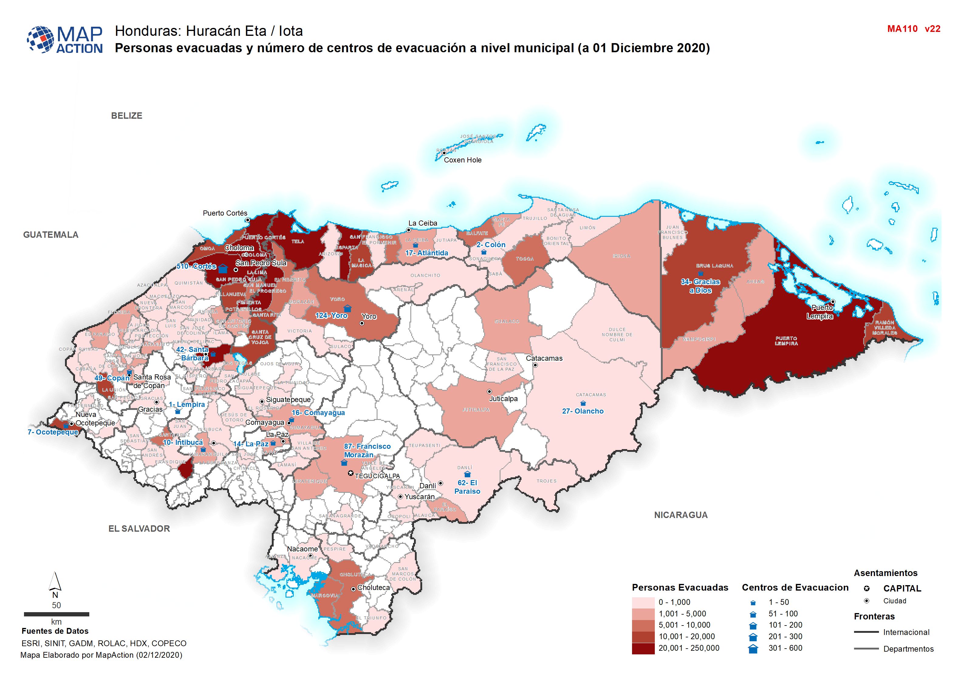
Honduras: Personas evacuadas y número de centros de evacuación a nivel munici...
Personas evacuadas y número de centros de evacuación a nivel municipal (a 01 Diciembre 2020 -

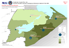
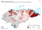
Honduras: Población afectada (%) por municipio como porcentaje de la població...
Población afectada (%) por municipio como porcentaje de la población de referencia a las Dic 01 -

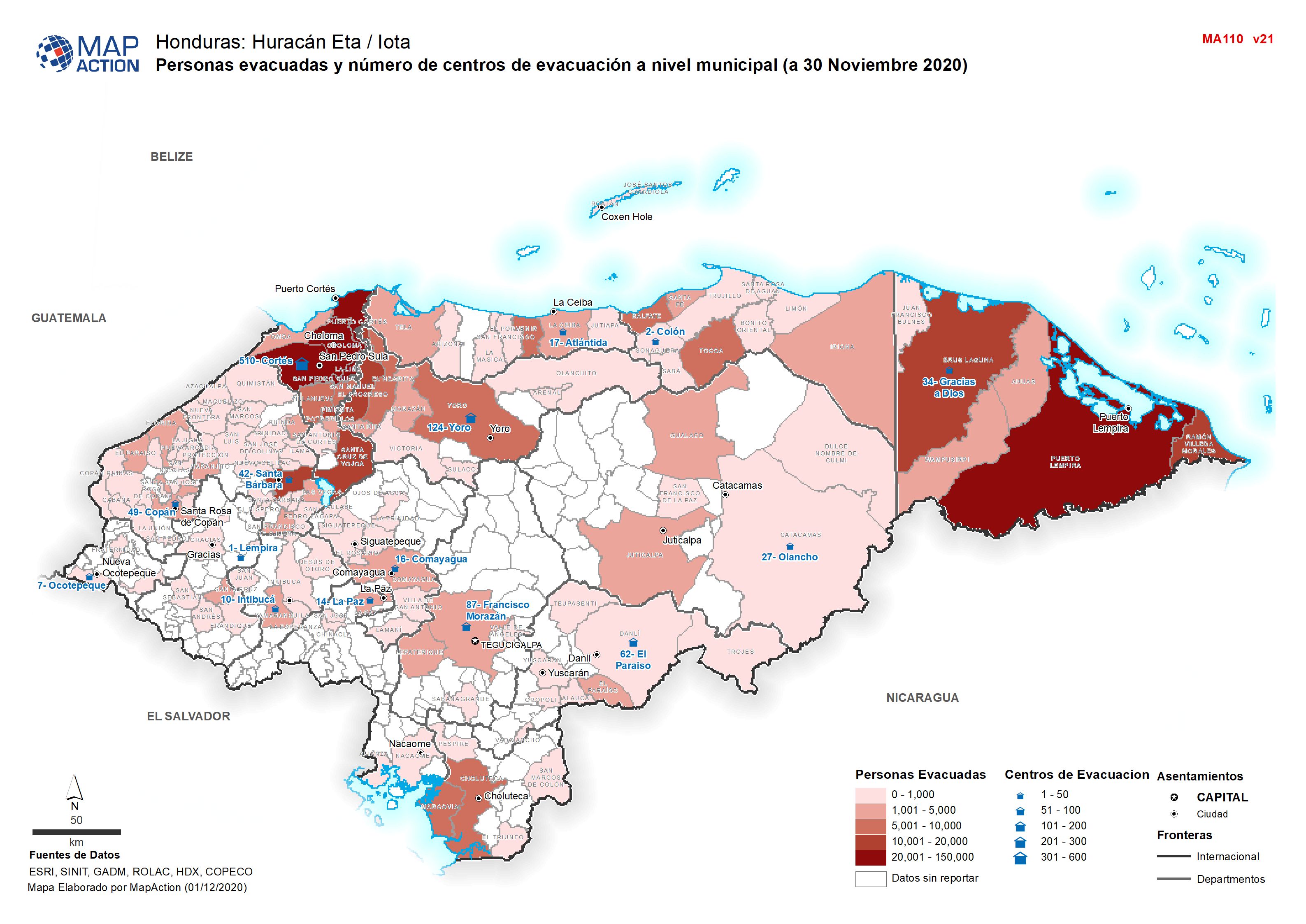
Honduras: Personas evacuadas y número de centros de evacuación a nivel munici...
Personas evacuadas y número de centros de evacuación a nivel municipal (a 30 Noviembre 2020 -

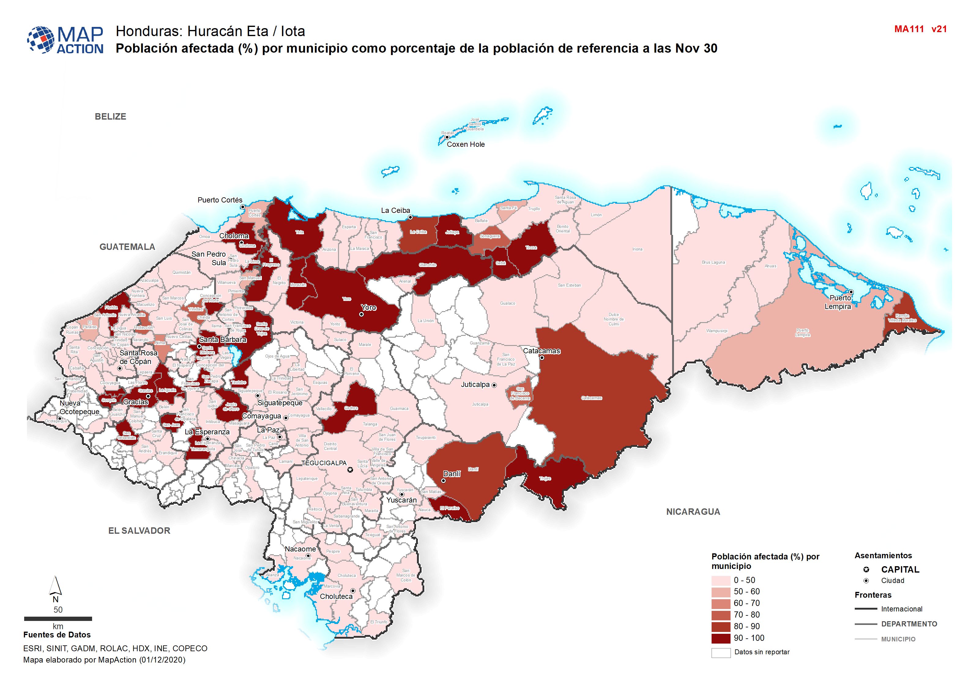
Honduras: Población afectada (%) por municipio como porcentaje de la població...
Población afectada (%) por municipio como porcentaje de la población de referencia a las Nov 30 -
Honduras: Personas evacuadas y número de centros de evacuación a nivel munici...
Personas evacuadas y número de centros de evacuación a nivel municipal (el 29 Noviembre 2020 -
Honduras: Población afectada (%) por municipio como porcentaje de la població...
Población afectada (%) por municipio como porcentaje de la población de referencia a las Nov 29