-
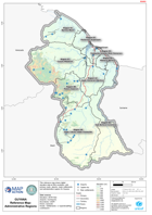
Guyana Reference Map: Administrative Regions
This reference map shows digital elevation data at 90m resolution, with primary roads, airports, major settlements and administrative regions for Guyana. -

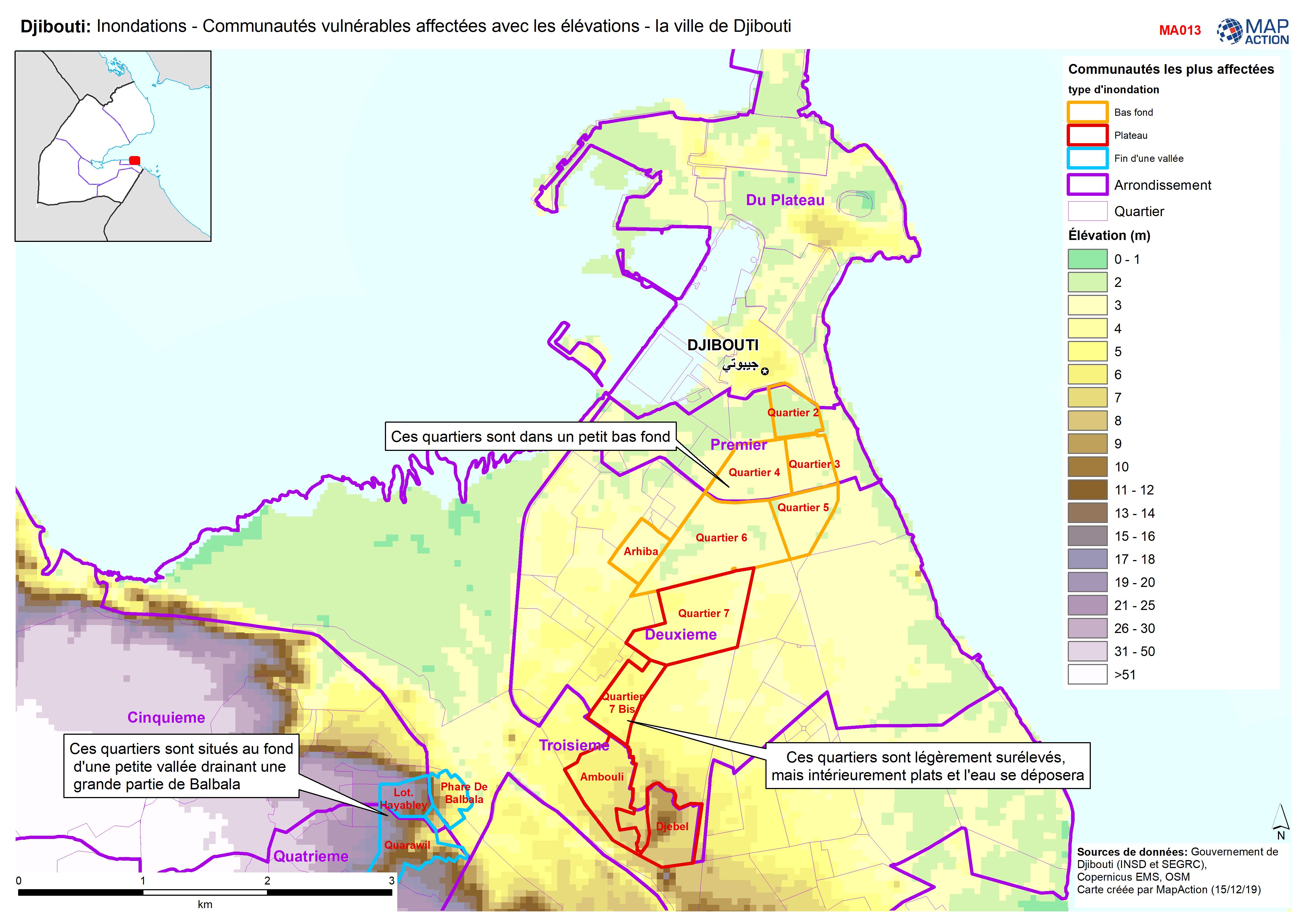
Djibouti: Inondations - Communautés vulnérables affectées avec les élévations...
Djibouti City - Map shows the most affected flooded communities, containing the most vulnerable populations, alongside elevation data to demonstrate the effects of elevation and... -
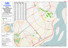
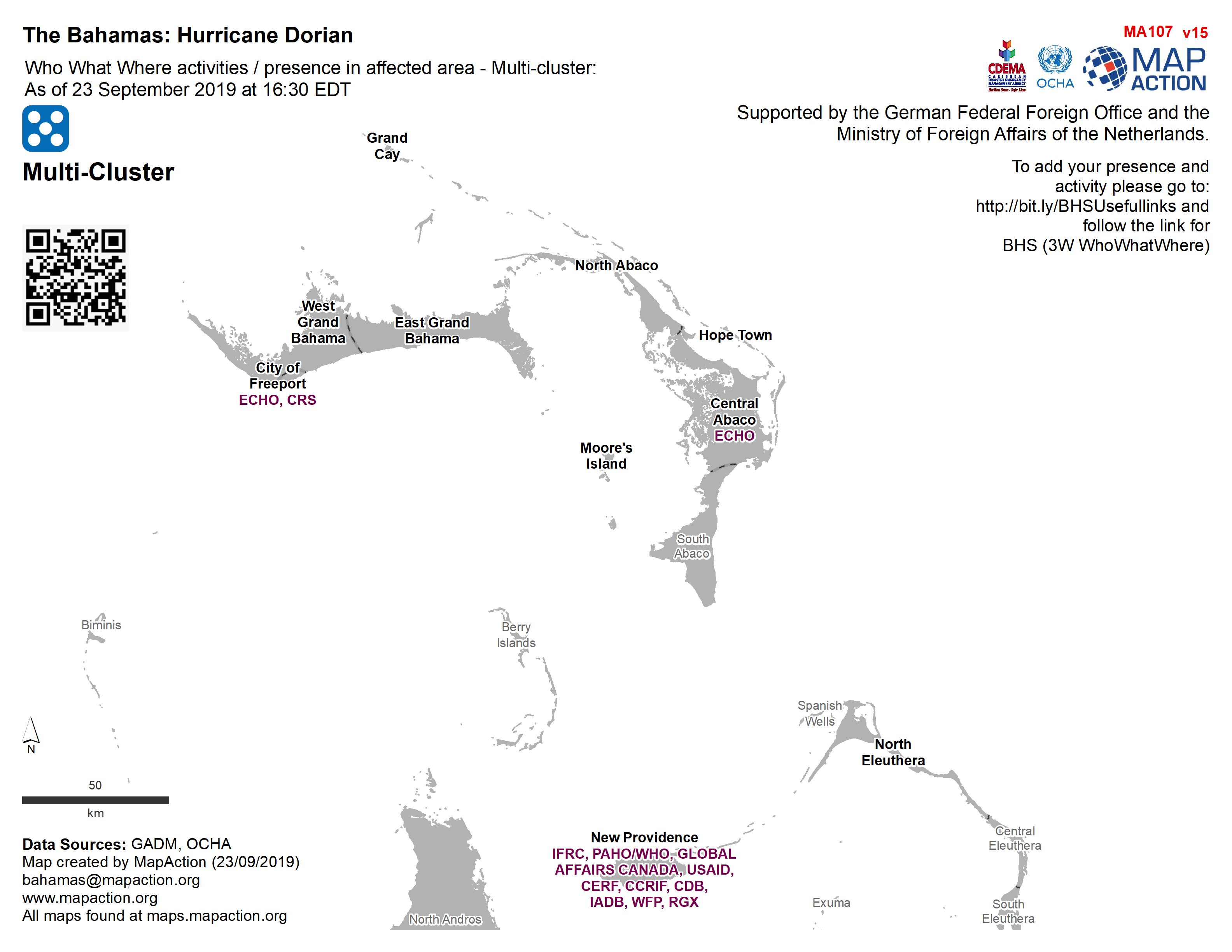
Who What Where activities / presence in affected area - Multi-cluster: As of ...
Who, What, Where for Coordination - Multi-Cluster -
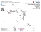
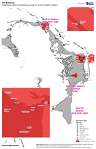
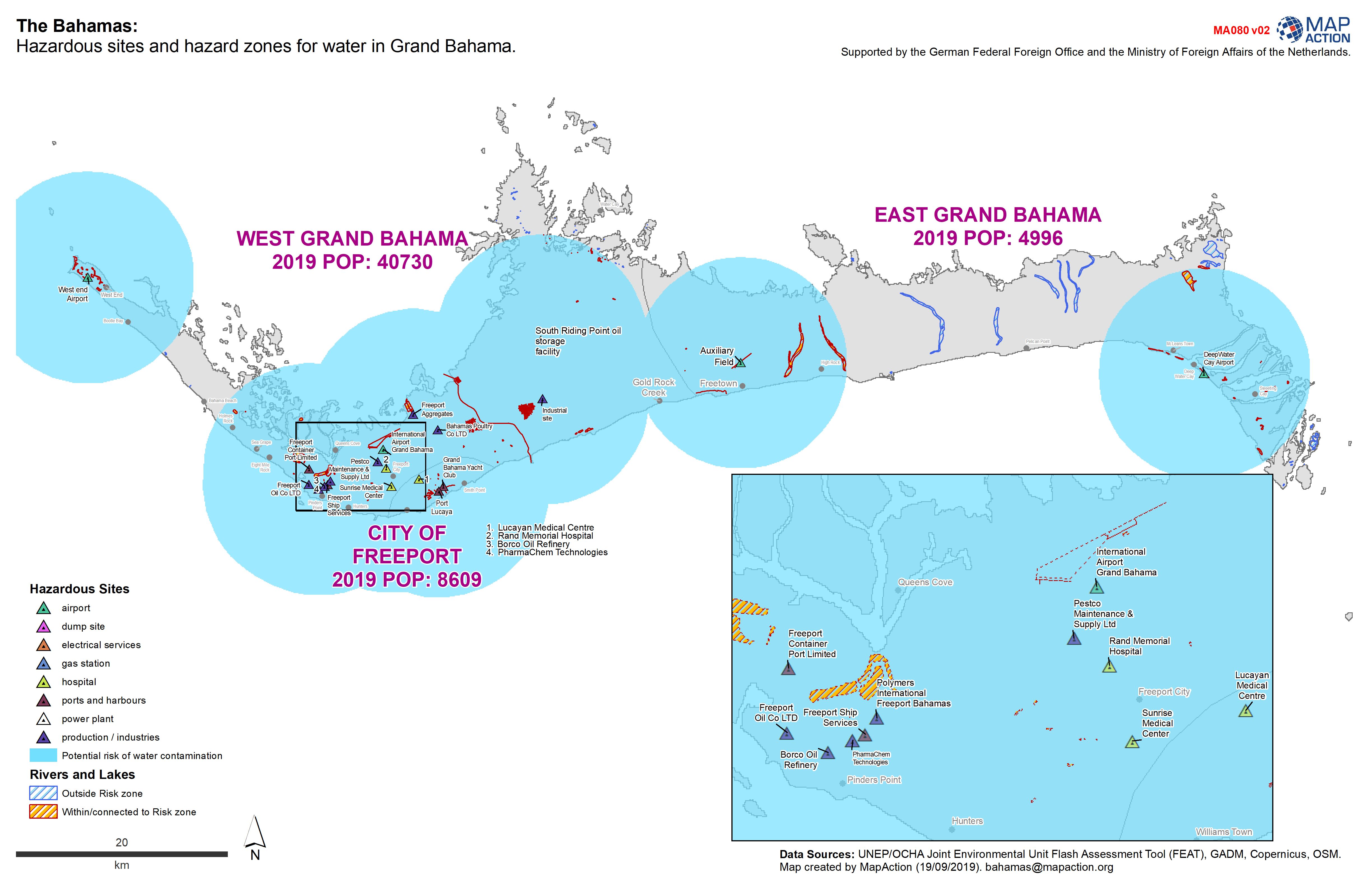
The Bahamas: Hazardous sites and hazard zones for water in Grand Bahama.
Hazardous sites and hazardous zones for human health. -
Who What Where activities / presence in affected area - Multi-cluster: As of ...
Who, What, Where for Coordination - Multi-Cluster -

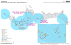
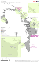
The Bahamas: Hazardous sites and hazardous areas for water in Abaco.
Hazardous sites in Abaco -
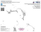
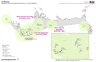
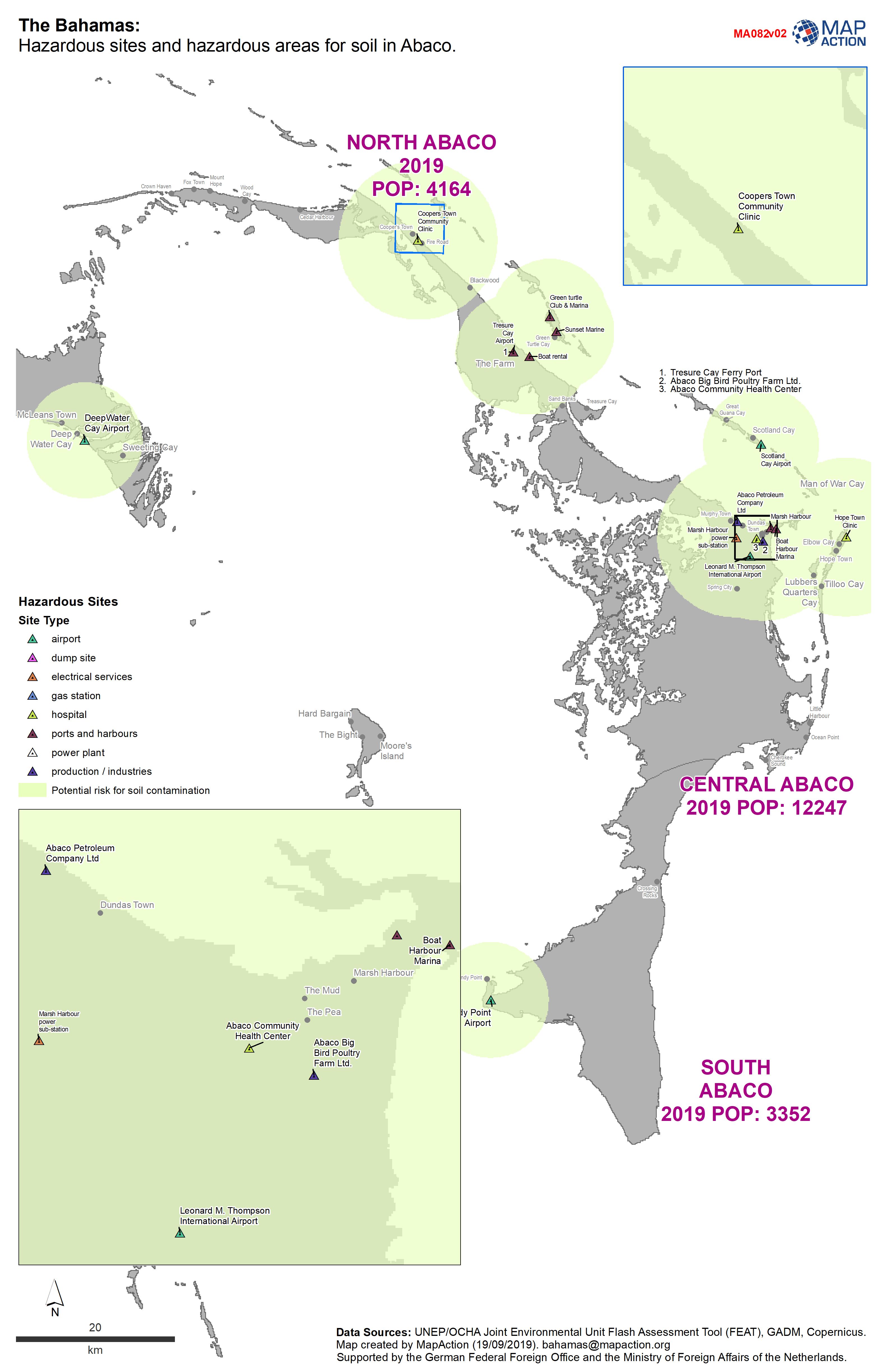
The Bahamas: Hazardous sites and hazardous areas for soil in Abaco.
Hazardous sites in Abaco -
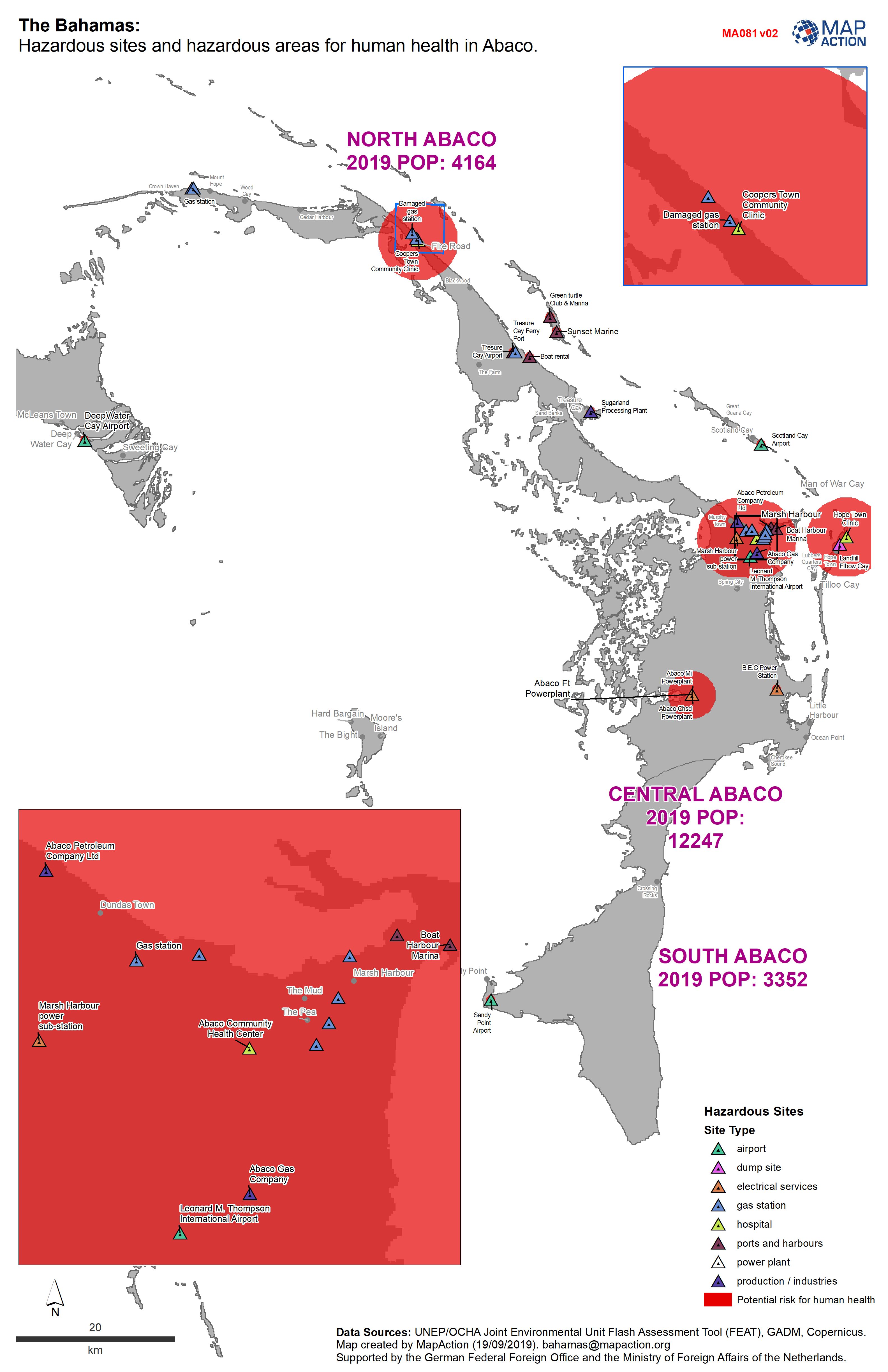
The Bahamas: Hazardous sites and hazardous areas for human health in Abaco.
Sites hazardous to human health in Abaco -
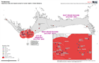
The Bahamas: Hazardous sites and hazardous zones for soil in Grand Bahama.
Hazardous sites and hazardous zones for soil -
The Bahamas: Hazardous sites and hazard zones for human health in Grand Bahama.
Hazardous sites and hazardous zones for human health. -
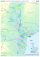
Mozambique: Cyclone Idai - Flood extent change between 20, 31 March and 7 Apr...
Map shows the change in flood extent between the 20, 31 of March and 7 April -
Central Sulawesi: IDP sites within modelled Liquefaction risk areas.
Map shows IDP sites as identified through analysis of Digital Globe imagery from 2nd - 5th October, and areas at risk of liquefaction as determined through the USGS preferred... -

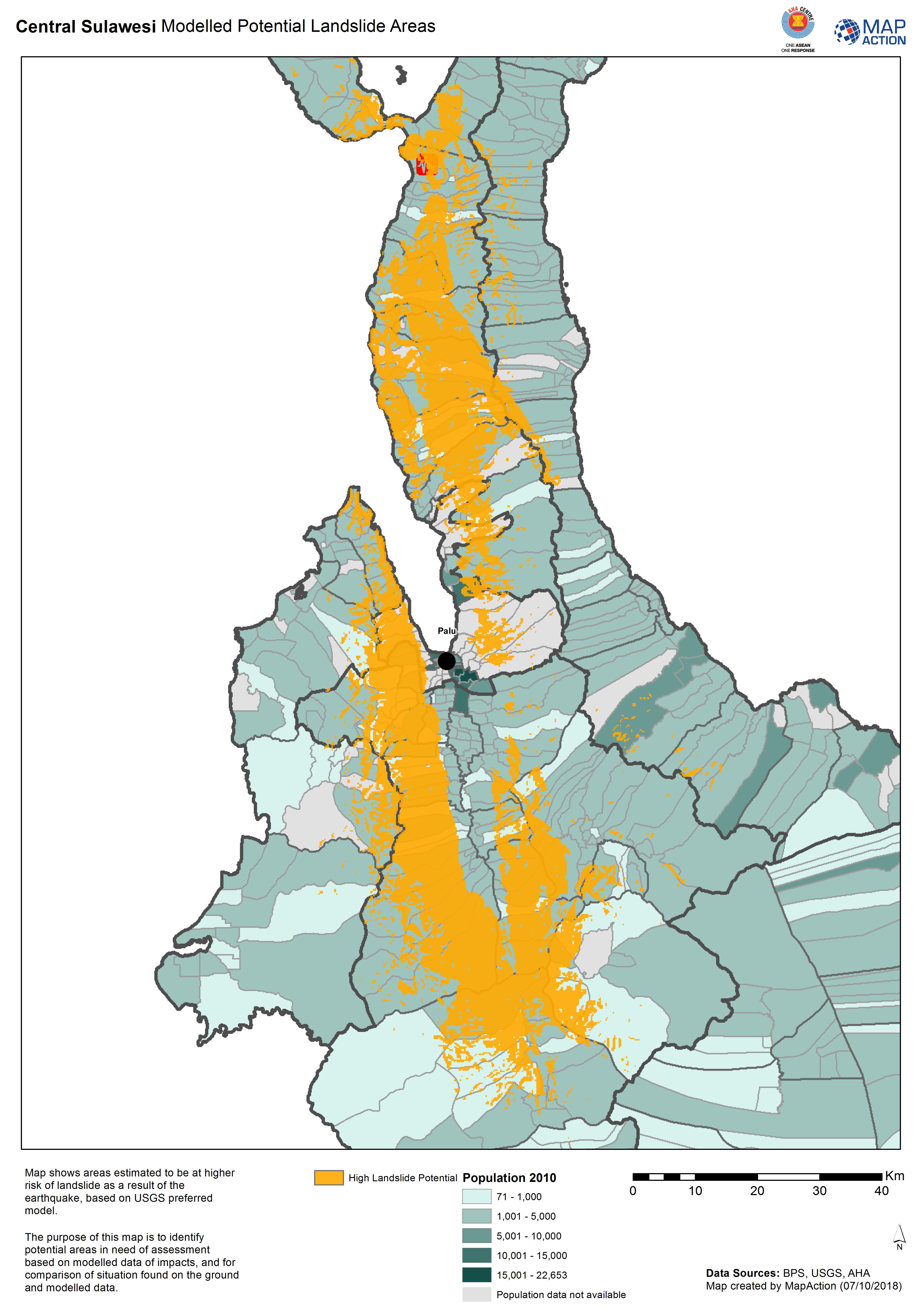
Central Sulawesi Modelled Potential Landslide Areas
Map shows areas estimated to be at higher risk of landslide as aresult of the earthquake, based on USGS preferred model. -

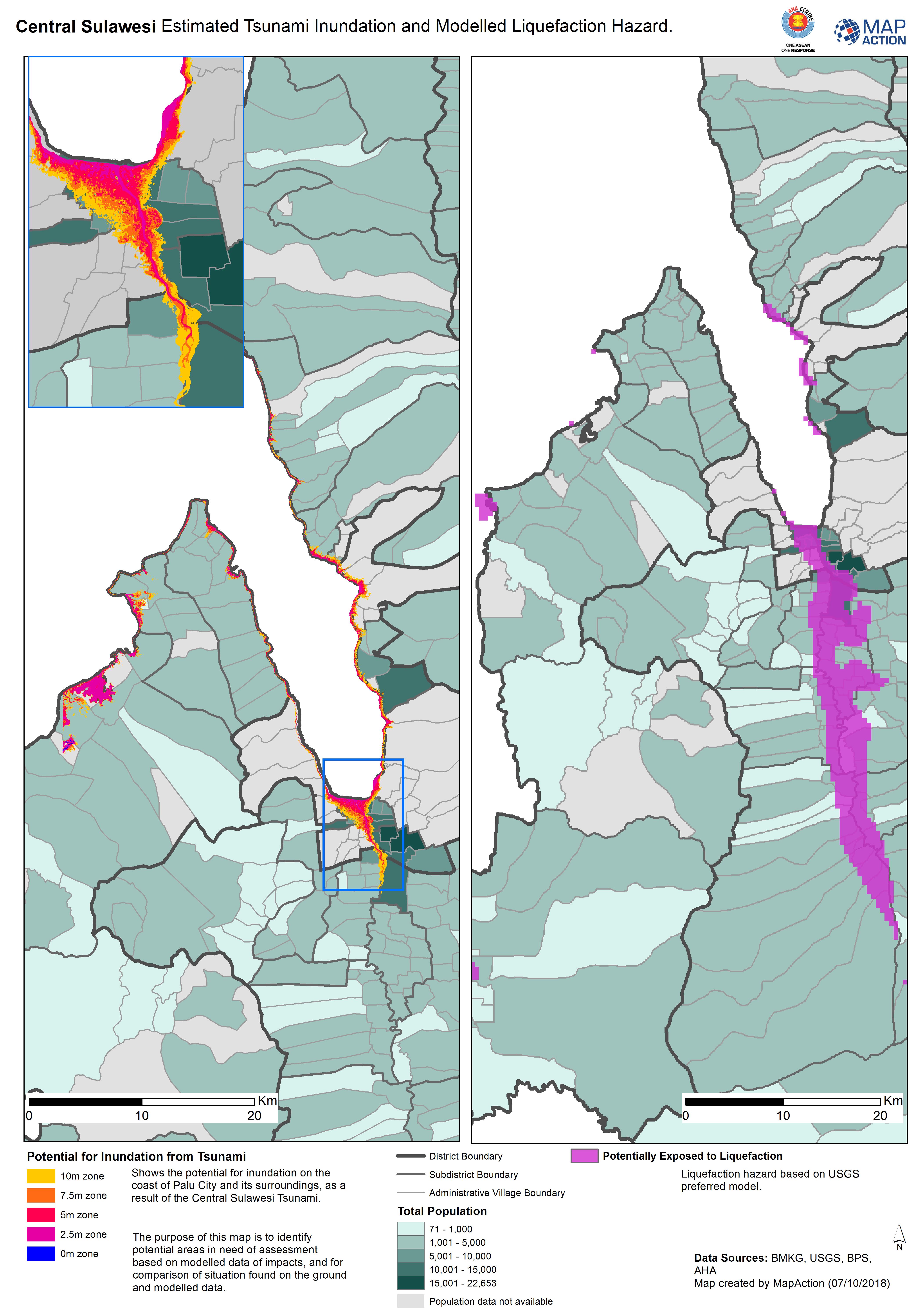
Central Sulawesi Estimated Tsunami Inundation and Modelled Liquefaction Hazard.
Shows the potential for inundation on the coast of Palu City and its surroundings, as a result of the Central Sulawesi Tsunami. The purpose of this map is to identify potential... -

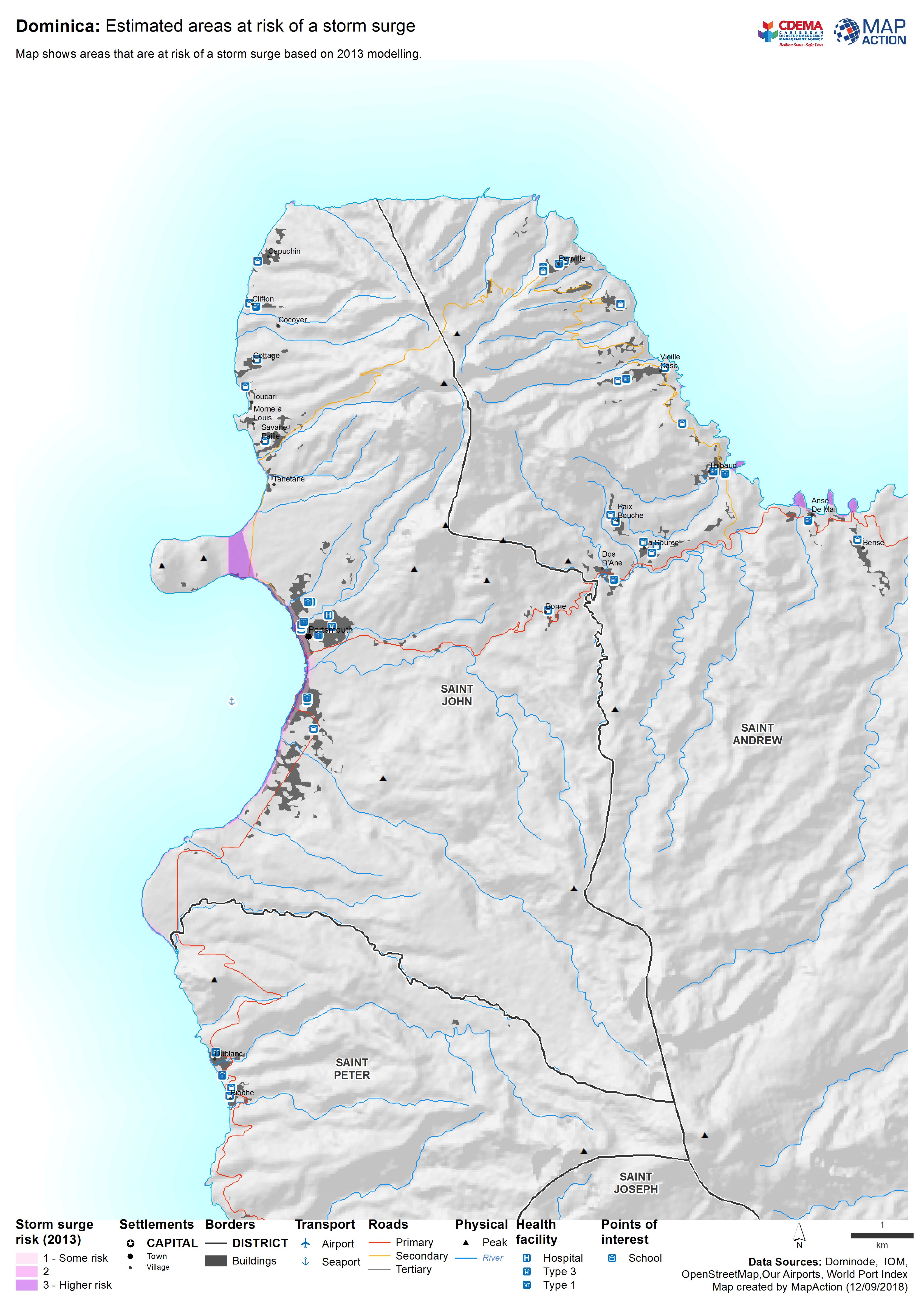
Dominica: Estimated areas at risk of a storm surge
Map shows areas that are at risk of a storm surge based on 2013 modelling. -

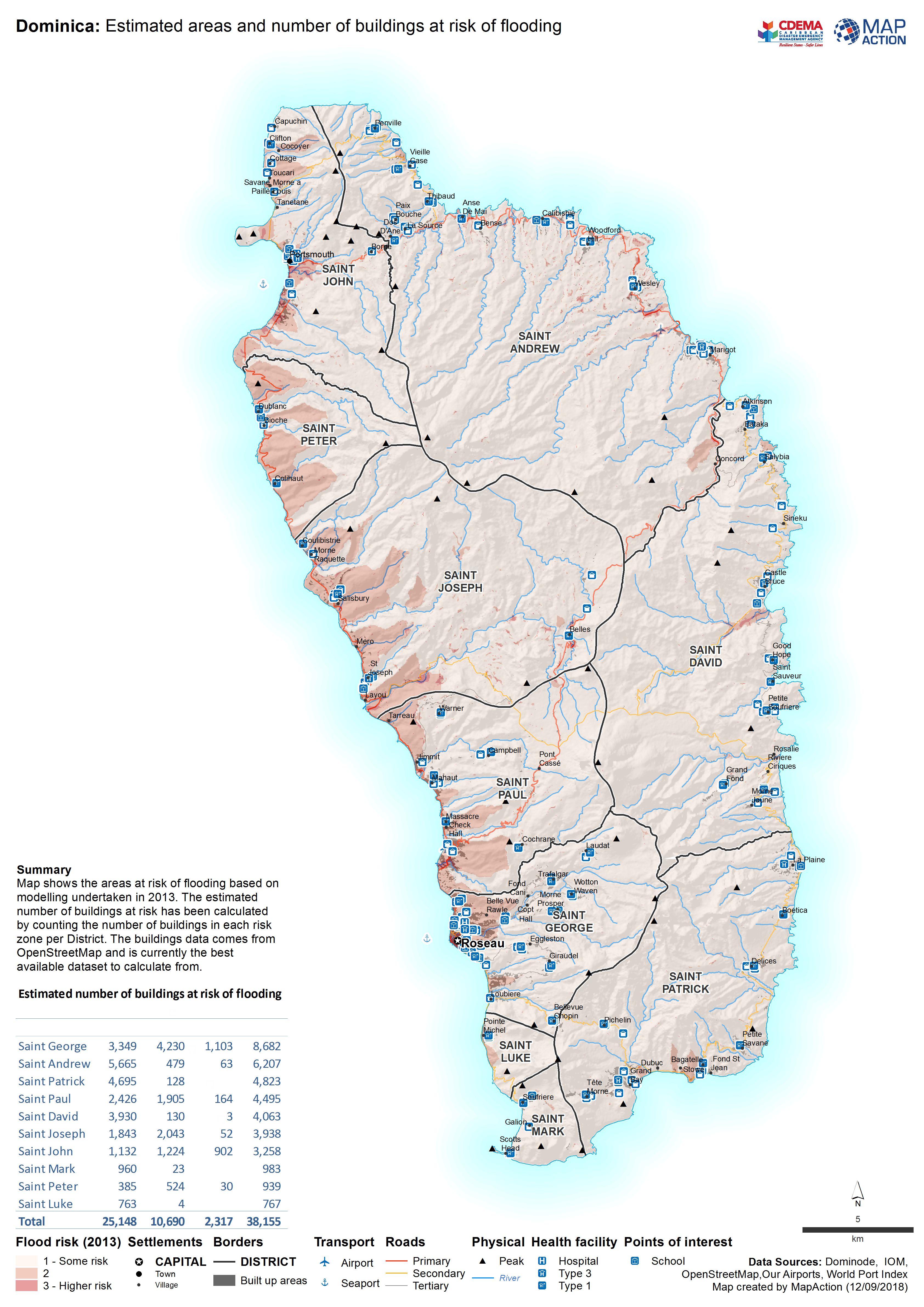
Dominica: Estimated areas and number of buildings at risk of flooding
Map shows the areas at risk of flooding based on modelling undertaken in 2013. The estimated number of buildings at risk has been calculated by counting the number of buildings... -

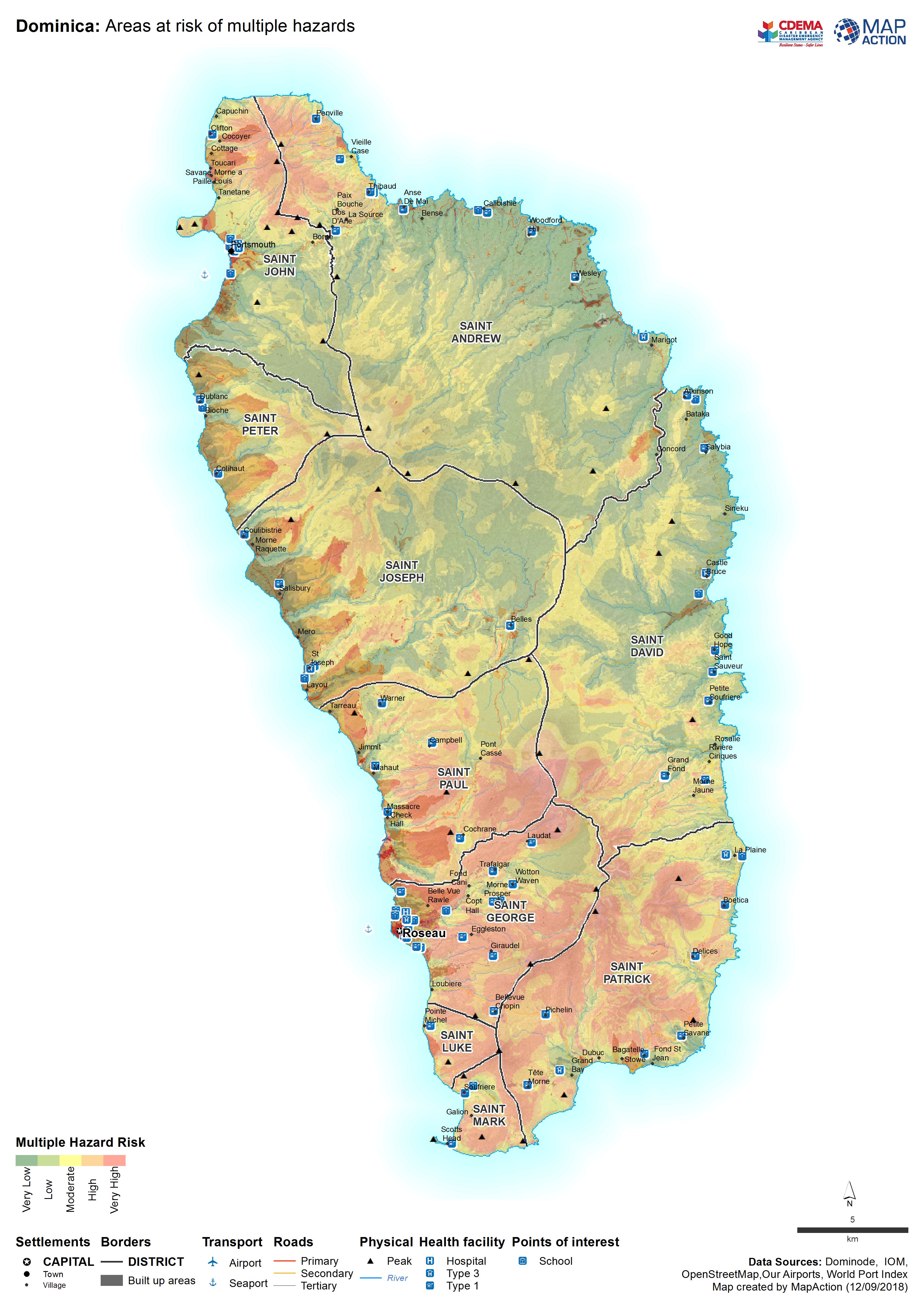
Dominica: Areas at risk of multiple hazards
Map shows areas that are at risk of multiple hazards including landslides, storm surge and flooding. -
Congo: Brazzaville Munitions Depot Explosion - Environmental Assessement (as ...
Map shows the location of the test sites for the environmental testing. Initial measurements for heavy metals in soils have not shown any noticeable -
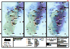
Madagascar: Cyclone Enawo - Rainfall 1 day accumulation maps (as of 10 Mar 2017)
A series of maps showing 1-day rainfall accumulations for 3 successive days, together with the track of cyclone Enawo.