-
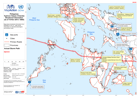
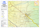
Philippines Typhoon Haiyan (Yolanda) Situational Information (as of 10 Nov 20...
Map shows situational information from NDRRMC sit rep 10. Map shows.Information on stranded passengers and blocked roads -

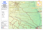
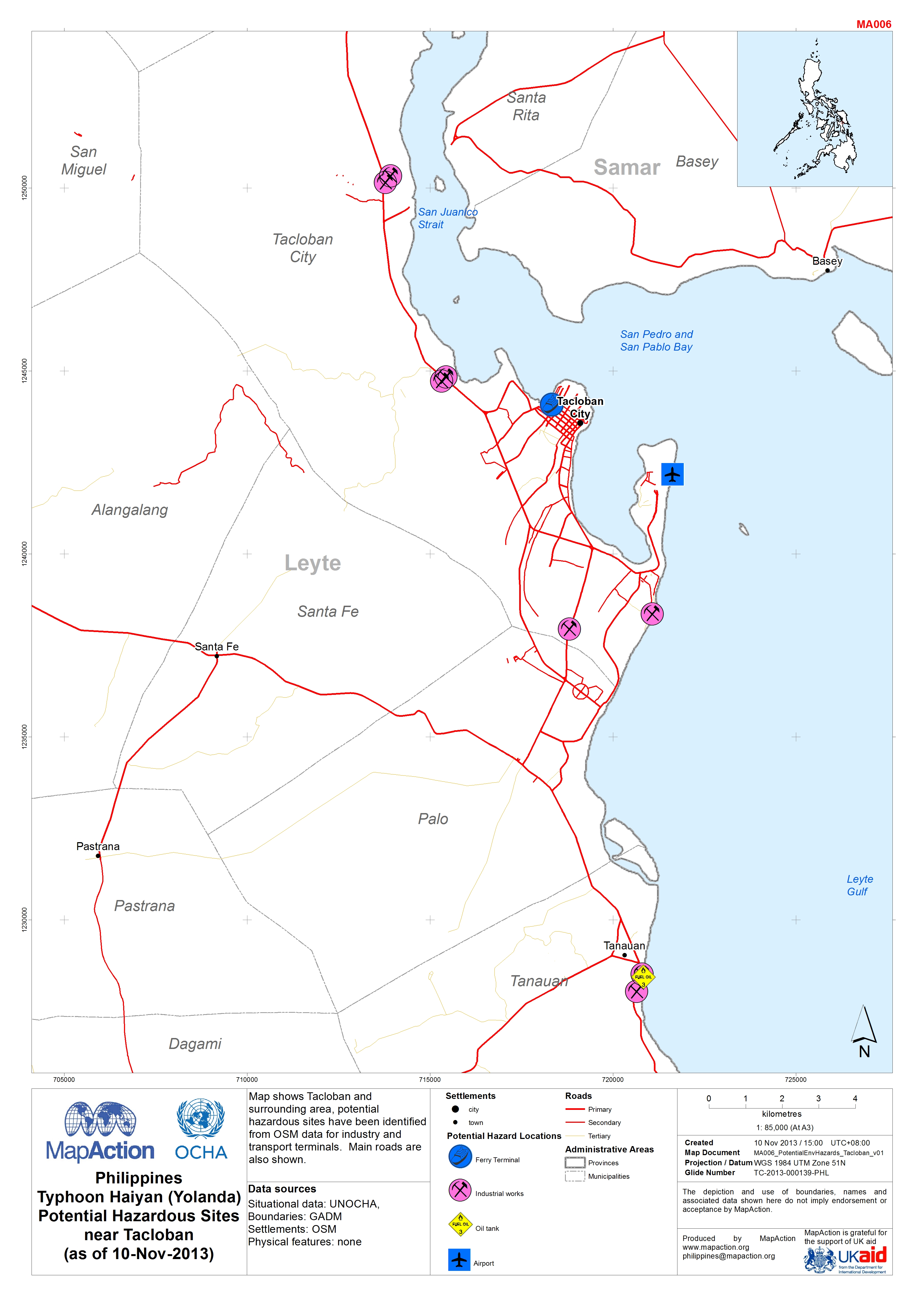
Philippines Typhoon Haiyan (Yolanda) Potential Hazardous Sites near Tacloban ...
Map shows Tacloban and surrounding area, potential hazardous sites have been identified from OSM data for industry and transport terminals. Main roads are also shown. -

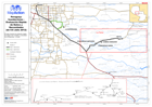
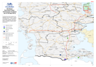
Typhoon Haiyan (Yolanda) Probable Affected Provinces (as of 09 Nov 2013)
Map shows the predicted and actual paths of the typhoon. Administration levels are shown at Province level, highlighting the provinces that are probably affected. -

Typhoon Haiyan (Yolanda) Population by municipality in the path of the typhoo...
Map shows the predicted and actual paths of the typhoon. Population figures are shown only for the likely affected areas. Population data is from 2010. -
Paraguay: Inundaciónes - Vuelo de Evaluación Rápida (de 12 Julio 2012)
Vuelo de evaluación de las comunidades de Buena Vista y Comunidad 96, al noroeste de Concepción. -

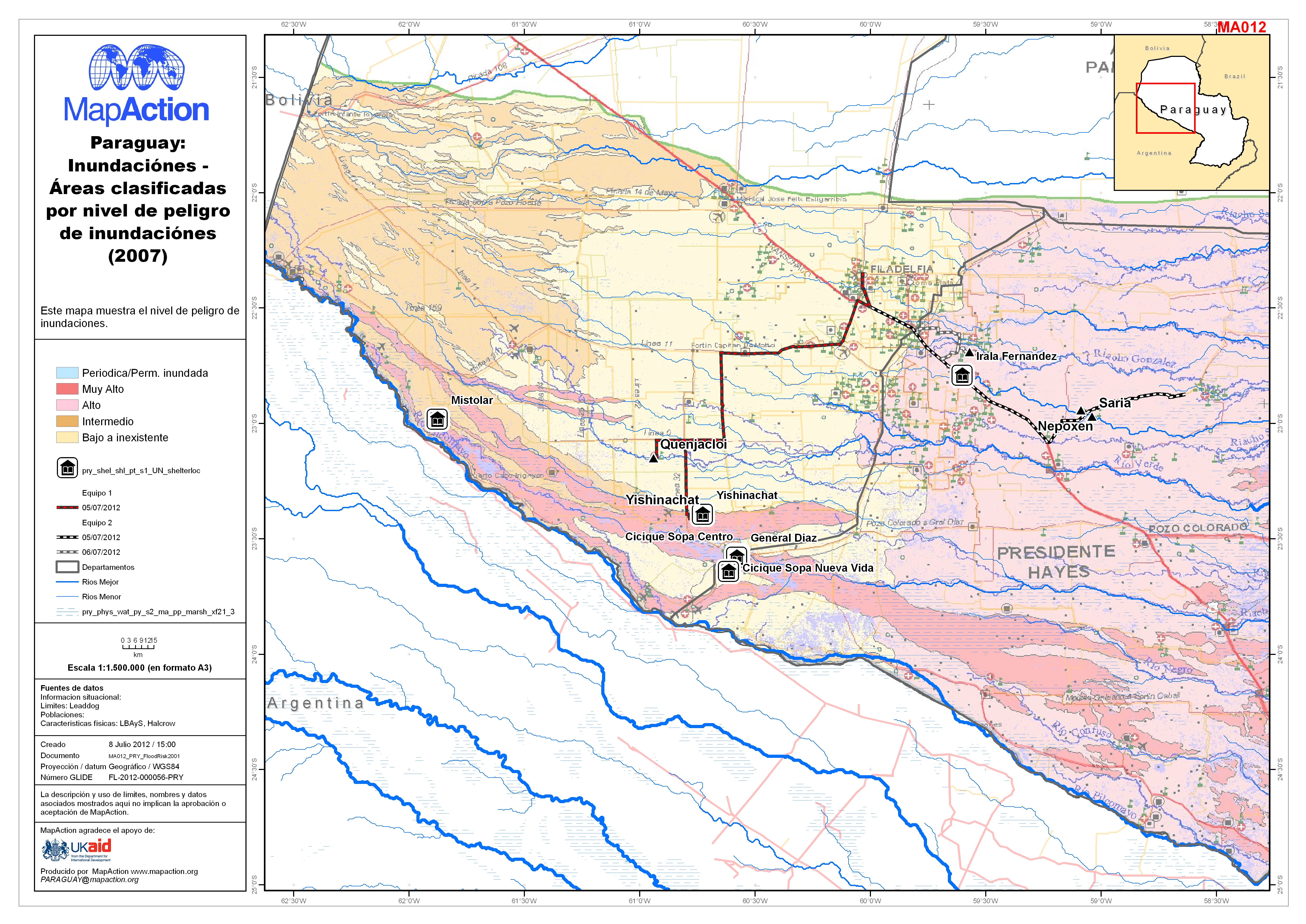
Paraguay: Inundaciónes - Ãreas clasificadas por nivel de peligro de inundació...
This dataset has no description
-
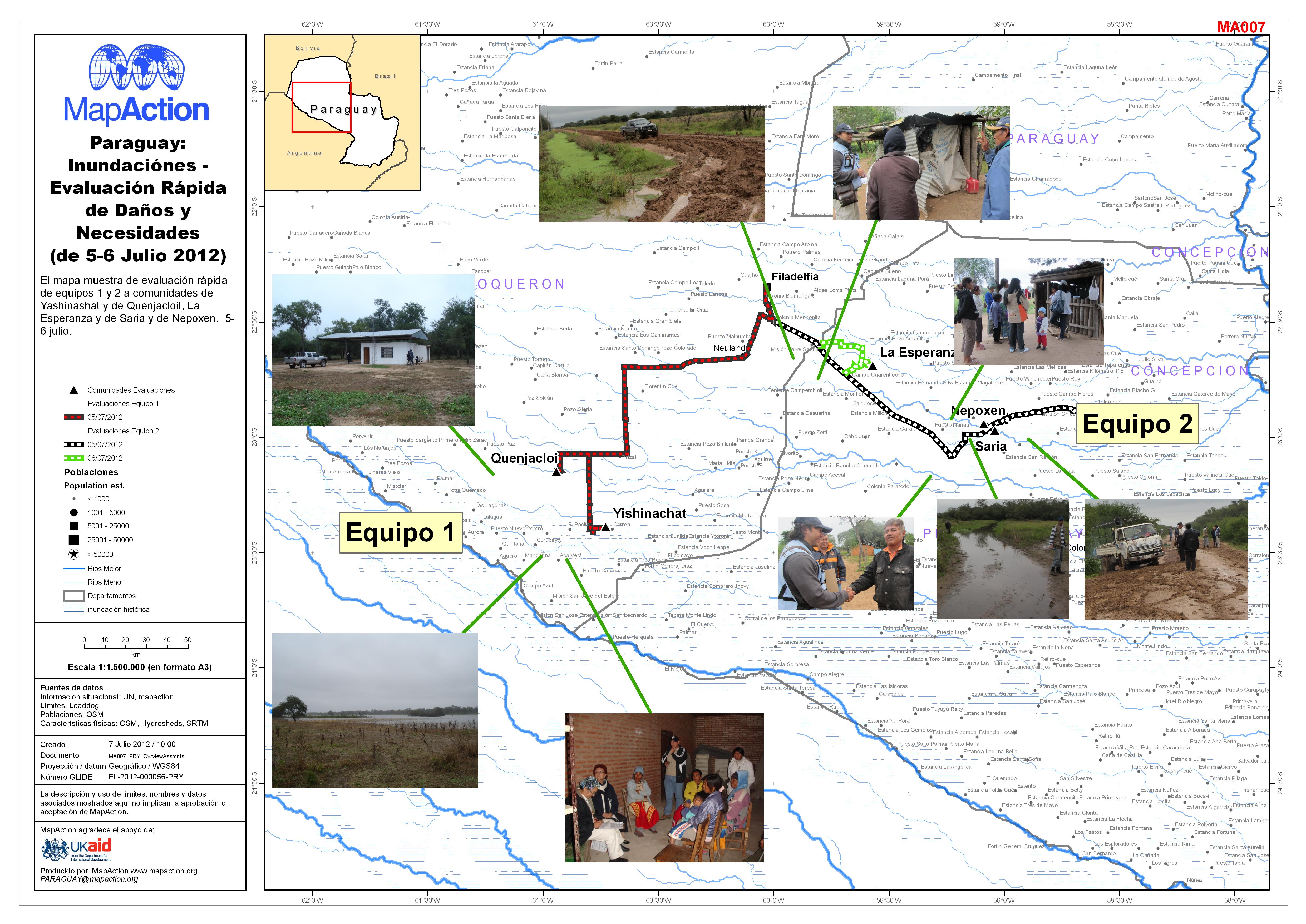
Paraguay: Inundaciónes - Evaluación Rápida de Daños y Necesidades (de 5-6 Jul...
This dataset has no description
-

Paraguay: Inundaciónes - Evaluación Rápida de Daños y Necesidades (de 5-6 Jul...
This dataset has no description
-

Paraguay: Inundaciónes - Evaluación Rápida de Daños y Necesidades (de 6 Julio...
This dataset has no description
-
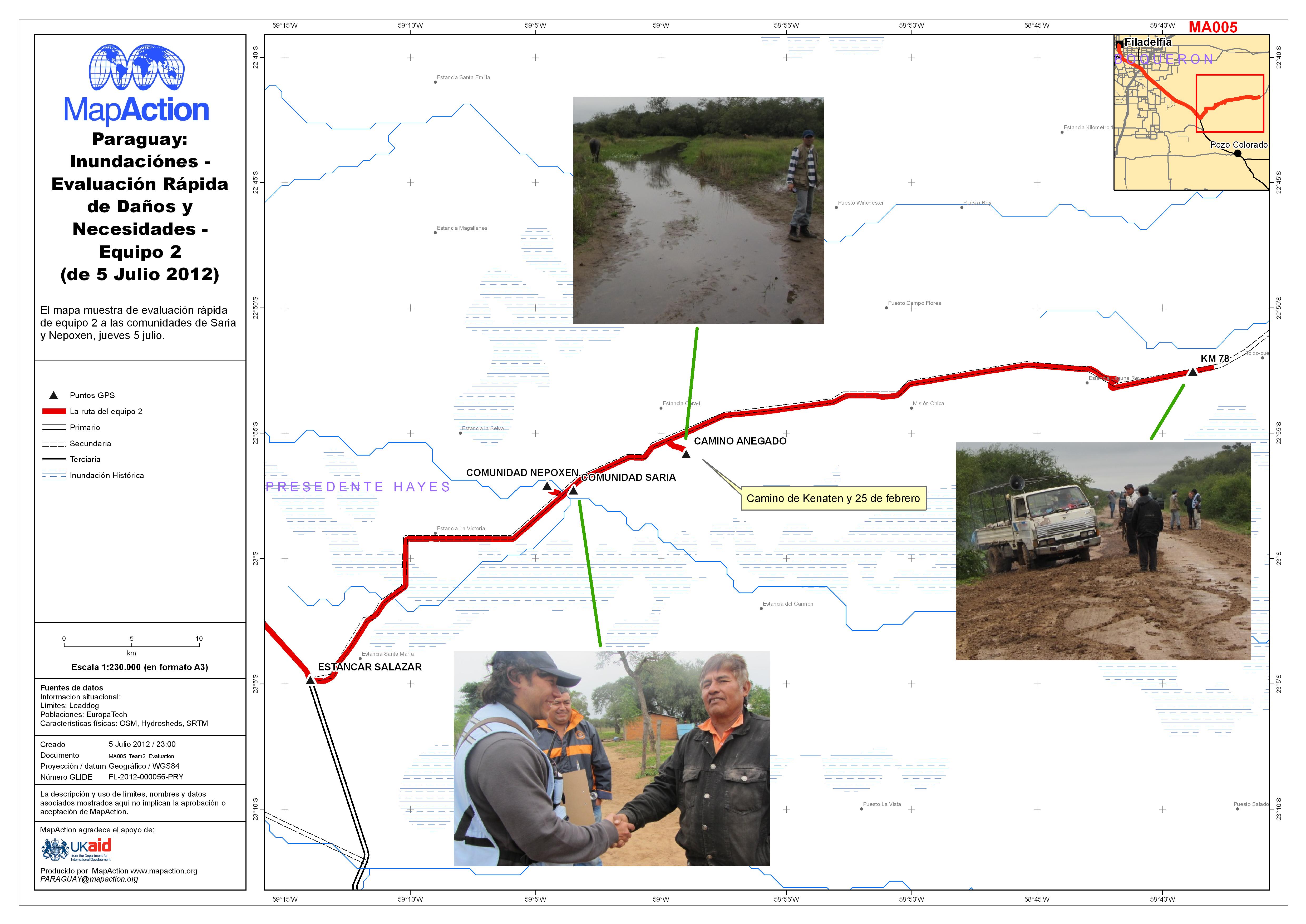
Paraguay: Inundaciónes - Evaluación Rápida de Daños y Necesidades - Equipo 2 ...
This dataset has no description
-

Paraguay: Inundaciónes - Evaluación Rápida de Daños y Necesidades (de 5 Julio...
This dataset has no description
-
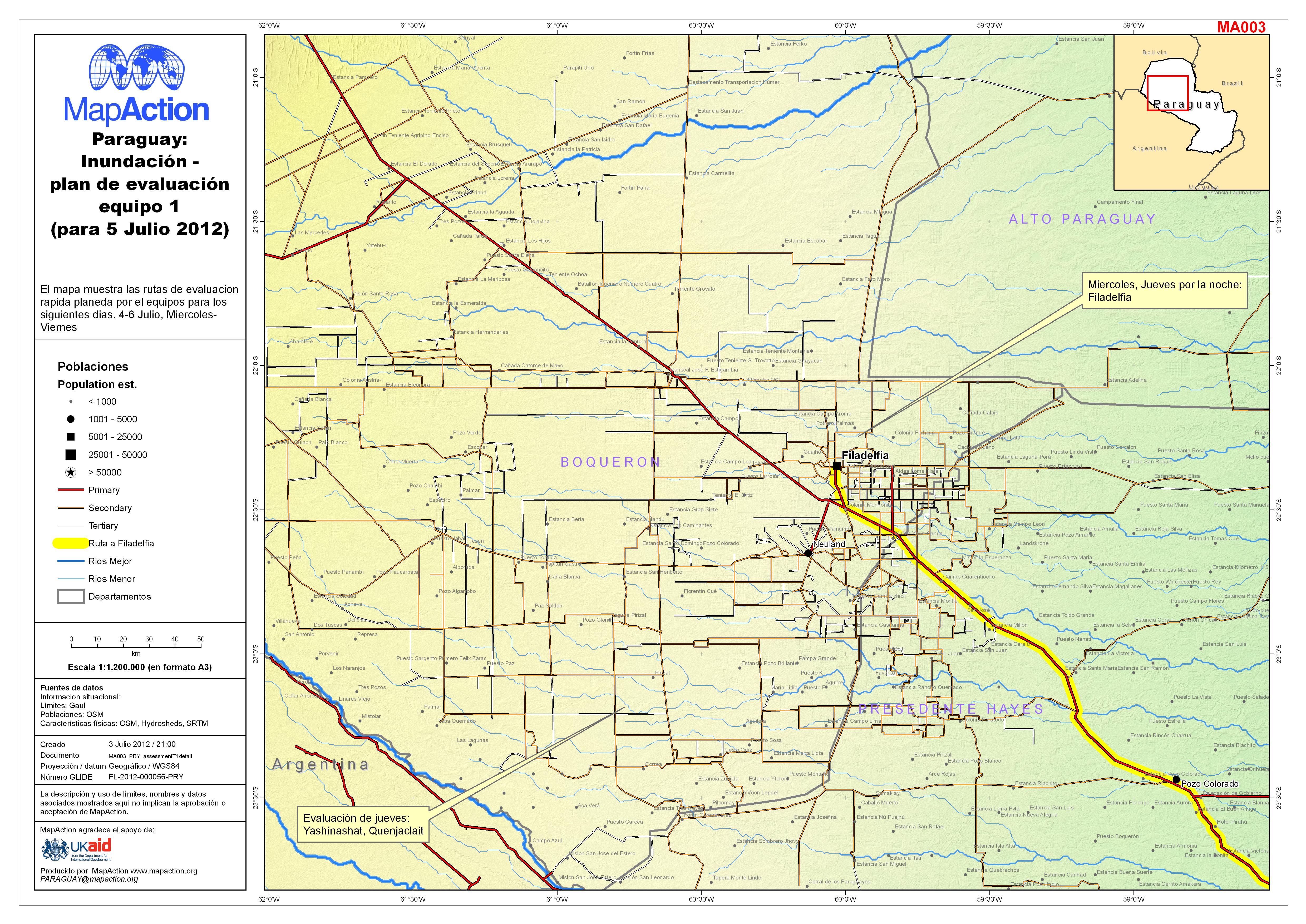
Paraguay: Inundación - plan de evaluación equipo 1 (para 5 Julio 2012)
This dataset has no description
-

Paraguay: Inundación - plan de evaluación equipo 1 (para 4 Julio 2012)
This dataset has no description
-
Paraguay: Inundación - Plan de Evaluación - Equipo 2 (de 4 Junio 2012)
This dataset has no description
-

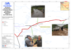
EXERCISE: Hurricane Fubar - Nordland/Sydland Assessment Results (as of 01 Oct...
This Map shows the general situation overview including the likely area to be flooded and some of the results from the assessments on the morning of 01.10.2013. -
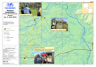
EXERCISE - Nordland: Hurricane Fubar - Assessment locations (as of 30 Sept 2013)
This Map shows the 6 locations to be assessed on the morning of 1.10.2013. The priority areas 1 - 6 were identified by the NEMA. Locations 1 and 3 are airport. Their status and... -

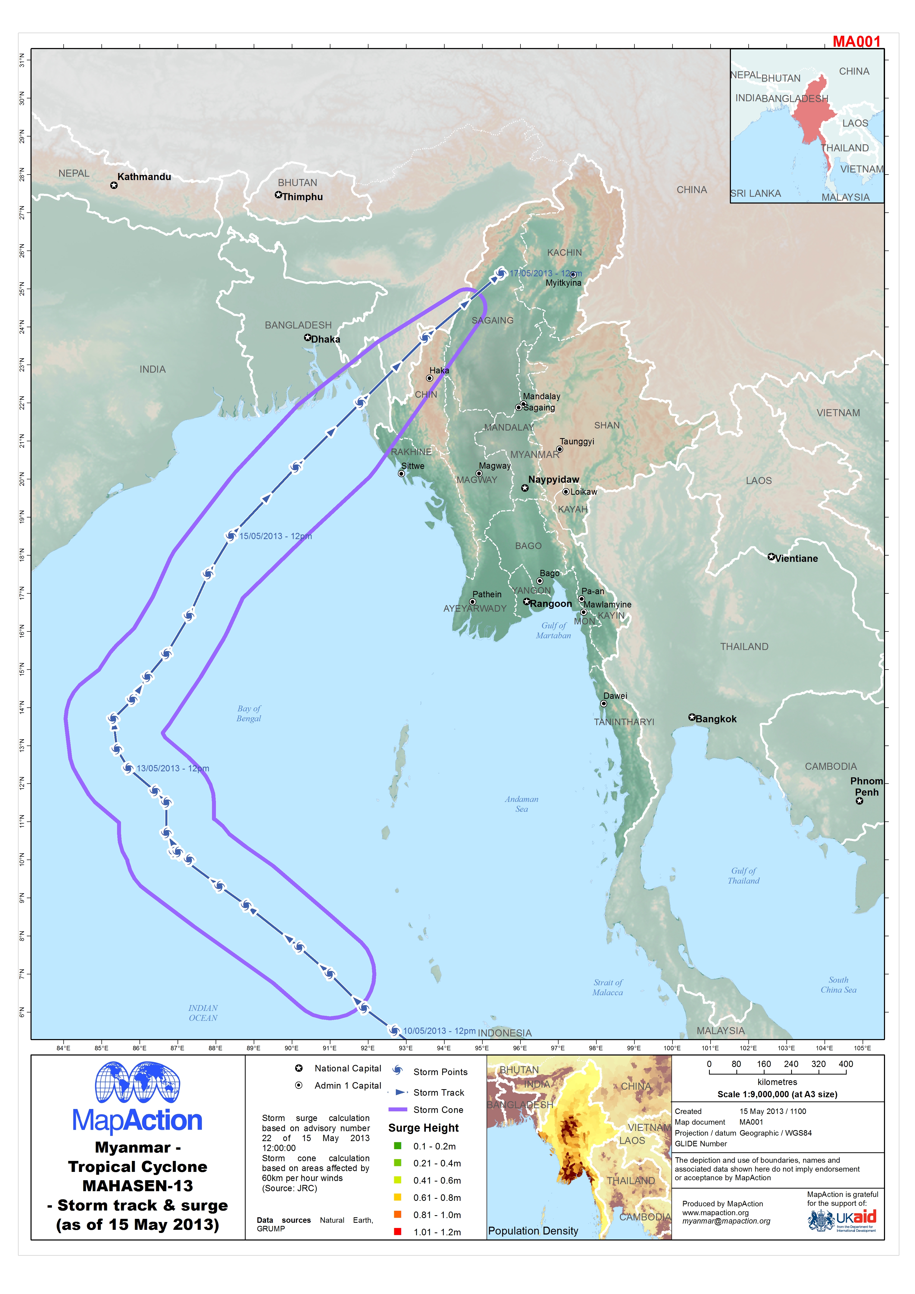
Myanmar: Tropical Cyclone MAHASEN-13 - Storm track & surge (as of 15 May 2013)
The map shows the predicted path and surge of Tropical Cyclone MAHASEN-13. The storm surge calculation is based on advisory number 22 of 15 May 2013 12:00. The storm cone... -
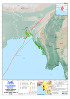
Myanmar: Topical cyclone MAHASEN-13 - Actual storm track and surge
Map shows the predicted and actual storm track of Tropical Cyclone MAHASEN-13, with the storm surge. The storm surge calculation is based on advisory 24 of 16 May 2013. -
Serbia: Floods - Situation (as of 28 May 2014)
Situation in most affected areas as of 28 May: * Emergency situation remains in 2 cities and 14 municipalities. * Stagnation is expected on the Rivers Danube and Saya. * Floods... -
Serbian Floods Situation Data (as at 27 May 2014).
Click the following link to download a Google Earth KMZ showing the Serbian Floods Situation Data (as at 27 May 2014).