-

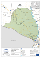
Paraguay: Inundaciones - Mapa de Referência: Ñeembucu (a 18 de Abril 2016)
El mapa muestra Paraguay con las áreas de administración, los ríos principales, las carreteras principales, los ferrocarriles, los asentamientos y los aeropuertos. -
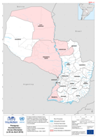
Paraguay: Inundaciones - Mapa de Referência: Presidente Hayes (a 18 de Abril ...
El mapa muestra el departmento Presidente Hayes con las áreas de administración, los ríos principales, las carreteras principales, los ferrocarriles, los asentamientos y los... -
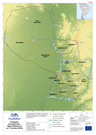
Paraguay: Inundaciones - Mapa Referência (a 17 de Abril 2016)
El mapa muestra Paraguay con las áreas de administración, los ríos principales, las carreteras principales y los capitales de departamento. -
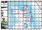
Paraguay: Inundaciones - Zonas Afectadas (a 20 de Abril 2016)
El mapa muestra la extension de la inundación conocida a 18 de abril de 2016. Los datos de las zonas afectadas provienen del OCHA. Además el mapa muestra las áreas de... -

Libya: Complex - Chocha Camp KMZ Update
An up dated kmzof the layout of Choucha Camp on the Tunisia/ Libya border. -
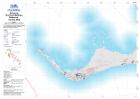
Bahamas: Hurricane Matthew- Northern Andros Overview
Interpretation of situation in sample areas in selected critical zones as assessed during CDEMA Rapid Assessments conducted 8-11 October 2016 for Government of Bahamas. -

Bahamas: Hurricane Matthew- CDEMA RNAT Locations
Fig. X Location of CDEMA Rapid Needs Assessment Teams -

Bahamas: Hurricane Matthew- Assessment Survey Areas New Providence 8-11 Oct 2016
Location of CDEMA Rapid Assessment Survey Areas, grouped by either South Coast Constituency or General Survey Area. Jointly conducted with Government of Bahamas, UNDAC and... -

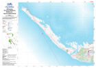
Bahamas: Hurricane Matthew- Reference - Island Assessments
1:100 000 Reference maps for Bahamas showing islands, settlements, transport infrastructure, districts and topographic features -
Bahamas: Hurricane Matthew- Reference - Island Assessments
1:100 000 Reference maps for Bahamas showing islands, settlements, transport infrastructure, districts and topographic features -
Bahamas: Hurricane Matthew- Reference - Country Map
1:250 000 Reference maps for Bahamas showing islands, settlements, transport infrastructure, districts and topographic features -

Tanzania Earthquake NE of Kagera Region Administrative Map (as of 22 Sep 2016)
Map shows the extent of the damaged districts/wards from the Earthquake with terrain. This is primarily a reference map with villages, road and river displayed to show context... -
-
Haiti: Hurricane Matthew: Reference Series at Commune Level (as of 12 Oct 2016)
Reference map at commune admin level -
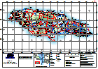
Jamaica: Hurricane Matthew - Assessment Planning
Basemap for assessment and field team planning showing settlements, schools, healthcare facilities and road networks. -

Bahamas: Hurricane Matthew - Reference - Country Map
Reference map for Bahamas showing major islands, districts and topographic features -

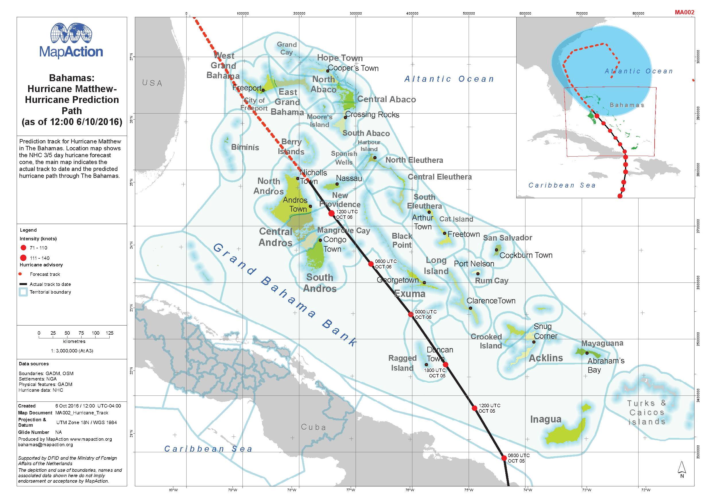
Bahamas: Hurricane Matthew - Hurricane Prediction Path (as of 12:00 6/10/2016)
Prediction track for Hurricane Matthew in The Bahamas. Location map shows the NJC 3/5 day hurricane forecast. The main map indicates the actual track to date and the predicted... -
Haiti: Hurricane Matthew, General Overview (as of 6 Oct 2016)
Reference map showing main affected areas of Haiti following hurricane Matthew. -
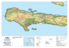
Jamaica: Hurricane Matthew - Topographic Reference
General Topography Map of Jamaica for orientation, including major settlement, topography and transport infrastructure. -

Cape Verde - Brava - Reference Map (Mapa de Referência)
Basic reference map of Brava island in Cape Verde showing terrain and location of port, transport routes and main settlements (Portuguese version)