-
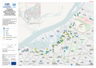
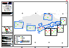
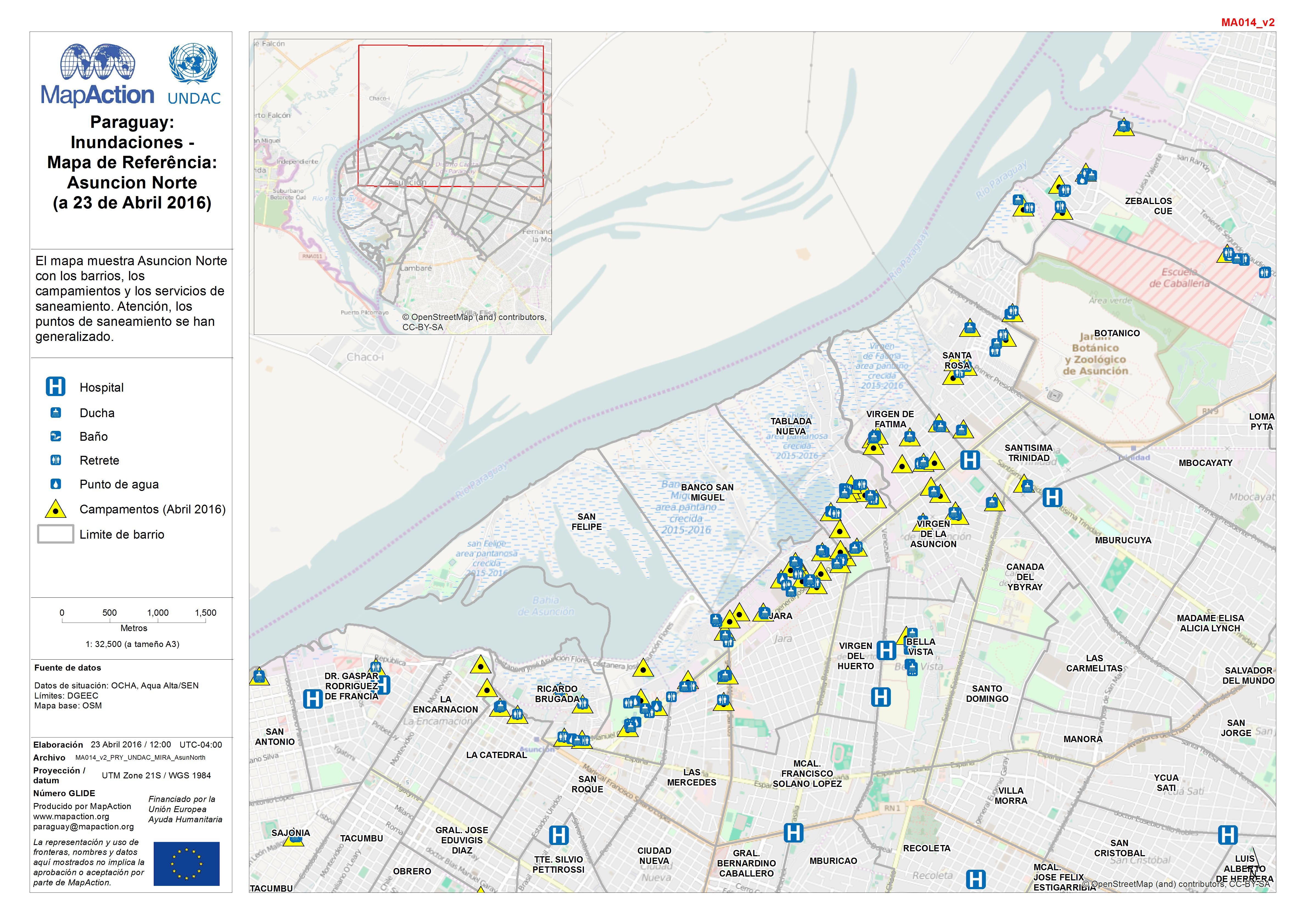
Paraguay: Inundaciones - Mapa de Referência: Asuncion Norte (a 23 de Abril 2016)
El mapa muestra Asuncion Norte con los barrios, los campamientos y los servicios de saneamiento. Atención, los puntos de saneamiento se han generalizado. -
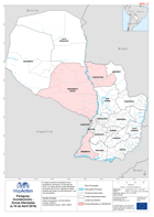
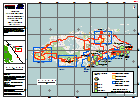
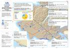
Paraguay: Inundaciones - Zonas Afectadas (a 18 de Abril 2016)
El mapa muestra la extension de la inundación conocida a 18 de abril de 2016. Los datos de las zonas afectadas provienen del OCHA. Además el mapa muestra las áreas de... -

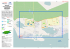
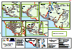
Bahamas: Hurricane Matthew- Reference - Island Assessments
1:100 000 Reference maps for Bahamas showing islands, settlements, transport infrastructure, districts and topographic features -
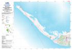
Bahamas: Hurricane Matthew- Reference - Island Assessments
1:100 000 Reference maps for Bahamas showing islands, settlements, transport infrastructure, districts and topographic features -
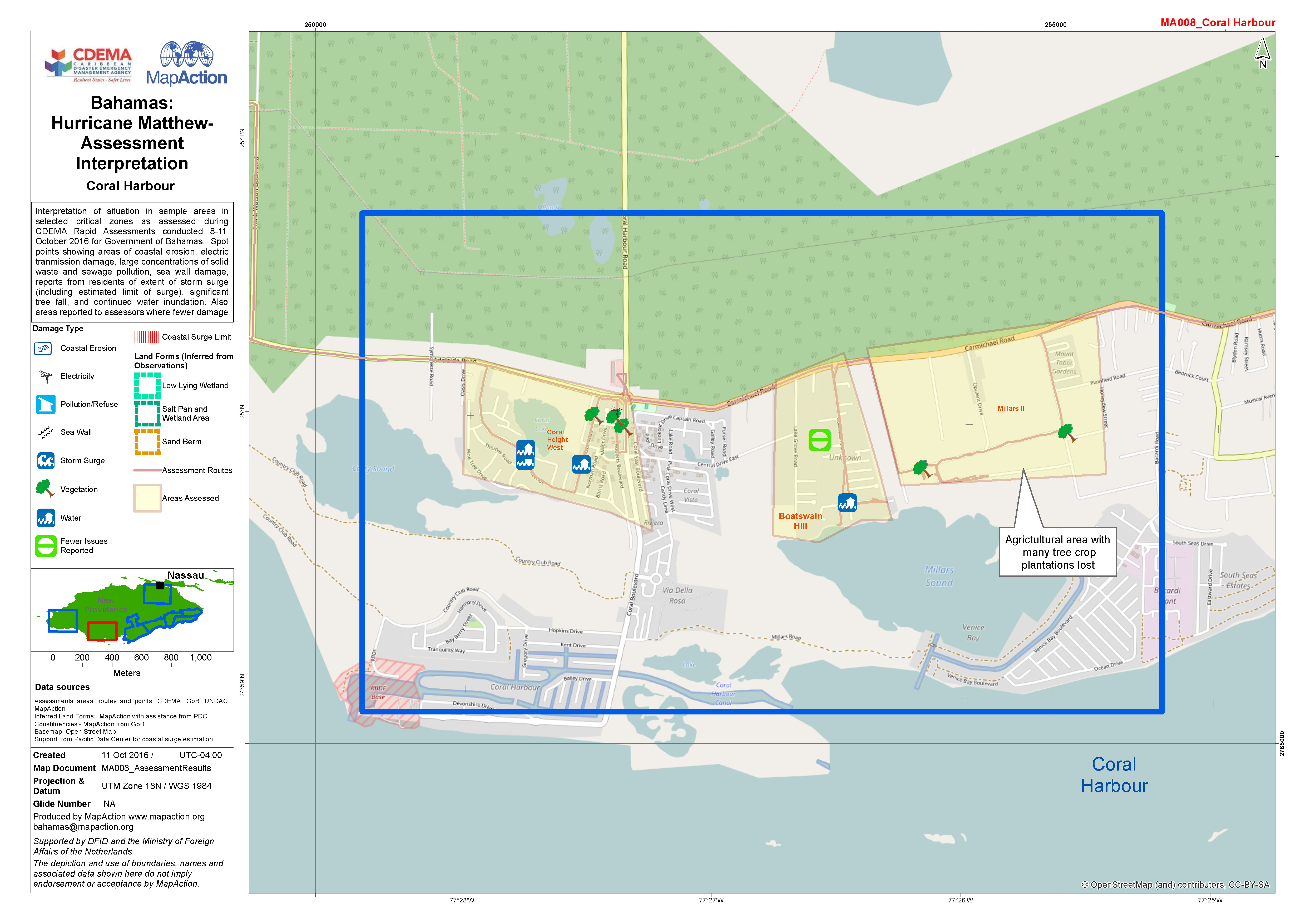
Bahamas: Hurricane Matthew- Assessment Interpretation
Interpretation of situation in sample areas in selected critical zones as assessed during CDEMA Rapid Assessments conducted 8-11 October 2016 for Government of Bahamas. Spot... -
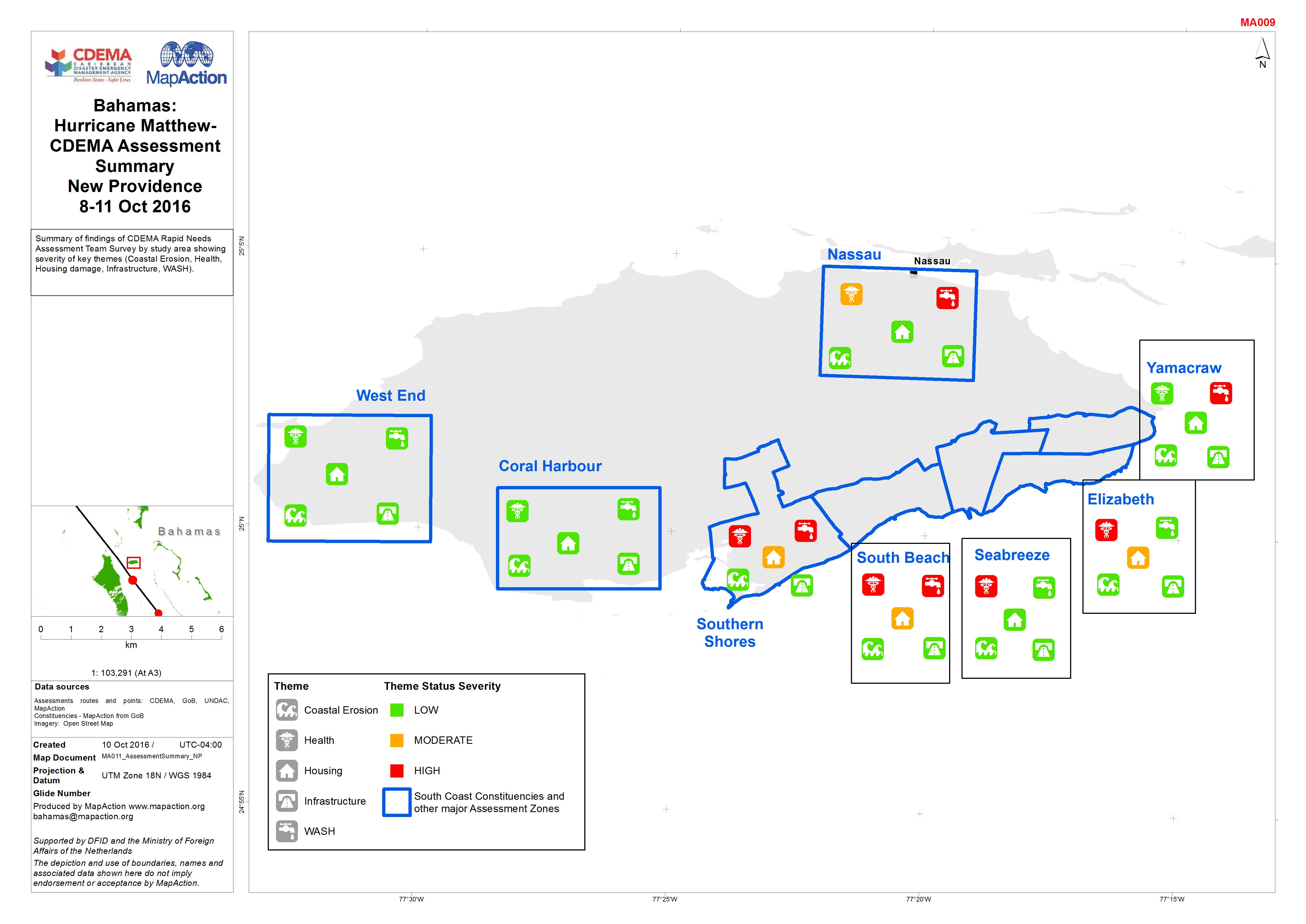
Bahamas: Hurricane Matthew- CDEMA Assessment Summary New Providence 8-11 Oct ...
Summary of findings of CDEMA Rapid Needs Assessment Team Survey by study area showing severity of key themes (Coastal Erosion, Health, Housing damage, Infrastructure, WASH). -
Bahamas: Hurricane Matthew- Rapid Assessment Housing Damage Estimate New Prov...
Estimates of housing damage in areas assessed for CDEMA. Level 0 - no damage, Level 1 - superficial damage, Level 2 - significant damage but habitable, Level 3 - not... -

Tanzania Earthquake Kagera Region Percentage Damaged Houses (as of 26 Sep 2016)
Map shows the percentage of damaged houses based on major damage to buildings in: Wards: Bukoba Rural; Bukoba Urban; Kagerwa: Missenyi Districts: Kyerwa; Muleba * Data was only... -

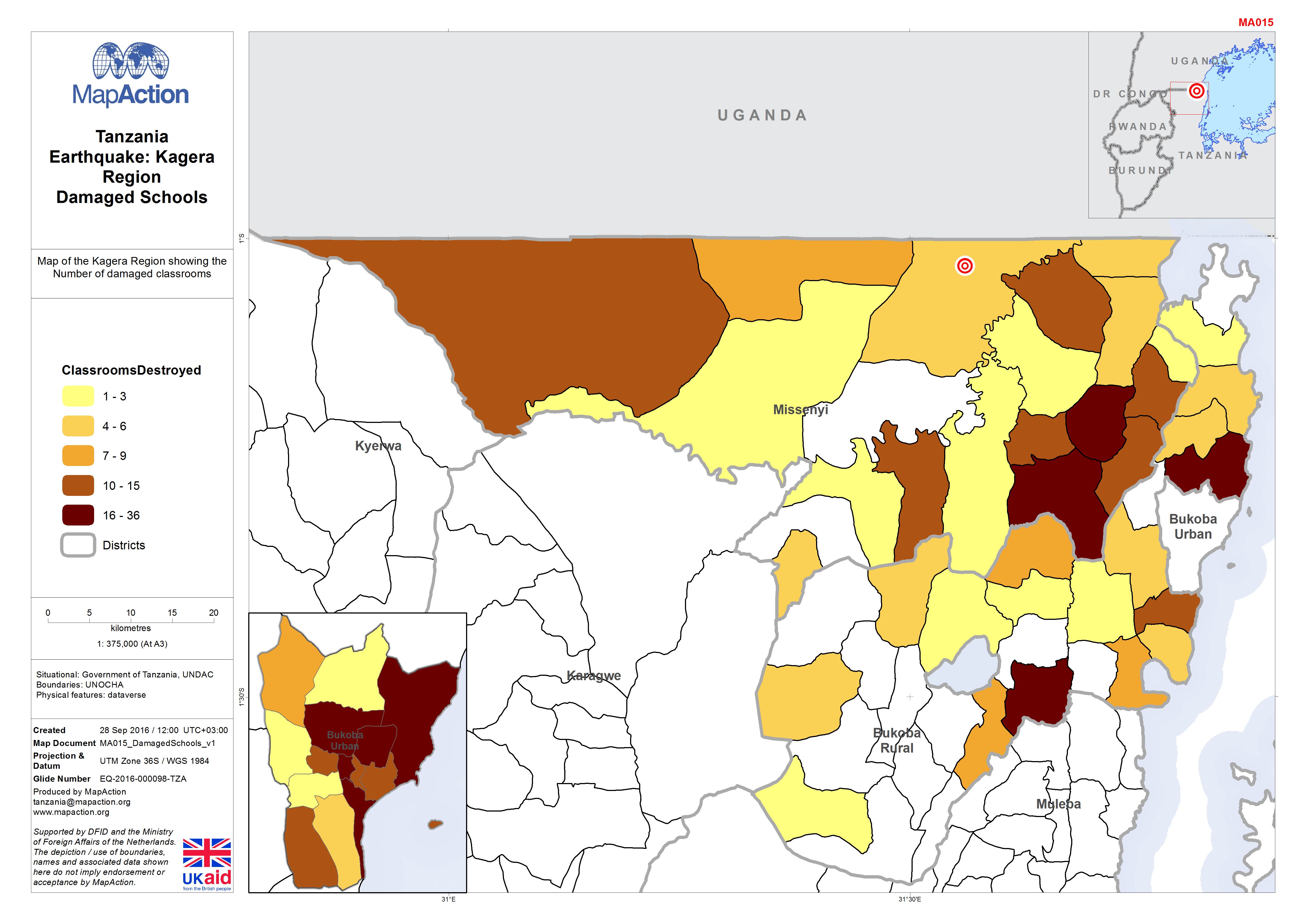
Tanzania Earthquake: Kagera Region Damaged Schools
Map of the Kagera Region showing the Number of damaged classrooms -

Haiti: Hurricane Matthew, Damaged Buildings, Jeremie - (as of 10 Oct 2016)
Reference map showing number of destroyed and severely damaged buildings in the Jeremie area, by Section and 5km square. -
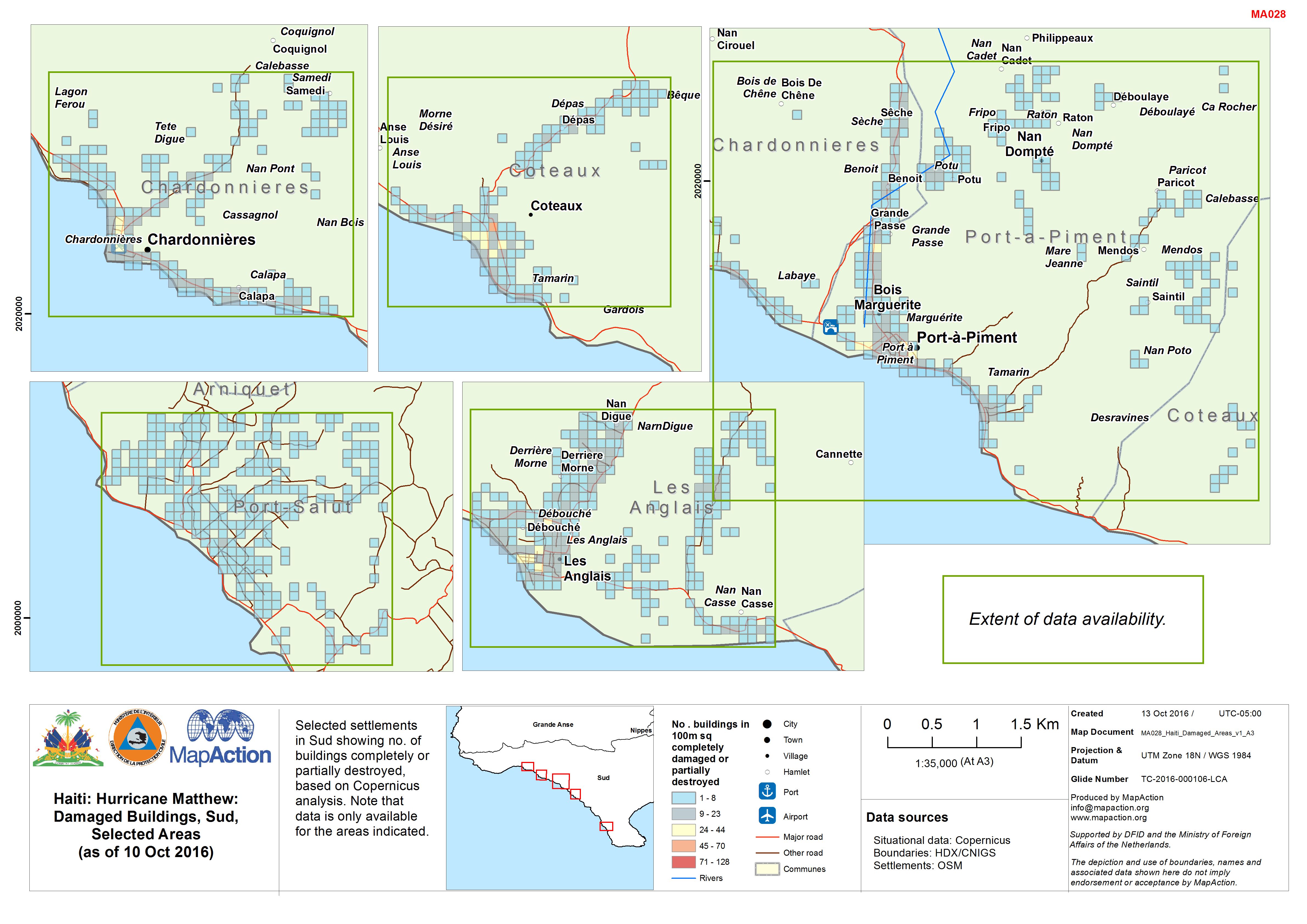
Haiti: Hurricane Matthew: Damaged Buildings, Sud, Selected Areas (as of 10 Oc...
Selected settlements in Sud showing no. of buildings completely or partially destroyed, based on Copernicus analysis. Note that data is only available for the areas indicated. -

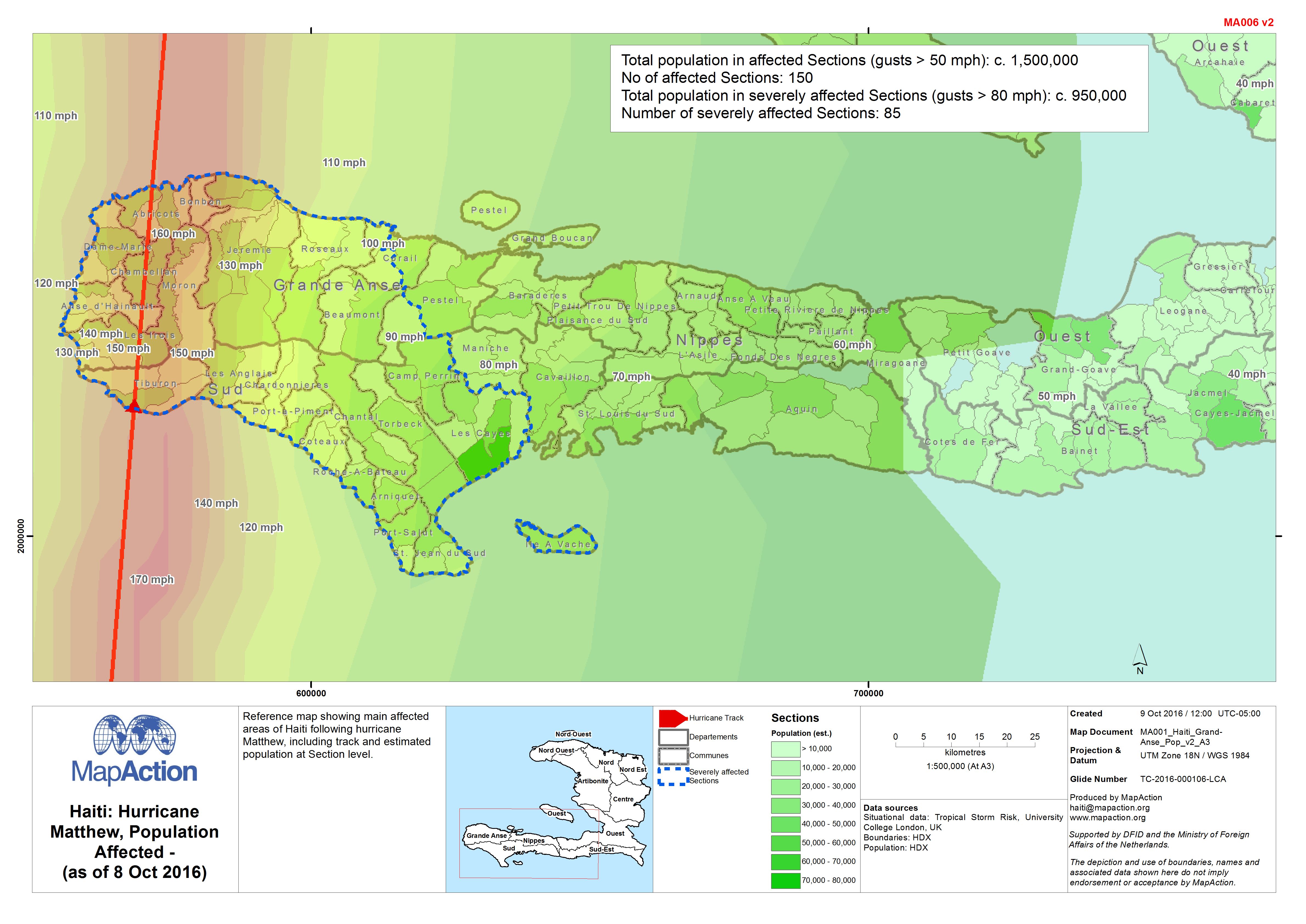
Haiti: Hurricane Matthew, Population Affected - (as of 8 Oct 2016)
Reference map showing main affected areas of Haiti following hurricane Matthew, including track and estimated population at Section level. -

Haiti: Hurricane Matthew, Main Bridge/Road Obstacles - South (as of 7 Oct 2016)
Reference map showing main obstacles/blockages in Southern Haiti following Hurricane Matthew. -
Haiti: Hurricane Matthew, Population Affected - (as of 7 Oct 2016)
Reference map showing main affected areas of Haiti following hurricane Matthew, including track and estimated population at Section level. -

Haiti: Hurricane Matthew - General Overview and Track (as of 6 Oct 2016)
Reference map showing main affected areas of Haiti following hurricane Matthew, including hurricane track. -
SORLAND Hurricane Windblown IDP Sites Assessment Findings (from 27 September)
Summarises the findings of initial multi-cluster needs assessments. Assessments were carried out by mixed teams at six IDP sites on 27 September 2016 following Hurricane Windblown. -

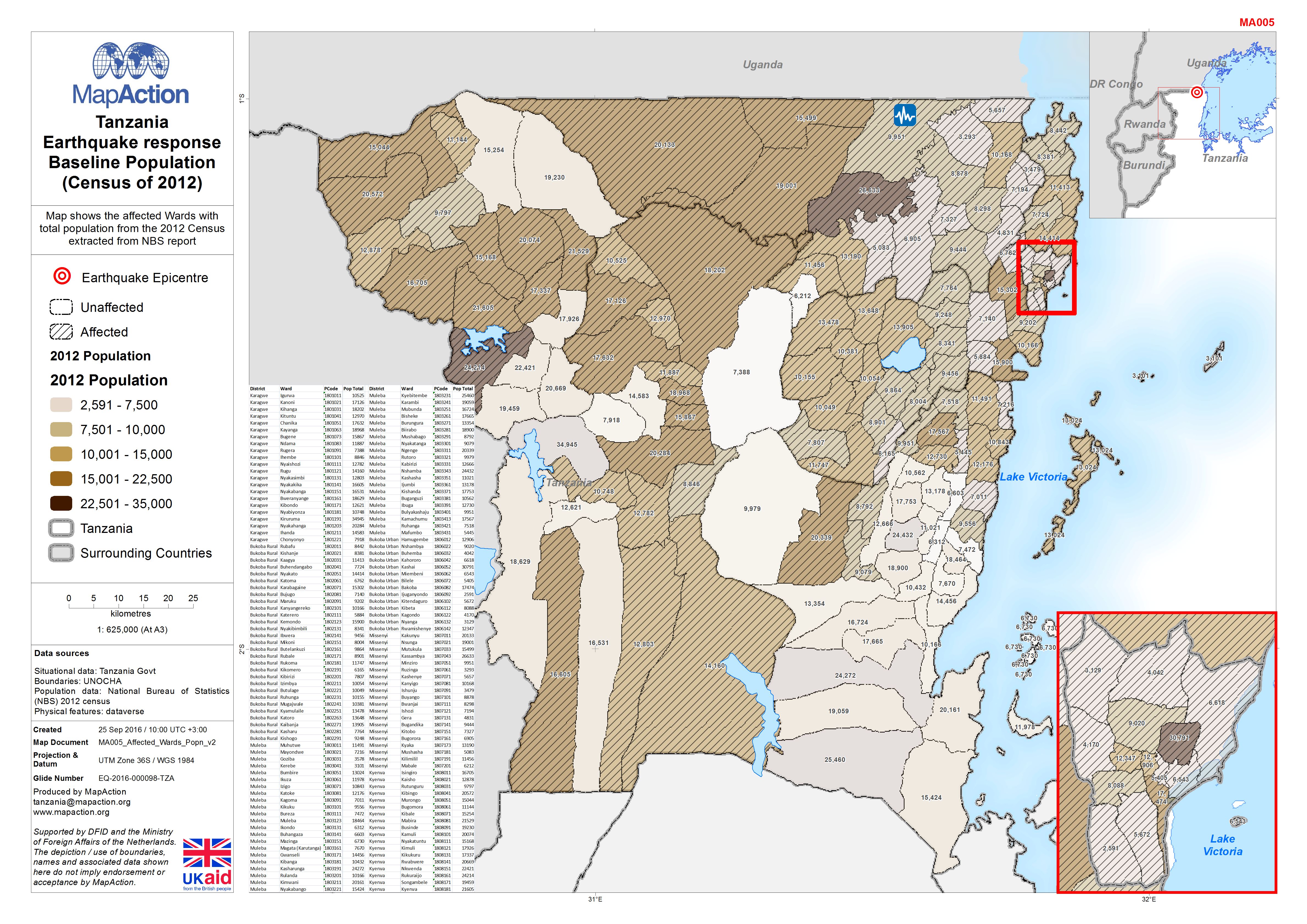
Tanzania Earthquake response Baseline Population (Census of 2012)
Map shows the affected Wards with total population from the 2012 Census extracted from NBS report. -

Tanzania Earthquake response Baseline Population (Census of 2012)
Map shows the affected Wards with total population from the 2012 Census extracted from NBS report -
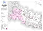
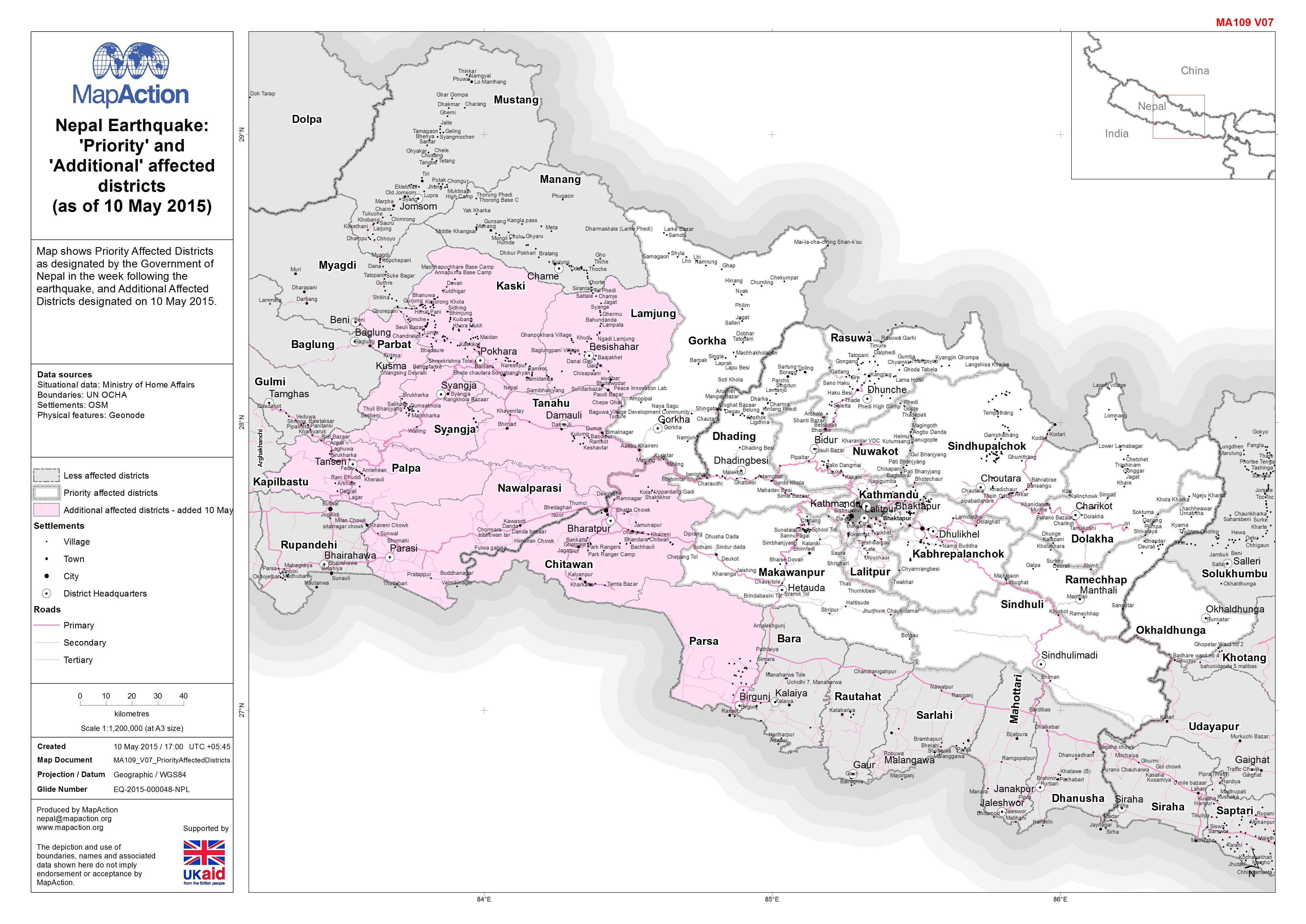
Nepal: Earthquake - 'Priority' and 'Additional' affected districts (as of 10 ...
Map shows Priority Affected Districts as designated by the Government of Nepal in the week following the earthquake, and Additional Affected Districts designated on 10 May 2015. -
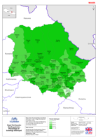
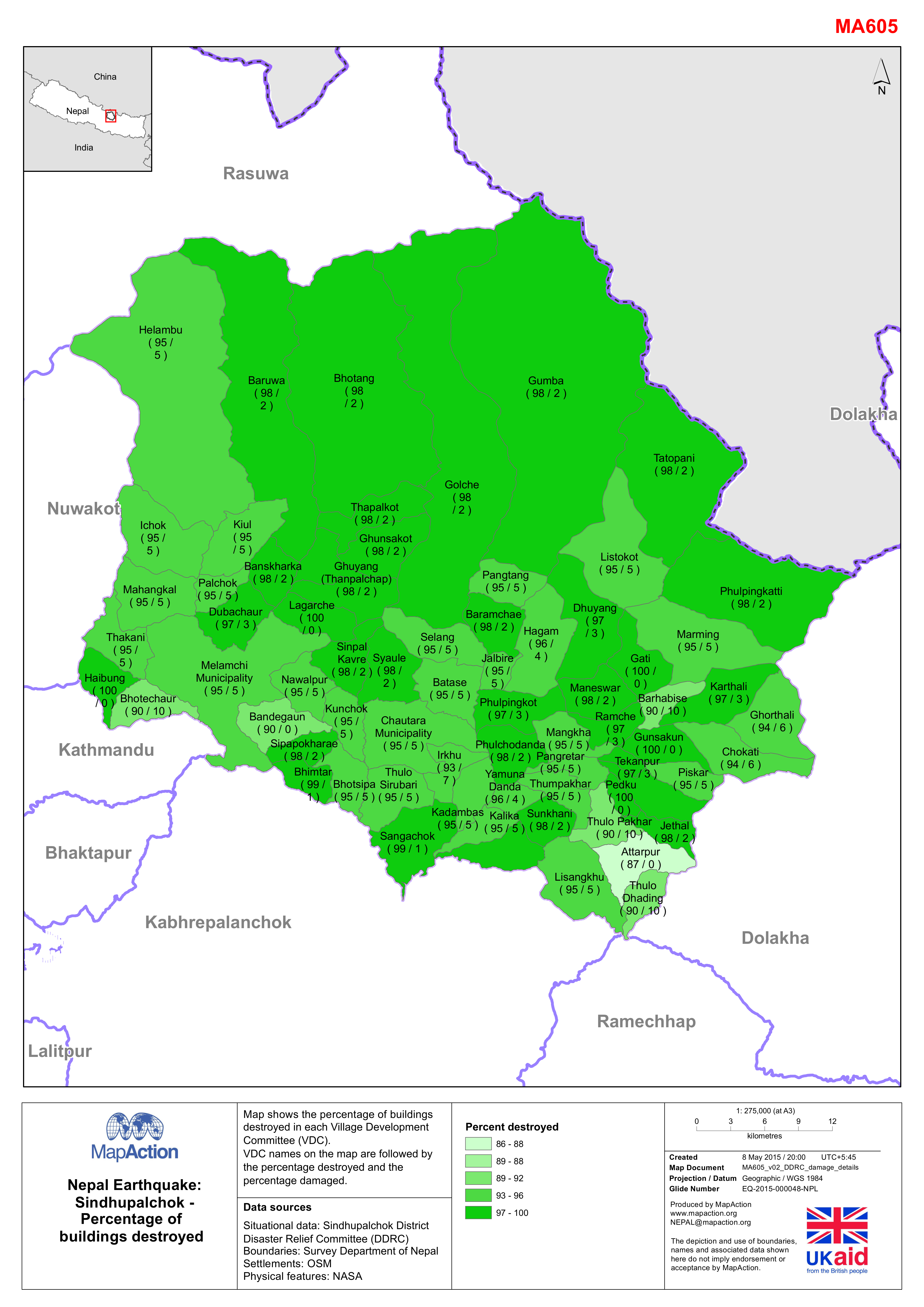
Nepal: Earthquake - Sindhupalchok - Percentage of destroyed buildings
Map shows the percentage of buildings destroyed in each Village Development Committee (VDC). The VDC names on the map are followed by the percentage destroyed and the percentage...