-

Cumulative Rainfall (1st - 13th March 2023), and affected population. MA019
Southern Region: Total Rainfall (1st - 15th March 2023), and affected population per Traditional Authority -

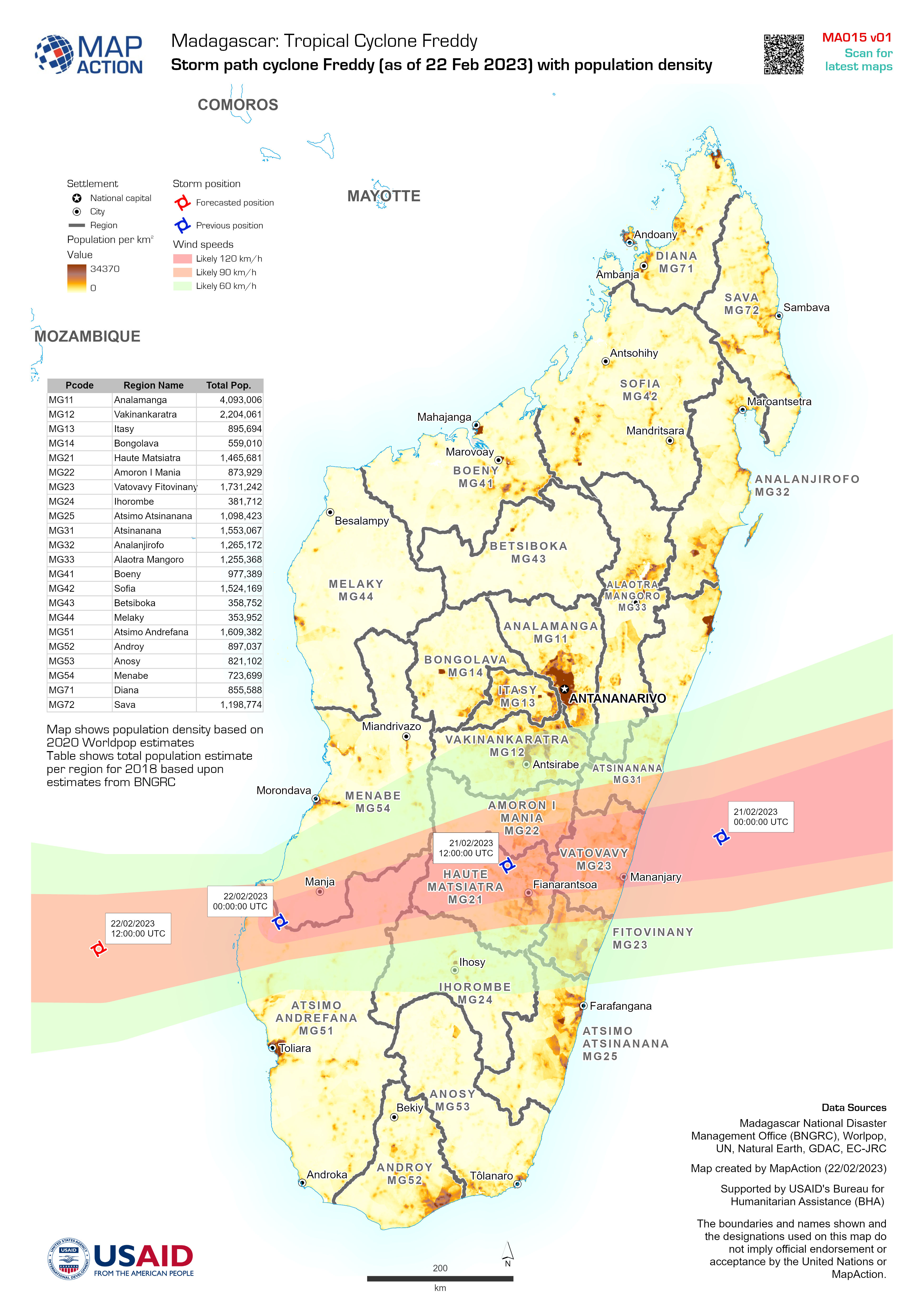
Storm path cyclone Freddy (as of 22 Feb 2023) with population density
Map shows population density based on 2020 Worldpop estimates Table shows total population estimate per region for 2018 based upon estimates from BNGRC -
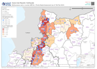
Multi-purpose cash or voucher (MPCA) - Priority Needs Assessment (as of 13th ...
Multi-purpose cash or voucher priority of REACH Surveys for NW Syria aggregated by Sub-District. Data coming from multiple sources as of Feb 13th 2023. -

Winterisation Support - Priority Needs Assessment (as of 13th Feb 2023)
Winterisation support priority of REACH Surveys for NW Syria aggregated by Sub-District. Data coming from multiple sources as of Feb 13th 2023. -

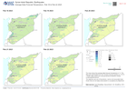
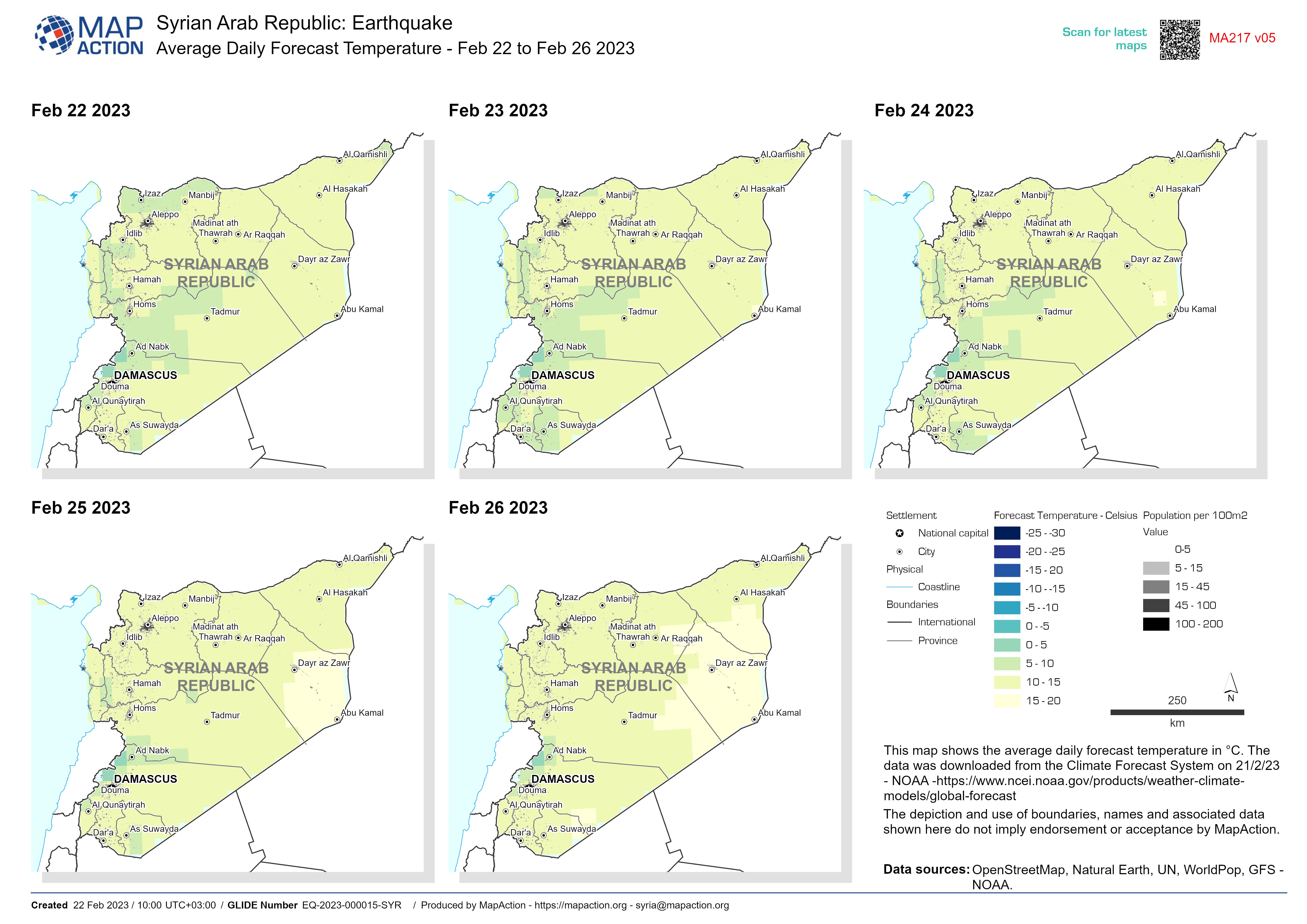
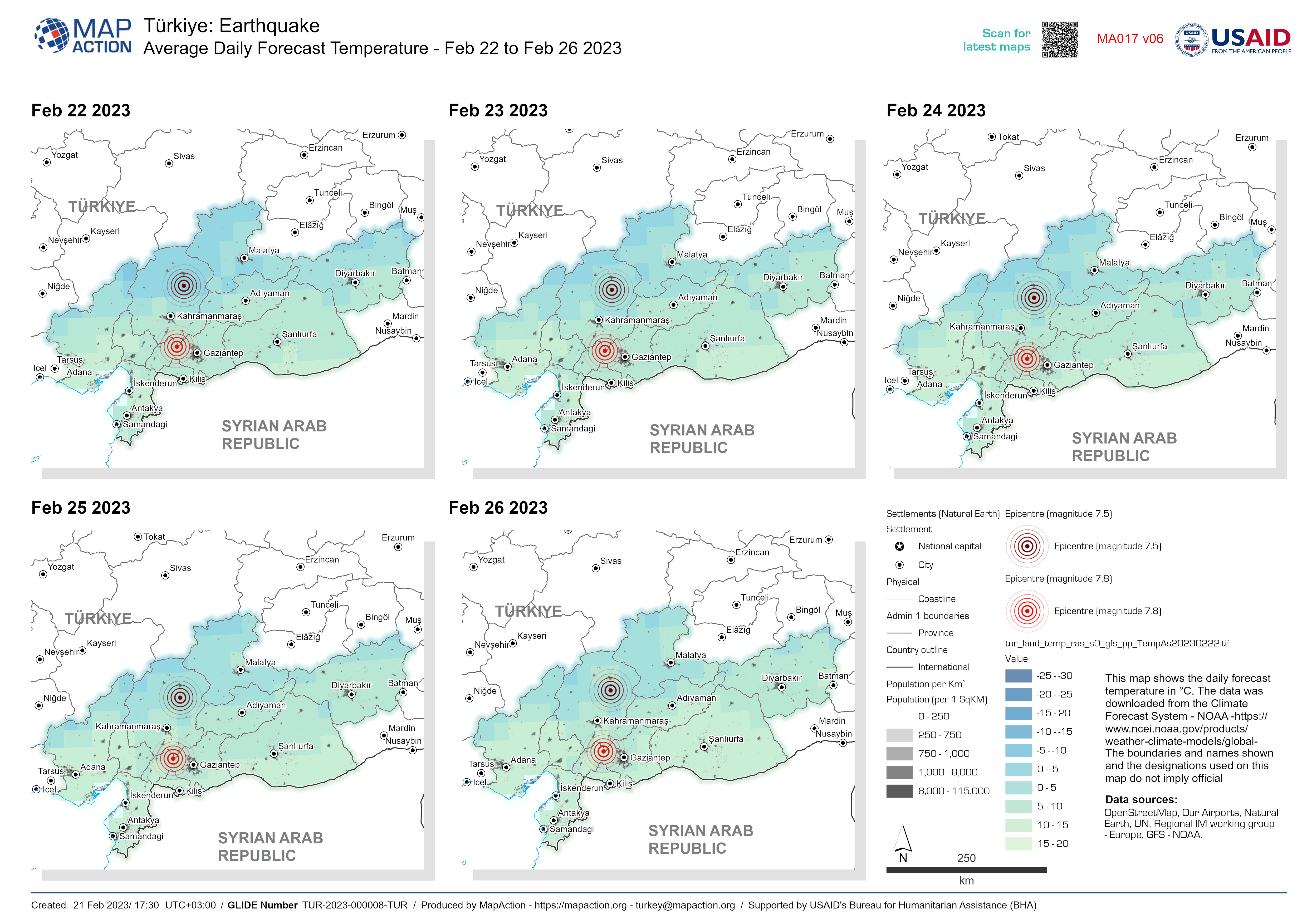
Average Daily Forecast Temperature - Feb 22 to Feb 26 2023
This map shows the average daily forecast temperature in °C. The data was downloaded from the Climate Forecast System on 21/2/23 - NOAA... -

Average Daily Forecast Temperature - Feb 22 to Feb 26 2023
This map shows the daily forecast temperature in °C. The data was downloaded from the Climate Forecast System - NOAA... -
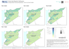
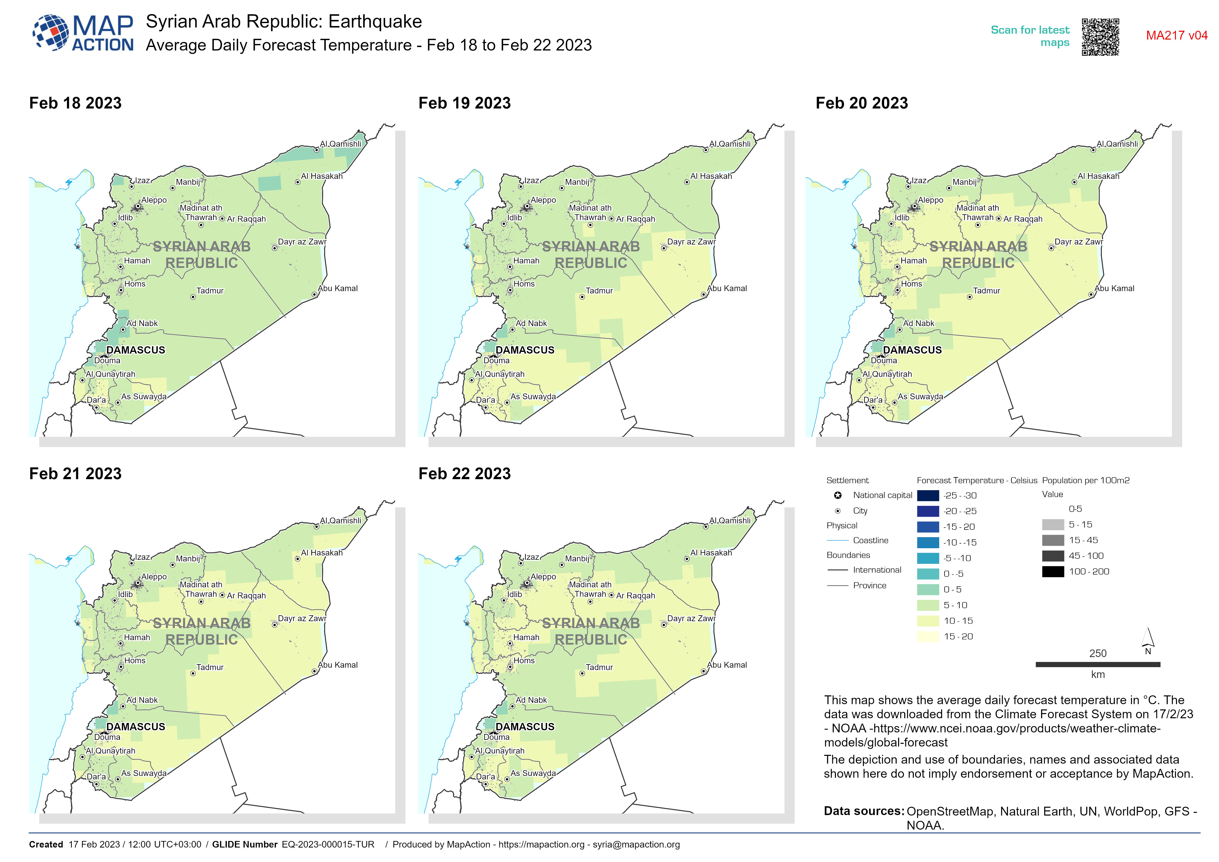
Average Daily Forecast Temperature - Feb 18 to Feb 22 2023
This map shows the average daily forecast temperature in °C. The data was downloaded from the Climate Forecast System on 17/2/23 - NOAA... -

Average Daily Forecast Temperature - Feb 18 to Feb 22 2023
This map shows the daily forecast temperature in °C. The data was downloaded from the Climate Forecast System - NOAA... -
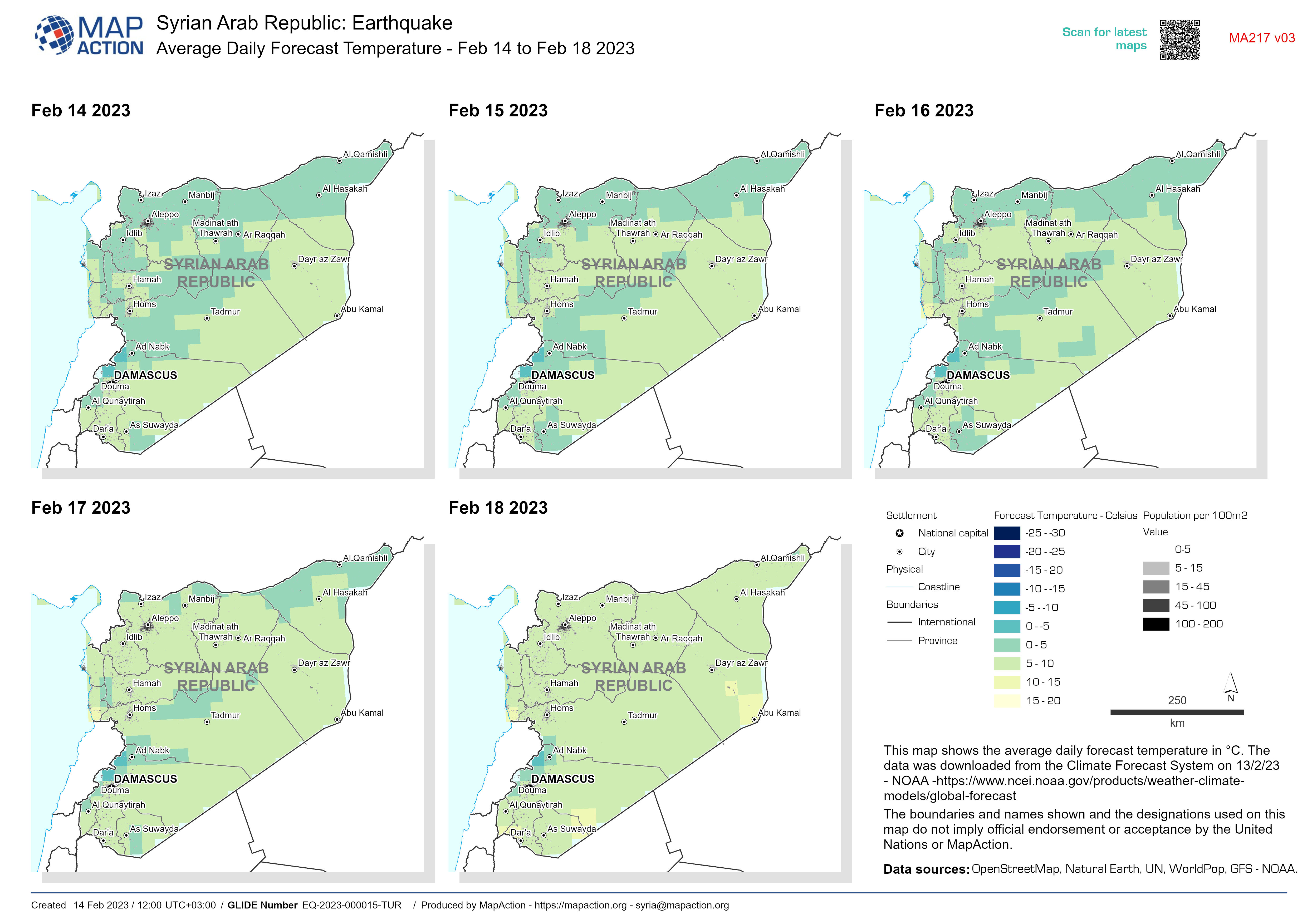
Average Daily Forecast Temperature - Feb 14 to Feb 18 2023
This map shows the average daily forecast temperature in °C. The data was downloaded from the Climate Forecast System on 13/2/23 - NOAA... -

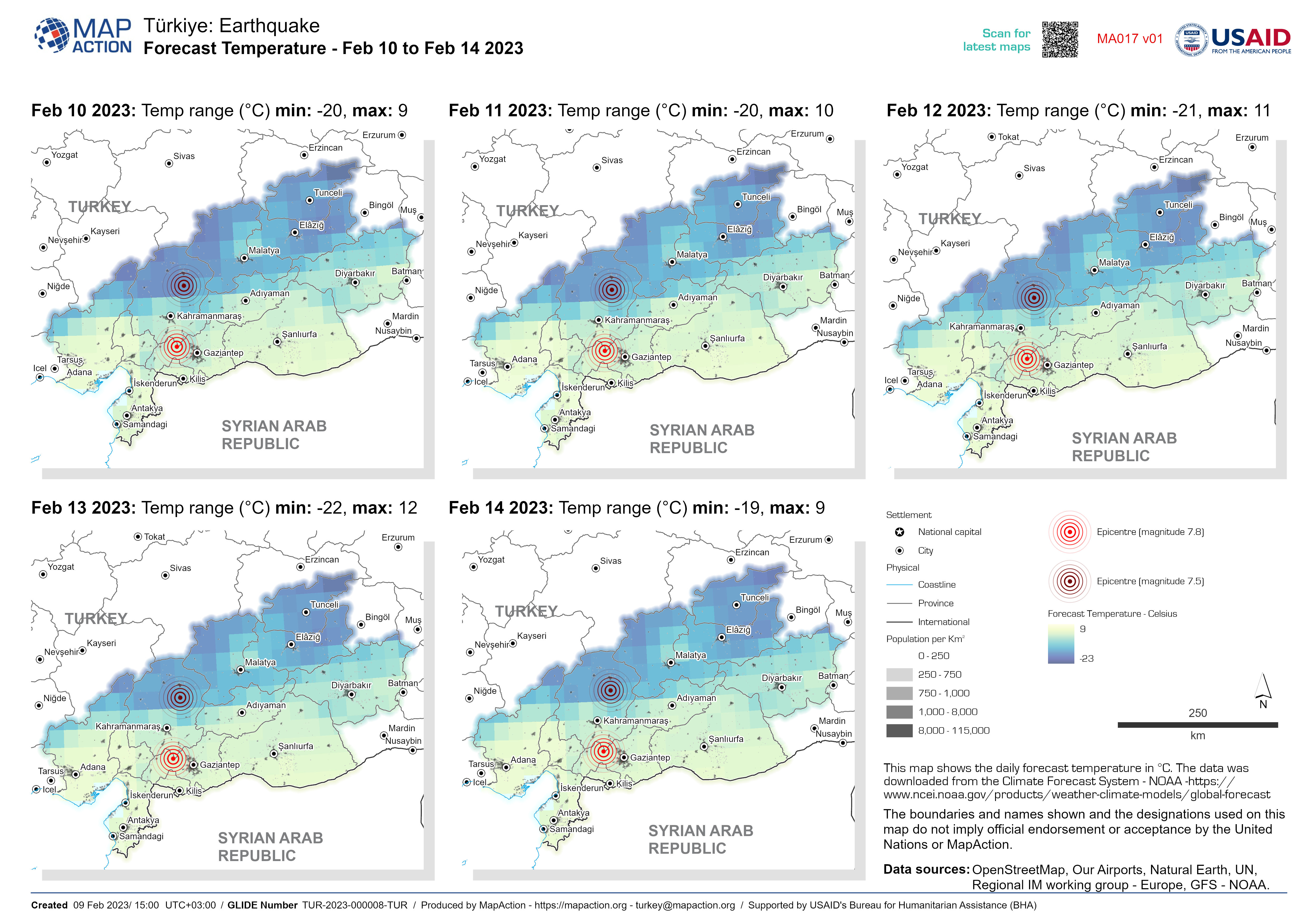
Average Daily Forecast Temperature - Feb 10 to Feb 14 2023
This map shows the daily forecast temperature in °C. The data was downloaded from the Climate Forecast System - NOAA... -

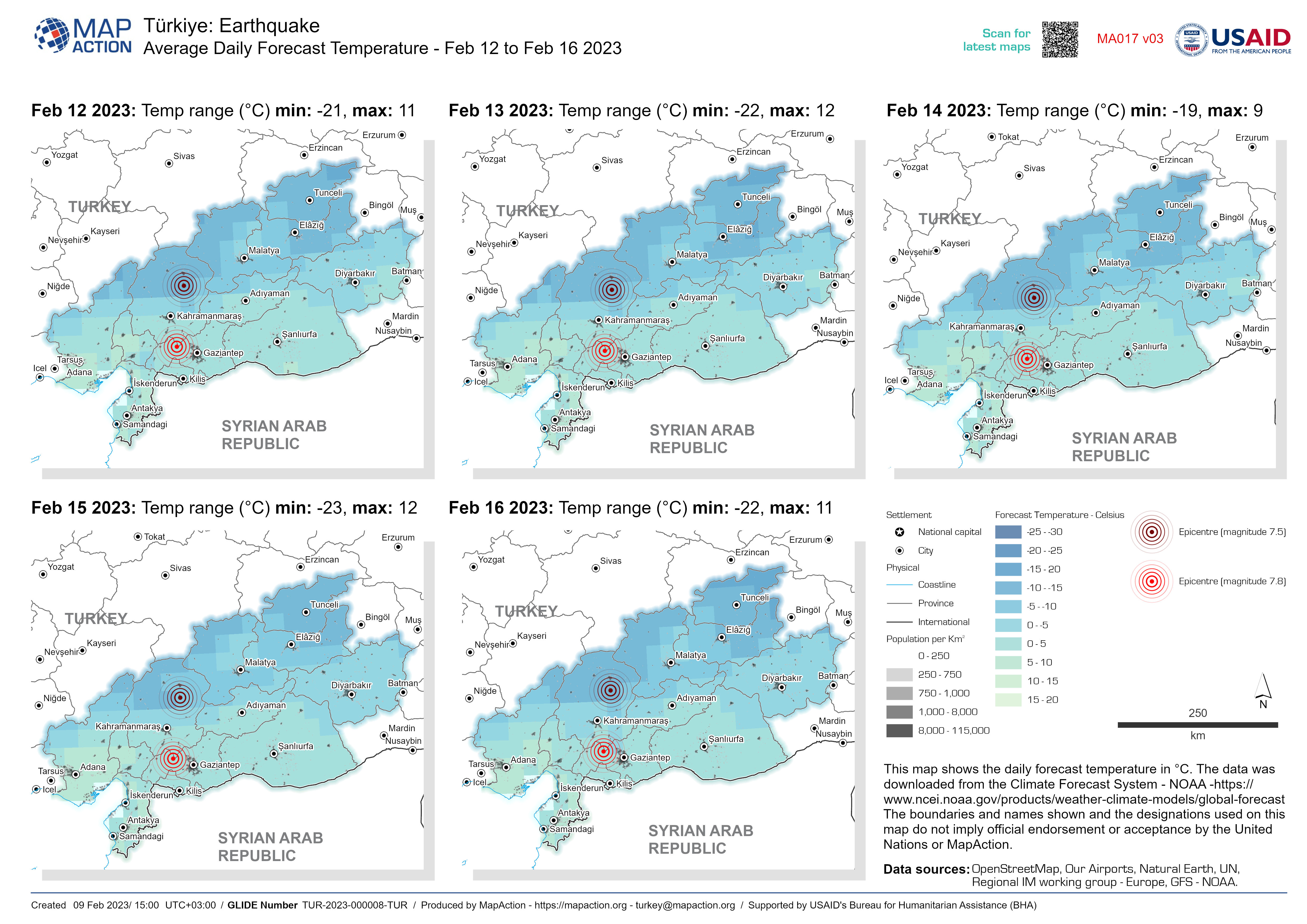
Average Daily Forecast Temperature - Feb 12 to Feb 16 2023
This map shows the daily forecast temperature in °C. The data was downloaded from the Climate Forecast System - NOAA... -

Average Daily Forecast Temperature - Feb 11 to Feb 15 2023
This map shows the daily forecast temperature in °C. The data was downloaded from the Climate Forecast System - NOAA... -
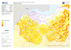
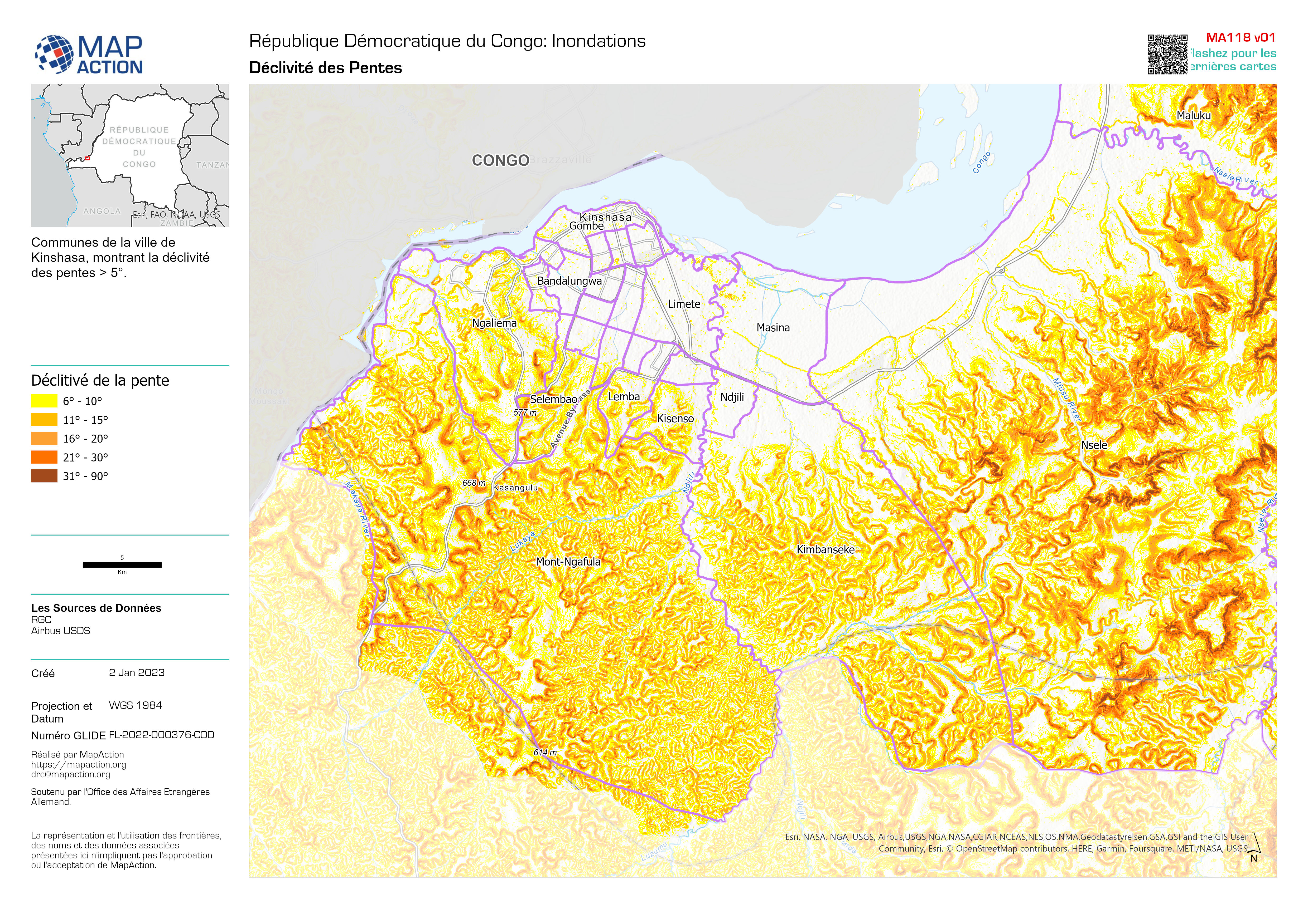
Déclivité des Pentes
Communes de la ville de Kinshasa, montrant la déclivité des pentes > 5°. -

Categorías de Sequía (US Drought Monitor) 26 Junio 2022 al 25 Septiembre 2022
MIRA - Comunidades identificadas para la recolección de datos primarios en los departamentos de Boquerón, Presidente Hayes -

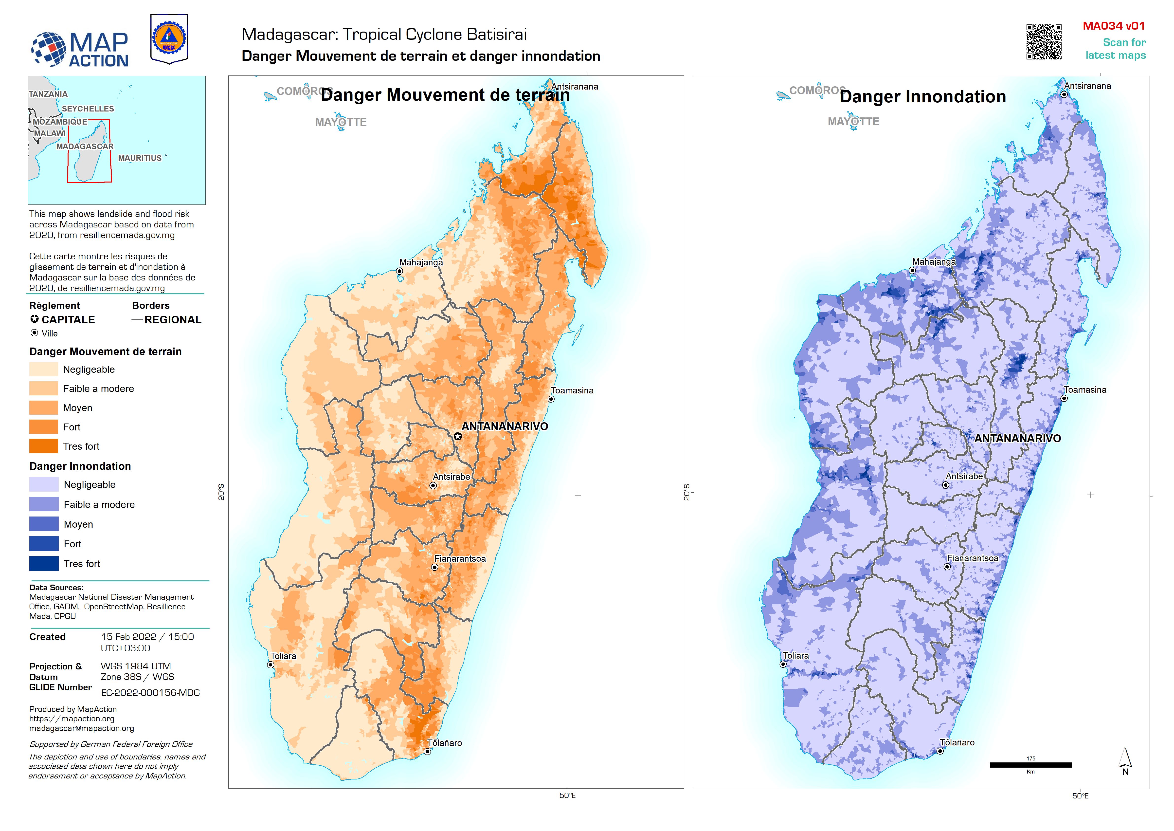
Danger Mouvement de terrain et danger innondation
This map shows landslide and flood risk across Madagascar based on data from 2020, from resilliencemada.gov.mg Cette carte montre les risques de glissement de terrain et... -

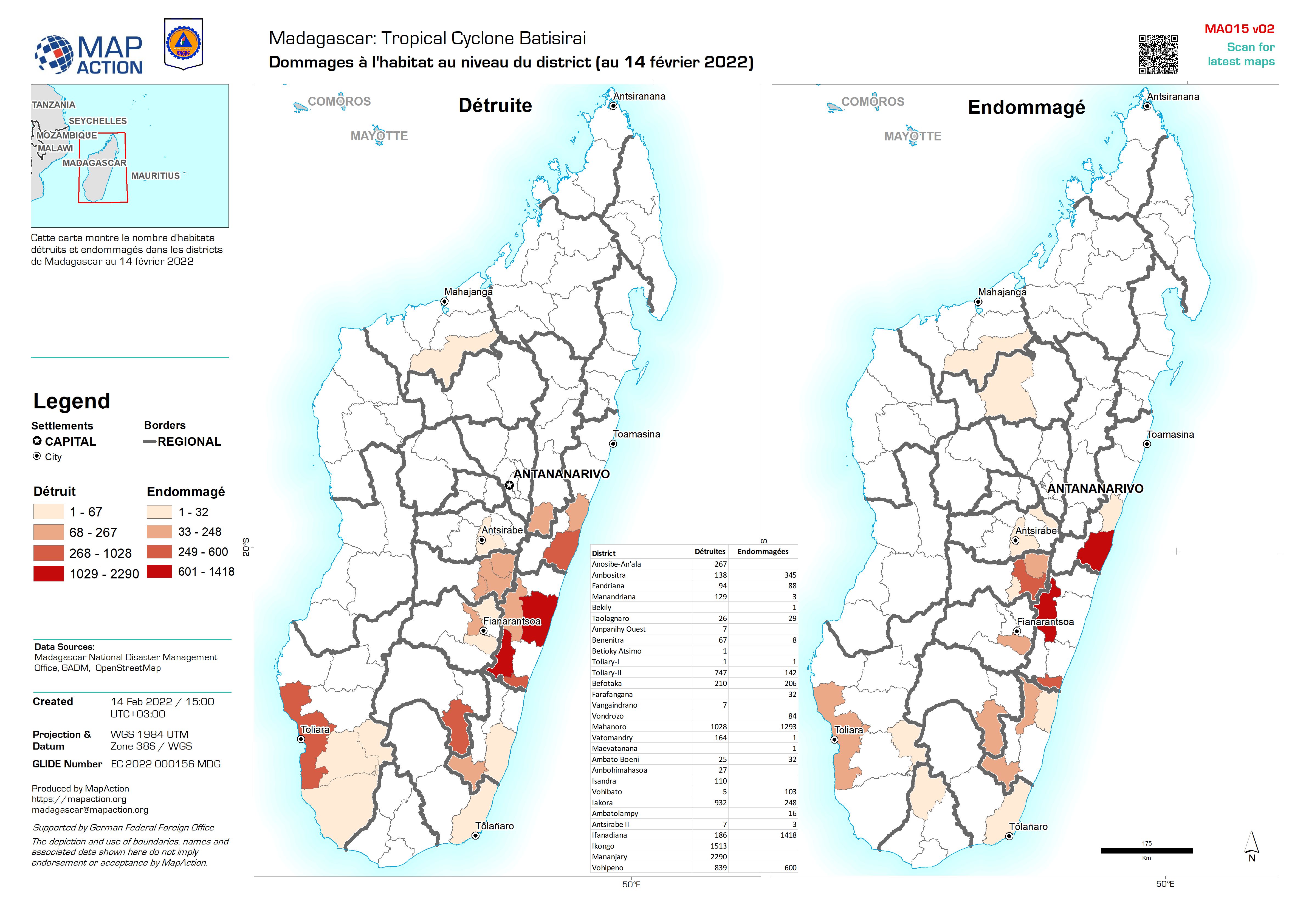
Dommages à l'habitat au niveau du district (au 14 février 2022)
Cette carte montre le nombre d'habitats détruits et endommagés dans les districts de Madagascar au 14 février 2022 -

Habitat Damage at District level (As of 8th Feb 2022)
This map shows the number of destroyed and damaged habitats in Districts of Madagascar as of 8th Feb 2022 -
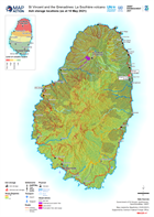
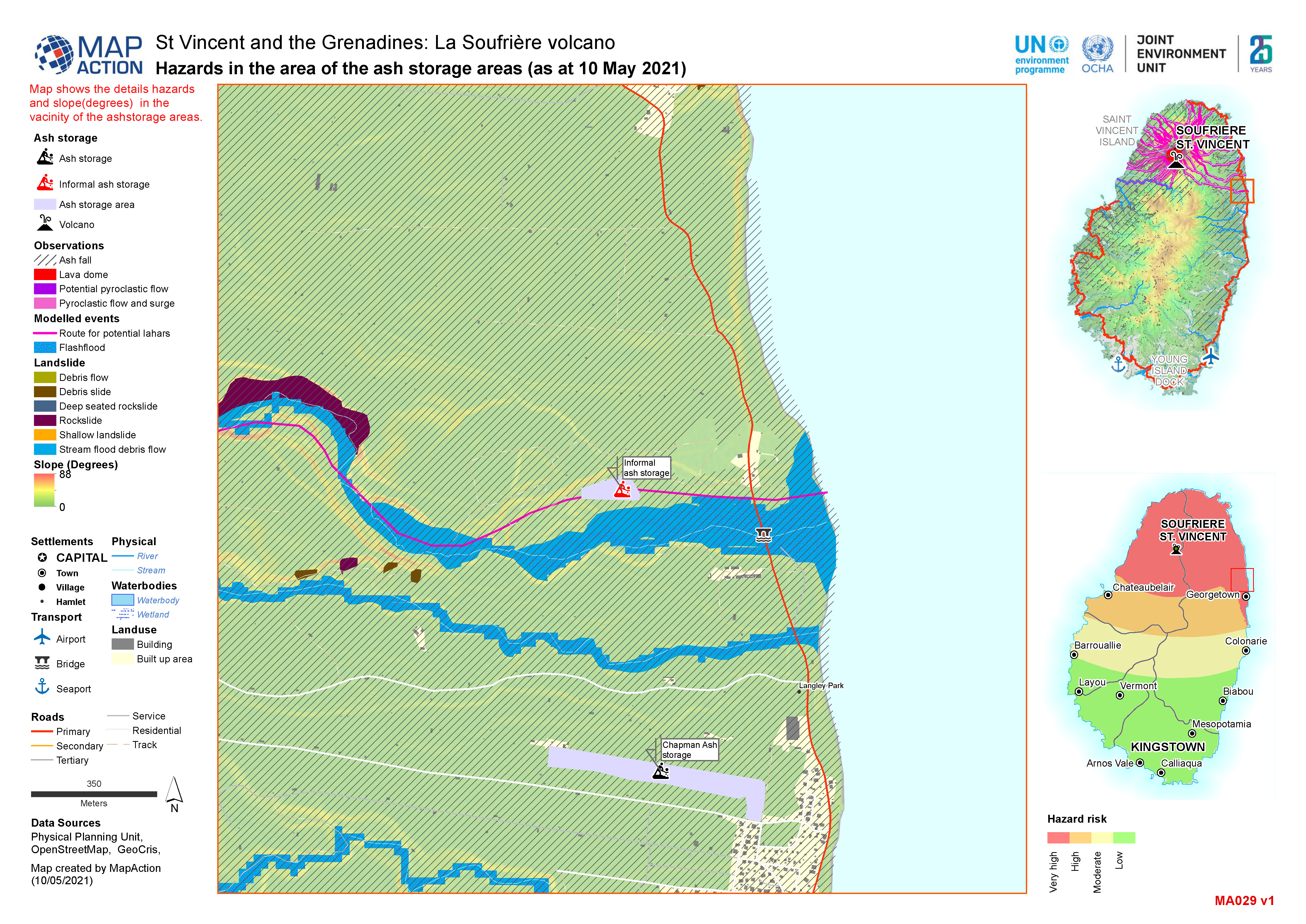
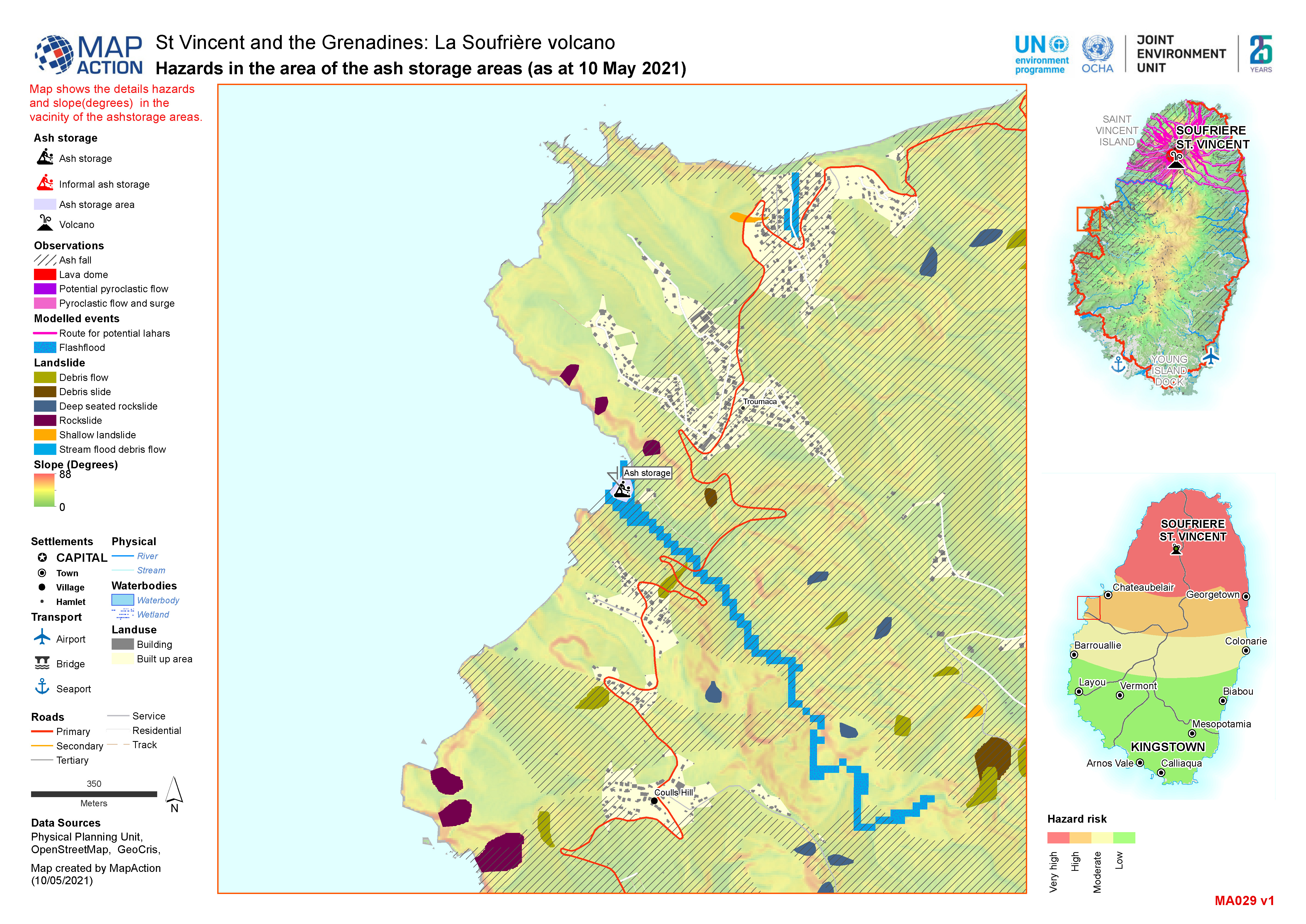
Ash storage locations (as at 10 May 2021)
Map shows the slopes of Saint Vincent and the location of known ash storage. -
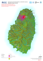
Modelled drainage channels
Map shows modelled drainage channels using a combination of 5m and 30m resolution elevation data. Whilst many of the channelsdo have water (i.e. streams and rivers) in them some...
