-
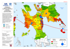
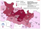
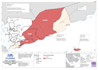
MA1003 Philippines:Typhoon Yolanda -Severity and OperationalPresence,Eastern ...
Severity score was generated from a multivariate formula incorporating physical factors (est storm surge, proximity to storm path, etc) reported affected population stats and... -

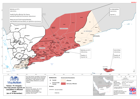
MA1001 Philippines:Typhoon Yolanda -Severity Ranking (as at 30 Nov 2013)
Severity score was generated from a multivariate formula incorporating physical factors (est storm surge, proximity to storm path, etc) reported affected population stats and... -

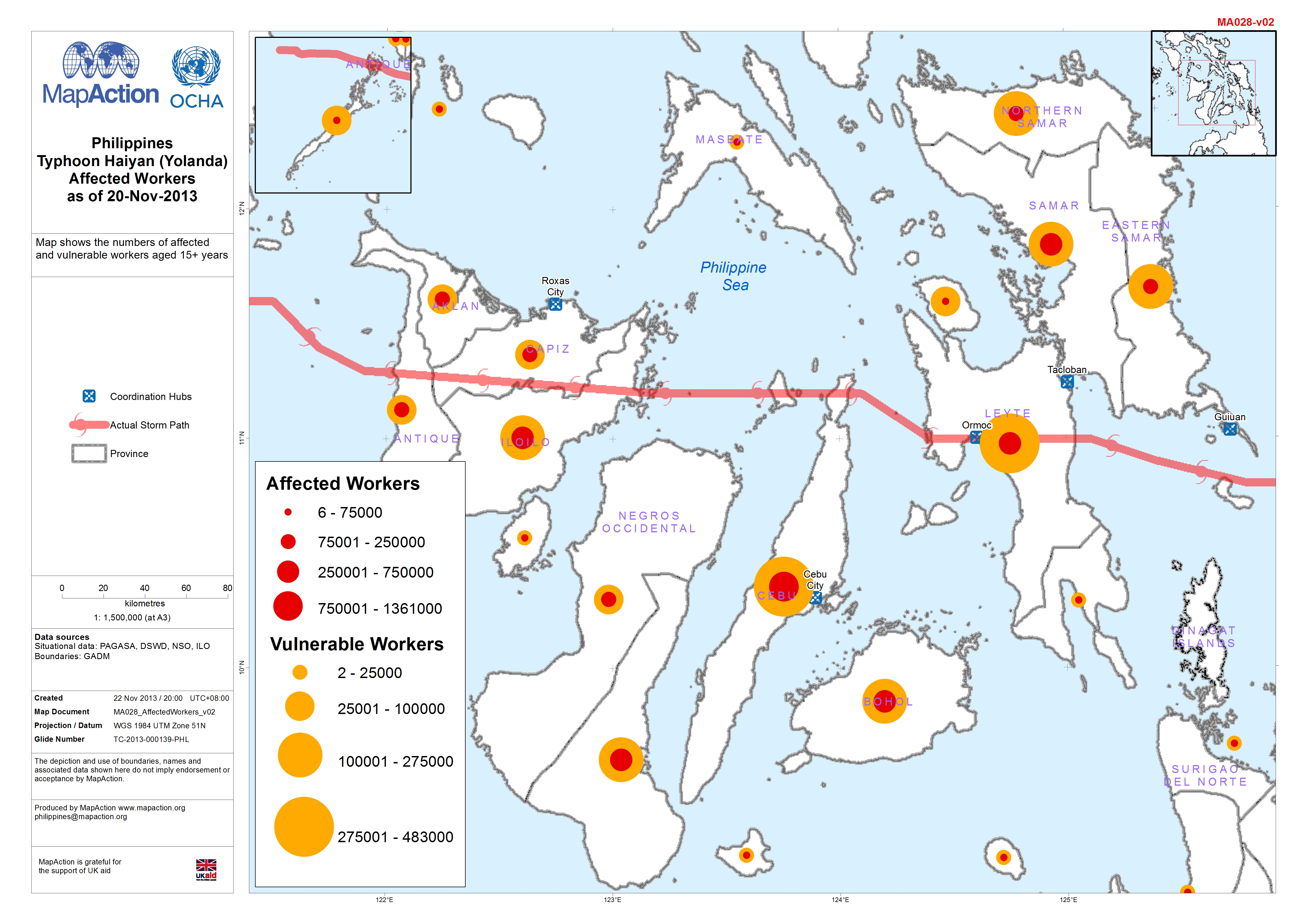
Philippines: Typhoon Haiyan (Yolanda) - Affected Workers as of 20-Nov-2013
This dataset has no description
-

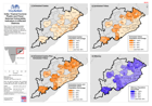
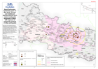
Philippines: Typhoon Haiyan (Yolanda) - Percentage Affected population as of ...
Map shows percentage affected population by Municipality, DROMIC Report No. 20. Areas where no data has been reported are in white. Also shown is predicted storm surge > 0.5 m -
India: Tropical Cyclone Phailin and Flood -Selected Vulnerablity Indicators i...
Map shows the selected population demographics taken from the 2011 census at block level, for the districts that have been identified as affected by Tropical Cyclone Phailin and... -
-

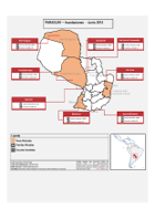
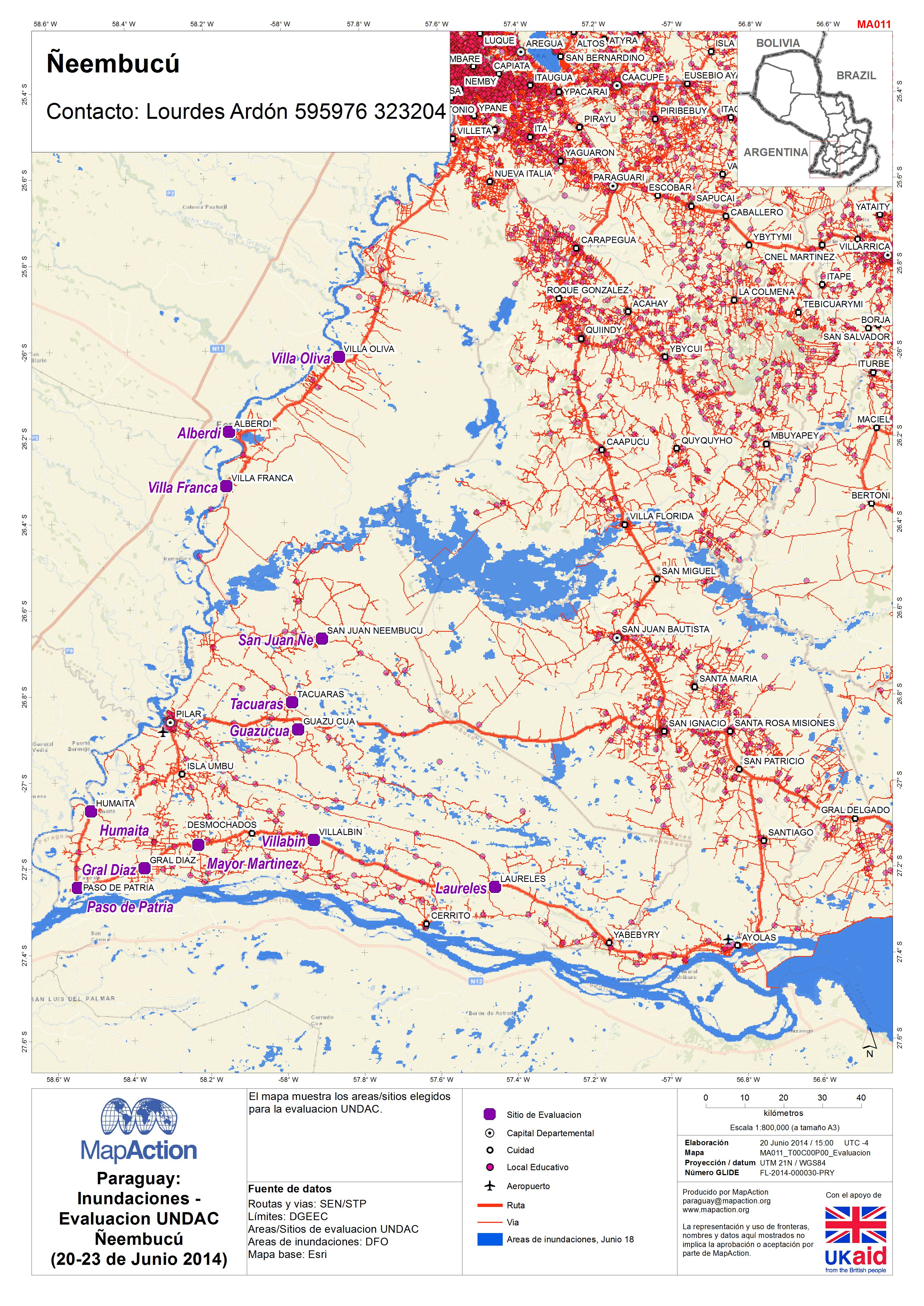
Paraguay: Inundaciones - Evaluacion UNDAC Ñeembucú (20-23 de Junio 2014)
El mapa muestra los areas/sitios elegidos para la evaluacion UNDAC. -
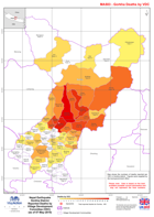
Nepal: Earthquake - Estimate of population directly affected by destroyed ho...
The numbers here should be seen as indicative only. Analysis based on an estimate of the number of buildings destroyed (not including government buildings) and the average... -

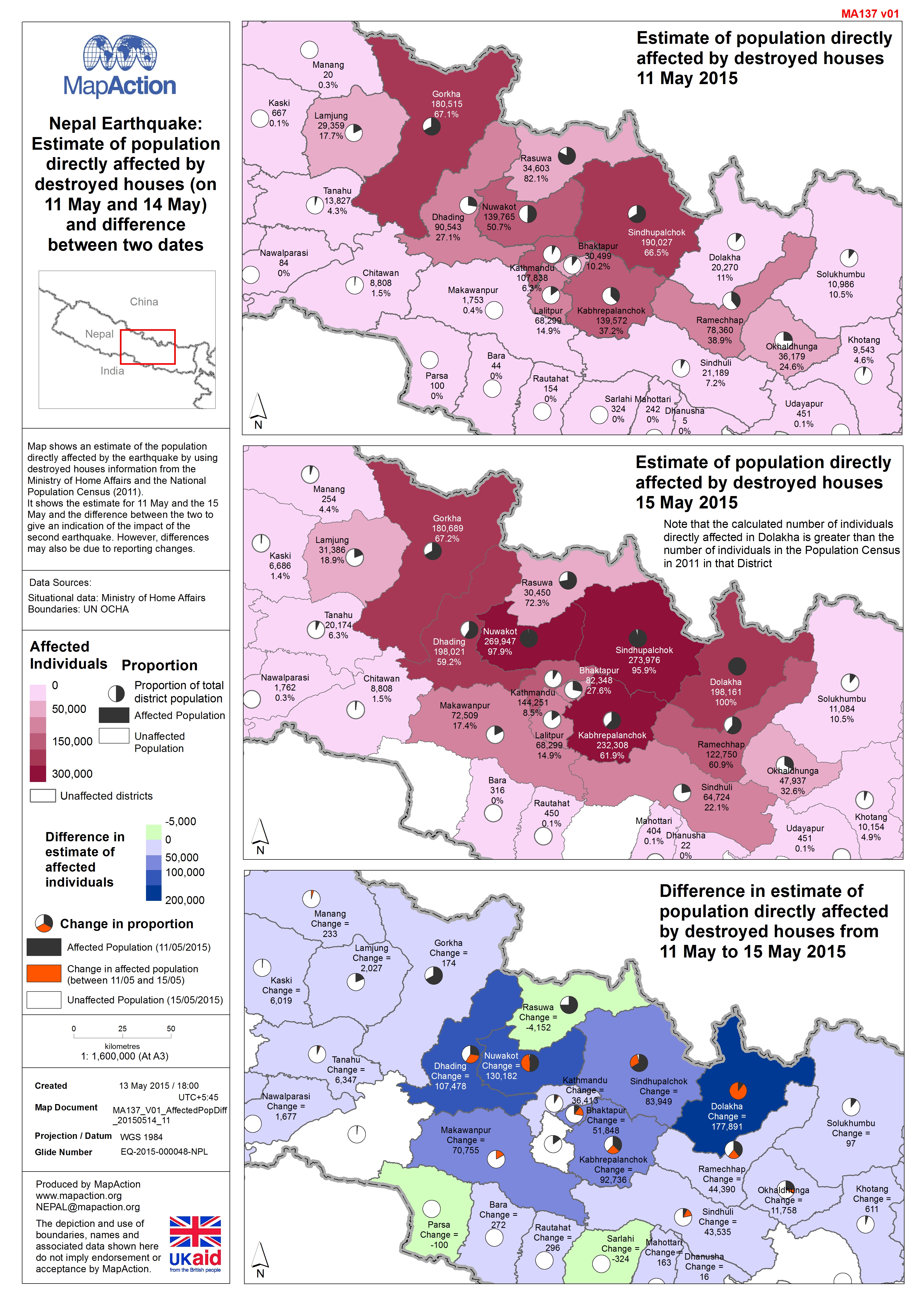
Nepal: Earthquake - Estimate of population directly affected by destroyed hou...
Map shows an estimate of the population directly affected by the earthquake by using destroyed houses information from the Ministry of Home Affairs and the National Population... -
Nepal: Earthquake - Estimate of population directly affected by destroyed hou...
The numbers here should be seen as indicative only. Analysis based on an estimate of the number of buildings destroyed (not including government buildings) and the average... -
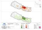
Nepal: Earthquake - Epicentres (up to 13 May 2015), 'Priority' and 'Additiona...
Map shows Priority Affected Districts as designated by the Government of Nepal in the week following the original earthquake, and additional affected districts designated on 10... -
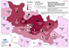
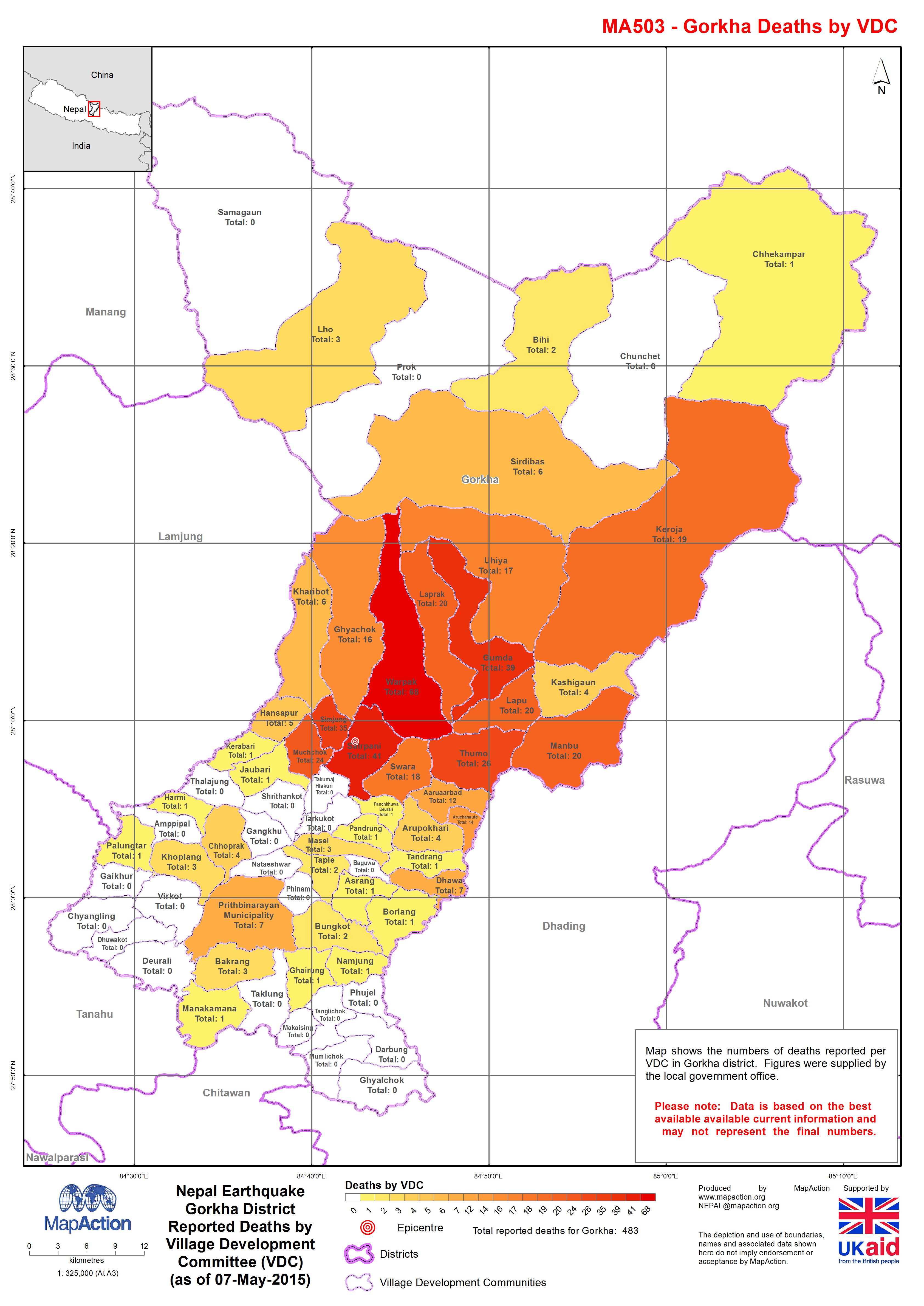
Nepal: Earthquake - Gorkha District - Reported Deaths by Village Development ...
Map shows the numbers of deaths reported per VDC in Gorkha district. Figures were supplied by the local government office. Please note: Data is based on the best available... -

Nepal: Earthquake - Estimate of population directly affected by destroyed hou...
The numbers here should be seen as indicative only. Analysis based on an estimate of the number of buildings destroyed (not including government buildings) and the average... -
Nepal Kathmandu Earthquake. Deaths and Injuries by District (as of 3 May 2015)
Map shows numbers of deaths and injuries by district. White areas have zero numbers or no data. Map also shows earthquake epicentre. -

Nepal: Kathmandu Earthquake. Deaths and Injuries by District(as of 01 May 201...
Map shows numbers of deaths and injuries by district. White areas have zero numbers or no data. Map also shows epicentre. -
Nepal: Earthquake - Reported injuries in Nepal by district (as of 27 April 2015)
Map shows the early reported number of injuries by District in Nepal. -
Yemen: TC Chapala - Reports of casualties in affected areas (as of 14 Nov 2015)
The map shows casualties in the three affected Governates and the Mukalla City District. It also reports on some health facilities affected by cyclone Chapala. -

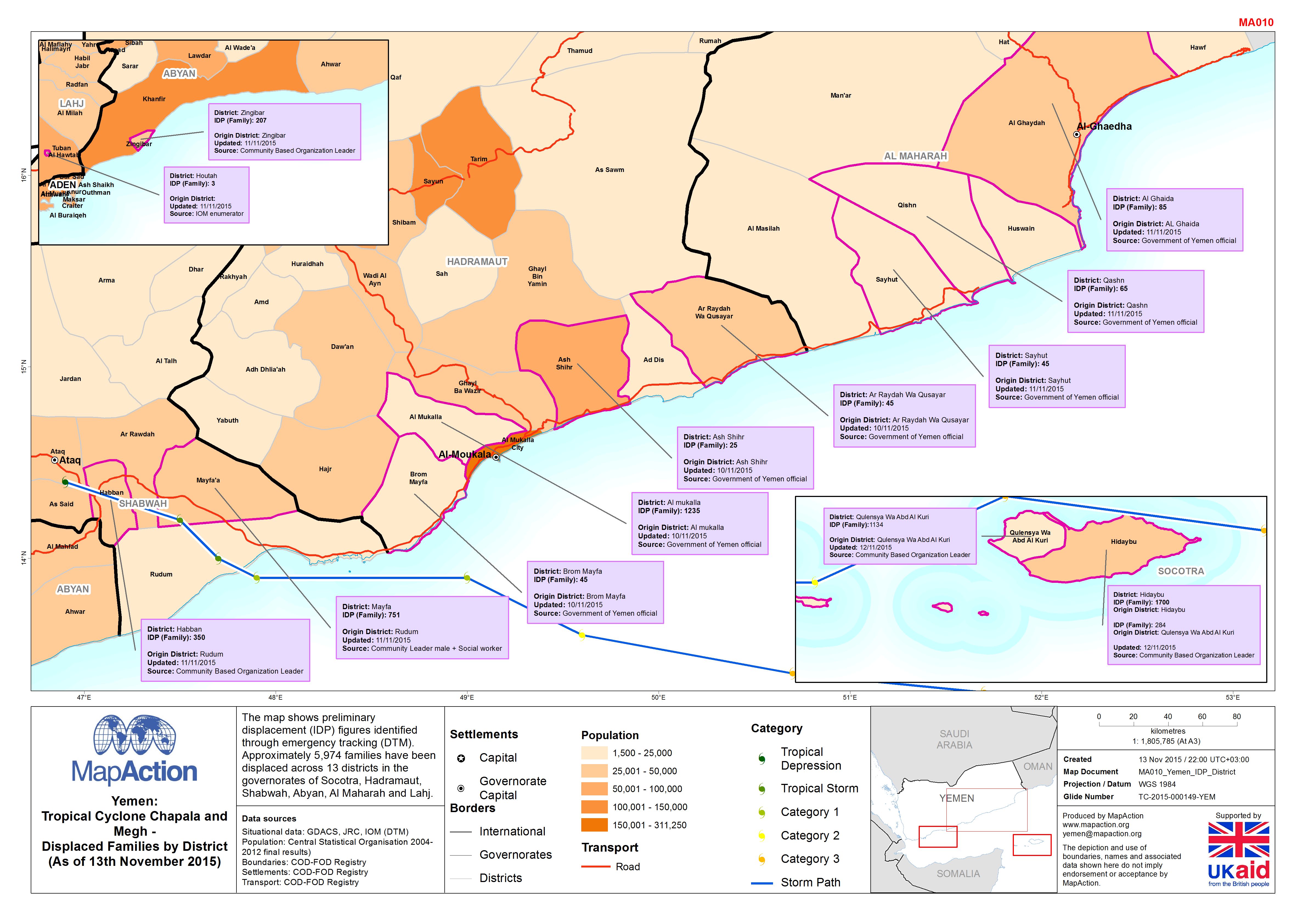
Yemen: Tropical Cyclone Chapala and Megh - Displaced families by district (as...
The map shows preliminary displacement (IDP) figures identified through emergency tracking (DTM). Approximately 5,974 families have been displaced across 13 districts in the... -
Yemen: TC Chapala -The map shows reports on casualties in affected areas.
This dataset has no description
-

Fiji: Cyclone Winston - 2016 Population in Government Hotspot Areas
Projected 2016 population densities by enumeration areas within the Fiji Government Hotspot areas - planning areas for the prioritisation of relief efforts. Showing total...