-
Honduras: Dam locations and capacity levels (as of 10 Nov 2020)
Honduras, Dam locations and capacity levels as of 10th Nov 2020 -
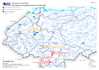
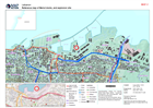
The Philippines: Typhoons Vamco (Ulysses), Goni(Rolly) and Astani - Actual an...
Map shows the tracks of Typhoons Vamco (Ulysses), Goni (Rolly) and Astani moving through The Philippines. -

Honduras: Damaged Infrastructure (as at 09 Nov 2020)
Honduras, Damaged Infrastructure as of 09th Nov 2020 -

-

Honduras: Affected Departments and Municipalities (as of 07 Nov 2020)
This map shows the storm affected administration level 1 departments and level 2 municipalities for Honduras. -
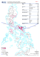
The Philippines: Typhoon Goni (Rolly) - Affected population by Municipality (...
Map shows the number of reported affected people per Municipality. -
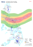
The Philippines: Typhoon Goni (Rolly) - Flood affected areas (as at 1 Nov 2020)
Map shows flood extents derived from satallite imagery that has been processed by the Department of Science and Technology, The Philippines. -

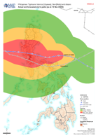
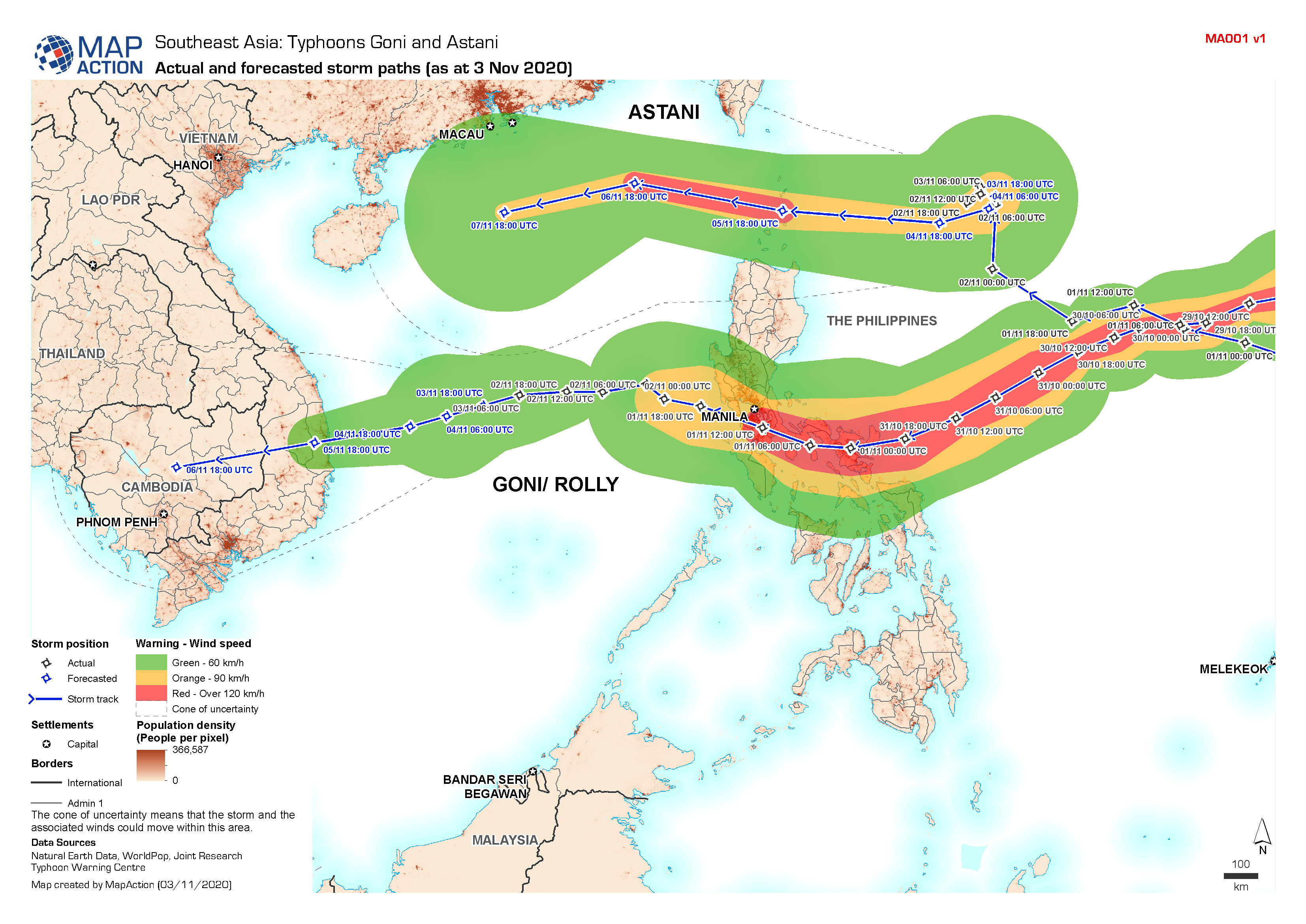
Southeast Asia: Typhoons Goni and Astani - Actual and forecasted storm paths ...
Map shows the actual and forecasted storm tracks for Typhoon Goni and Astani. -
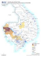
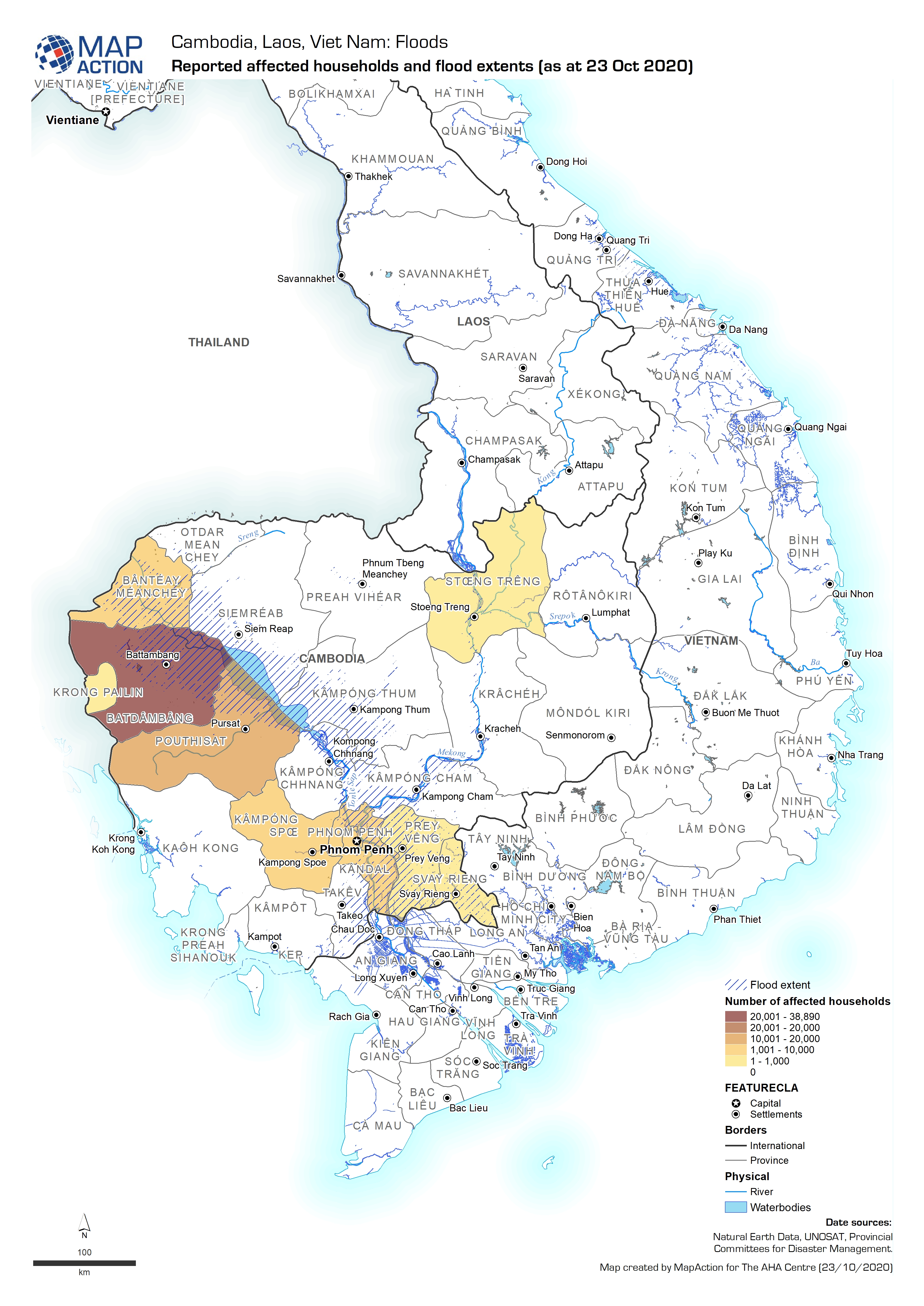
Reported affected households and flood extents (as at 23 Oct 2020)
Map shows the reported number of households affected by flooding in Cambodia. -
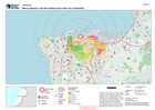
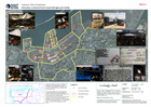
Zone Socio-economic Vulnerability with ACAPS blast radius damage estimate
The socio-economic status of households living pre-blast in each zone was estimated by UN-Habitat based on (1) a national ranking of 498 disadvantaged area undertaken to inform... -
Beirut explosion site with infrastructure sites and vulnerability
Beirut explosion site with infrastructure sites and vulnerability. -
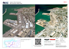
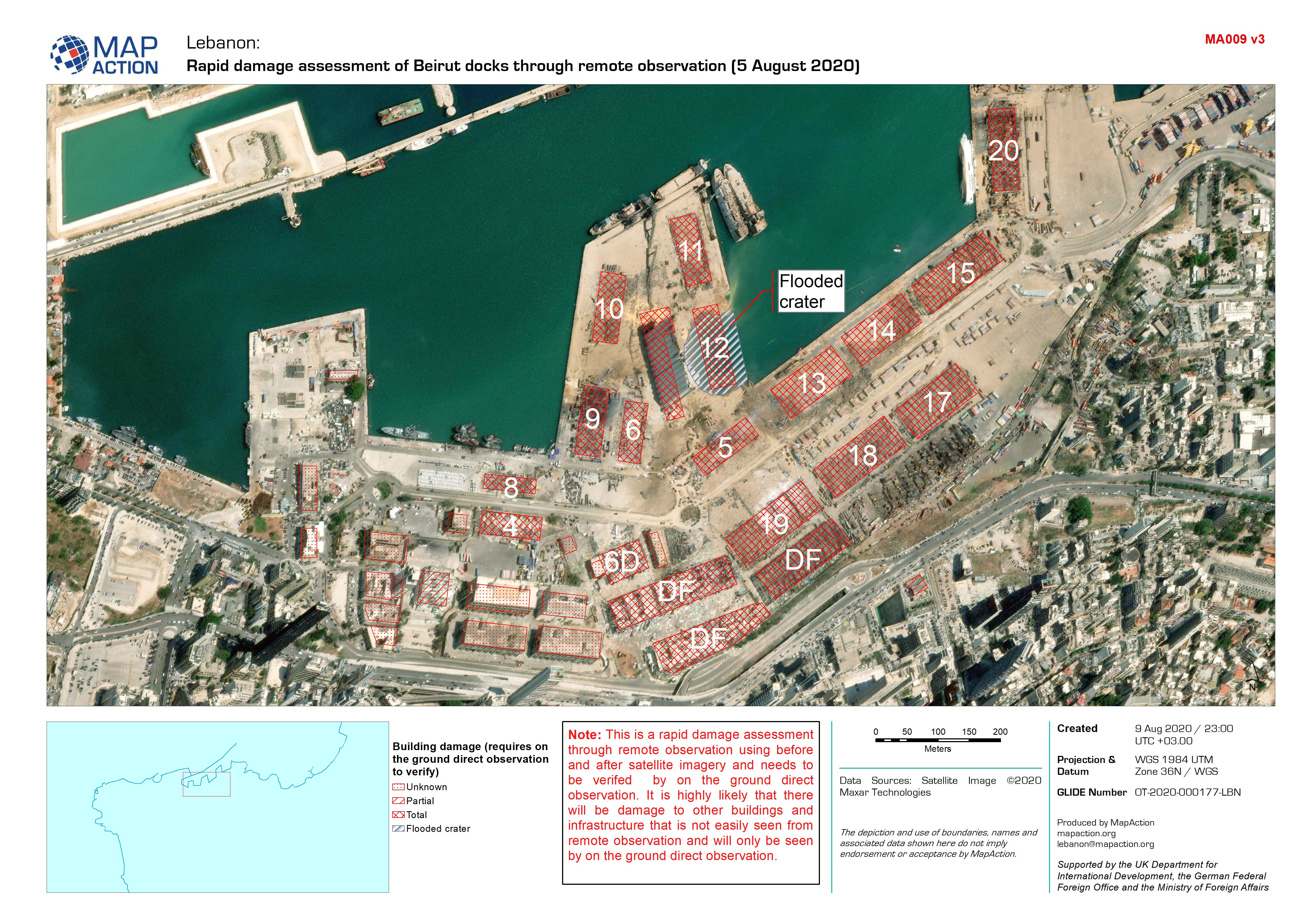
Rapid damage assessment of Beirut docks through remote observation (5 August ...
This dataset has no description
-
3D Visualisation of Beirut Port
Map shows building numbers used within Beirut port, on pre and post explosion imagery -

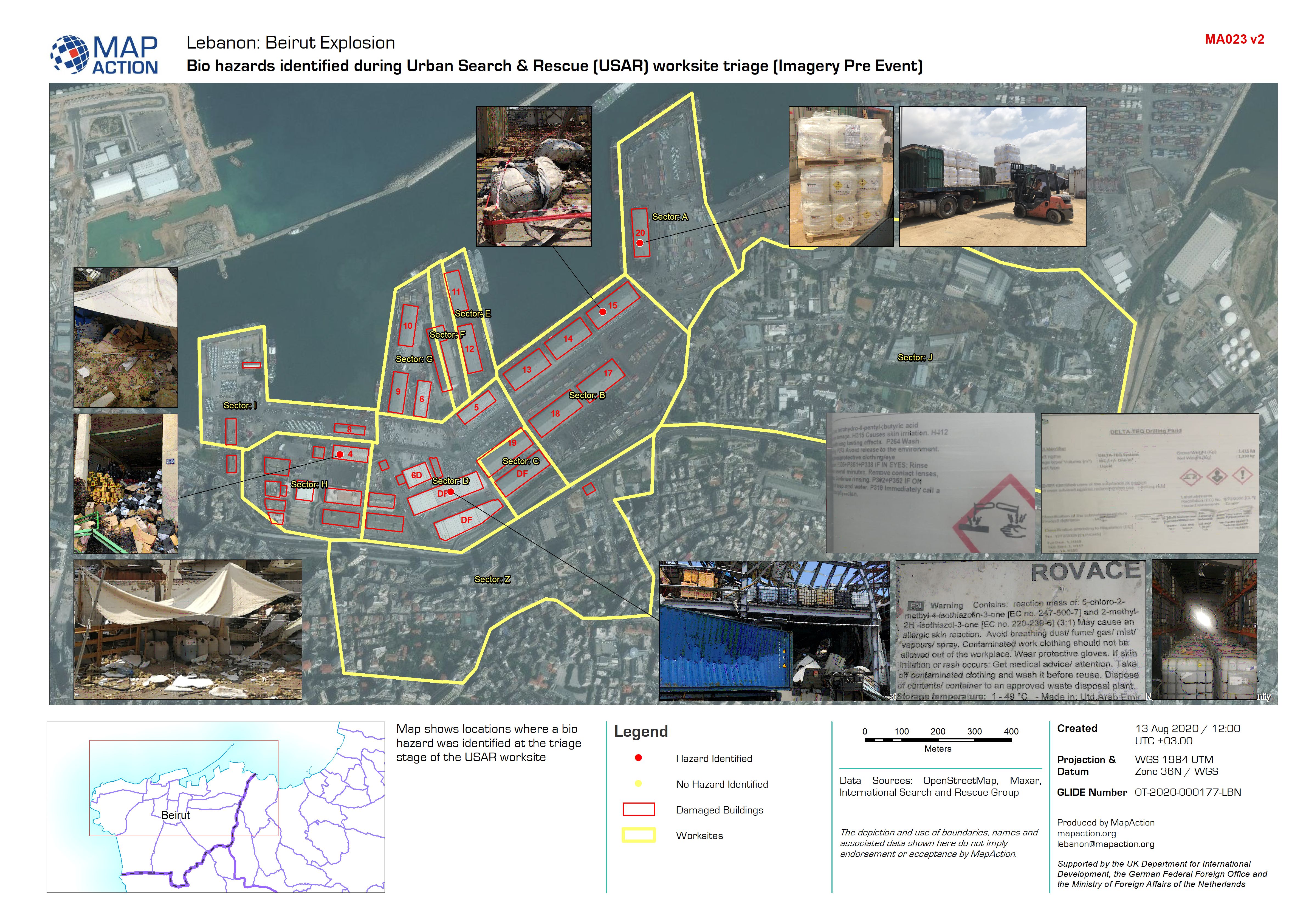
Bio hazards identified during Urban Search & Rescue (USAR) worksite triage (I...
Map shows locations where a bio hazard was identified at the triage stage of the USAR worksite -

Bio hazards identified during Urban Search & Rescue (USAR) worksite triage (I...
Map shows locations where a bio hazard was identified at the triage stage of the USAR worksite -

Rapid damage assessment of Beirut docks through remote observation (5 August ...
This dataset has no description
-
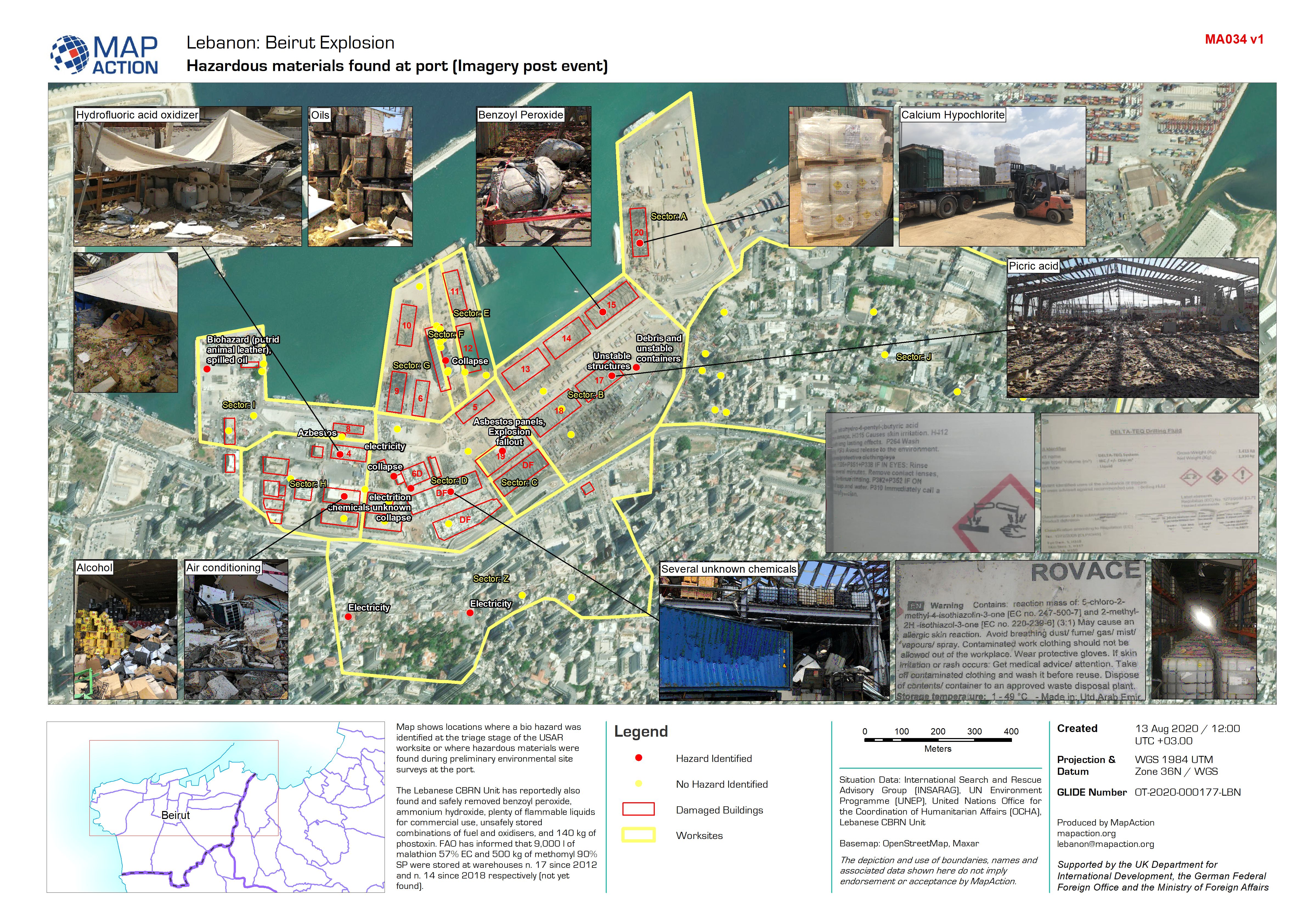
Hazardous materials found at port (Imagery post event)
Map shows locations where a bio hazard was identified at the triage stage of the USAR worksite or where hazardous materials were found during preliminary environmental site... -
Hazardous materials found at port (Imagery pre event)
Map shows locations where a bio hazard was identified at the triage stage of the USAR worksite or where hazardous materials were found during preliminary environmental site... -
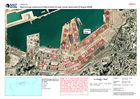
Reference map of Beirut docks, and explosion site
Reference map of Beirut docks, and explosion site -

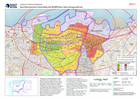
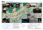
North West Syria Migration Crisis - Most Affected Sub-districts (as of 28 Apr...
This map shows a situational overview the most affected sub-districts in the North West of the Syrian Arab Republic.