-
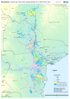
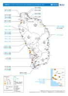
Mozambique: Cyclone Idai - Flood extent change between 20, 31 March and 7 Apr...
Map shows the change in flood extent between the 20, 31 of March and 7 April -

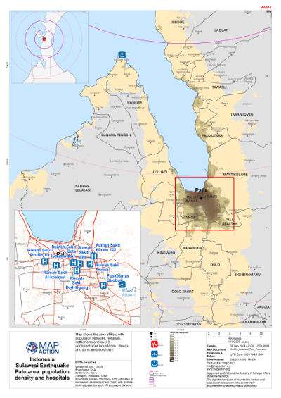
Sulawesi Earthquake - Palu area - Population density and hospitals
Map shows population density in the Palu area, hospitals, level 3 admininstration boundaries and settlements. -

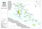
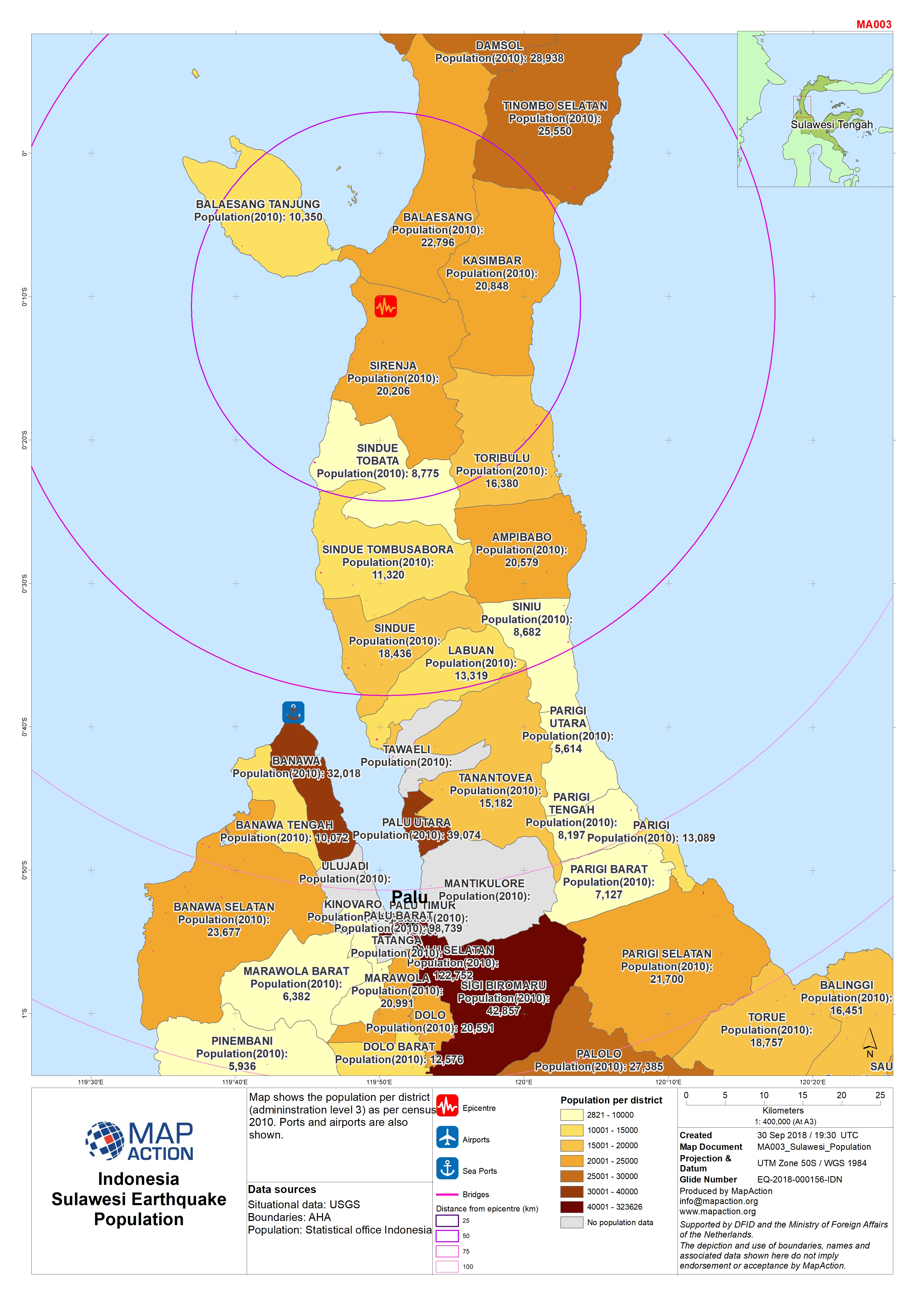
Sulawesi Earthquake - Population
Map shows population per district (admininstration level 3). Ports are also shown. -
Sulawesi Earthquake - Health
Map shows hospitals, level 3 admininstration boundaries and settlements. Roads and ports are also shown. -
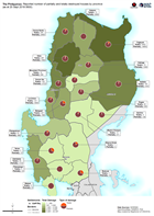
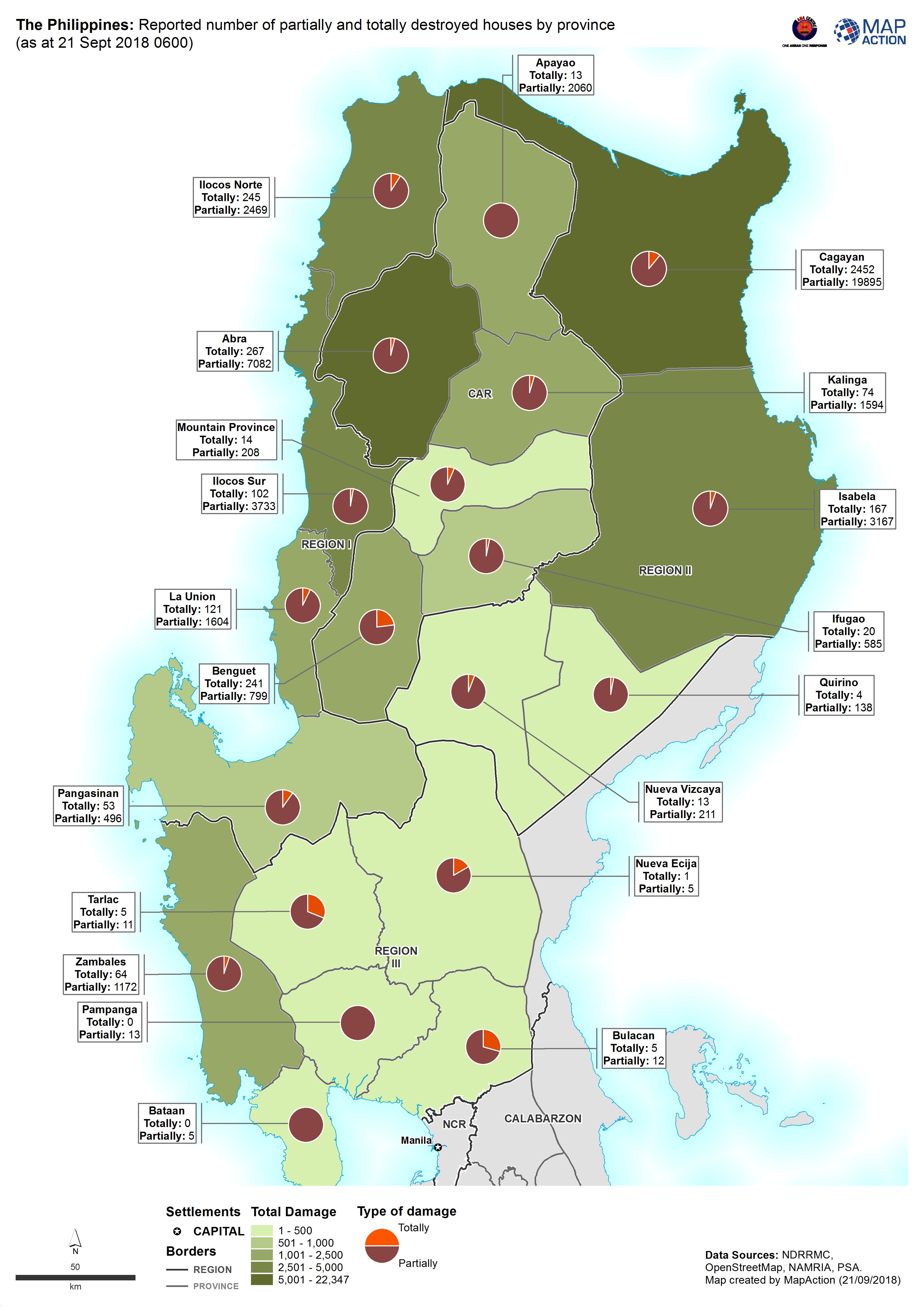
The Philippines: Reported number of partially and totally destroyed houses by...
Map shows the reported number of damaged and destroyed houses per province. -

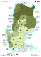
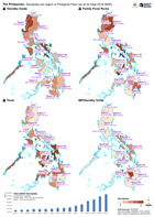
The Philippines: Affected population by municipality (as at 22 Sept 2018 0600)
Map shows the reported number of affected people per province. -

The Philippines: Areas at potential risk of a 2m storm surge based on histori...
Map shows areas at potential of a 2m storm surge based on historical data and inundation maps -
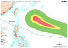
The Philippines: Location of Super Typhoon Mangkhut and Tropical Storm Trami ...
Map shows the paths of Super Typhoon Mangkhut and Typhoon Trami. -
The Philippines: Reported number of partially and totally destroyed houses by...
Map shows the reported number of damaged and destroyed houses per province. -
The Philippines: Total cost of of assistance per province in Philippine Peso ...
Map shows the estimated cost of assistance per province in response to Typhoon Mangkhut. -
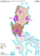
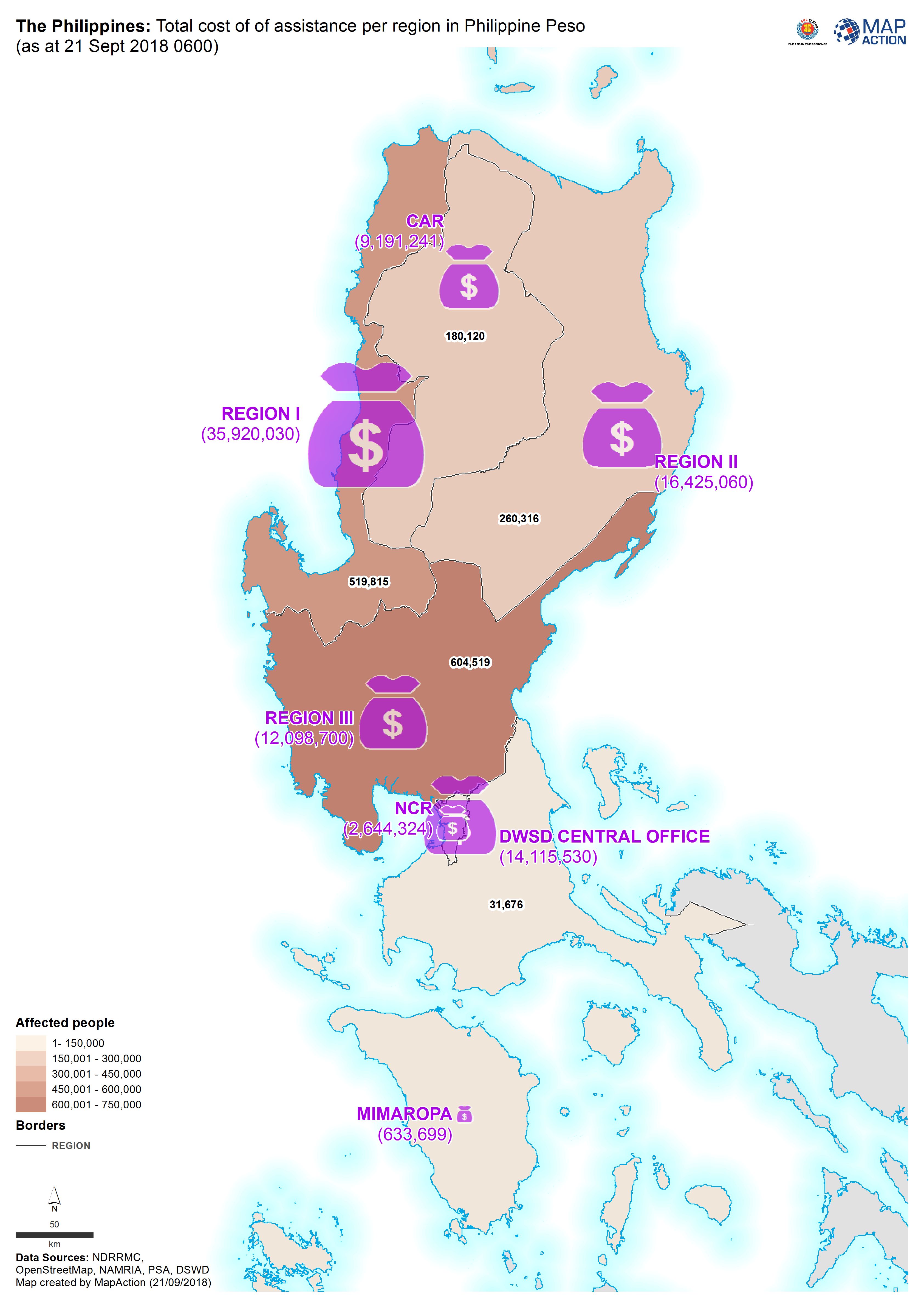
The Philippines: Total cost of of assistance per region in Philippine Peso (a...
Map shows the estimated cost of assistance per region in response to Typhoon Mangkhut. -
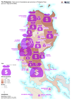
The Philippines: Stockpiles per region in Philippine Peso (as at 20 Sept 2018...
The DSWD Central Office (CO), concerned Field Offices (FOs), and National Resource Operations Center (NROC) have stockpiles and standby funds amounting to ₱1,579,599,449.33 with... -

Reference map atlas of Lombok, Indonesia
A series of 1:75,000 reference maps covering the island of Lombok, Indonesia. -
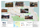
DOMINICA: food and water distributions (as of 26 September 2017)
Map of Dominica showing food and water distributions. -

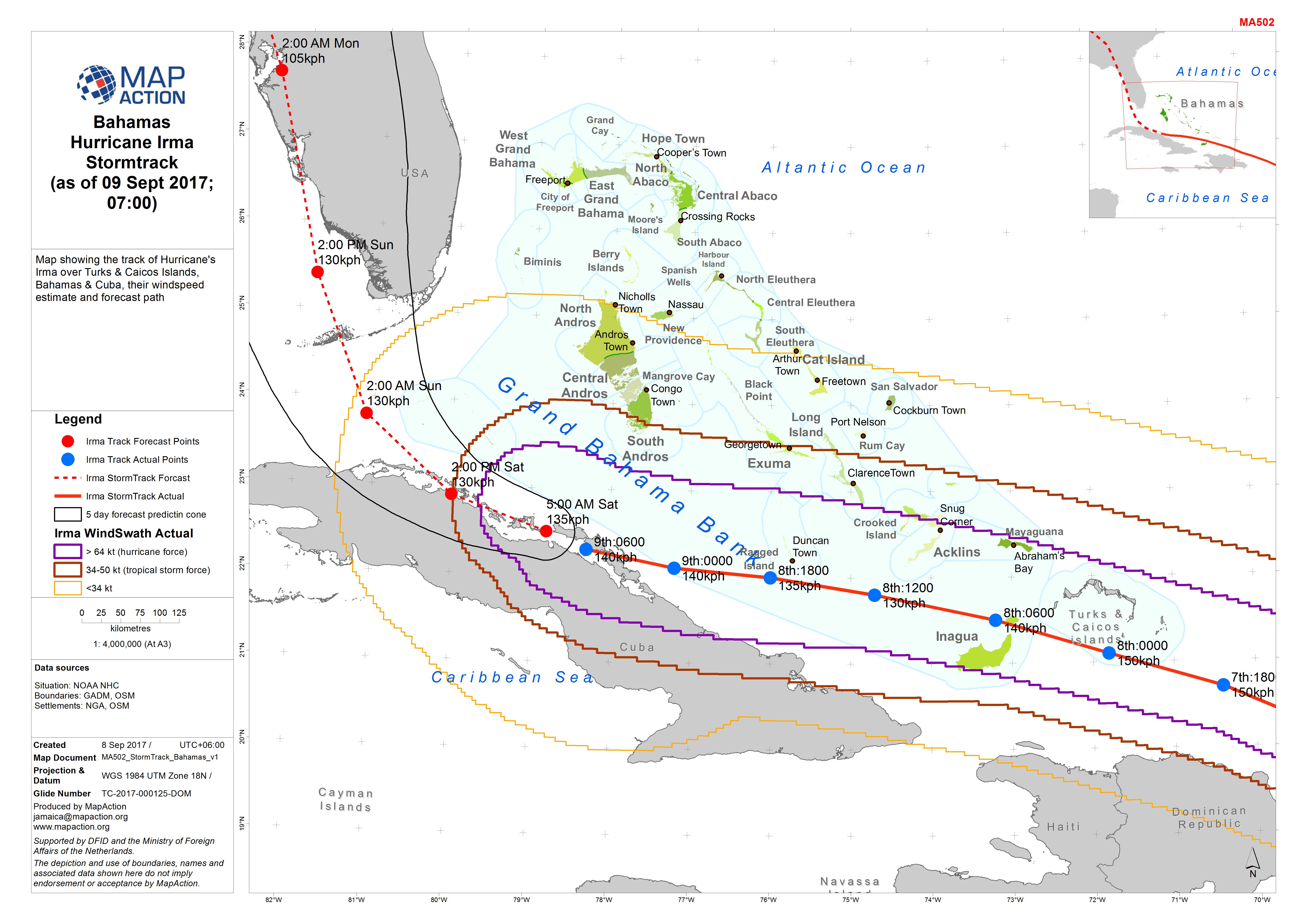
Bahamas Hurricane Irma Stormtrack (as of 09 Sept 2017; 07:00)
Map showing the track of Hurricane's Irma over Turks & Caicos Islands, Bahamas & Cuba, their windspeed estimate and forecast path -
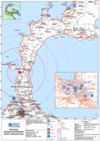
Bahamas Hurricane Irma Reference Map of Bahamas (as of 08 Sept 2017)
Reference map for Bahamas showing major islands, districts and topographic features -

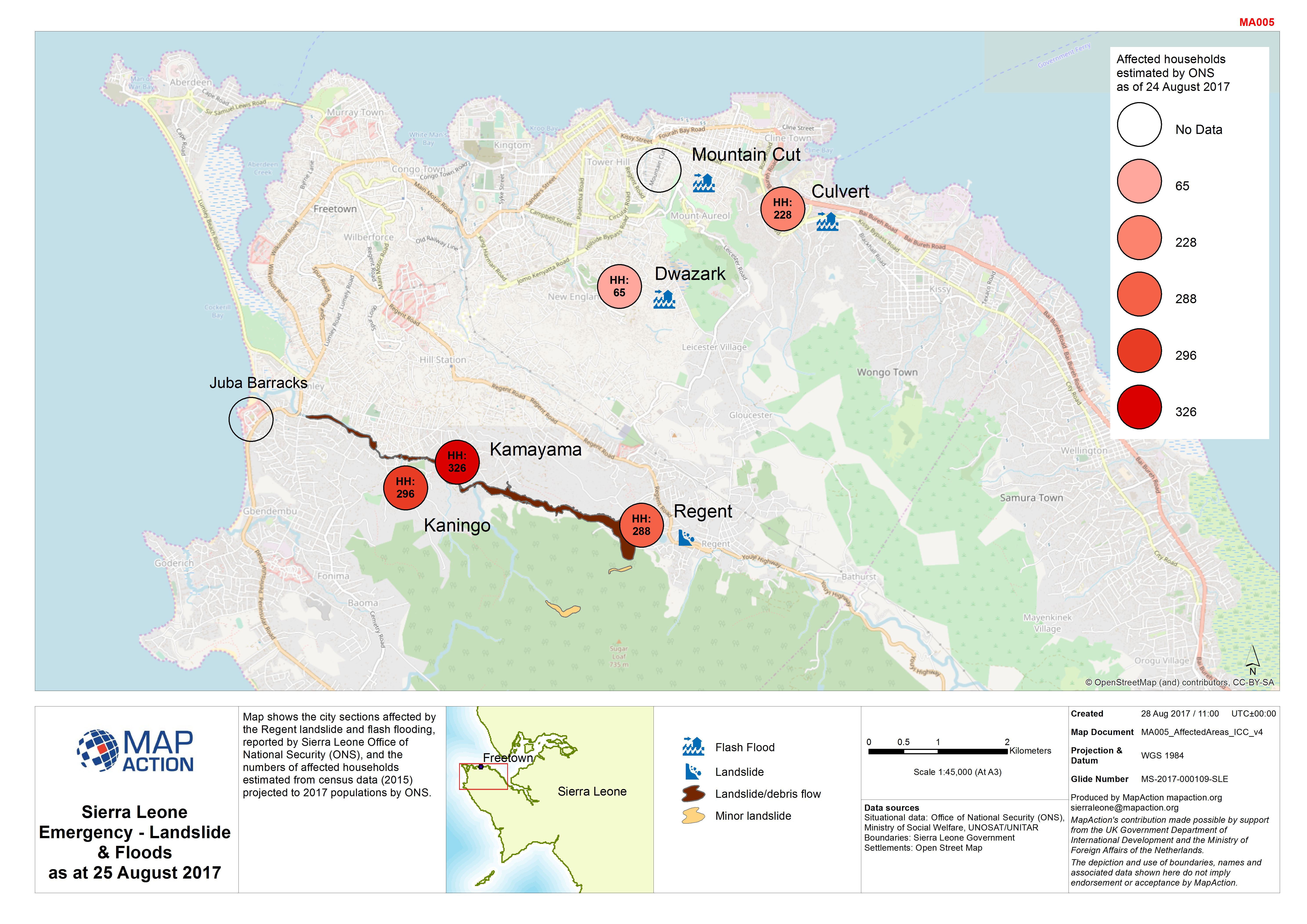
Sierra Leone Emergency - Landslide & Floods as at 25 August 2017
Map shows the city sections affected by the Regent landslide and flash flooding, reported by Sierra Leone Office of National Security (ONS), and the numbers of affected... -

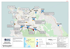
Sierra Leone Landslide/floods - Operations/Logistics (as of 23 Aug 2017)
Map shows key operational locations and the activies being conducted at each site. Points of Interest relevant to the operational setting are also provided. -
Sierra Leone Landslide/floods - Operations/Logistics (as of 23 Aug 2017)
Map shows key operational locations and the activies being conducted at each site. Points of Interest relevant to the operational setting are also provided. -
Sierra Leone Landslide & Floods Shelter Sites as of 23 August 2017
Map indicates the location of active and proposed shelters in Freetown identified by national agencies. Confirmation is needed of the status and population of these shelters.