-

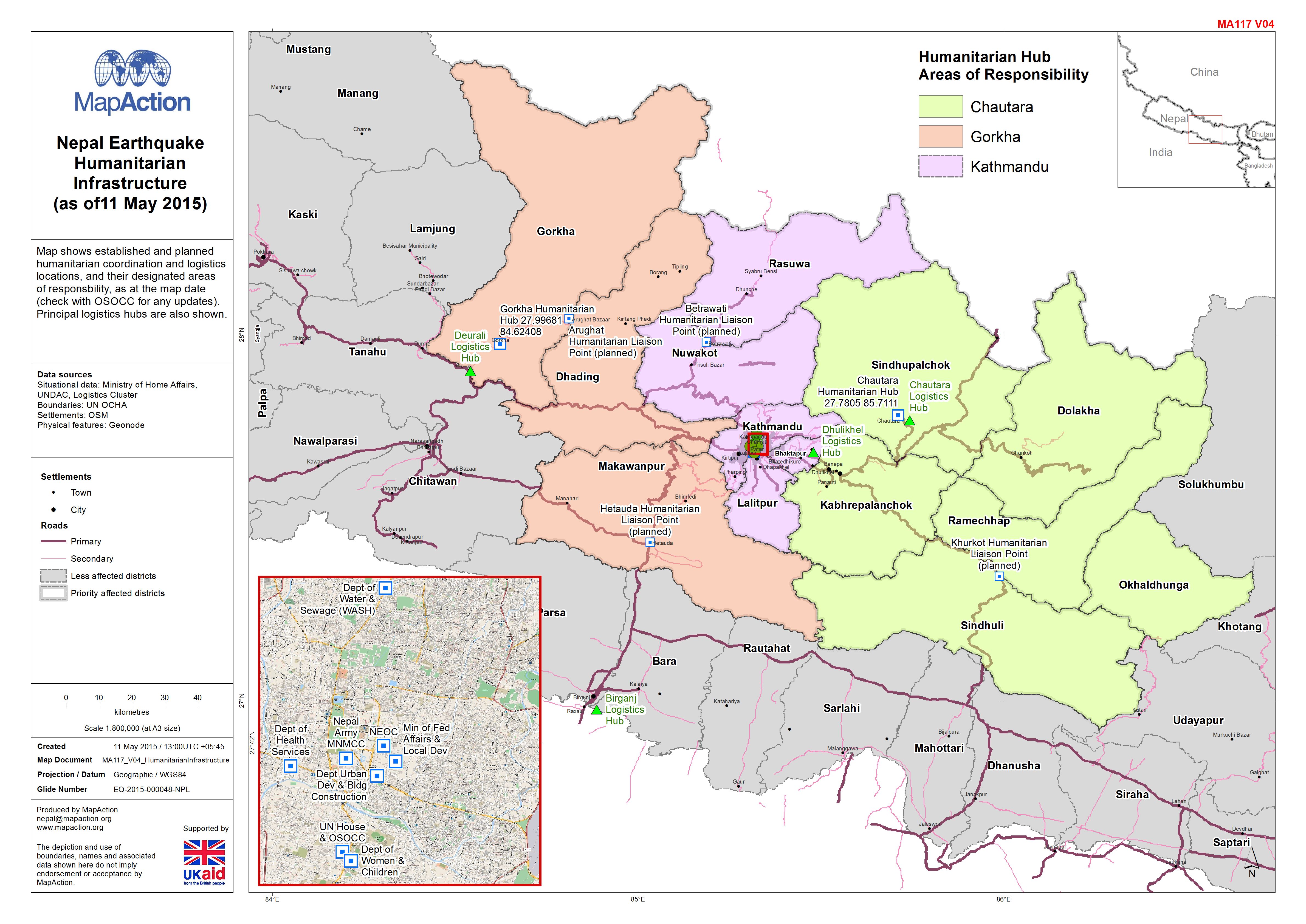
Nepal: Earthquake - Humanitarian Infrastructure(as of11 May 2015)
Map shows established and planned humanitarian coordination and logistics locations, and their designated areas of responsbility, as at the map date (check with OSOCC for any... -

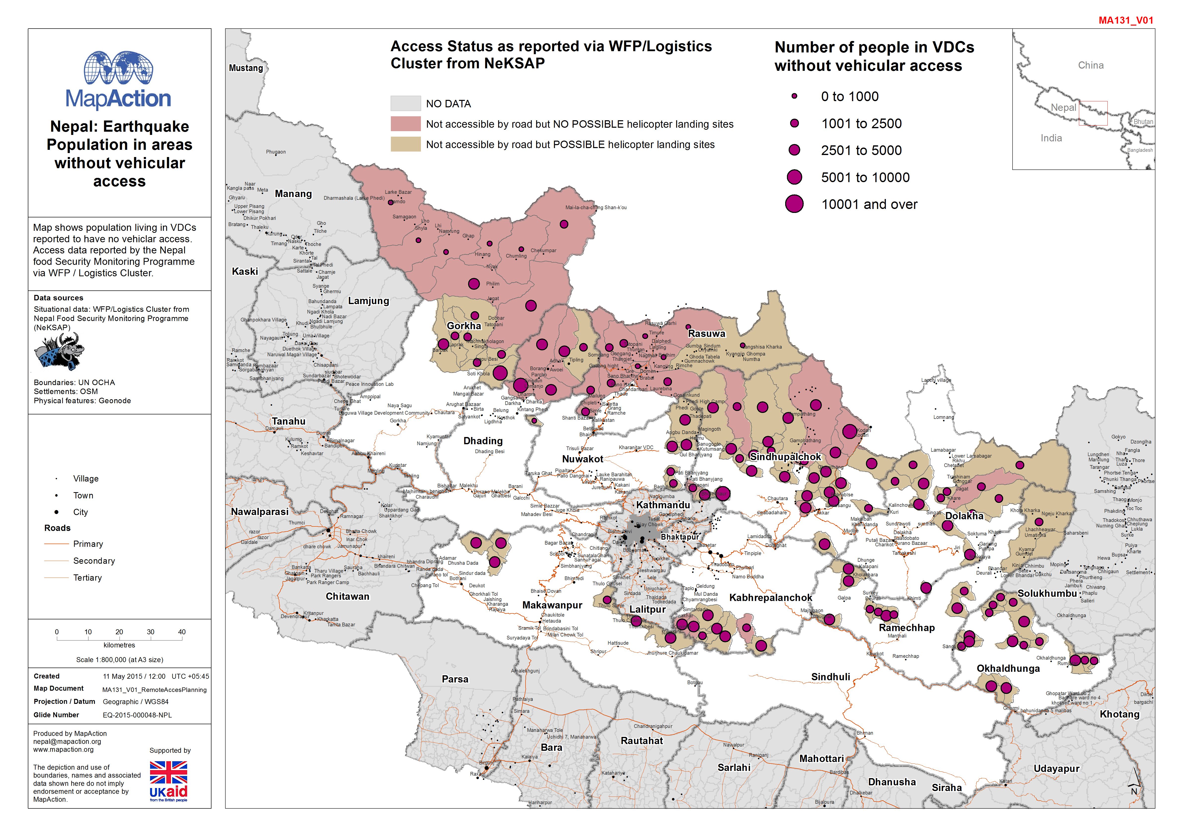
Nepal: Earthquake - Population in areas without vehicular access
Map shows population living in VDCs reported to have no vehiclar access. Access data reported by the Nepal food Security Monitoring Programme via WFP / Logistics Cluster. -
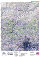
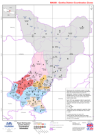
Nepal: Earthquake - District detail map series - Nuwakot
Map shows the terrain, roads, rivers and settlements. -

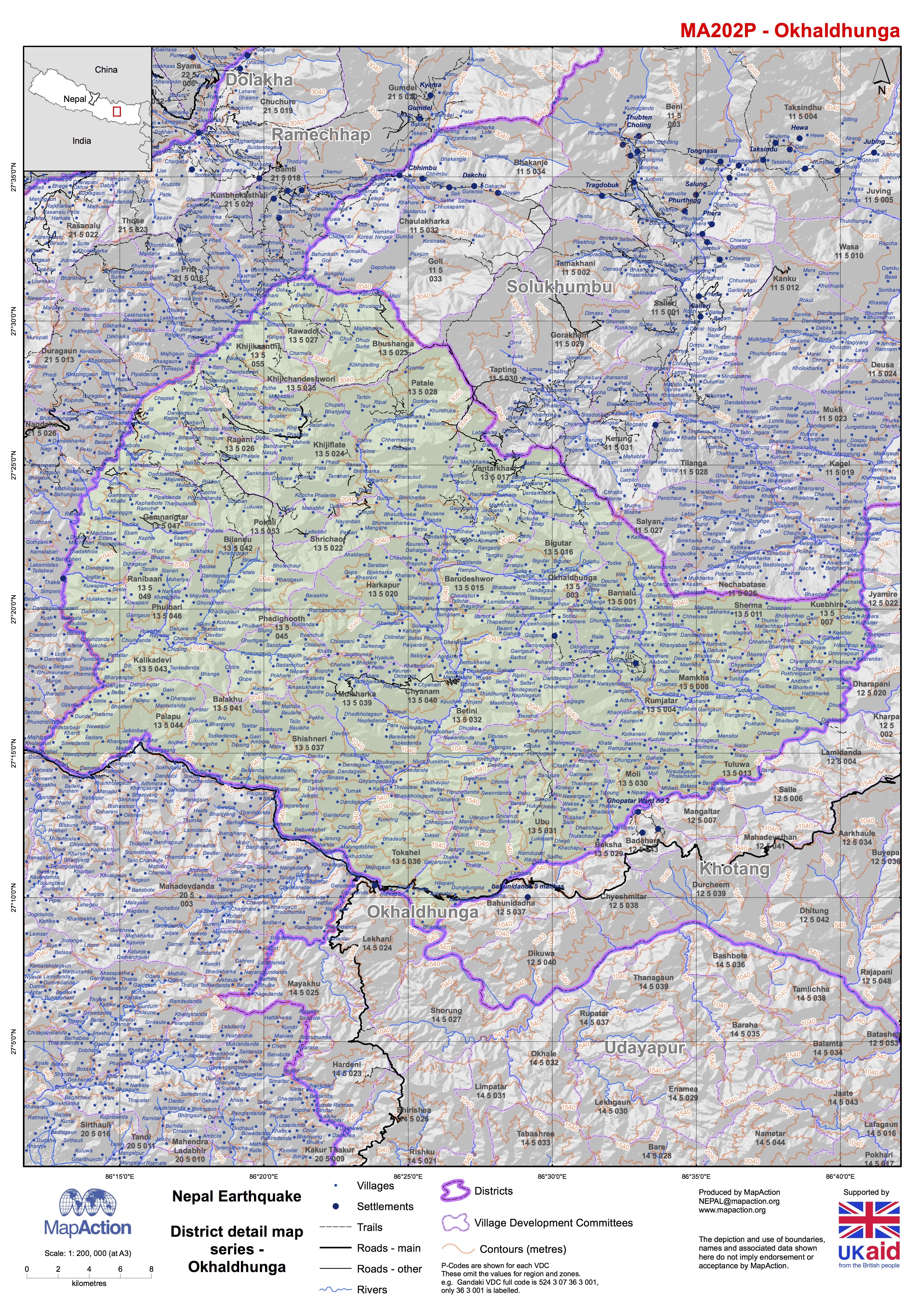
Nepal: Earthquake - District detail map series - Okhaldhunga
Map shows the terrain, roads, rivers and settlements. -
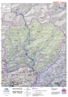
Nepal: Earthquake - District detail map series - Lamjung
Map shows the terrain, roads, rivers and settlements. -

Nepal: Earthquake - Main language groups
Map shows main language groups in Nepal and intended for use in planning public communications with disaster affected communities.Data from:... -
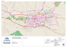
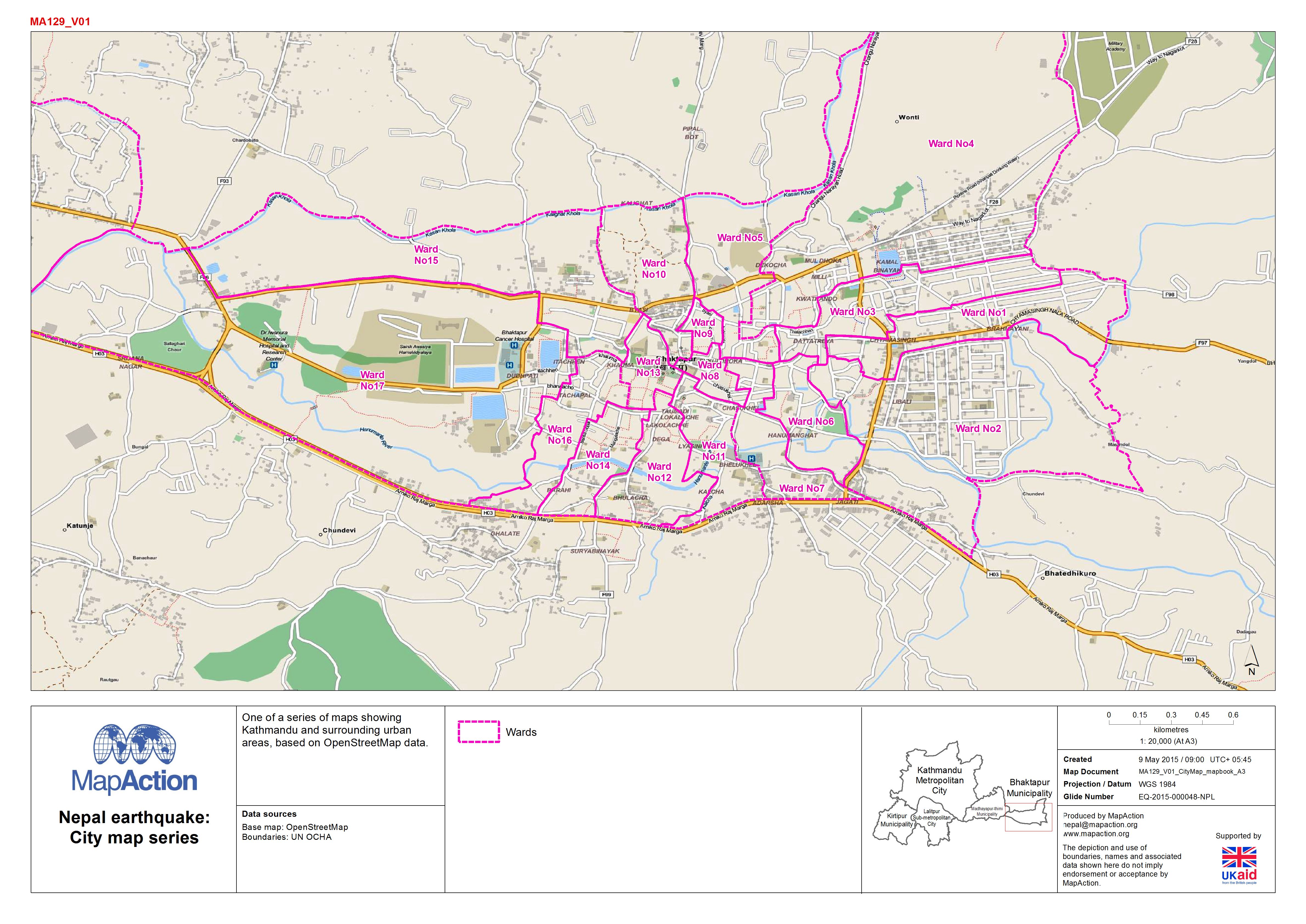
Nepal: Earthquake - City map series
Mapbook featuring OpenStreetMap coverage of central Kathmandu and surrounding areas. -

Nepal: Earthquake - Access overview (as of 8 May 2015)
This Mapbook shows access to VDCs as reported by WFP / Logistics Cluster. Multiple areas are covered in the document. -
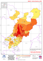
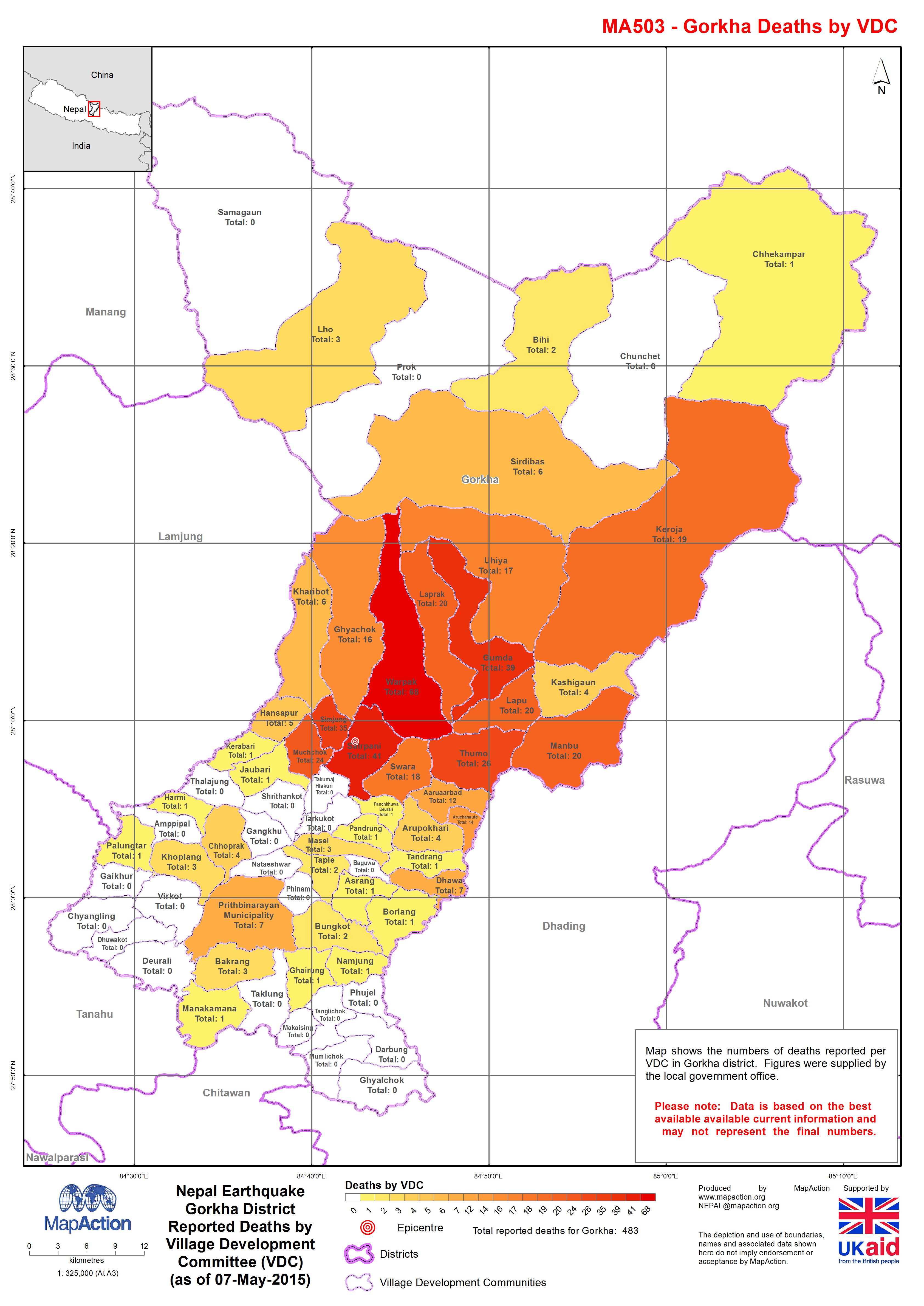
Nepal: Earthquake - Gorkha District - Reported Deaths by Village Development ...
Map shows the numbers of deaths reported per VDC in Gorkha district. Figures were supplied by the local government office. Please note: Data is based on the best available... -

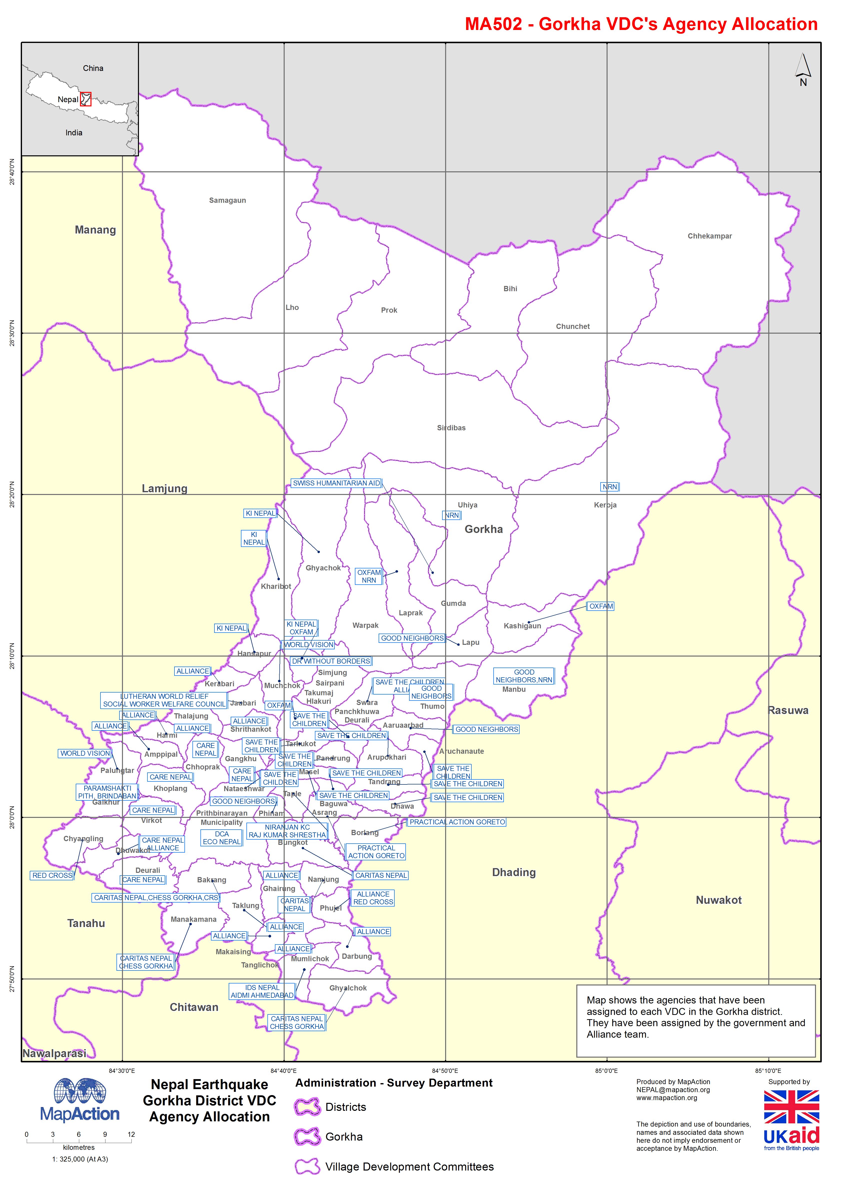
Nepal: Earthquake - Gorkha District - VDC Agency Allocation
Map shows the agencies that have been assigned to each VDC in the Gorkha district. They have been assigned by the government and Alliance team. -

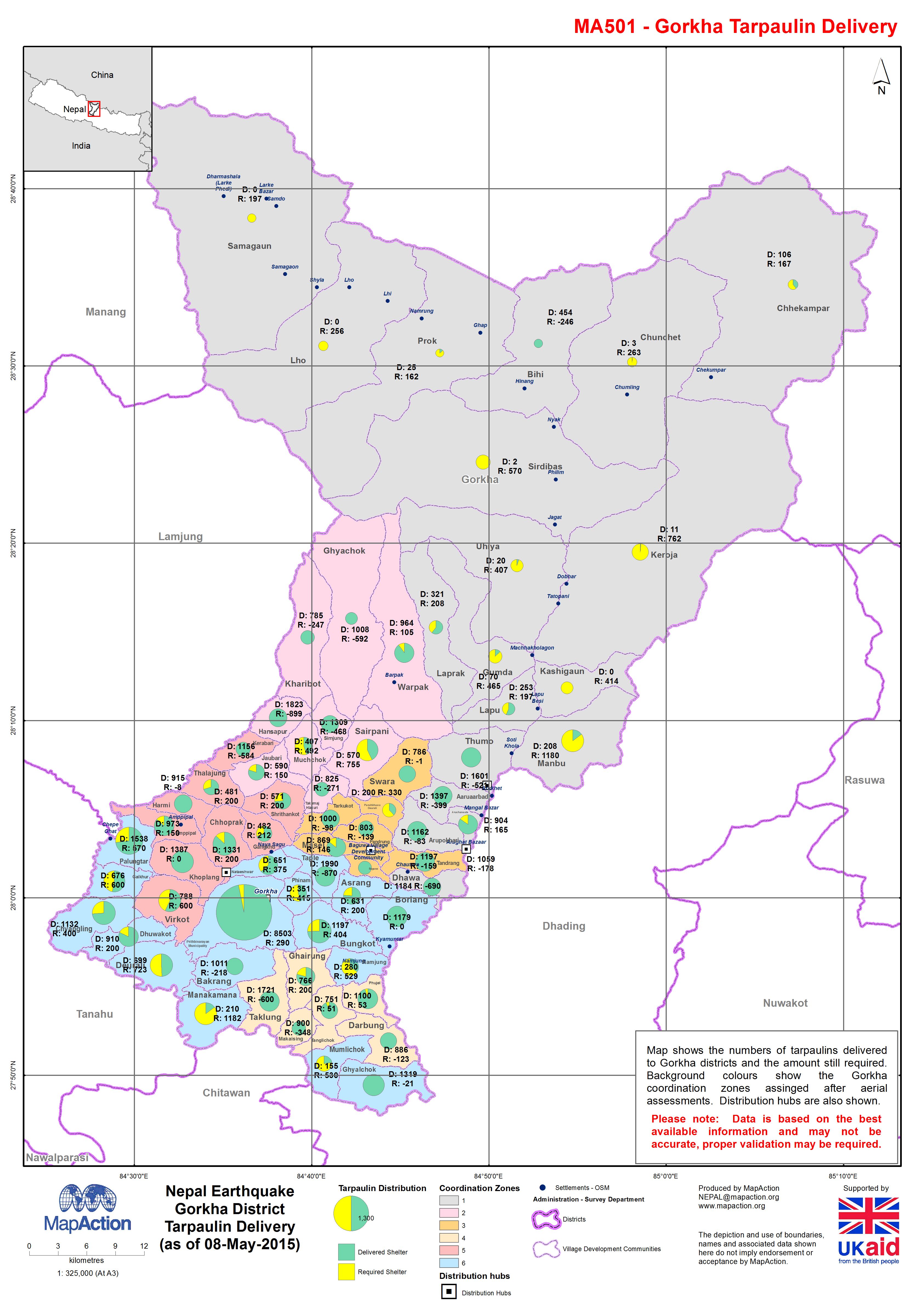
Nepal Earthquake; Gorkha District - Tarpaulin Delivery (as of 08-May-2015)
Map shows the numbers of tarpaulins delivered to Gorkha districts and the amount still required. Background colours show the Gorkha coordination zones assigned after aerial... -
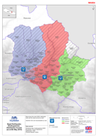
Nepal: Earthquake - Gorkha District - Coordination Information
Map shows the coordination zones (1-6) that have been set up by the local DDC and NGO's, these are primarily based on access for distribution. Sectors A, B and C are projected... -
Nepal: Earthquake - Humanitarian Infrastructure (as of 8 May 2015)
Map shows established and planned humanitarian coordination and logistics locations as at the map date (check with OSOCC for updates). Principle logistics hubs are also show.... -
Nepal: Earthquake - Sindhupalchok - Distribution Access (as at 6th May 2015)
Map shows the main DDRC distribution hubs and the areas served by each. Hatched VDCs are inaccessable by road. -

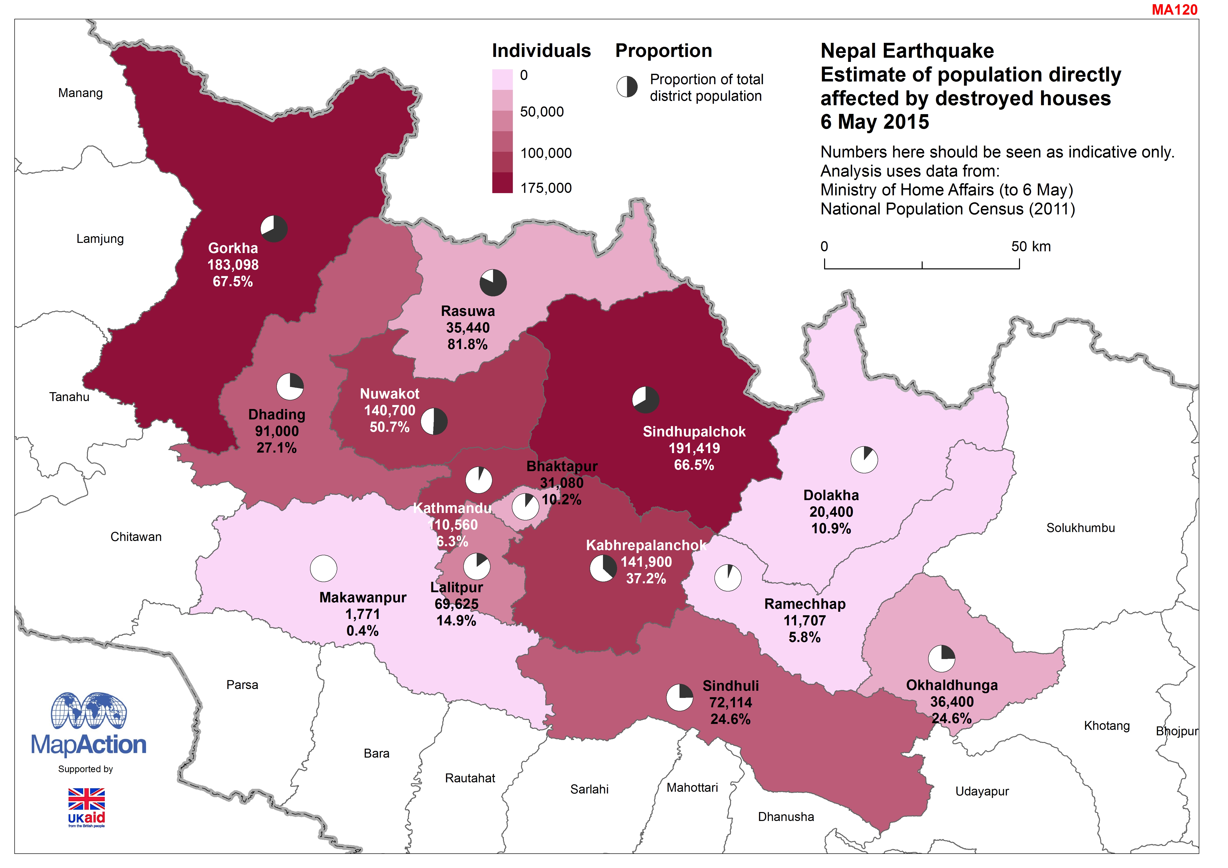
Nepal: Earthquake - Estimate of population directly affected by destroyed hou...
The numbers here should be seen as indicative only. Analysis based on an estimate of the number of buildings destroyed (not including government buildings) and the average... -

Nepal Earthquake:Who, What, Where - Number of agenies per VDC in Sindhupalcho...
Map shows each VDC, coloured by the number of agencies operating in there. The labels show the VDC name and number of agencies operating. -

Nepal: Earthquake - Estimate of population directly affected by destroyed hou...
The numbers here should be seen as indicative only. Analysis based on an estimate of the number of buildings destroyed (not including government buildings) and the average... -

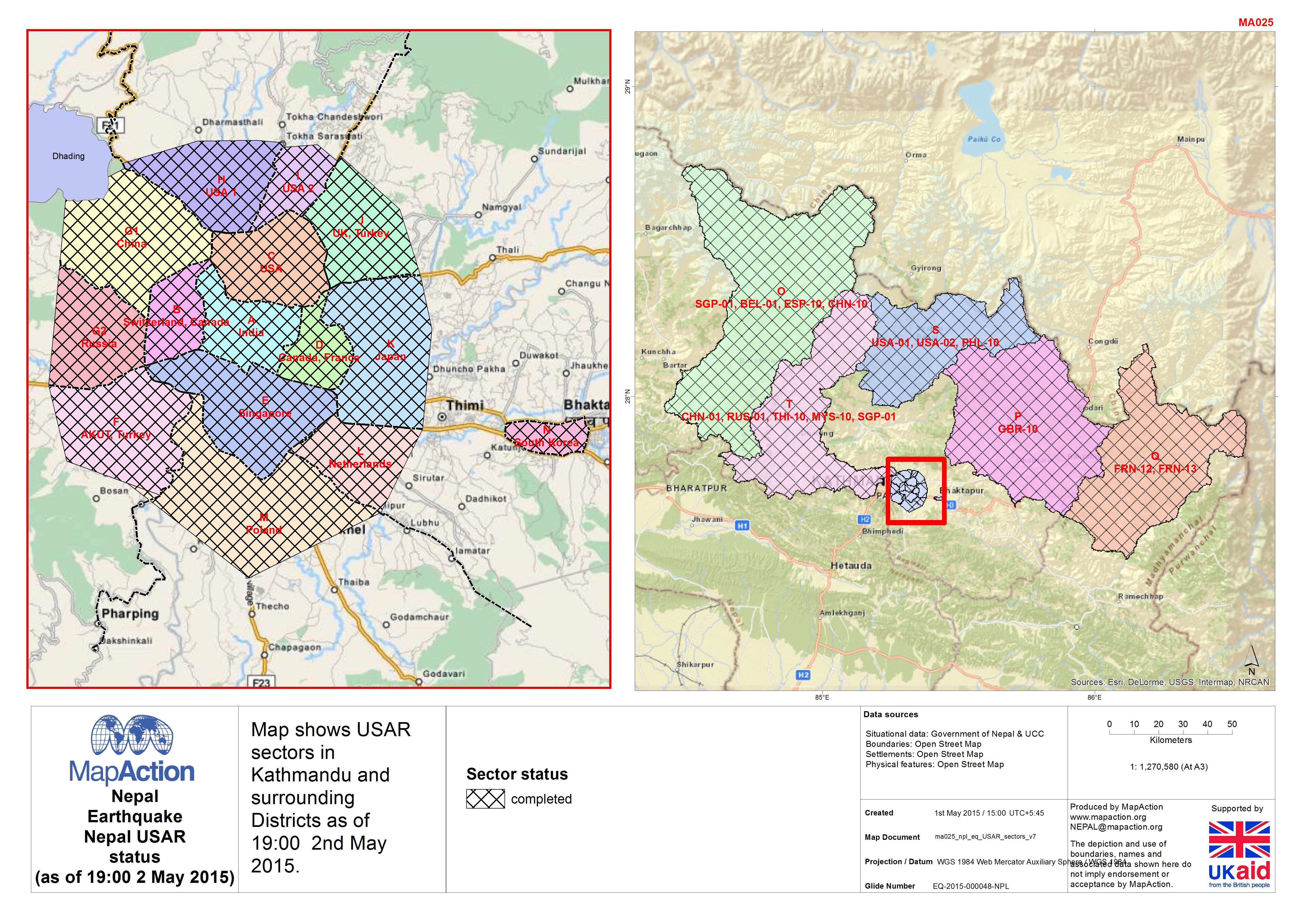
Nepal: Earthquake - Nepal USAR status(as of 19:00 2 May 2015)
Map shows USAR sectors in Kathmandu and surrounding Districts as of 19:00 2nd May 2015. -

Nepal: Earthquake - Population map Makawanpur District
Map shows population by Village Development Communities, hill shaded relief and some settlement information. -

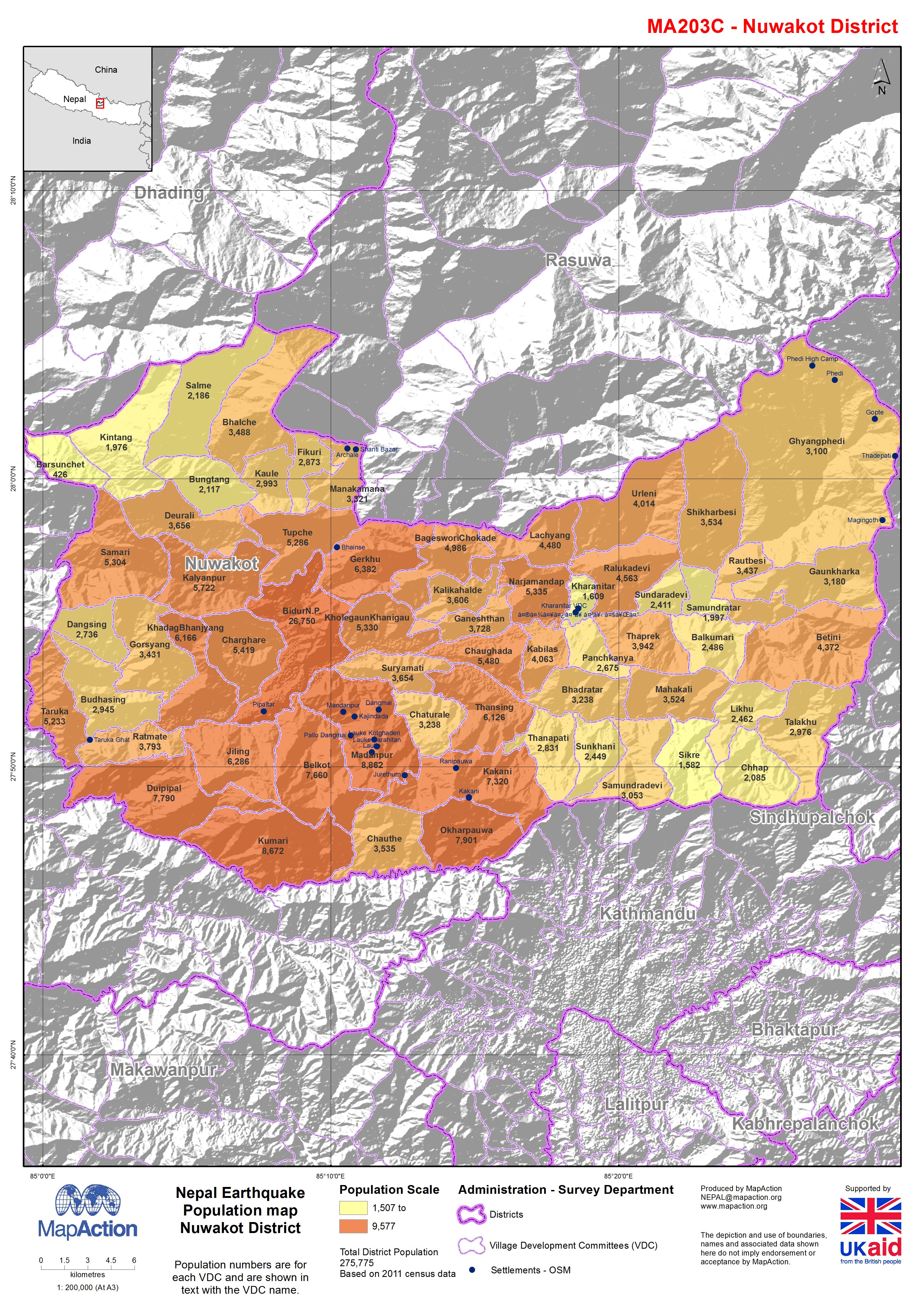
Nepal: Earthquake - Population map Nuwakot District
Map shows population by Village Development Communities, hill shaded relief and some settlement information.