-
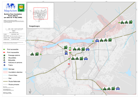
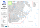
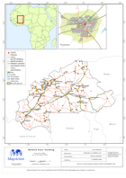
Burkina Faso: Flooding - Ponts affecte (en date de 14 Sep 2009)
This dataset has no description
-
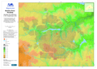
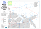
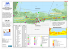
Burkina Faso: Flooding - Elevation and Waterways in the Ouagadougou area
This dataset has no description
-
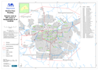
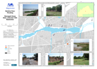
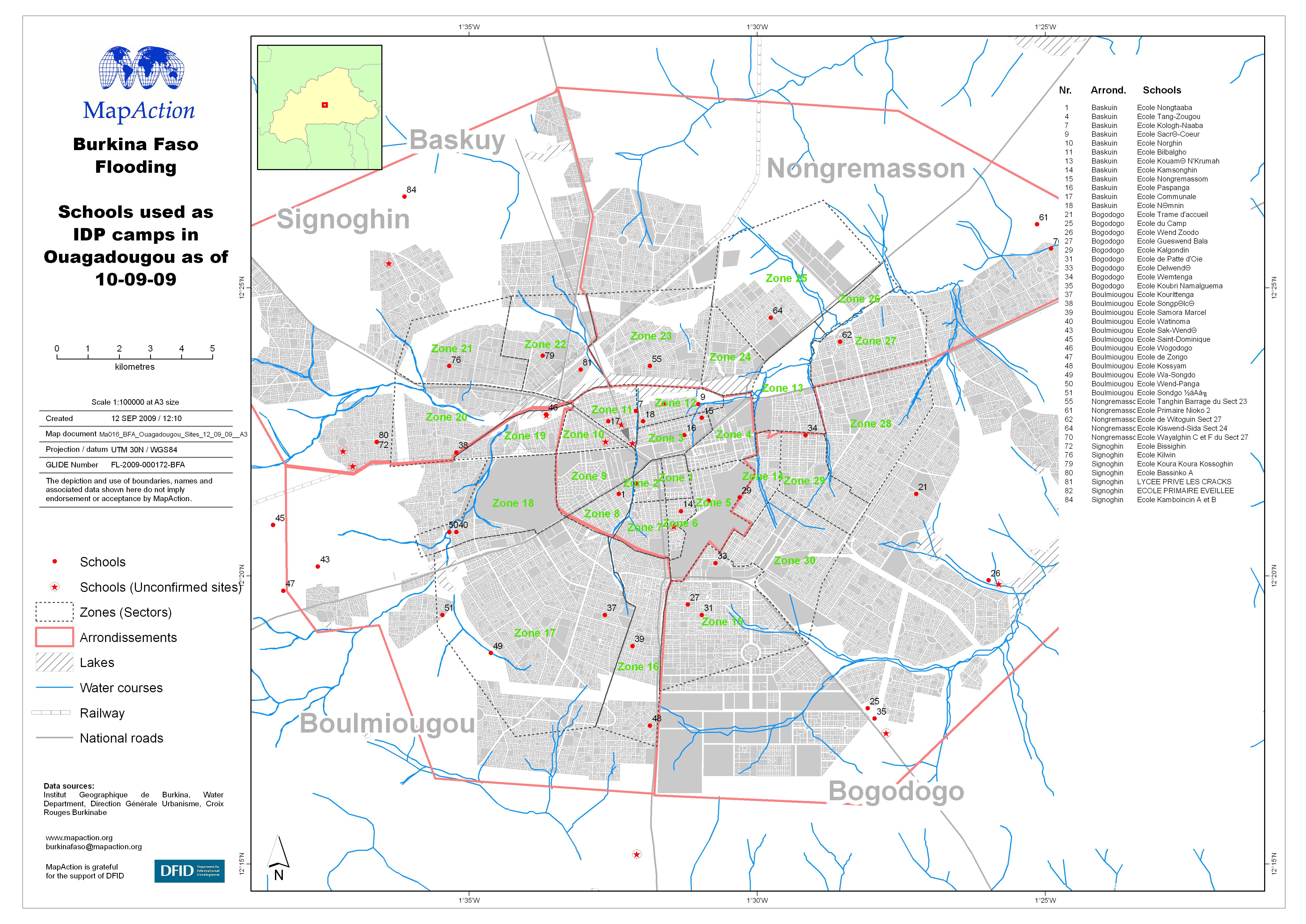
Burkina Faso: Flooding - Schools used as IDP camps in Ouagadougou as of 10 Se...
This dataset has no description
-
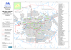
Burkina Faso: Flooding - IDP Sites collected by Red Cross as of 10 Sept 2009
This dataset has no description
-

Burkina Faso: Flooding - Baskuy IDP Sites collected by Red Cross as of 10 Sep...
This dataset has no description
-
Burkina Faso: Flooding - Bogodogo IDP Sites collected by Red Cross as of 10 S...
This dataset has no description
-
Burkina Faso: Flooding - Nongremasson IDP Sites collected by Red Cross as of ...
This dataset has no description
-

Burkina Faso: Flooding - Boulmiougou IDP Sites collected by Red Cross as of 1...
This dataset has no description
-

Burkina Faso: Flooding - Signoghin IDP Sites collected by Red Cross as of 10 ...
This dataset has no description
-
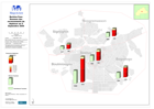
Burkina Faso: Flooding - Damaged Areas Data collected 10th September
This dataset has no description
-
Burkina Faso: Flooding - Donnees des recensements de deplaces au 5 Septembre ...
This dataset has no description
-
-
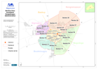
Burkina Faso: Flooding - Ouagadougou Administration
Carte de arrondissements et secteurs de Ouagodougou -
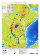
East Africa Rift Valley - History of seismic events in relation to population...
This dataset has no description
-
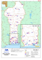
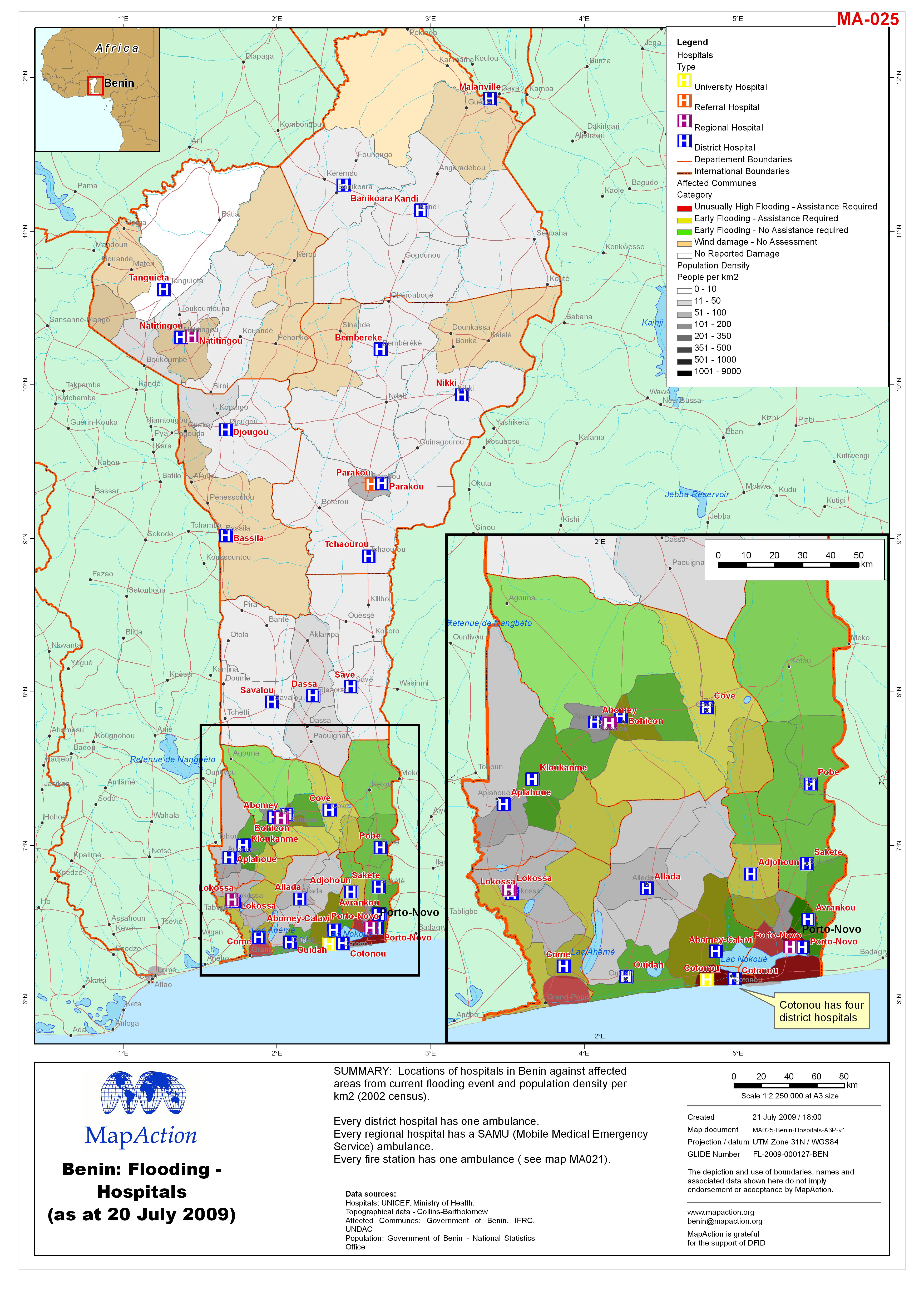
Benin: Flooding - Hospitals
Locations of hospitals in Benin. Every district hospital has one ambulance. Every regional hospital has a SAMU (Mobile Medical Emergency Service) ambulance. Every fire station... -

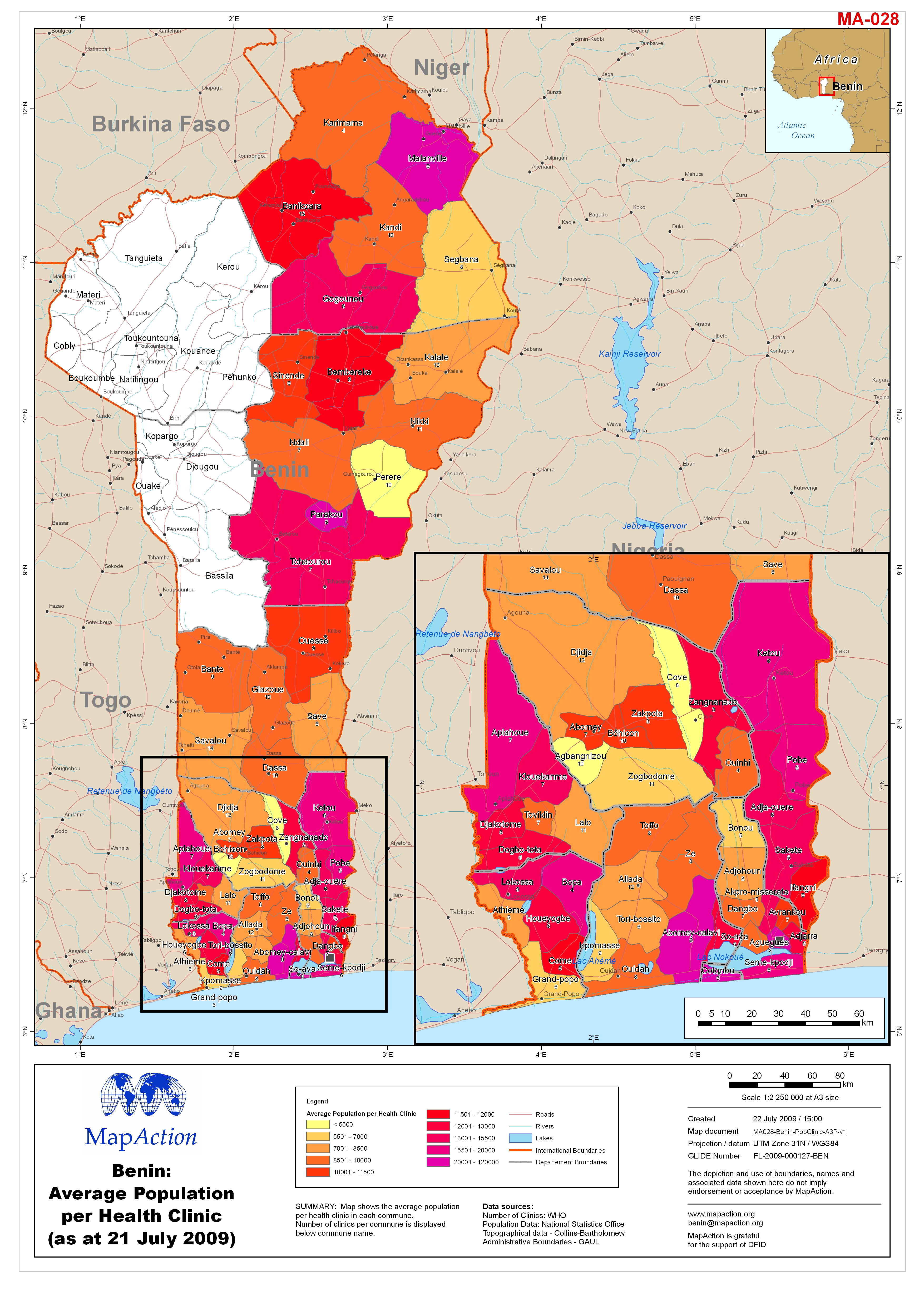
Benin: Average Population per Health Clinic (as at 21 July 2009)
Map shows the average population per health clinic in each commune. Mumber of clinics per commune is displayed below commune name. -

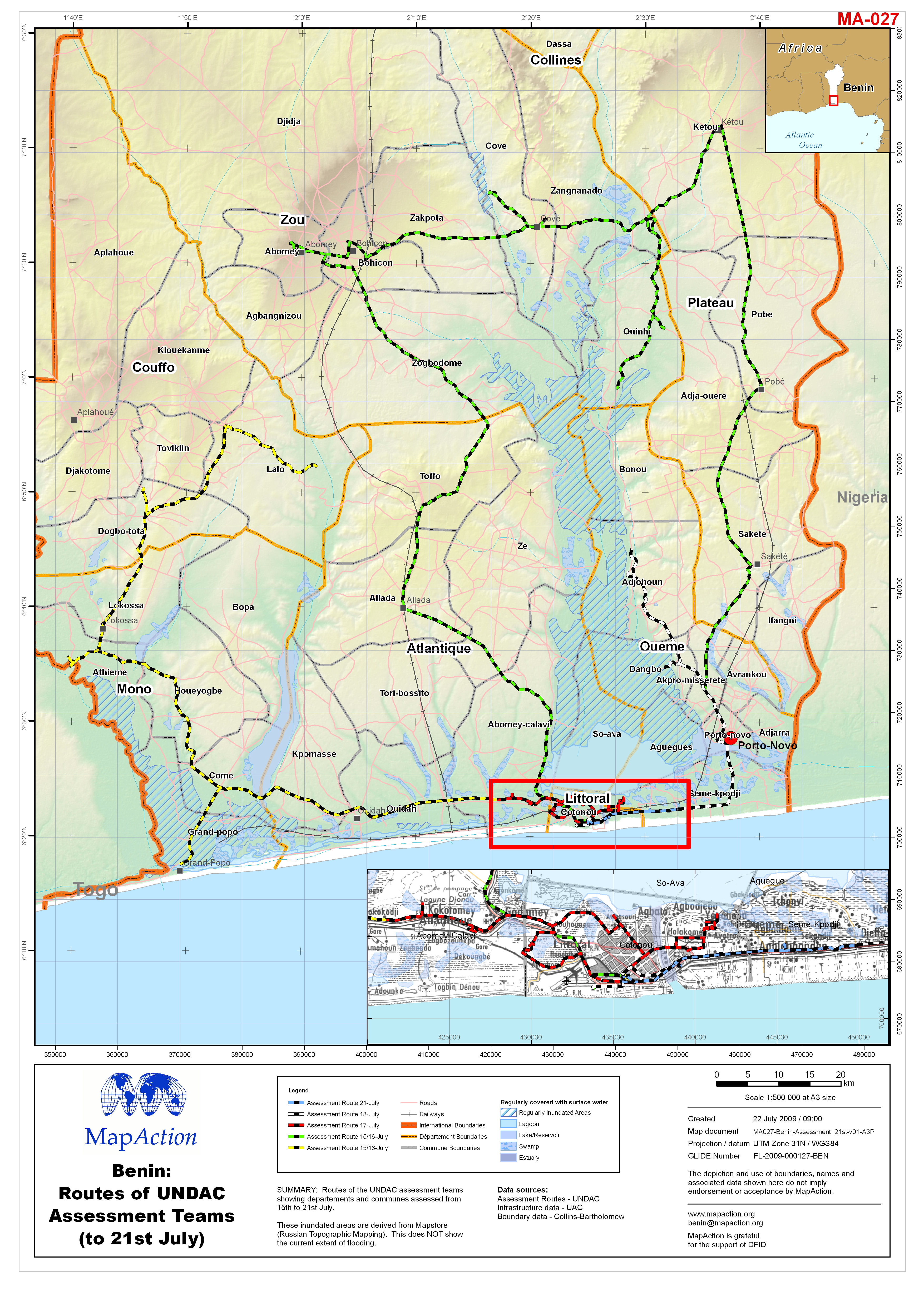
Benin: Routes of UNDAC Assessment Teams (to 21st July)
Routes of the UNDAC assessment teams showing departements and communes assessed from 15th to 21st July. These inundated areas are derived from Mapstore (Russian Topographic... -

Benin: Flooding - Affected Communes (as at 20 July 2009)
Map shows the affected communes categorised by type of damage and assessment. -
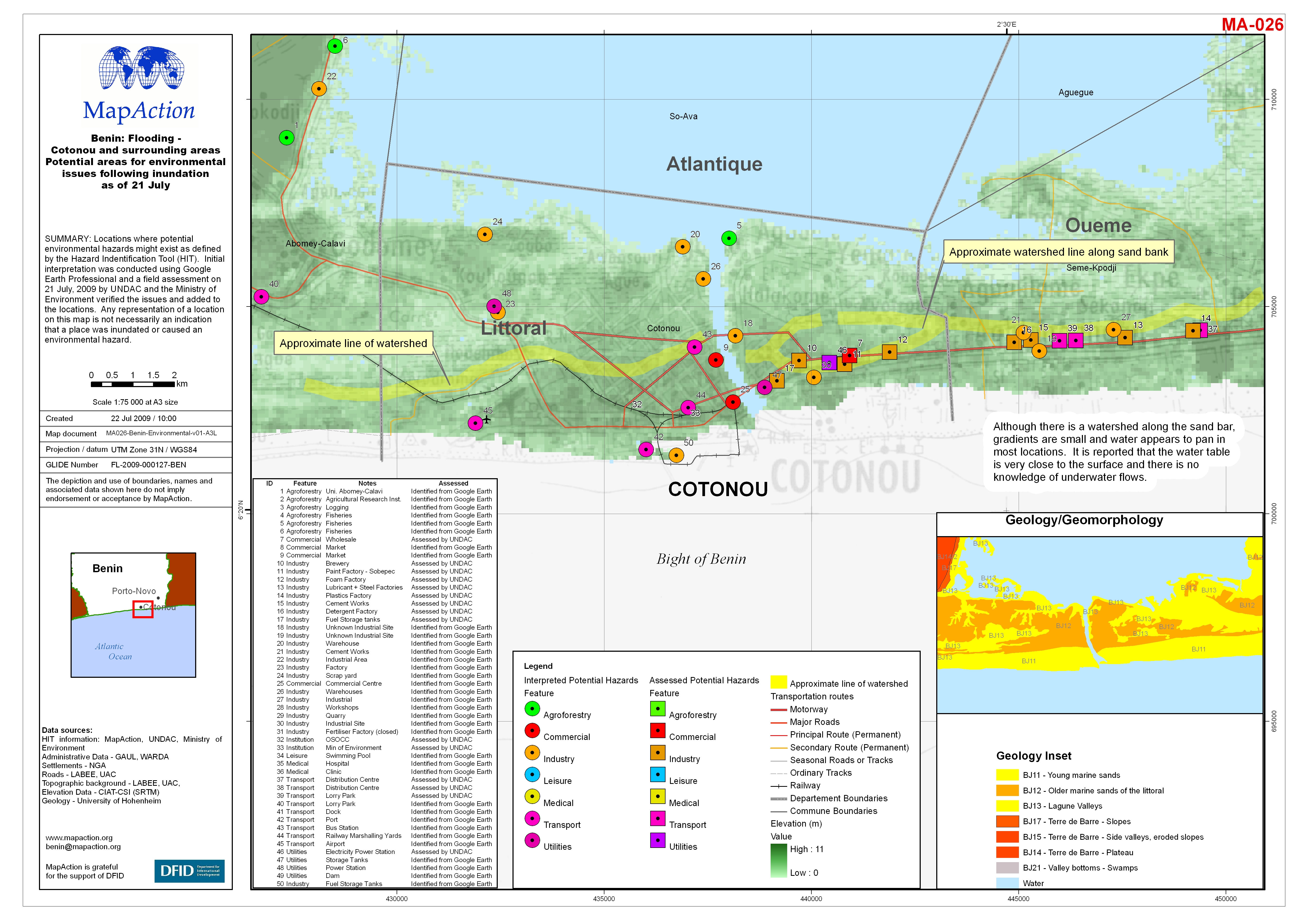
Benin: Flooding - Cotonou and surrounding areas Potential areas for environme...
Locations where potential environmental hazards might exist as defined by the Hazard Indentification Tool (HIT). Initial interpretation was conducted using Google Earth... -
Benin: Flooding - Hospitals (as at 20 July 2009)
Locations of hospitals in Benin against affected areas from current flooding event and population density per km2 (2002 census). Every district hospital has one ambulance.