-

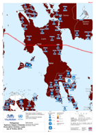
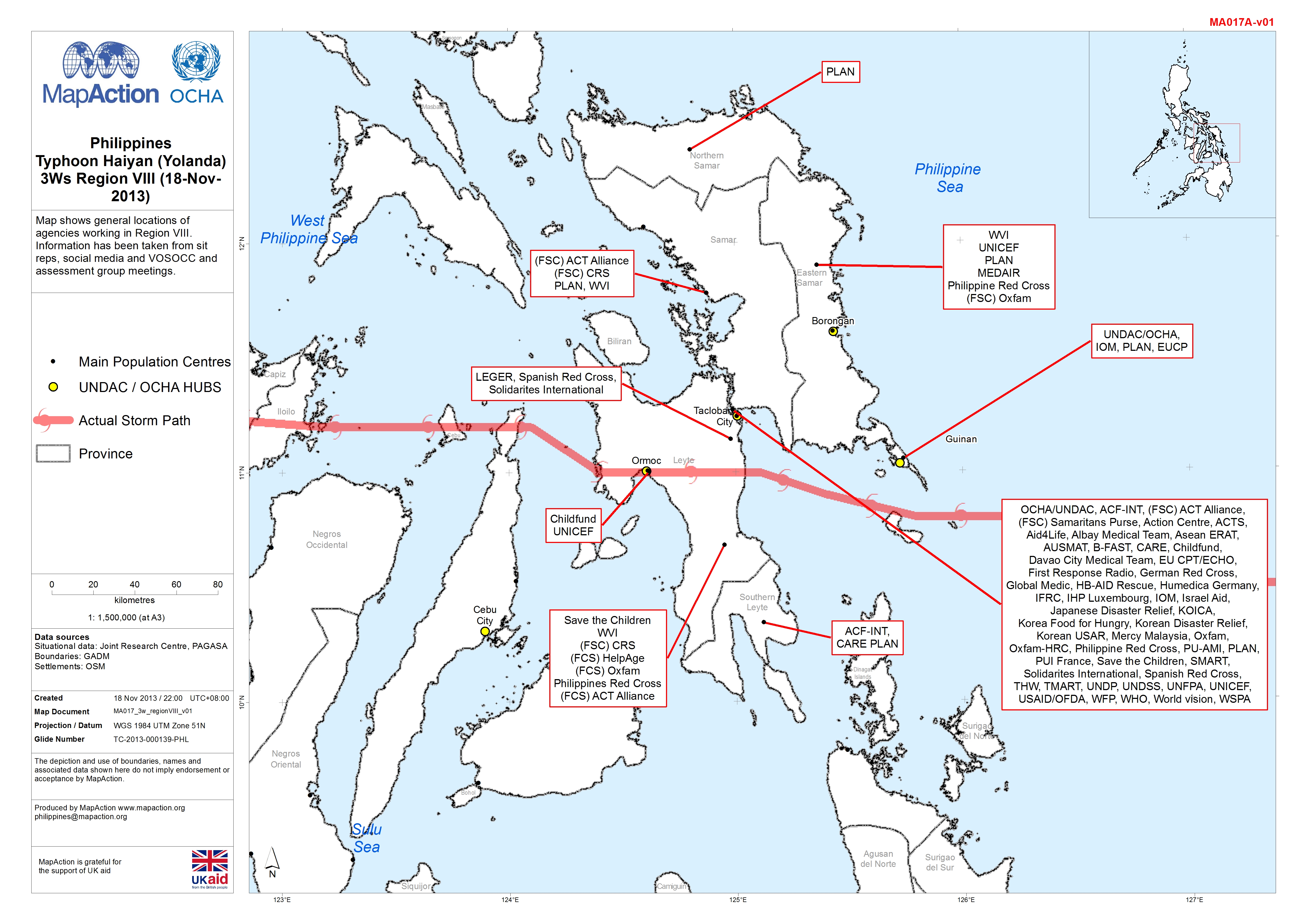
Philippines Typhoon Haiyan (Yolanda) 3Ws Region VIII (18-Nov-2013)
Map shows general locations of agencies working in Region VIII. Information has been taken from sit reps, social media and VOSOCC and assessment group meetings. -
Philippines Typhoon Haiyan (Yolanda) Meeting and Other Locations - Tacloban C...
Map shows meeting and other locations for Tacloban City and near area.Please be advised that datasets may not be complete. -

Philippines Typhoon Haiyan (Yolanda) Food Security & Agriculture Cluster Init...
Map shows the assessments that are:Planned, In Process or CompletedData based on the Food Security Cluster and provided by the Samaritans -

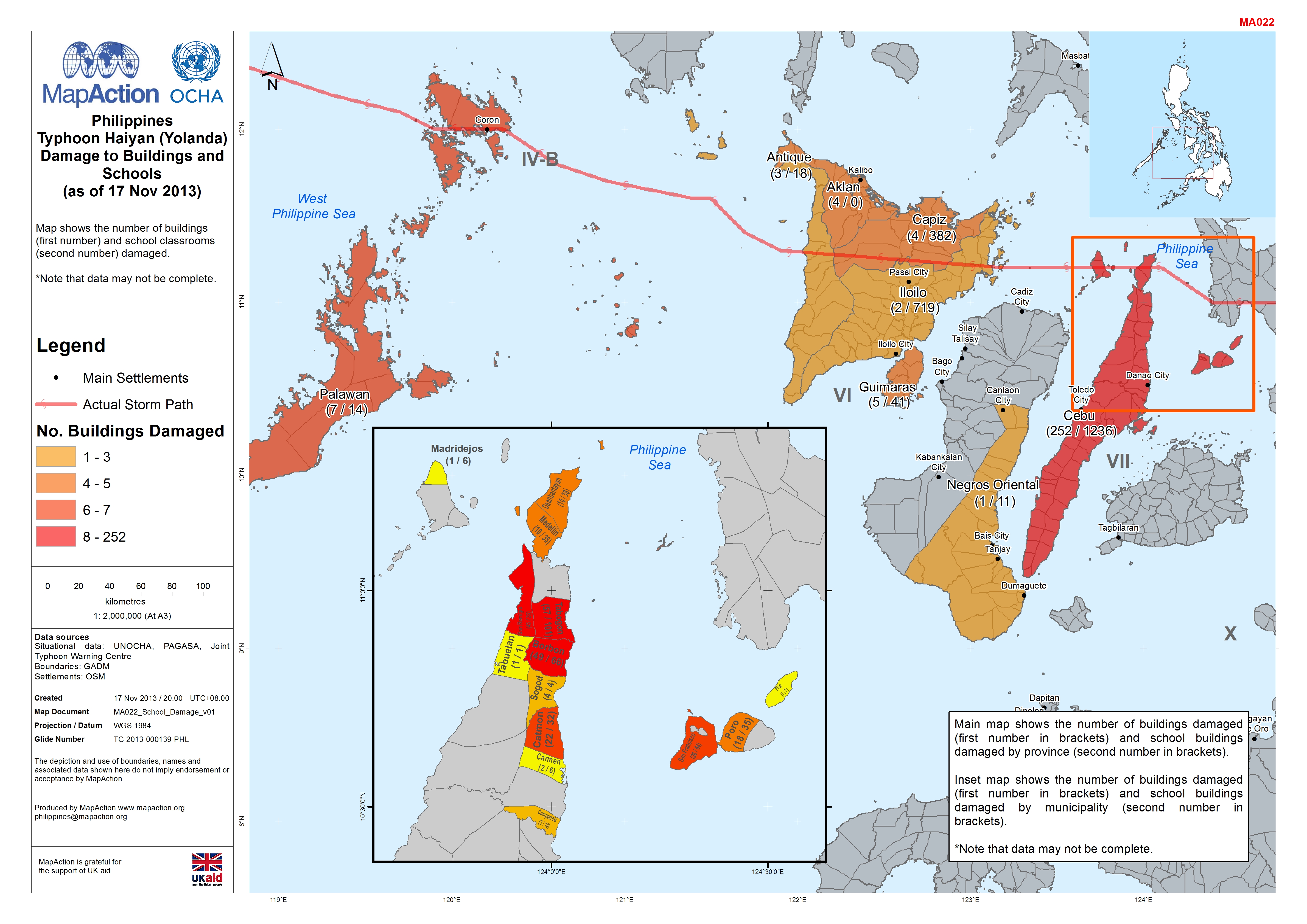
Philippines Typhoon Haiyan (Yolanda) Damage to Buildings and Schools (as of 1...
Map shows the number of buildings (first number) and school classrooms (second number) damaged.*Note that data may not be complete. -
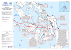
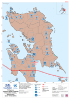
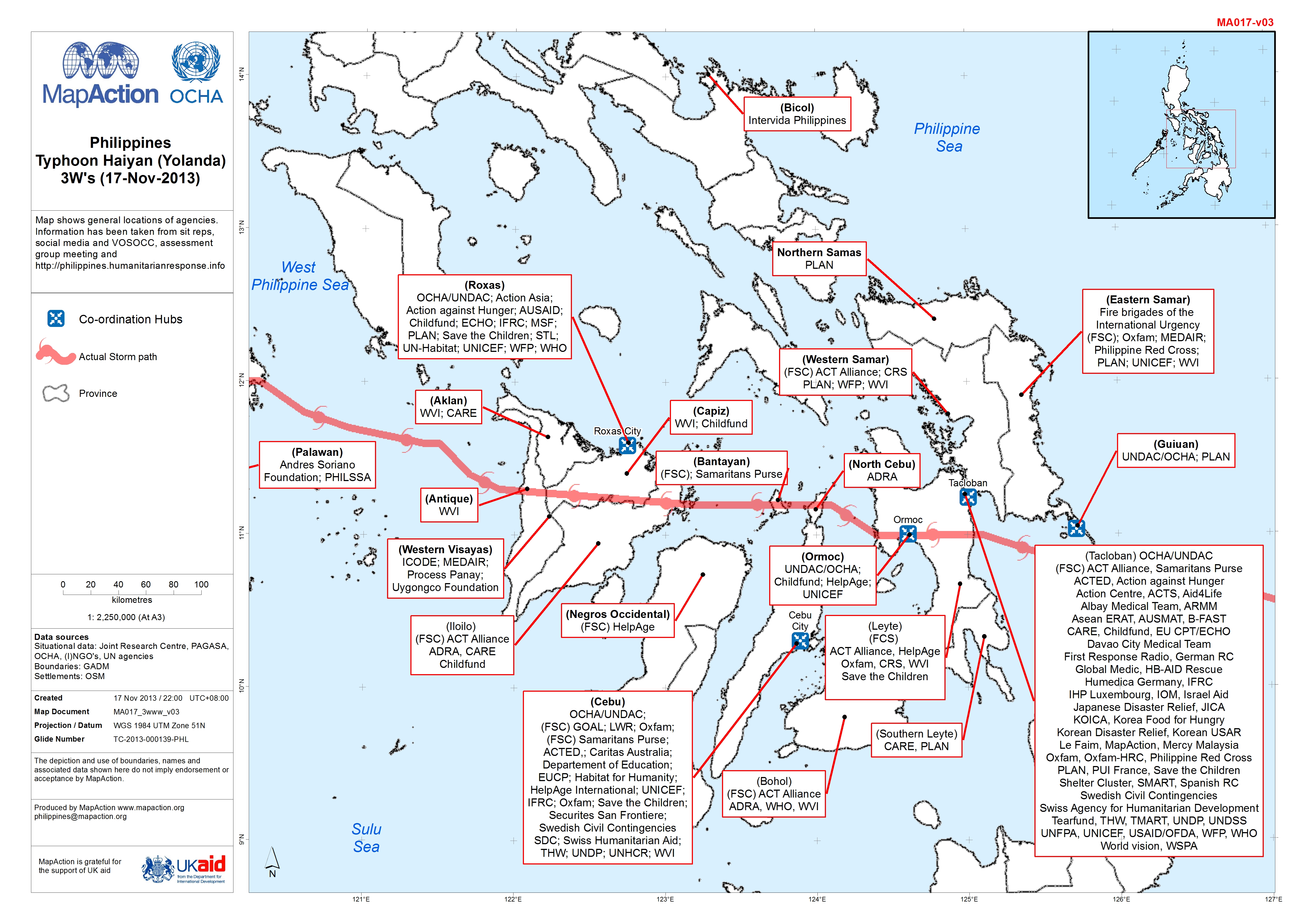
Philippines Typhoon Haiyan (Yolanda) 3Ws (17-Nov-2013)
Map shows general locations of agencies. Information has been taken from sit reps, social media and VOSOCC, assessment group meeting and... -
Philippines Typhoon Haiyan (Yolanda) Situational Information (as of 16-Nov-20...
Map shows situational information from NDRRMC sit rep 23. information on power disruption and phone coverage.Damaged areas are digitised from satellite imagery and are not... -

Philippines Typhoon Haiyan (Yolanda) Evacuation Centres, Masbate and Sorgoson...
Map shows number of people in evacuation centres by municipality in Masbate and Sorgoson regions.Please be advised that datasets may not be complete. -

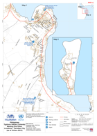
Philippines Typhoon Haiyan (Yolanda) Infrastructure - Calicoan Island (as of ...
Map shows Calicoan Island. Infrastructure, major transport terminals are shown for reference. Please be advised that datasets may not be complete, and in particular may not... -

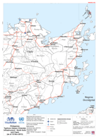
Philippines Typhoon Haiyan (Yolanda) Infrastructure - Samar (as of 16 Nov-2013)
Map shows the province of Samar. Infrastructure, major transport terminals are shown for reference. Please be advised that datasets may not be complete. -

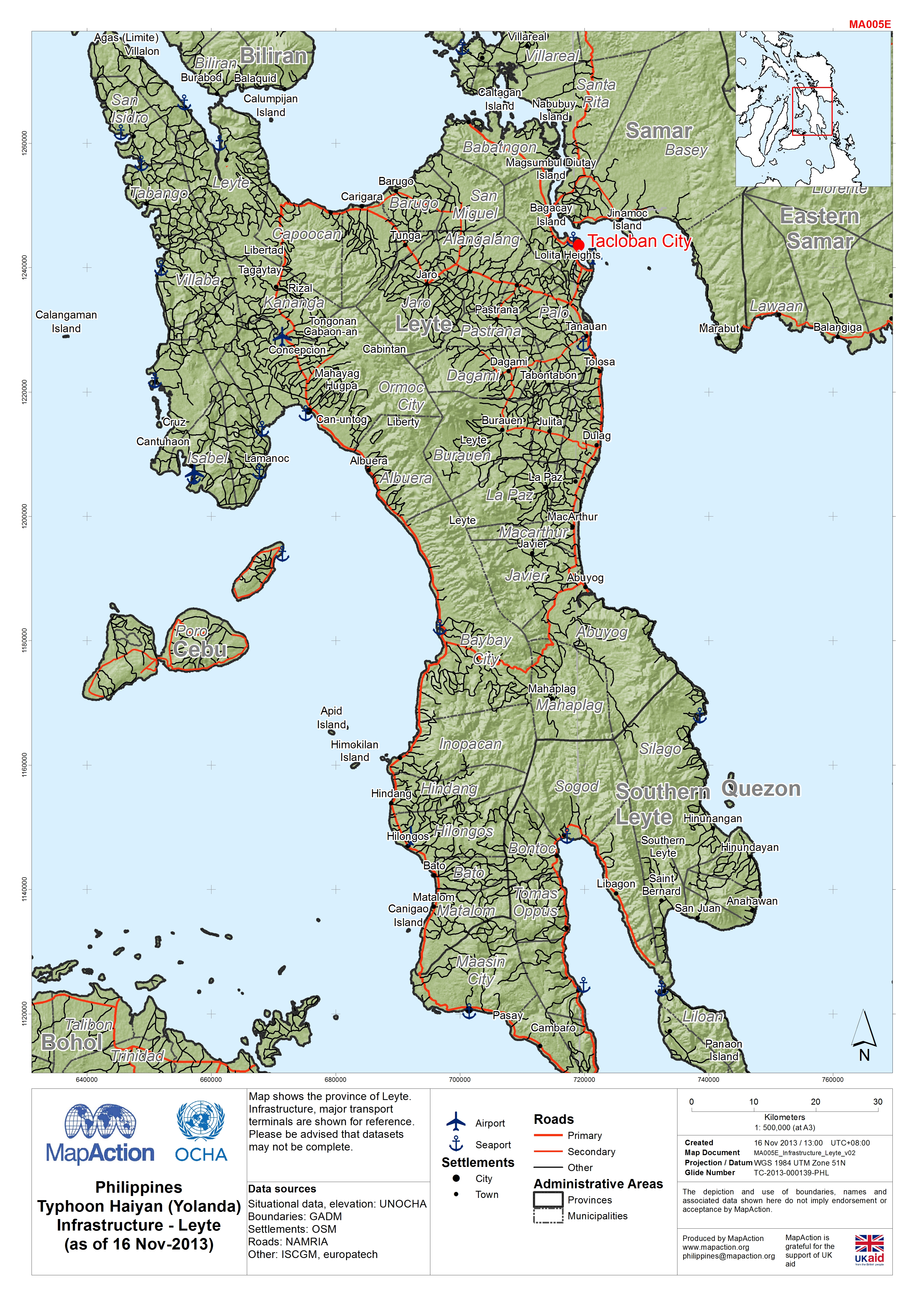
Philippines Typhoon Haiyan (Yolanda) Infrastructure - Leyte (as of 16 Nov-2013)
Map shows the province of Leyte. Infrastructure, major transport terminals are shown for reference. Please be advised that datasets may not be complete. -
Philippines Typhoon Haiyan (Yolanda) Evacuation Centres, Palawan and Antique ...
Map shows number of people in evacuation centres by municipality in Palawan and Antique regions.Please be advised that datasets may not be complete. -
Philippines Typhoon Haiyan (Yolanda) Evacuation Centres, Leyte (as of 15-Nov-...
Map shows number of people in evacuation centres by municipality in Leyte. Please be advised that datasets may not be complete. -

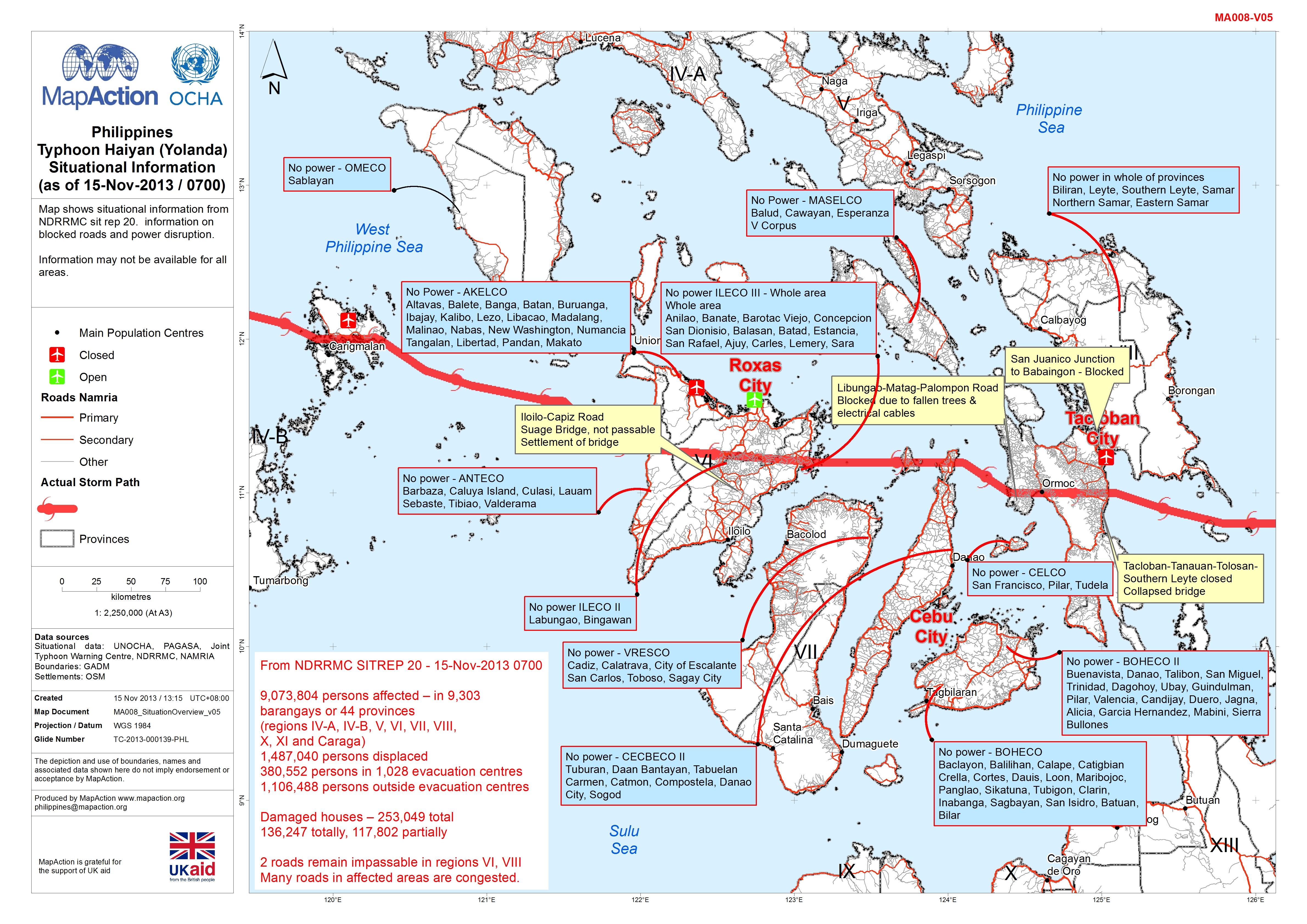
Philippines Typhoon Haiyan (Yolanda) Situational Information (as of 15-Nov-20...
Map shows situational information from NDRRMC sit rep 20. information on blocked roads and power disruption.Information may not be available for all areas. -

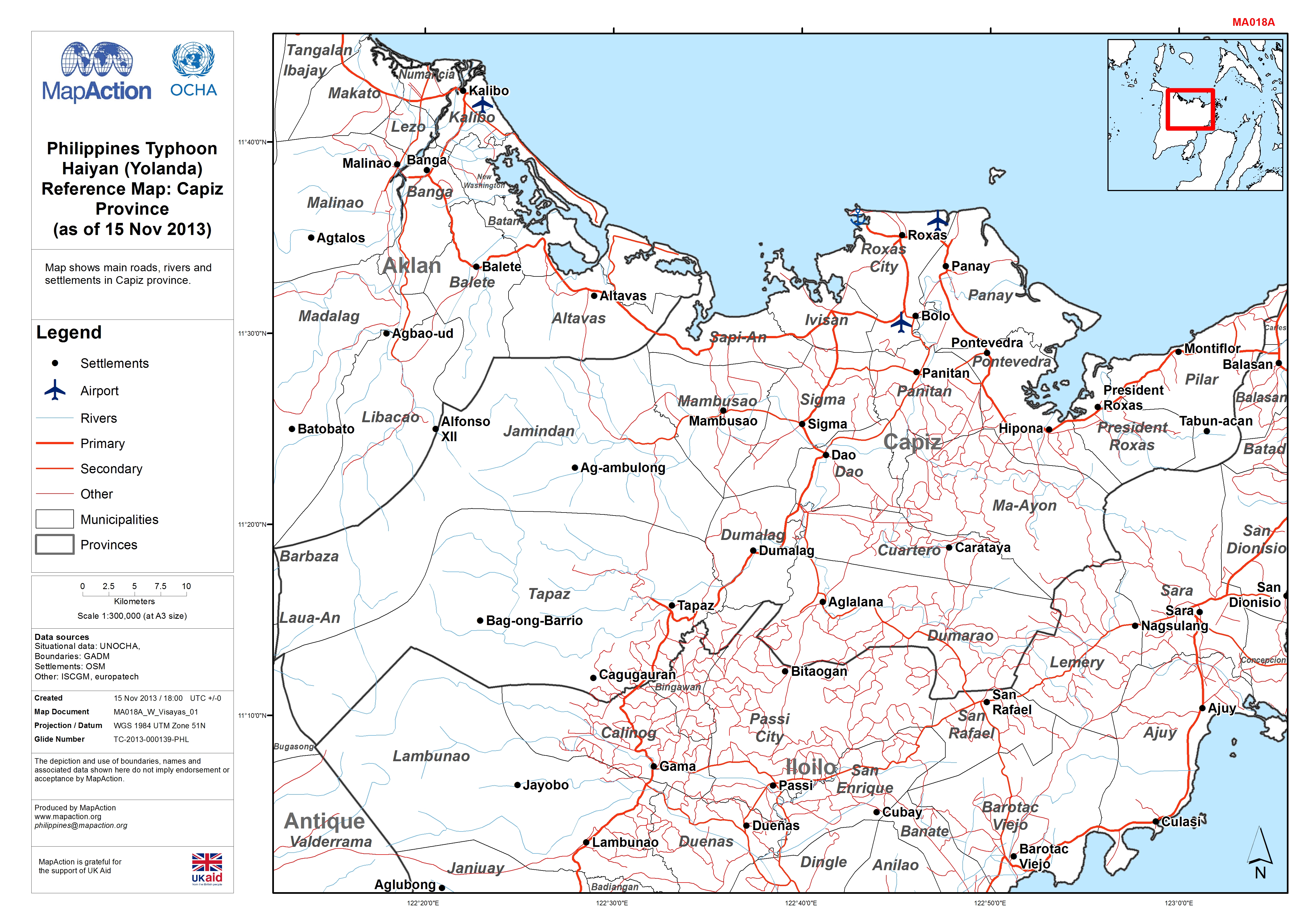
Philippines Typhoon Haiyan (Yolanda) Reference Map: Capiz Province (as of 15 ...
Map shows main roads, rivers and settlements in Capiz province. -

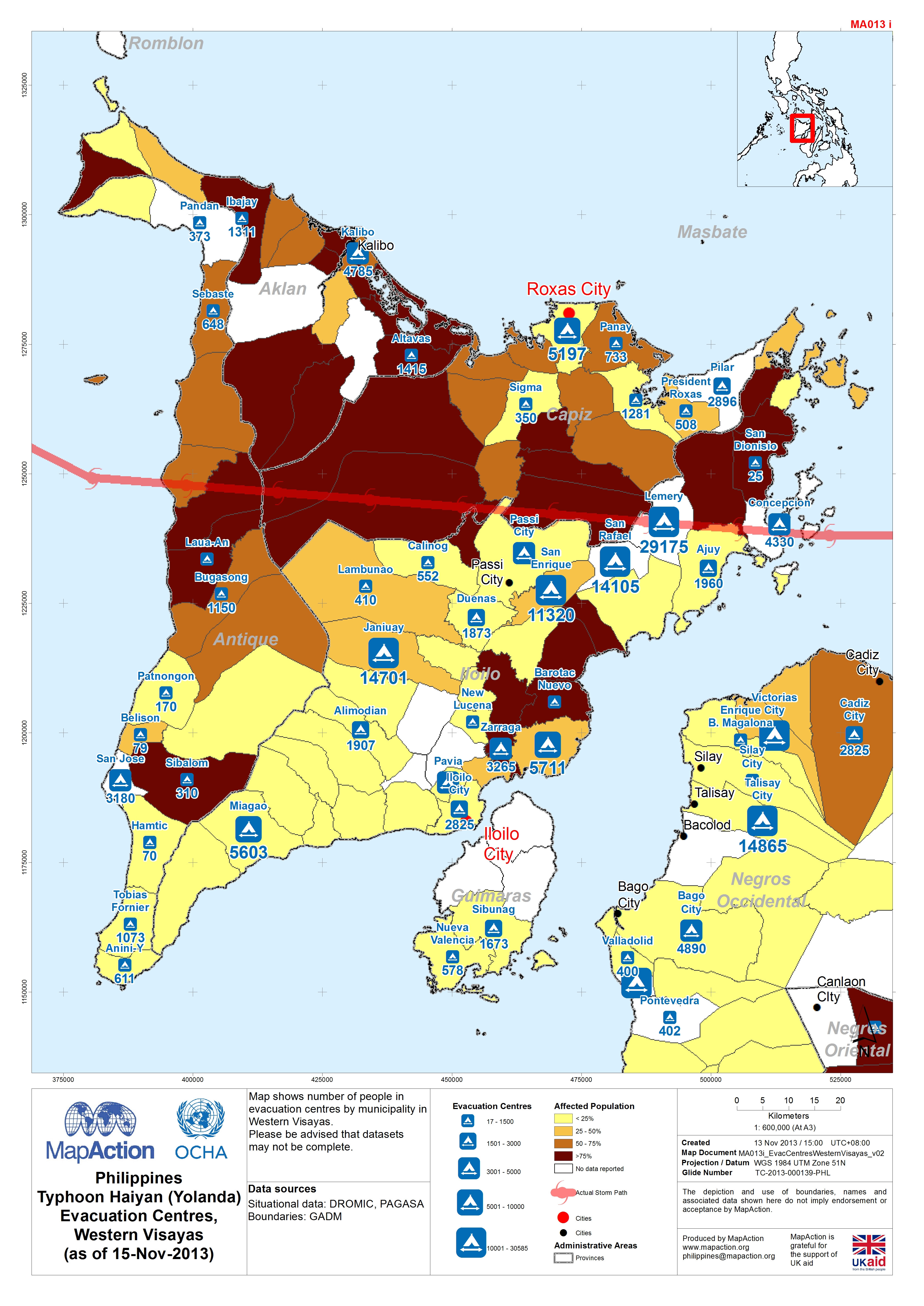
Philippines Typhoon Haiyan (Yolanda) Evacuation Centres, Western Visayas (as ...
Map shows number of people in evacuation centres by municipality in Western Visayas. Please be advised that datasets may not be complete. -
Philippines Typhoon Haiyan (Yolanda) Evacuation Centres, Samar/Leyte (as of 1...
Map shows number of people in evacuation centres by municipality in Samar. Percentage population affected is 100% (DROMIC).Please be advised that datasets may not be complete. -

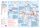
Philippines Typhoon Haiyan (Yolanda) Potential Hazardous Sites near Tacloban ...
Map shows Tacloban and surrounding area, potential hazardous sites have been identified from OSM data for industry and transport terminals. Main roads are also shown. -

Philippines Typhoon Haiyan (Yolanda) Infrastructure - Guiuan (as of 15 Nov-2013)
Map shows the municipality of Guiuan. Infrastructure, major transport terminals are shown for reference. Please be advised that datasets may not be complete, and in particular... -
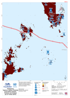
Philippines Typhoon Haiyan (Yolanda) Infrastructure - North Iloilo and Capiz ...
Map shows the provinces of Northern Iloilo and Capiz of Samar. Infrastructure, major transport terminals are shown for reference.Please be advised that datasets may not be... -
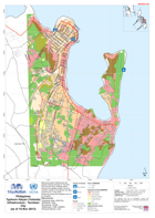
Philippines Typhoon Haiyan (Yolanda) Infrastructure - Tacloban City (as of 15...
Map shows basic infrastructure and graded buildings damage for Tacloban City and near area. Damage data is derived from satellite imagery and has not been verified on the...