-

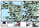
Tanzania Earthquake NE of Kagera Region Administrative Map (as of 22 Sep 2016)
Map shows the extent of the damaged districts/wards from the Earthquake with terrain. This is primarily a reference map with villages, road and river displayed to show context... -

Tanzania Earthquake Kagera Region Percentage Damaged Houses (as of 26 Sep 2016)
Map shows the percentage of damaged houses based on major damage to buildings in: Wards: Bukoba Rural; Bukoba Urban; Kagerwa: Missenyi Districts: Kyerwa; Muleba * Data was only... -

Tanzania Earthquake: Kagera Region Damaged Schools
Map of the Kagera Region showing the Number of damaged classrooms -

Haiti: Hurricane Matthew, Damaged Buildings, Jeremie - (as of 10 Oct 2016)
Reference map showing number of destroyed and severely damaged buildings in the Jeremie area, by Section and 5km square. -
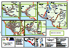
Haiti: Hurricane Matthew, Who does What Where (3W) (as of 13 Oct 2016)
Reference map showing agency activities by Commune in North, Centre, Ouest, Sud Est. -
Haiti: Hurricane Matthew: Damaged Buildings, Sud, Selected Areas (as of 10 Oc...
Selected settlements in Sud showing no. of buildings completely or partially destroyed, based on Copernicus analysis. Note that data is only available for the areas indicated. -
Haiti: Hurricane Matthew, Who does What Where (3W) (as of 13 Oct 2016)
Reference map showing agency activities by Commune in Grand Anse, Sud, Nippes. -

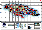
Jamaica: Hurricane Matthew - Assessment Planning
Basemap for assessment and field team planning showing settlements, schools, healthcare facilities and road networks. -

Haiti: Hurricane Matthew, Who does What Where (3W) (as of 9 Oct 2016)
Reference map showing agency activities by Commune in Grande Anse, Sud and Nippes. -

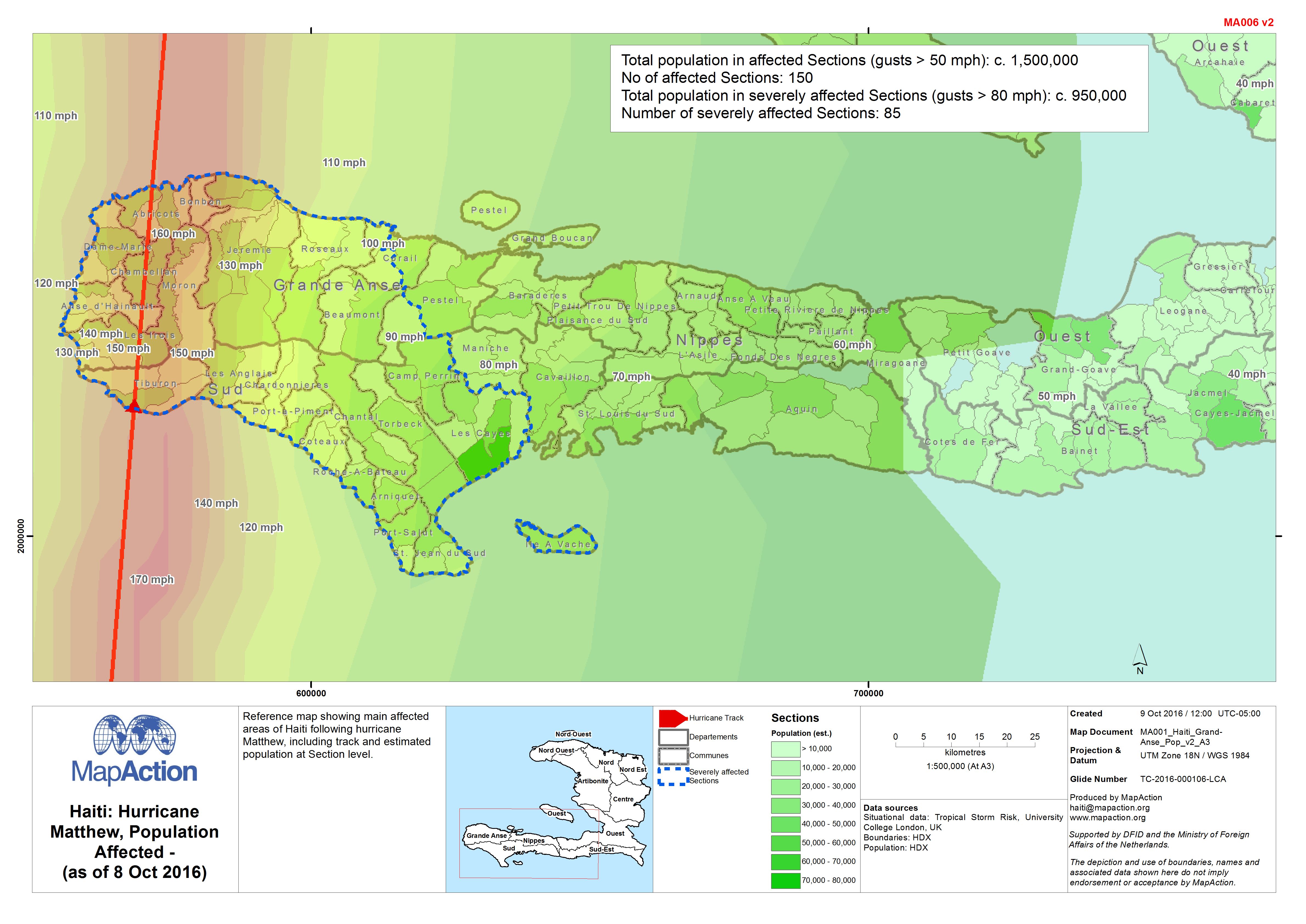
Haiti: Hurricane Matthew, Population Affected - (as of 8 Oct 2016)
Reference map showing main affected areas of Haiti following hurricane Matthew, including track and estimated population at Section level. -

Haiti: Hurricane Matthew, Main Bridge/Road Obstacles - South (as of 7 Oct 2016)
Reference map showing main obstacles/blockages in Southern Haiti following Hurricane Matthew. -
Haiti: Hurricane Matthew, Population Affected - (as of 7 Oct 2016)
Reference map showing main affected areas of Haiti following hurricane Matthew, including track and estimated population at Section level. -

Haiti: Hurricane Matthew - General Overview and Track (as of 6 Oct 2016)
Reference map showing main affected areas of Haiti following hurricane Matthew, including hurricane track. -

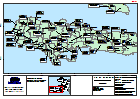
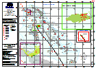
Bahamas: Hurricane Matthew - Reference - Country Map
Reference map for Bahamas showing major islands, districts and topographic features -

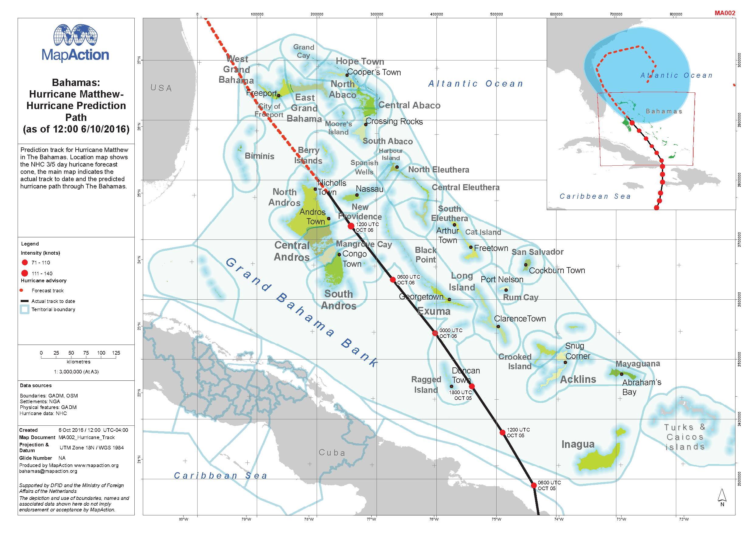
Bahamas: Hurricane Matthew - Hurricane Prediction Path (as of 12:00 6/10/2016)
Prediction track for Hurricane Matthew in The Bahamas. Location map shows the NJC 3/5 day hurricane forecast. The main map indicates the actual track to date and the predicted... -
Bahamas: Hurricane Matthew - Baseline - Population 2010 Supervisory Districts
2010 Census Population for Supervisory Districts (represented as points). Data from Statoids derived from Bahamas Department of Statistics -
Haiti: Hurricane Matthew, General Overview (as of 6 Oct 2016)
Reference map showing main affected areas of Haiti following hurricane Matthew. -
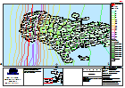
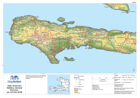
Jamaica: Hurricane Matthew - Topographic Reference
General Topography Map of Jamaica for orientation, including major settlement, topography and transport infrastructure. -
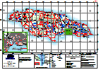
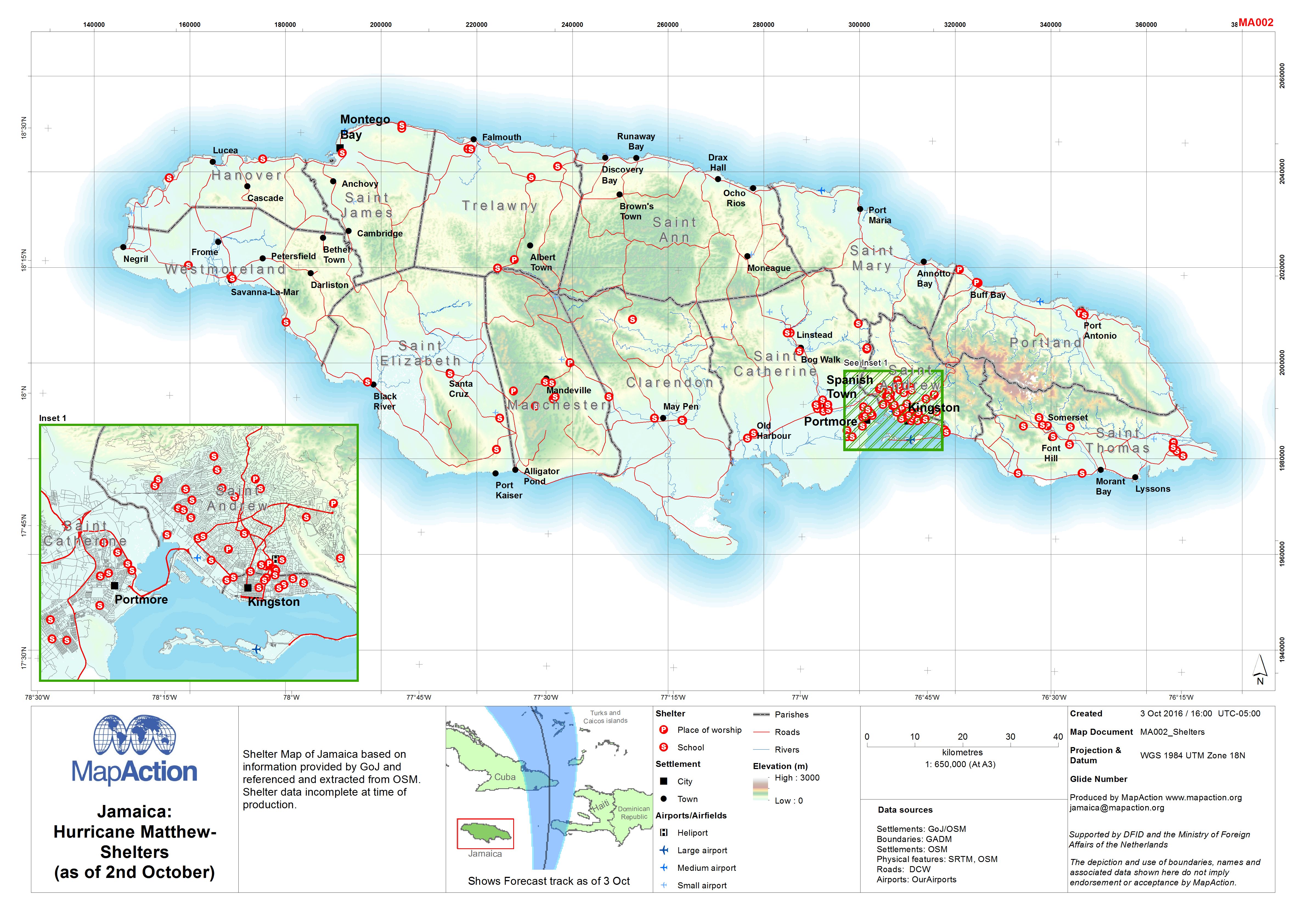
Jamaica: Hurricane Matthew - Shelters (as of 2nd October)
Shelter Map of Jamaica based on information provided by GoJ and referenced and extracted from OSM. Shelter data incomplete at time of production. -
SORLAND Hurricane Windblown IDP Sites Assessment Findings (from 27 September)
Summarises the findings of initial multi-cluster needs assessments. Assessments were carried out by mixed teams at six IDP sites on 27 September 2016 following Hurricane Windblown.