-

Storm path for cylones Batsirai (actual) and Emnati (predicted as of 23 Feb 2...
Storm path for cyclones Batsirai (actual on 6th Feb 2022) and Emnati (predicted as of 23 Feb 2022) with population density (2020 estimate) All forecasted storm positions, path... -

Storm path for cylones Batsirai (actual) and Emnati (predicted as of 22 Feb 2...
Storm path for cyclones Batsirai (actual on 6th Feb 2022) and Emnati (predicted as of 22 Feb 2022) with population density (2020 estimate) All forecasted storm positions, path... -

-
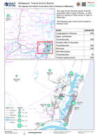
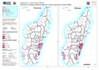
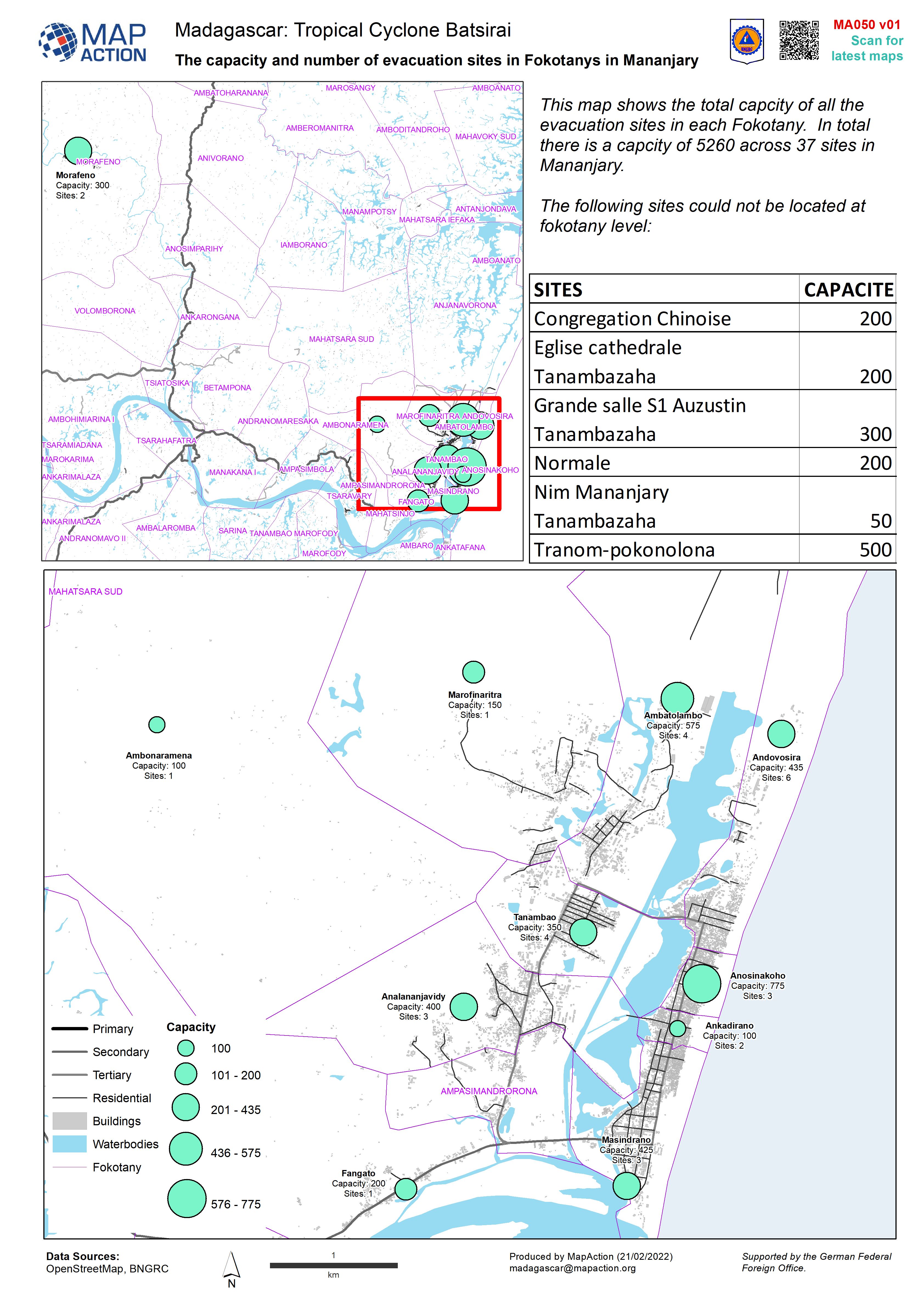
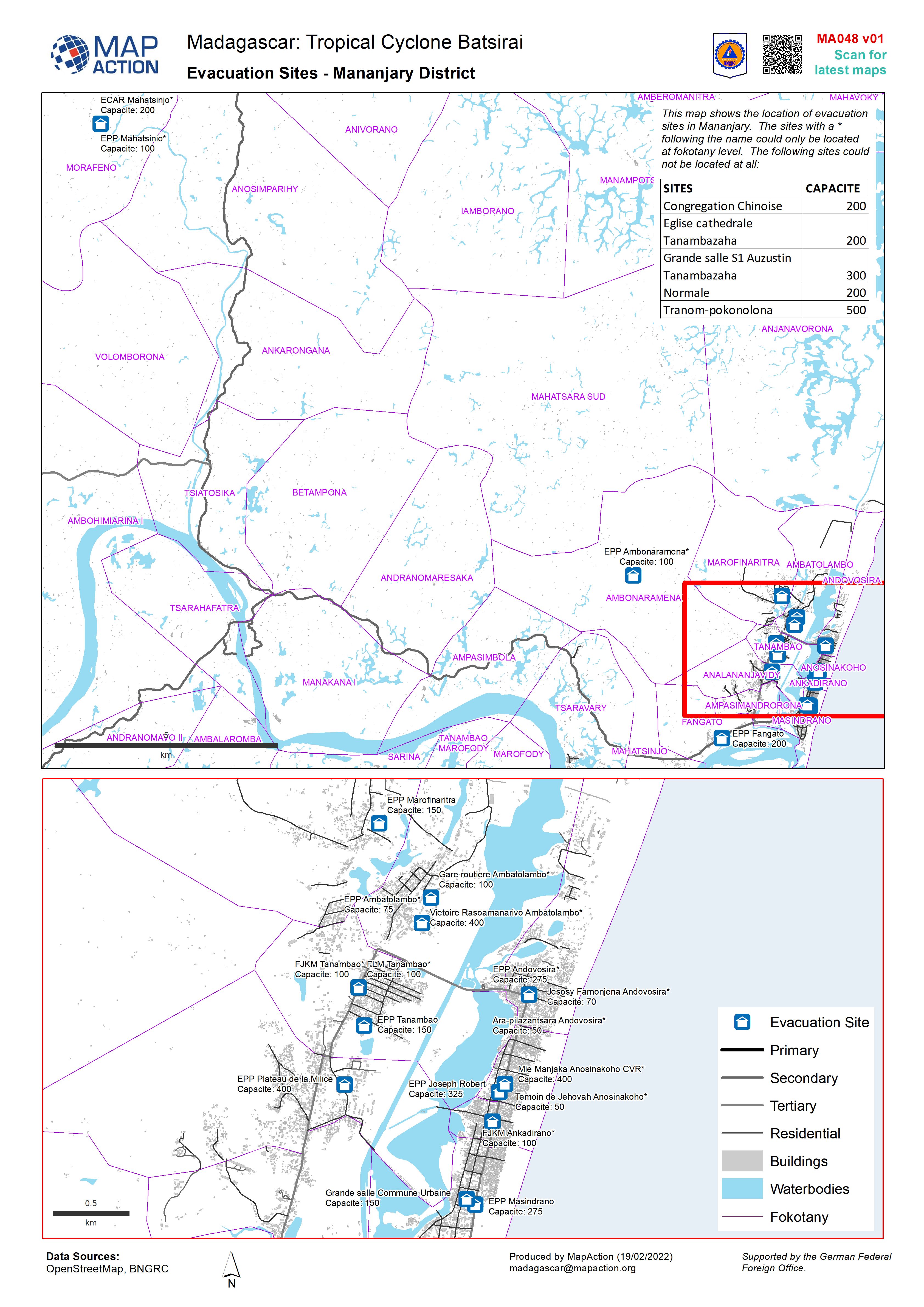
The capacity and number of evacuation sites in Fokotanys in Mananjary
This dataset has no description
-

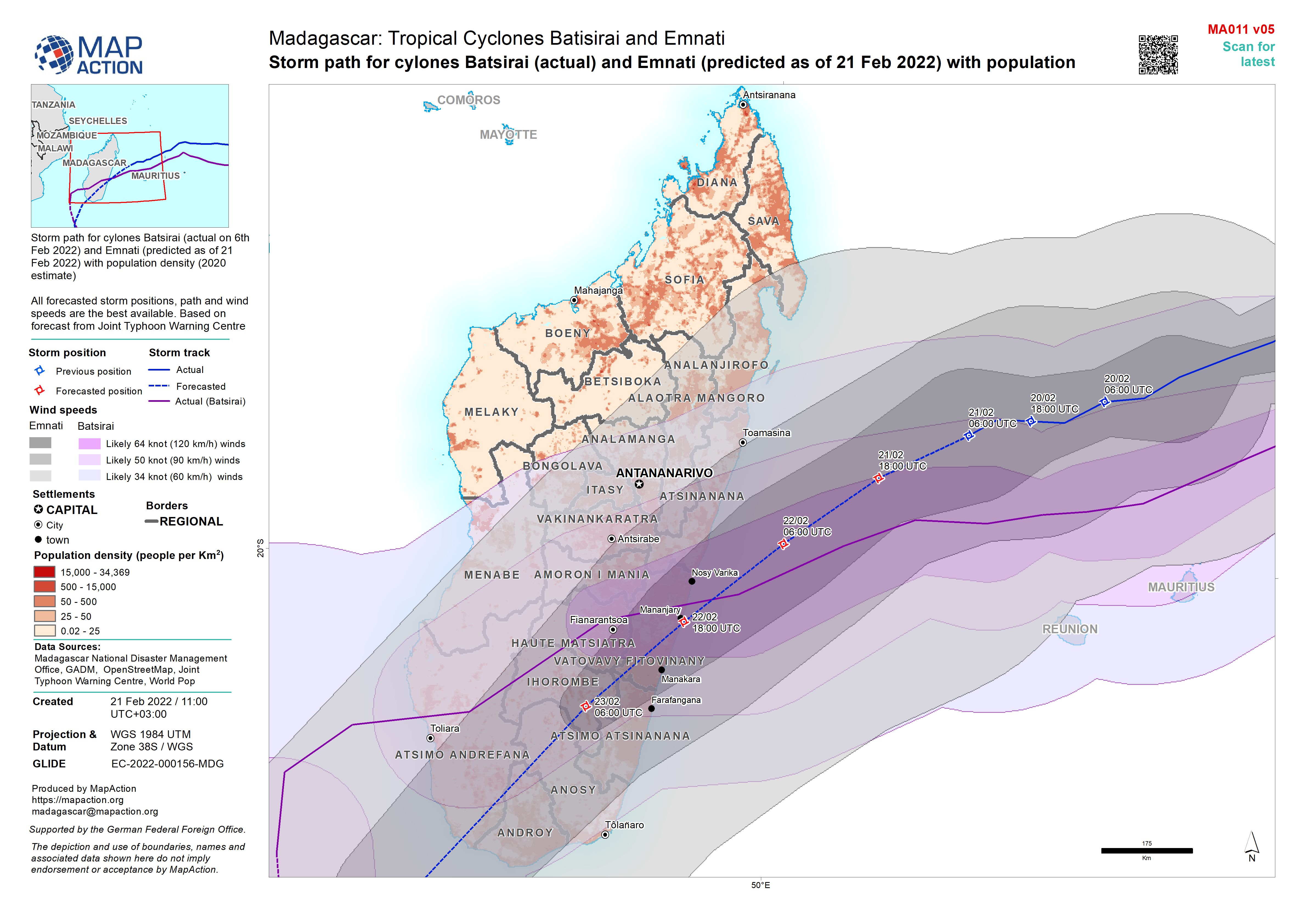
Storm path for cylones Batsirai (actual) and Emnati (predicted as of 21 Feb 2...
Storm path for cylones Batsirai (actual on 6th Feb 2022) and Emnati (predicted as of 21 Feb 2022) with population density (2020 estimate) All forecasted storm positions, path... -

-

Storm path for cylones Batsirai (actual) and Emnati (predicted as of 19 Feb 2...
Storm path for cylones Batsirai (actual on 6th Feb 2022) and Emnati (predicted as of 19 Feb 2022) with population density (2020 estimate) All forecasted storm positions, path... -
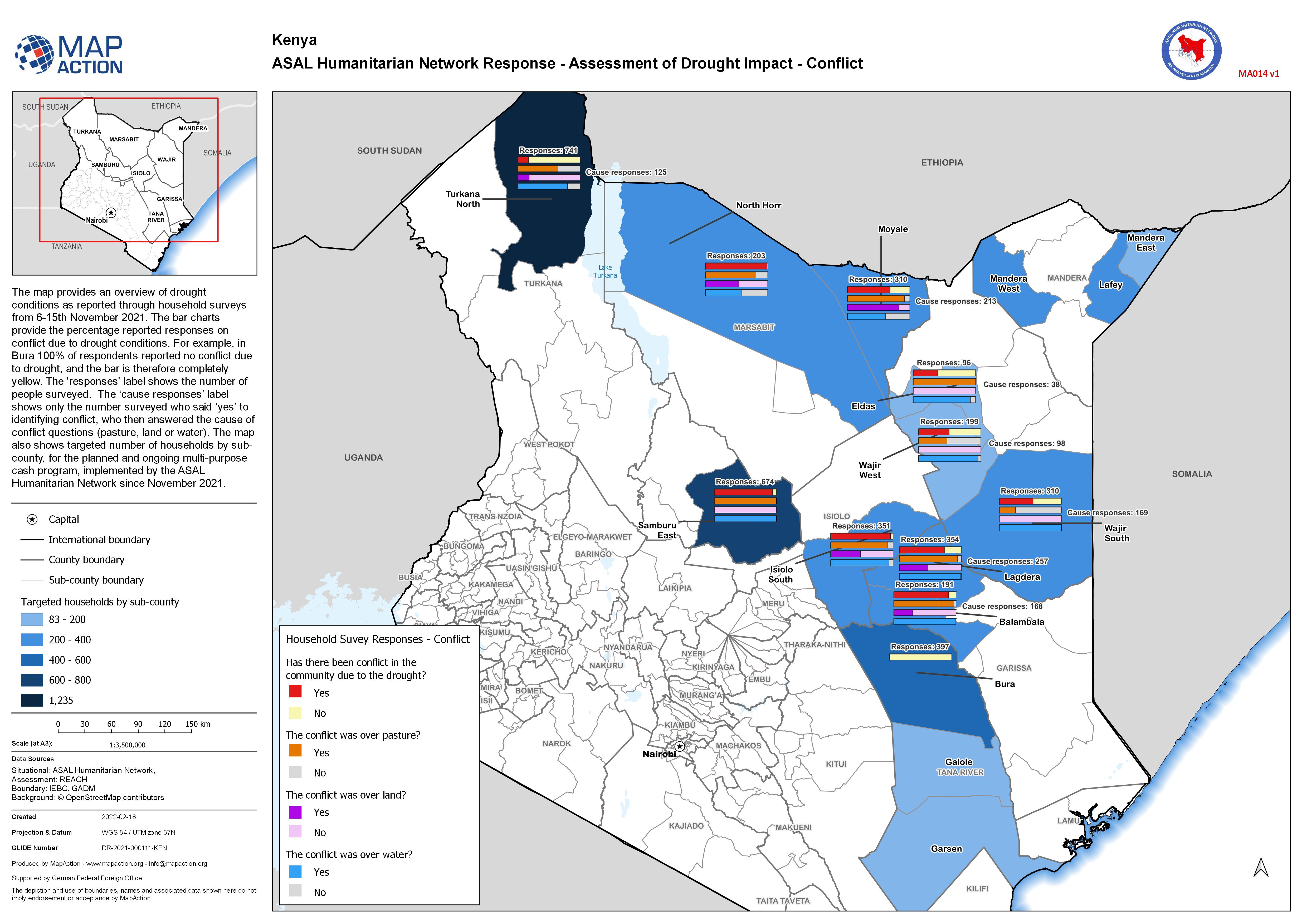
ASAL Humanitarian Network Response - Assessment of Drought Impact - Conflict
The map provides an overview of drought conditions as reported through household surveys from 6-15th November 2021. The bar charts provide the percentage reported responses on... -

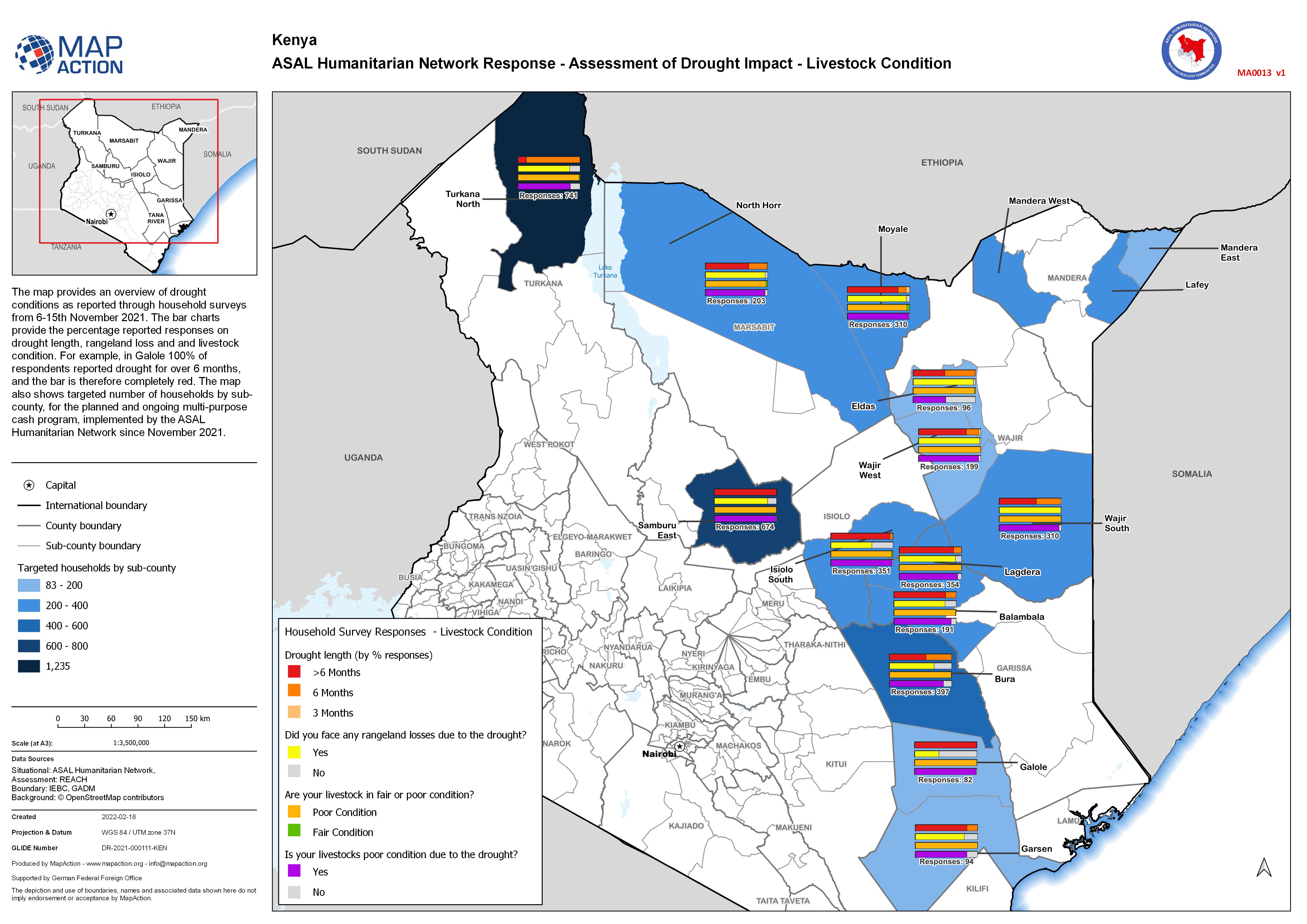
ASAL Humanitarian Network Response - Assessment of Drought Impact - Livestock...
The map provides an overview of drought conditions as reported through household surveys from 6-15th November 2021. The bar charts provide the percentage reported responses on... -
ASAL Humanitarian Network Response - Assessment of Drought Impact - Crop Losses
The map provides an overview of drought and crop conditions as reported through household surveys from 6-15th November 2021. The bar charts provide the percentage reported... -

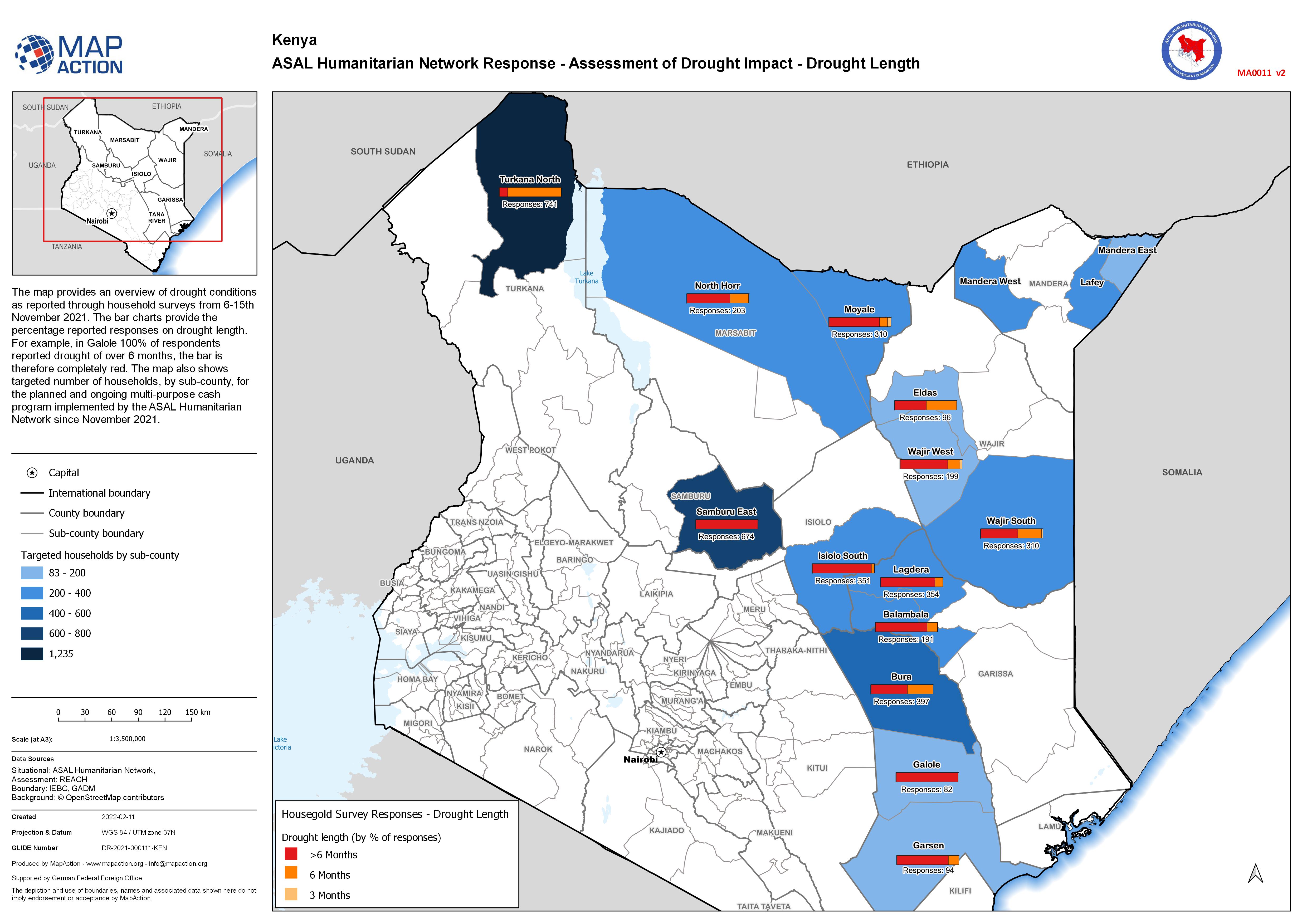
ASAL Humanitarian Network Response - Assessment of Drought Impact - Drought L...
The map provides an overview of drought conditions as reported through household surveys from 6-15th November 2021. The bar charts provide the percentage reported responses on... -

World Central Kitchen Sites Mananjary (17/02/22)
World Central Kitchen sites and the number of people served as of 17/02/2022 -
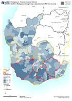
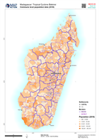
Southern Madagascar drought map - population and IPC food security
Map of southern madagascar -
-
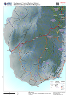
Detailed road map of Southern Madagascar
Map shows major settlements, transport links and physical features of Madagascar. -
-

-

Road map and access constraints (15/02/22)
Map shows major settlements, transport links and physical features of Madagascar. -
Personnes et ménages actuellement déplacés au niveau du district (au 14 févri...
This map shows the number of displaced people and households in Districts of Madagascar as of 14th Feb 2022. Cette carte montre le nombre de personnes déplacées et de ménages...
