-

Population density (2020) and maximum flood extents during 01 - 29 August
Flood extents for 01 - 29 August as detected by UNOSAT and estimates of population affected based upon Worldpop data for 2020 -

-

Flood extents and affected population estimates for 12 - 21 July and 01 - 29 ...
Flood extents for 12 - 21 July and 01 - 29 August as detected by UNOSAT and estimates of population affected based upon Worldpop data for 2020 -

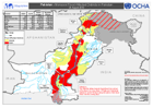
Maximum severity index score per district (as of 26 August 2022)
Maximum severity index score per district (as of 26 Aguust 2022) -

Mean severity index per district (as of 26 August 2022)
Mean severity index per district (as of 26 Aguust 2022) -

-
Flooded areas from 15 to 30 August from GFM
Flooded areas from 15 to 30 from GFM show with main cities, roads and railways -

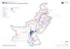
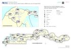
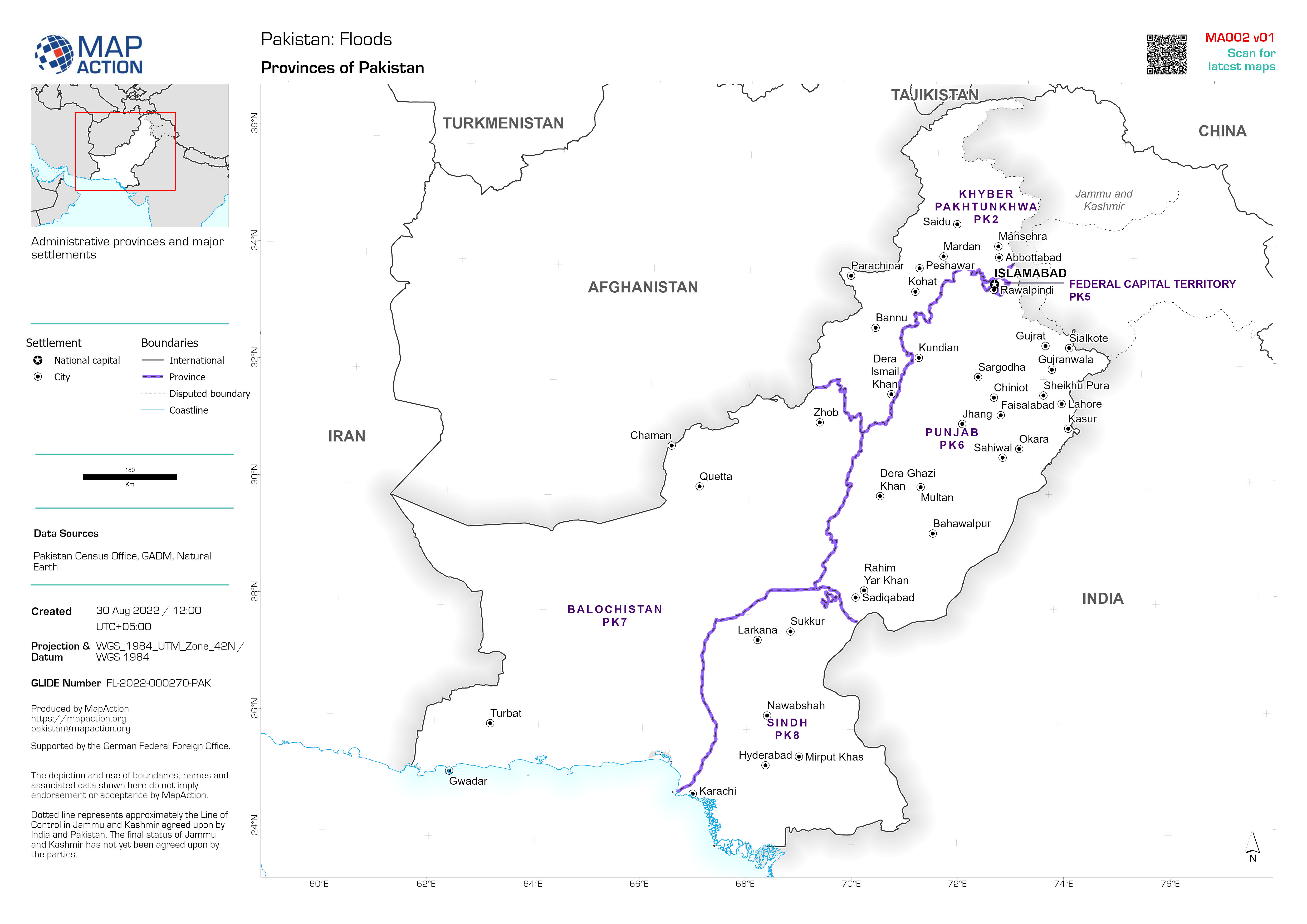
Country Overview
Country overview map showing main settlements, transport links, elevation, water features and administrative boundaries -
-

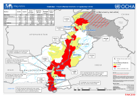
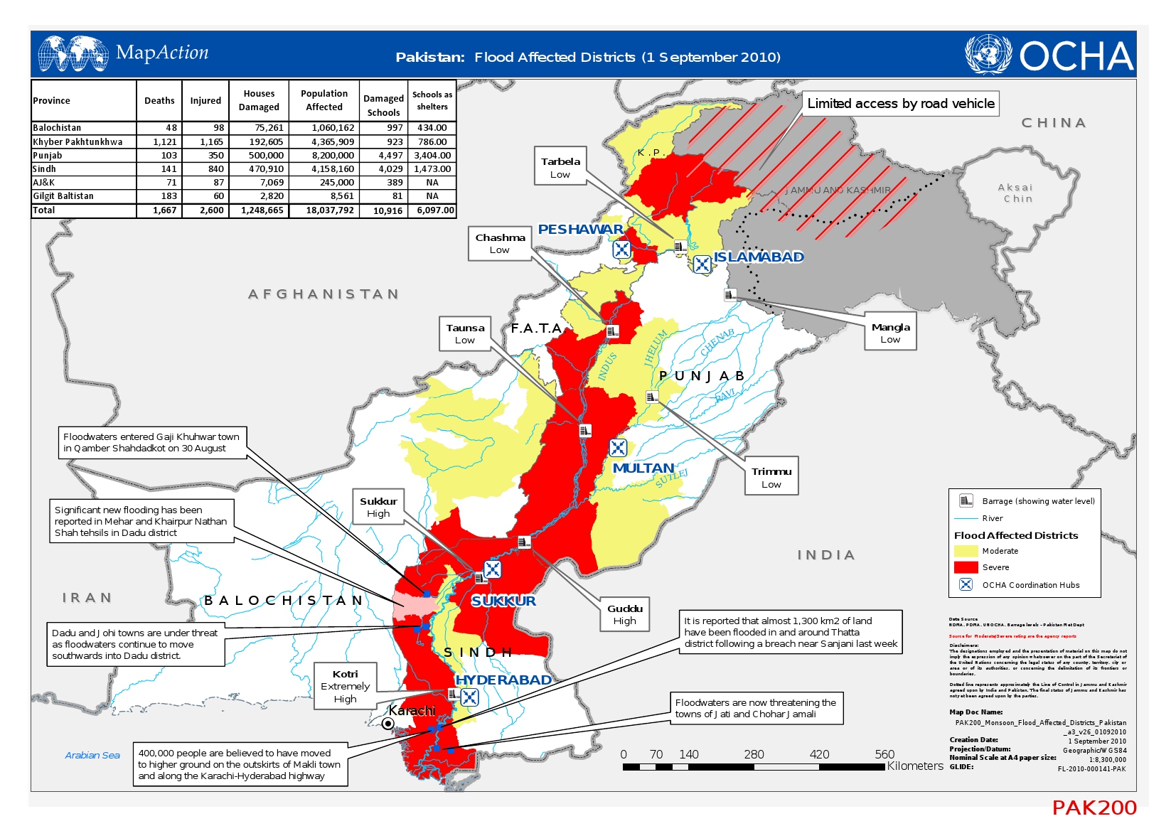
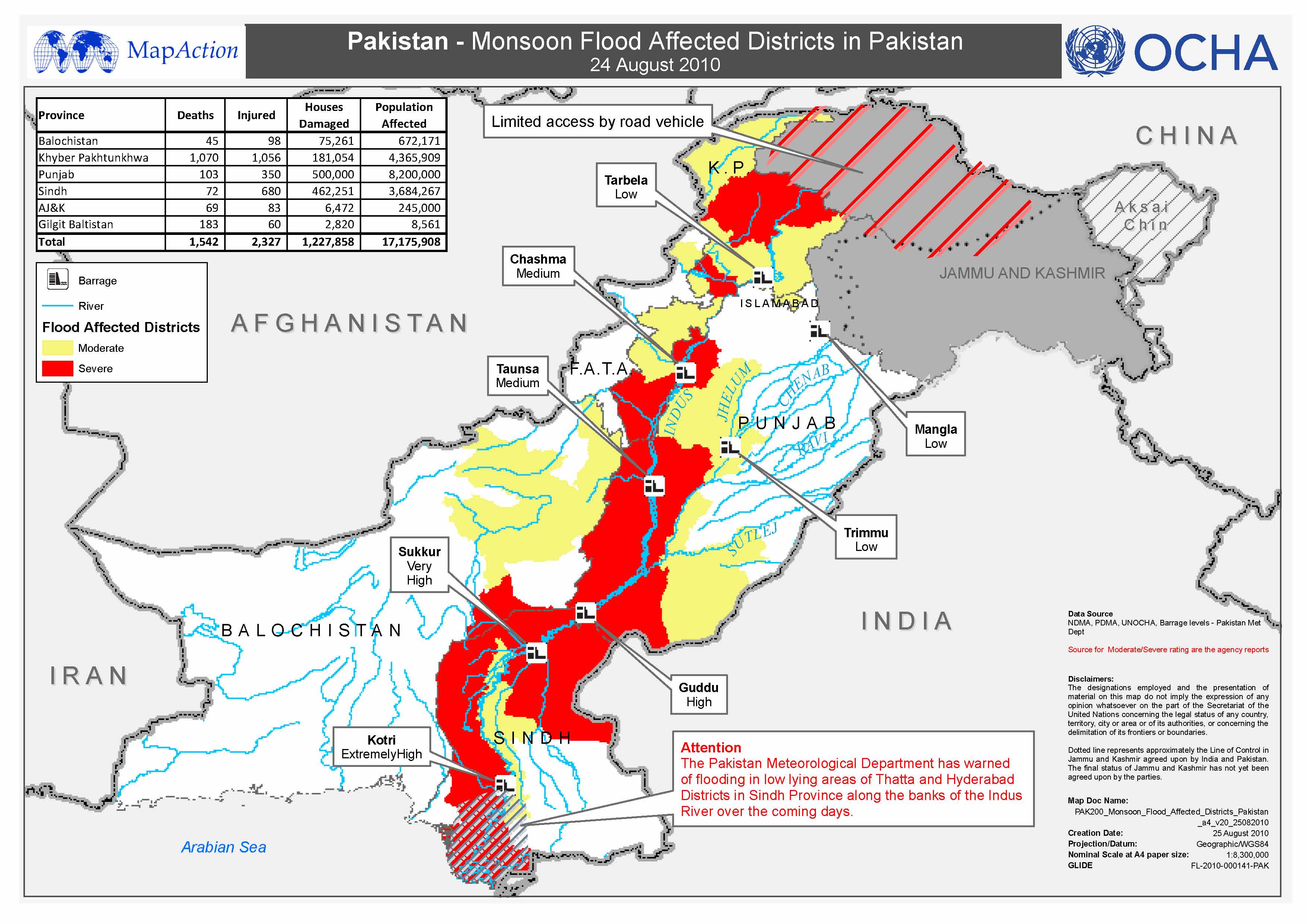
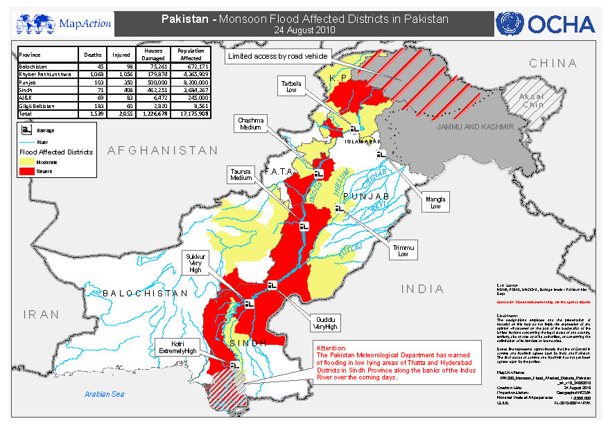
Pakistan - Monsoon Flood Affected Districts in Pakistan - 24-August 2010
This dataset has no description
-
Pakistan - Monsoon Flood Affected Districts in Pakistan - 24 August 2010
This dataset has no description
-
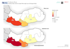
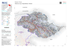
Severity index scores for Upper River region (as of 25 August 2022)
Severity index scores for Upper River region (as of 25 August 2022). Showing mean and maximum aggregated scores -

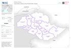
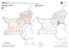
Maximum severity index score per district (as of 25 August 2022)
Maximum severity index score per district (as of 25 Aguust 2022) -

Mean severity index per district (as of 25 August 2022)
Mean severity index per district (as of 25 Aguust 2022) -
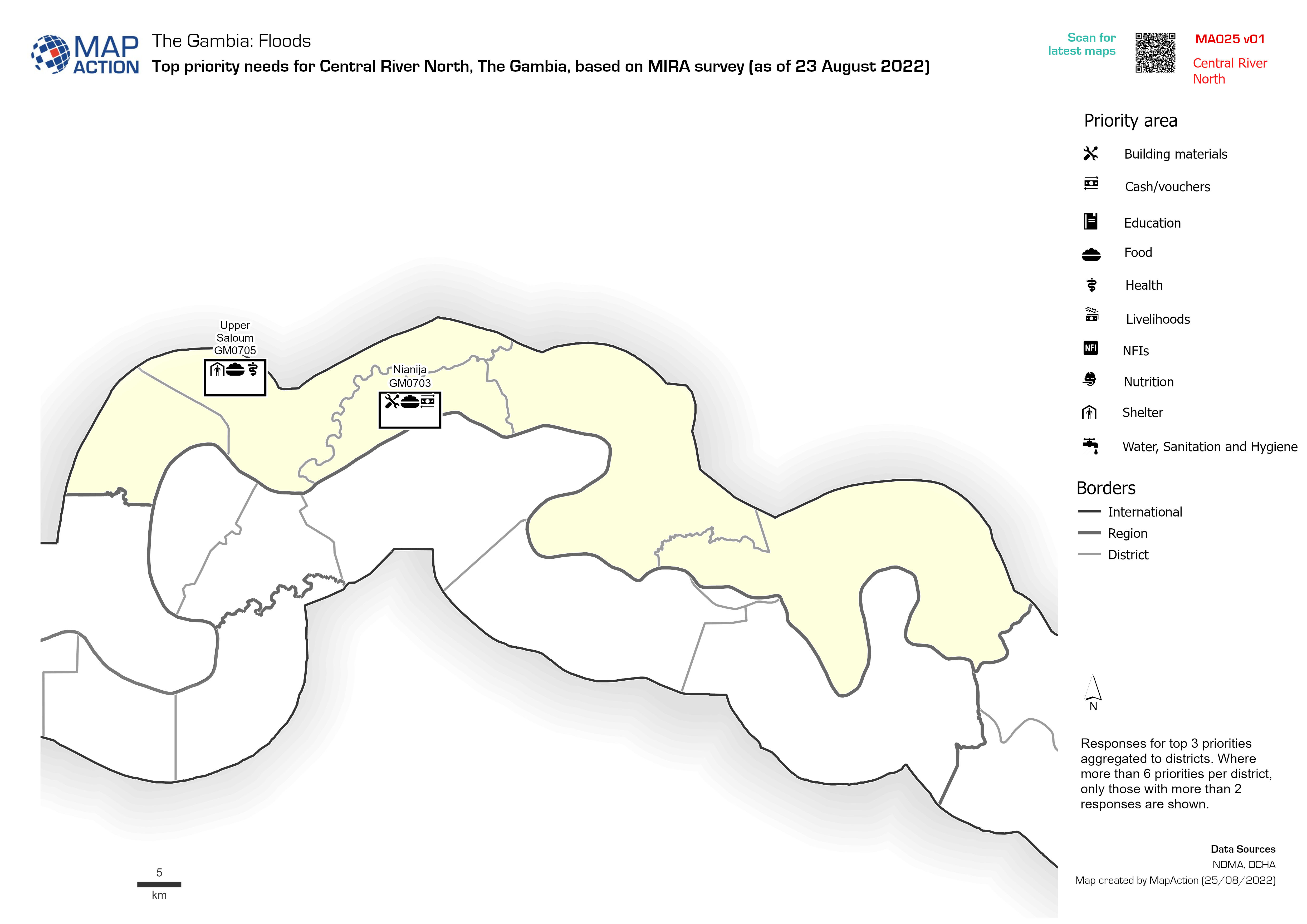
Top priority needs per district based on MIRA survey (as of 23 August 2022)
Responses for top 3 priorities aggregated to districts. Where more than 6 priorities per district, only those with more than 2 responses are shown.


