-
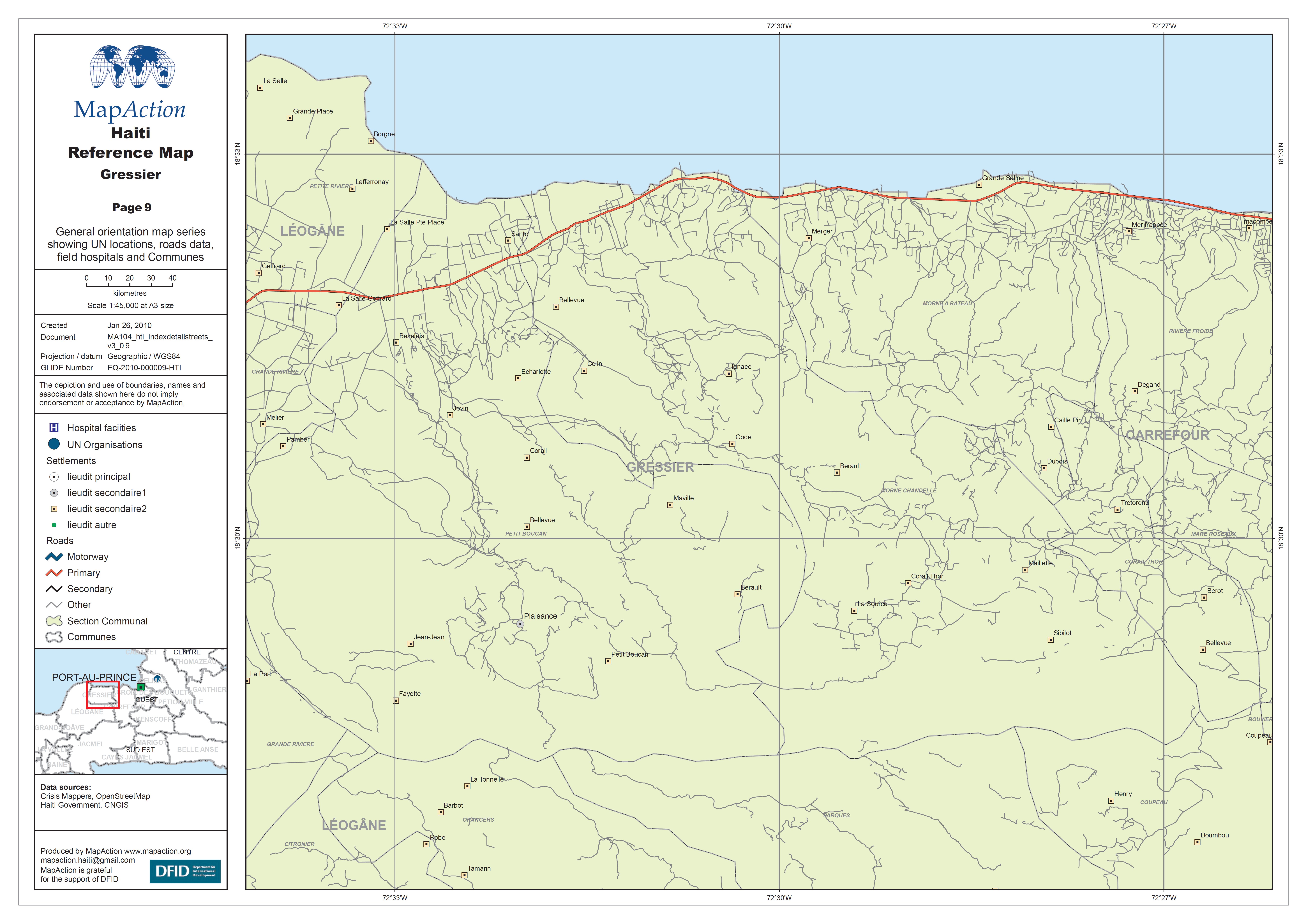
Haiti Reference Map - Gressier
General orientation map series showing UN locations, roads data, field hospitals and Communes. -
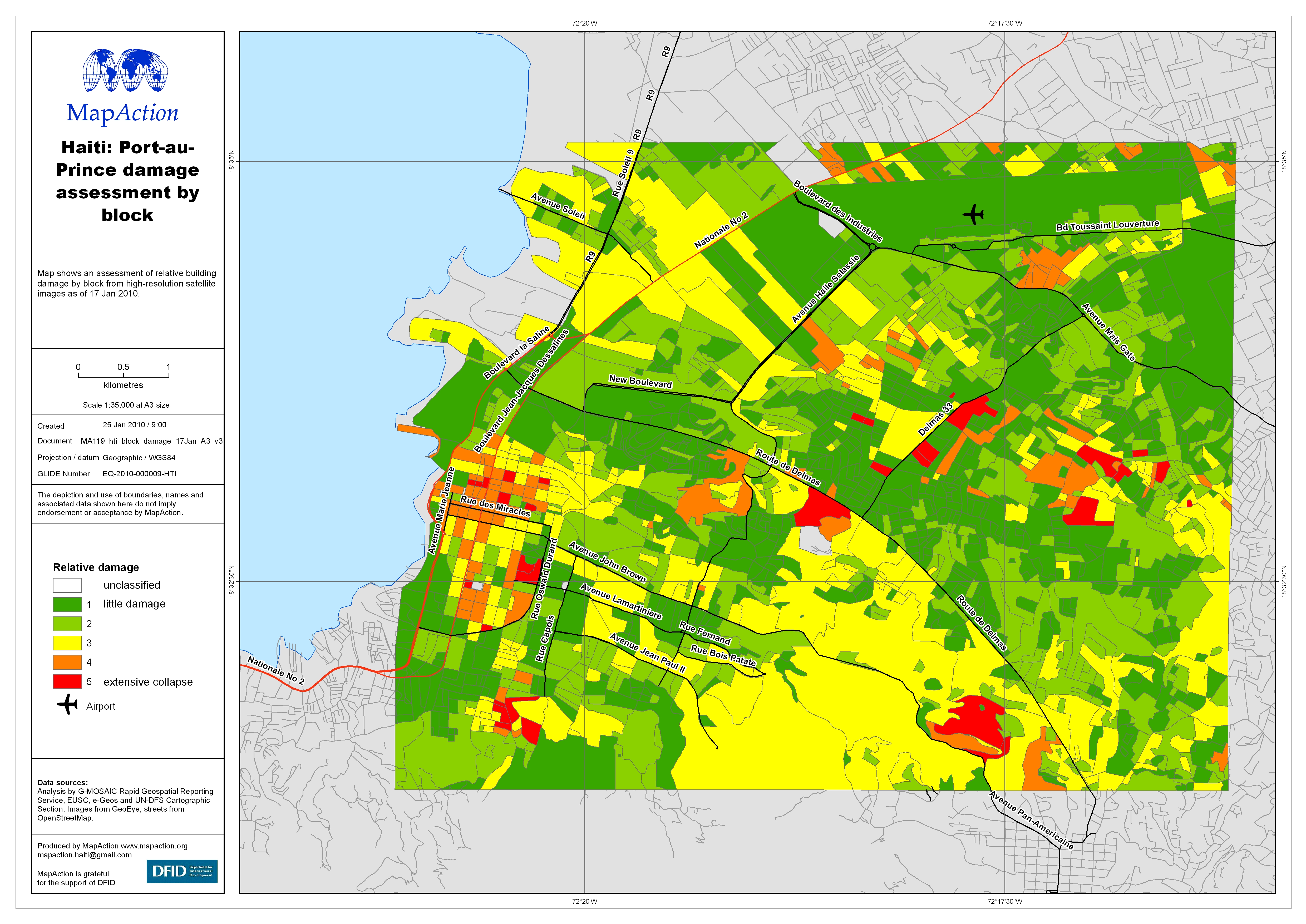
Haiti: Port-au-Prince damage assessment by block
Map shows an assessment of relative building damage by block from high-resolution satellite images as of 17 Jan 2010. -

Humanitarian Camp Map OCHA/UNDAC/EU Port au Prince Airport
Map shows the locations UN tents and related organisations -
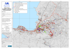
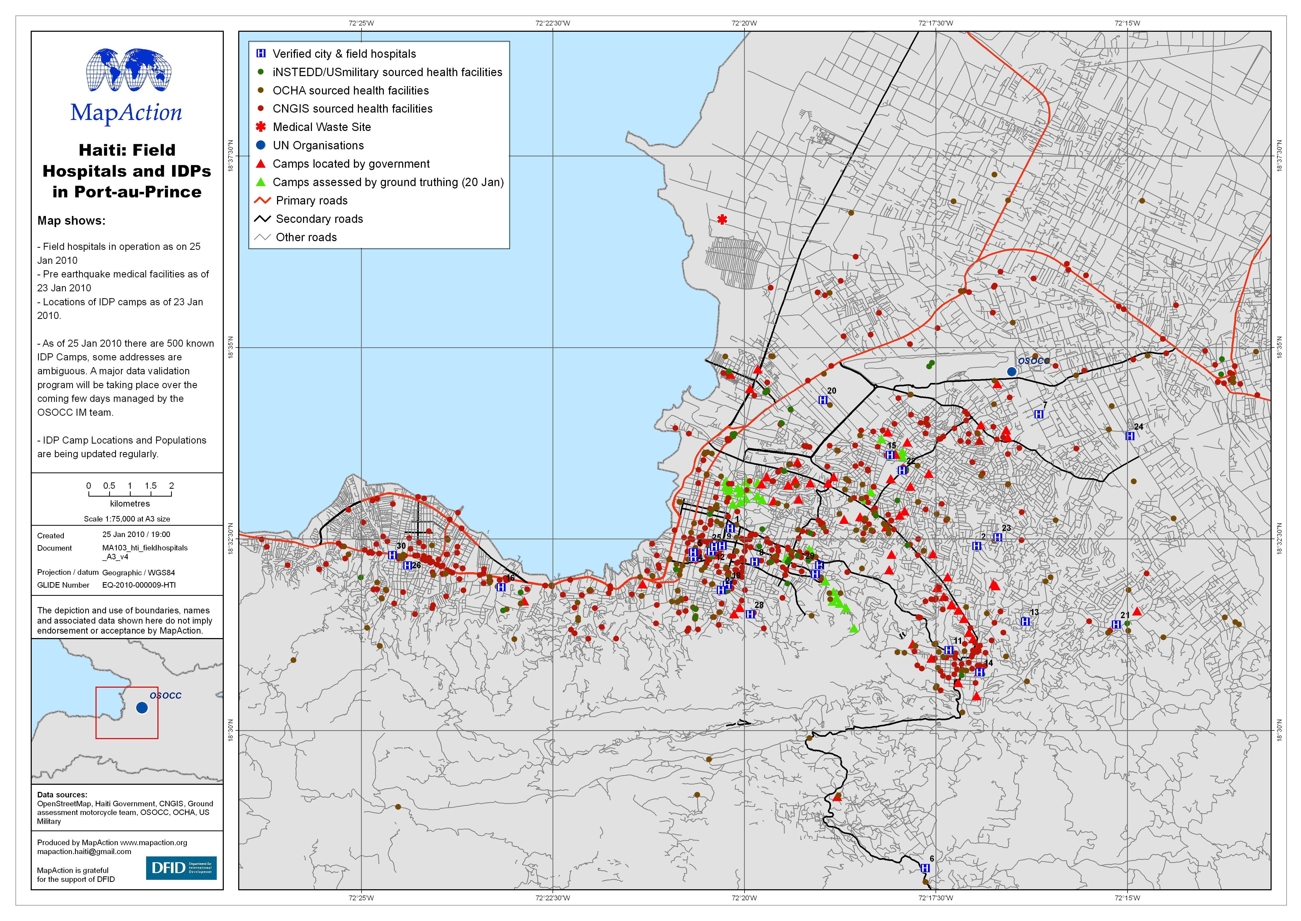
Haiti: Field Hospitals and IDPs in Port-au-Prince
Map shows Field hospitals in operation as on 25 Jan 2010. - Pre earthquake medical facilities as of 23 Jan 2010. - Locations of IDP camps as of 23 Jan 2010. - As of 25 Jan 2010... -
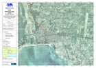
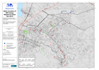
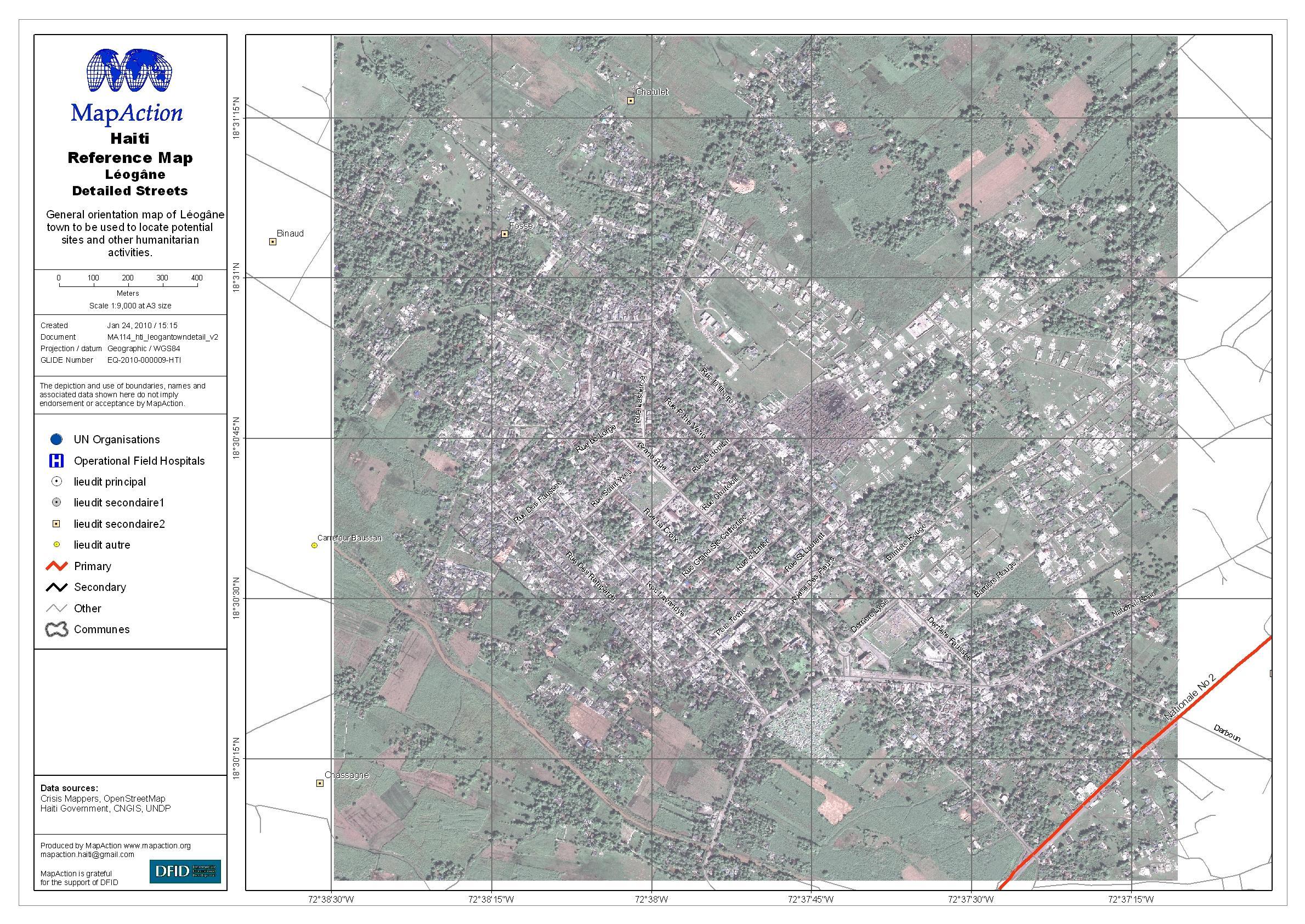
Haiti: Léogâne Street Map
General map of Léogâne town, with some street names, for navigation, locating potential sites, and other humanitarian activities. -

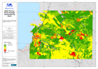
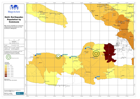
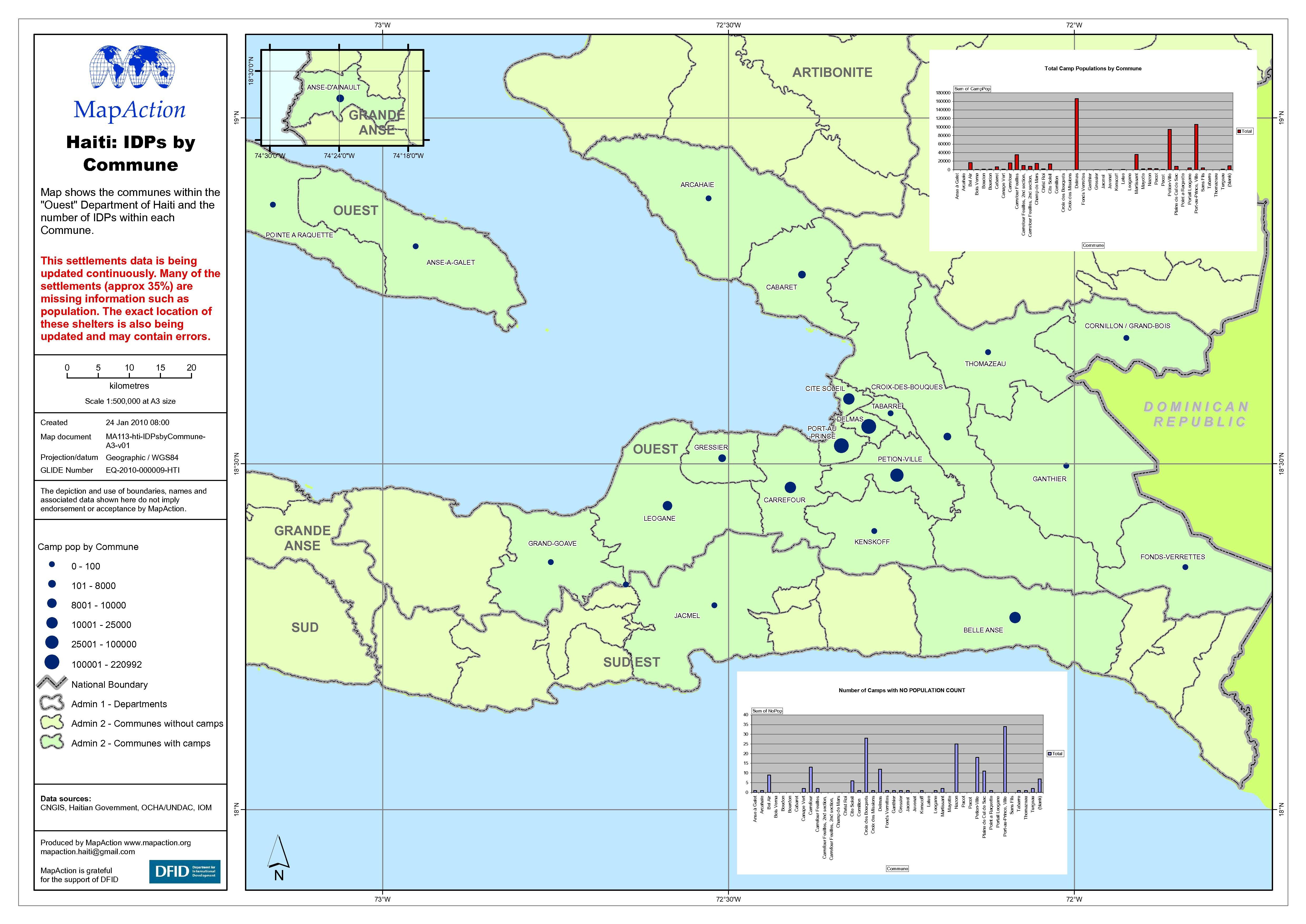
Haiti: IDP numbers by Commune
Map shows the Communes within the Ouest Department of Haiti and the number of internally displaced persons (IDPs) within each Commune. -

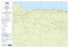
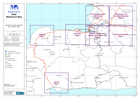
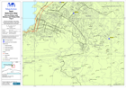
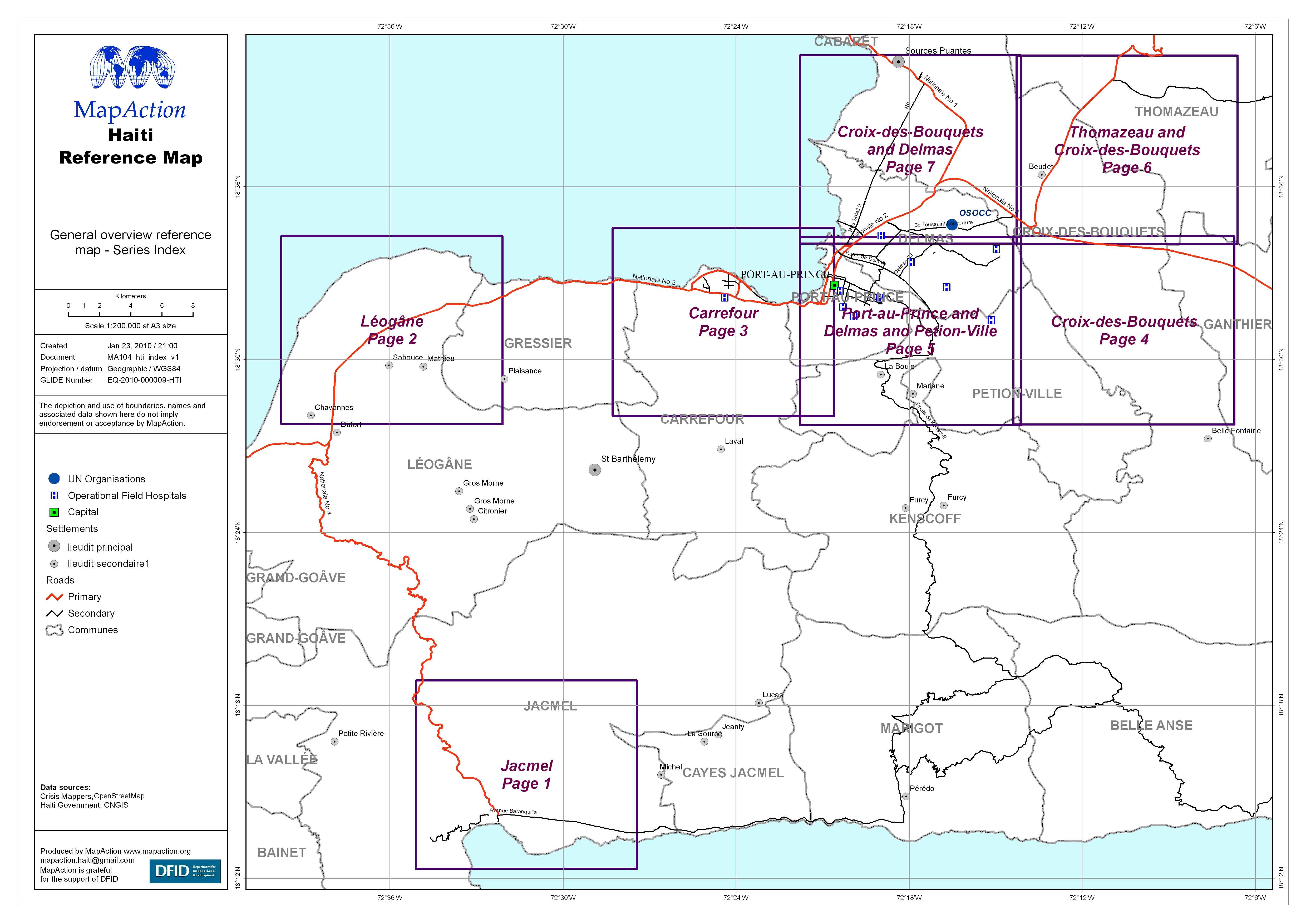
Haiti Reference Map Series
General reference map series, containing an index map and seven 1:45,000 reference maps for the following locations: (1) Carrefour, (2) Croix-des-Bouquets, (3)... -
-

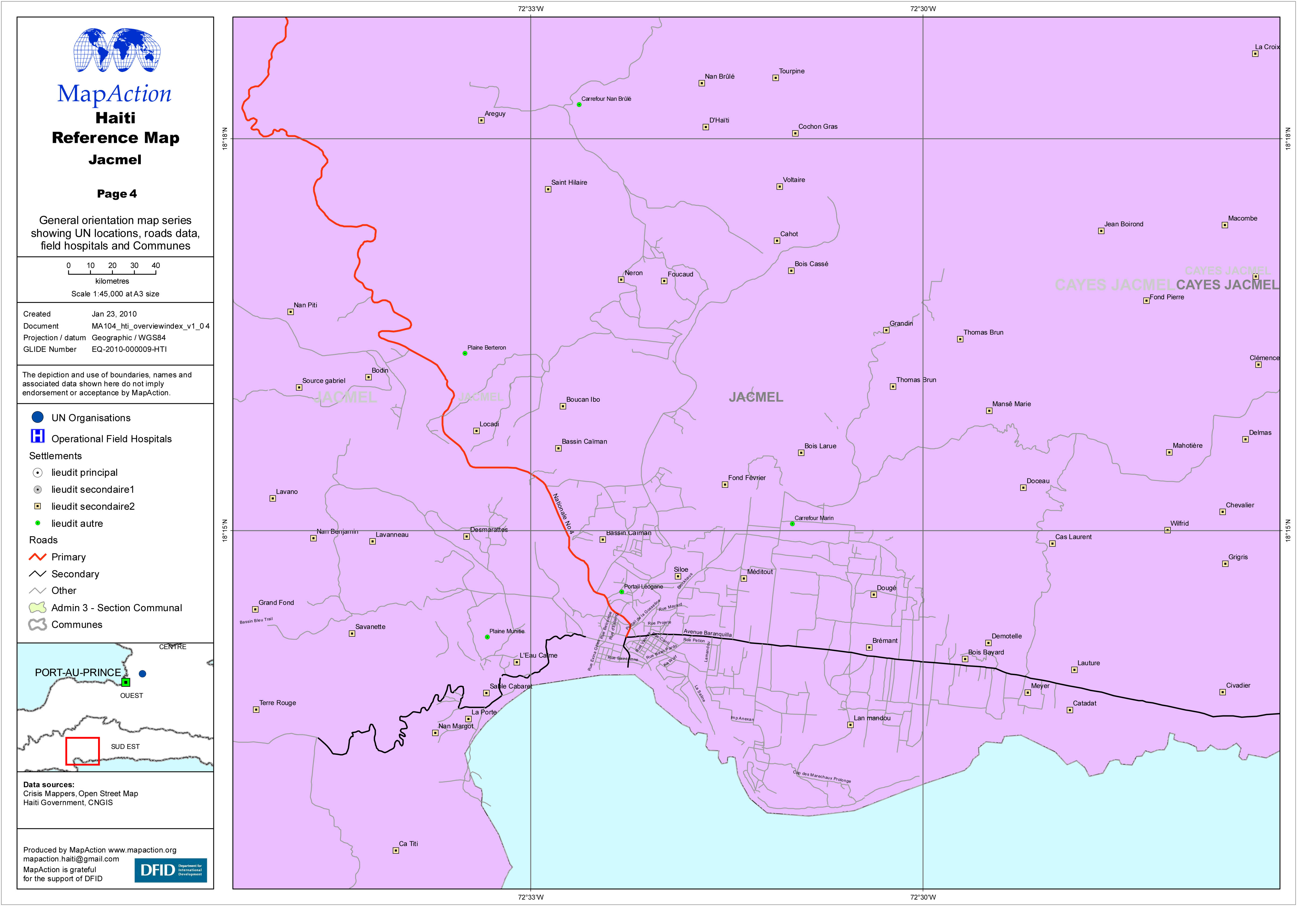
Haiti Reference Map - Jacmel
General orientation map series showing UN locations, roads data, field hospitals and Communes. -

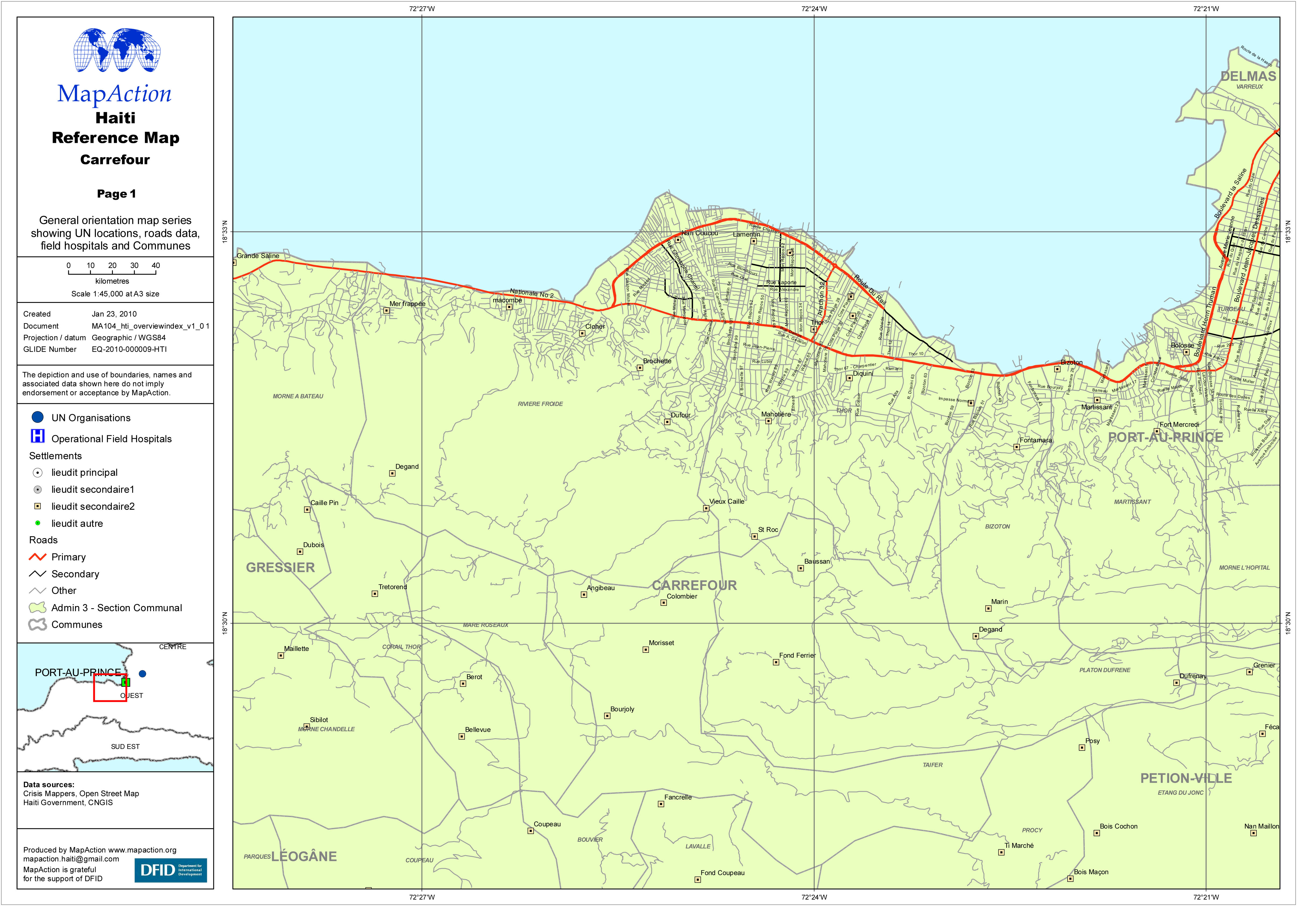
Haiti Reference Map - Carrefour
General orientation map series showing UN locations, roads data, field hospitals and Communes. -
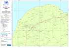
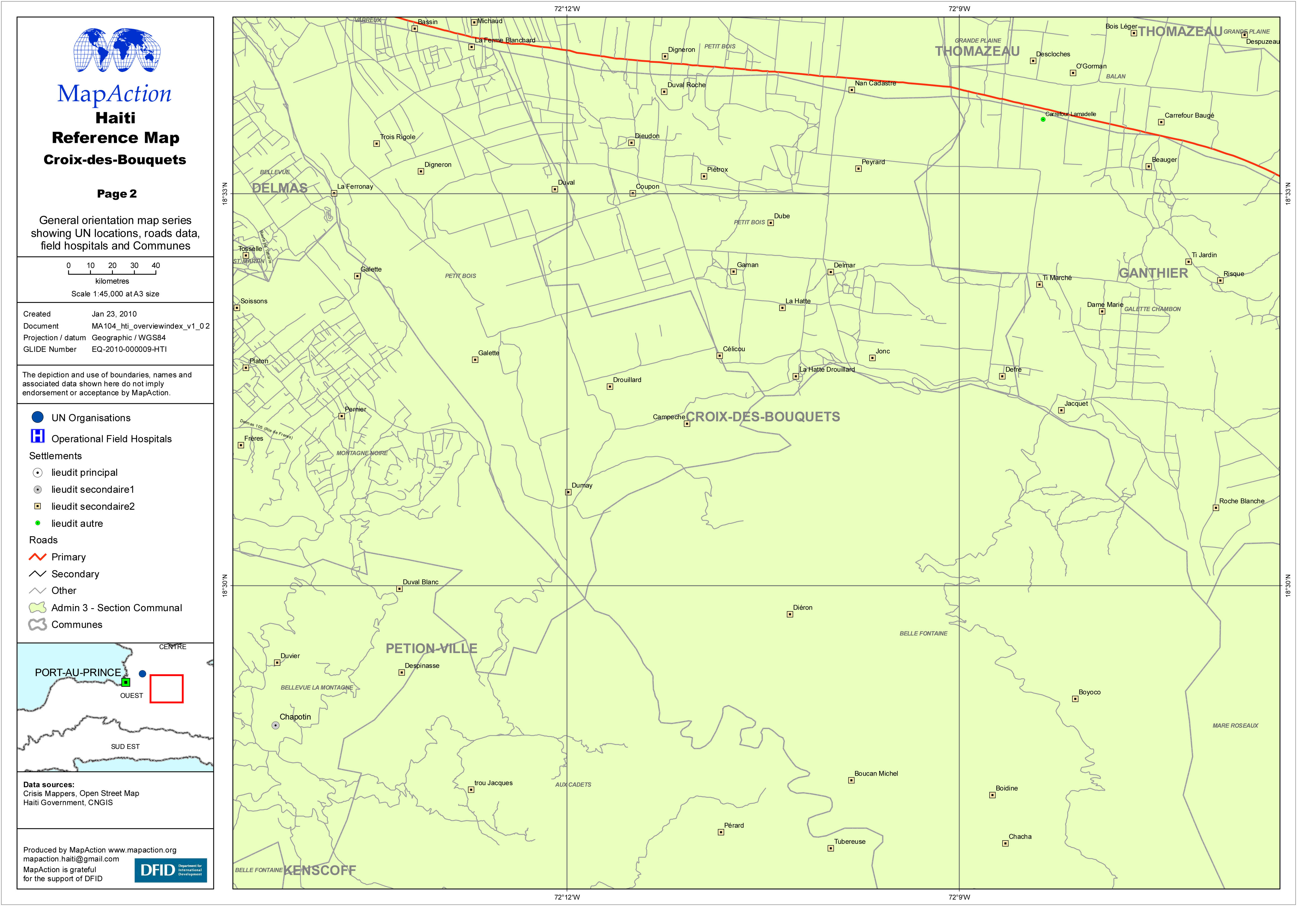
Haiti Reference Map - Croix-des-Bouquets
General orientation map series showing UN locations, roads data, field hospitals and Communes. -

Haiti Reference Map - Croix-des-Bouquets and Delmas
General orientation map series showing UN locations, roads data, field hospitals and Communes. -
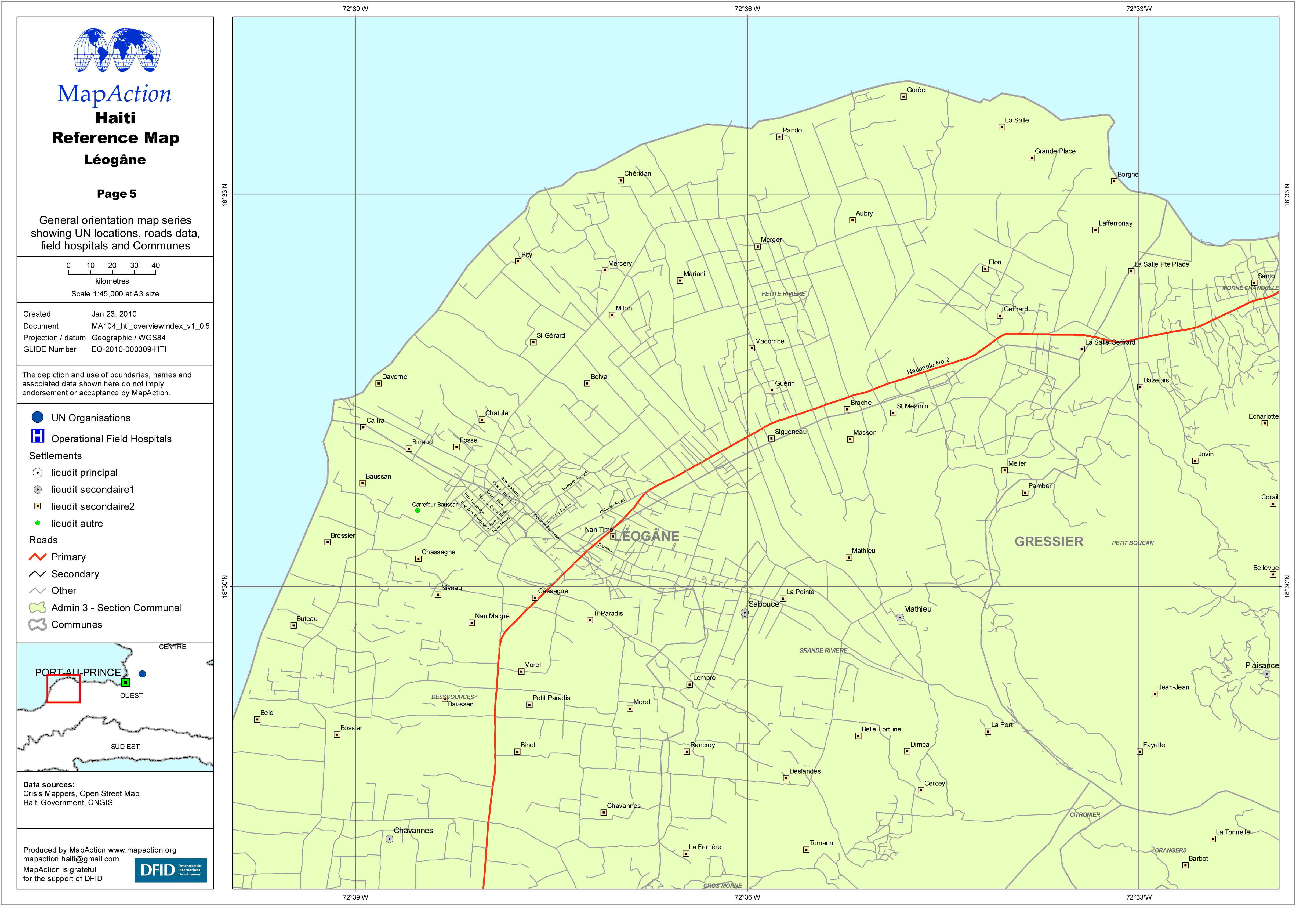
Haiti Reference Map - Léogâne
General orientation map series showing UN locations, roads data, field hospitals and Communes. -
Haiti: Jacmel Street Map
General map of Jacmel town, with some street names, for navigation, locating potential sites, and other humanitarian activities. -
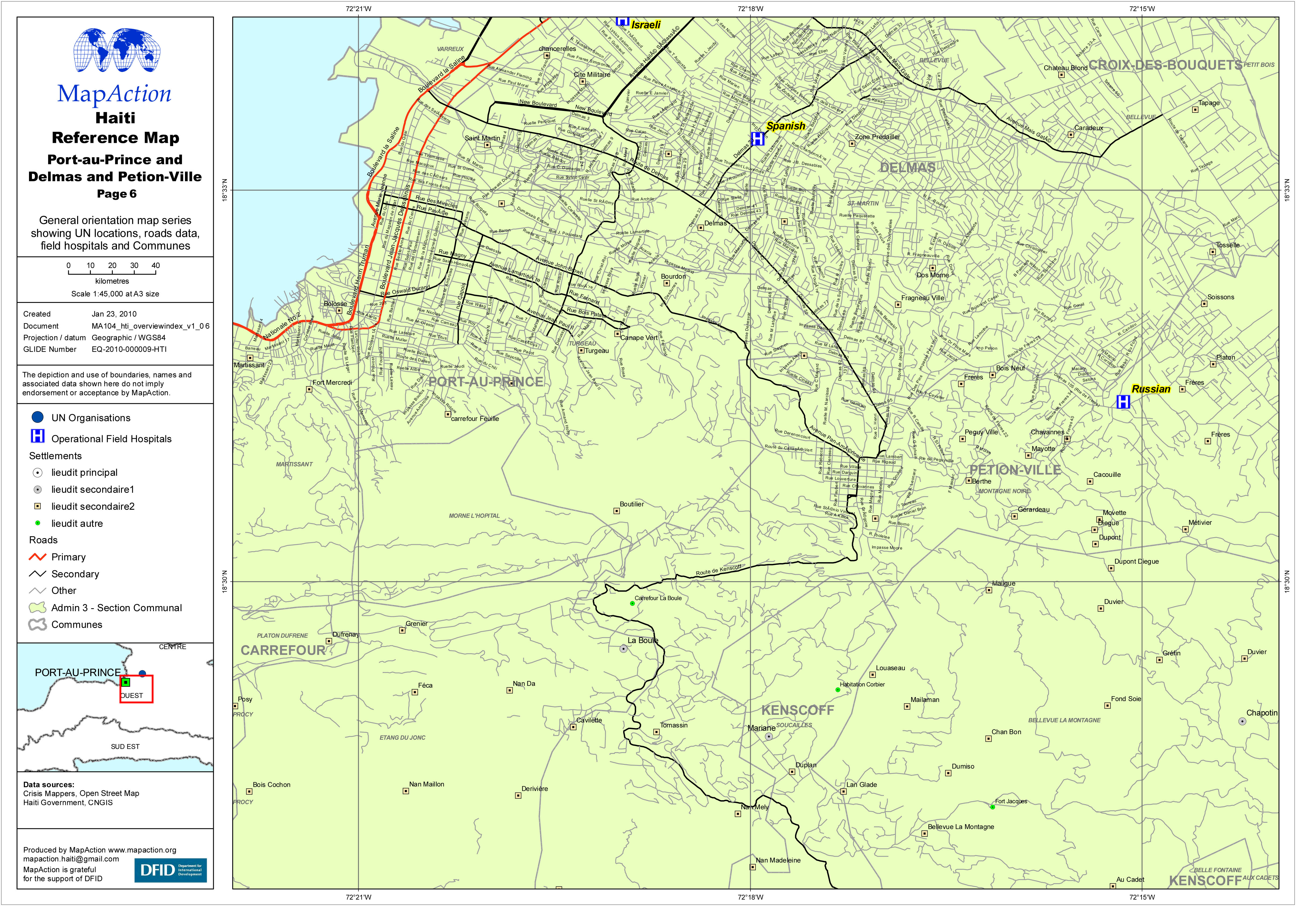
Haiti Reference Map - Port-au-Prince and Delmas and Petion-Ville
General orientation map series showing UN locations, roads data, field hospitals and Communes. -

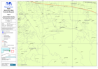
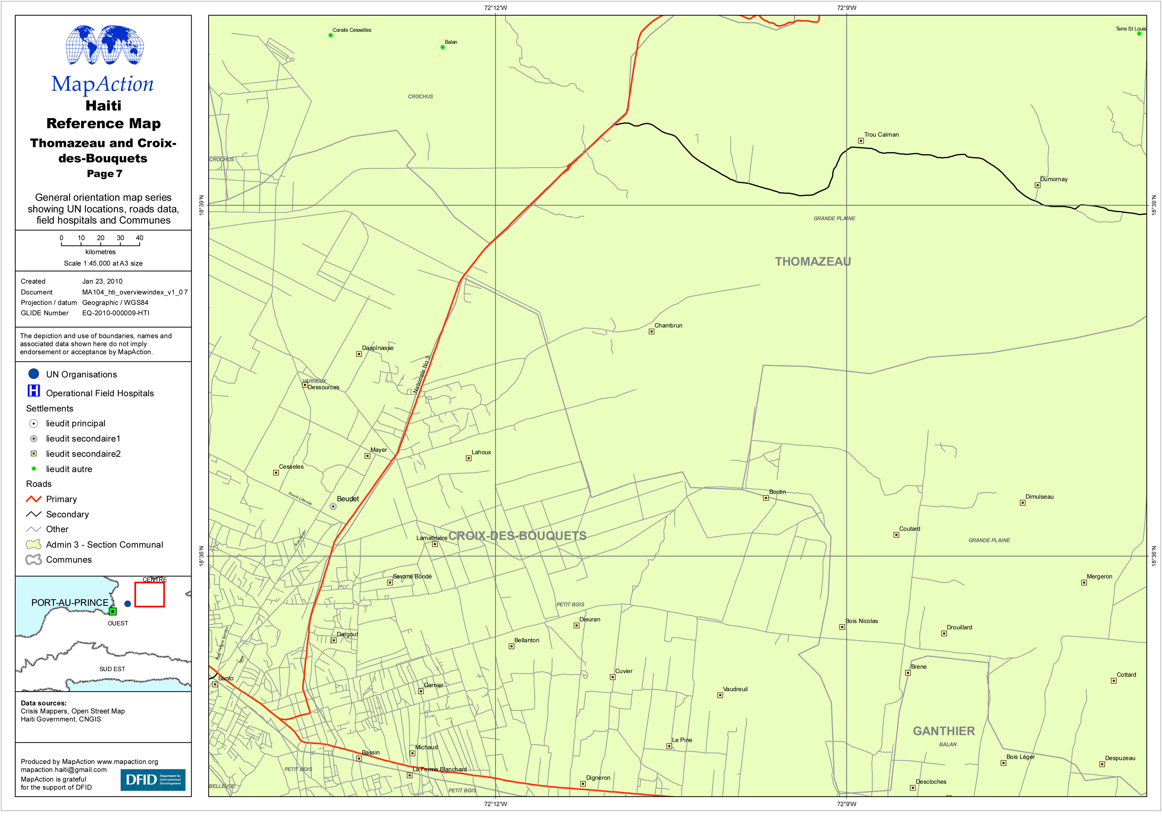
Haiti Reference Map - Thomazeau and Croix-des-Bouquets
General orientation map series showing UN locations, roads data, field hospitals and Communes. -
Haiti: Earthquake - Population by Commune
Map shows the population of Communes covering Port-au-Prince west to Miragoane, based on 2006 census -

Haiti: Field Hospitals and IDPs in Port-au-Prince and surrounding areas (as o...
Map shows the field hospitals in operation as at 23 Jan 2010 and locations of IDP camps which have been mapped on 23 Jan 2010. There are approximately 500 known IDP Camps but... -
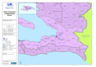
Haiti: Communes of Department Ouest:
Map shows the communes within the West Department of Haiti -
Haiti: IDP Camps in Port-au-Prince (as of 22 Jan 2010)
Map shows the locations of IDP camps which have been mapped on 22 Jan 2010. Many camps still not been position due to vagaries of descriptive locational text