-
Union of the Comoros: Floods - Population of affected settlements on Moheli (...
Map shows population numbers in affected settlements on the island of Moheli. -

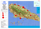
Union of the Comoros: Floods - Population of Affected Villages on Grande Comore
Map shows population numbers in villages affected by flooding - Grande Comore. (25 May 2012) -

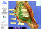
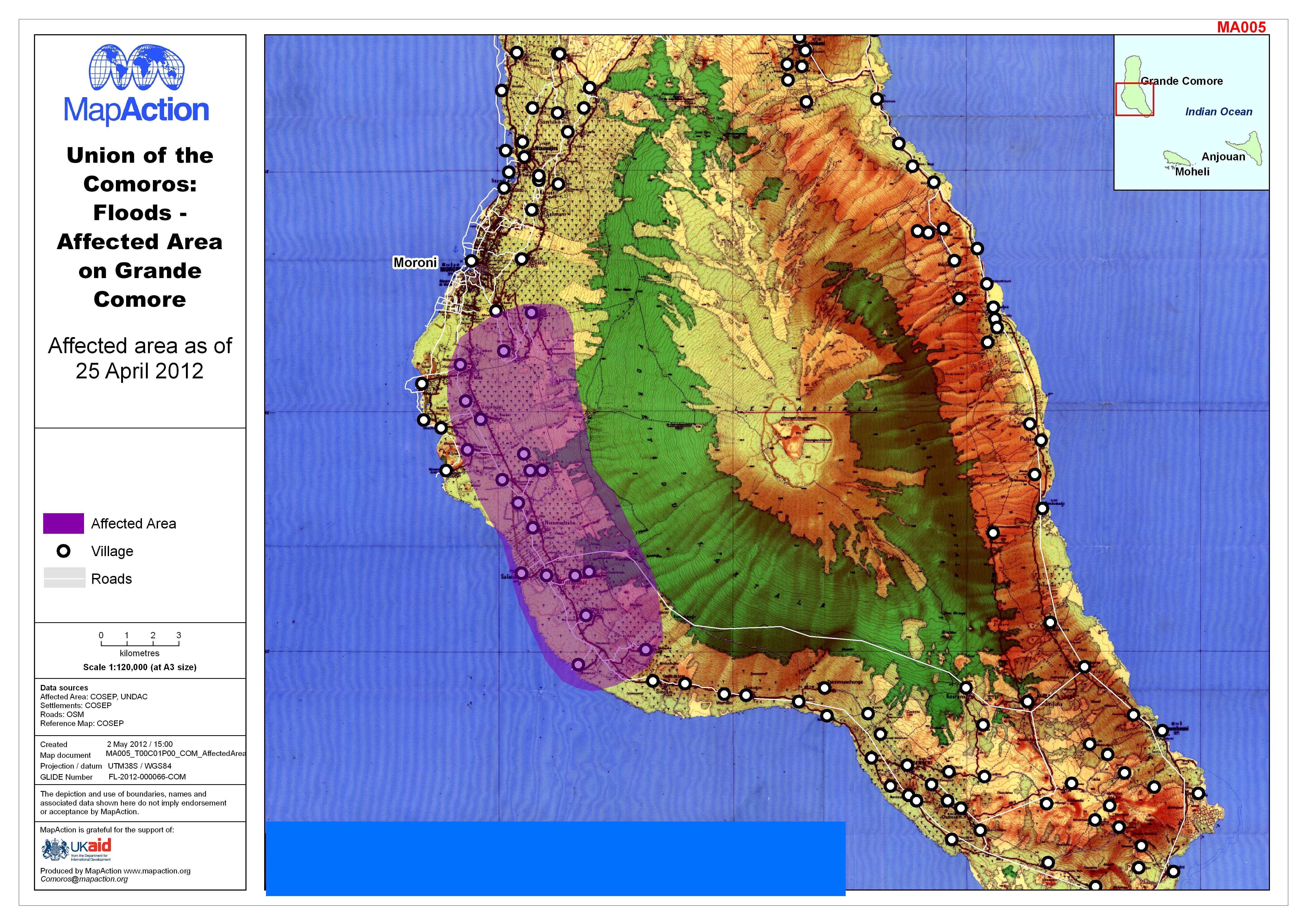
Union of the Comoros: Floods - Affected Area on Grande Comore
Map shows area affected by flooding on Grande Comore, as of 25 April 2012 -
Union of the Comoros: Floods - Affected Infrastructure on Grande Comore
Affected Infrastructure as of 25 April 2012 -

Union of the Comoros: Floods - Population of affected settlements on Moheli (...
Map shows the affected population as of 25th April -

Saint Lucia Tropical Cyclone Overview Orientation Map
Map shows a general overview of SaintLucia. Information includes roads,rivers, reservoirs, coastline, settlements,forestry areas and elevation data. -
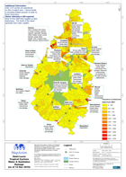
Saint Lucia Tropical Cyclone Water & Sanitation Damage (as of 12 Nov 2010)
Map shows the location of Water and Sanatation Department (WASCO) reported damage points. Also shown are settlement areas, with approximate population numbers (2001), quarter... -
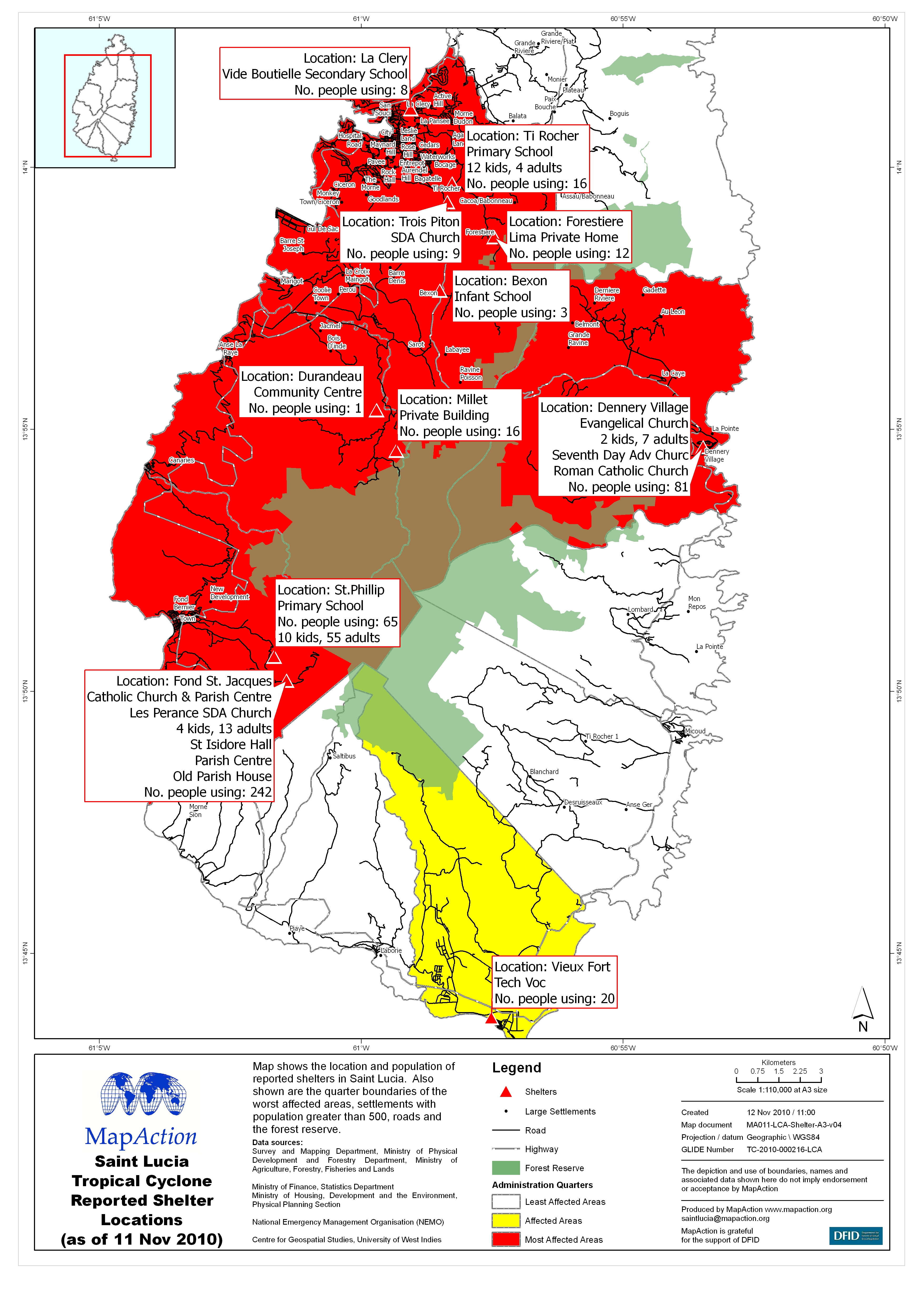
Saint Lucia Tropical Cyclone Reported Shelter Locations (as of 11 Nov 2010)
Map shows the location and population of reported shelters in Saint Lucia. Also shown are the quarter boundaries of the worst affected areas, settlements with population greater... -

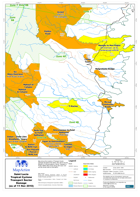
Saint Lucia Tropical Cyclone Transport Sector Damage (as of 11 Nov 2010) - Ma...
Map shows the location of Transport Sector Damage throughout the island, this map shows the areas covered by the MapBook series. Also shown are the Ministry of Communications,... -

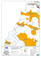
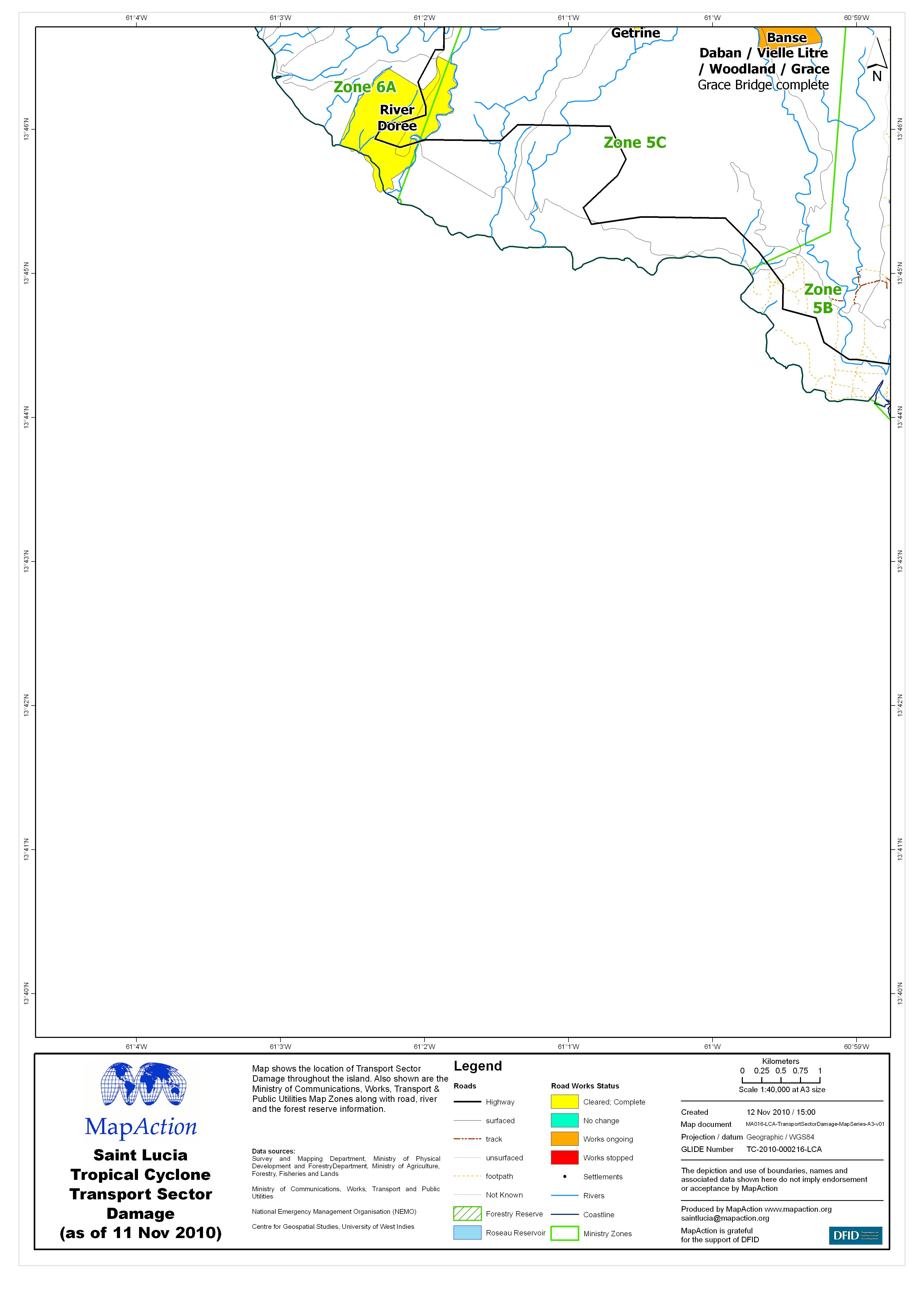
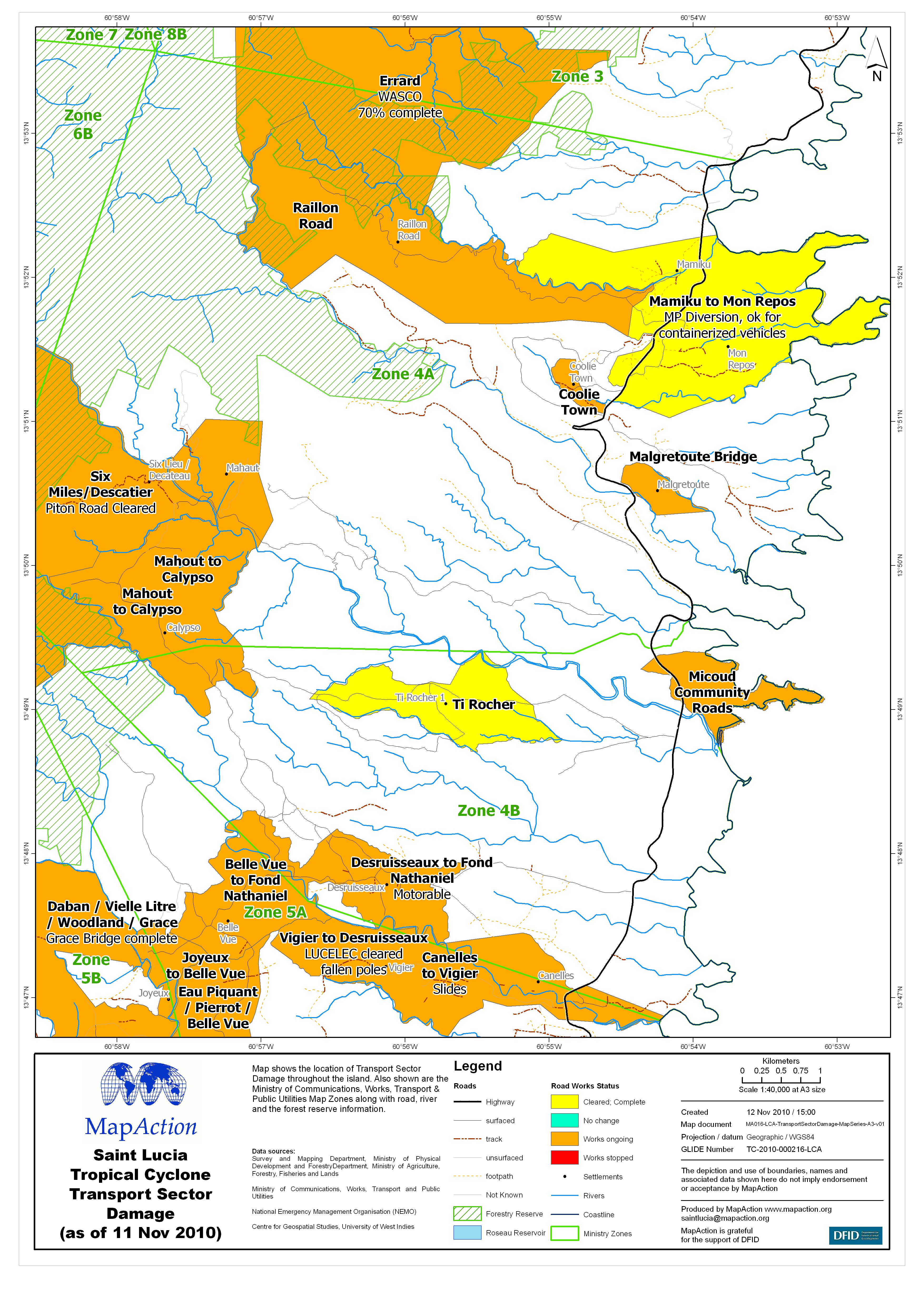
Saint Lucia Tropical Cyclone Transport Sector Damage (as of 11 Nov 2010) - Ma...
Map shows the location of Transport Sector Damage throughout the island. Also shown are the Ministry of Communications, Works, Transport & Public Utilities Map Zones along... -

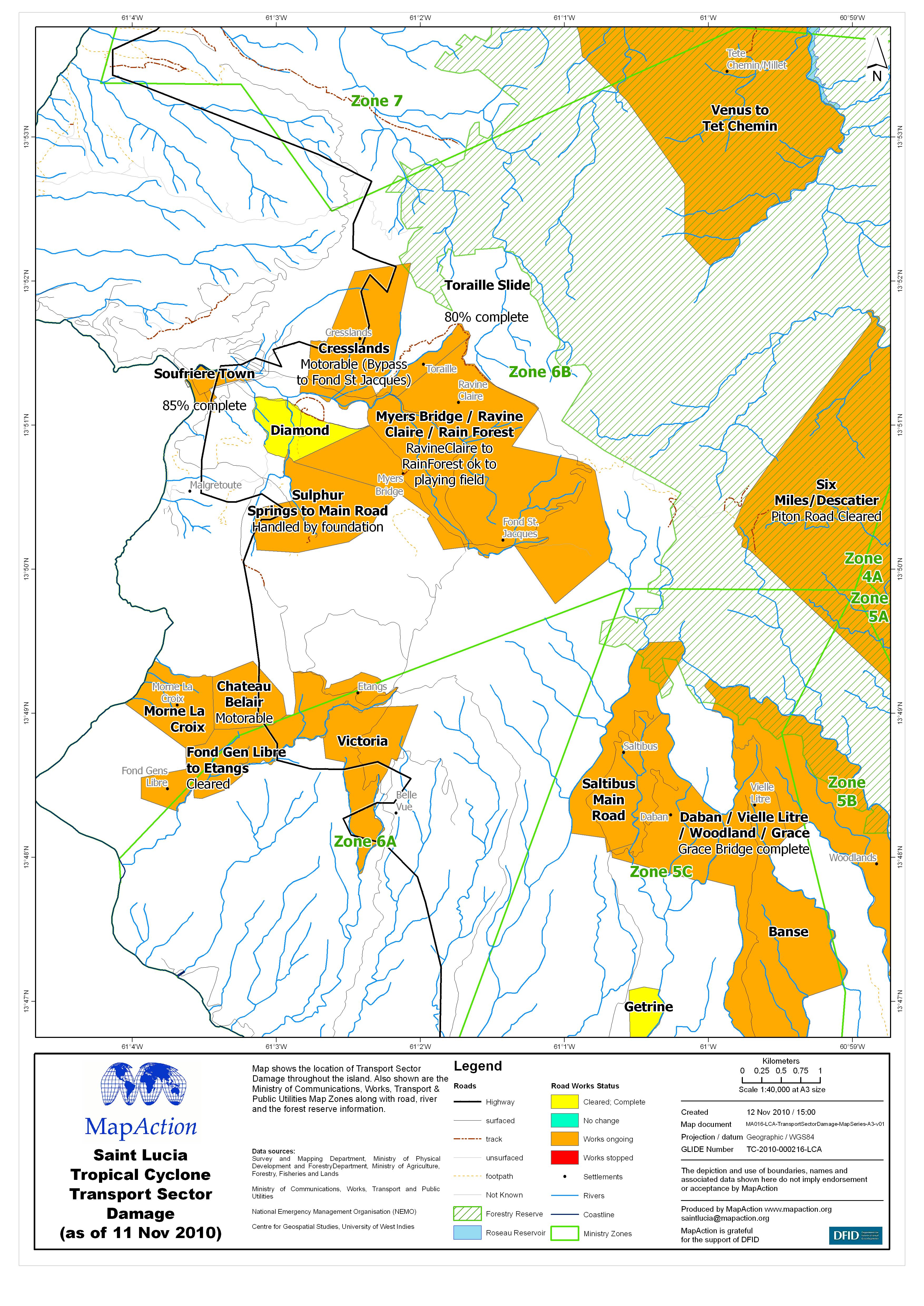
Saint Lucia Tropical Cyclone Transport Sector Damage (as of 11 Nov 2010) - Ma...
Map shows the location of Transport Sector Damage throughout the island. Also shown are the Ministry of Communications, Works, Transport & Public Utilities Map Zones along... -
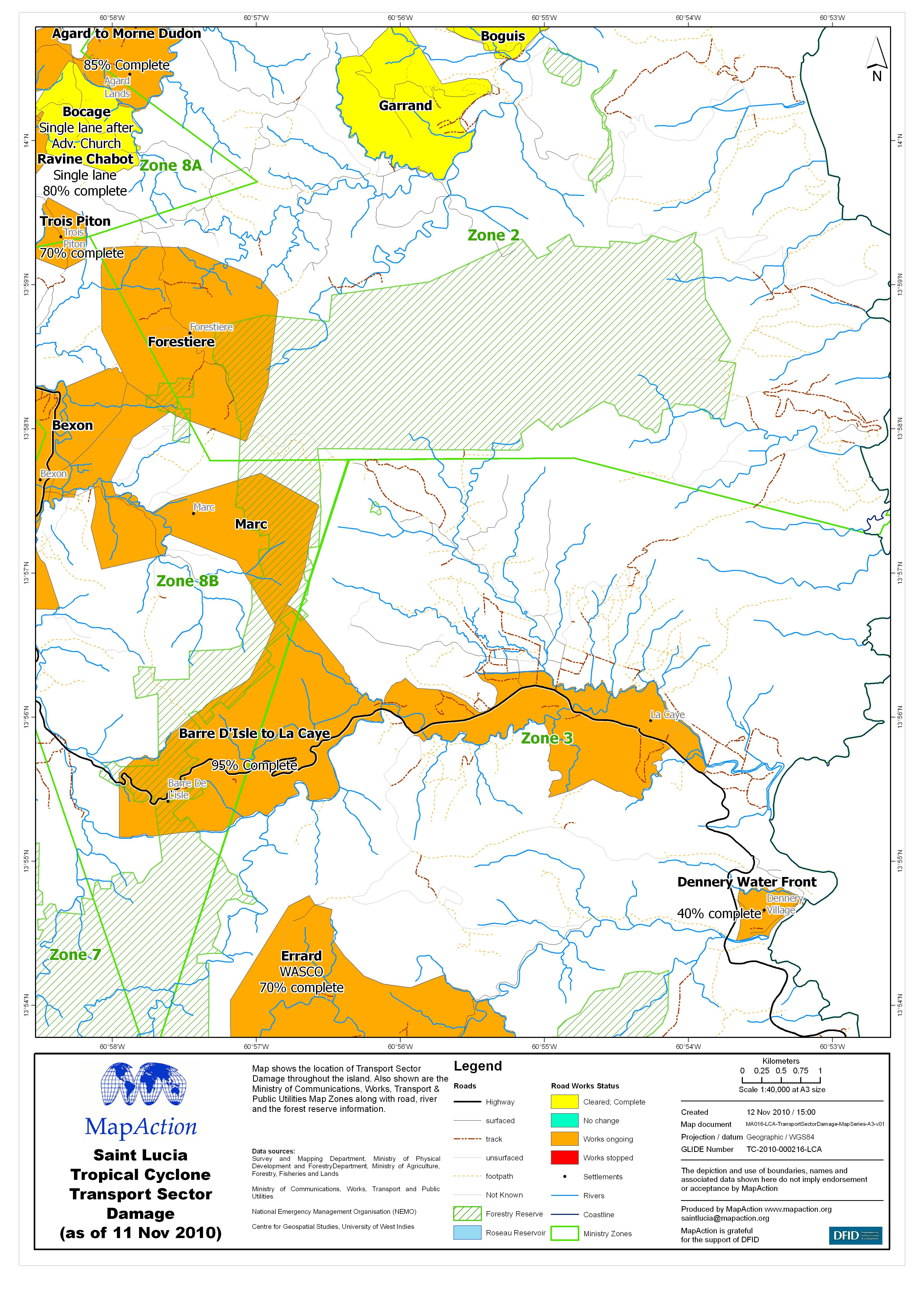
Saint Lucia Tropical Cyclone Transport Sector Damage (as of 11 Nov 2010) - Ma...
Map shows the location of Transport Sector Damage throughout the island. Also shown are the Ministry of Communications, Works, Transport & Public Utilities Map Zones along... -

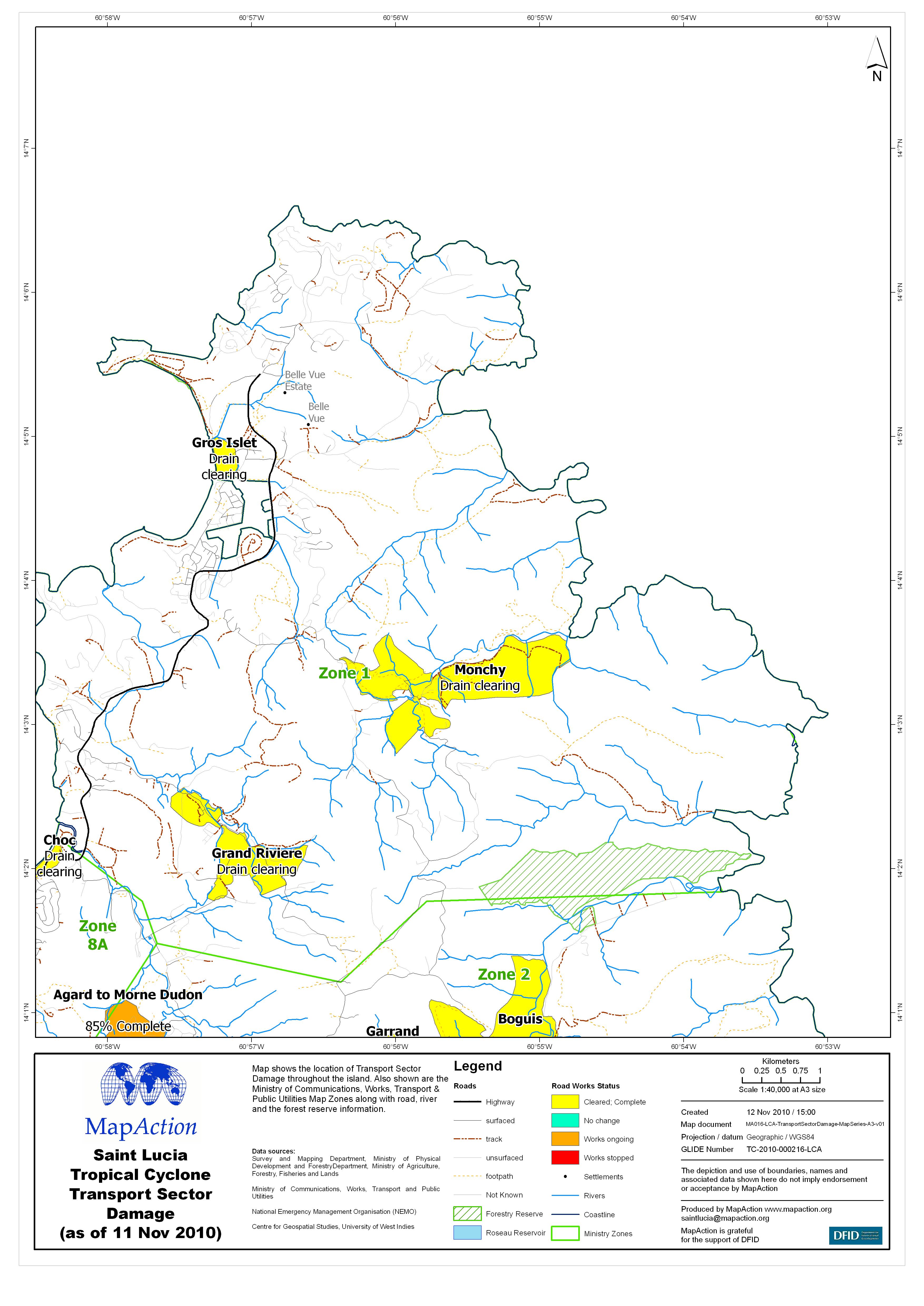
Saint Lucia Tropical Cyclone Transport Sector Damage (as of 11 Nov 2010) - Ma...
Map shows the location of Transport Sector Damage throughout the island. Also shown are the Ministry of Communications, Works, Transport & Public Utilities Map Zones along... -

Saint Lucia Tropical Cyclone Transport Sector Damage (as of 11 Nov 2010) - Ma...
Map shows the location of Transport Sector Damage throughout the island. Also shown are the Ministry of Communications, Works, Transport & Public Utilities Map Zones along... -
Saint Lucia Tropical Cyclone Transport Sector Damage (as of 11 Nov 2010) - Ma...
Map shows the location of Transport Sector Damage throughout the island. Also shown are the Ministry of Communications, Works, Transport & Public Utilities Map Zones along... -

Saint Lucia Tropical Cyclone Transport Sector Damage (as of 11 Nov 2010) - Ma...
Map shows the location of Transport Sector Damage throughout the island. Also shown are the Ministry of Communications, Works, Transport & Public Utilities Map Zones along... -
Saint Lucia Tropical Cyclone Transport Sector Damage (as of 11 Nov 2010) - Ma...
Map shows the location of Transport Sector Damage throughout the island. Also shown are the Ministry of Communications, Works, Transport & Public Utilities Map Zones along... -
Saint Lucia Tropical Cyclone Reported Shelter Locations (as of 10 Nov 2010)
Map shows the location and population of reported shelters in Saint Lucia. Also shown are the quarter boundaries of the worst affected areas, settlements with population greater... -
Saint Lucia Tropical Cyclone Education Sector Damage (as of 08 Nov 2010)
Map shows the location of education buildings with reported damage. Also shown are the quarter boundaries, the national forest reserve, roads and the settlements highlighted... -

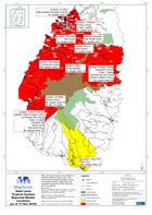
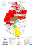
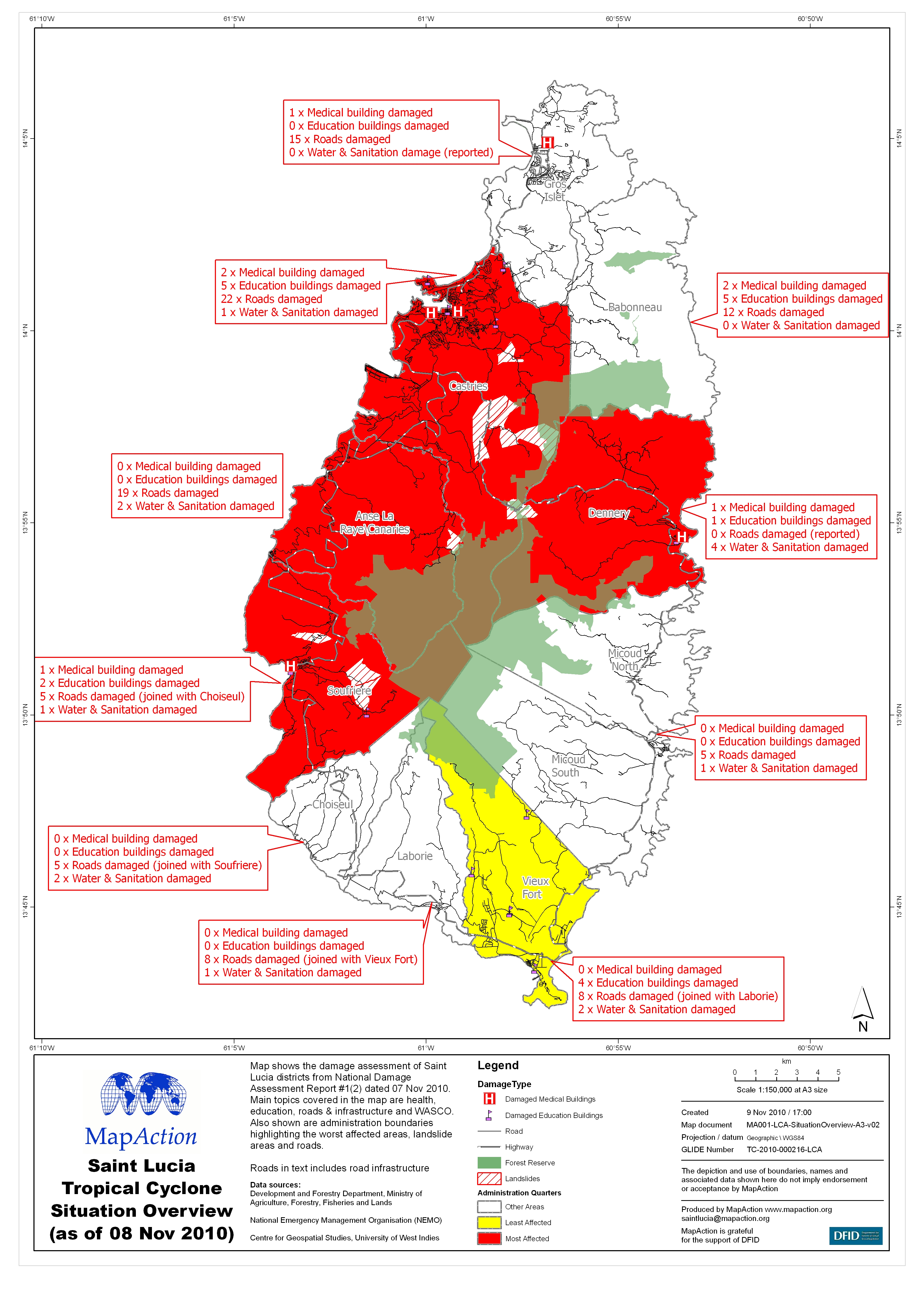
Saint Lucia Tropical Cyclone Situation Overview(as of 08 Nov 2010)
Map shows the damage assessment of Saint Lucia districts from National Damage Assessment Report #1(2) dated 07 Nov 2010. Main topics covered in the map are health,education,...