-

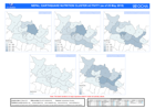
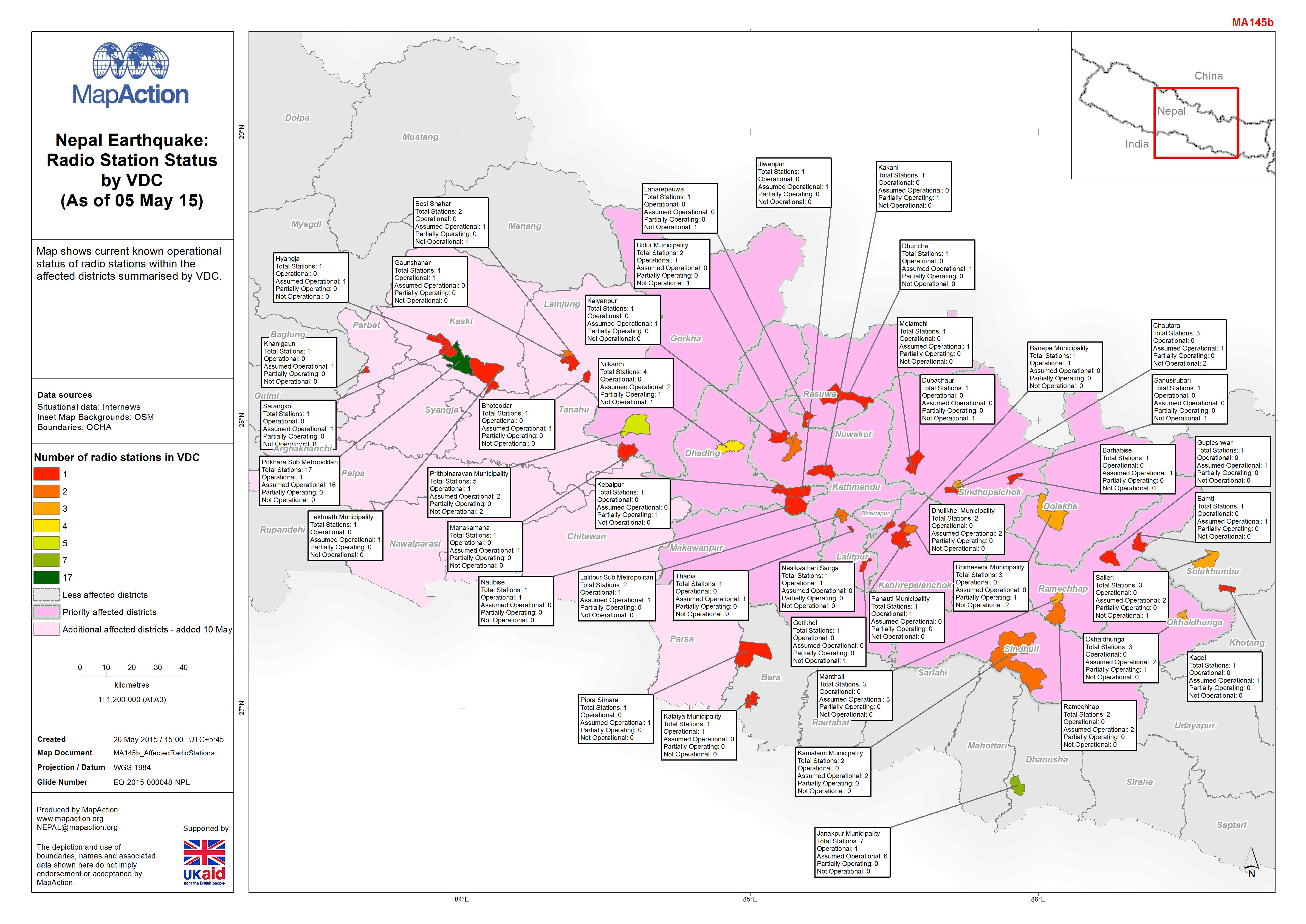
Nepal Earthquake:Radio Station Status by VDC (As of 05 May 15)
Map shows current known operational status of radio stations within the affected districts summarised by VDC. -

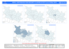
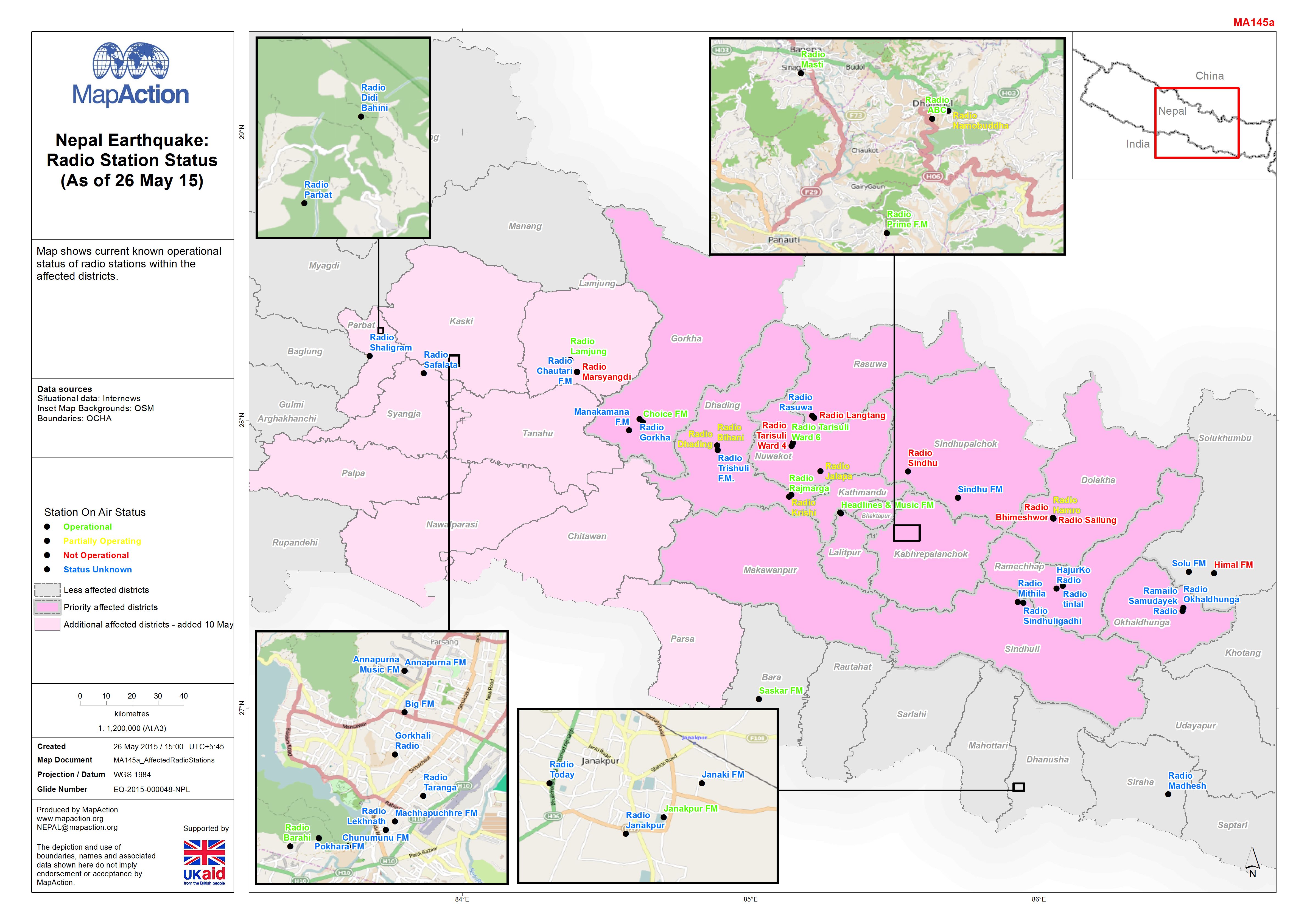
Nepal Earthquake:Radio Station Status (As of 26 May 15)
Map shows current known operational status of radio stations within the affected districts. -

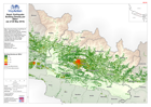
Nepal: Earthquake - Helicopter Landing Sites (Map Series)
This map series shows the Helicopter Landing Sites in central Nepal along with terrain, roads, rivers and settlements. This is a series of 34 map sheets, the image below is only... -

Nepal: Earthquake - WASH CLUSTER ACTIVITY (as of 25 May 2015)
Map shows WASH cluster activity as of 25 May 2015 -
Nepal: Earthquake - NUTRITION CLUSTER ACTIVITY (as of 25 May 2015)
Map shows nutrition cluster activity as of 25 May 2015 -
Nepal: Earthquake - FOOD SECURITY CLUSTER ACTIVITY (as of 25 May 2015)
Map shows food security cluster activity as of 25 May 2015 -

Nepal: Earthquake - EDUCATION CLUSTER ACTIVITY (as of 25 May 2015)
Map shows education cluster activity as of 25 May 2015 -
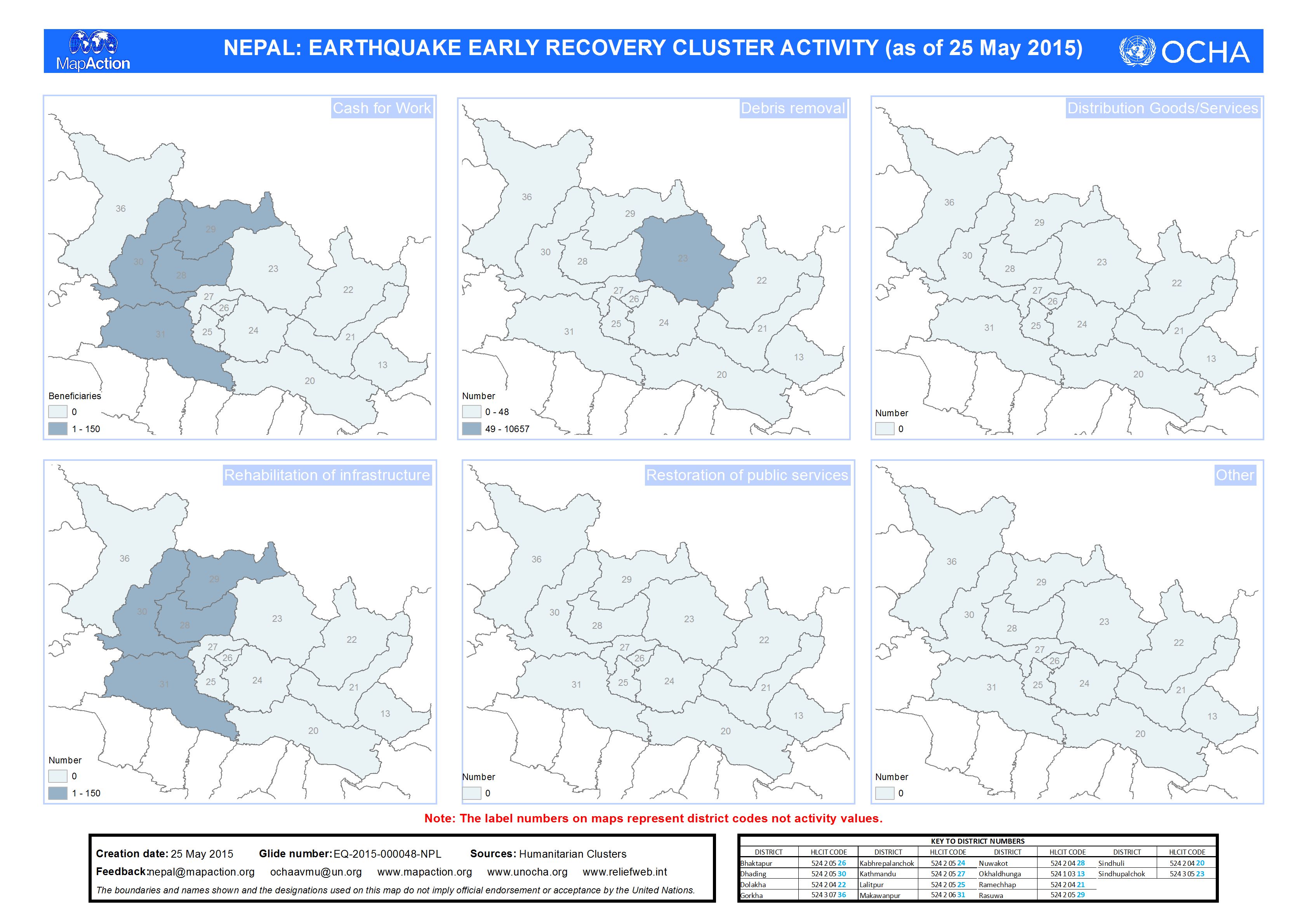
Nepal: Earthquake - EARLY RECOVERY CLUSTER ACTIVITY (as of 25 May 2015)
Map shows early recovery cluster activity as of 25 May 2015 -

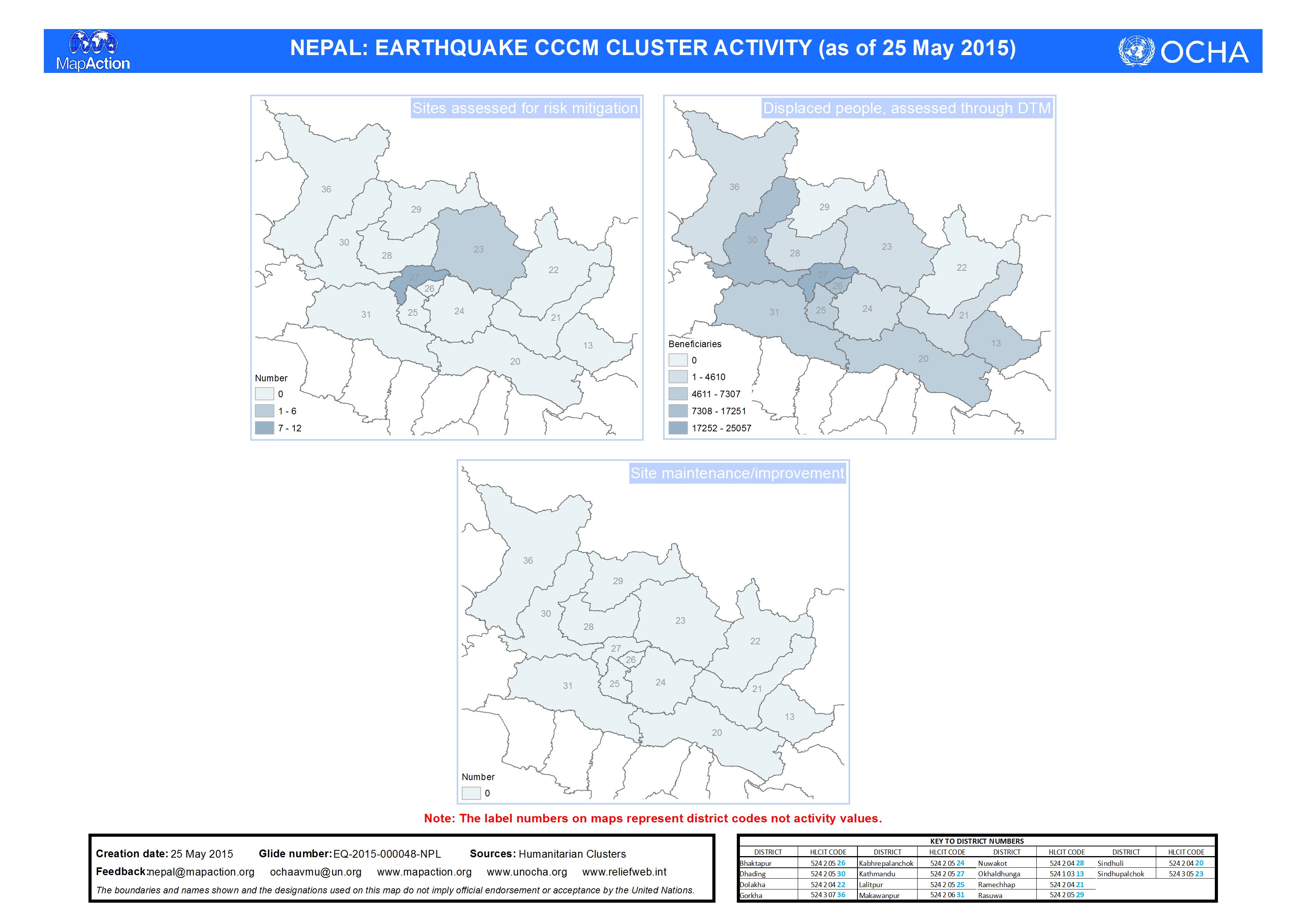
Nepal: Earthquake - CCCM CLUSTER ACTIVITY (as of 25 May 2015)
Map shows CCCM cluster activity as of 25 May 2015 -
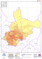
Nepal: Earthquake - Population map - Dolakha District - Tamakoshi Hydro Surve...
Map shows population by Village Development Communities based on figures from a local hydropower company called Tamakoshi Hydro Ltd. -
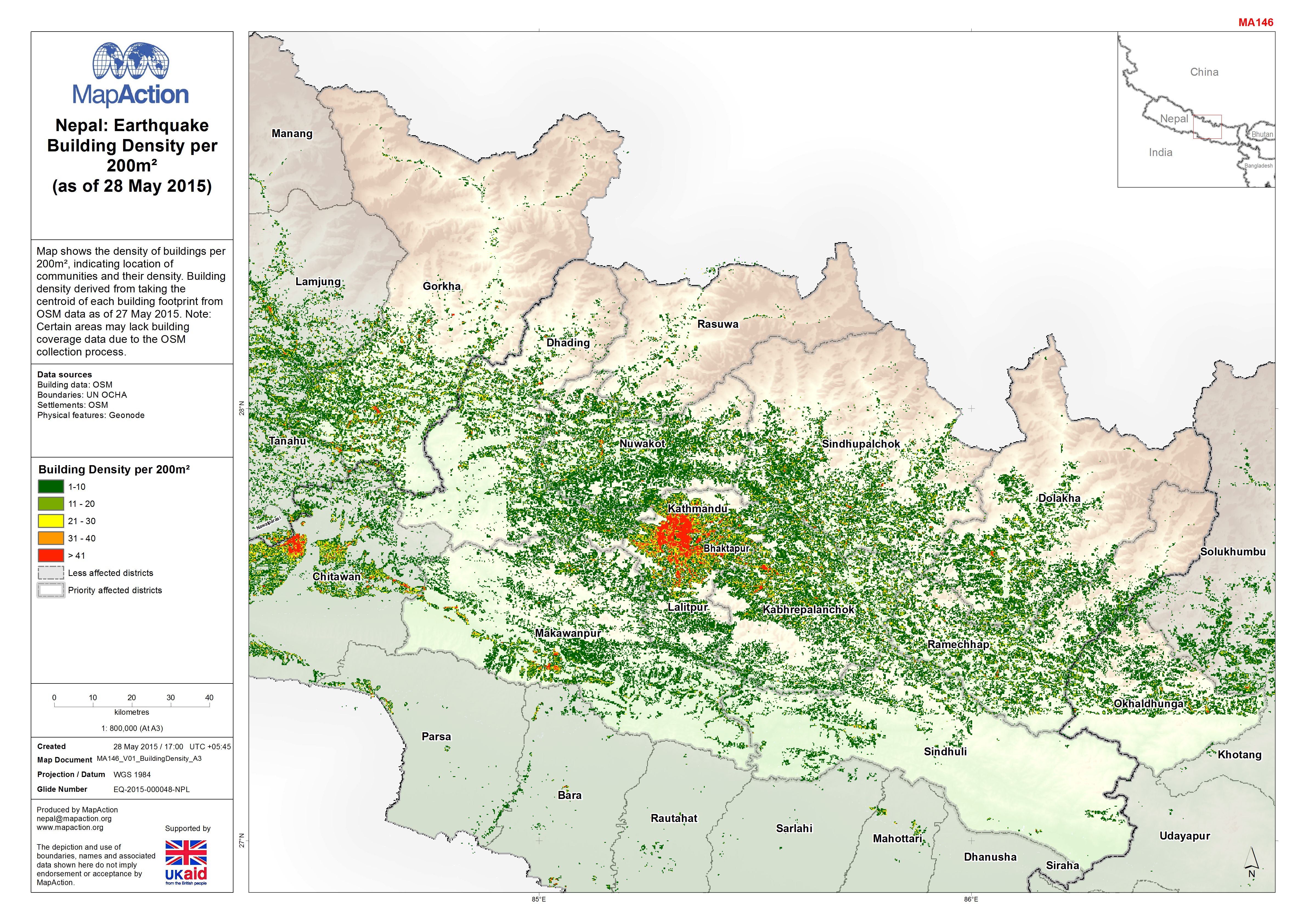
Nepal: Earthquake - Building Density per 200m²(as of 28 May 2015)
Map shows the density of buildings per 200m², indicating location of communities and their density. Building density derived from taking the centroid of each building footprint... -
Interactive Mapping - Nepal Earthquake: Who, What, Where at Village Developme...
Click here for the interactive Who, What, Where mapping tool. This map shows Who, What, Where information, complied by each cluster, detailing the agencies operating in each... -
Nepal: Earthquake - Estimate of population directly affected by destroyed hou...
Map shows the numbers of affected population by district as a proportion of the 2011 Census (using estimated household size to get population totals based on building damage) -
Nepal: Earthquake - Who, What, Where - Education cluster activities by Distri...
This is a multi-page atlas. Download the PDF for all pages. The image below is only a sample page. Map shows the number of activities and an agency list within a Village... -
Nepal: Earthquake - Who, What, Where - Food Security cluster activities by Di...
This is a multi-page atlas. Download the PDF for all pages. The image below is only a sample page. Map shows the number of activities and an agency list within a Village... -
Nepal: Earthquake - Who, What, Where - Nutrition cluster activities by Distri...
This is a multi-page atlas. Download the PDF for all pages. The image below is only a sample page. Map shows the number of activities and an agency list within a Village... -
Nepal: Earthquake - Who, What, Where - Health cluster activities by District ...
This is a multi-page atlas. Download the PDF for all pages. The image below is only a sample page. Map shows the number of activities and an agency list within a Village... -
Nepal: Earthquake - Who, What, Where - CCCM cluster activities by District (a...
This is a multi-page atlas. Download the PDF for all pages. The image below is only a sample page. Map shows the number of activities and an agency list within a Village... -
Nepal: Earthquake - Who, What, Where - WASH cluster activities by District (a...
This is a multi-page atlas. Download the PDF for all pages. The image below is only a sample page. Map shows the number of activities and an agency list within a Village... -
Nepal: Earthquake - Who, What, Where - Shelter cluster activities by District...
This is a multi-page atlas. Download the PDF for all pages. The image below is only a sample page. Map shows the number of activities and an agency list within a Village...