-

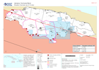
Assessment locations - 10 and 15 July 2024
Map shows the location of the assessments carried out on 10 July 2024. Teams included members from ODPEM, UNDAC, OIM, FAO, UNDSS, UNDP, UNICEF, ATLAS, JEU and TSF. Roads,... -
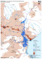
Situation Overview (as of 12 July)
Situation overview as of 12 July 2024. Showing hurricane wind speeds, cumulative rainfall (1-9 July), Office of Disaster Preparedness and Emergency Management (ODPEM) priority... -

COPERNICUS EMS Building Assessment 5 July - Union Island: Atlas
Overview of Union Island showing damage assessment data sourced from Copernicus EMS, 5 July. -

Baseline Population and Shake Intensity showing Affected Area
Overview of baseline population (using 2020 estimates of density per 100m) within affected region of Syria due to earthquakes on 6th Feb 2023 -
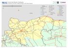
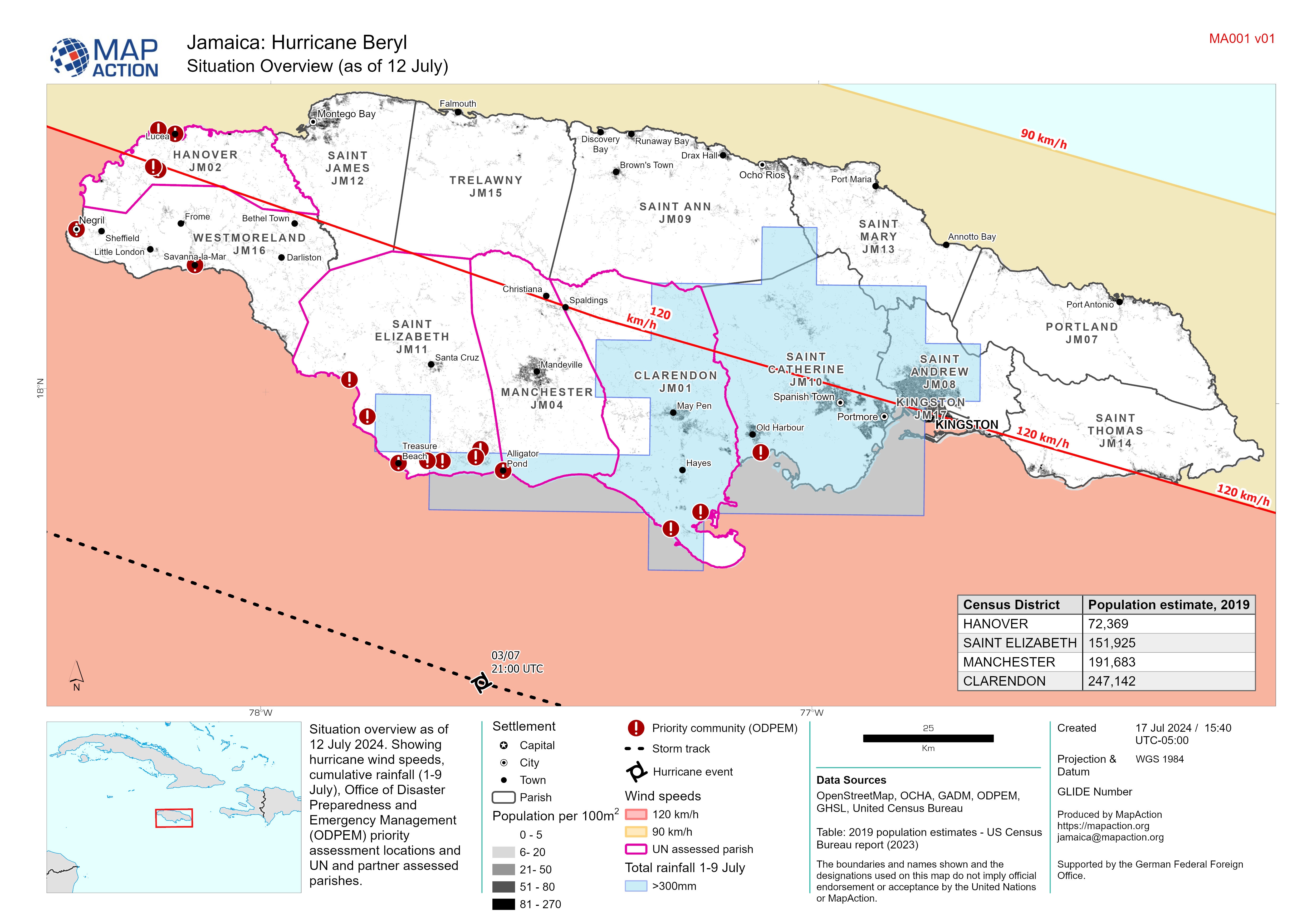
Situational Overview of Affected Region with Shake Intensity
Overview of baseline population (using 2020 estimates of density per 100m) within affected region of Syria due to earthquakes on 6th Feb 2023 -

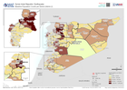
Baseline Population and Shake Intensity Overview
Overview of baseline population (using 2020 estimates) within affected region of Syria due to earthquakes on 6th Feb 2023 -
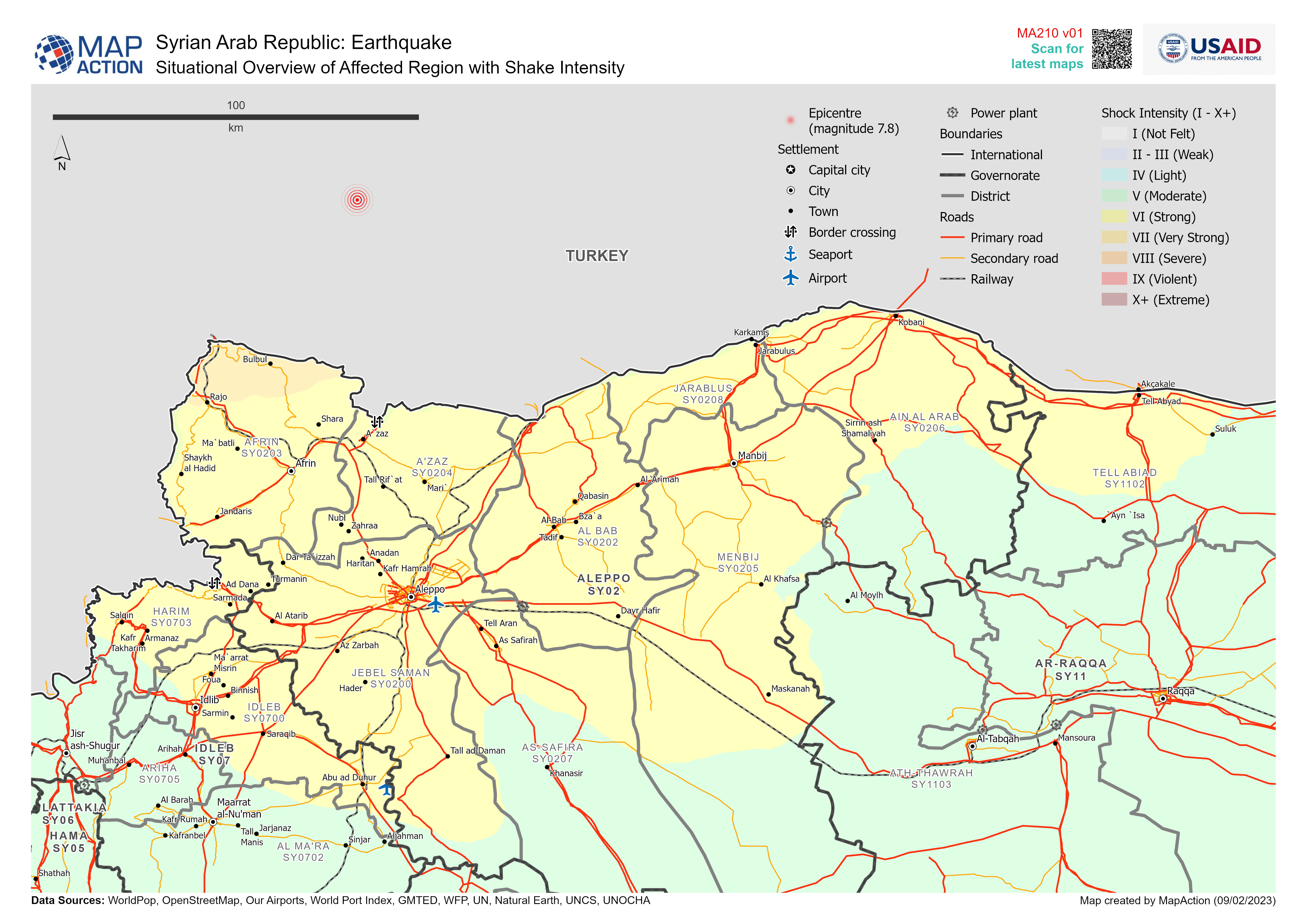
Baseline Population Counts per District (Admin 2)
Overview of baseline population (total number of people per District (Admin 2)) -

Nicaragua: Potential storm track, elevation and municipalities: 3 Nov 2020, ...
This map shows the affected administration level 2 municipalities for Nicaragua, with population estimates and predicted wind speed cones. -

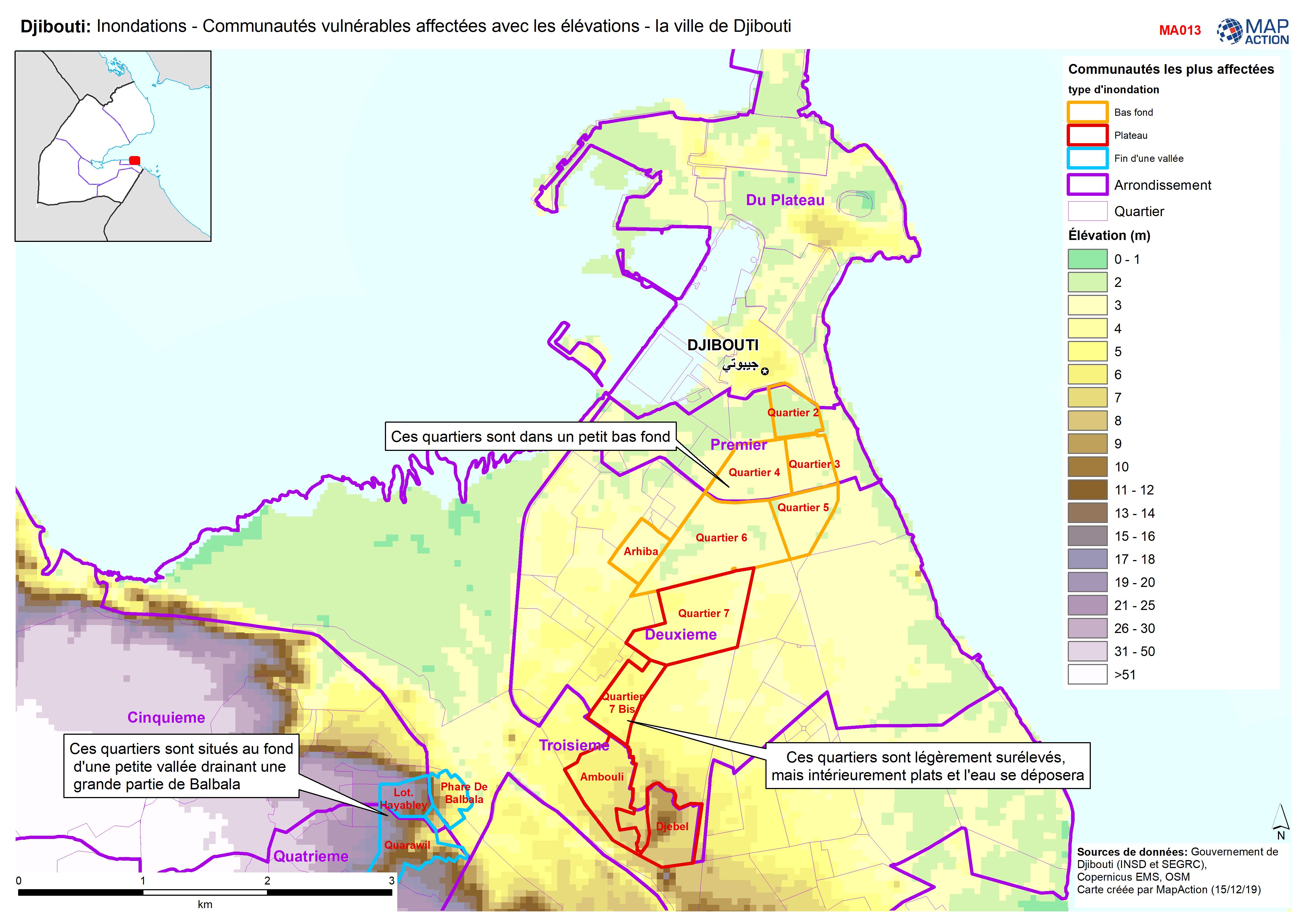
Djibouti: Inondations - Communautés vulnérables affectées avec les élévations...
Djibouti City - Map shows the most affected flooded communities, containing the most vulnerable populations, alongside elevation data to demonstrate the effects of elevation and... -
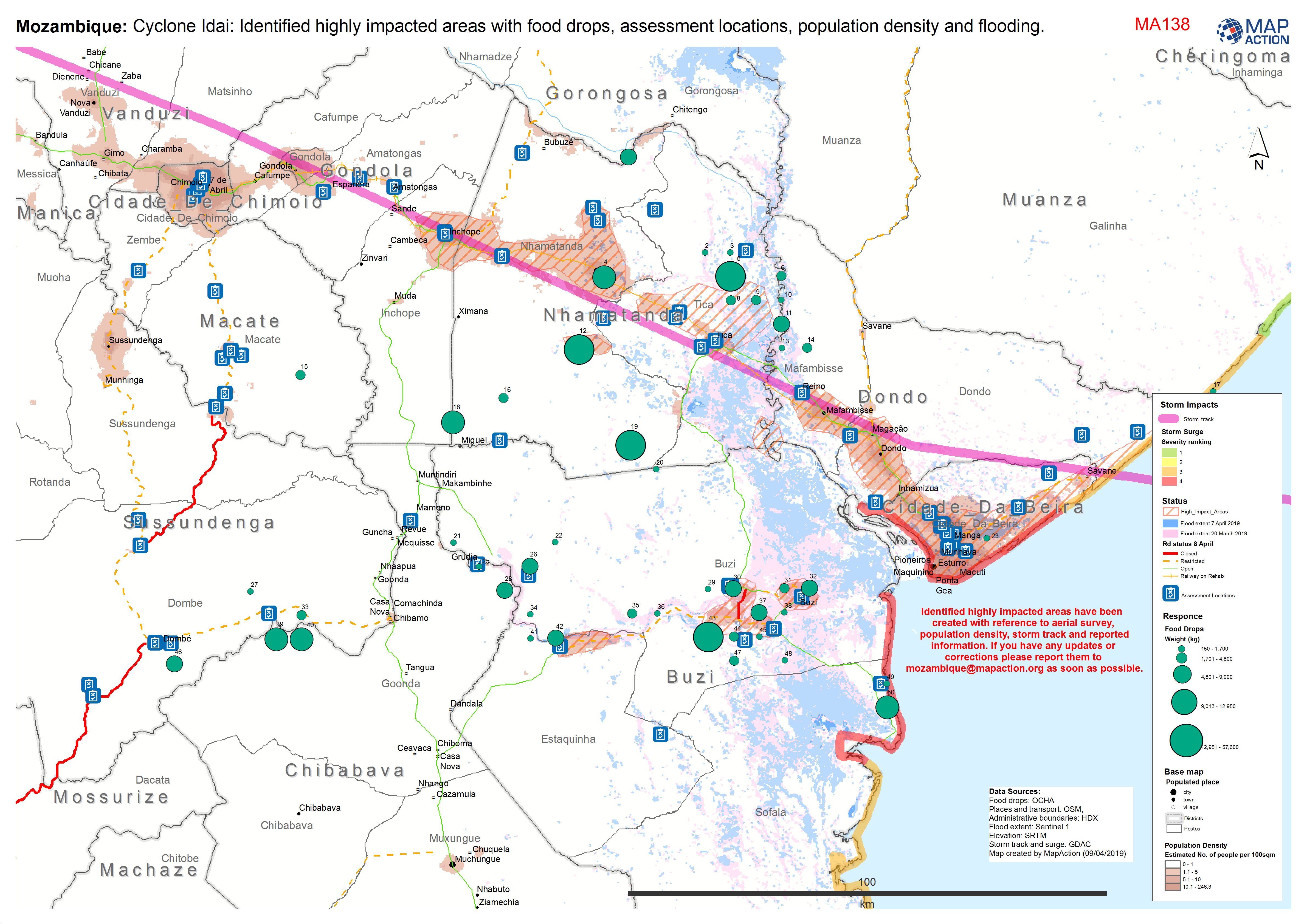
Mozambique: Cyclone Idai: Identified highly impacted areas with food drops, a...
Situation map showing areas of high impact, assessment locations, access and food drops to date. As at 9 April 2019. -
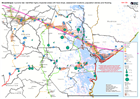
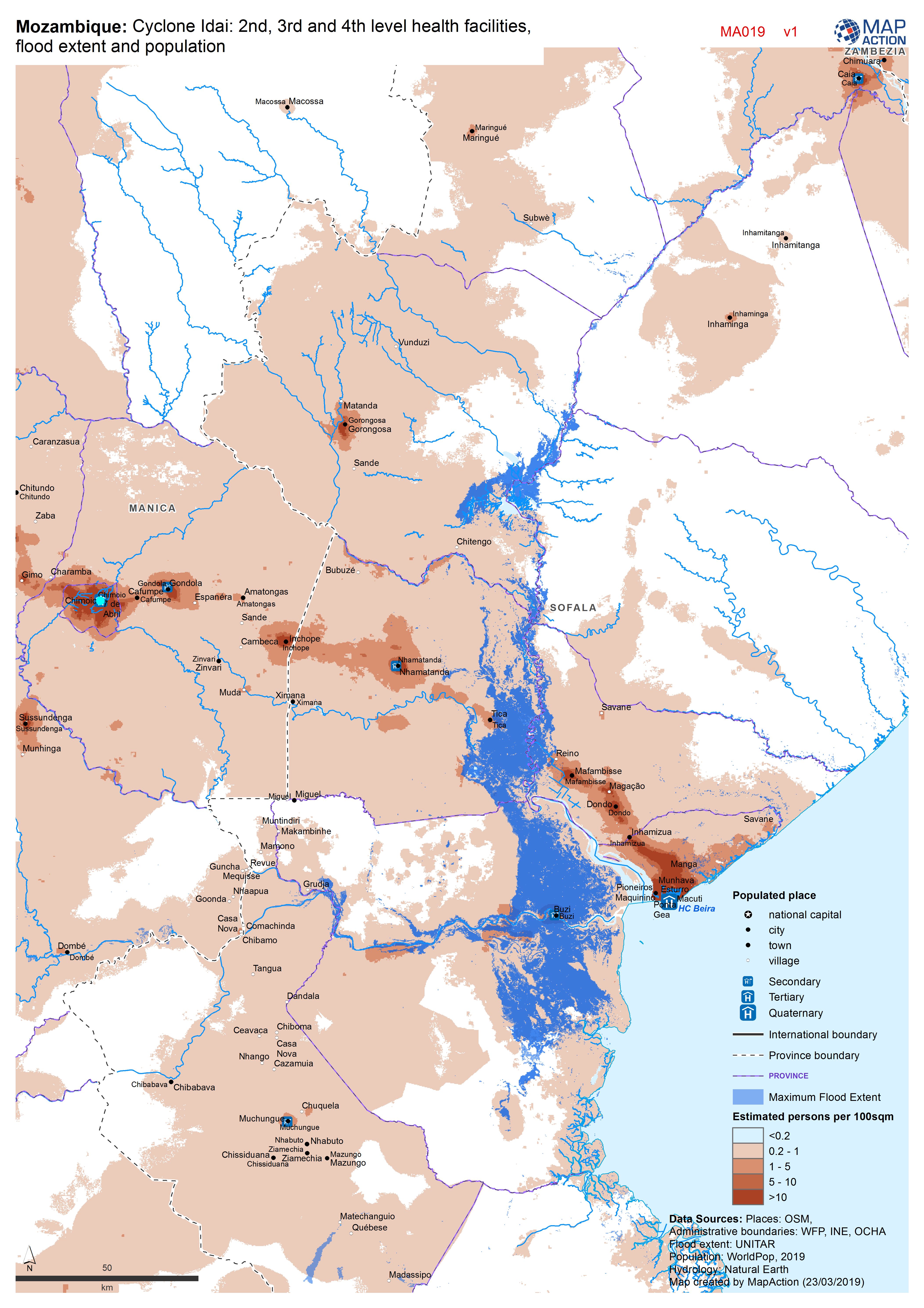
Mozambique: Cyclone Idai - 2nd, 3rd and 4th level health facilities, flood ex...
Map shows the population (based on WorldPop at 100m resolution generating through AI) and the Flood Extents known as of 19/20 March 2019 plus Health facilities

