-

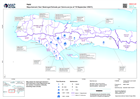
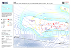
Path of Typhoon Rai (Odette) - as of 17 Dec 21
Map shows the path of the Super Typhoon Rai (Odette) and estimated wind speeds. The cone of uncertainty shows where the storm could go. -

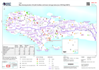
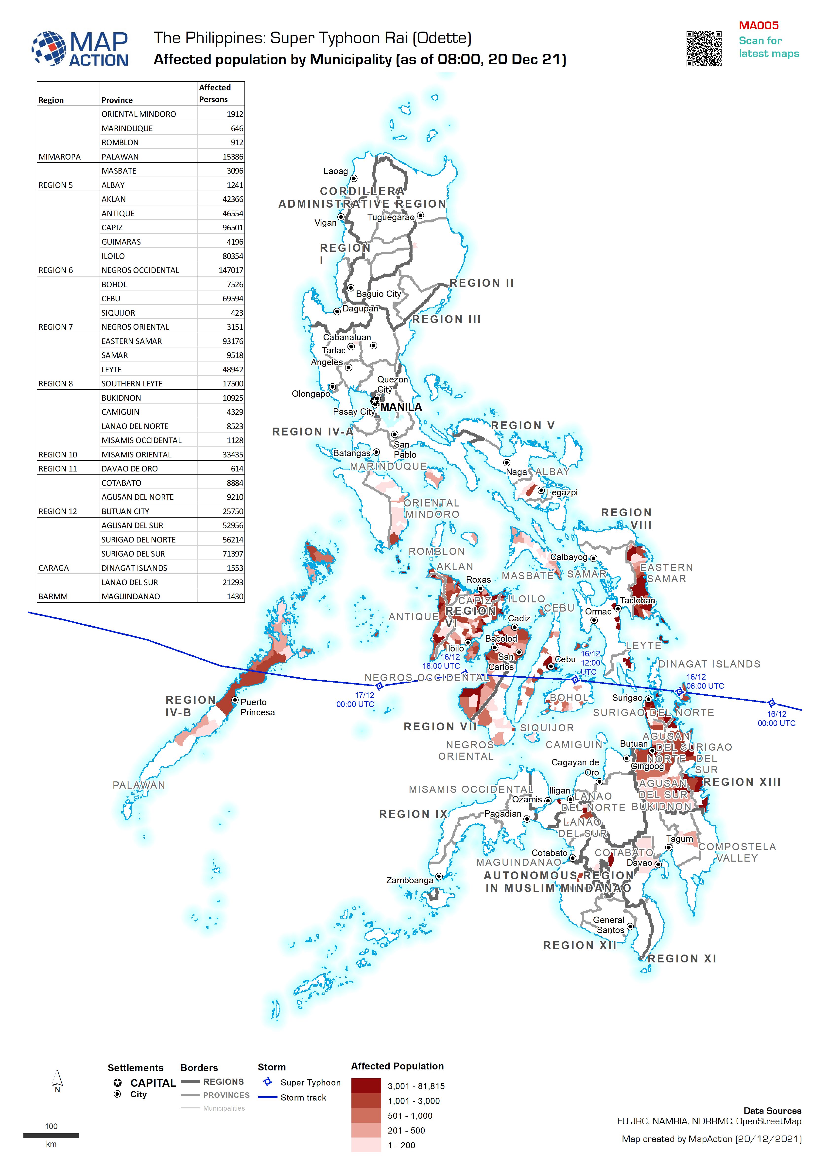
Affected population by Municipality (as of 08:00, 20 Dec 21)
Map shows the affected population per Municipality (admin 3). -
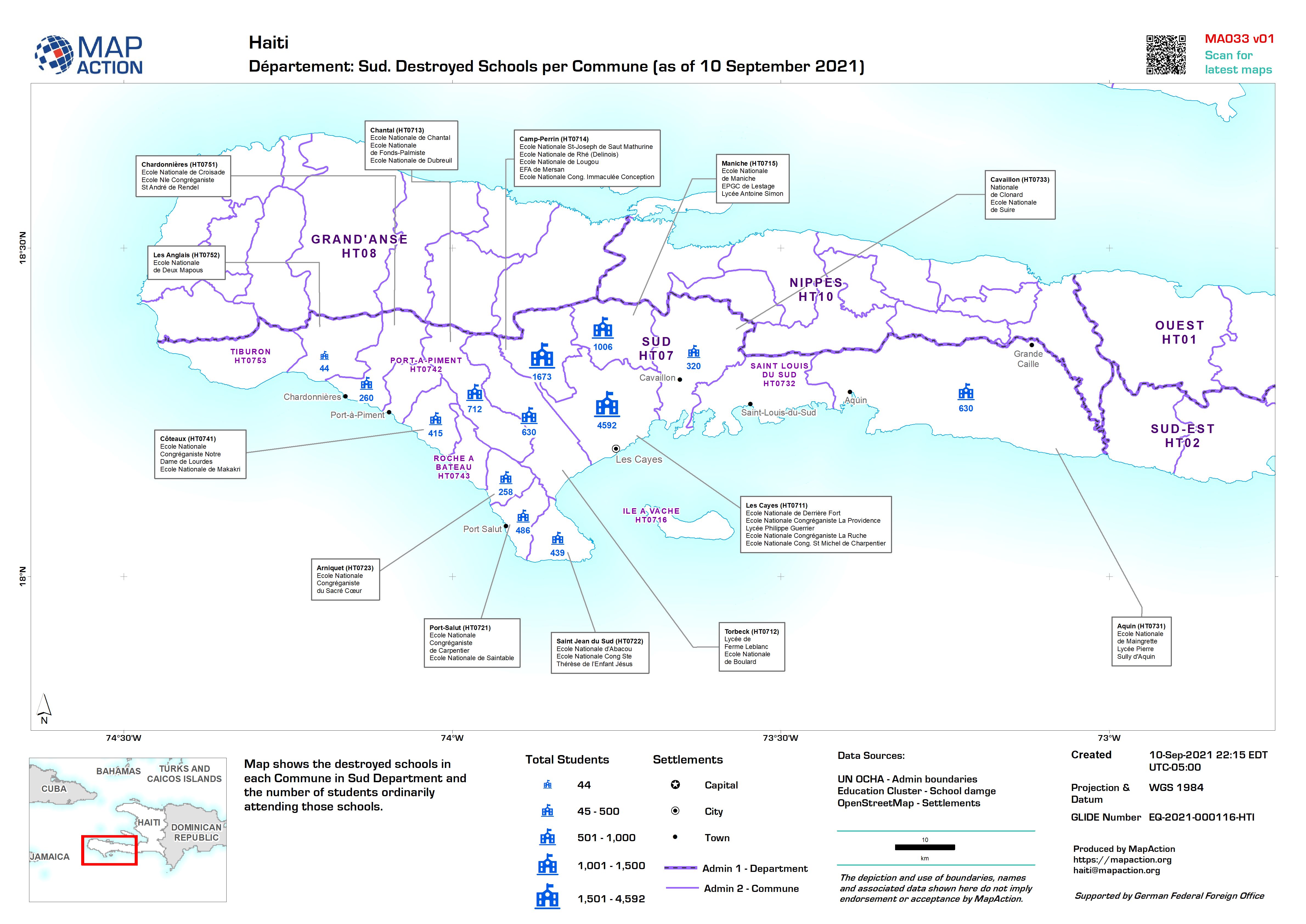
Département: Sud. Destroyed Schools per Commune (as of 10 September 2021)
Map shows the destroyed schools in each Commune in Sud Department and the number of students ordinarily attending those schools. -
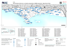
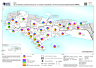
Earthquake Casualties and Damage - Figures received on 24/08/2021
Département: Map showing earthquake damage and casualties with numbers from the Haitian Civil Protection General Directorate (DGPC). Figures were received on 24 Aug 2021. -
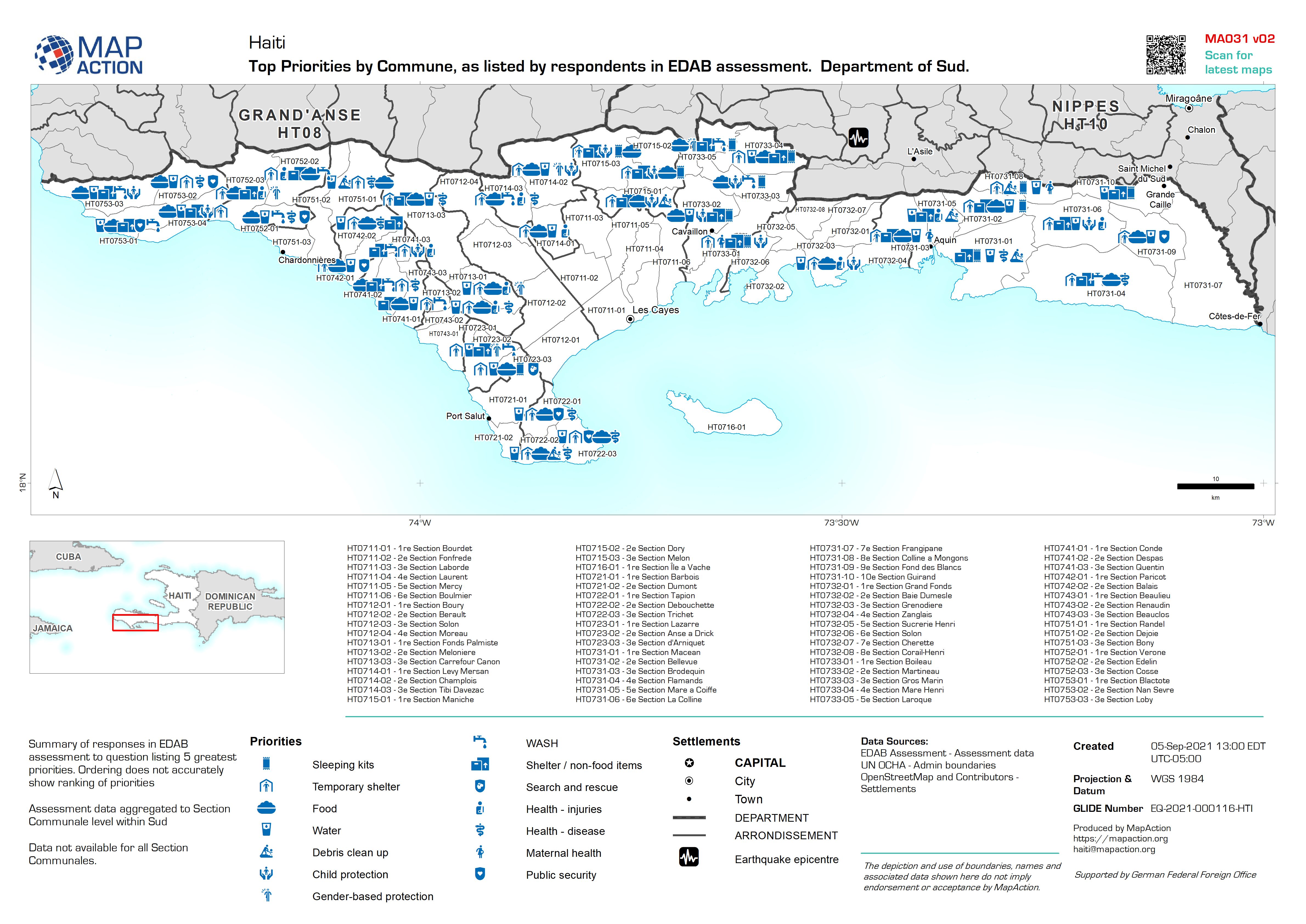
Top Priorities by Commune, as listed by respondents in EDAB assessment. Depar...
Summary of responses in EDAB assessment to question listing 5 greatest priorities. Ordering does not accurately show ranking of priorities Assessment data aggregated to Section... -
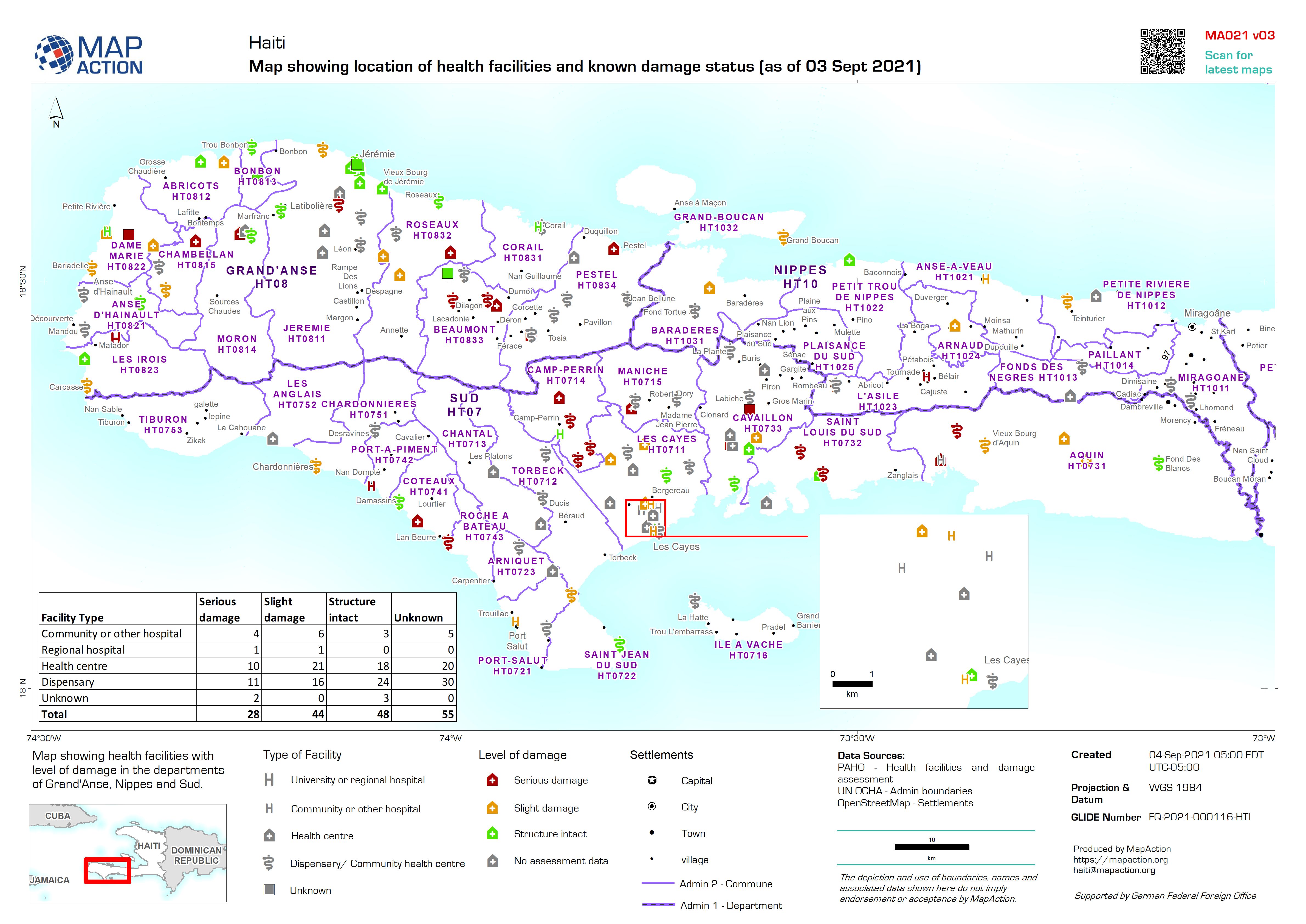
Map showing location of health facilities and known damage status (as of 03 S...
Map showing health facilities with level of damage in the departments of Grand'Anse, Nippes and Sud. Map based upon data published by PAHO accessed on 31/08/2021 -
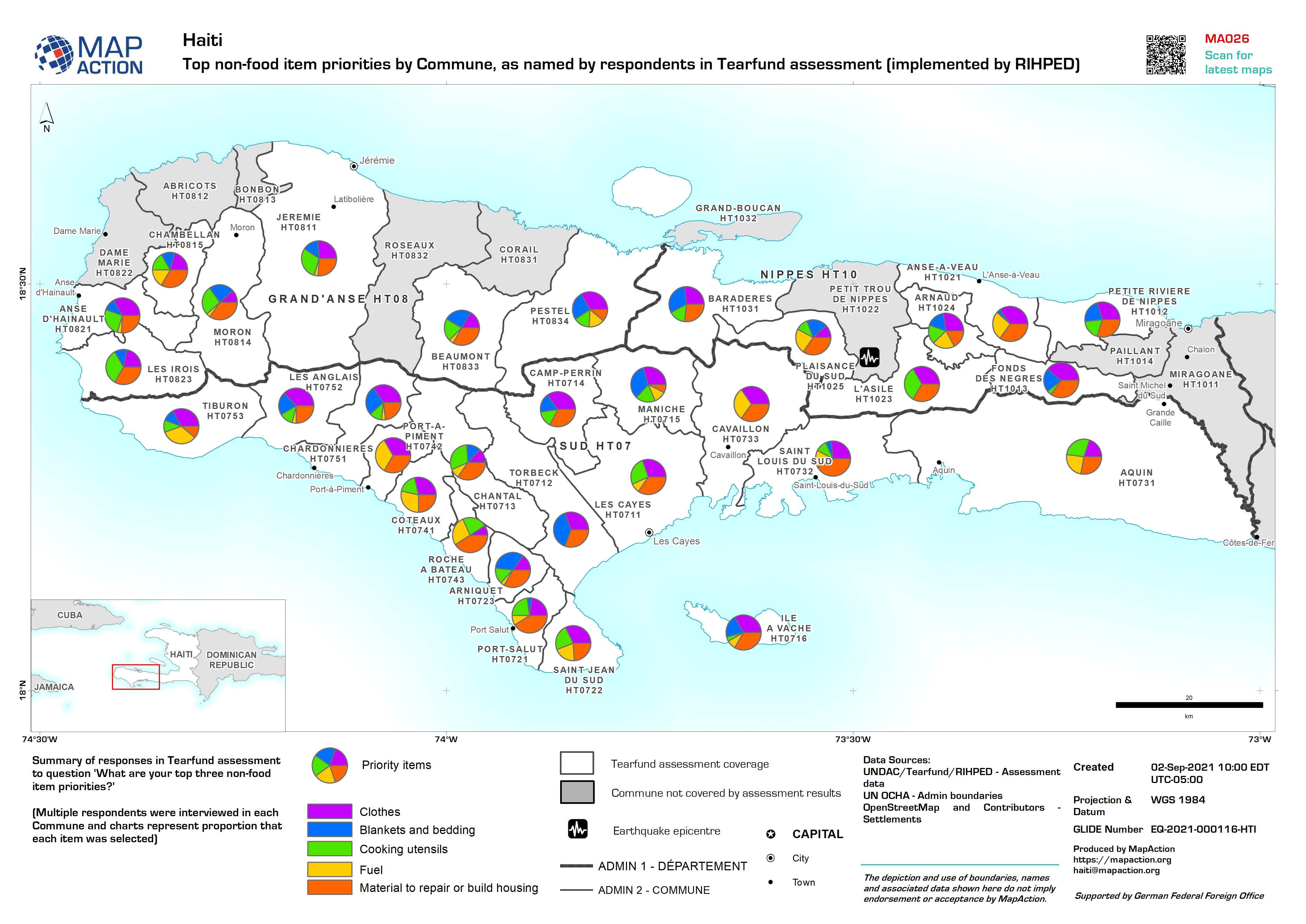
Top non-food item priorities by Commune, as named by respondents in Tearfund ...
Summary of responses in Tearfund assessment to question 'What are your top three non-food item priorities?' (Multiple respondents were interviewed in each Commune and charts... -

Map showing location of health facilities and known damage status (as of 03 S...
Map showing health facilities with level of damage in the departments of Grand'Anse, Nippes and Sud. Map based upon data published by PAHO accessed on 31/08/2021 -

Topographic map showing earthquake shake intensity
Topographic map of Grande 'Anse, Nippes and South Départements, with earthquake shake intensity contours -

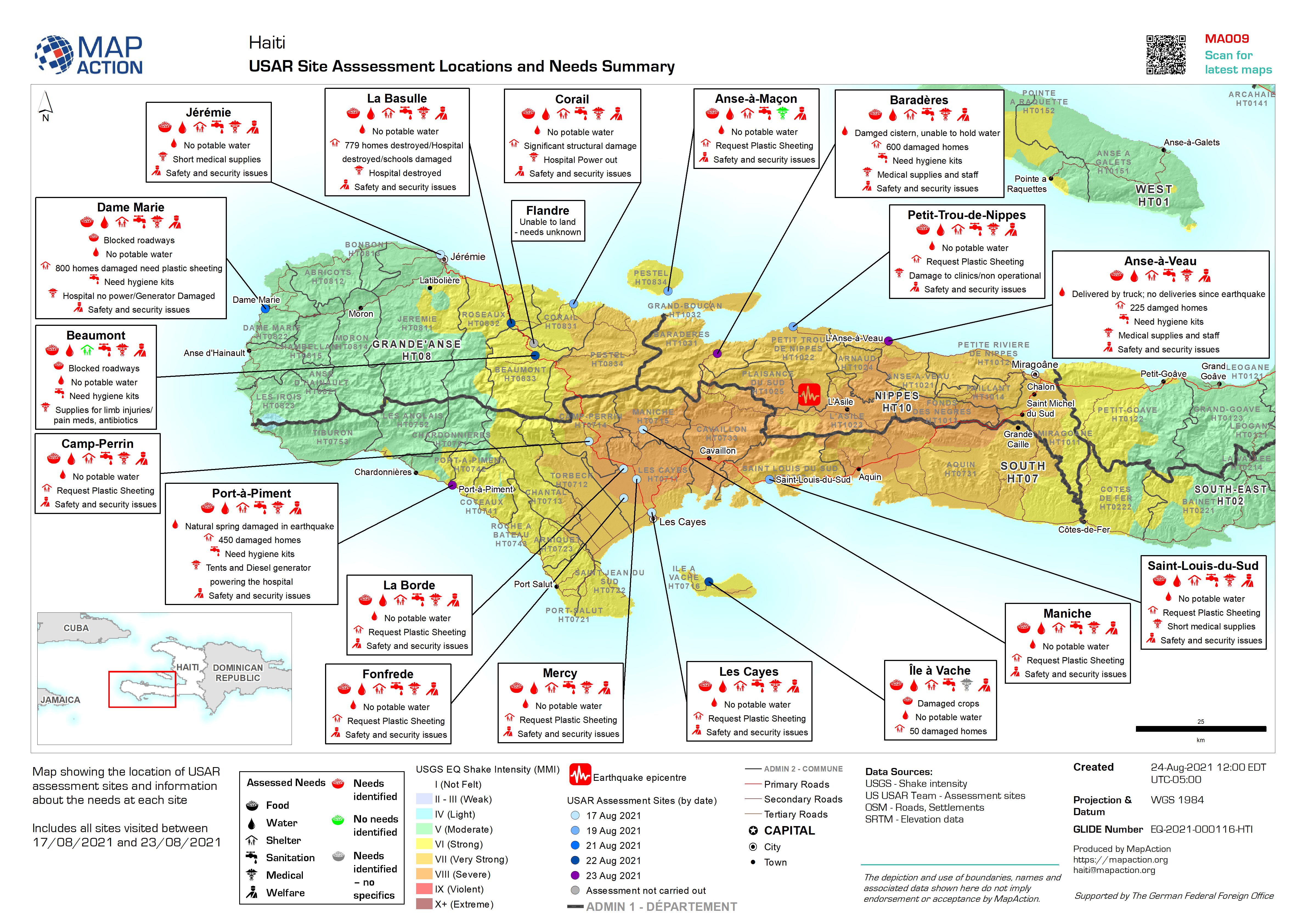
USAR Site Assessment Locations and Needs Summary
Map showing the location of USAR assessment sites and information about the needs at each site Includes all sites visited between 17/08/2021 and 23/08/2021 -
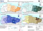
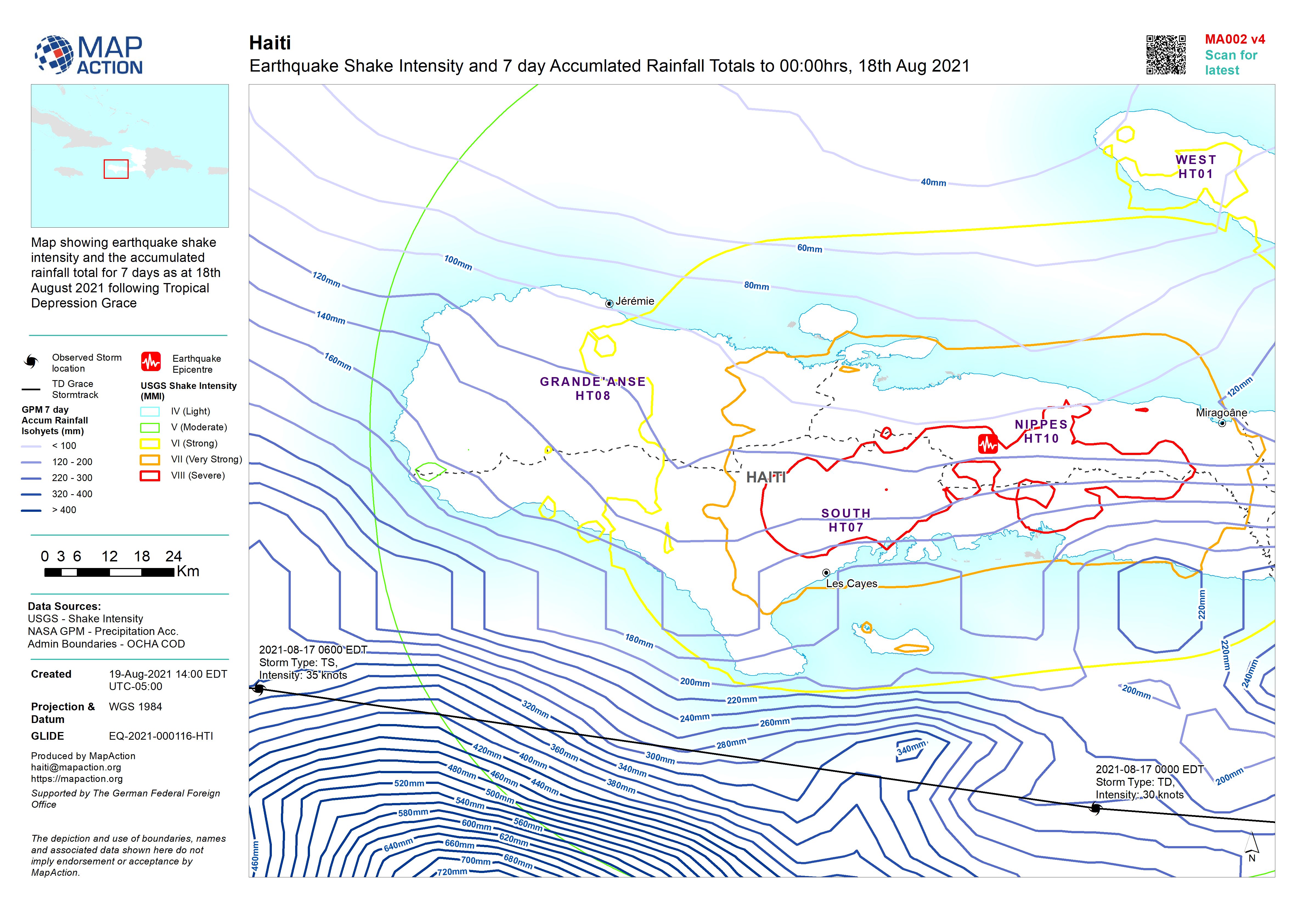
Earthquake Shake Intensity and 7 day Accumulated Rainfall Totals to 00:00hrs,...
Map showing earthquake shake intensity and the accumulated rainfall total for 7 days as at 18th August 2021 following Tropical Depression Grace -
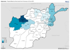
Afghanistan: People affected by flood events from 26 January to 28 July 2021
This dataset has no description
-

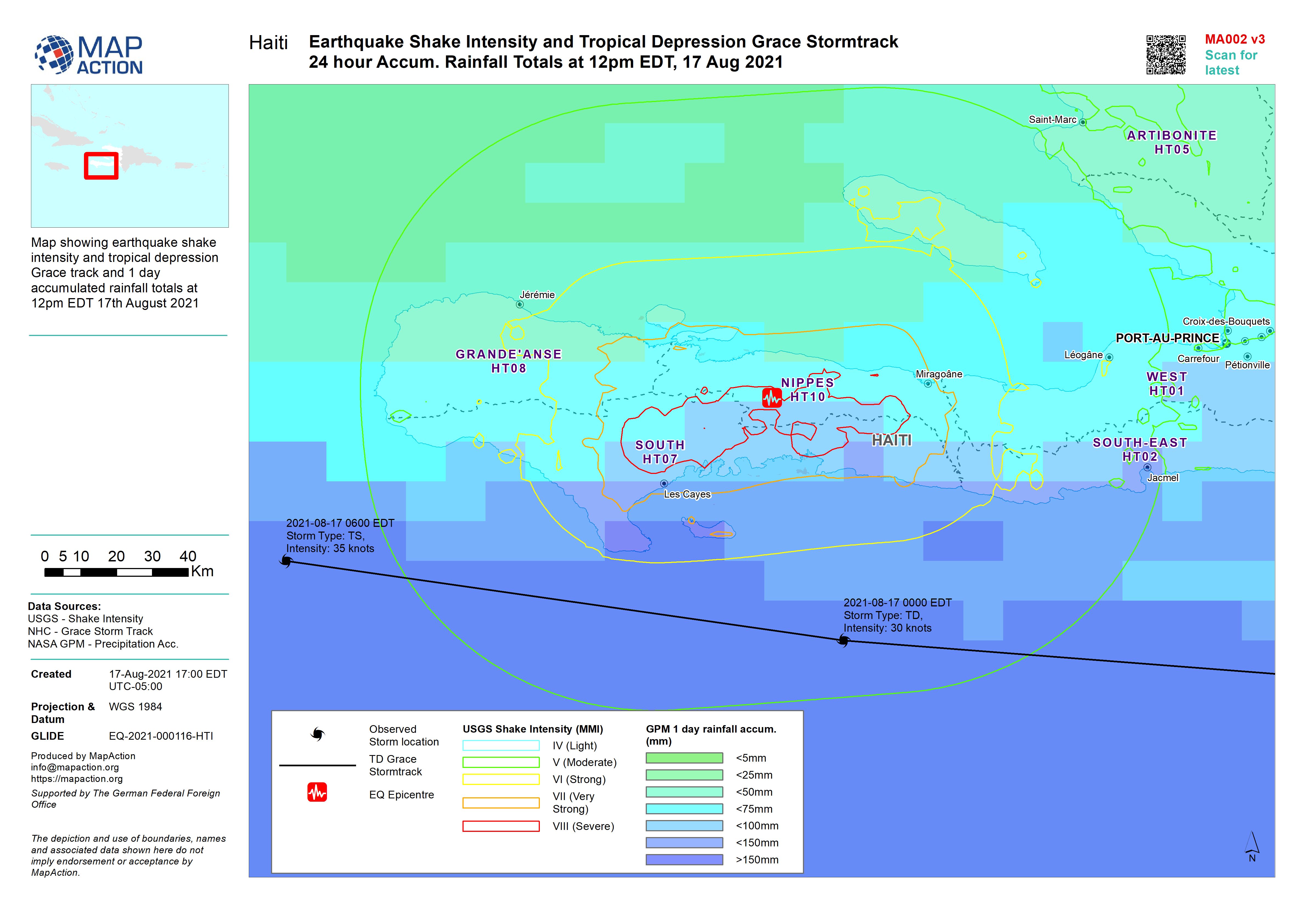
Earthquake Shake Intensity and Tropical Depression Grace Stormtrack 24 hour A...
Map showing earthquake shake intensity and tropical depression Grace track and 1 day accumulated rainfall totals at 12pm EDT 17th August 2021 -

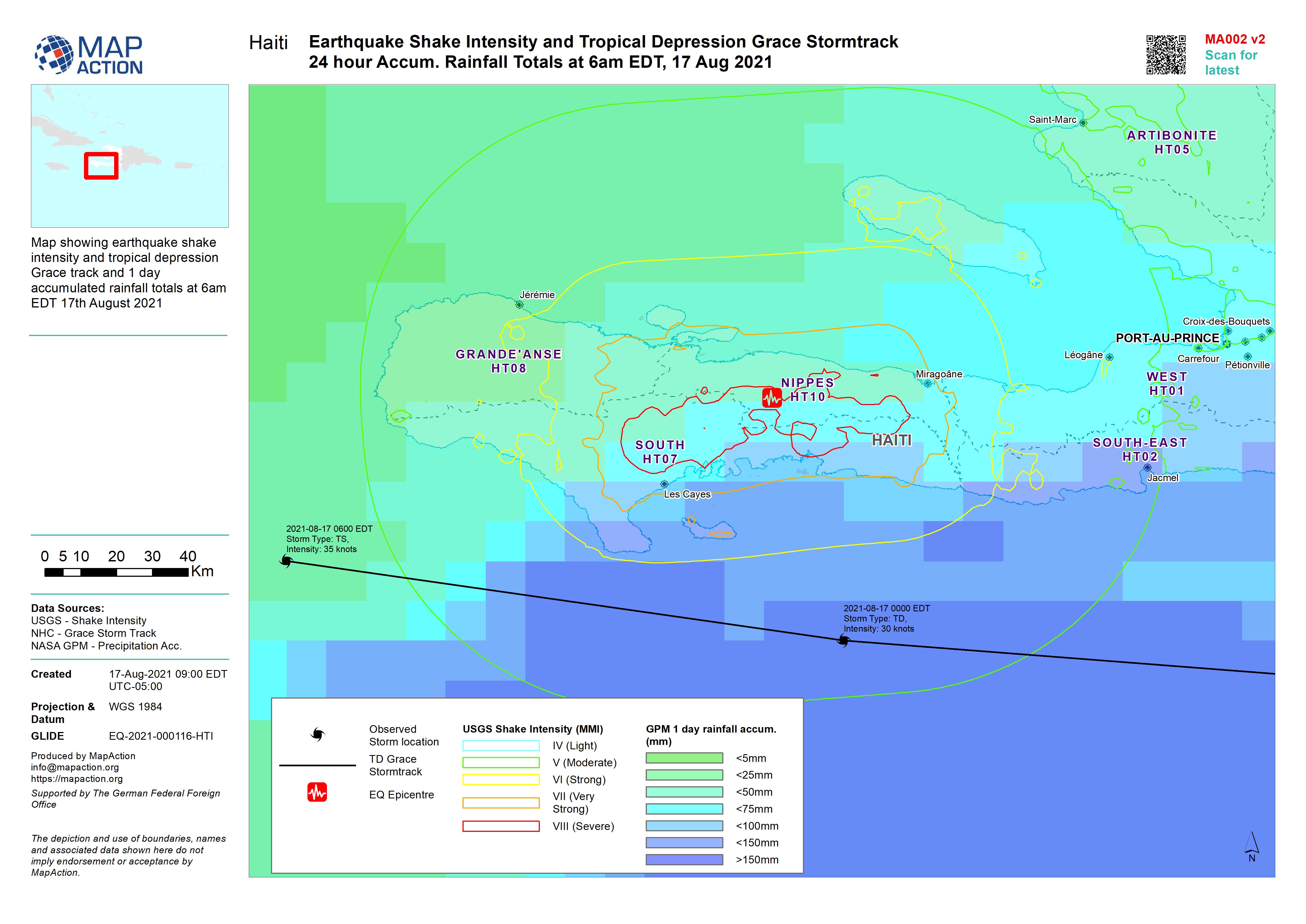
Earthquake Shake Intensity and Tropical Depression Grace Stormtrack 24 hour A...
Map showing earthquake shake intensity and tropical depression Grace track and 1 day accumulated rainfall totals at 6am EDT 17th August 2021 -
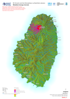
Modelled drainage channels
Map shows modelled drainage channels using a combination of 5m and 30m resolution elevation data. Whilst many of the channelsdo have water (i.e. streams and rivers) in them some... -

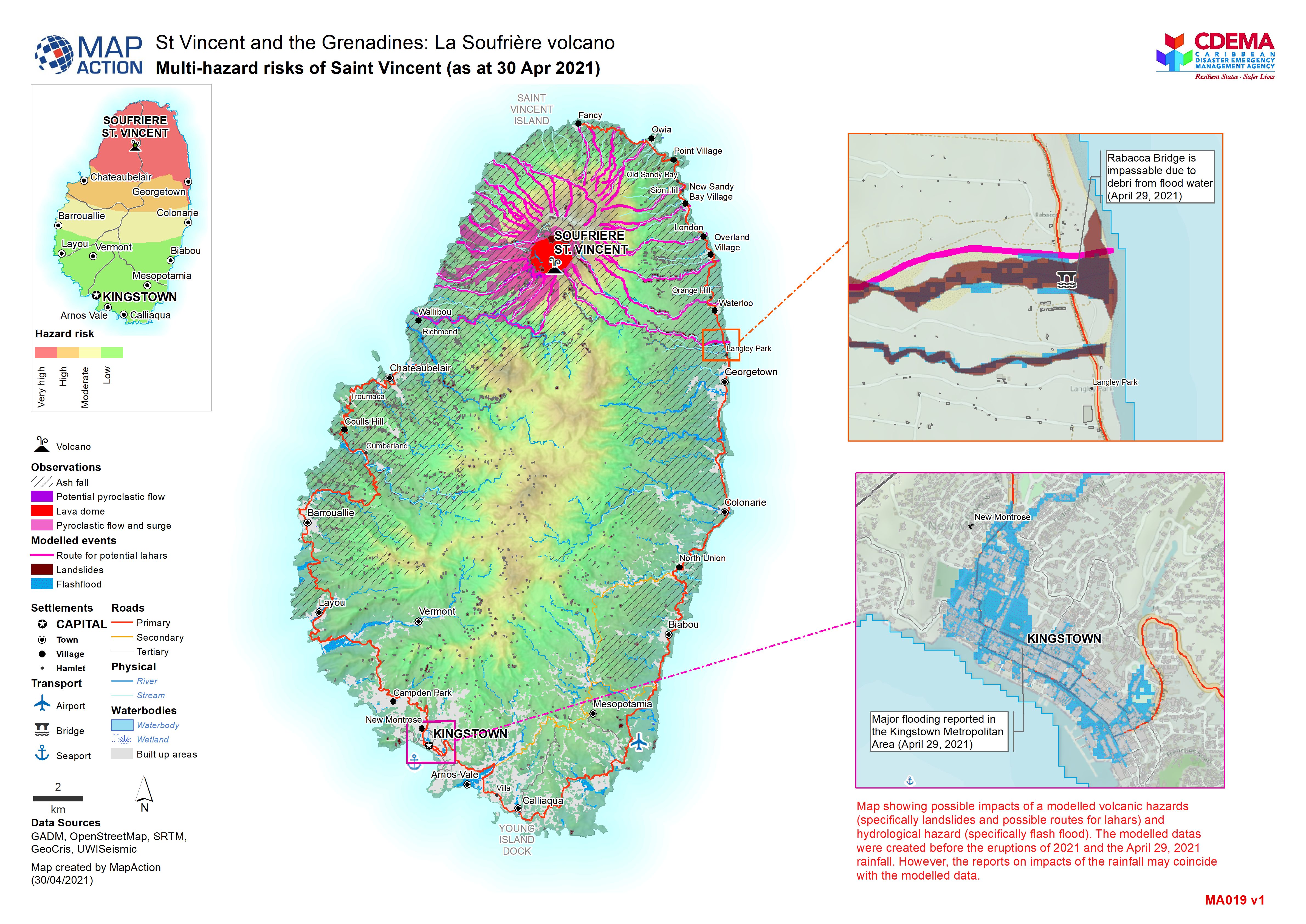
Multi-hazard risks of Saint Vincent (as at 30 Apr 2021)
Map showing possible impacts of a modelled volcanic hazards (specifically landslides and possible routes for lahars) and hydrological hazard (specifically flash flood). The... -

Agricultural land cover and volcanic hazards
Map shows landuse in Saint Vincent and the extent of the ash from the La Soufrière eruptions. -

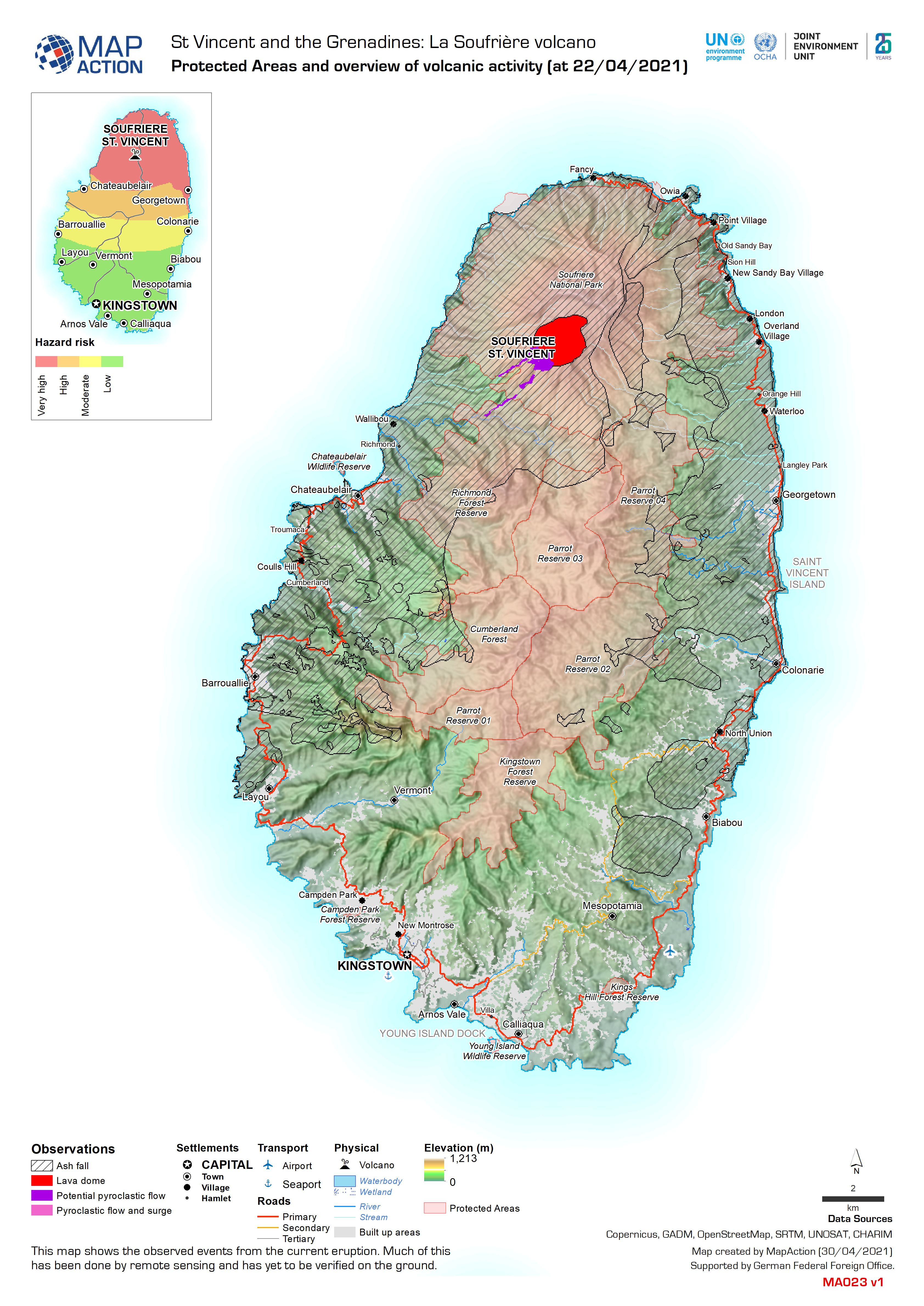
Protected Areas and overview of volcanic activity (at 22/04/2021)
This map shows the observed events from the current eruption. Much of this has been done by remote sensing and has yet to be verified on the ground. -

Transportation Overview (as of 20 Apr 2021)
Map showing the status of the transportation network of St. Vincent -

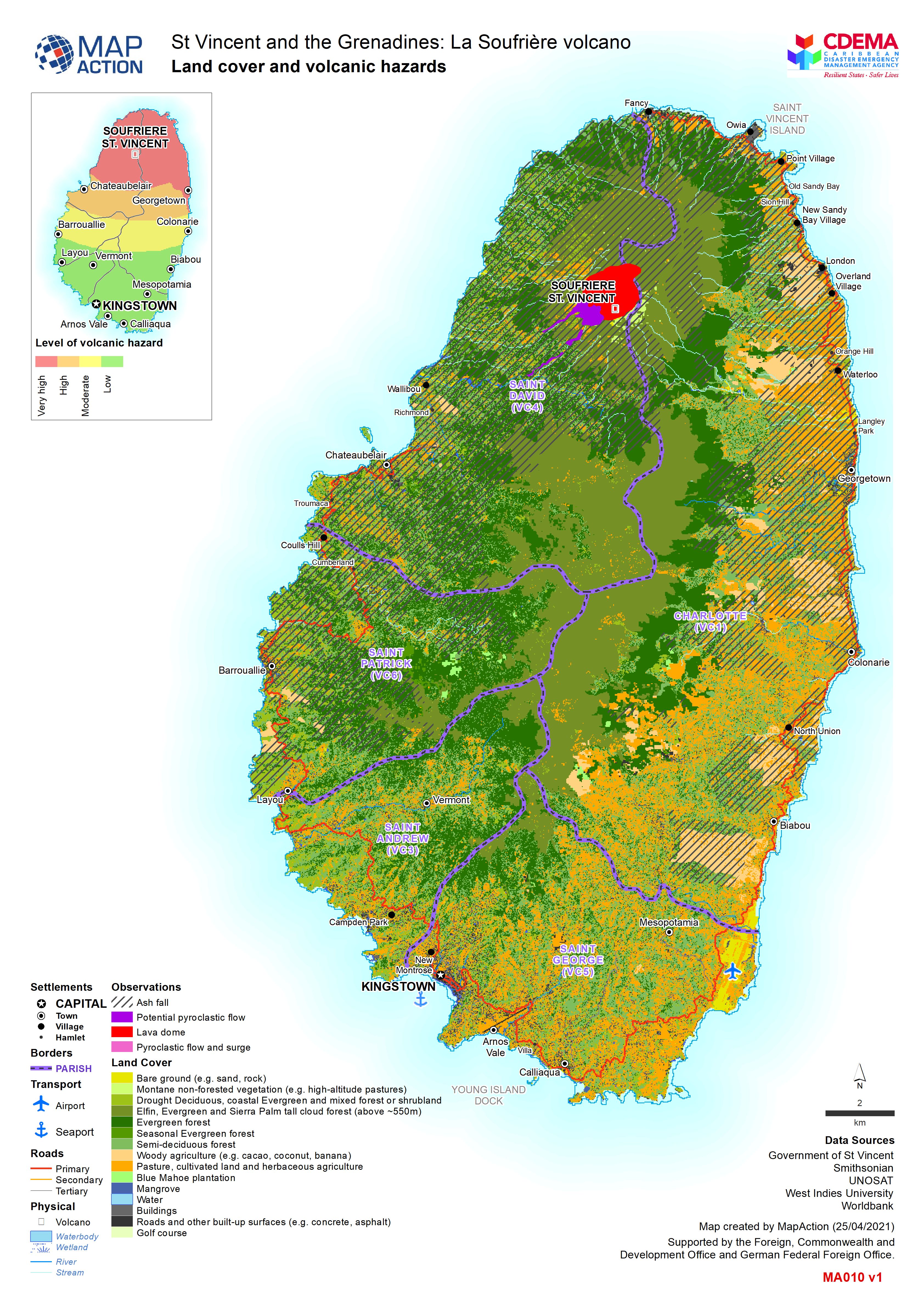
Land cover and volcanic hazards
Map shows landuse in Saint Vincent and the extent of the ash from the La Soufrière eruptions.