-
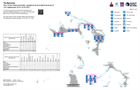
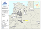
Who What Where activities / presence at sub-island level as of 11th September...
Who What Where activities / presence at sub-island level as of 11th September 2019 16:30 EDT -

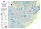
Who What Where activities / presence in affected area for Telecoms and WASH c...
3W for Telecoms and WASH as of 10th September 2019 -

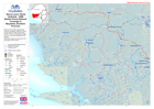
Mozambique - Cyclone Idai: Primary Language and Radio Station Status (as of 0...
Map shows primary languages spoken and known radio station operational status -
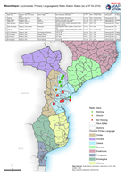
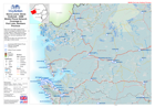
Mozambique: Cyclone Idai: Primary Language and Radio Station Status (as of 07...
Map shows primary languages spoken and known radio station operational status (as of 07.04.2019) -

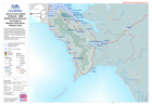
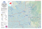
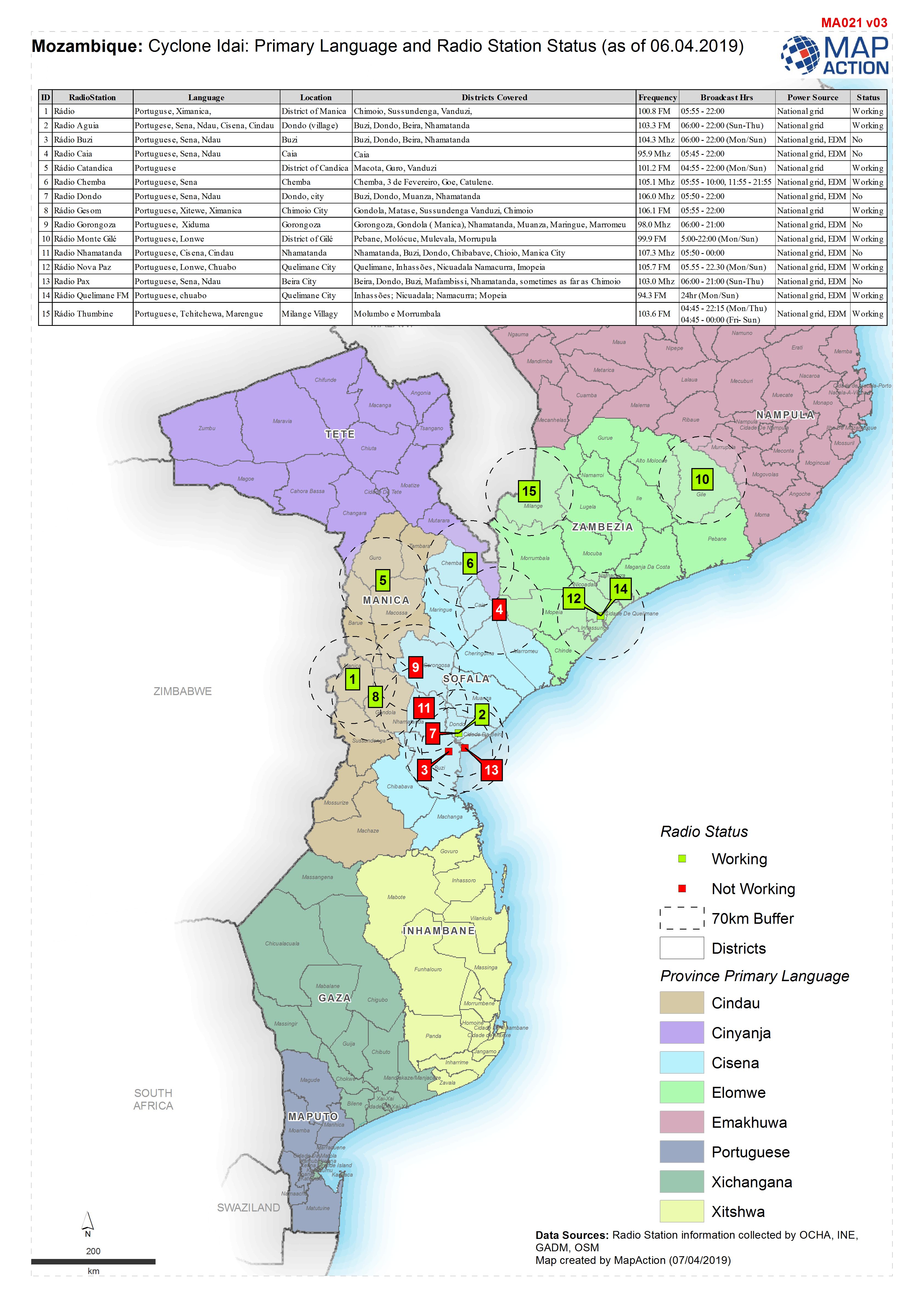
Mozambique: Cyclone Idai: Primary Language and Radio Station Status (as of 06...
Map shows primary languages spoken and known radio station operational status (as of 06.04.2019) -

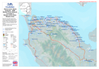
Mozambique: Cyclone Idai: Primary language and Radio Station status
Map shows primary languages spoken and known radio station operational status -
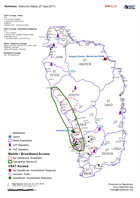
Dominica: Telecoms Status (27 Sep 2017)
Shows the Telecoms coverage including: mobile, VHF and VSAT, -

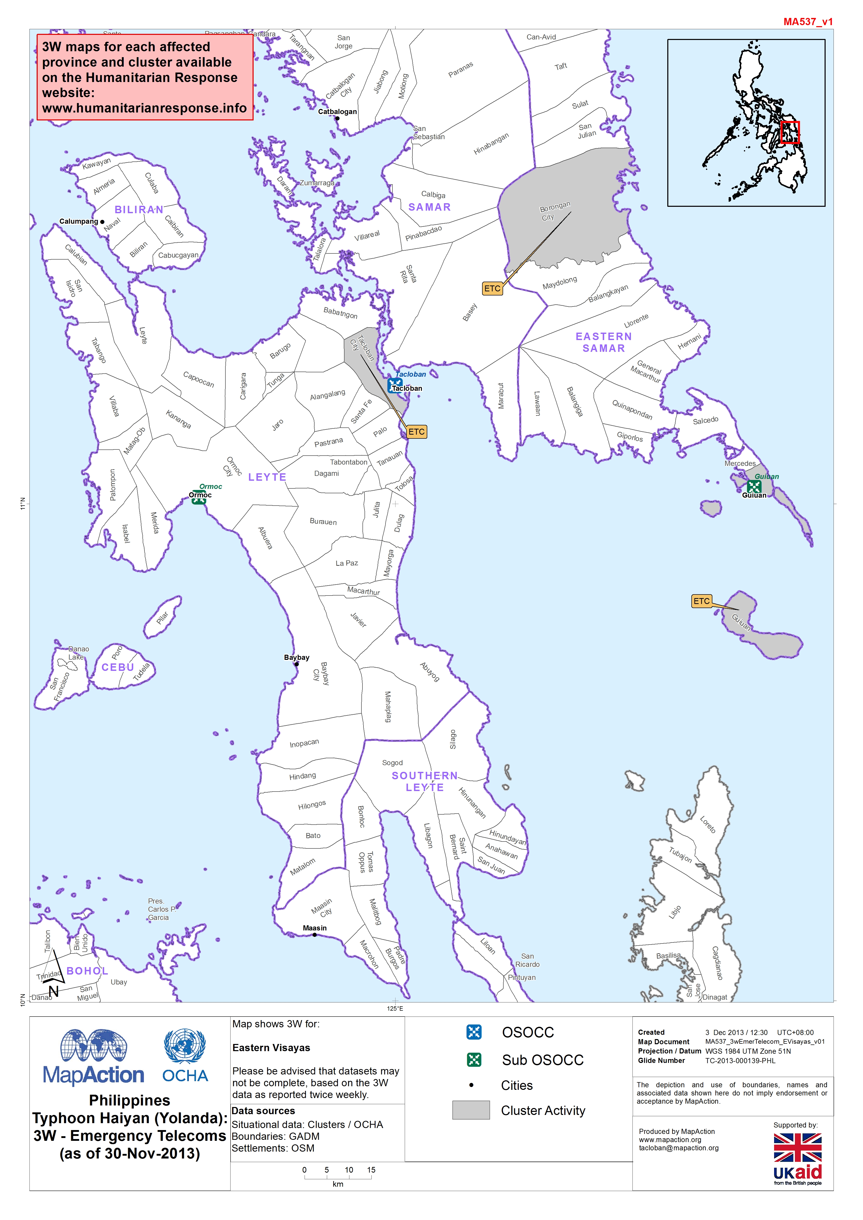
MA 537 PhilippinesTyphoon Haiyan (Yolanda):3W - Emergency Telecoms(as of 30-N...
Map shows 3W for: Eastern Visayas Please be advised that datasets may not be complete, based on the 3W data as reported twice weekly. -

Philippines Typhoon Haiyan (Yolanda) Radio Station Activity (as of 19-Nov-2013)
Map shows the various radio stations and their status -
Nepal: Earthquake - Radio Station Status (as of 26 June15)
Map shows current known operational status of radio stations within the affected districts. -

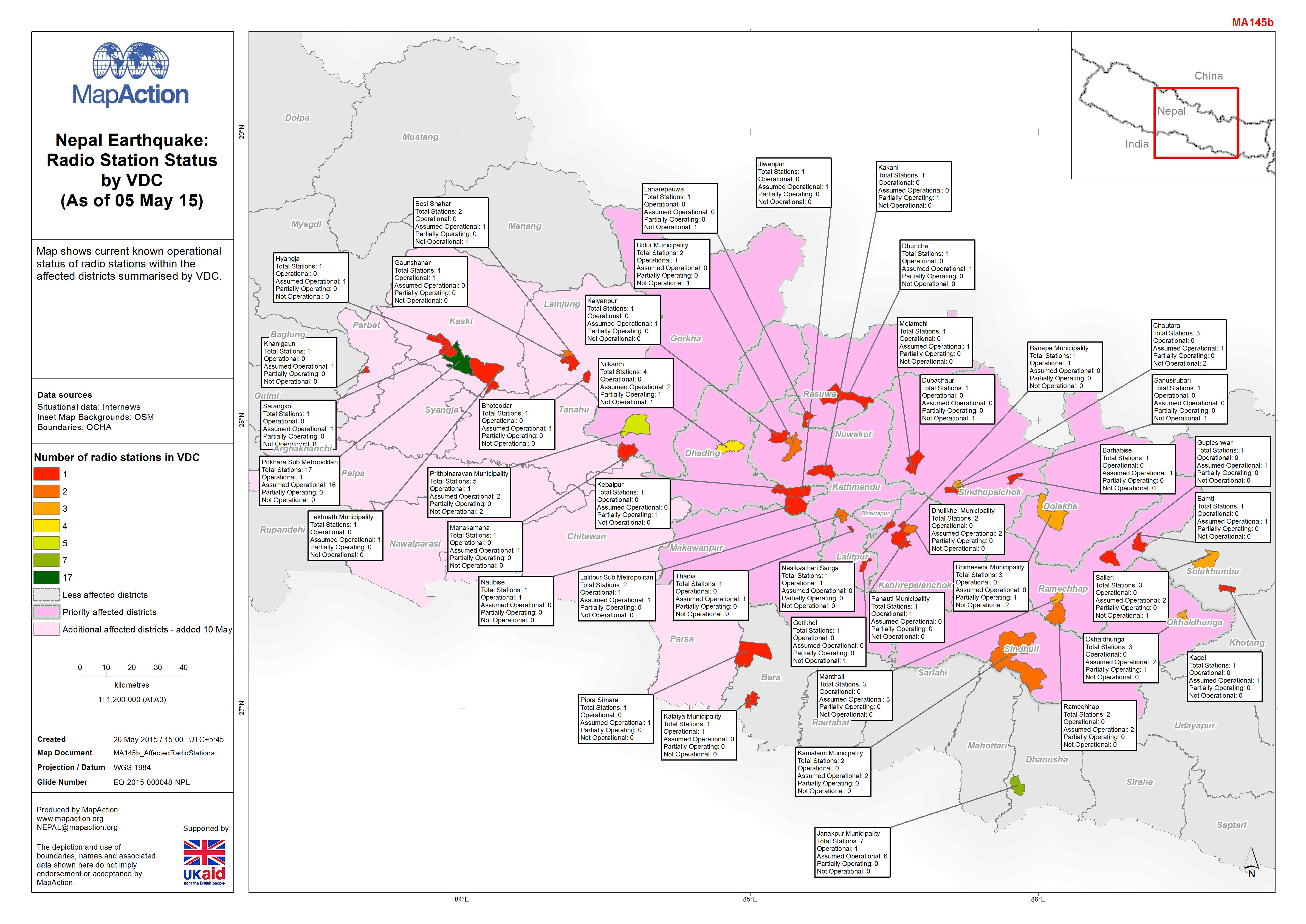
Nepal Earthquake:Radio Station Status by VDC (As of 05 May 15)
Map shows current known operational status of radio stations within the affected districts summarised by VDC. -

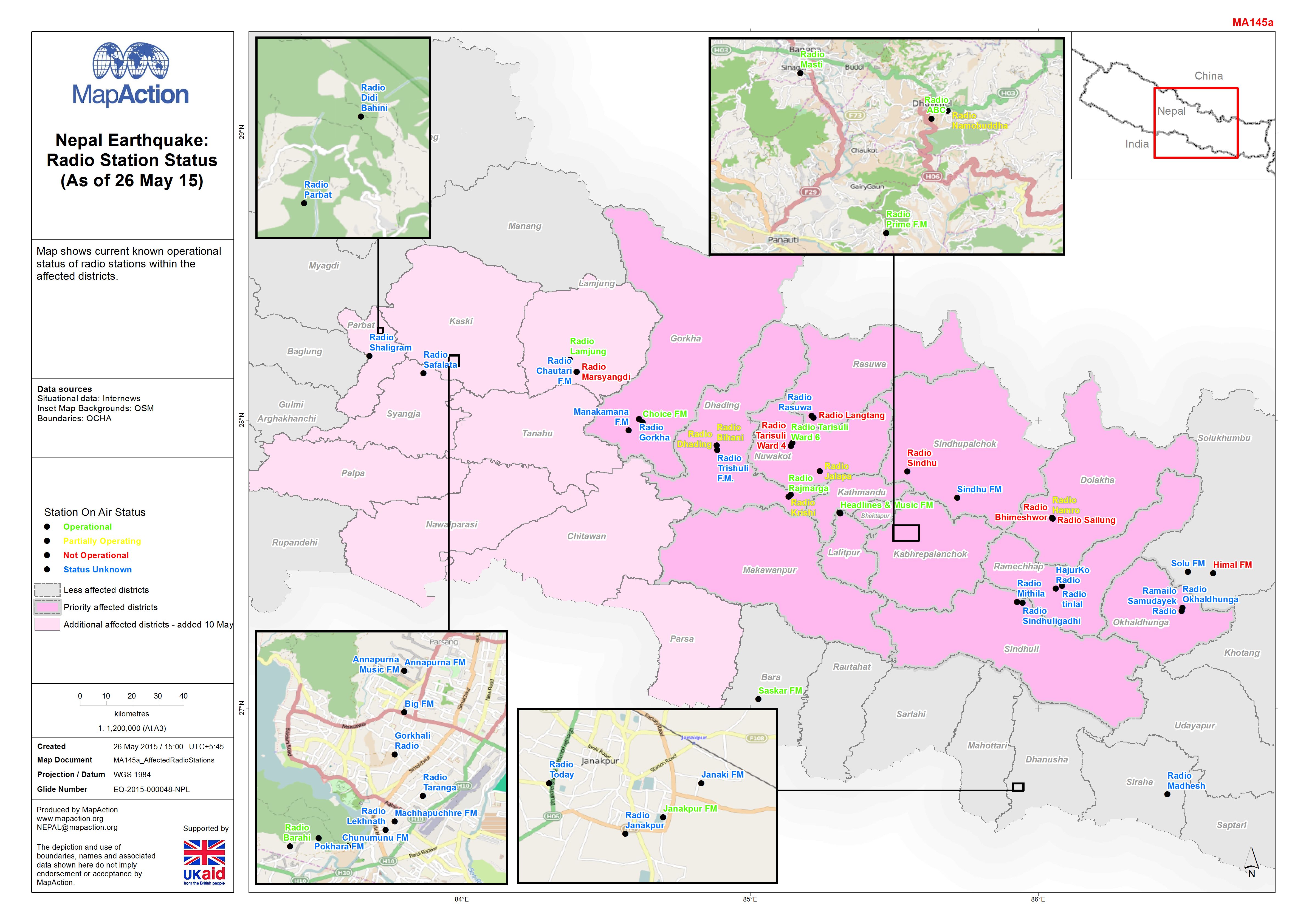
Nepal Earthquake:Radio Station Status (As of 26 May 15)
Map shows current known operational status of radio stations within the affected districts. -
Philippines TS Washi (Sendong) MIRA (Multi-Cluster Initial Rapid Assessment) ...
Telecomms issues reported by the Multi-Cluster Initial Rapid Assessment, January 2012. -
Sierra Leone: Ebola Outbreak - GSM Mobile Phone Network Coverage in Kenema Di...
Map shows the GSM mobile phone network coverage for districts in Sierra Leone, based on data received from the ETC. This is a combined coverage map for all networks operating in... -
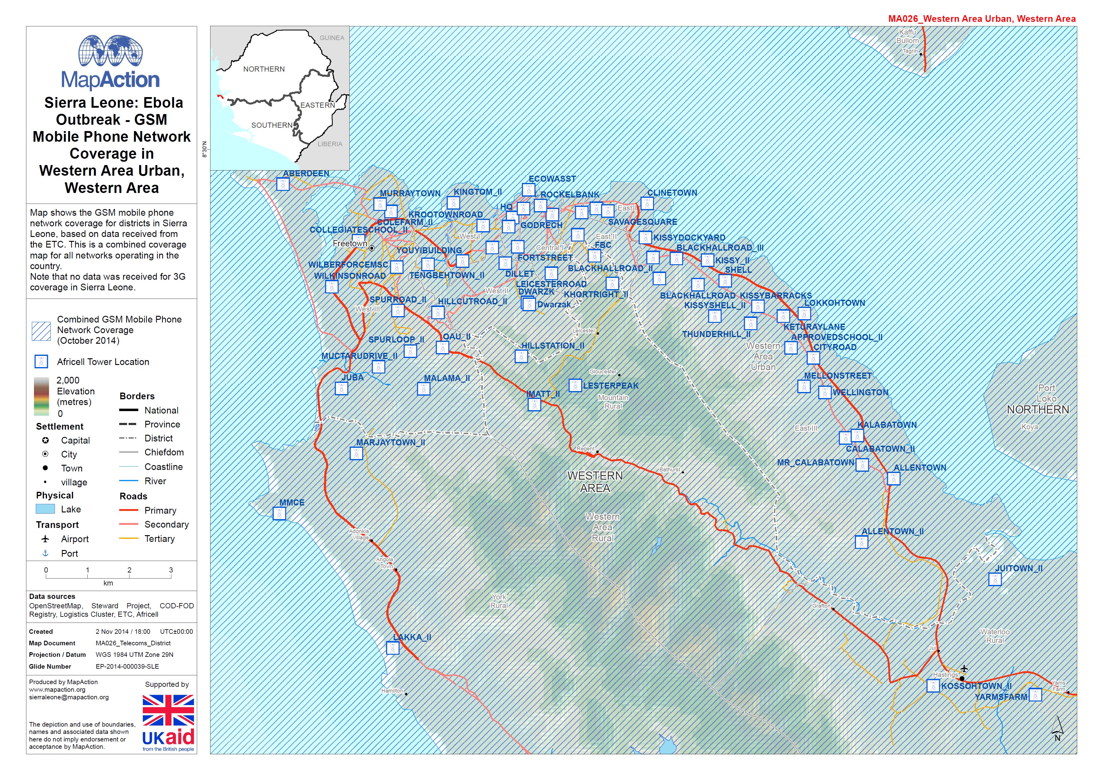
Sierra Leone: Ebola Outbreak - GSM Mobile Phone Network Coverage in Western A...
Map shows the GSM mobile phone network coverage for districts in Sierra Leone, based on data received from the ETC. This is a combined coverage map for all networks operating in... -
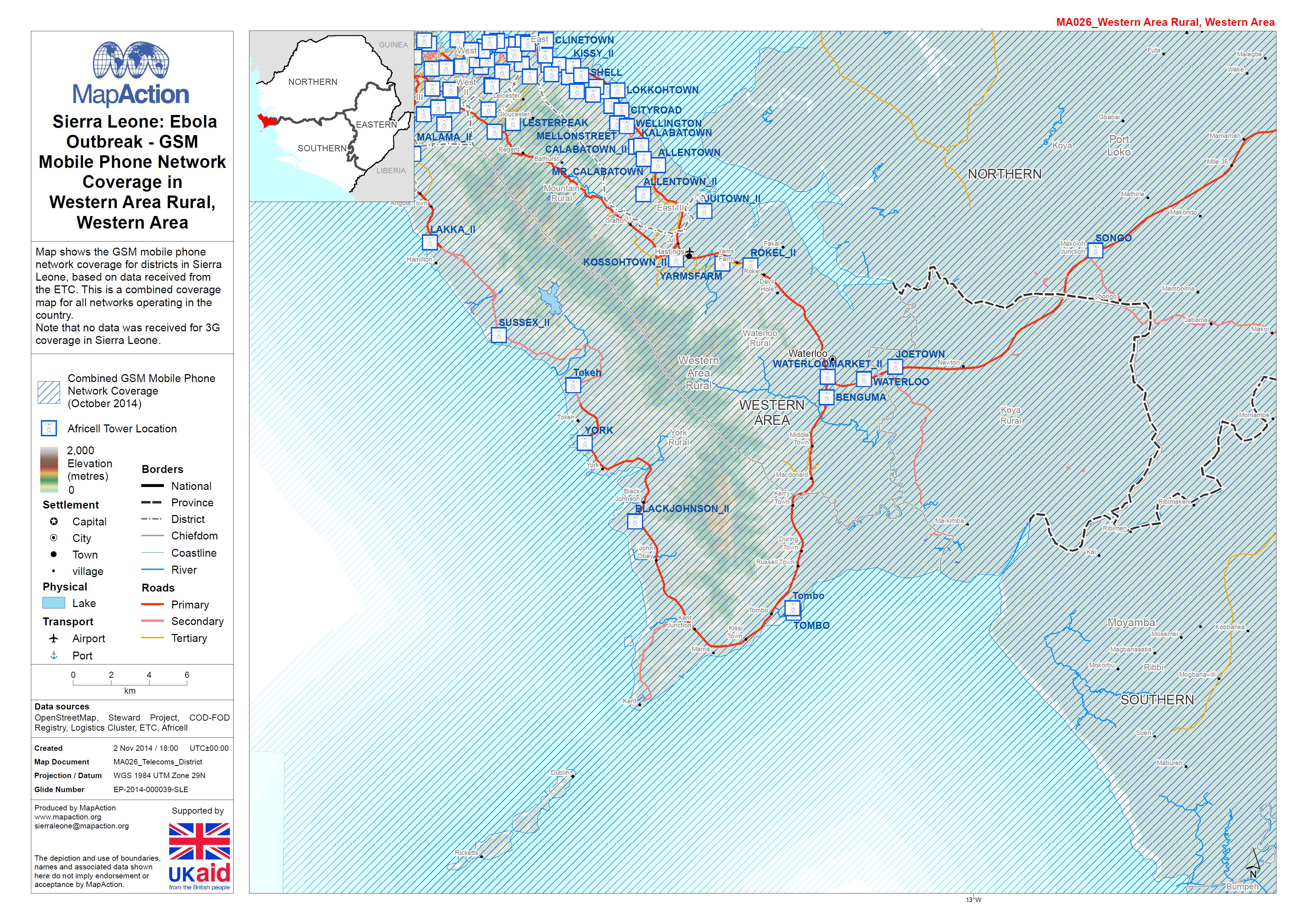
Sierra Leone: Ebola Outbreak - GSM Mobile Phone Network Coverage in Western A...
Map shows the GSM mobile phone network coverage for districts in Sierra Leone, based on data received from the ETC. This is a combined coverage map for all networks operating in... -
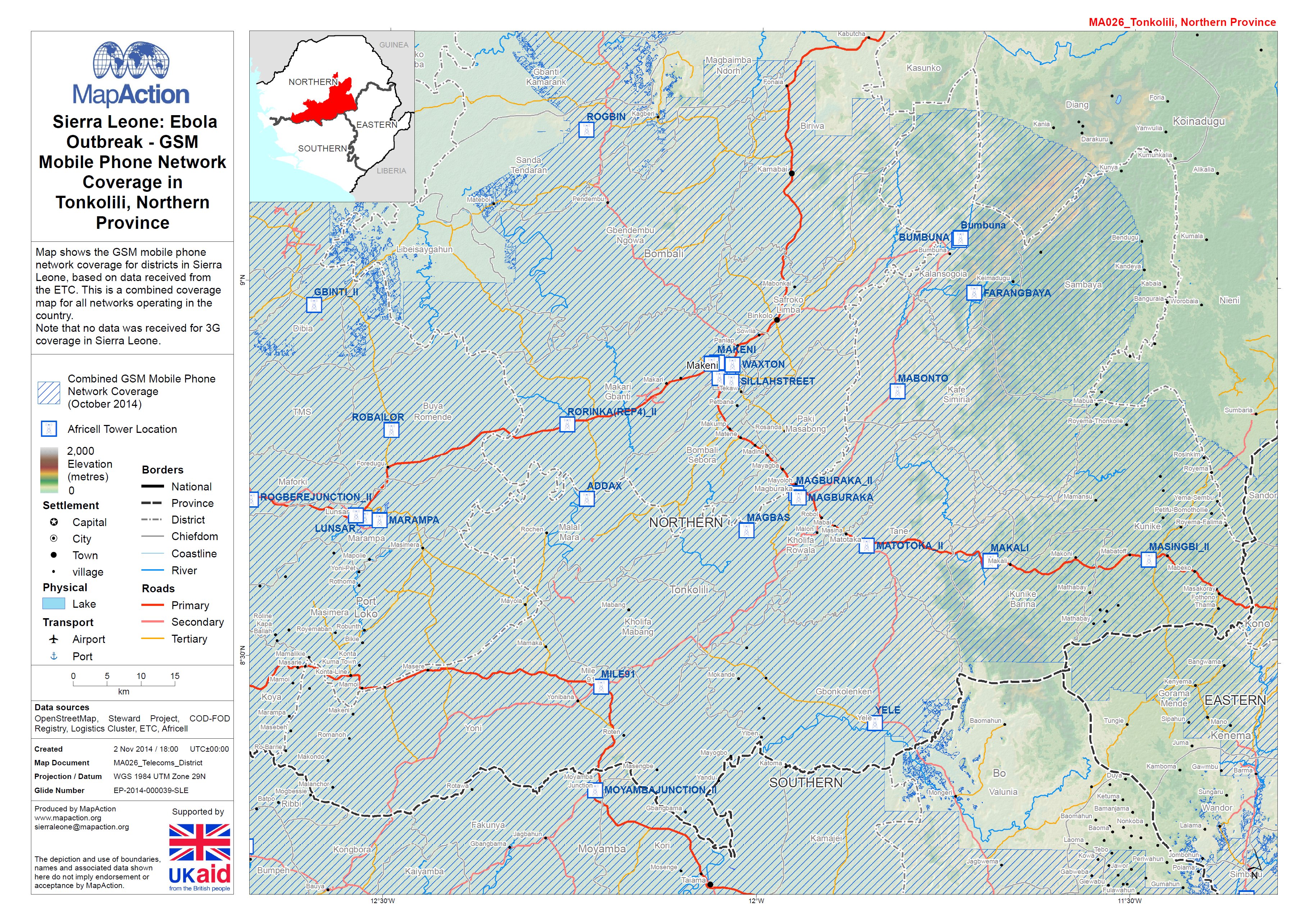
Sierra Leone: Ebola Outbreak - GSM Mobile Phone Network Coverage in Tonkolli ...
Map shows the GSM mobile phone network coverage for districts in Sierra Leone, based on data received from the ETC. This is a combined coverage map for all networks operating in... -

Sierra Leone: Ebola Outbreak - GSM Mobile Phone Network Coverage in Pujehun D...
Map shows the GSM mobile phone network coverage for districts in Sierra Leone, based on data received from the ETC. This is a combined coverage map for all networks operating in... -
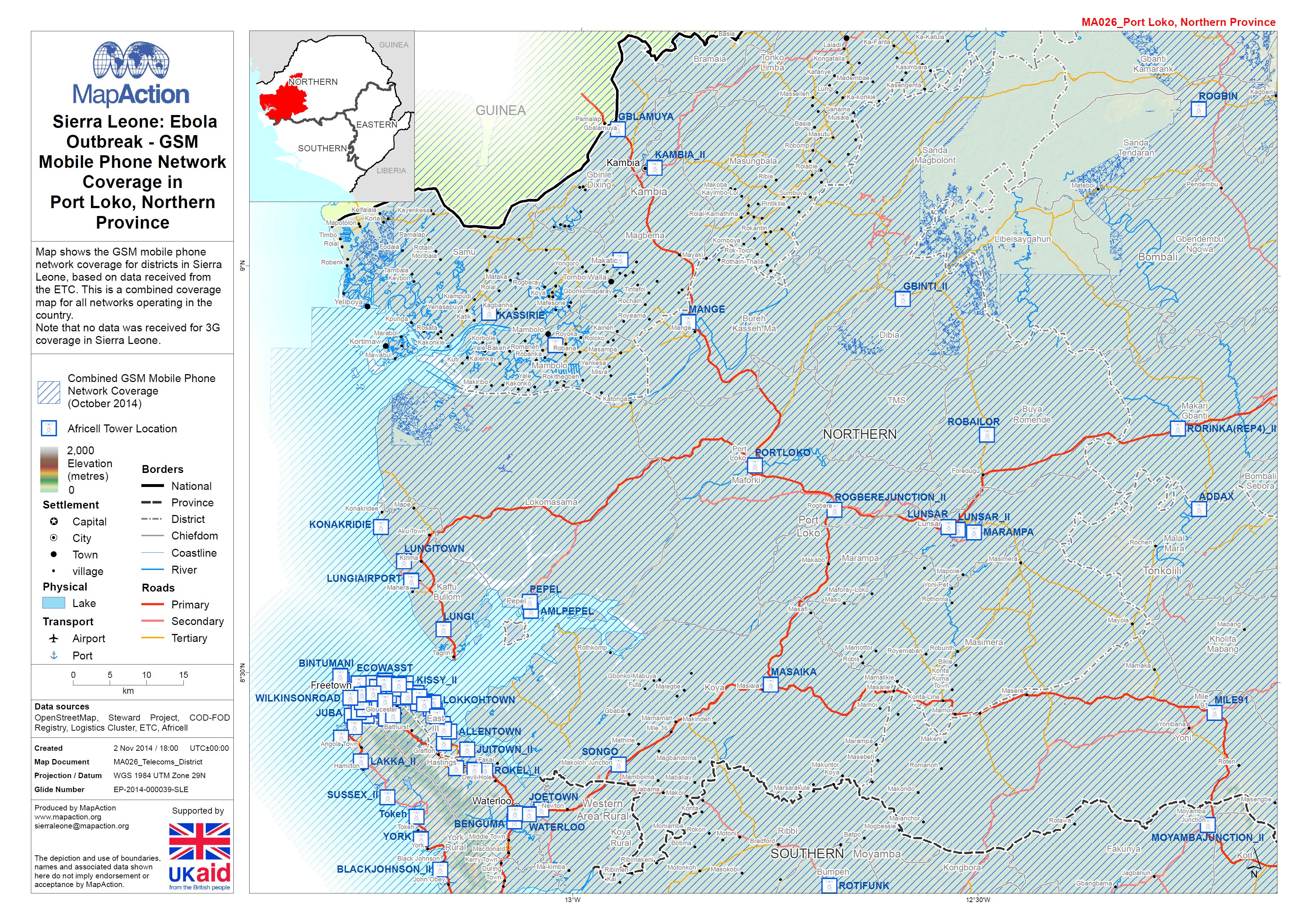
Sierra Leone: Ebola Outbreak - GSM Mobile Phone Network Coverage in Port Loko...
Map shows the GSM mobile phone network coverage for districts in Sierra Leone, based on data received from the ETC. This is a combined coverage map for all networks operating in... -
Sierra Leone: Ebola Outbreak - GSM Mobile Phone Network Coverage in Moyamba D...
Map shows the GSM mobile phone network coverage for districts in Sierra Leone, based on data received from the ETC. This is a combined coverage map for all networks operating in...