-
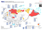
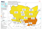
Honduras: Presencia Humanitaria por Departamento (a las 2200 el 01 Dic 2020)
Map shows the number of reported activities per Sector per Department in Honduras. Critical and High priority response areas are also shown. -
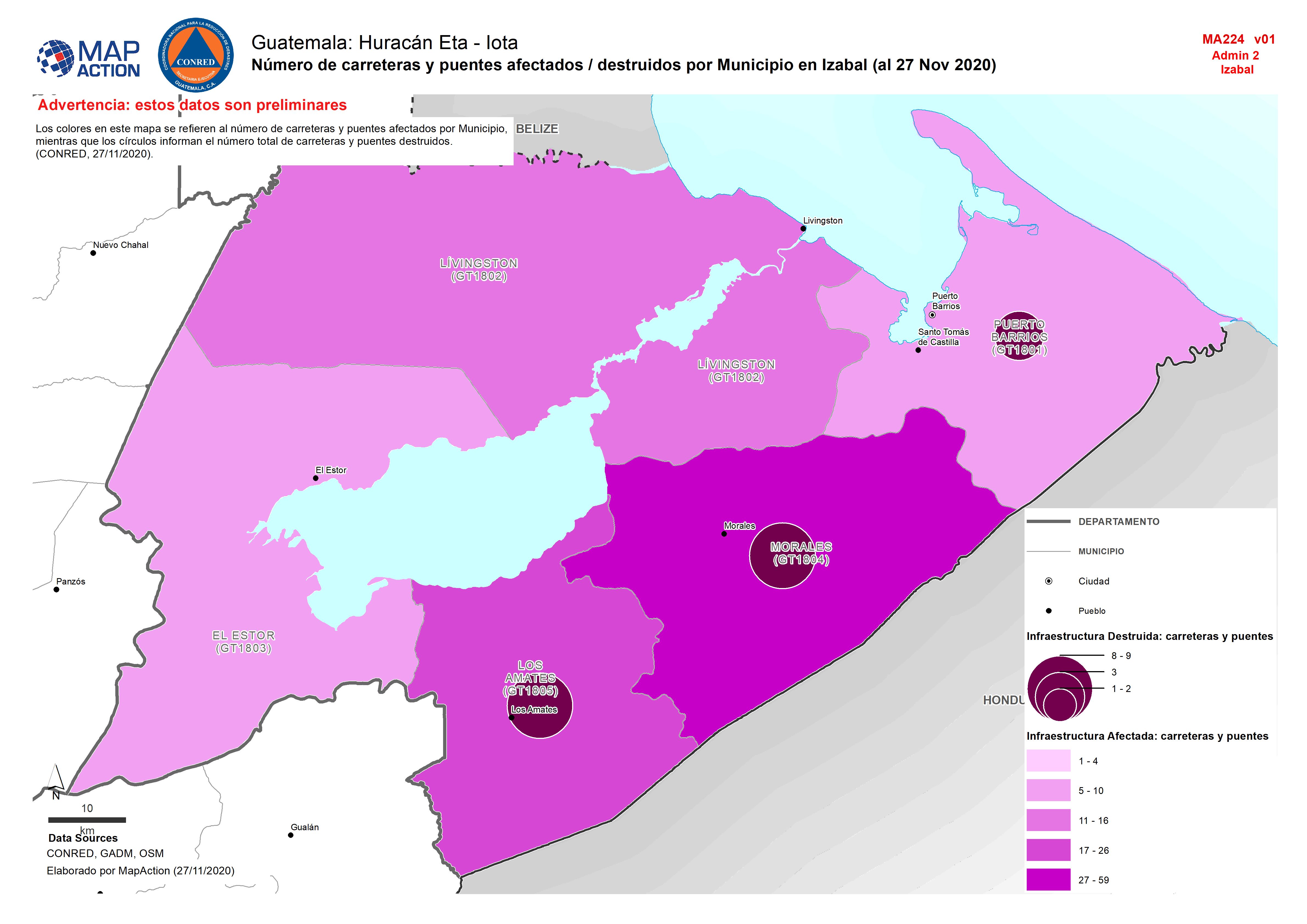
Guatemala: Número de carreteras y puentes afectados / destruidos por Municipi...
Map shows the number of destroyed and affected roads and bridges by department. -

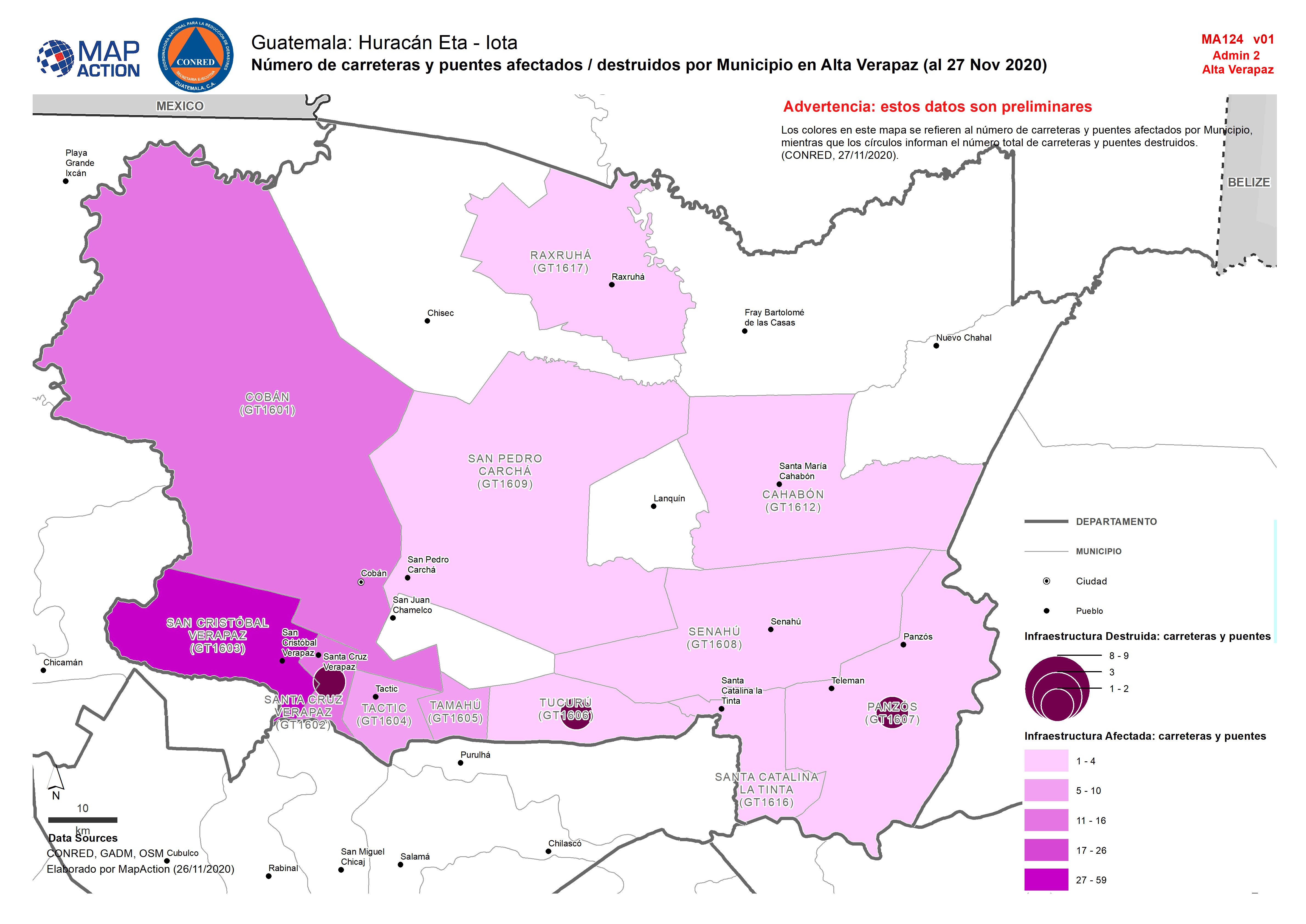
Guatemala: Número de carreteras y puentes afectados / destruidos por Municipi...
MMap shows the number of destroyed and affected roads and bridges by department. -

Guatemala: Número de escuelas afectadas por Municipio en Izabal (al 27 Nov 2020)
Número de escuelas afectadas por Municipio en Izabal (al 27 Nov 2020) -

Guatemala: Número de escuelas afectadas por Municipio en Alta Verapaz (al 27 ...
Número de escuelas afectadas por Municipio en Izabal (al 27 Nov 2020) -

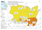
Guatemala: Affected and destroyed infrastructure by department (26th November...
Map shows the number of destroyed and affected roads and bridges by department. -

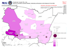
Columbia: Herramienta de Evaluación Ambiental Rápida (FEAT) y datos de destru...
Herramienta de Evaluación Ambiental Rápida (FEAT) y datos de destrucción en San Andrés, Colombia -
Colombia: Herramienta de Evaluación Ambiental Rápida (FEAT) y datos de destru...
Herramienta de Evaluación Ambiental Rápida (FEAT) y datos de destrucción en San Andrés, Colombia -
Guatemala: Food Security and Flood Threat by Municipality in Alta Verapaz
Map showing the food security classification (as of October 2020), as well as landslide threat (as of 16/11/2020) and population figures (2018) in each Municipality. -
Guatemala: Food Security and Landslide Threat in Alta Verapaz
Map showing the food security classification (as of October 2020), as well as landslide threat (as of 16/11/2020) and population figures (2018) in each Municipality. -

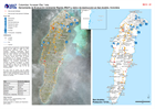
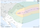
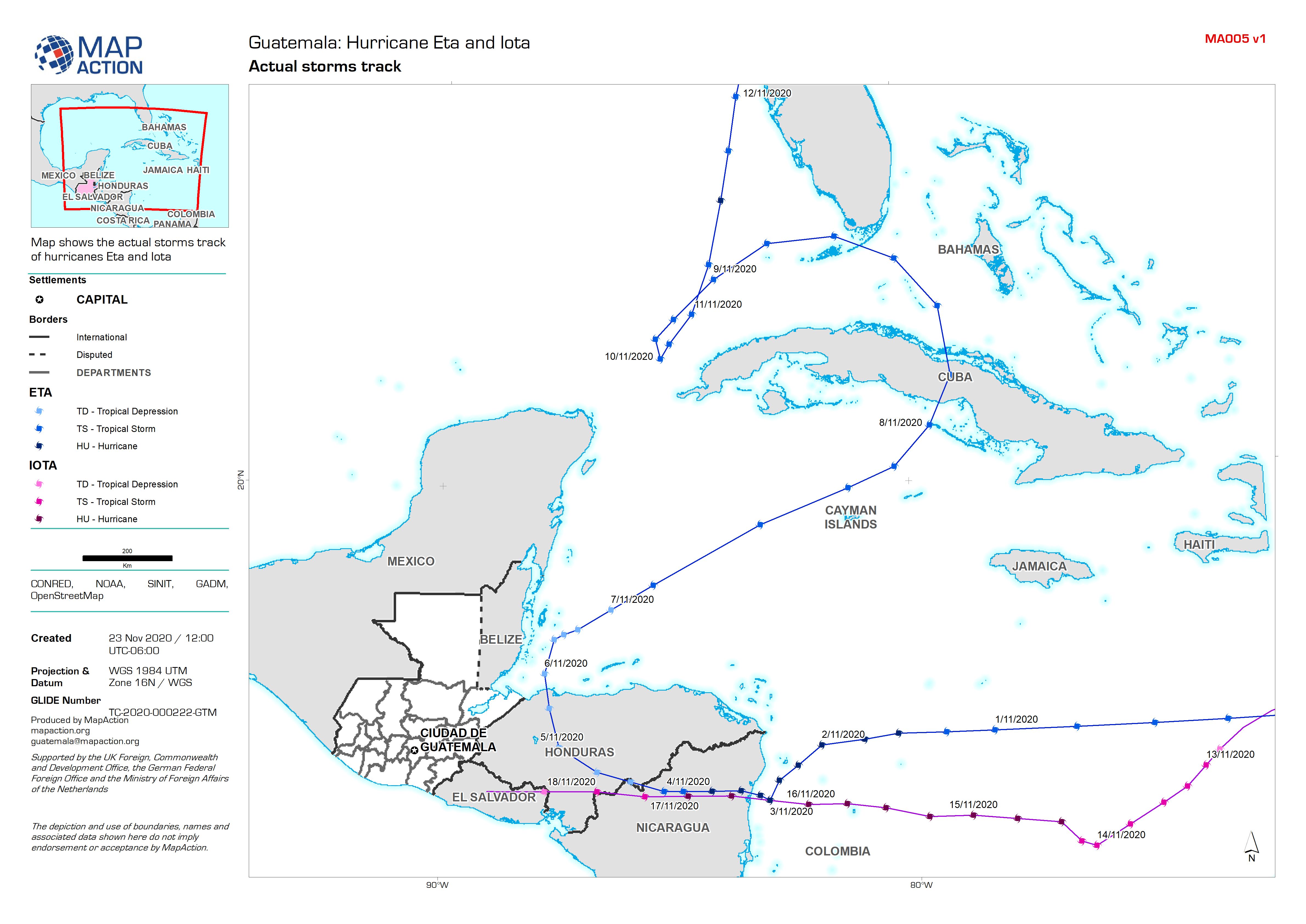
Guatemala: Actual storm tracks
Map shows the actual storms track of hurricanes Eta and Iota -
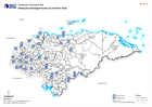
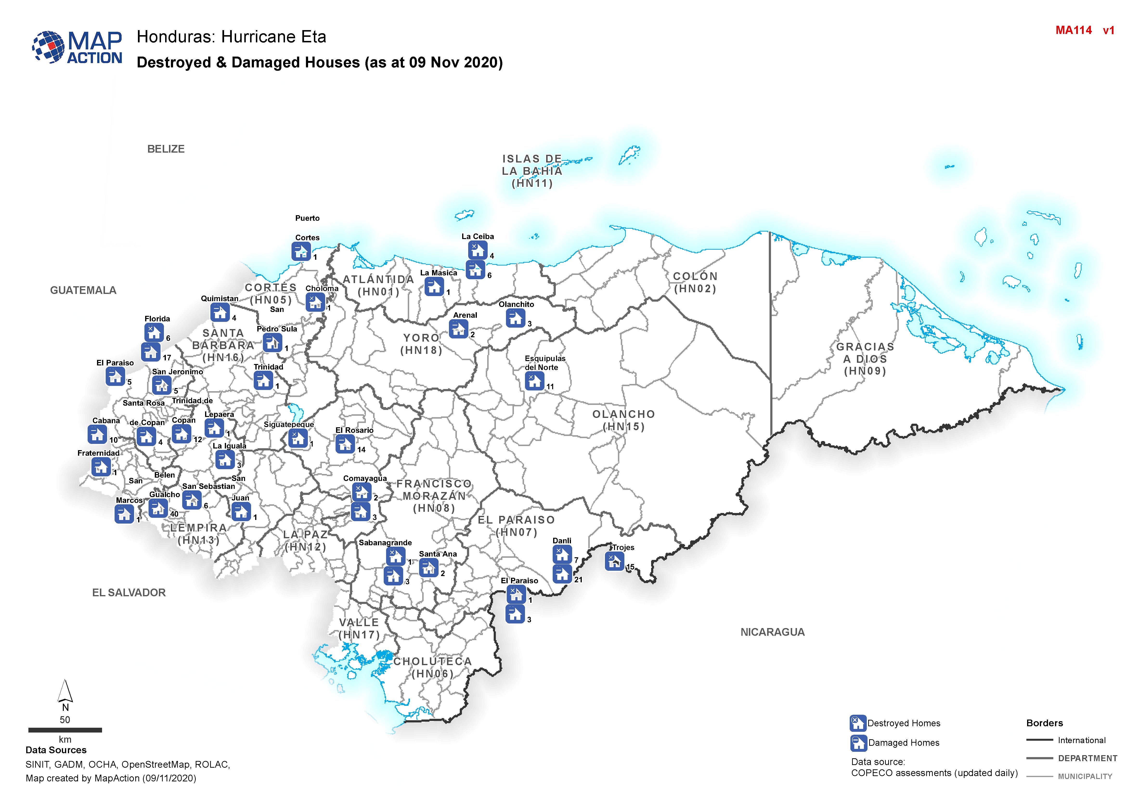
Honduras: Destroyed & Damaged Houses (as at 09 Nov 2020)
Honduras, Destroyed & Damaged Houses per Municipality as of 09th Nov 2020 -

Centro América: Huacán Iota - Trayectoria potencial de Iota e inundaciones de...
This map shows the storm track for hurricane Iota, with potentially affected administrative departments for Nicaragua and Honduras. It also includes previous flooded areas from... -
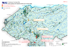
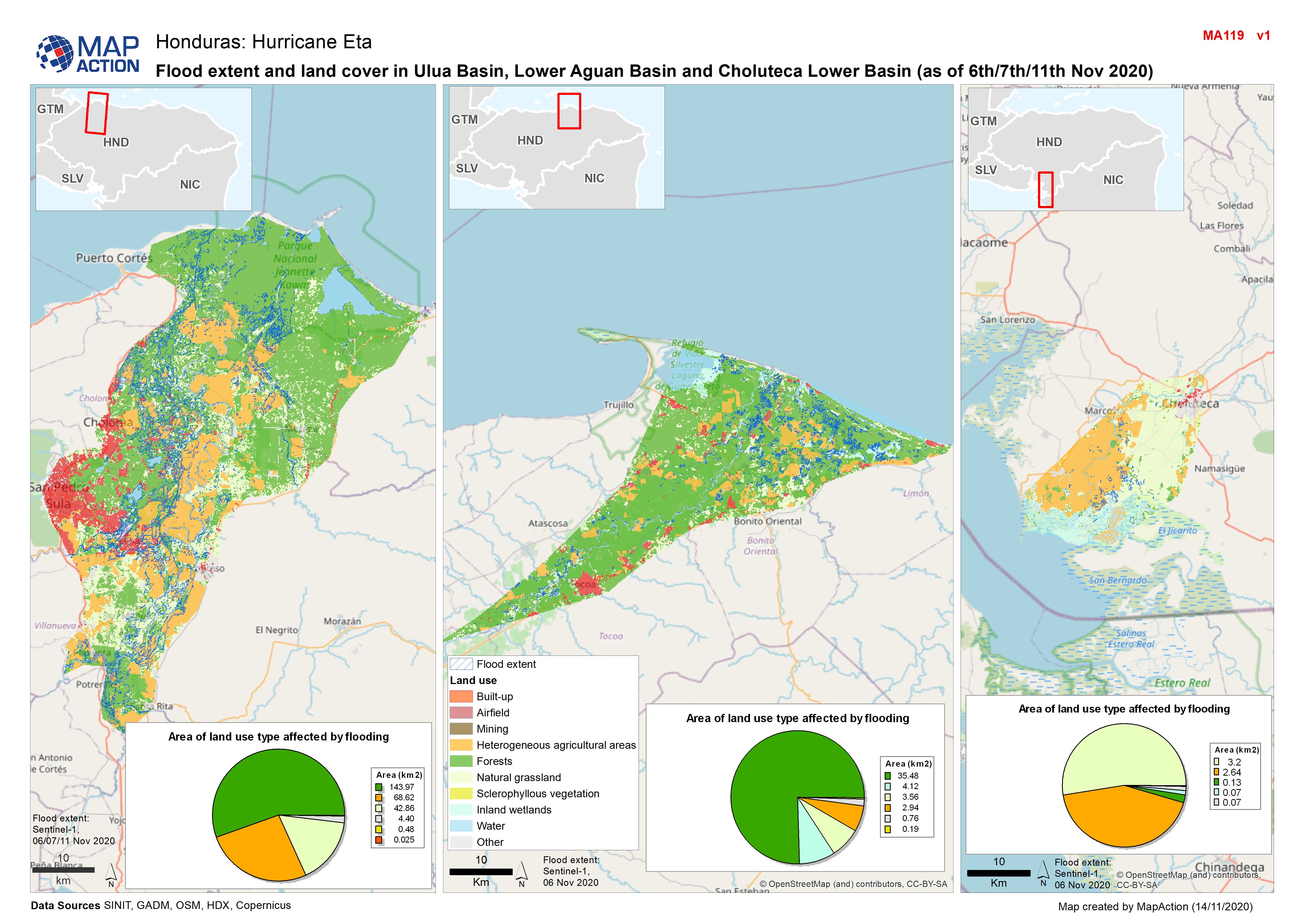
Honduras: Flood extent and land cover in Ulua Basin, Lower Aguan Basin and Ch...
Map shows flood extents and land use in Ulua Basin, Lower Aguan Basin and Choluteca Lower Basin (as at 6th/11th Nov 2020) -

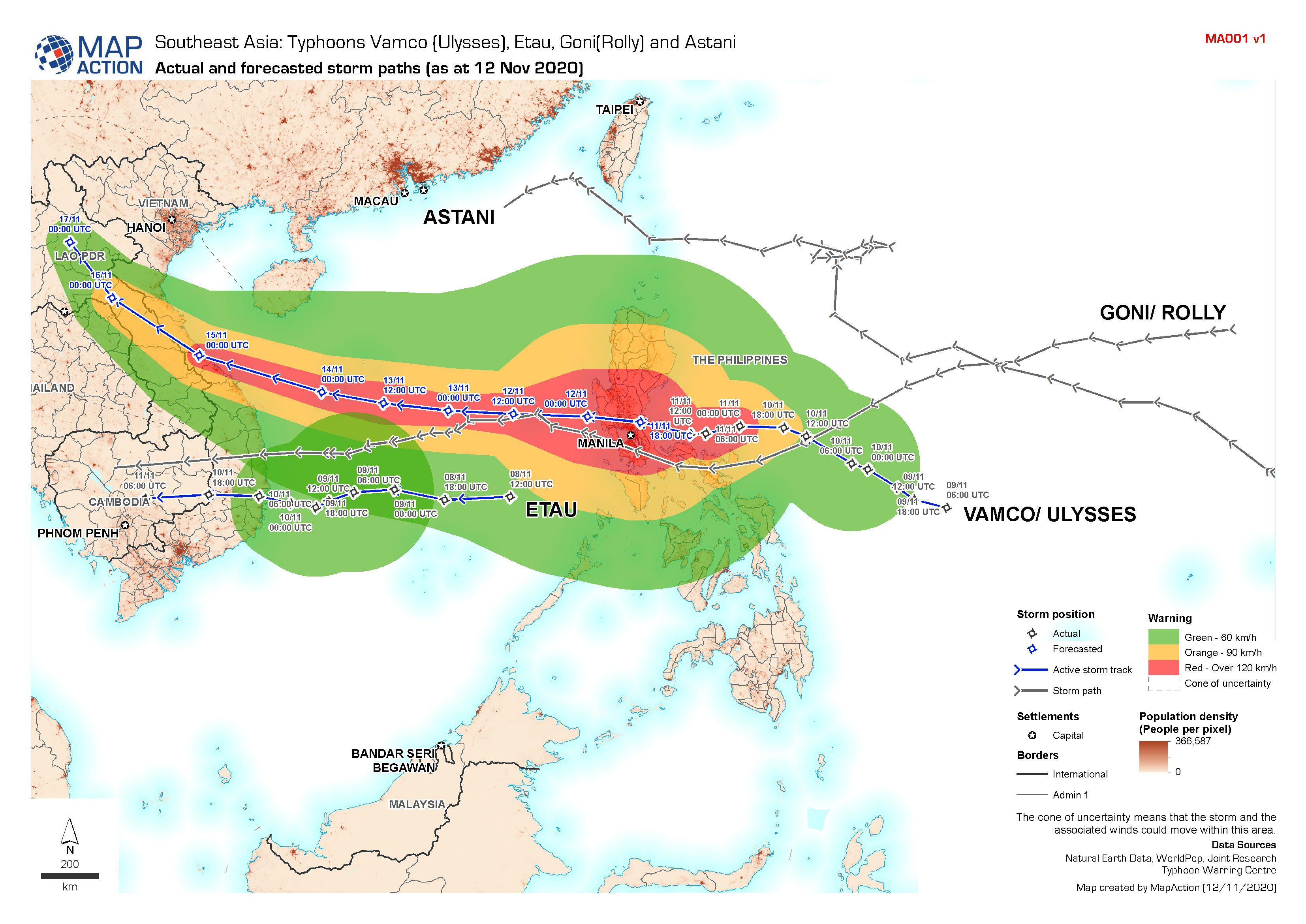
Southeast Asia Typhoons: Actual and forecasted storm paths (as at 12 Nov 2020)
Map shows the tracks of Typhoons Vamco (Ulysses), Etau, Goni (Rolly) and Astani. -

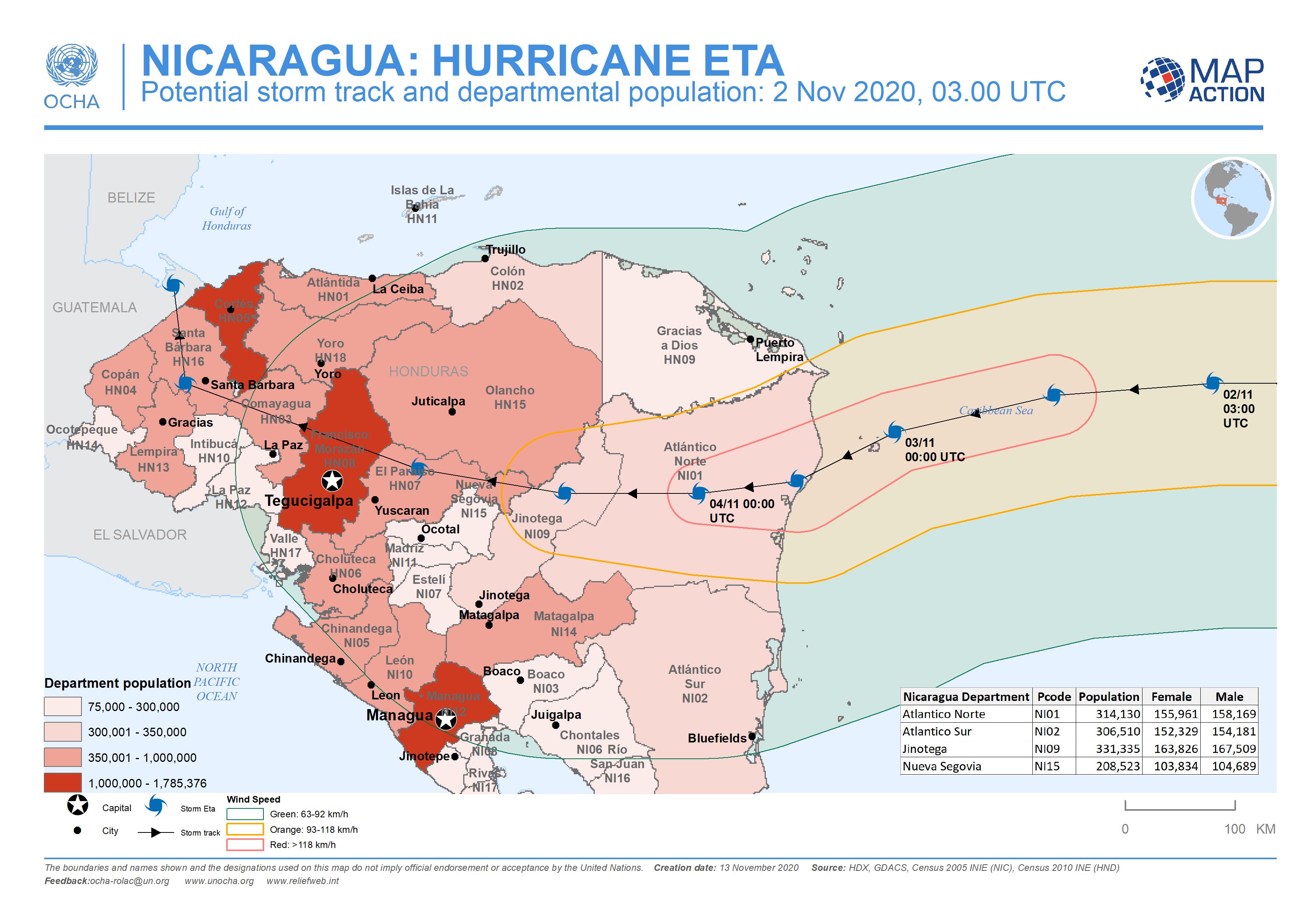
Nicaragua: Potential storm track and departmental population: 2 Nov 2020, 03....
This map shows the potentially affected administration level 1 departments for Nicaragua and Honduras, with departmental population and predicted wind speed cones. -

Nicaragua: Potential storm track, elevation and municipalities: 4 Nov 2020, 0...
This map shows the Hurricane Eta affected administration level 2 municipalities for Nicaragua with predicted wind speed cones, aganst elevation data and settlement locations. -

Nicaragua: Potential storm track, elevation and municipalities: 3 Nov 2020, ...
This map shows the affected administration level 2 municipalities for Nicaragua, with population estimates and predicted wind speed cones. -
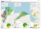
Honduras: Dam locations and capacity levels (as of 10 Nov 2020)
Honduras, Dam locations and capacity levels as of 10th Nov 2020 - including additional settlements and population density. -
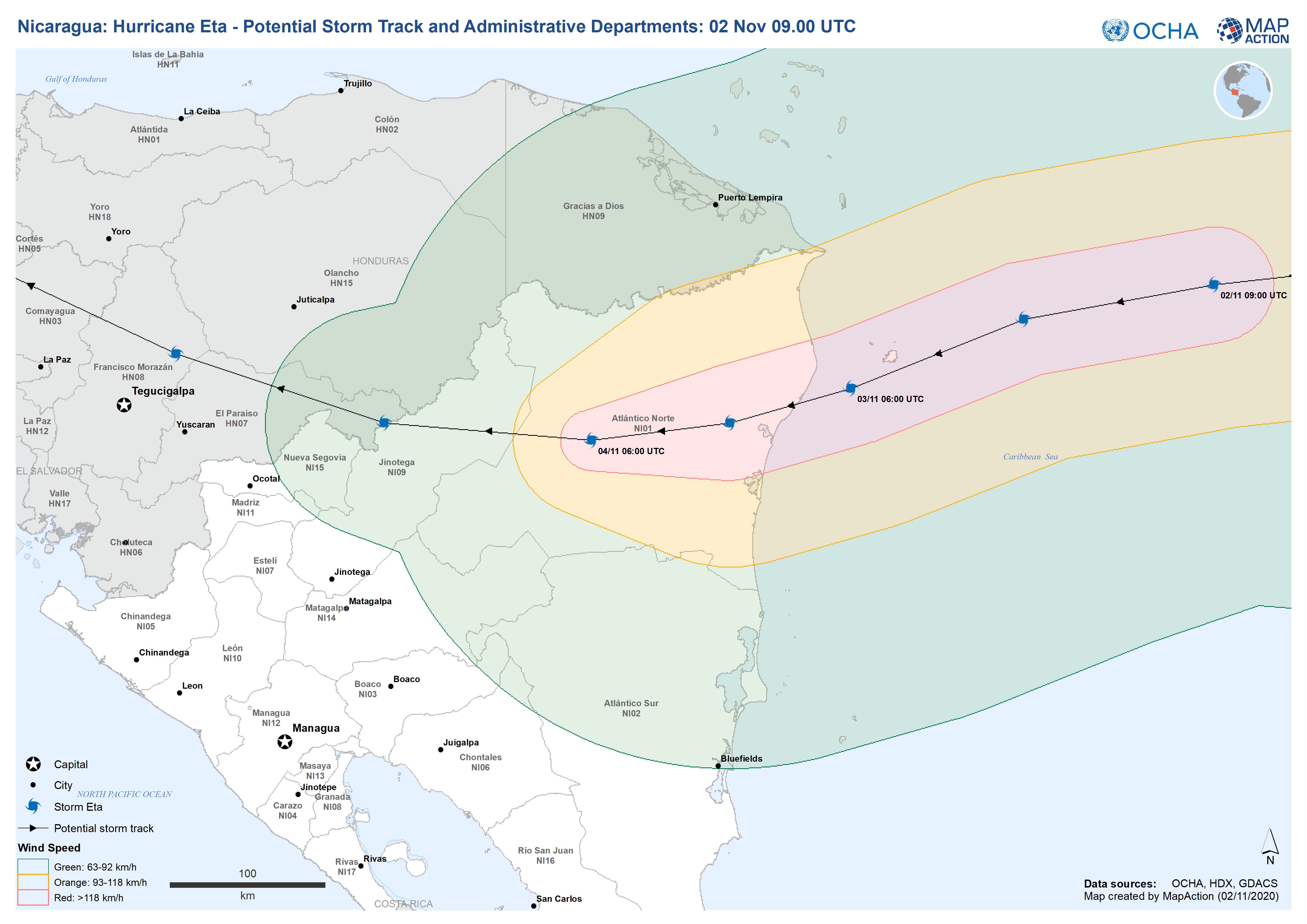
Nicaragua: Hurricane Eta - Potential Storm Track and Administrative Departmen...
This map shows the potential storm track for hurricane Eta with administration level 1 departments for Nicaragua and Honduras.