-

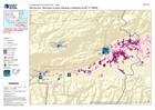
Presencia humanitaria: quién hace qué, dónde en cada municipio, departmento: ...
Mapbook shows who is delivering Sector activities, per Municipality in Honduras. Population density, number of shelters and occupants per Municipality -

Honduras: Presencia humanitaria: quién hace qué, dónde en cada municipio, dep...
Mapbook shows who is delivering Sector activities, per Municipality in Honduras. Critical and High priority response areas with population density, number of shelters and... -

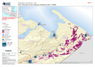
Guatemala: Persons evacuated and in shelter (26 November 2020)
Map shows the number of reported activities per Sector per Department in Guatemala. Critical and High priority response areas are also shown. -

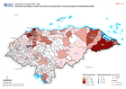
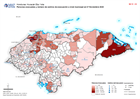
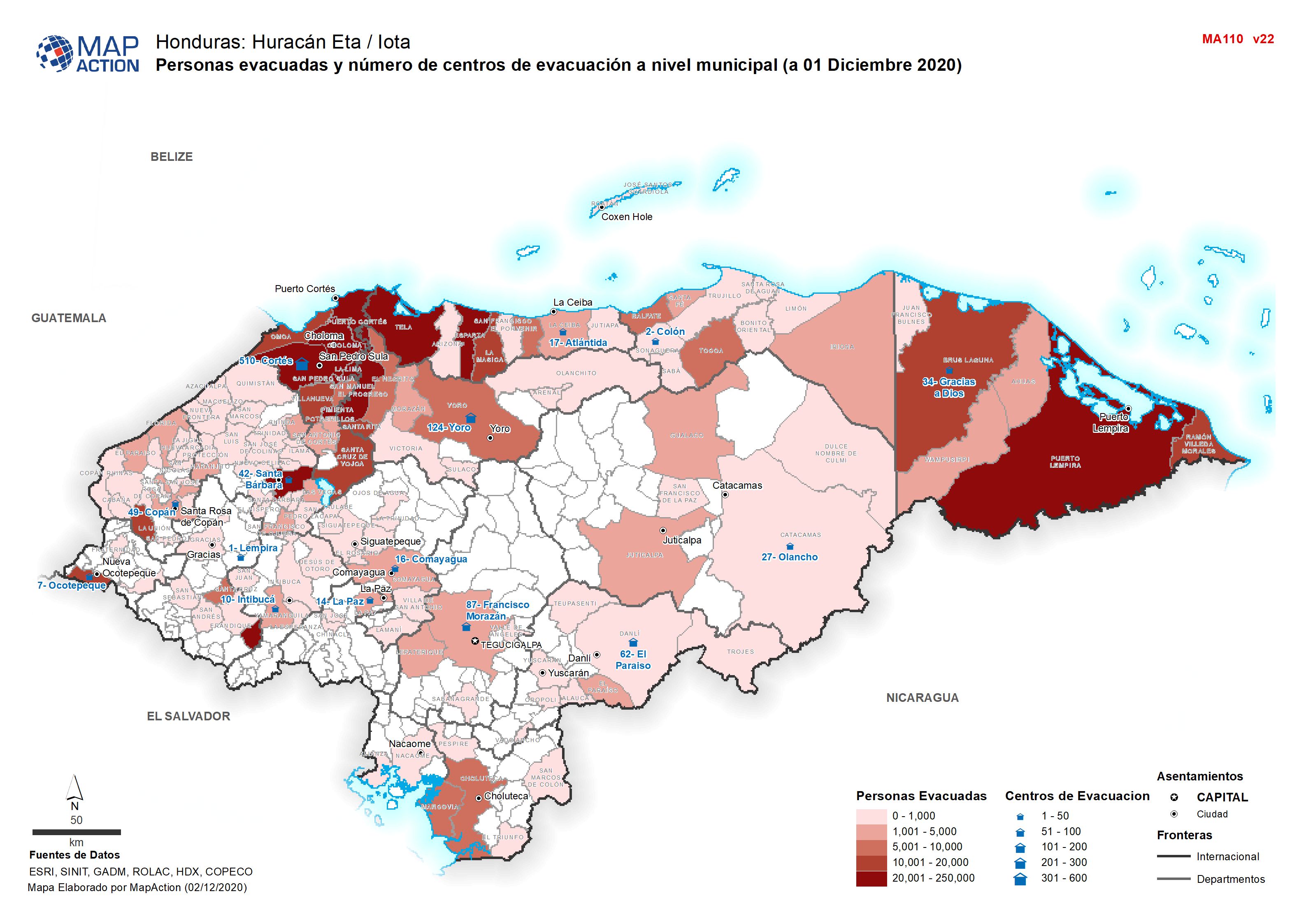
Honduras: Personas evacuadas y número de centros de evacuación a nivel munici...
Personas evacuadas y número de centros de evacuación a nivel municipal (a 01 Diciembre 2020 -

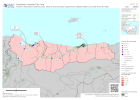
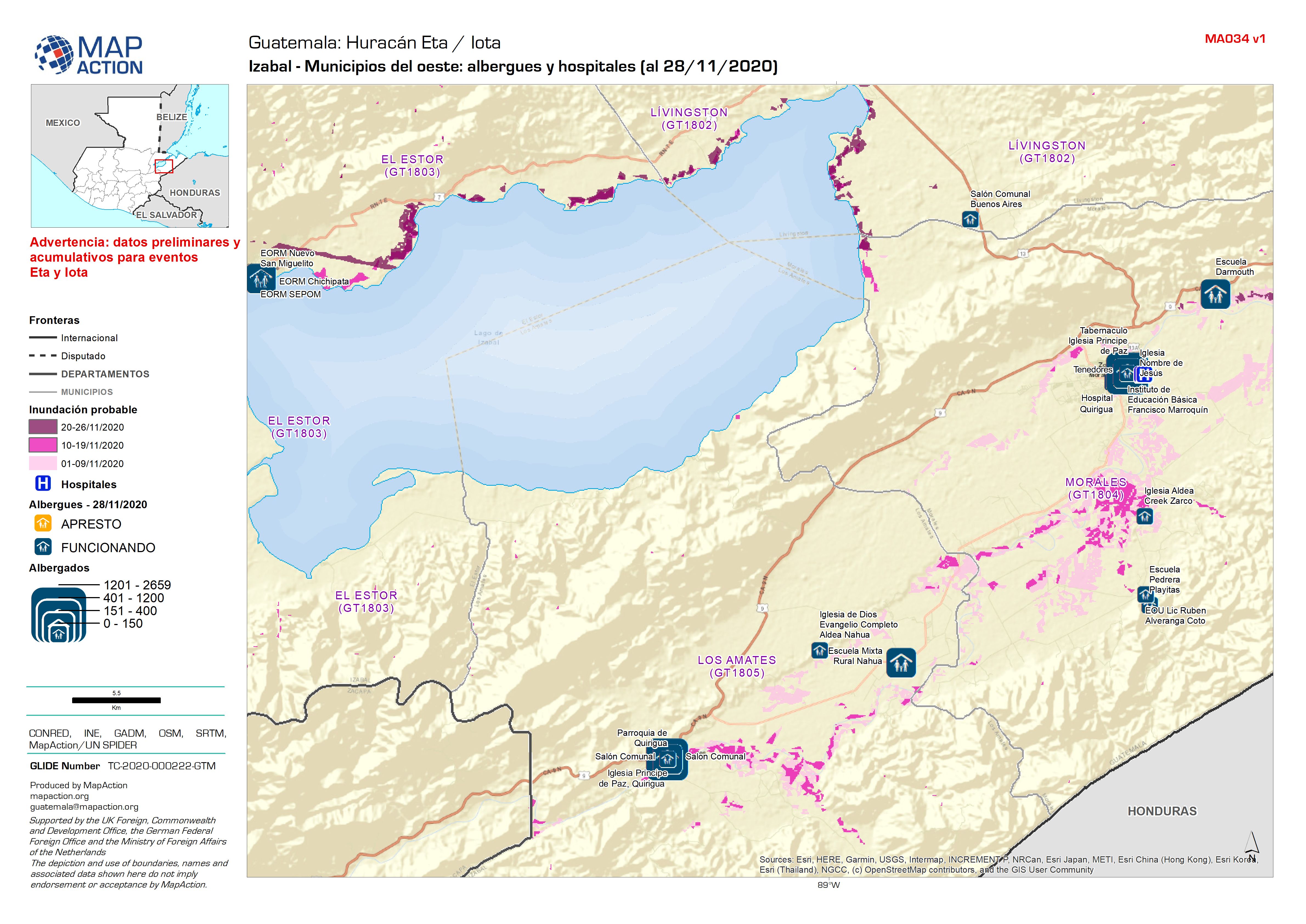
Guatemala: Izabal - Municipios del oeste: albergues y hospitales (al 28/11/2020)
Shelters and Hospitals -
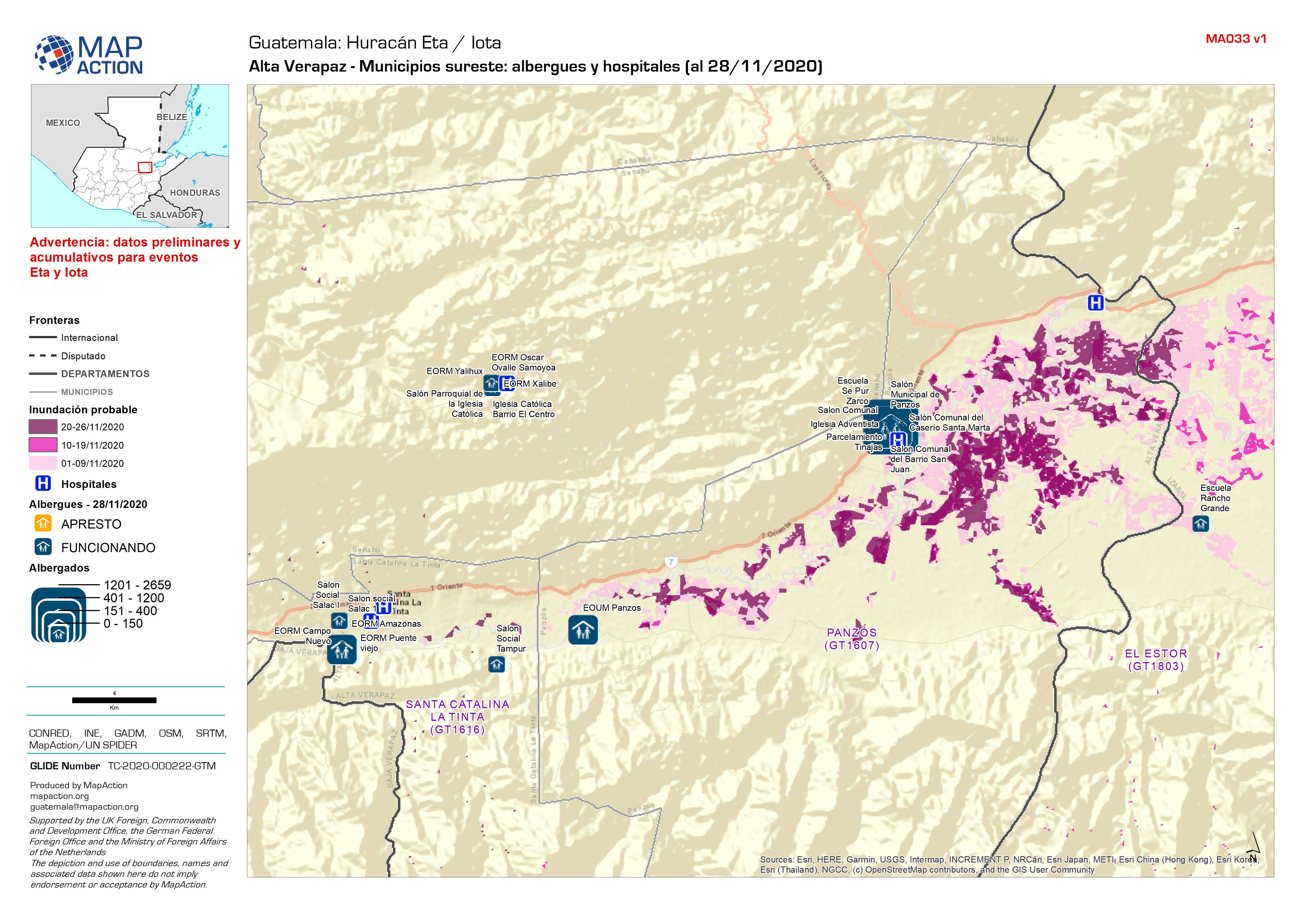
Guatemala: Alta Verapaz - Municipios sureste: albergues y hospitales (al 28/1...
Shelters and Hospitals -
Guatemala: Izabal - Municipios del este: albergues y hospitales (al 28/11/2020)
Shelters and Hospitals -
Honduras: Presencia humanitaria: quién hace qué, dónde en cada municipio, dep...
Mapbook shows the number of reported activities per Sector, and who is delivering them, per Municipality in Honduras. Critical and High priority response areas and satellite... -

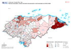
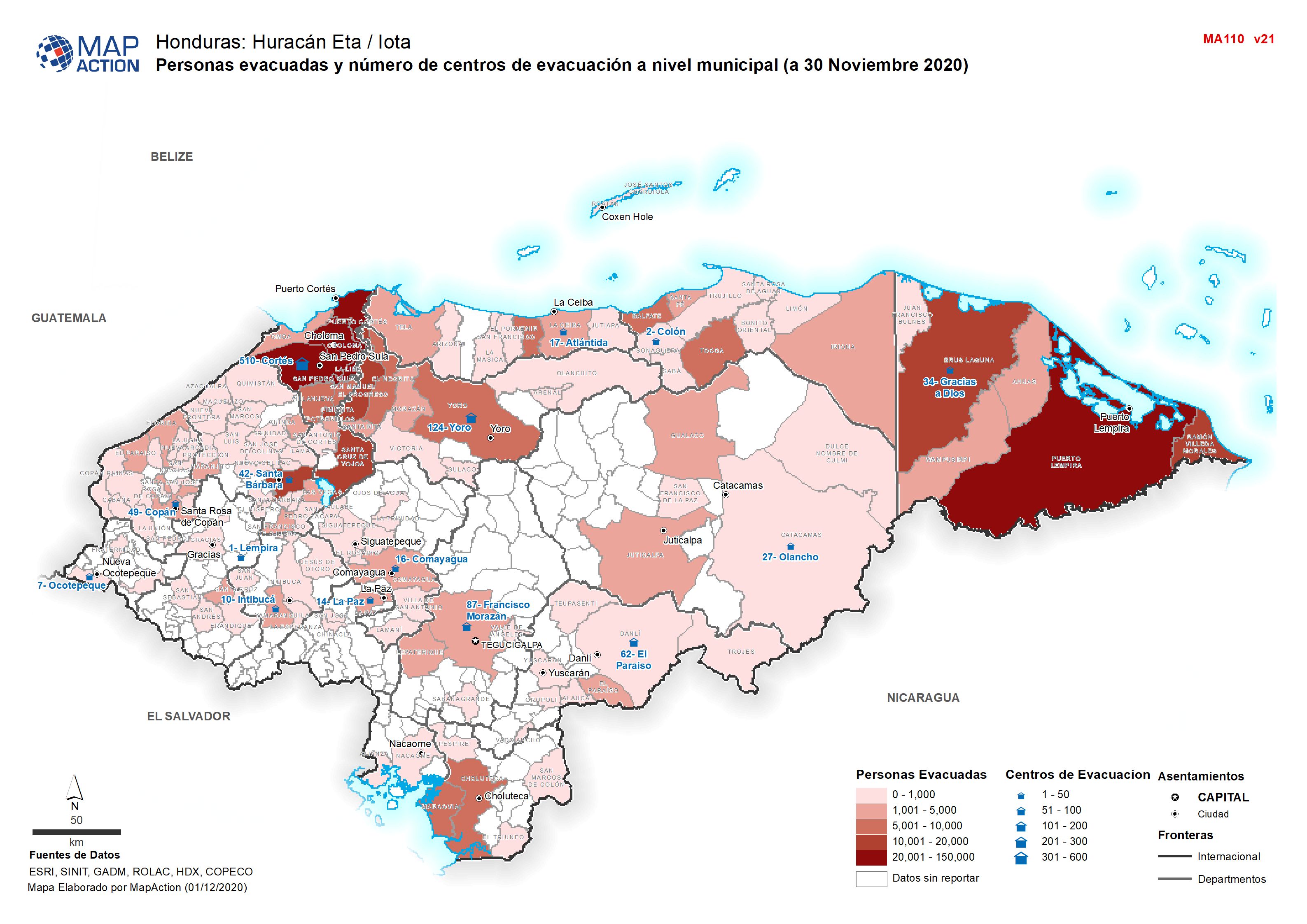
Honduras: Personas evacuadas y número de centros de evacuación a nivel munici...
Personas evacuadas y número de centros de evacuación a nivel municipal (a 30 Noviembre 2020 -

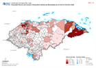
Honduras: Personas evacuadas y número de centros de evacuación a nivel munici...
Personas evacuadas y número de centros de evacuación a nivel municipal (el 29 Noviembre 2020 -

Honduras: Centros de evacuación por Municipio (el 27 Noviembre 2020)
Shelter situation by Municipality as on 27 Nov 2020. Maps are created only where the number of affected people is greater than 10,000. -
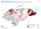
Honduras: Personas evacuadas y número de centros de evacuación a nivel munici...
Personas evacuadas y número de centros de evacuación a nivel municipal (el 27 Noviembre 2020 -
Honduras: Personas evacuadas y número de centros de evacuación a nivel munici...
Personas evacuadas y número de centros de evacuación a nivel municipal (el 27 Noviembre 2020 -
Honduras: Personas evacuadas y número de centros de evacuación a nivel munici...
Personas evacuadas y número de centros de evacuación a nivel municipal (a el 26 Nov 2020) -
Honduras: Centros de evacuación por Municipio (el 27 Noviembre 2020)
Shelter situation by Municipality as on 27 Nov 2020. Maps are created only where the number of affected people is greater than 10,000. -

Honduras: Evacuated Persons and number of Evacuation Centres per Municipality...
Map shows evacuated persons and number of evacuation centres per Municipality (as at 19:00 on 23rd Nov 2020) -
Honduras: Evacuated Persons and number of Evacuation Centres per Municipality...
Map shows evacuated persons and number of evacuation centres per Municipality (as at 16:00 on 23rd Nov 2020) -
Honduras: Evacuated Persons and number of Evacuation Centres per Municipality...
Map shows evacuated persons and number of evacuation centres per Municipality (as at 12:00 on 22nd Nov 2020) -

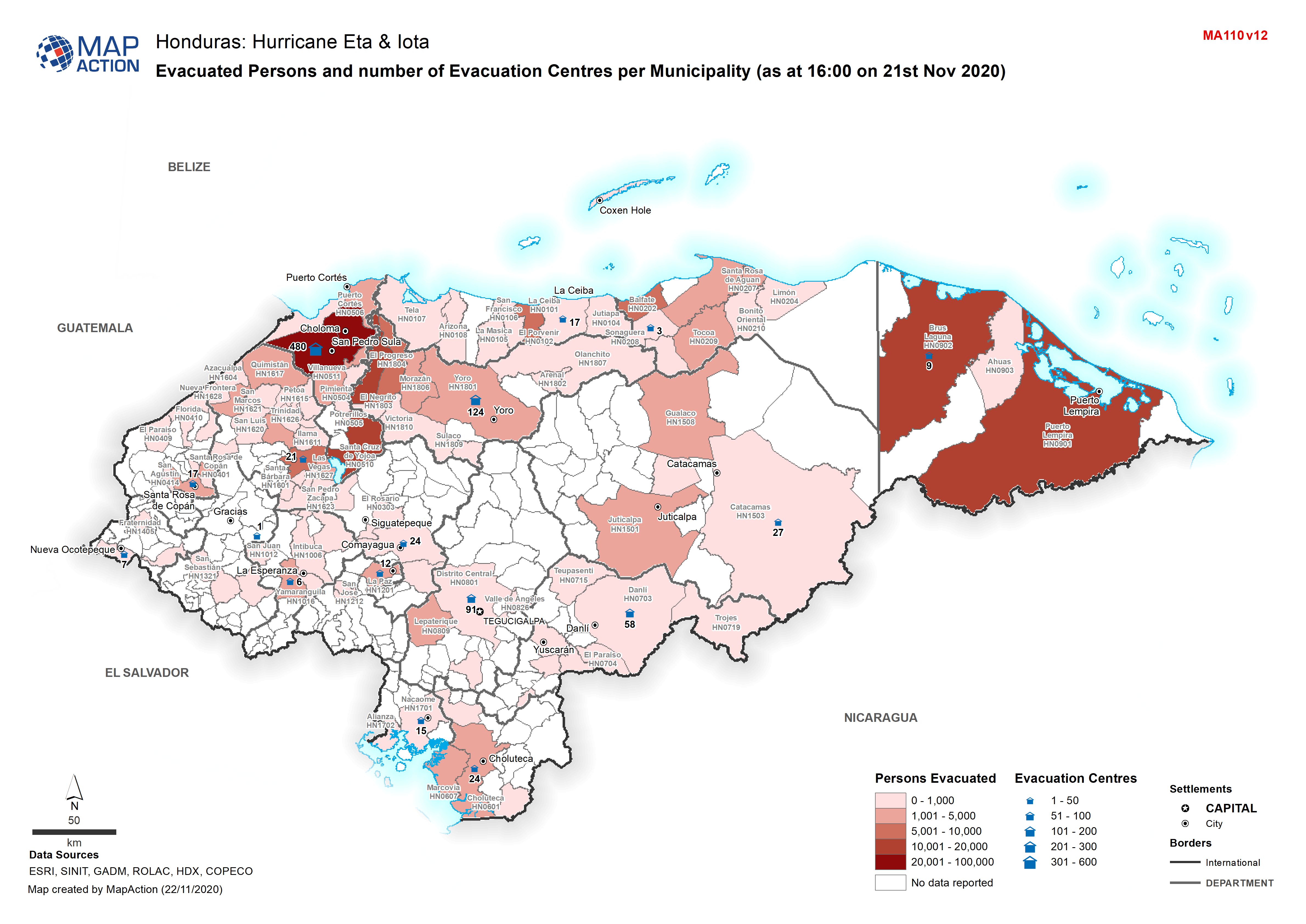
Honduras: Evacuated Persons and number of Evacuation Centres per Municipality...
Map shows evacuated persons and number of evacuation centres per Municipality (as at 16:00 on 21st Nov 2020) -
Honduras: Evacuated Persons and number of Evacuation Centres per Municipality...
Map shows evacuated persons and number of evacuation centres per Municipality (as at 04:00 on 20th Nov 2020)