-
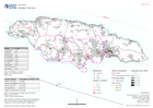
Situation Overview
Situation overview as of 08 July 2024. Showing settlements, baseline population, affected areas for assessment and populated evacuation centers -

Número de viviendas impactadas: (datos reportados Abril 27, 2023).
Representación de la número de casas afectadas, inhabitables y destruidas en el departamentos de Lambayeque. -

Número de viviendas impactadas (datos reportados Abril 26, 2023).
Representación de la número de casas afectadas, inhabitables y destruidas en el departamentos de Lambayeque, Piura y Tumbes. -

Número de viviendas impactadas (datos reportados Abril 23, 2023).
Representación de la número de casas afectadas, inhabitables y destruidas en el departamentos de Lambayeque, Tumbes y Piura. -

Población impactada y número de personas en albergues: Lambayeque - (datos re...
Representación de la población impactada por inundación y el numero de albergues por distrito en Lambayeque. -
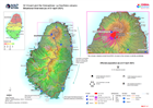
Situational Overview (as of 21 April 2021)
Map shows the situational overview of the current events and activities as a result of the ongoing eruption of the La Soufrière volcano. -

HONDURAS: TORMENTAS TROPICALS ETA - Noroeste municipios afectados y personas ...
This map shows the affected administration level 2 municipalities for north-west Honduras, population by 30m square (facebook), flood extents (satellite data from 5-9 and 13-17... -

Honduras: Tormentas Tropicals ETA - Noroeste municipios afectados y personas ...
This map shows the affected administration level 2 municipalities for north-west Honduras, population by 30m square (facebook), flood extents (satellite data from 5-9 and 13-17... -

Guatemala: Persons evacuated and in shelter (26 November 2020)
Map shows the number of reported activities per Sector per Department in Guatemala. Critical and High priority response areas are also shown. -
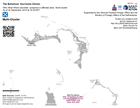
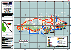
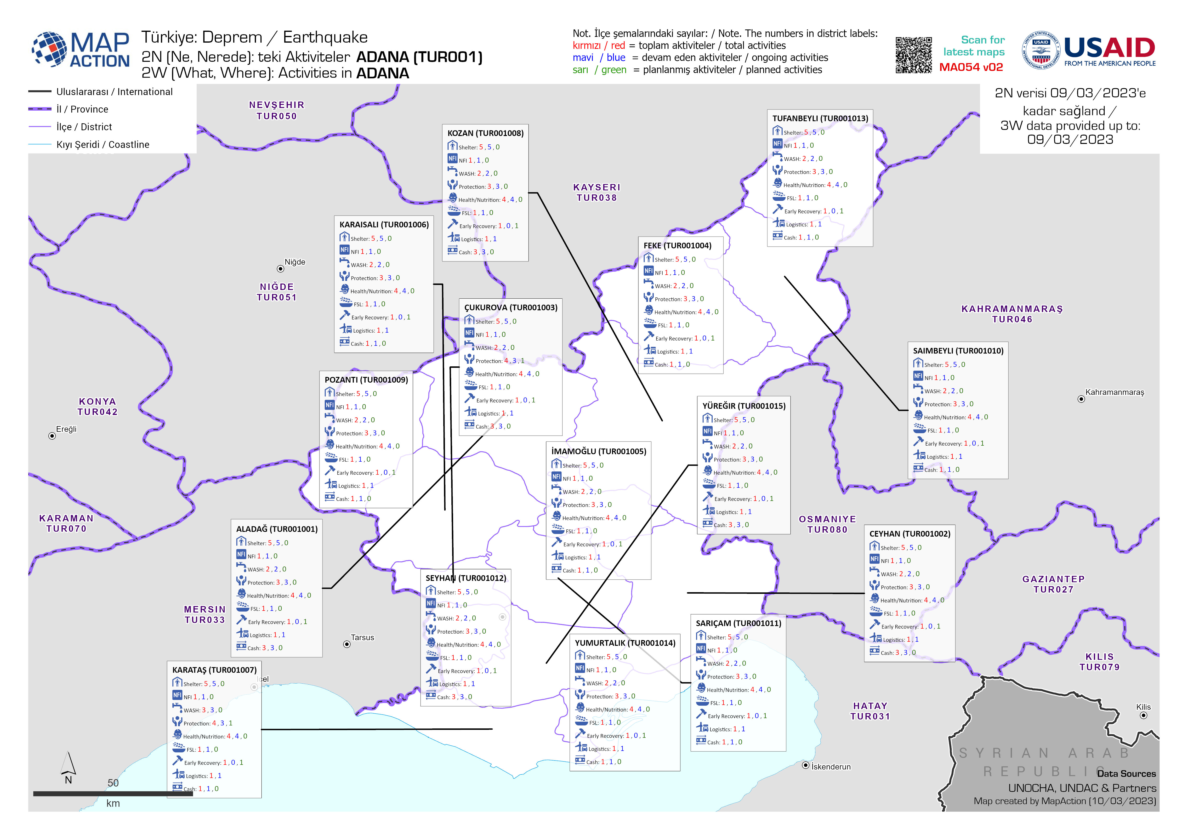
Who What Where activities / presence in affected area - Multi-cluster: As of ...
Who, What, Where for Coordination - Multi-Cluster -
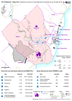
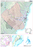
The Philippines - Naga City: Situational overview of area affected by landsli...
Map shows the affected areas, number of displaced and location of the evacuation centres being used as a result of the landslide to hit Naga city. The table below shows the... -
The Philippines - Naga City: Affected areas affected by landslide (as at 28 S...
Map shows the affected by the landslide in Naga City, Cebu. -
Bahamas: Hurricane Matthew- Rapid Assessment Housing Damage Estimate New Prov...
Estimates of housing damage in areas assessed for CDEMA. Level 0 - no damage, Level 1 - superficial damage, Level 2 - significant damage but habitable, Level 3 - not...


