-

Storm path tropical cyclone Mocha (as of 14 May 2023) with baseline populatio...
Storm path as reported by Joint Typhoon Warning Centre. Population totals in table are 2022 estimates by UNFPA and US Census Bureau (USCB). Baseline population distribution... -

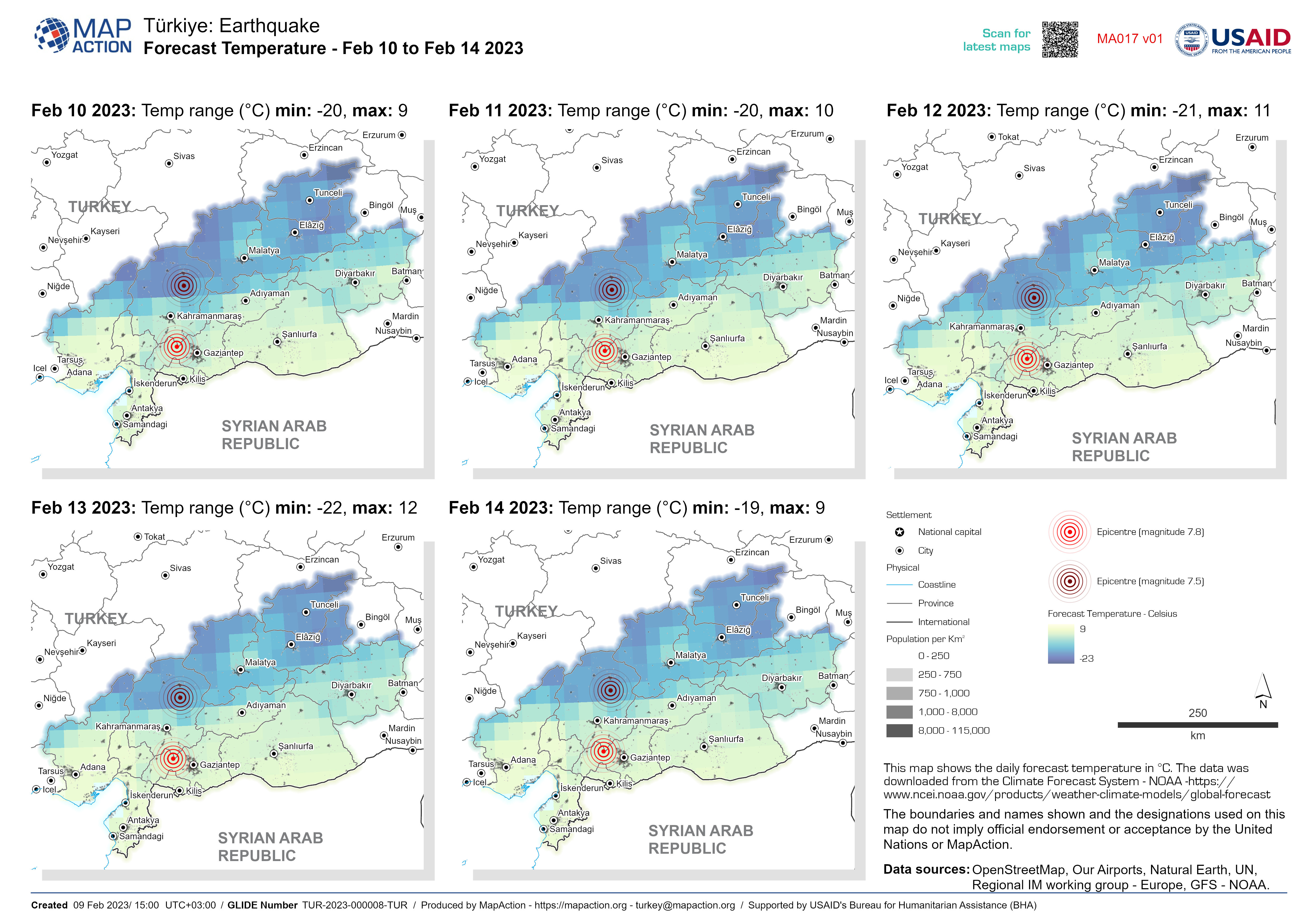
Average Daily Forecast Temperature - Feb 10 to Feb 14 2023
This map shows the daily forecast temperature in °C. The data was downloaded from the Climate Forecast System - NOAA... -

Categorías de Sequía (US Drought Monitor) 26 Junio 2022 al 25 Septiembre 2022
MIRA - Comunidades identificadas para la recolección de datos primarios en los departamentos de Boquerón, Presidente Hayes -
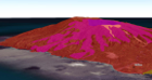
La Soufrière volcano 3D overview
Web map shows the key volcanic events and hazards the La Soufrière volcano -
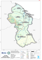
Guyana Reference Map: Administrative Regions
This reference map shows digital elevation data at 90m resolution, with primary roads, airports, major settlements and administrative regions for Guyana. -
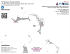
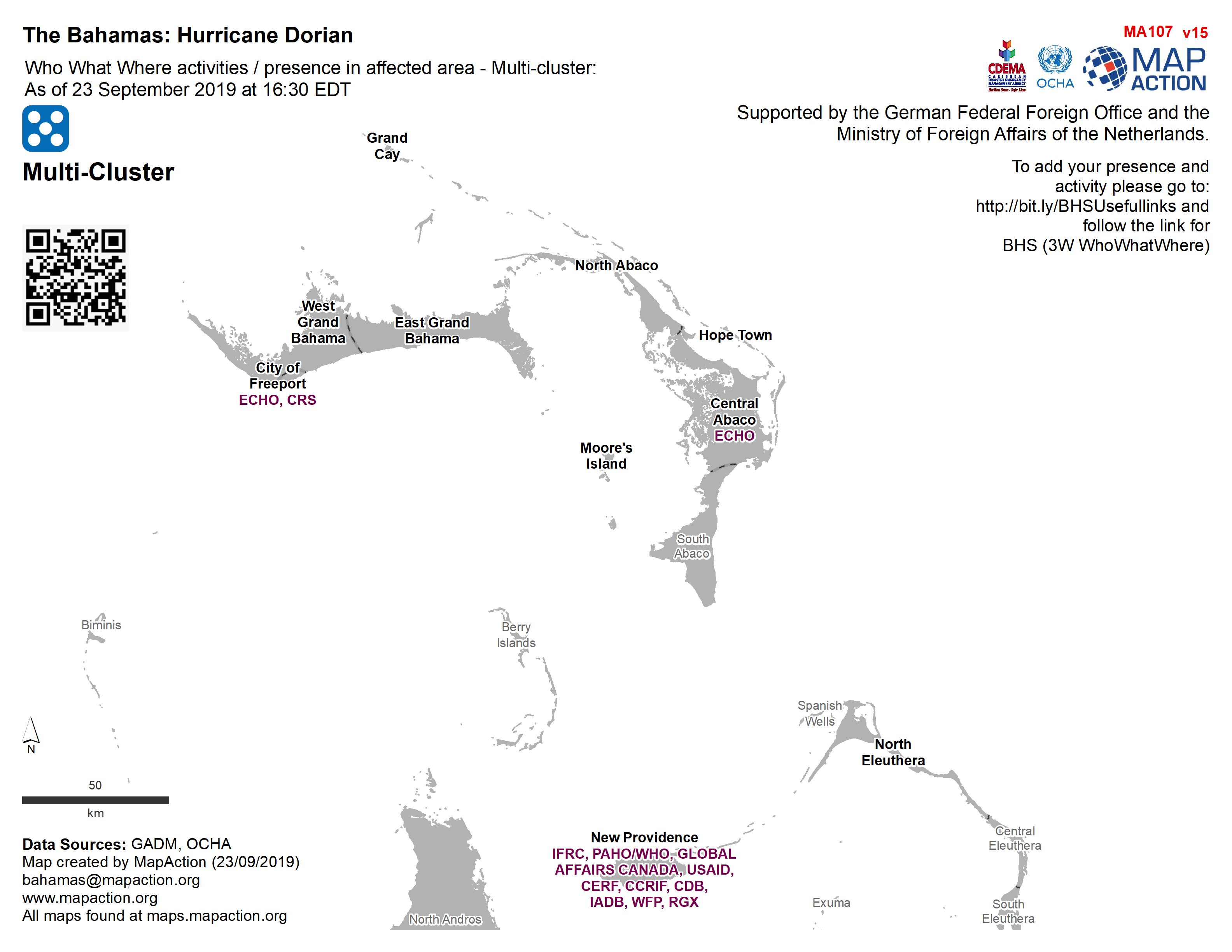
Who What Where activities / presence in affected area - Multi-cluster: As of ...
Who, What, Where for Coordination - Multi-Cluster -
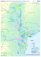
Mozambique: Cyclone Idai - Flood extent change between 20, 31 March and 7 Apr...
Map shows the change in flood extent between the 20, 31 of March and 7 April