-

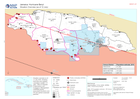
Assessment locations - 10 and 15 July 2024
Map shows the location of the assessments carried out on 10 July 2024. Teams included members from ODPEM, UNDAC, OIM, FAO, UNDSS, UNDP, UNICEF, ATLAS, JEU and TSF. Roads,... -
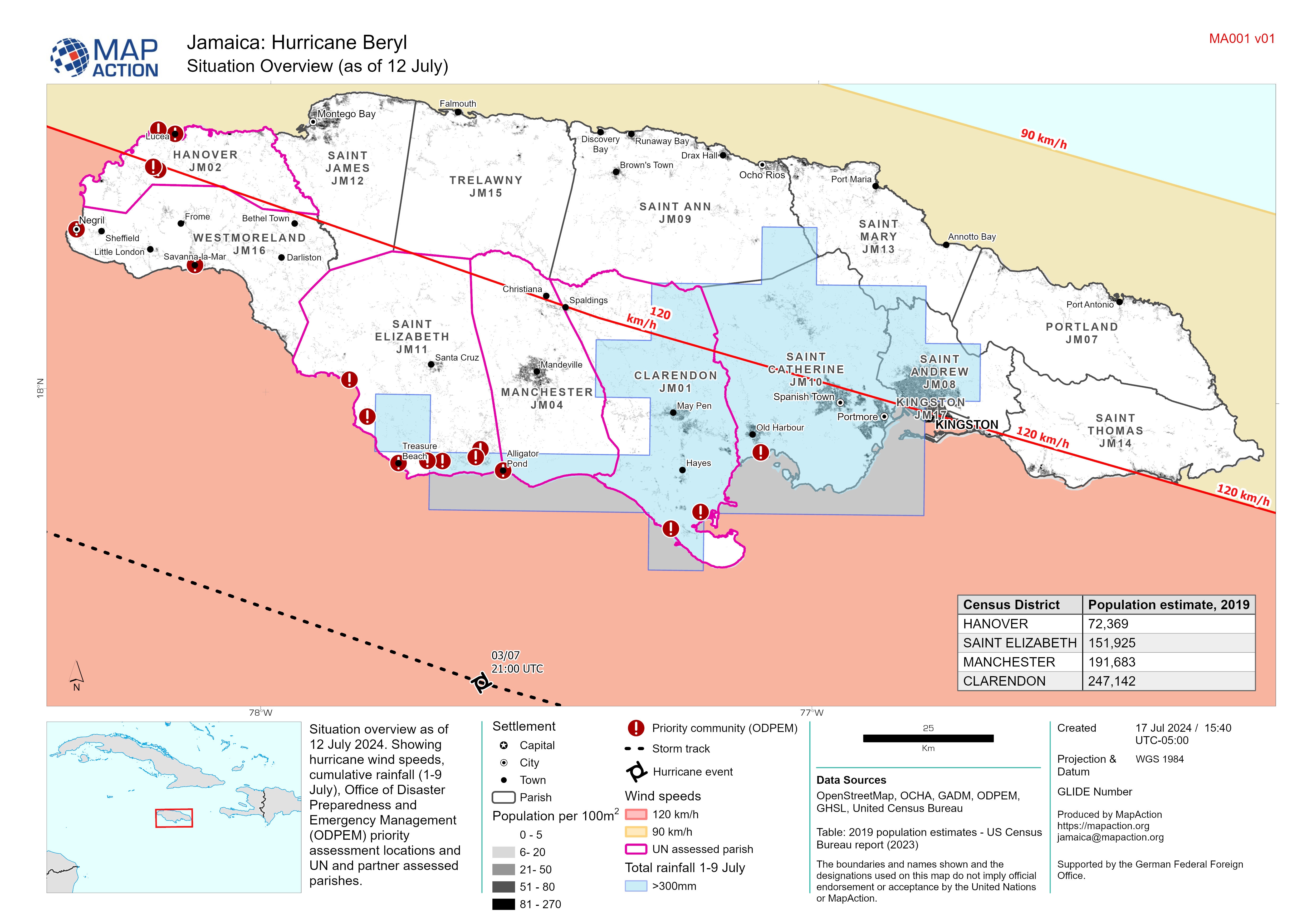
Situation Overview (as of 12 July)
Situation overview as of 12 July 2024. Showing hurricane wind speeds, cumulative rainfall (1-9 July), Office of Disaster Preparedness and Emergency Management (ODPEM) priority... -
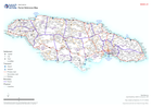
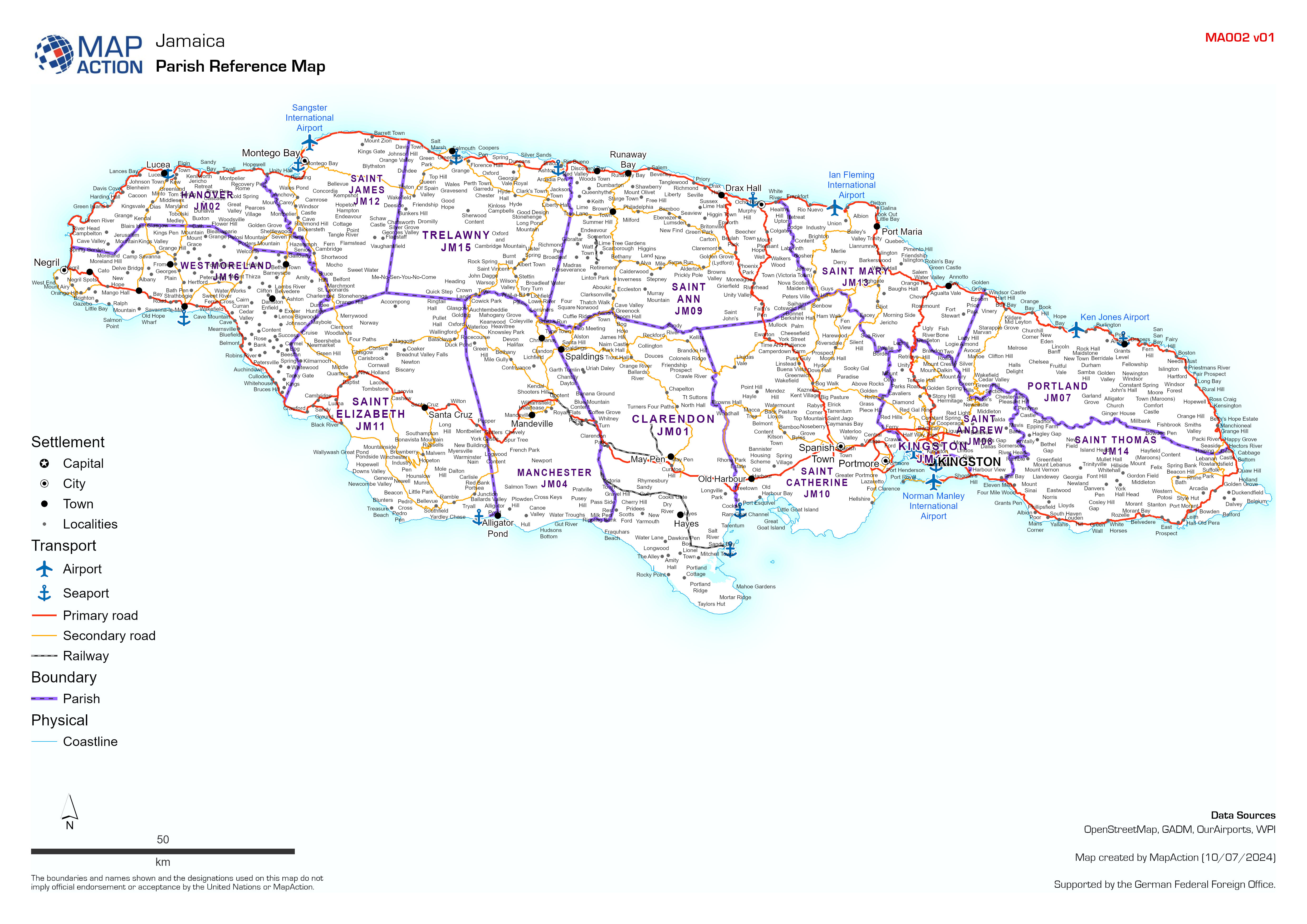
Parish Reference Map
Country overview showing administrative parishes, main settlements, transport links, airports and ports. -
-
-
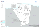
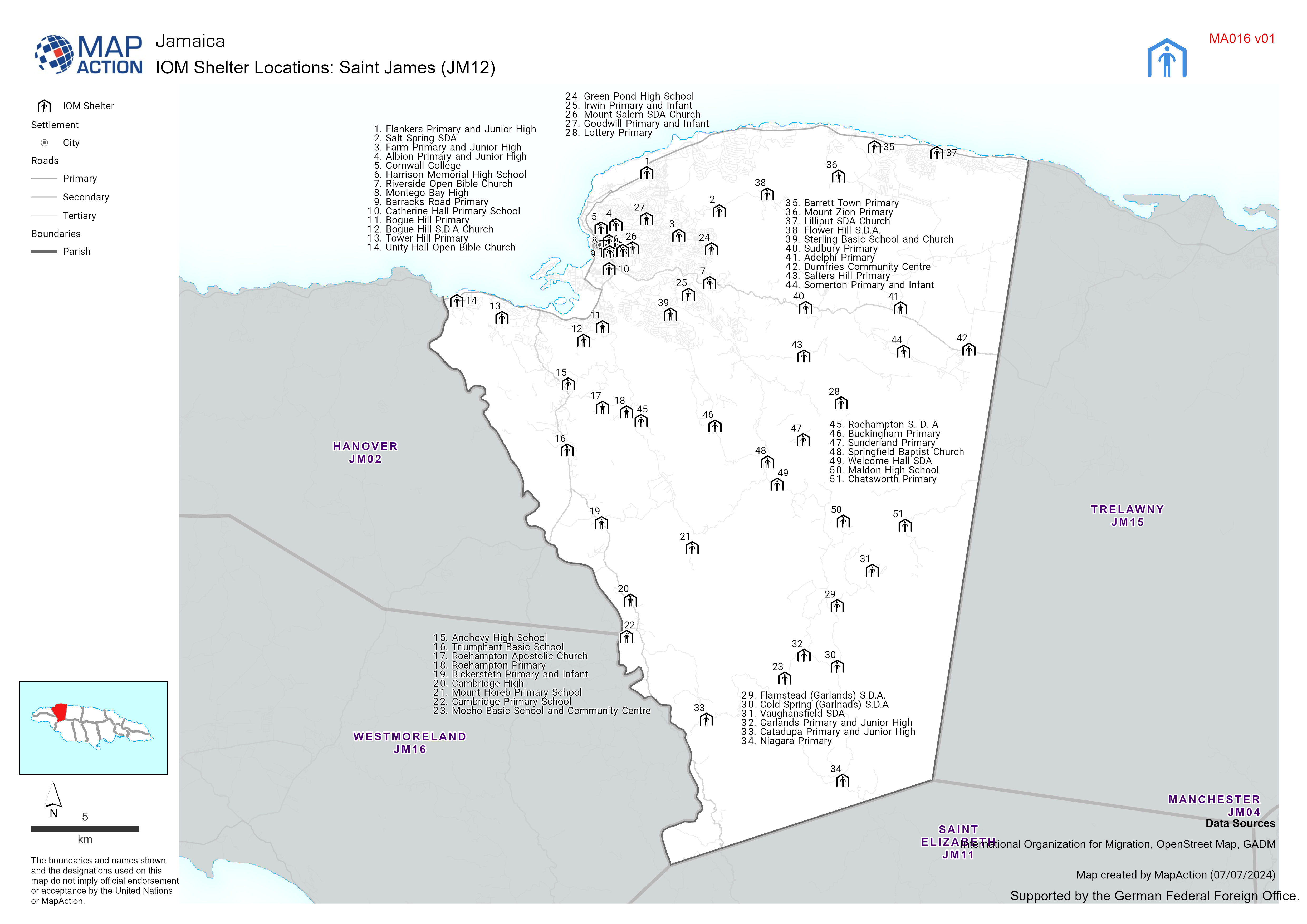
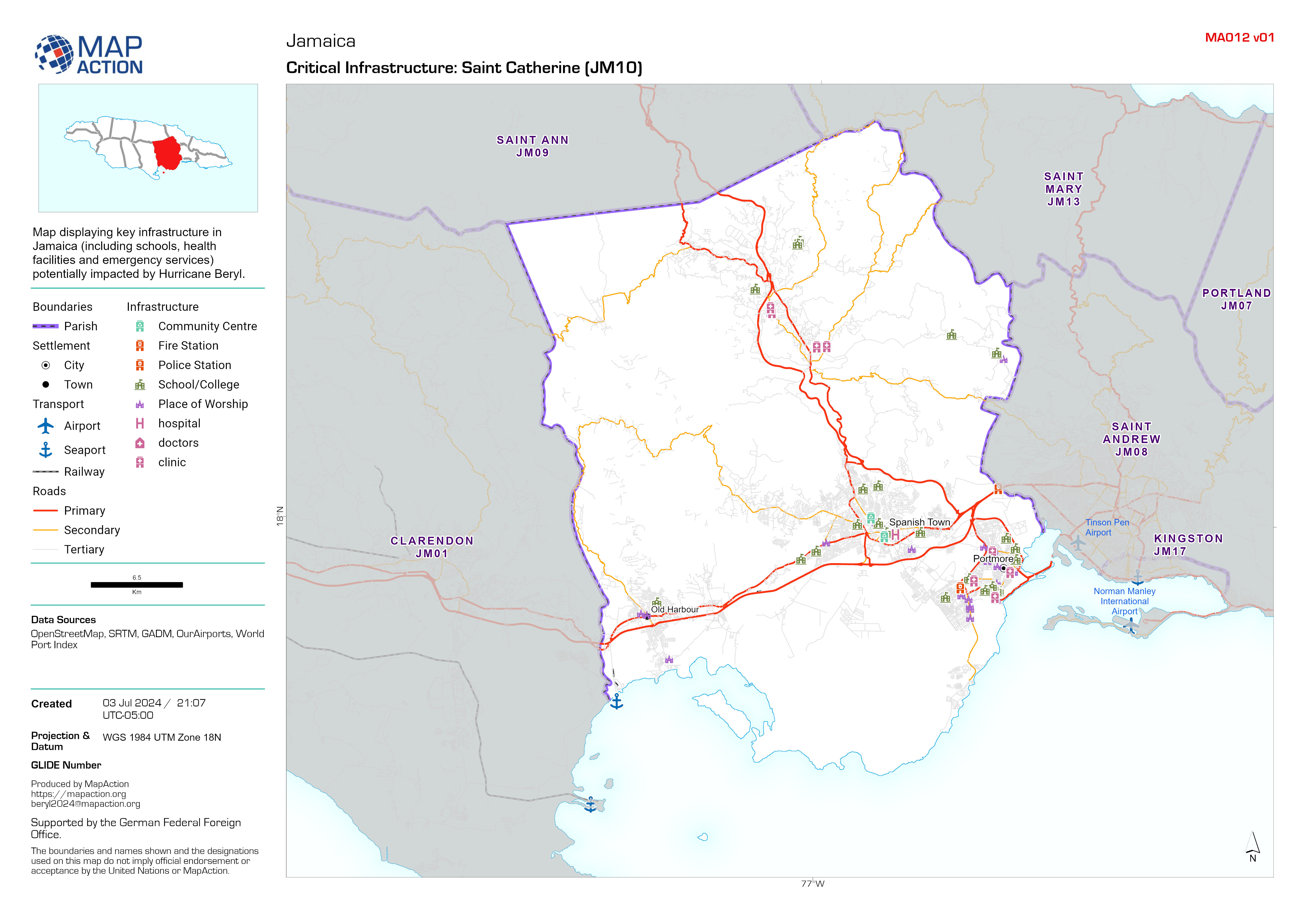
Critical Infrastructure map atlas
Map displaying key infrastructure in Jamaica (including schools, health facilities and emergency services) potentially impacted by Hurricane Beryl. -

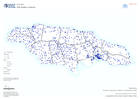
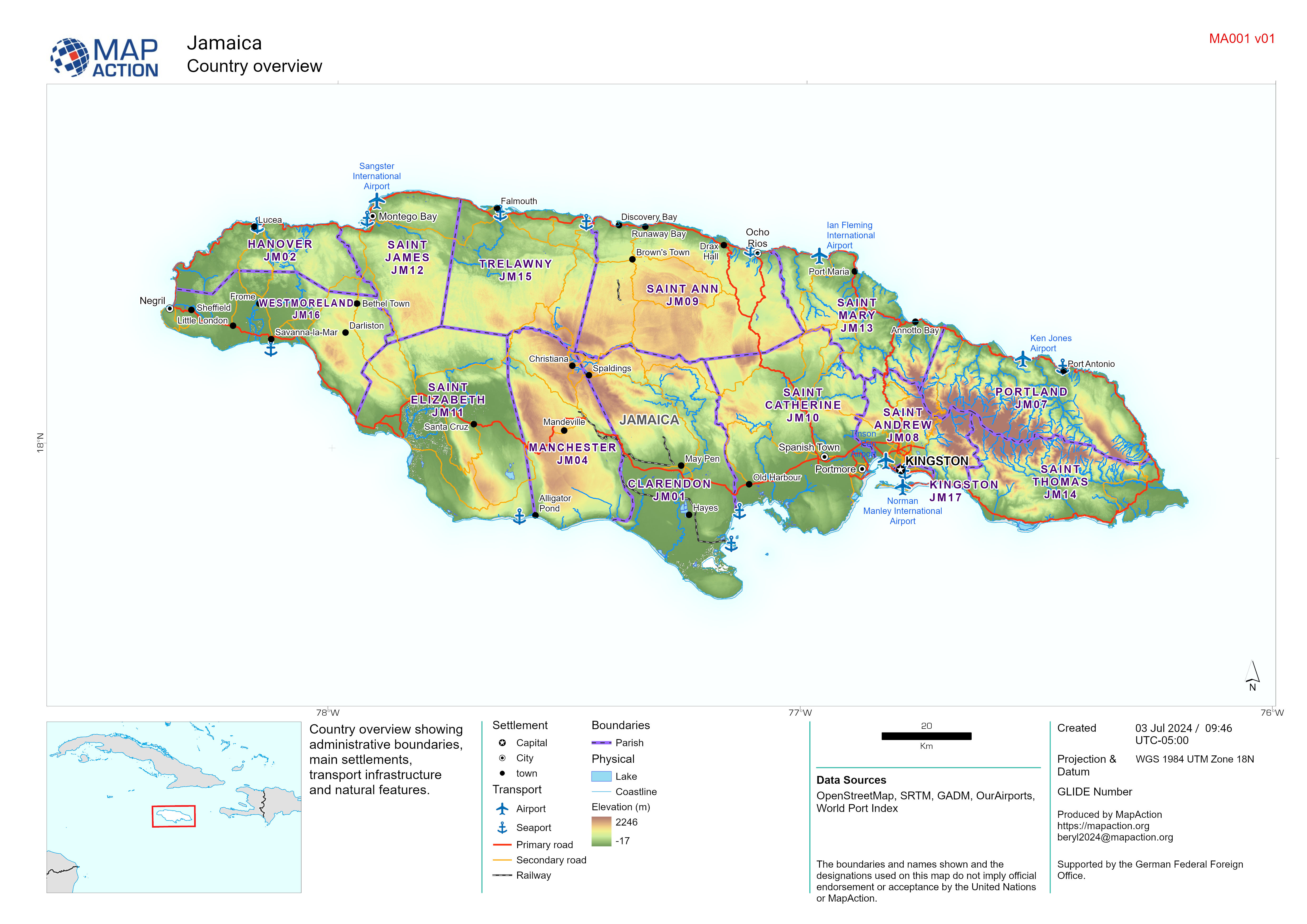
Country overview
Country overview showing administrative boundaries, main settlements, transport infrastructure and natural features.