-
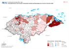
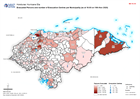
Honduras: Evacuated Persons and number of Evacuation Centres per Municipality...
Map shows evacuated persons and number of evacuation centres per Municipality (as at 16:00 on 23rd Nov 2020) -
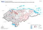
Honduras: Evacuated Persons and number of Evacuation Centres per Municipality...
Map shows evacuated persons and number of evacuation centres per Municipality (as at 12:00 on 22nd Nov 2020) -

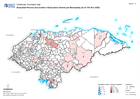
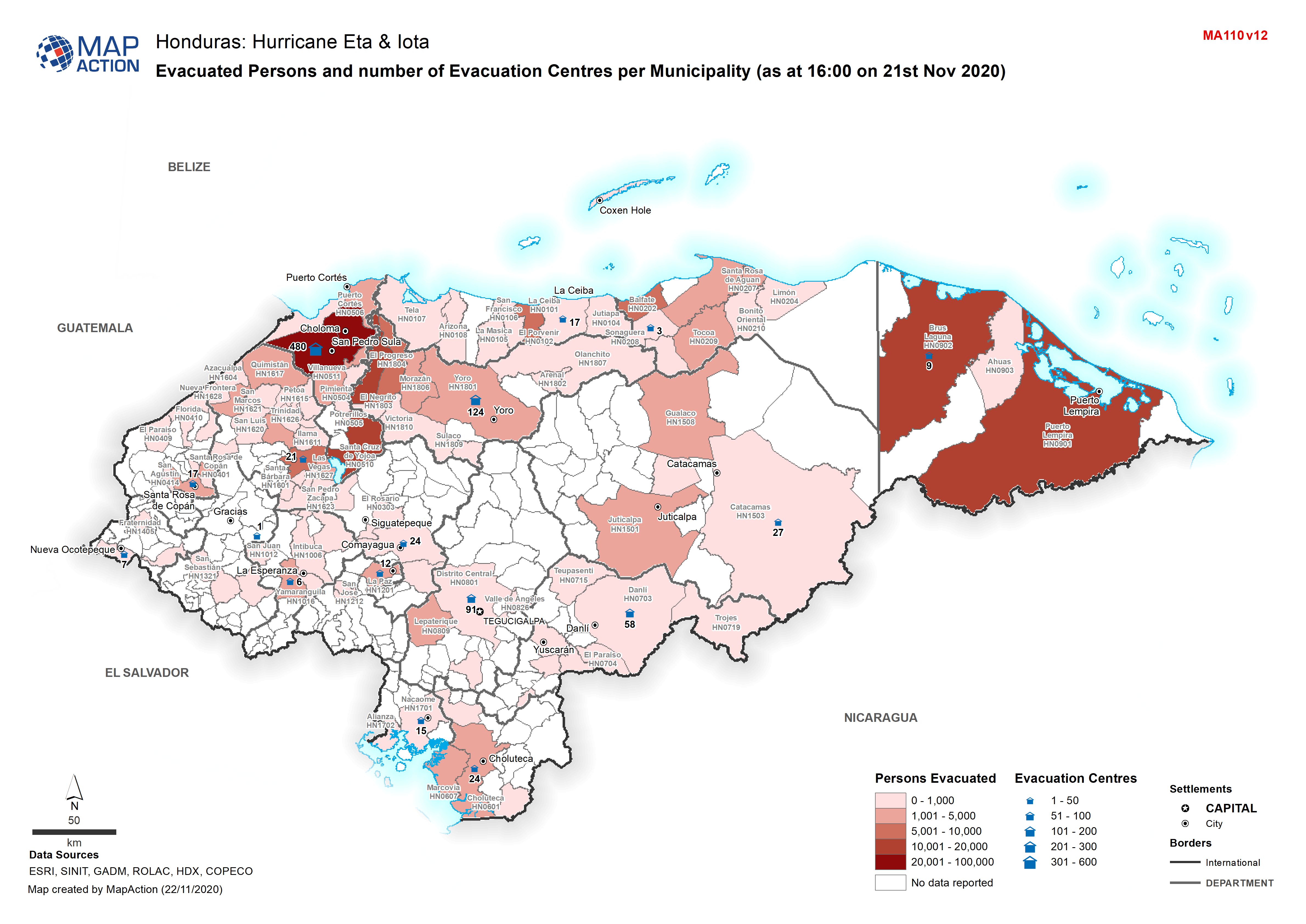
Honduras: Evacuated Persons and number of Evacuation Centres per Municipality...
Map shows evacuated persons and number of evacuation centres per Municipality (as at 16:00 on 21st Nov 2020) -
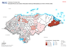
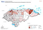
Honduras: Evacuated Persons and number of Evacuation Centres per Municipality...
Map shows evacuated persons and number of evacuation centres per Municipality (as at 04:00 on 20th Nov 2020) -
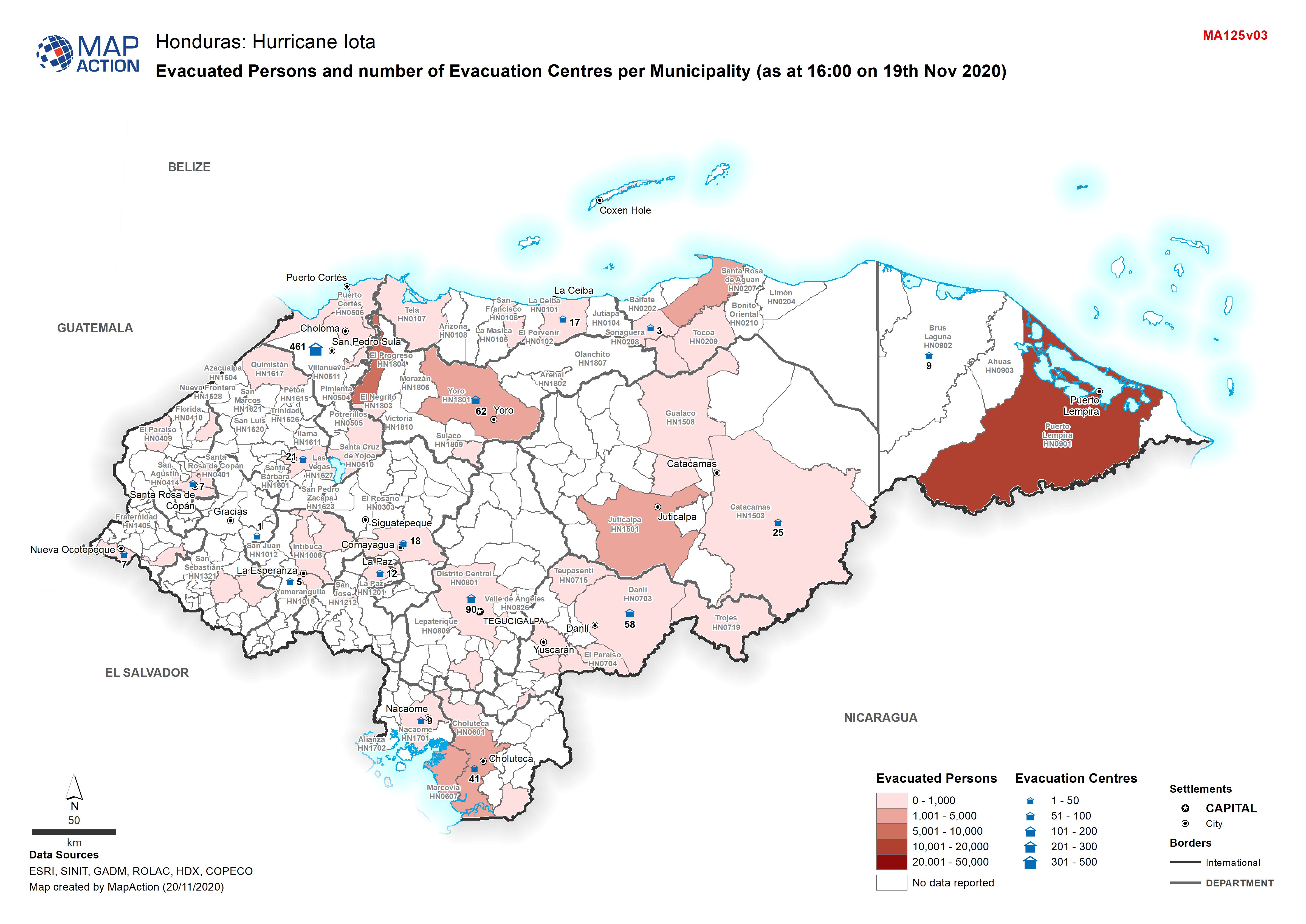
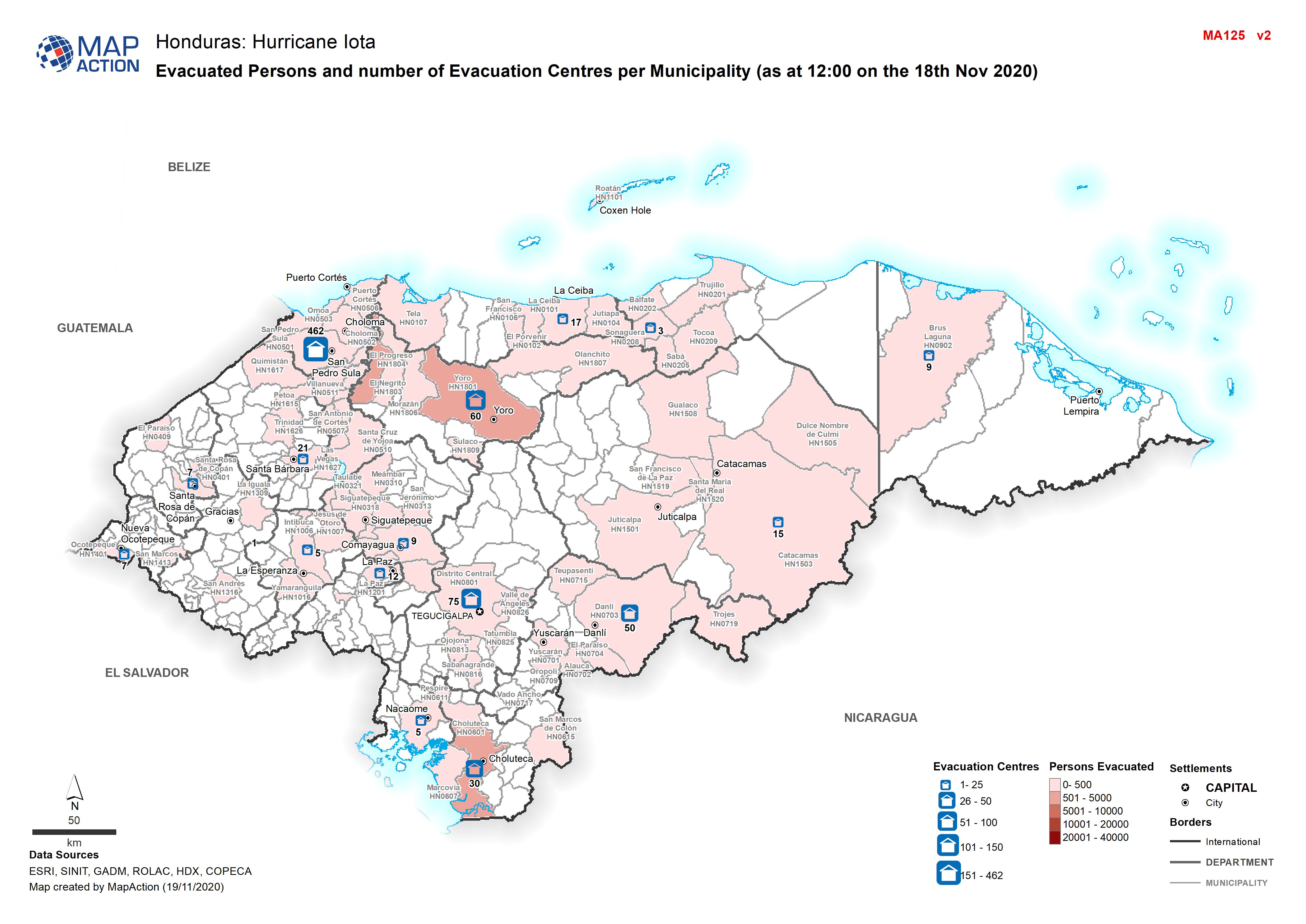
Honduras: Hurricate Iota, Evacuated Persons and number of Evacuation Centres ...
Map shows evacuated persons and number of evacuation centres per Municipality (as at 16:00 on19th Nov 2020) -
Honduras: Evacuated Persons and number of Evacuation Centres per Municipality...
Map shows evacuated persons and number of evacuation centres per Municipality (as at 16:00 on19th Nov 2020) -
Honduras: Evacuated Persons and number of Evacuation Centres per Municipality...
Map shows evacuated persons and number of evacuation centres per Municipality (as at 14th Nov 2020) -
Honduras: Evacuated Persons and number of Evacuation Centres per Municipality...
Map shows evacuated persons and number of evacuation centres per Municipality (as at 14th Nov 2020) -

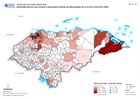
Ulua Basin: areas evacuated for Hurricane Iota, with El Cajón dam overspillin...
The Municipalities indicated were given mandatory evacuation ordres from low lying land near Ulua and Chameleco rivers pre hurricane Iota. Modelling of possible inundation from... -

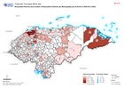
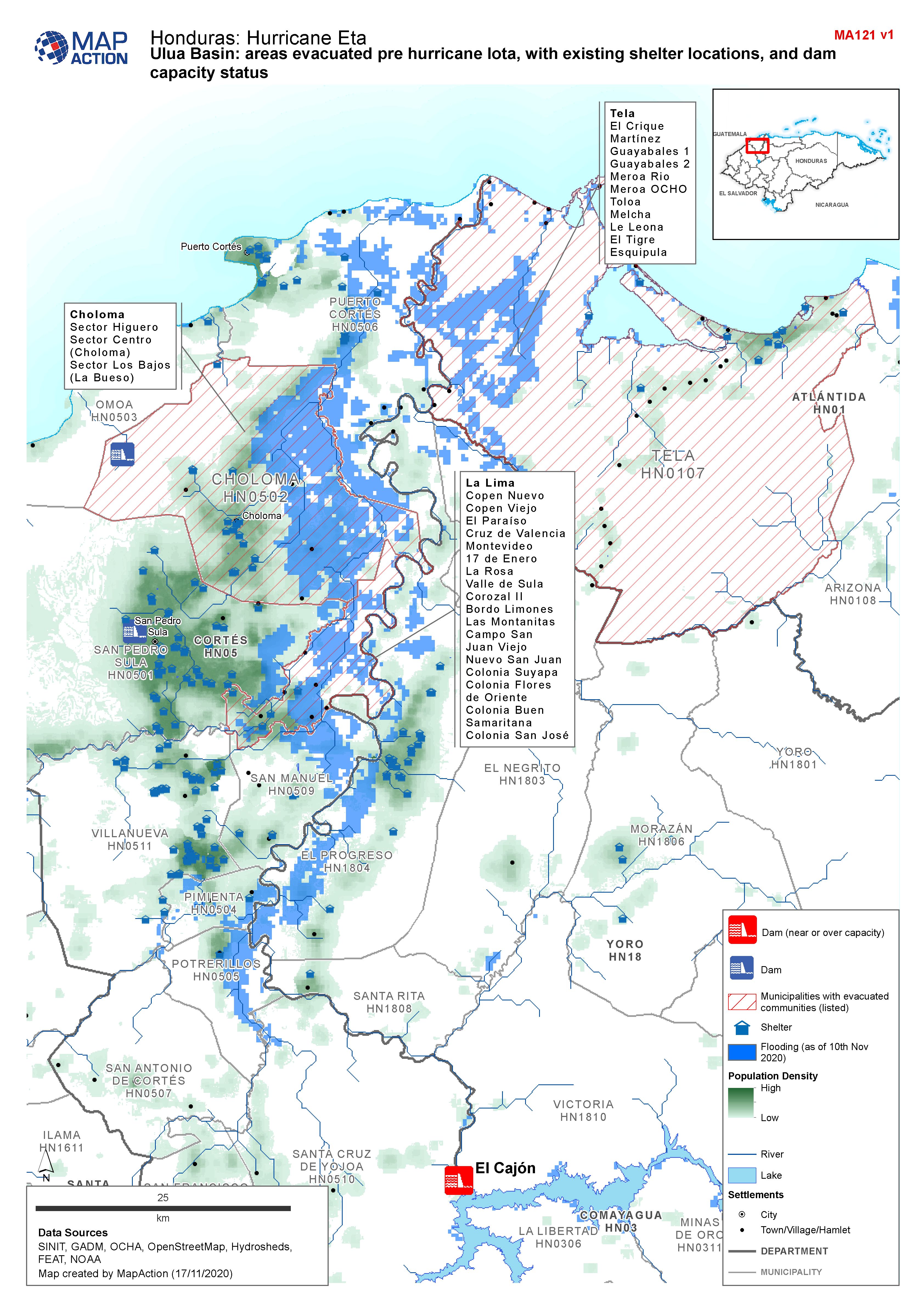
Honduras, Ulua Basin: areas evacuated pre Hurricane Iota, with existing shelt...
Map shows communities evacuated pre hurricane Iota, and existing shelter locations. Population density and capacity status of dams are also shown. -
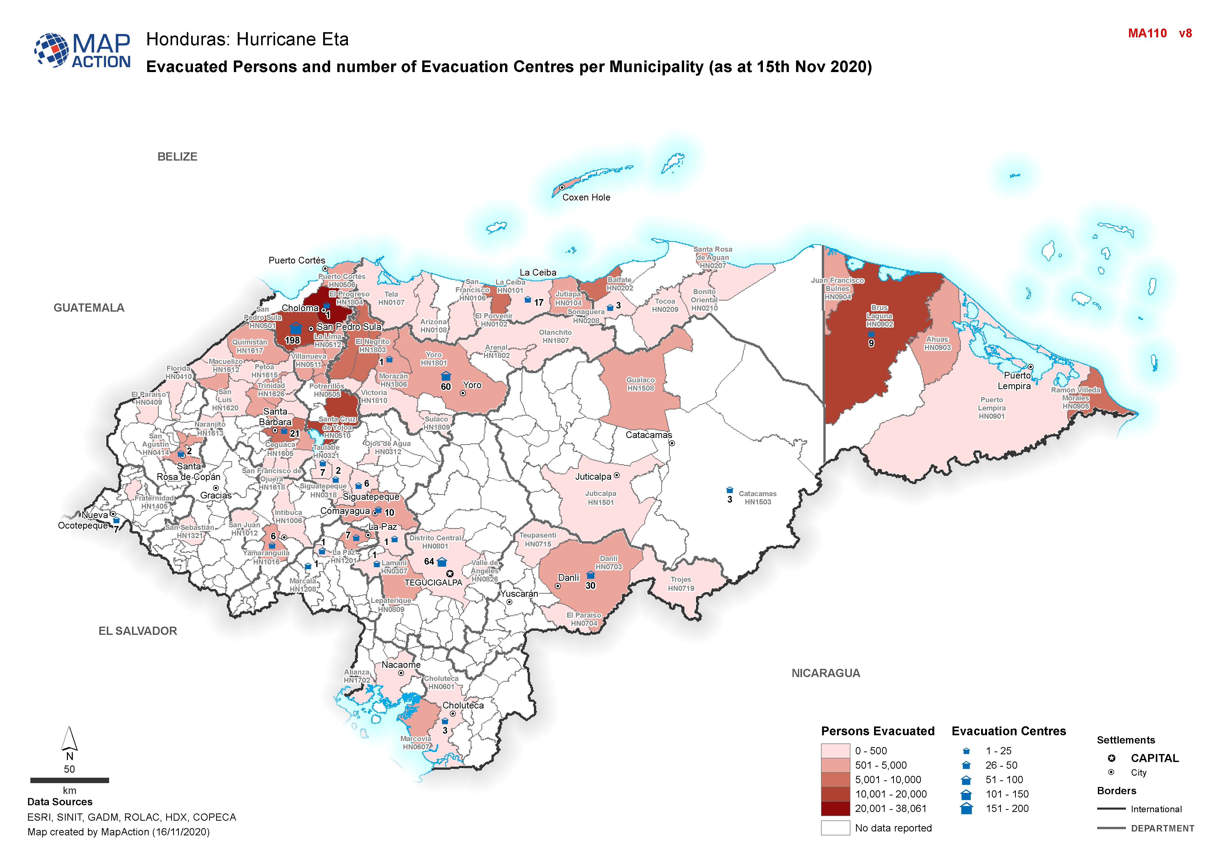
Honduras: Evacuated Persons and number of Evacuation Centres per Municipality...
Map shows evacuated persons and number of evacuation centres per Municipality (as at 16th Nov 2020) -

Honduras: Evacuated Persons and number of Evacuation Centres per Municipality...
Map shows evacuated persons and number of evacuation centres per Municipality (as at 14th Nov 2020) -
Honduras: Evacuated Persons and number of Evacuation Centres per Municipality...
Map shows evacuated persons and number of evacuation centres per Municipality (as at 14th Nov 2020) -

Honduras: Evacuated Persons and number of Evacuation Centres per Municipality...
Map shows evacuated persons and number of evacuation centres per Municipality (as at 11th Nov 2020) -

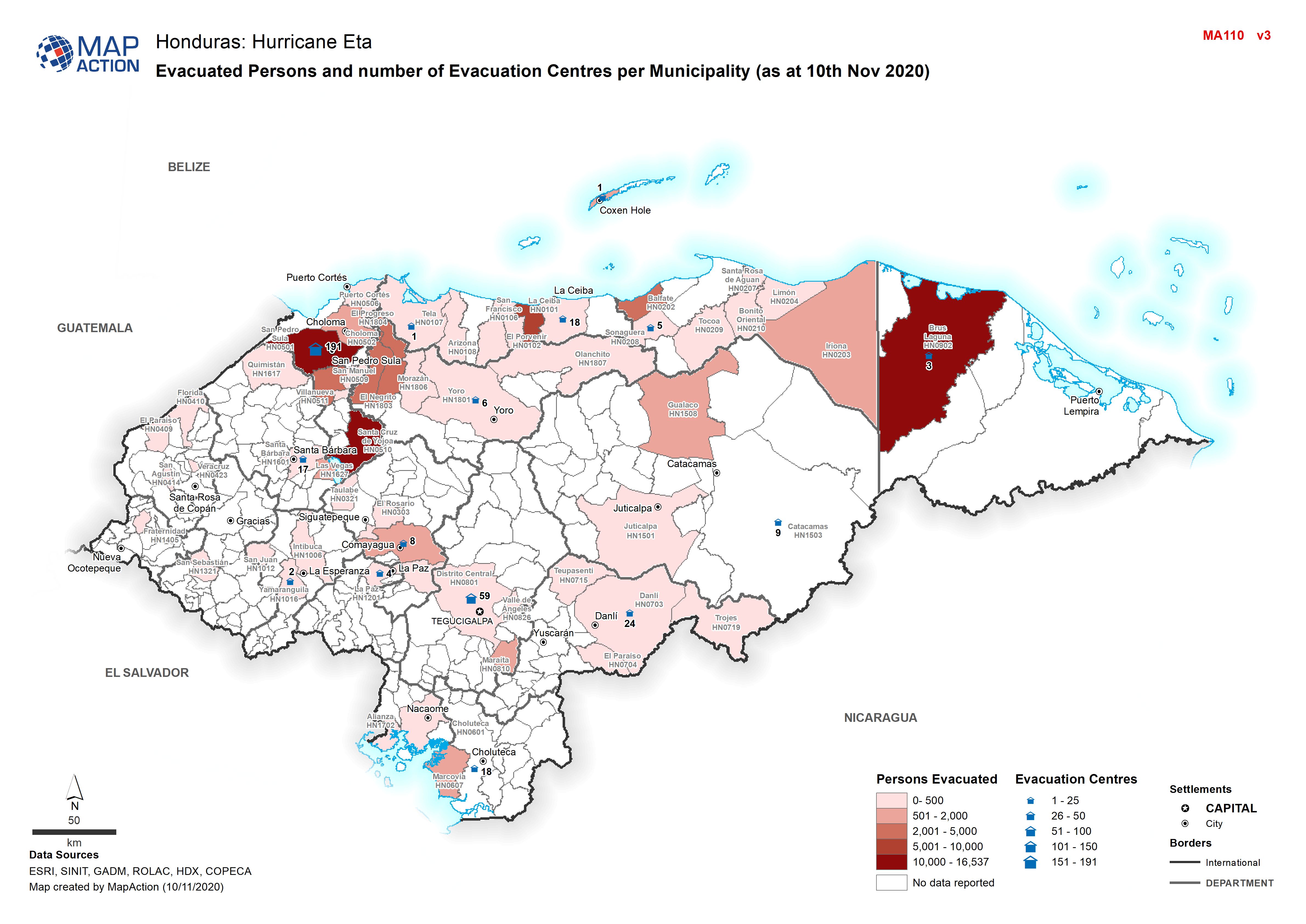
Honduras: Evacuated Persons and number of Evacuation Centres per Municipality...
Map shows evacuated persons and number of evacuation centres per Municipality (as at 10th Nov 2020) -

Honduras: Evacuated Persons and number of Evacuation Centres per Municipality...
Map shows evacuated persons and number of evacuation centres per Municipality (as at 8th Nov 2020) -
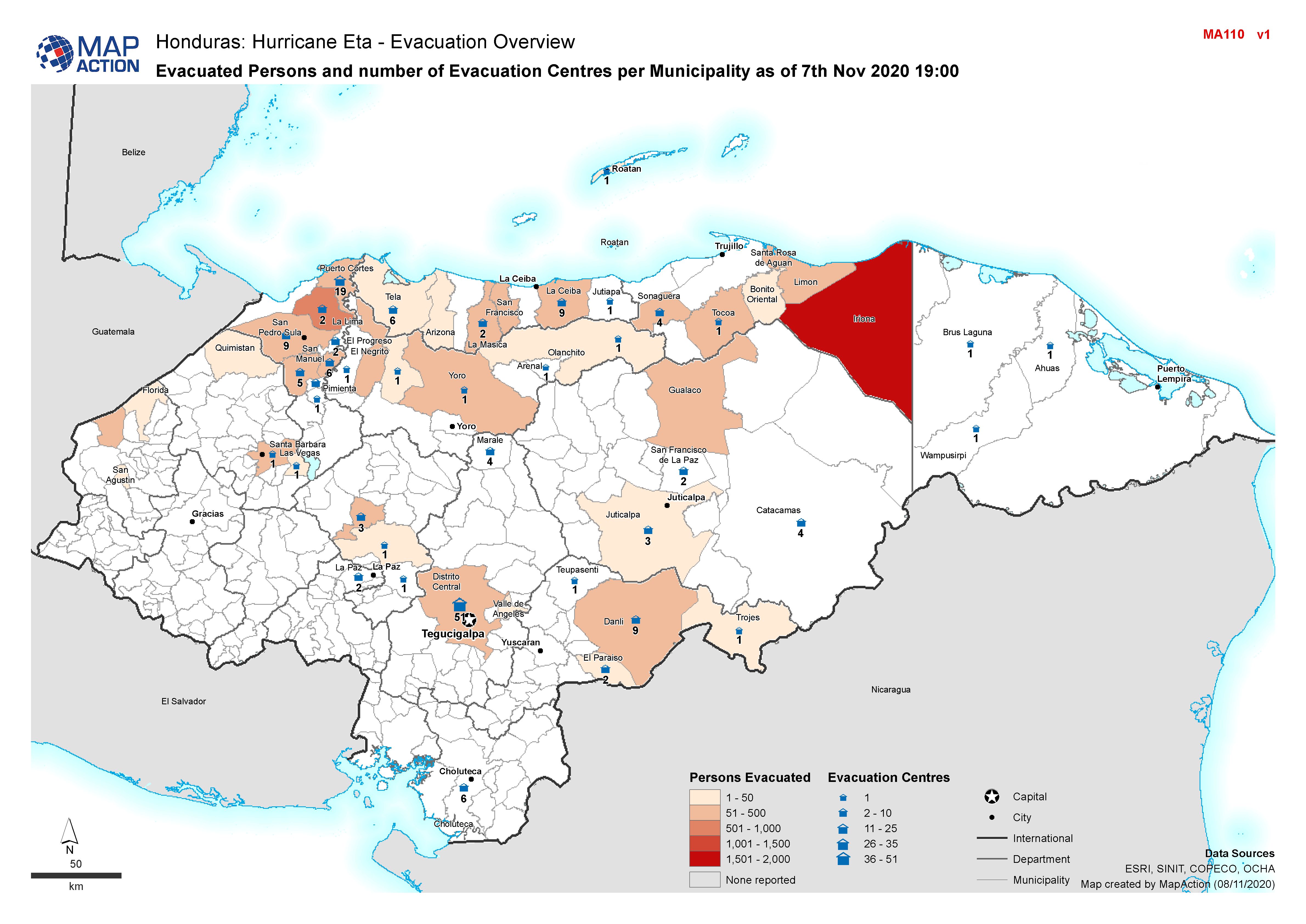
Honduras: Evacuated Persons and number of Evacuation Centres per Municipality...
Honduras, Evacuated Persons and number of Evacuation Centres per Municipality as of 7th Nov 2020 19:00