-
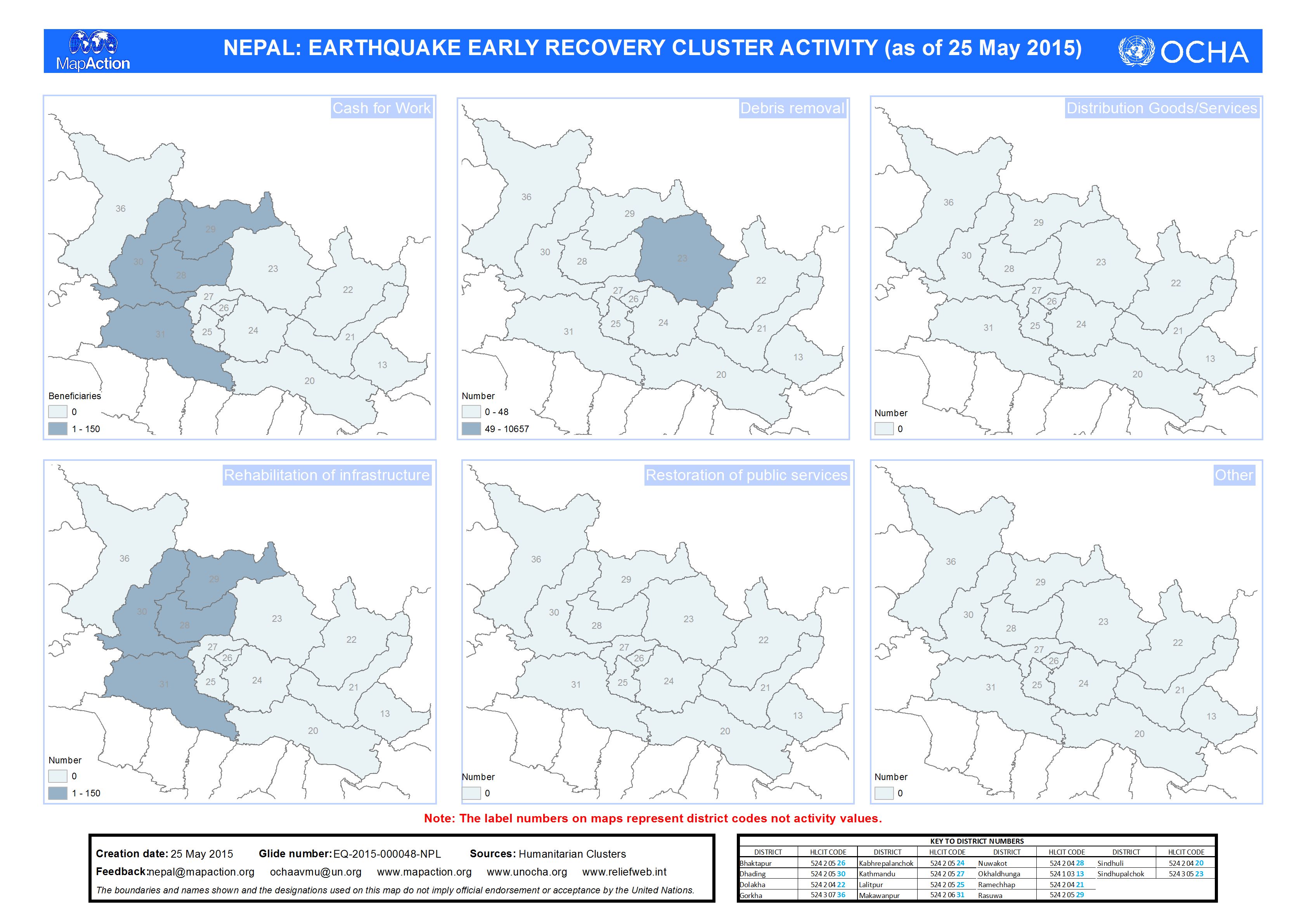
Nepal: Earthquake - EARLY RECOVERY CLUSTER ACTIVITY (as of 25 May 2015)
Map shows early recovery cluster activity as of 25 May 2015 -

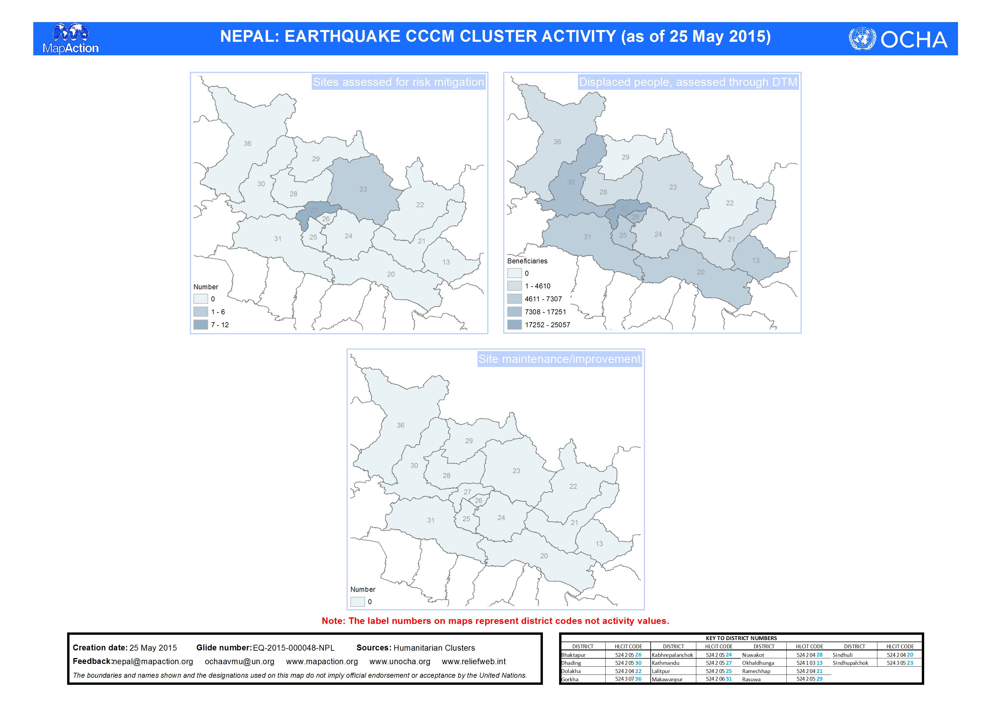
Nepal: Earthquake - CCCM CLUSTER ACTIVITY (as of 25 May 2015)
Map shows CCCM cluster activity as of 25 May 2015 -
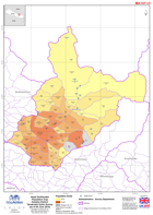
Nepal: Earthquake - Population map - Dolakha District - Tamakoshi Hydro Surve...
Map shows population by Village Development Communities based on figures from a local hydropower company called Tamakoshi Hydro Ltd. -
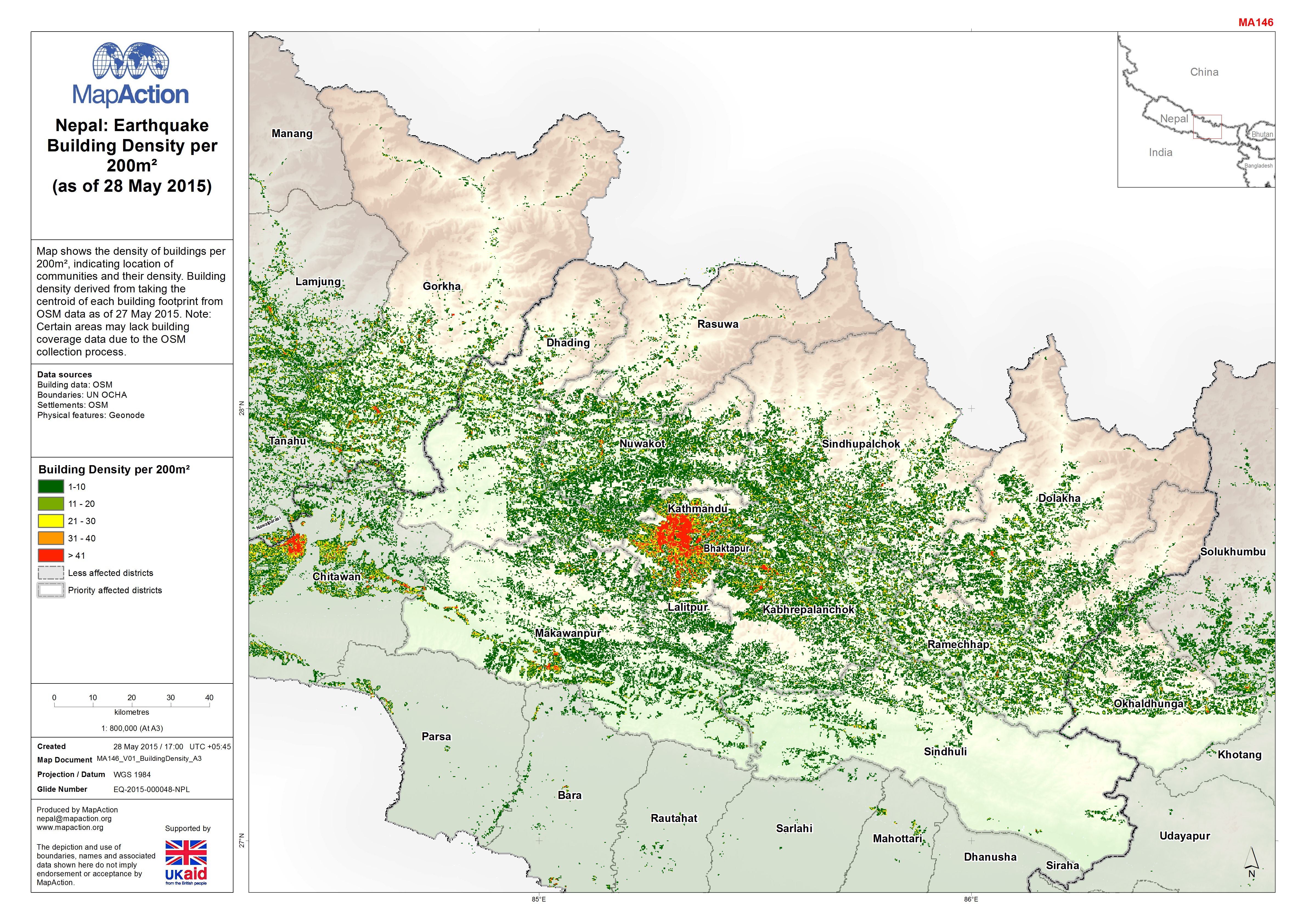
Nepal: Earthquake - Building Density per 200m²(as of 28 May 2015)
Map shows the density of buildings per 200m², indicating location of communities and their density. Building density derived from taking the centroid of each building footprint... -
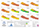
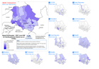
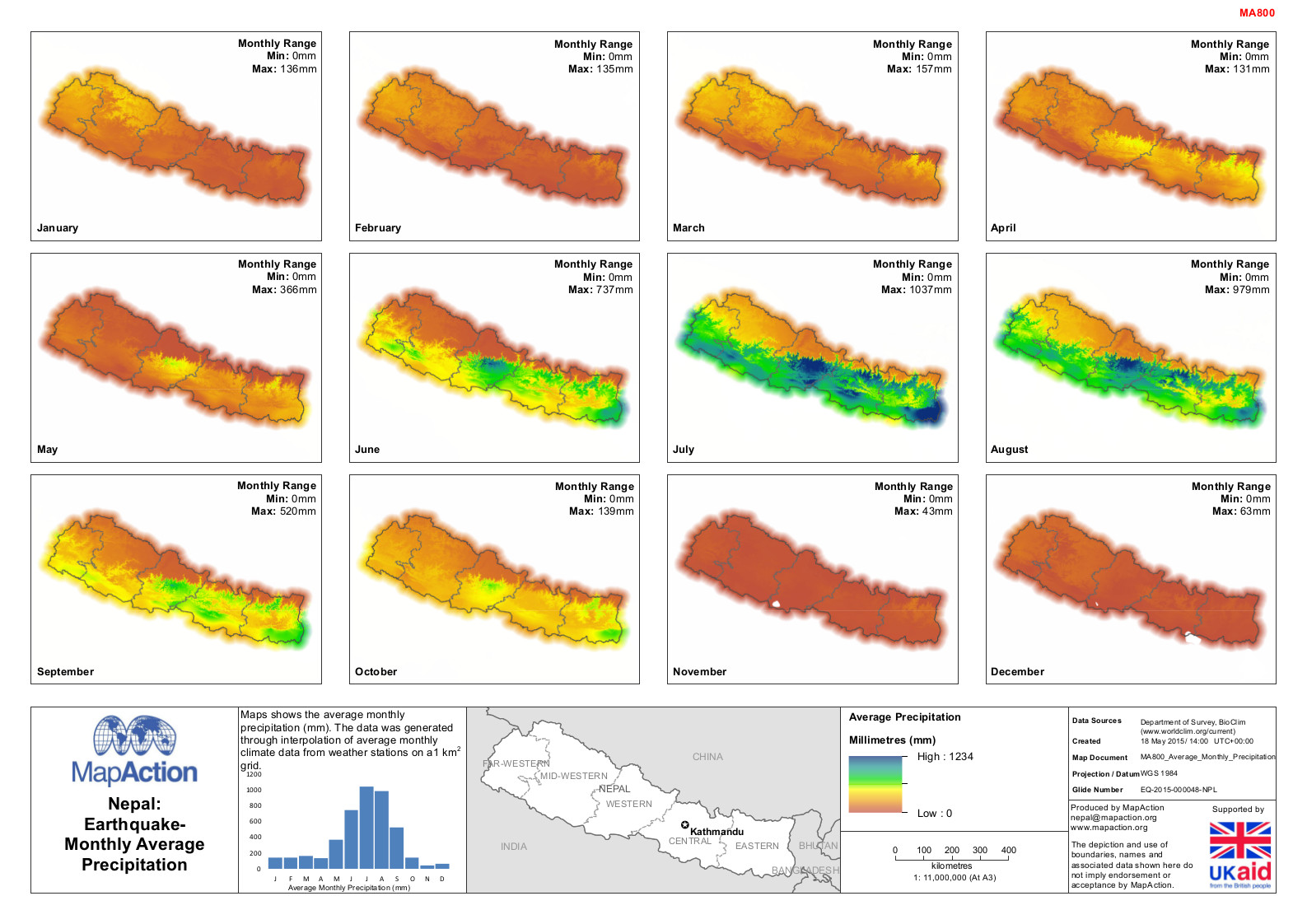
Nepal: Earthquake - Monthly Average Precipitation
Maps shows the average monthly precipitation (mm). The data was generated through interpolation of average monthly climate data from weather stations on a1 km2 grid. -
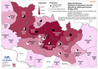
Nepal: Earthquake - Estimate of population directly affected by destroyed ho...
The numbers here should be seen as indicative only. Analysis based on an estimate of the number of buildings destroyed (not including government buildings) and the average... -
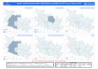
Nepal: Earthquake - VDC Level 4W Districts (as of 15 May 2015)
Currently only 64% of activities are being reported at VDC level. When District totals are stated higher, no VDC data is present. This map series is limited to districts with... -

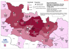
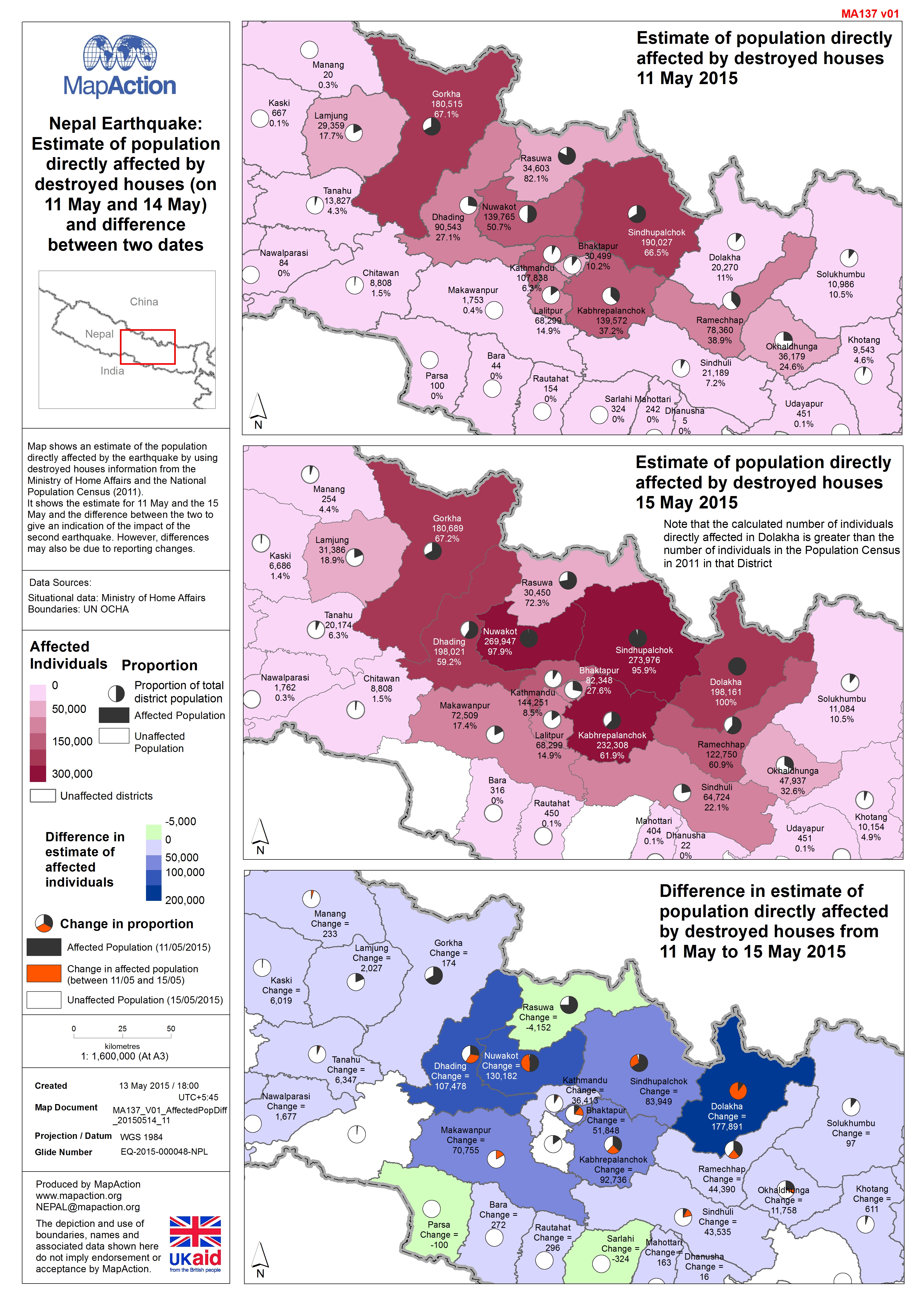
Nepal: Earthquake - Estimate of population directly affected by destroyed hou...
Map shows an estimate of the population directly affected by the earthquake by using destroyed houses information from the Ministry of Home Affairs and the National Population... -

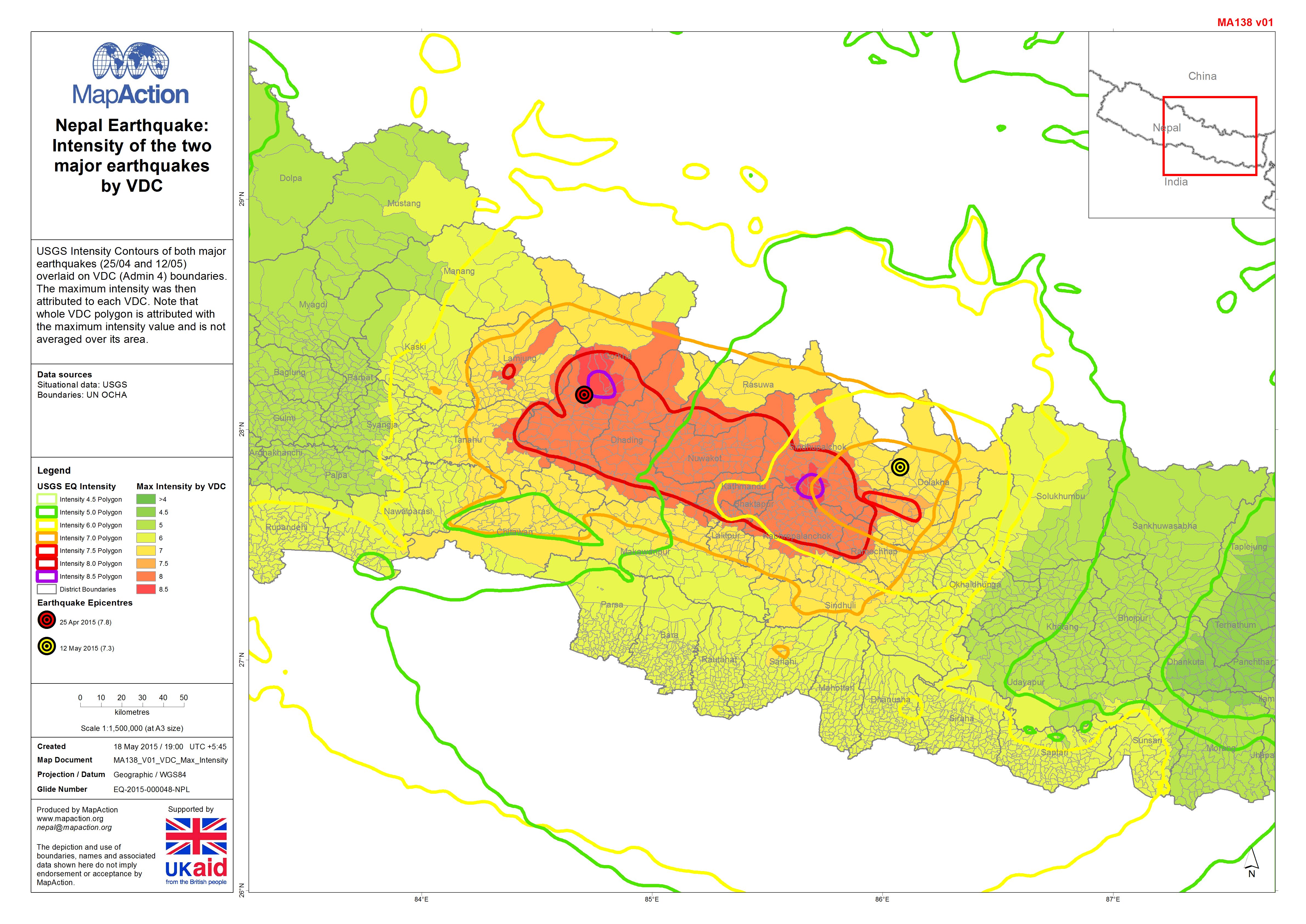
Nepal Earthquake:Intensity of the two major earthquakes by VDC
USGS Intensity Contours of both major earthquakes (25/04 and 12/05) overlaid on VDC (Admin 4) boundaries. The maximum intensity was then attributed to each VDC. Note that whole... -
Nepal: Earthquake - Estimate of population directly affected by destroyed hou...
The numbers here should be seen as indicative only. Analysis based on an estimate of the number of buildings destroyed (not including government buildings) and the average... -
Nepal: Earthquake - Epicentres (up to 13 May 2015), 'Priority' and 'Additiona...
Map shows Priority Affected Districts as designated by the Government of Nepal in the week following the original earthquake, and additional affected districts designated on 10... -

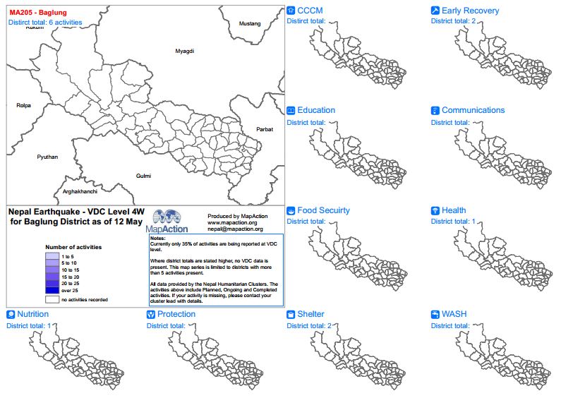
Nepal: Earthquake - VDC Level 4W Districts as of 12 May
Where district totals are stated higher, no VDC data is present. Currently only 35% of activities are being reported at VDC level. This map series is limited to districts with... -

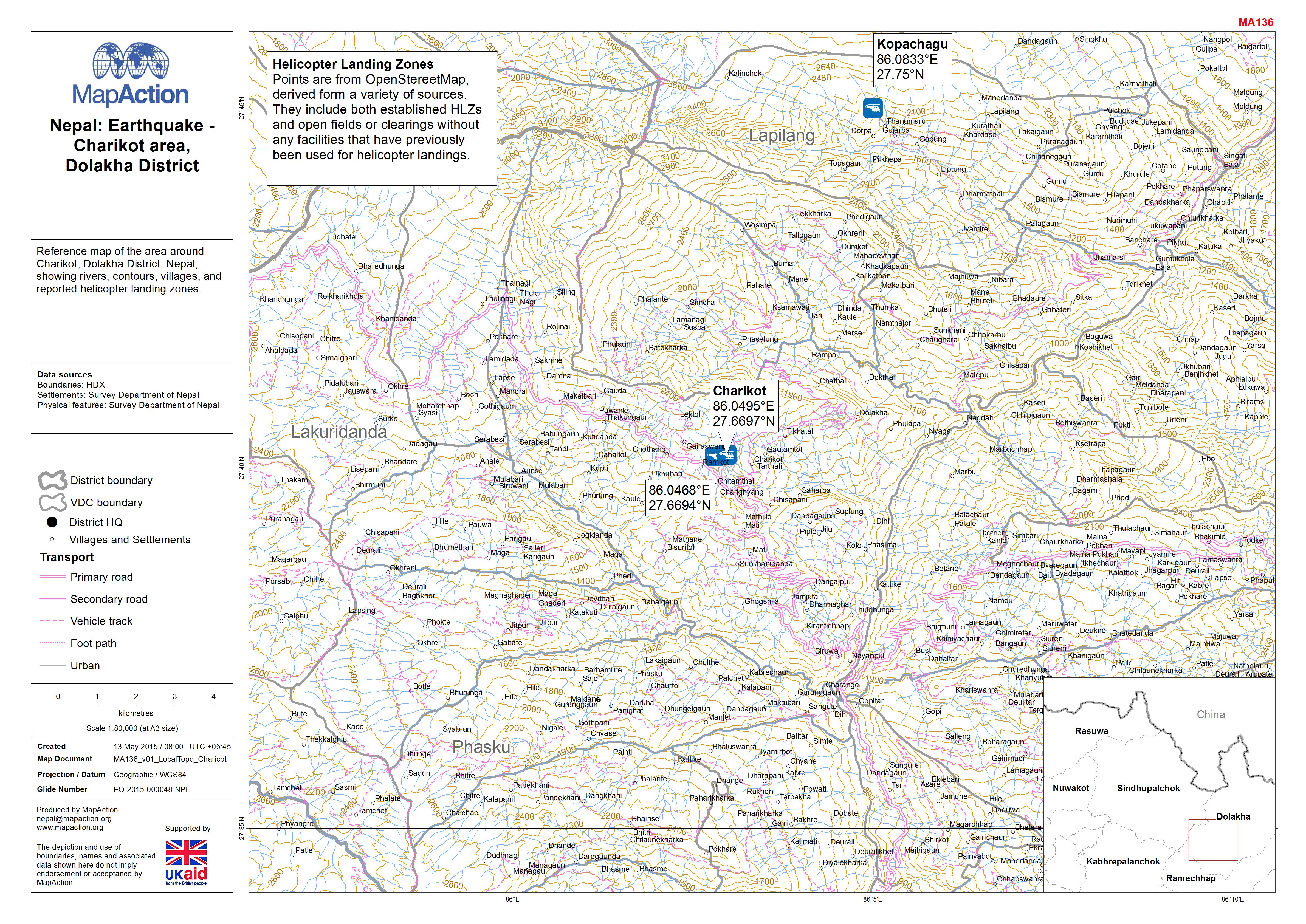
Nepal: Earthquake - Charikot area, Dolakha District
Reference map of the area around Charikot, Dolakha District, Nepal, showing rivers, contours, villages, and reported helicopter landing zones. -

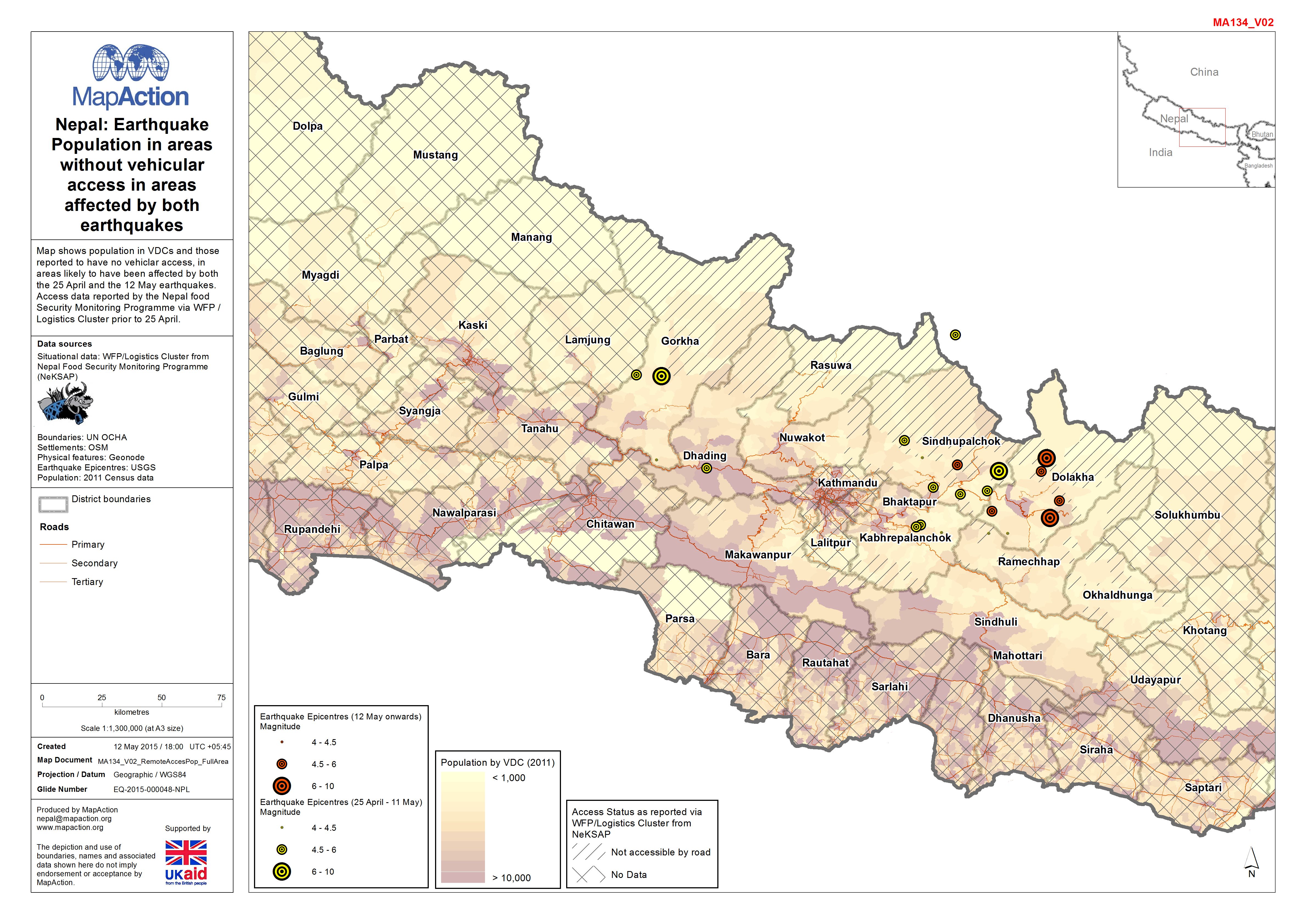
Nepal: Earthquake - Population in areas without vehicular access in areas aff...
Map shows population in VDCs and those reported to have no vehiclar access, in areas likely to have been affected by both the 25 April and the 12 May earthquakes. Access data... -

Nepal: Earthquake - Population in areas without vehicular access showing area...
Map shows population in VDCs and those reported to have no vehiclar access, in areas likely to have been affected by the 12 May earthquake. Access data reported by the Nepal... -
Nepal: Earthquake - Education Cluster District Lead Agencies (as of 11 May 2015)
Map shows Education Clusters district lead agencies, number of affected schools and percentage of damaged classrooms in each district. -

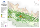
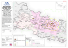
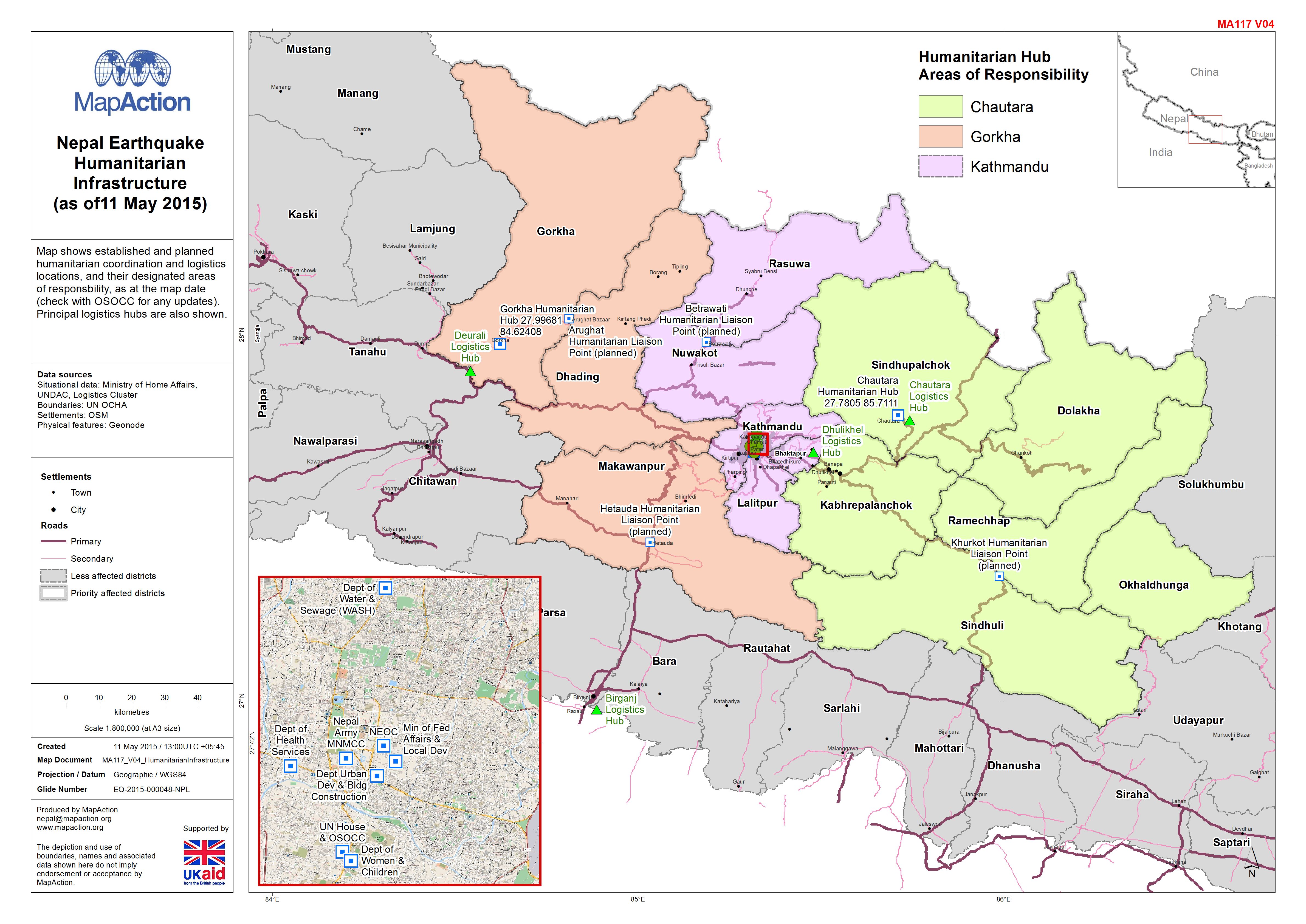
Nepal: Earthquake - Humanitarian Infrastructure(as of11 May 2015)
Map shows established and planned humanitarian coordination and logistics locations, and their designated areas of responsbility, as at the map date (check with OSOCC for any... -

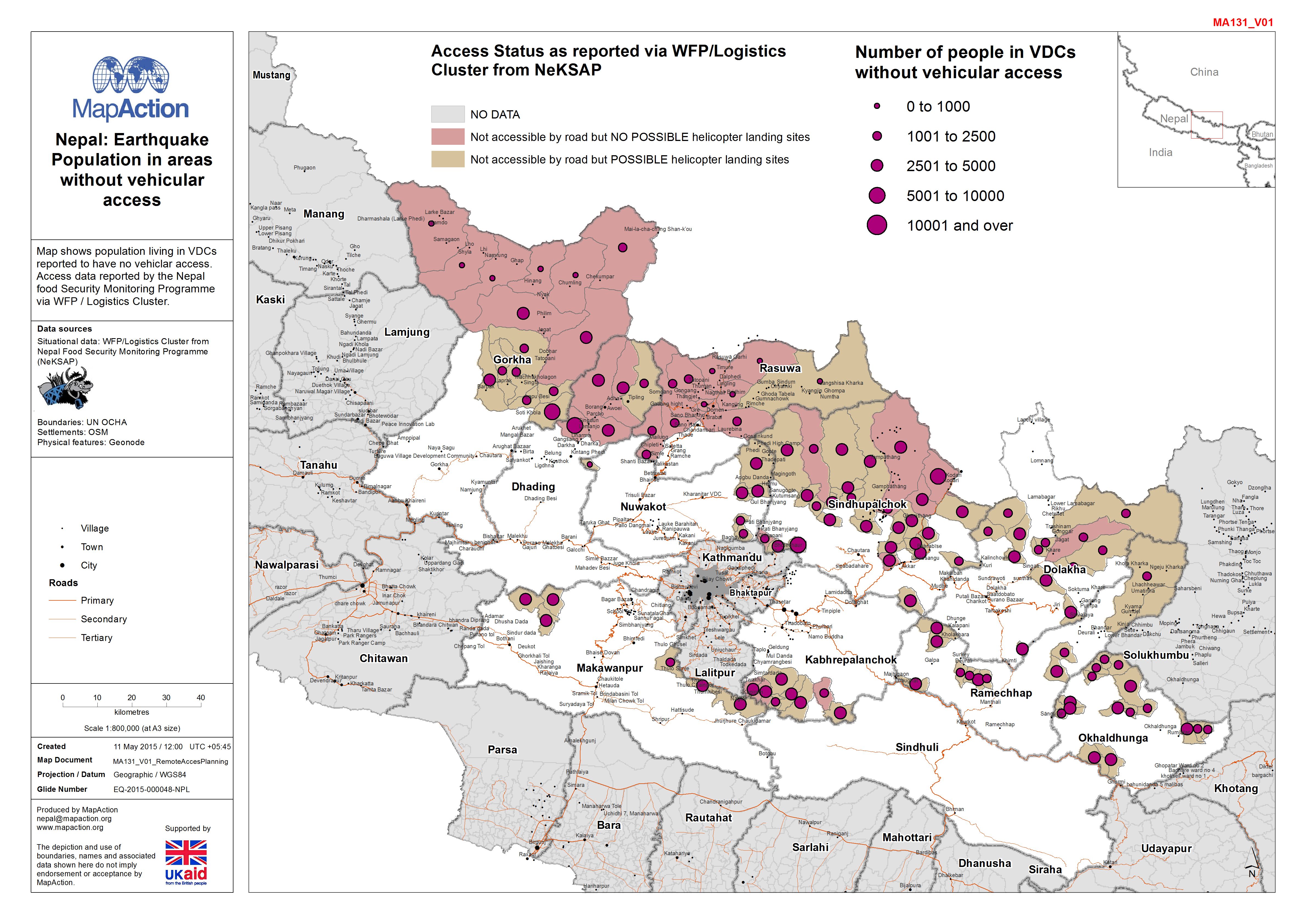
Nepal: Earthquake - Population in areas without vehicular access
Map shows population living in VDCs reported to have no vehiclar access. Access data reported by the Nepal food Security Monitoring Programme via WFP / Logistics Cluster. -
Nepal: Earthquake - District detail map series - Nuwakot
Map shows the terrain, roads, rivers and settlements. -

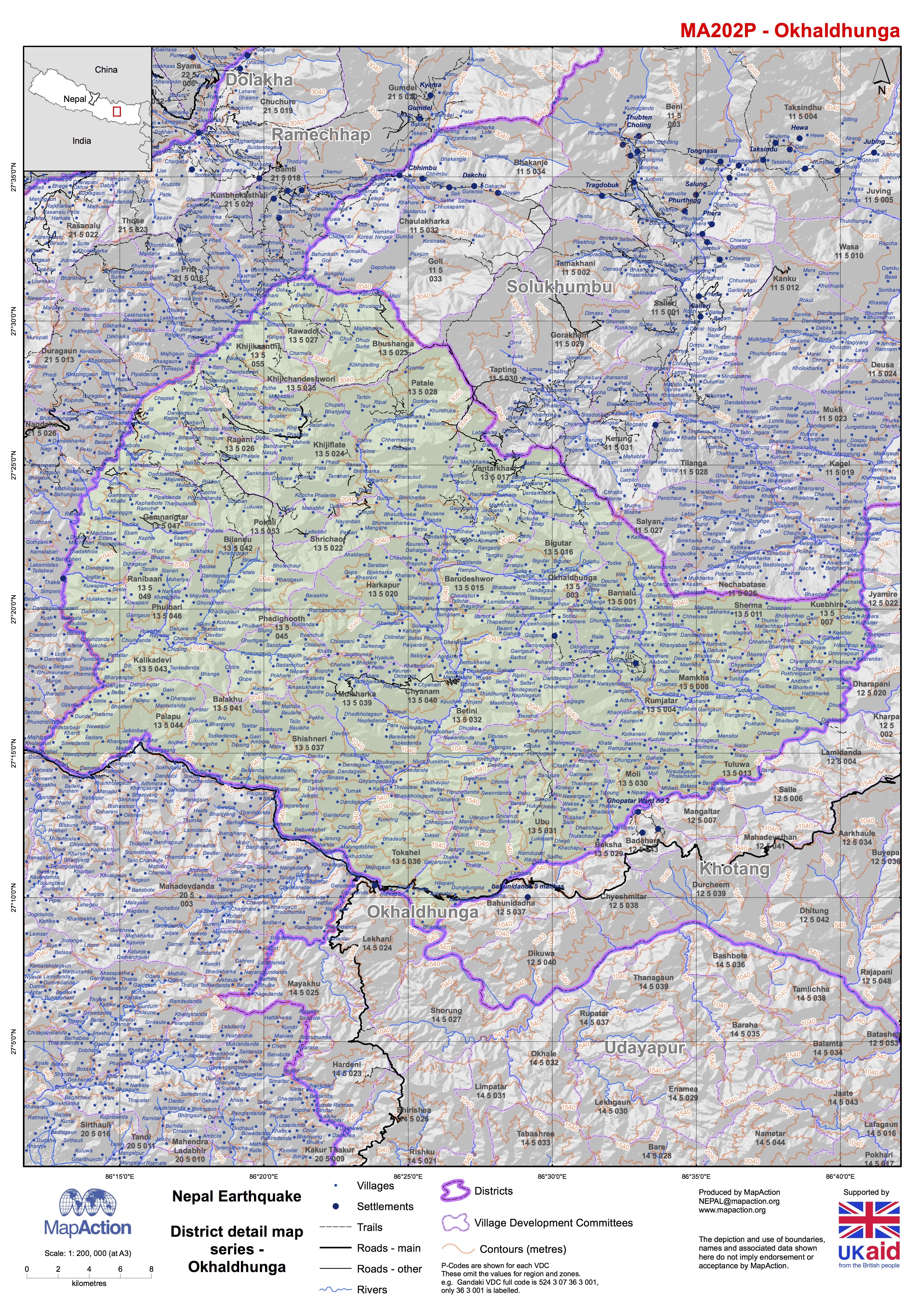
Nepal: Earthquake - District detail map series - Okhaldhunga
Map shows the terrain, roads, rivers and settlements.