-

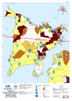
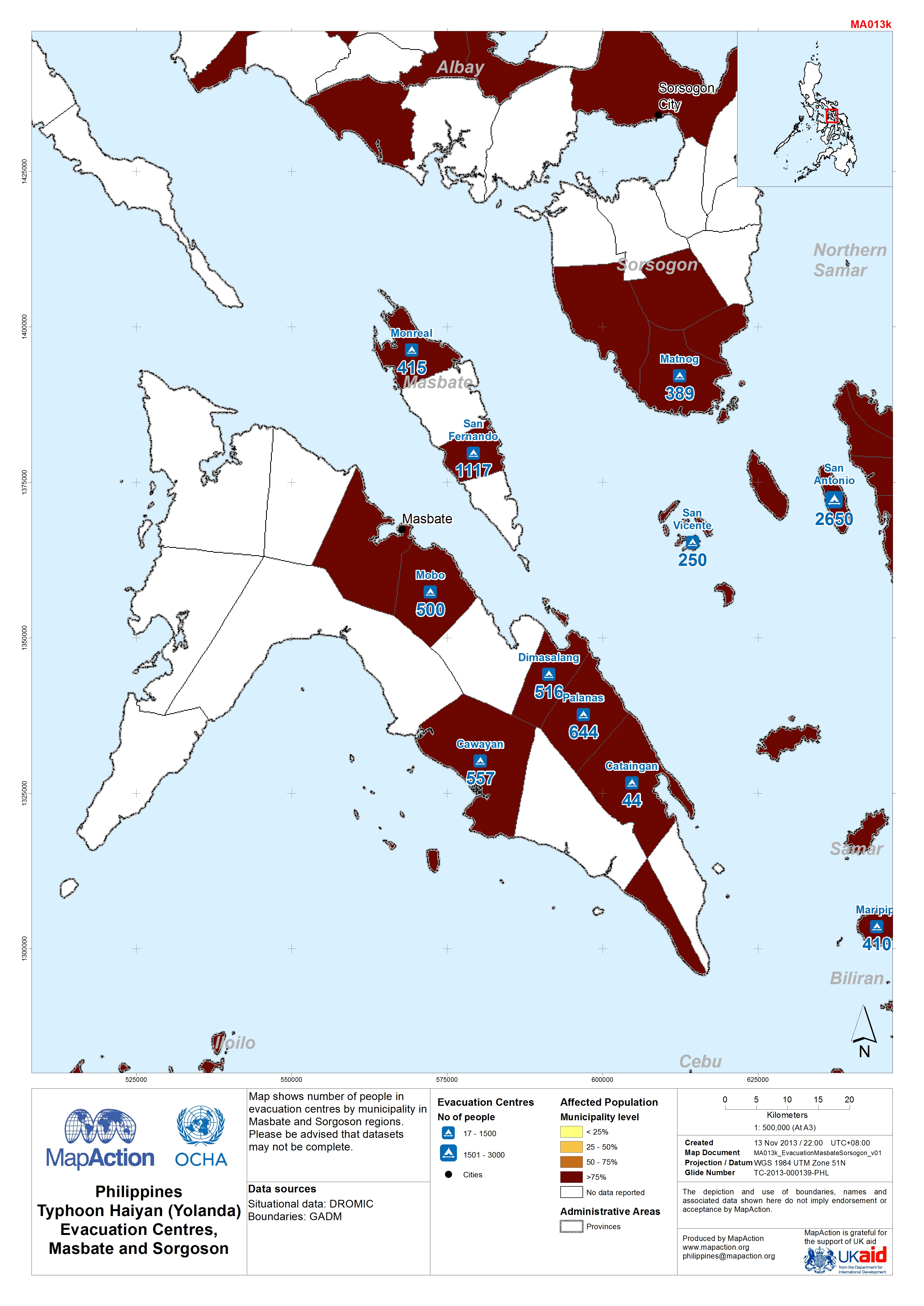
Map shows number of people in evacuation centres by municipality in Masbate and Sorgoson regions.Please be advised that datasets may not be complete.
-
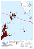
Map shows number of people in evacuation centres by municipality in Palawan and Antique regions.Please be advised that datasets may not be complete.
-
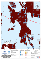
Map shows number of people in evacuation centres by municipality in Western Visayas. Please be advised that datasets may not be complete.
-

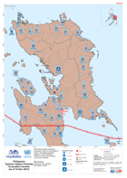
Map shows populations in evacuation centres by municipality in Central Visayas. Please be advised that datasets may not be complete.
-

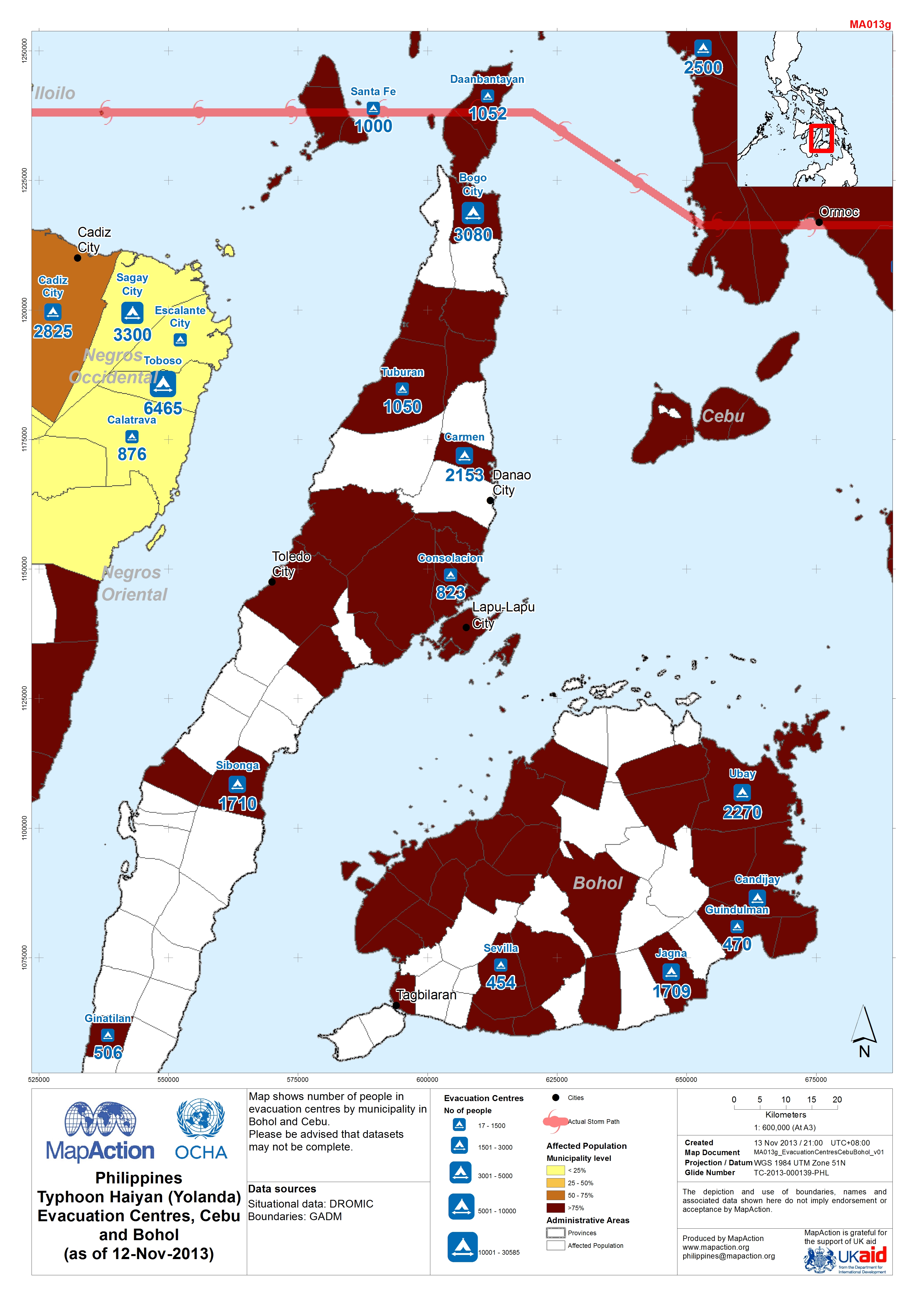
Map shows number of people in evacuation centres by municipality in Bohol and Cebu. Please be advised that datasets may not be complete.
-
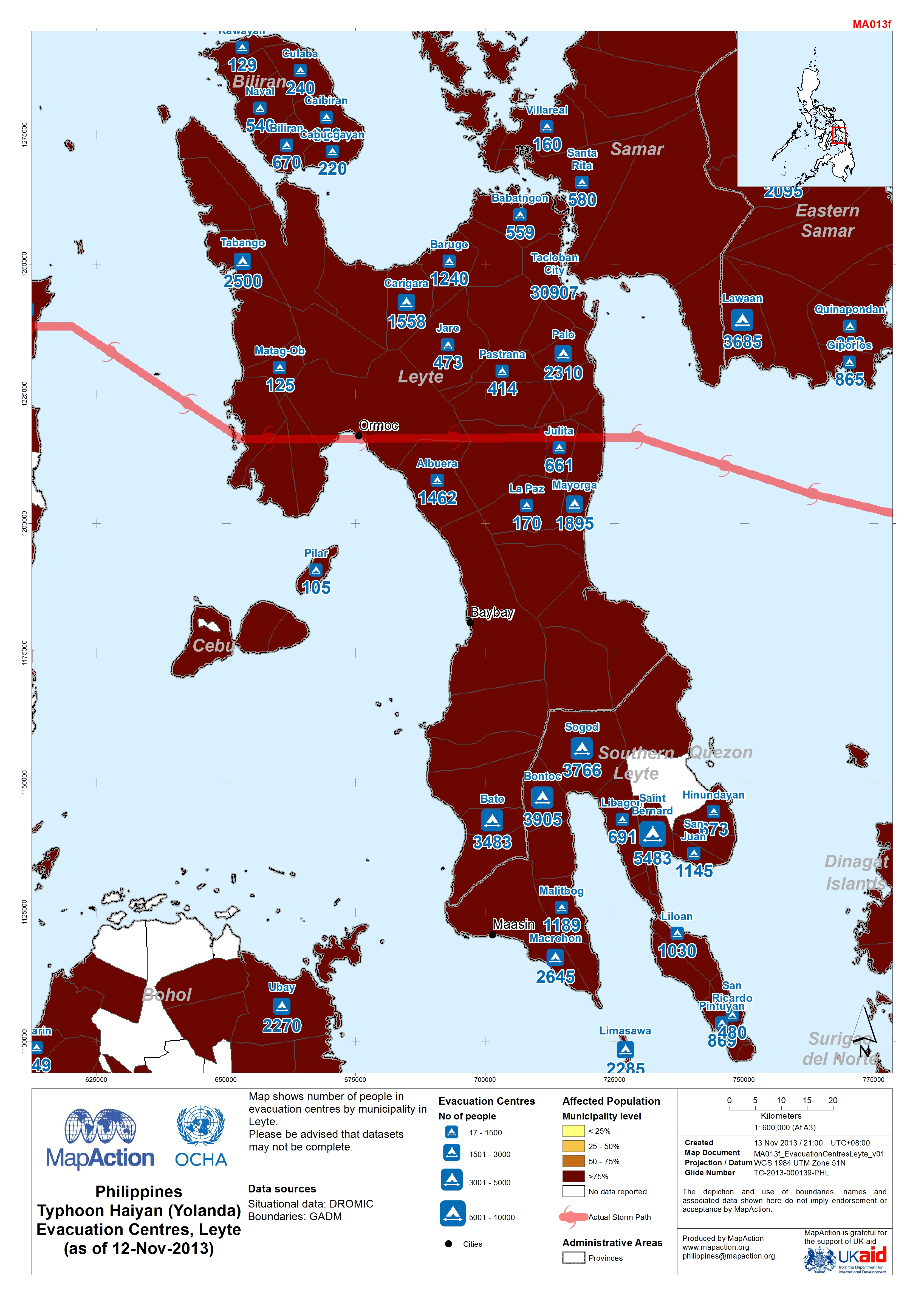
Map shows number of people in evacuation centres by municipality in Leyte. Please be advised that datasets may not be complete.
-
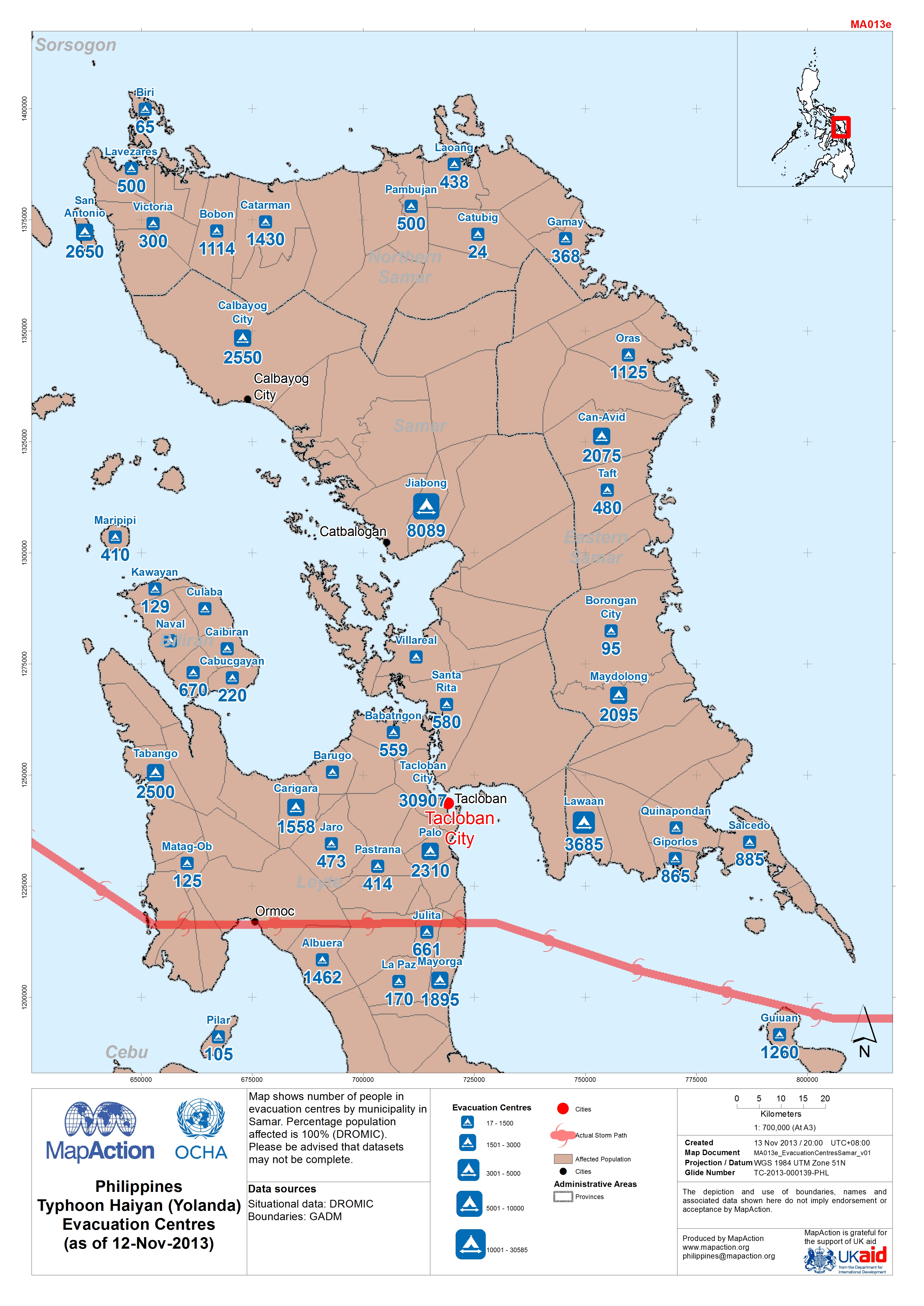
Map shows number of people in evacuation centres by municipality in Samar. Percentage population affected is 100% (DROMIC).Please be advised that datasets may not be complete.