-

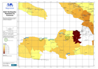
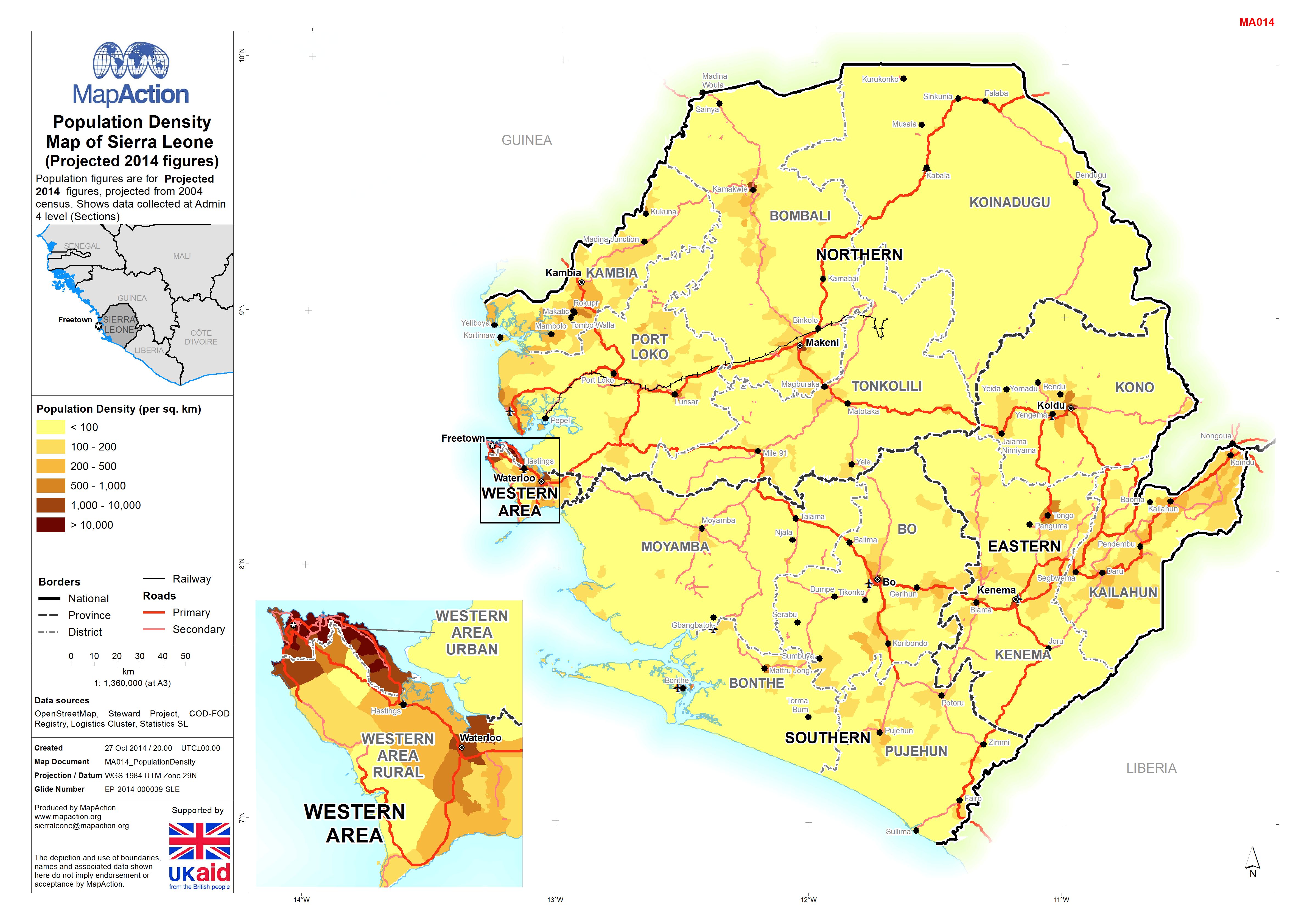
Population Density Map of Sierra Leone <FNT name =
Population figures are for Projected 2014 figures, projected from 2004 census. Shows data collected at Admin 4 level (Sections) -

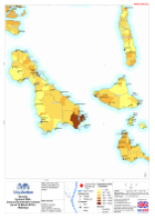
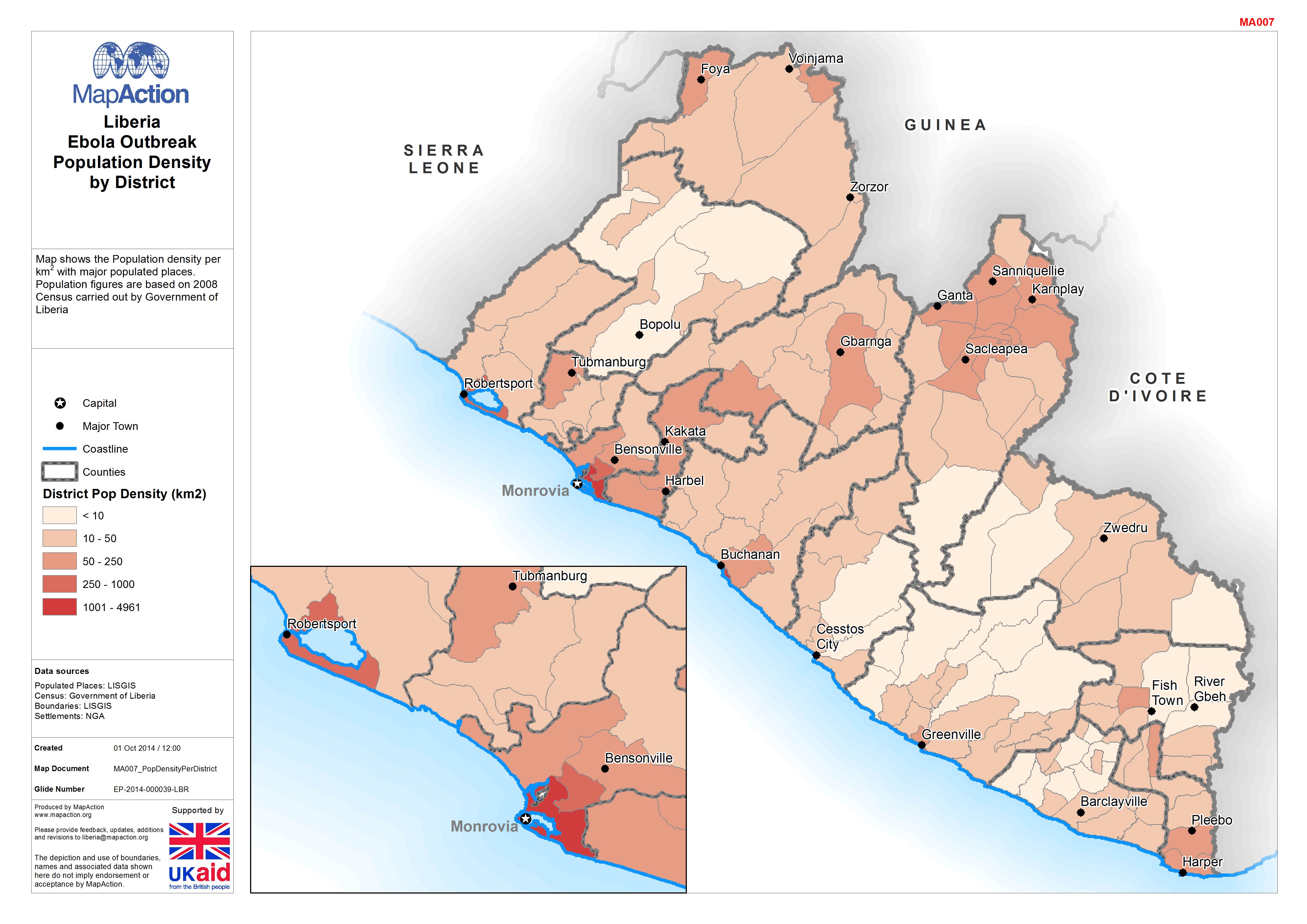
Liberia: Ebola Outbreak - Population Density by District
Map shows the Population density per km2 with major populated places. Population figures are based on 2008 Census carried out by Government of Liberia -
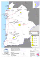
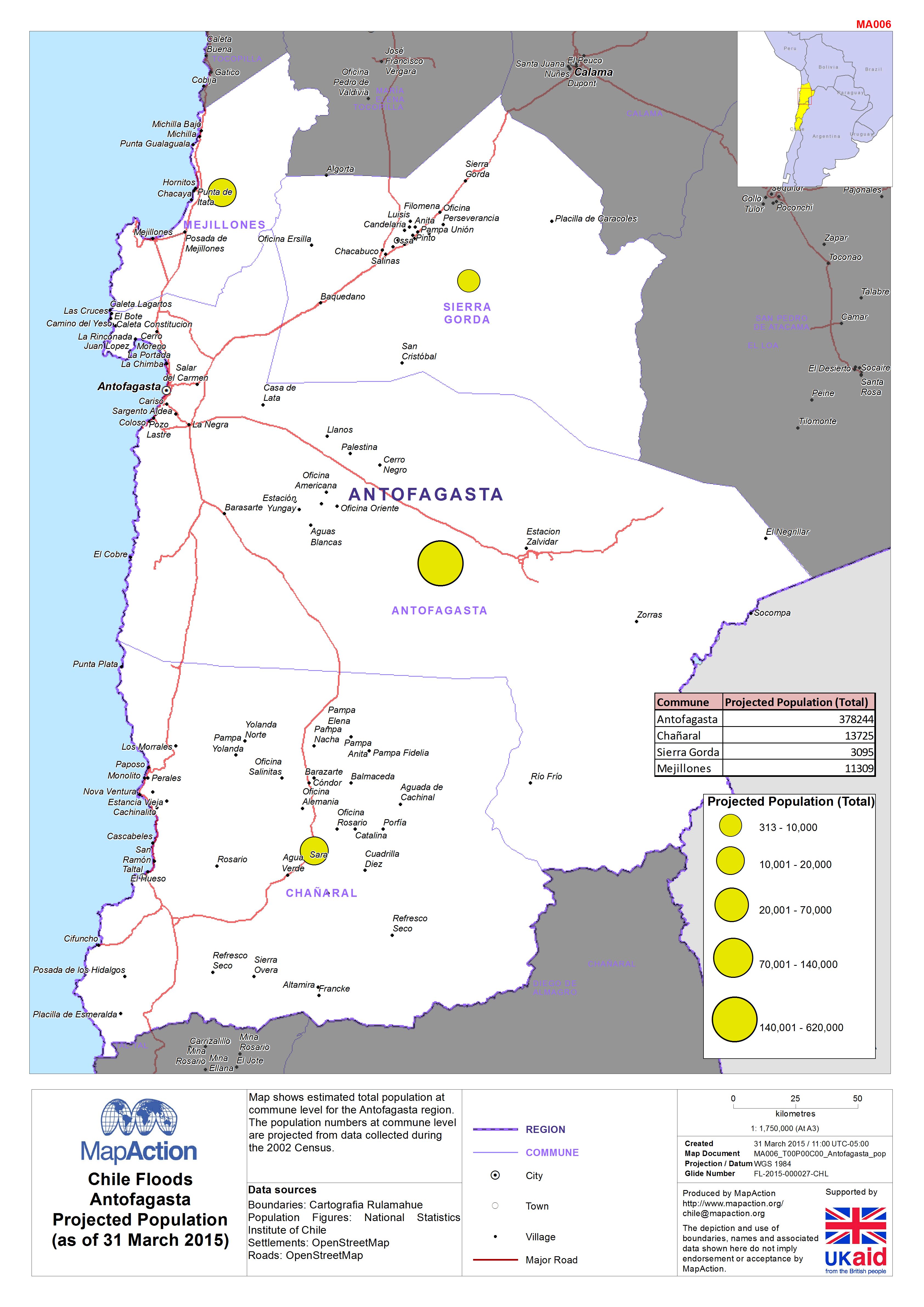
Chile: Floods - Antofagasta Projected Population (as of 31 March 2015)
Map shows estimated total population at commune level for the Antofagasta region. The population numbers at commune level are projected from data collected during the 2002 Census. -
Vanuatu: Cyclone PAM - Census Enumeration Centres (as of 16 March 2015)
PDF only map book, jpg only available for first page -
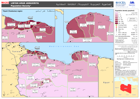
Haiti: Earthquake - Population by Commune
Map shows the population of Communes covering Port-au-Prince west to Miragoane, based on 2006 census -

Pakistan Population: Average Household Size by Tehsil (2010 Projection)
This dataset has no description
-