MA141_v01_KaligandakiRiver_LandslideDamAlert-30 ...
From the dataset abstract
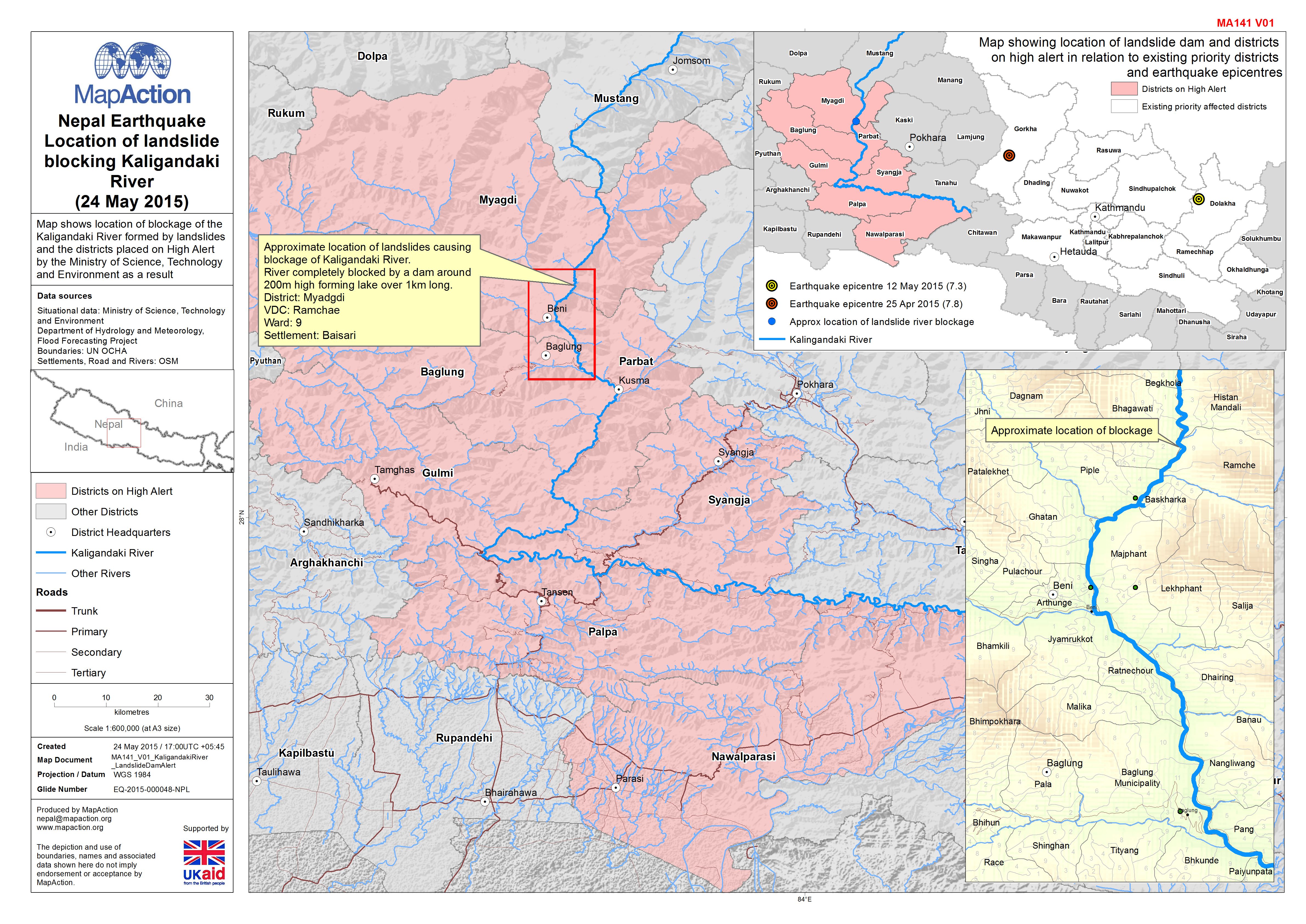
Map shows location of blockage of the Kaligandaki River formed by landslides and the districts placed on High Alert by the Ministry of Science, Technology and Environment as a result
Source: Nepal: Earthquake - Location of landslide blocking Kaligandaki River (24 May 2015)
Additional Information
| Field | Value |
|---|---|
| Data last updated | July 4, 2016 |
| Metadata last updated | July 4, 2016 |
| Created | July 4, 2016 |
| Format | JPEG |
| License | License not specified |
| Has views | True |
| Id | 593145b2-a043-4aef-8f4e-fff649b5cd4b |
| On same domain | True |
| Package id | 2c9b9913-9e58-46f2-be5f-a576ccdafa06 |
| Revision id | 5d733a59-41ee-4add-9e79-ac6fb4ce327f |
| State | active |
| Url type | upload |