thumbnail.png
From the dataset abstract
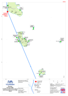
Map shows the location of sites flown over in an initial assessment.
Source: Vanuatu: Cyclone PAM - Location of sites flown over in aerial assement (as of 16 Mar 2015)
Additional Information
| Field | Value |
|---|---|
| Data last updated | July 28, 2016 |
| Metadata last updated | July 28, 2016 |
| Created | July 28, 2016 |
| Format | PNG |
| License | License not specified |
| Has views | True |
| Id | da03ce80-2858-4110-b59d-d954ea6901b7 |
| On same domain | True |
| Package id | b0bb71ca-26d5-4bcd-ad42-768f0f148983 |
| Position | 2 |
| Revision id | 7377bcfb-dee5-4316-beb0-af81e79d90cb |
| State | active |
| Url type | upload |