MA008_Flight_Assessments-300dpi.jpeg
From the dataset abstract
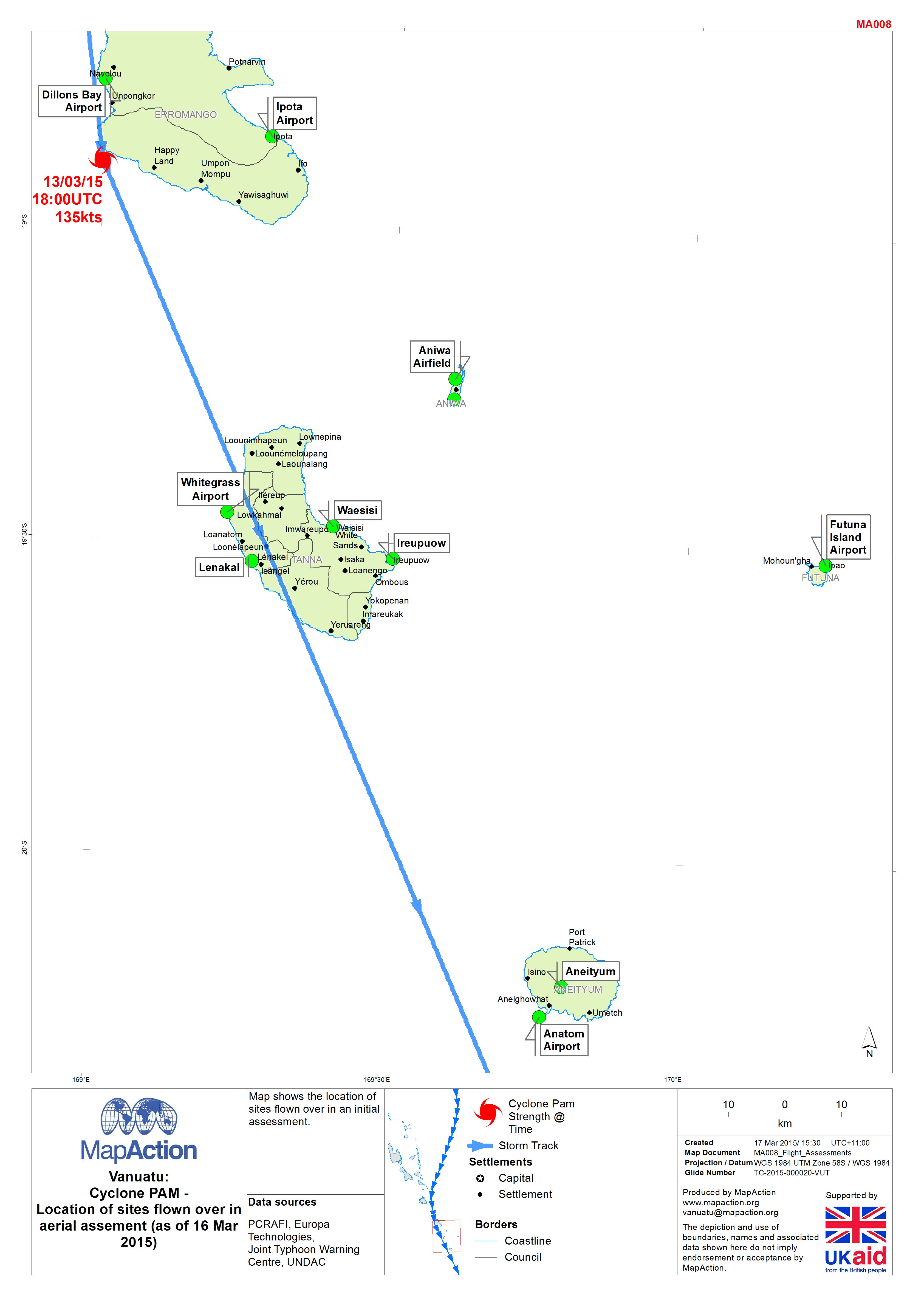
Map shows the location of sites flown over in an initial assessment.
Source: Vanuatu: Cyclone PAM - Location of sites flown over in aerial assement (as of 16 Mar 2015)
Additional Information
| Field | Value |
|---|---|
| Data last updated | July 4, 2016 |
| Metadata last updated | July 4, 2016 |
| Created | July 4, 2016 |
| Format | JPEG |
| License | License not specified |
| Has views | True |
| Id | 4d427b77-5559-4b1b-8e65-059eb883fcdb |
| On same domain | True |
| Package id | b0bb71ca-26d5-4bcd-ad42-768f0f148983 |
| Revision id | 83eac80f-cfb1-424e-acf5-d0a164966e42 |
| State | active |
| Url type | upload |