MA003_RainfallAccum_24hr_A3-300dpi.jpeg
From the dataset abstract
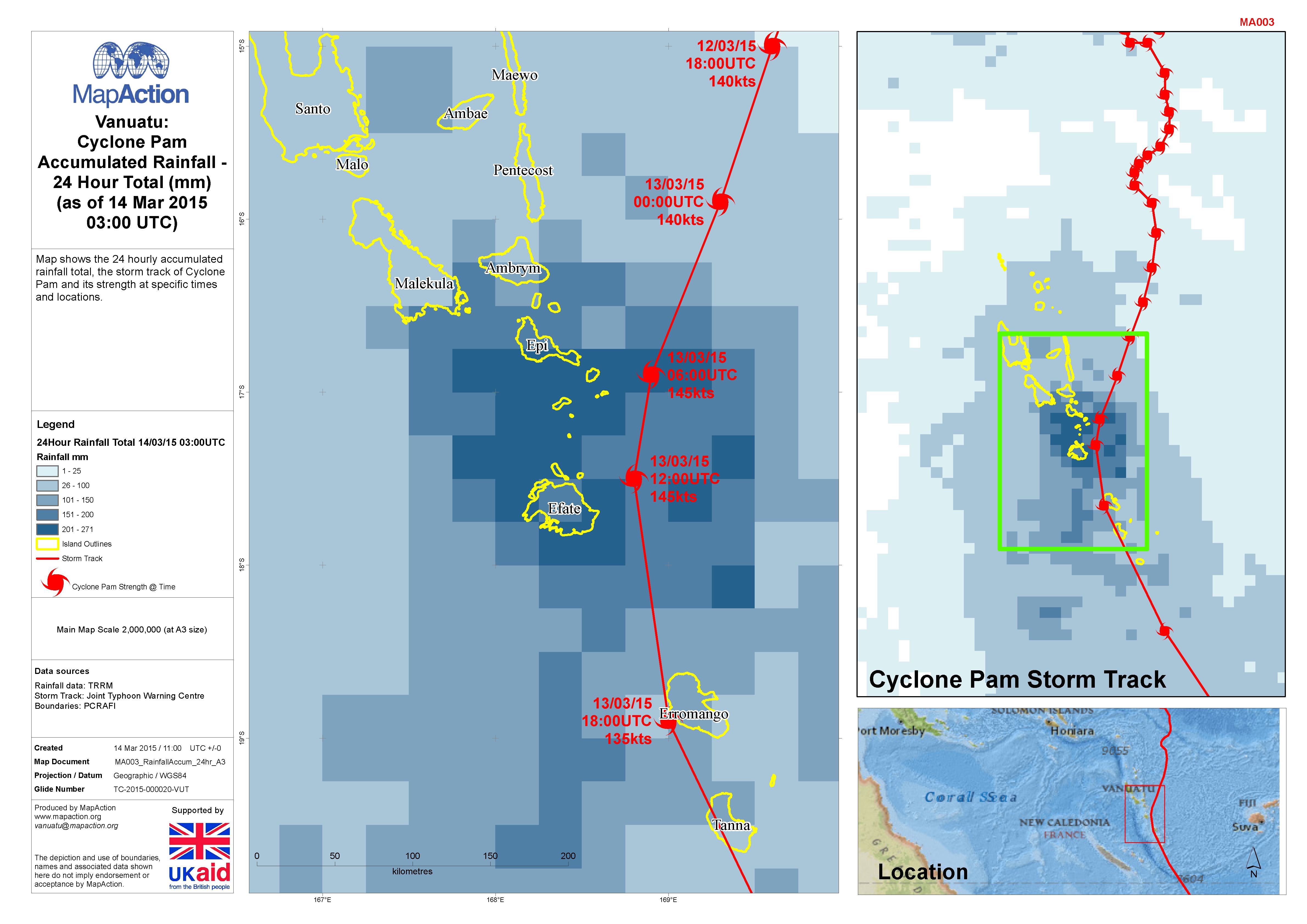
Map shows the 24 hourly accumulated rainfall total, the storm track of Cyclone Pam and its strength at specific times and locations.
Source: Vanuatu: Cyclone PAM - Accumulated Rainfall - 24 Hour Total (mm) (as of 14 Mar 2015 03:00 UTC)
Additional Information
| Field | Value |
|---|---|
| Data last updated | July 4, 2016 |
| Metadata last updated | July 4, 2016 |
| Created | July 4, 2016 |
| Format | JPEG |
| License | License not specified |
| Has views | True |
| Id | 9706d133-749c-4ace-aa42-8a90a929c817 |
| On same domain | True |
| Package id | da0b51f6-7923-4bee-a96d-7036e8f1db52 |
| Revision id | d928f94b-700a-40a5-adb6-452fc401feeb |
| State | active |
| Url type | upload |