MA0015_Chikwawa_EastBank_Road-300dpi.jpeg
From the dataset abstract
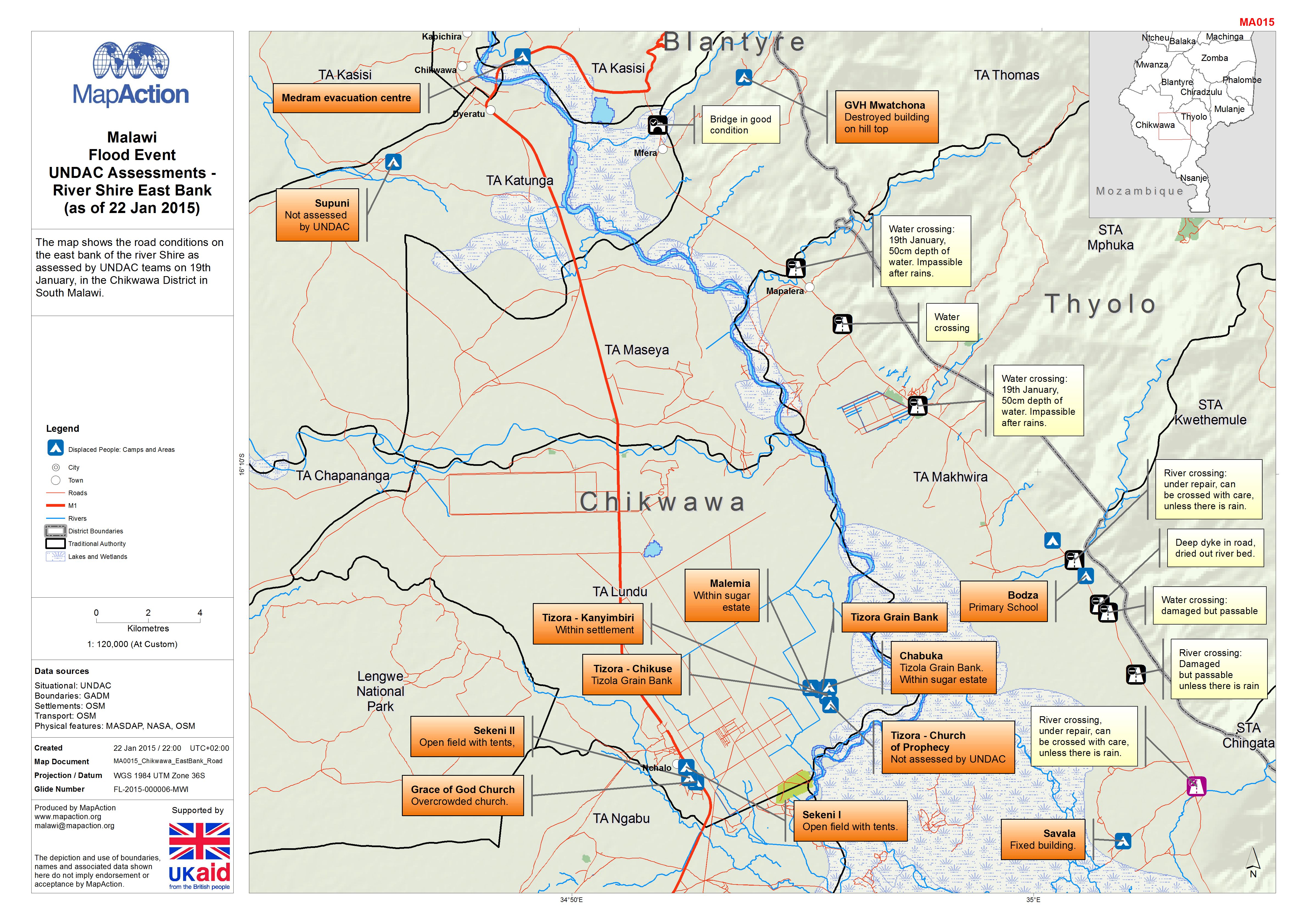
The map shows the road conditions on the east bank of the river Shire as assessed by UNDAC teams on 19th January, in the Chikwawa District in South Malawi.
Source: Malawi: Floods - UNDAC Assessments - River Shire East Bank (as of 22 Jan 2015)
Additional Information
| Field | Value |
|---|---|
| Data last updated | July 4, 2016 |
| Metadata last updated | July 4, 2016 |
| Created | July 4, 2016 |
| Format | JPEG |
| License | License not specified |
| Has views | True |
| Id | da70250e-9aa2-47b7-9a08-ec9dd0b42d28 |
| On same domain | True |
| Package id | daebe52e-3123-4b65-b1e8-ebb90aab6169 |
| Revision id | fdcfed75-72fd-459f-9693-c1aaf30f5e4b |
| State | active |
| Url type | upload |