MA022_School_Damage_v01-300dpi.jpeg
From the dataset abstract
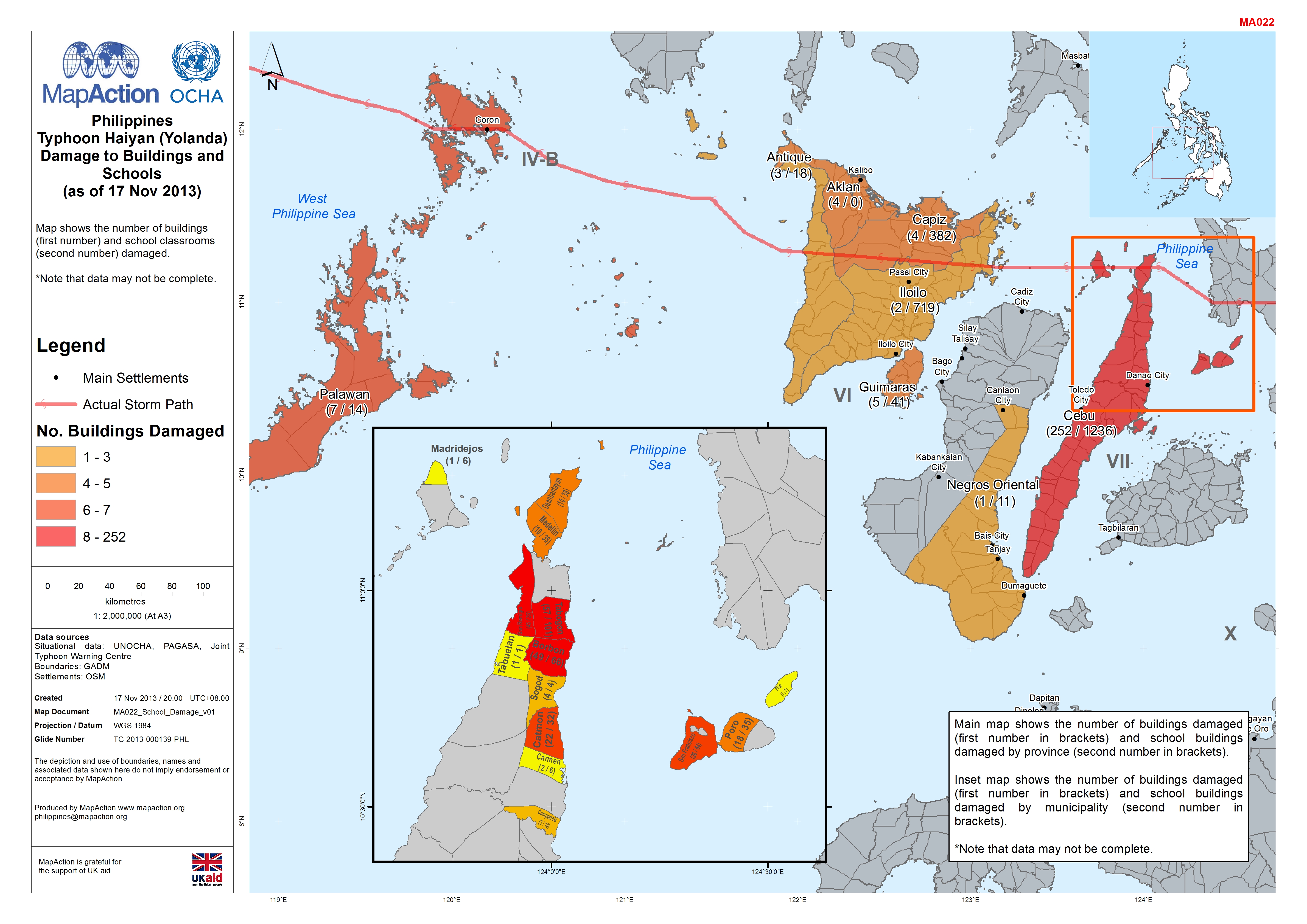
Map shows the number of buildings (first number) and school classrooms (second number) damaged.*Note that data may not be complete.
Source: Philippines Typhoon Haiyan (Yolanda) Damage to Buildings and Schools (as of 17 Nov 2013)
Additional Information
| Field | Value |
|---|---|
| Data last updated | July 4, 2016 |
| Metadata last updated | July 4, 2016 |
| Created | July 4, 2016 |
| Format | JPEG |
| License | License not specified |
| Has views | True |
| Id | 3dc4aa32-825e-46d1-a2fd-f184b897ec0b |
| On same domain | True |
| Package id | 458d3c13-23f2-48f7-b622-1f72da696dcd |
| Revision id | b3fe747f-a713-47fc-8e5e-7fea47a1045c |
| State | active |
| Url type | upload |