thumbnail.png
From the dataset abstract
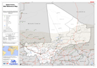
Reference map illustrating administrative boundaries, transport infrastructure and settlements.
Source: Sahel Crisis: Mali Reference Map
Additional Information
| Field | Value |
|---|---|
| Data last updated | July 28, 2016 |
| Metadata last updated | July 28, 2016 |
| Created | July 28, 2016 |
| Format | PNG |
| License | License not specified |
| Has views | True |
| Id | a83c9236-941d-4945-b564-38d489072623 |
| On same domain | True |
| Package id | c930556a-72c9-4b28-afbf-fac97151dc4b |
| Position | 2 |
| Revision id | ba68352c-e065-454e-b2a9-b2ca196090af |
| State | active |
| Url type | upload |