thumbnail.png
From the dataset abstract
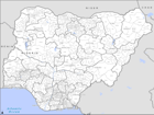
PowerPoint maps illustrating level 1 and level 2 administrative boundaries and transport links - click link to download - Sahel Crisis: PowerPoint Map Nigeria
Additional Information
| Field | Value |
|---|---|
| Data last updated | July 28, 2016 |
| Metadata last updated | July 28, 2016 |
| Created | July 28, 2016 |
| Format | PNG |
| License | License not specified |
| Has views | True |
| Id | 79e3fc07-6d23-4403-96d9-a5d1e2c39f29 |
| On same domain | True |
| Package id | acc47265-fc87-4357-84e2-3bf243fe7015 |
| Position | 3 |
| Revision id | 56a36005-f3d8-4c1d-8994-bae39a67ad42 |
| State | active |
| Url type | upload |