thumbnail.png
From the dataset abstract
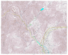
Detailed topographic mapping, scale 1:25,000. Each sheet covers approximately 11 x 9 km. For use only in disaster relief activities, by kind permission of Geospatial Information Authority...
Source: Japan Earthquake: 1:25,000 Topographic Sheet 584155 Sakari
Additional Information
| Field | Value |
|---|---|
| Data last updated | July 28, 2016 |
| Metadata last updated | July 28, 2016 |
| Created | July 28, 2016 |
| Format | PNG |
| License | License not specified |
| Has views | True |
| Id | a83fdcd4-4343-4f64-a9ca-8ea1f040e159 |
| On same domain | True |
| Package id | 659e1958-f631-4fc8-aa0f-96d606dc007a |
| Position | 2 |
| Revision id | e464fff9-52f0-401f-8b07-9cee811d978b |
| State | active |
| Url type | upload |