-
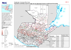
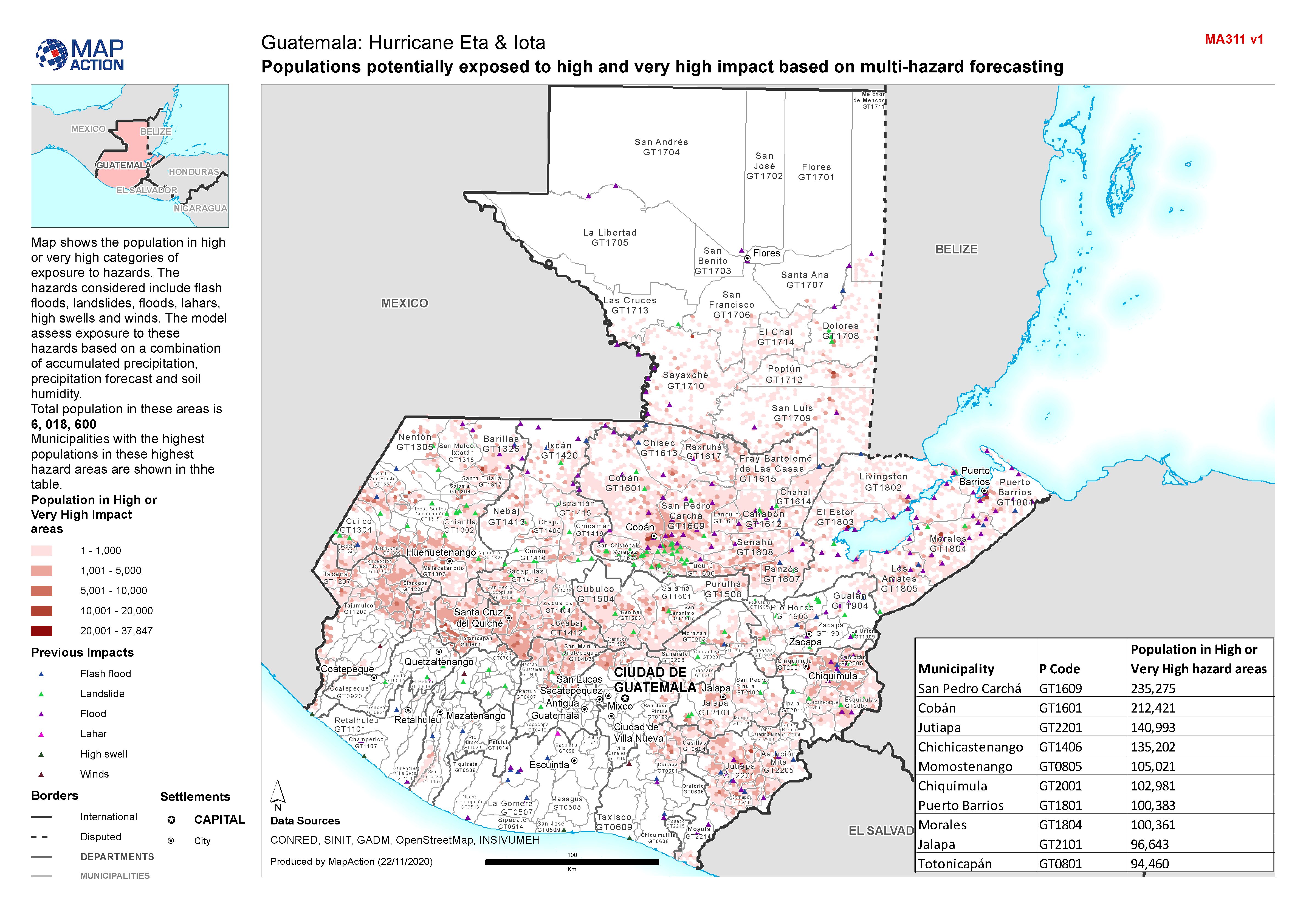
Guatemala: Populations potentially exposed to high and very high impact based...
Map shows the population in high or very high categories of exposure to hazards. The hazards considered include flash floods, landslides, floods, lahars, high swells and winds.... -

-

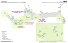
Ulua Basin: areas evacuated for Hurricane Iota, with El Cajón dam overspillin...
The Municipalities indicated were given mandatory evacuation ordres from low lying land near Ulua and Chameleco rivers pre hurricane Iota. Modelling of possible inundation from... -

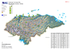
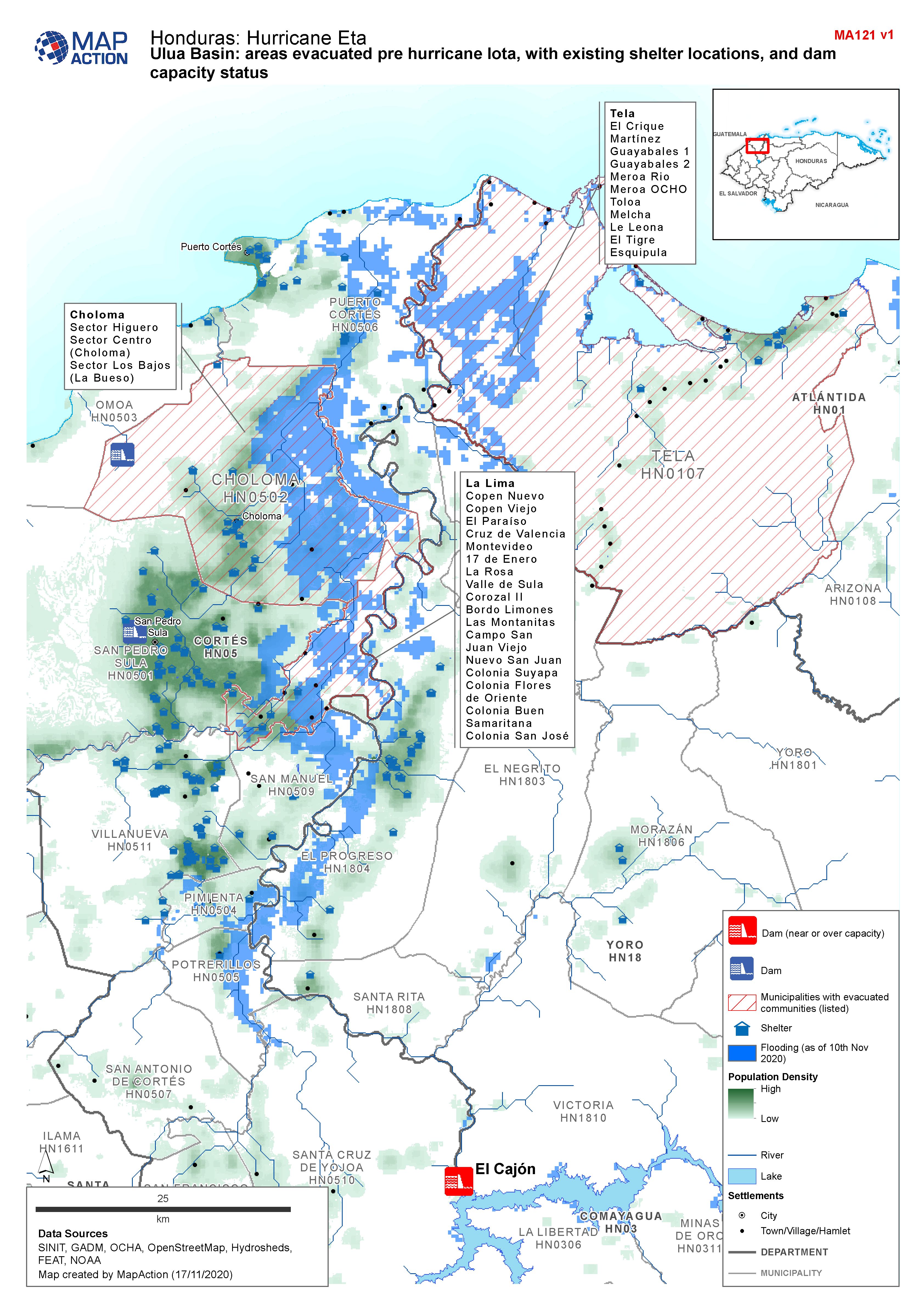
Honduras, Ulua Basin: areas evacuated pre Hurricane Iota, with existing shelt...
Map shows communities evacuated pre hurricane Iota, and existing shelter locations. Population density and capacity status of dams are also shown. -
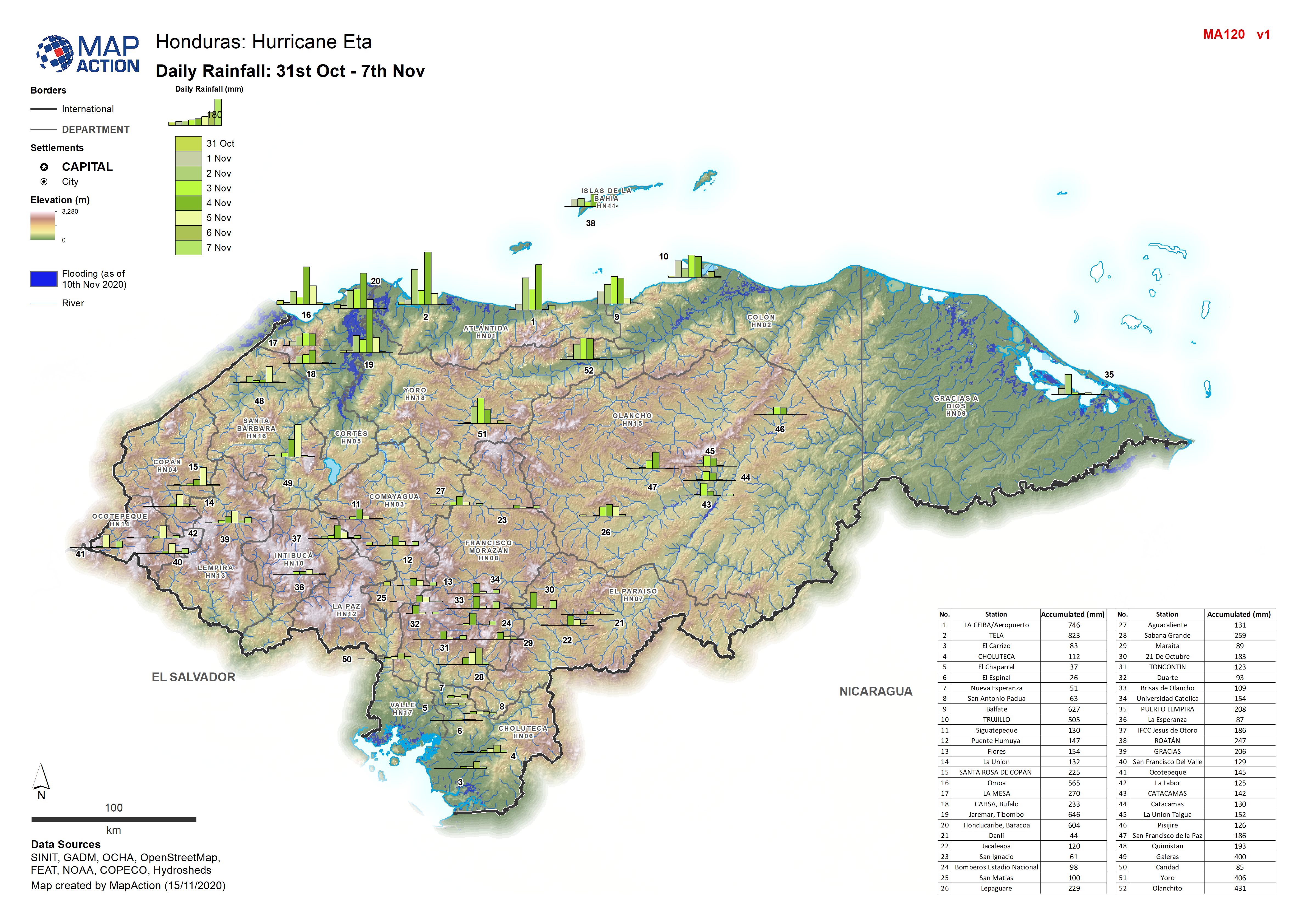
Honduras: Daily Rainfall: 31st Oct - 7th Nov 2020
Honduras: Daily Rainfall: 31st Oct - 7th Nov by weather station -
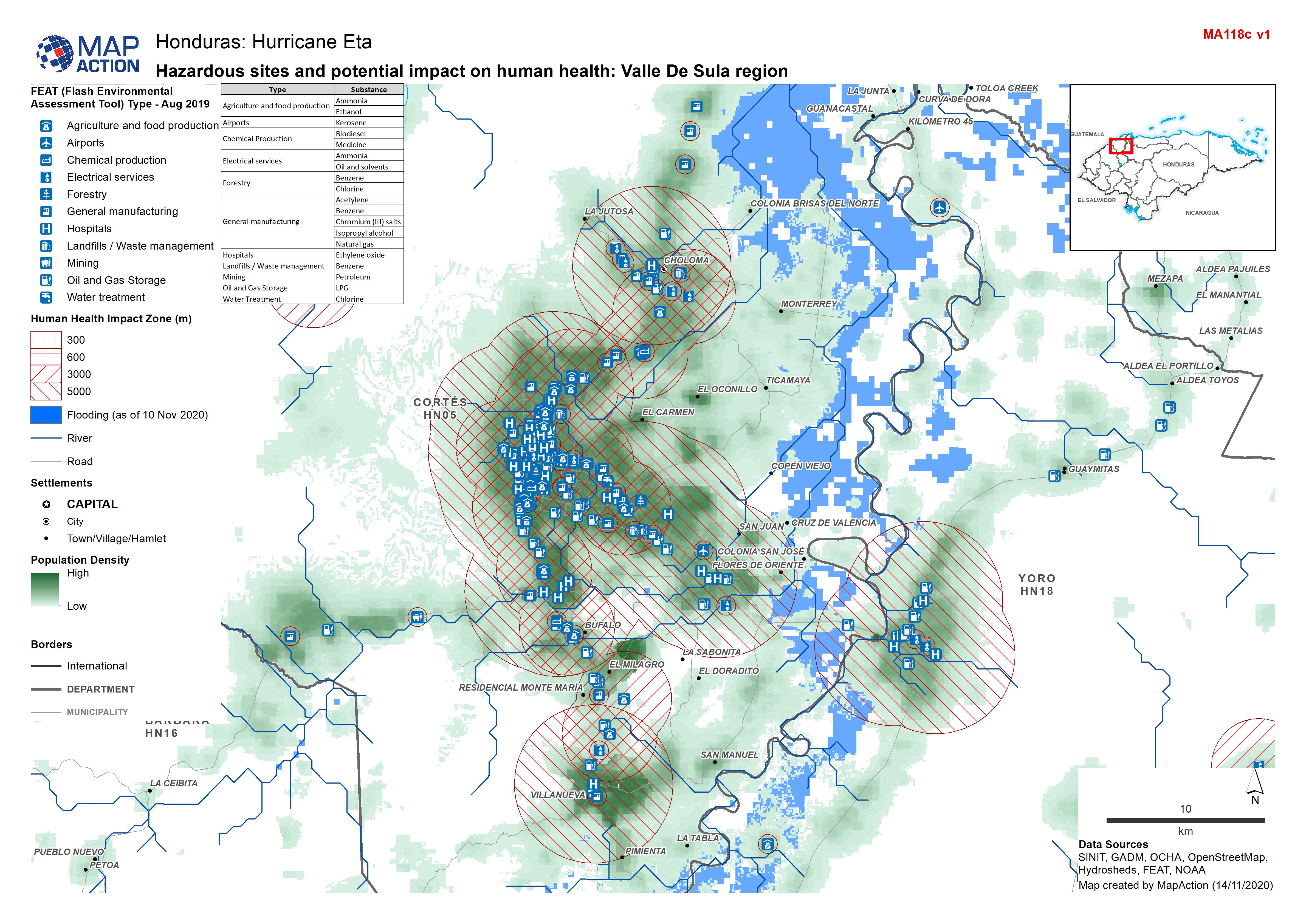
Honduras: Hazardous sites and potential impact on human health: Valle De Sula...
Honduras - Environmental Impact Zones (human health) from FEAT: Valle de Sula region (FEAT - Flash Environmental Assessment Tool) -

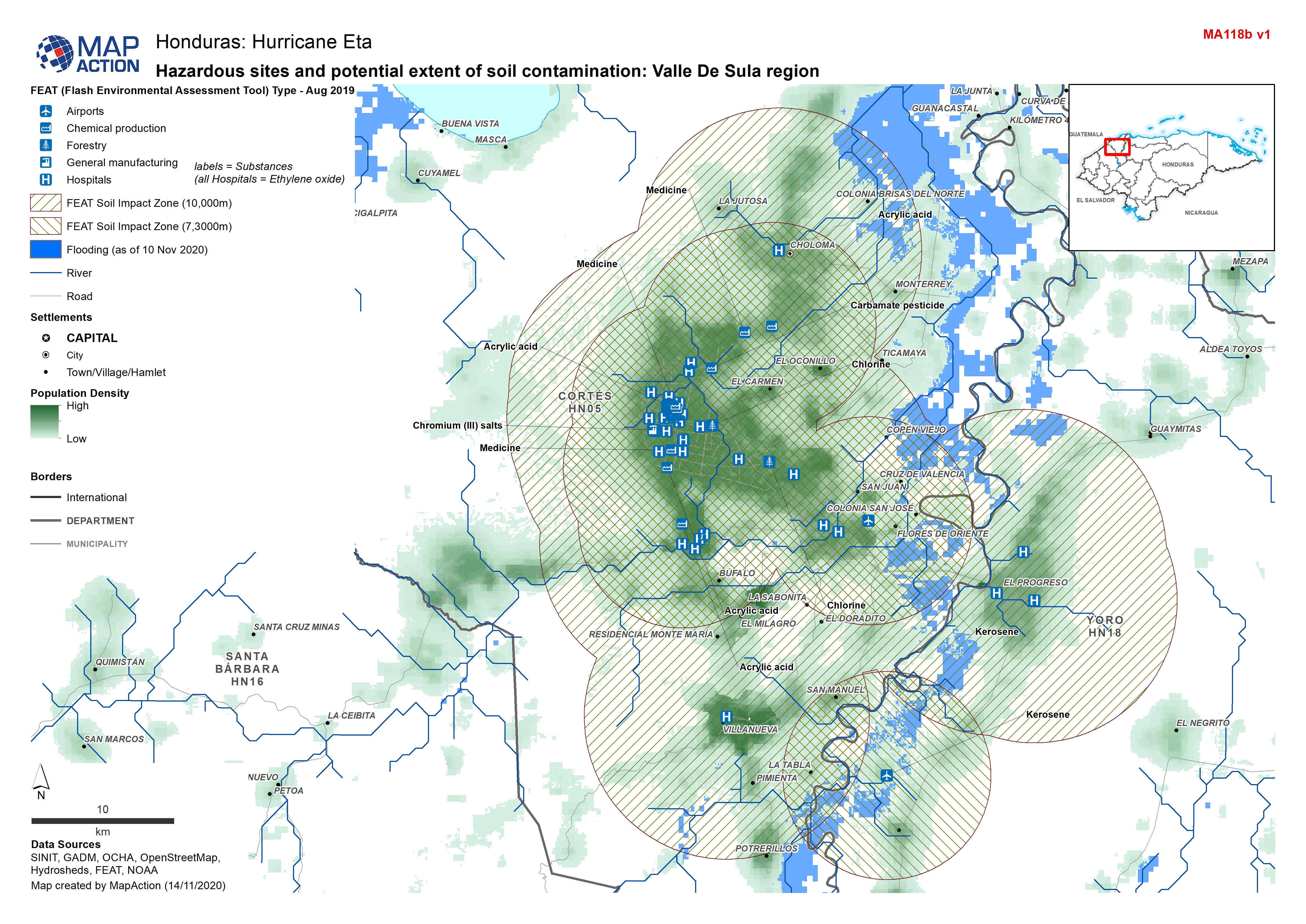
Honduras: Hazardous sites and potential extent of soil contamination: Valle D...
Honduras - Environmental Impact Zones (soil) from FEAT: Valle de Sula region (FEAT - Flash Environmental Assessment Tool) -

Honduras: Hazardous sites and potential extent of water contamination: Valle ...
Honduras - Environmental Impact Zones (water) from FEAT: Valle de Sula region (FEAT - Flash Environmental Assessment Tool) -

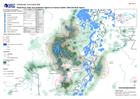
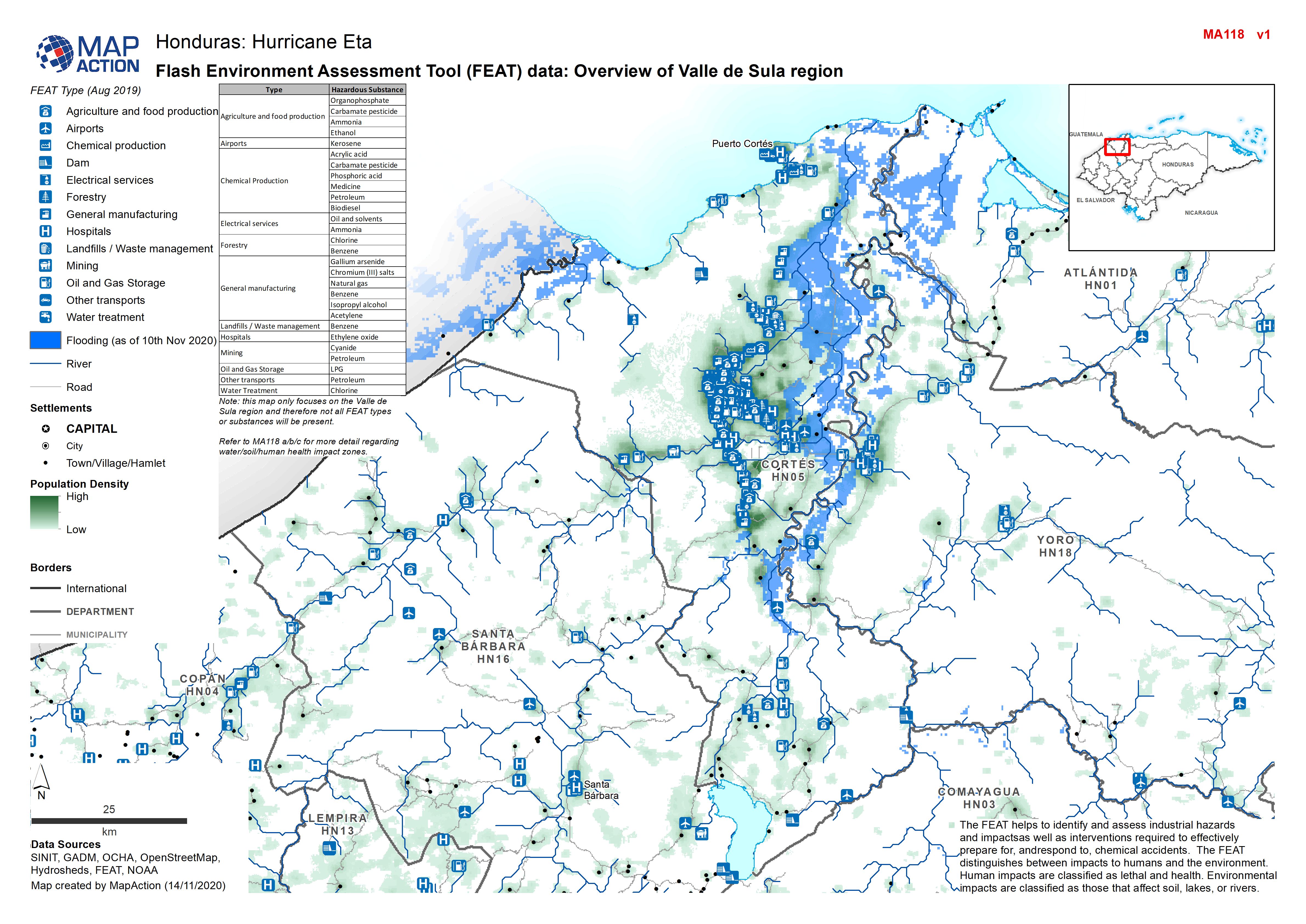
Honduras: Flash Environment Assessment Tool (FEAT) data: Overview of Valle de...
Flash Environment Assessment Tool (FEAT) data: Overview of Valle de Sula region -
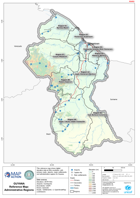
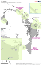
Guyana Reference Map: Administrative Regions
This reference map shows digital elevation data at 90m resolution, with primary roads, airports, major settlements and administrative regions for Guyana. -

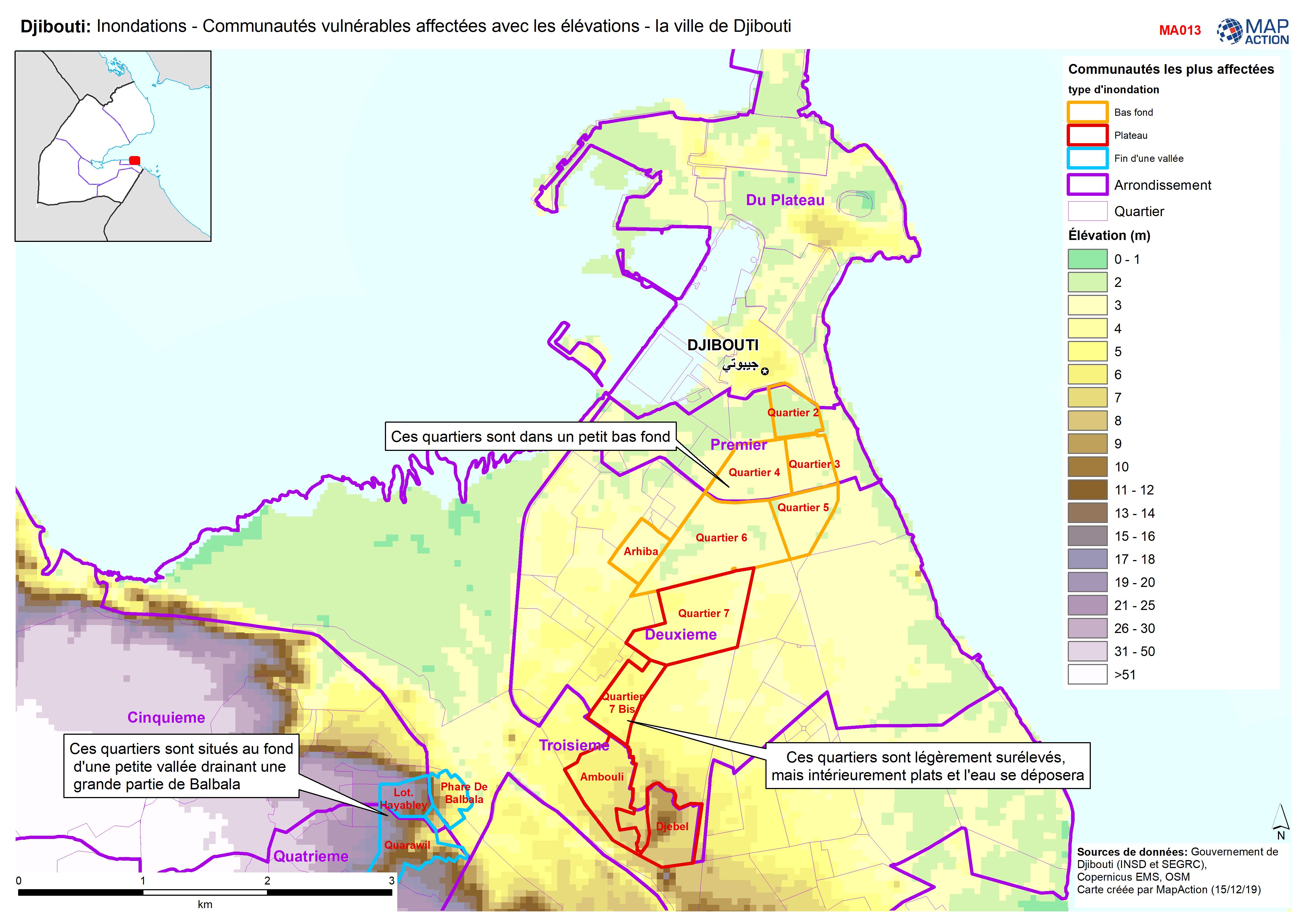
Djibouti: Inondations - Communautés vulnérables affectées avec les élévations...
Djibouti City - Map shows the most affected flooded communities, containing the most vulnerable populations, alongside elevation data to demonstrate the effects of elevation and... -
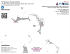
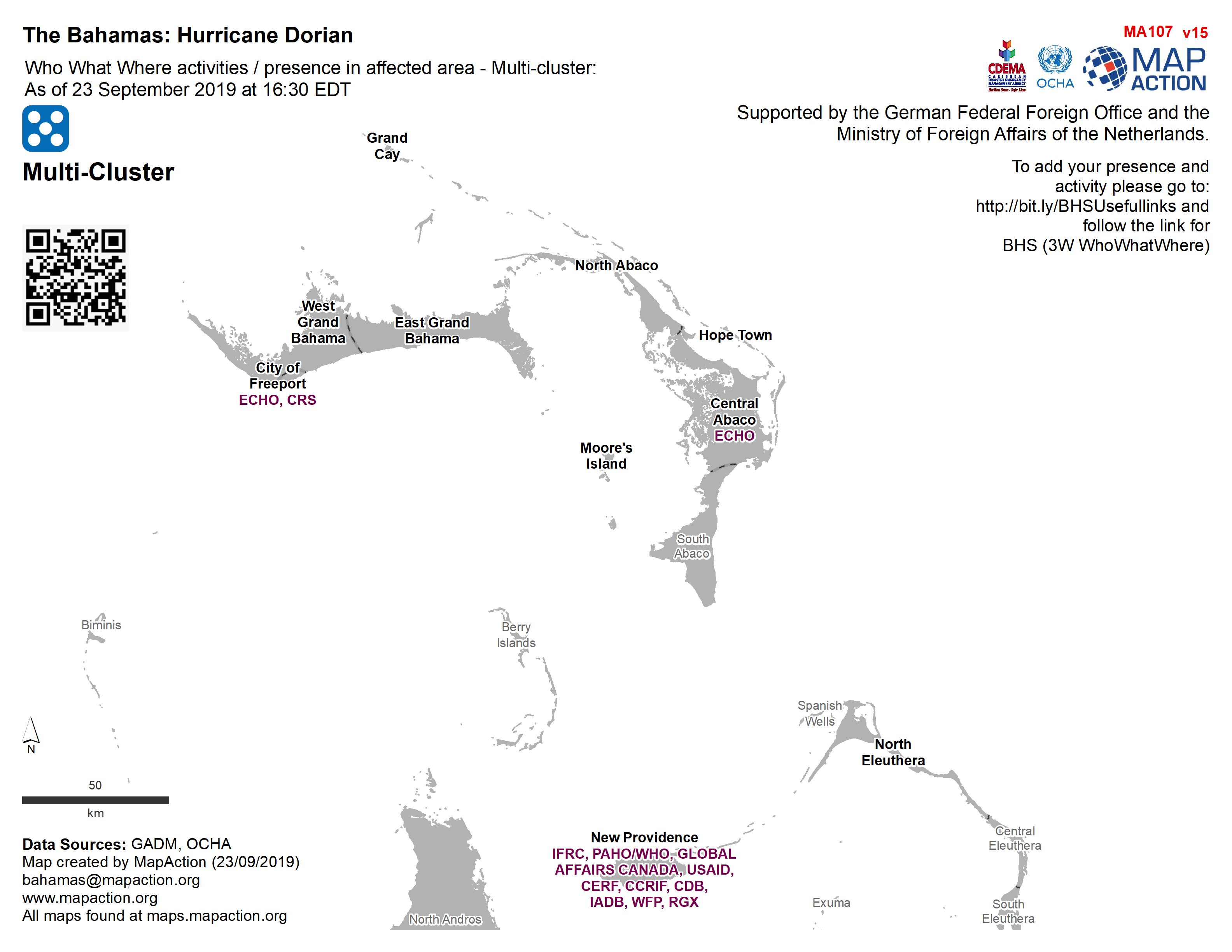
Who What Where activities / presence in affected area - Multi-cluster: As of ...
Who, What, Where for Coordination - Multi-Cluster -
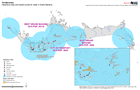
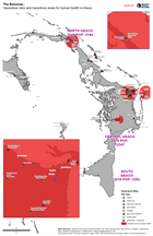
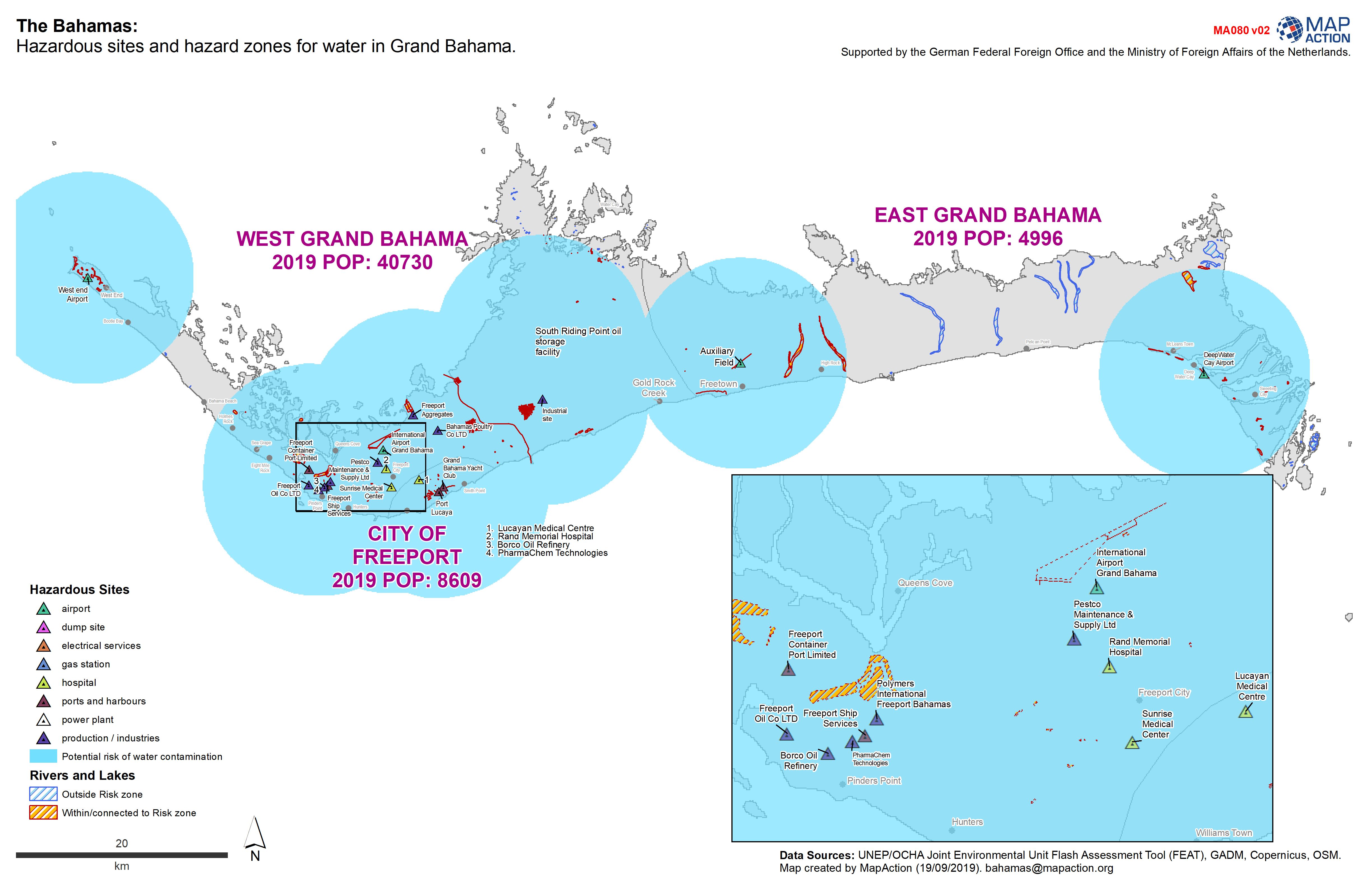
The Bahamas: Hazardous sites and hazard zones for water in Grand Bahama.
Hazardous sites and hazardous zones for human health. -
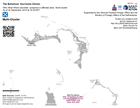
Who What Where activities / presence in affected area - Multi-cluster: As of ...
Who, What, Where for Coordination - Multi-Cluster -

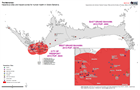
The Bahamas: Hazardous sites and hazardous areas for water in Abaco.
Hazardous sites in Abaco -
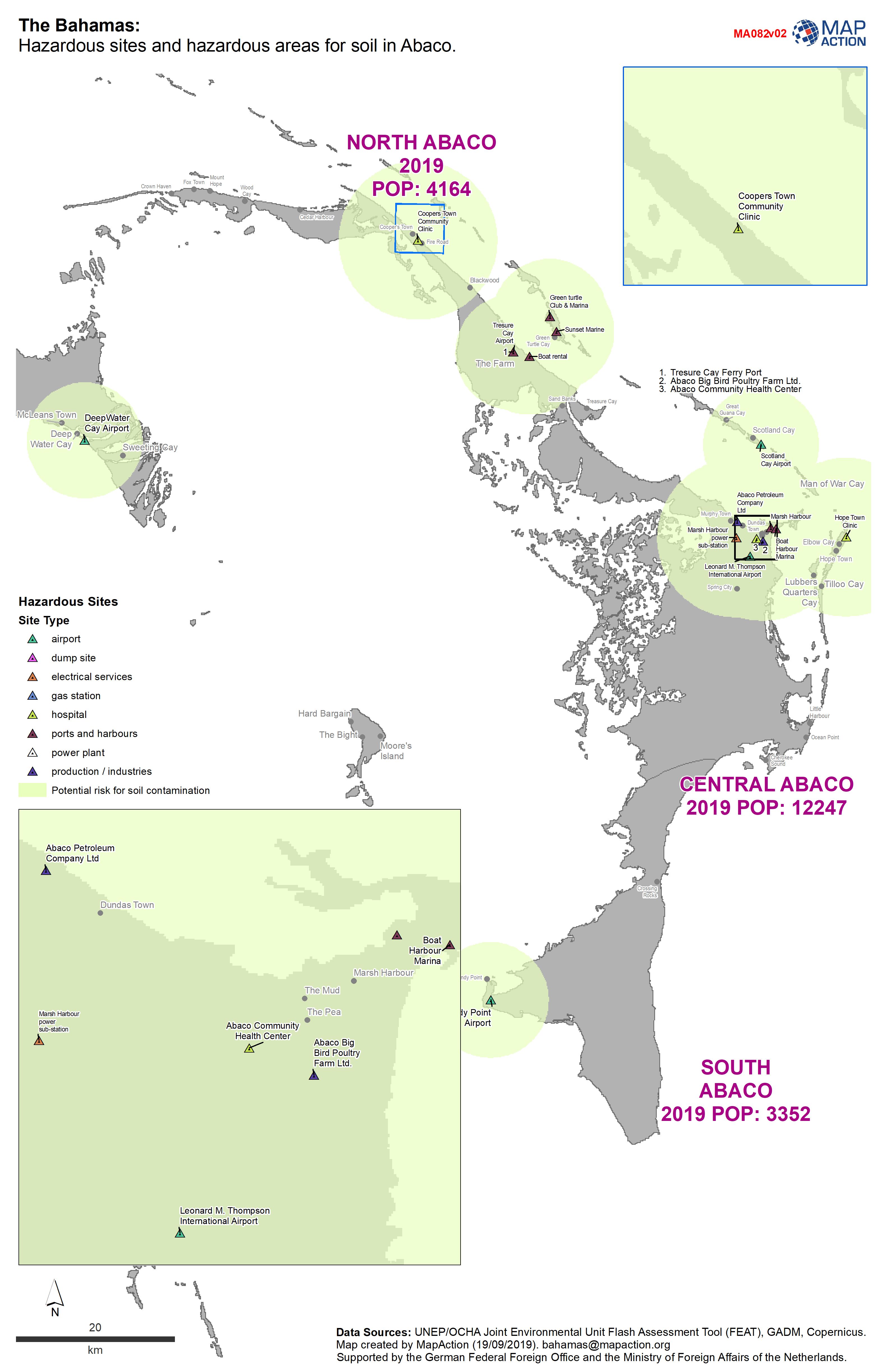
The Bahamas: Hazardous sites and hazardous areas for soil in Abaco.
Hazardous sites in Abaco -
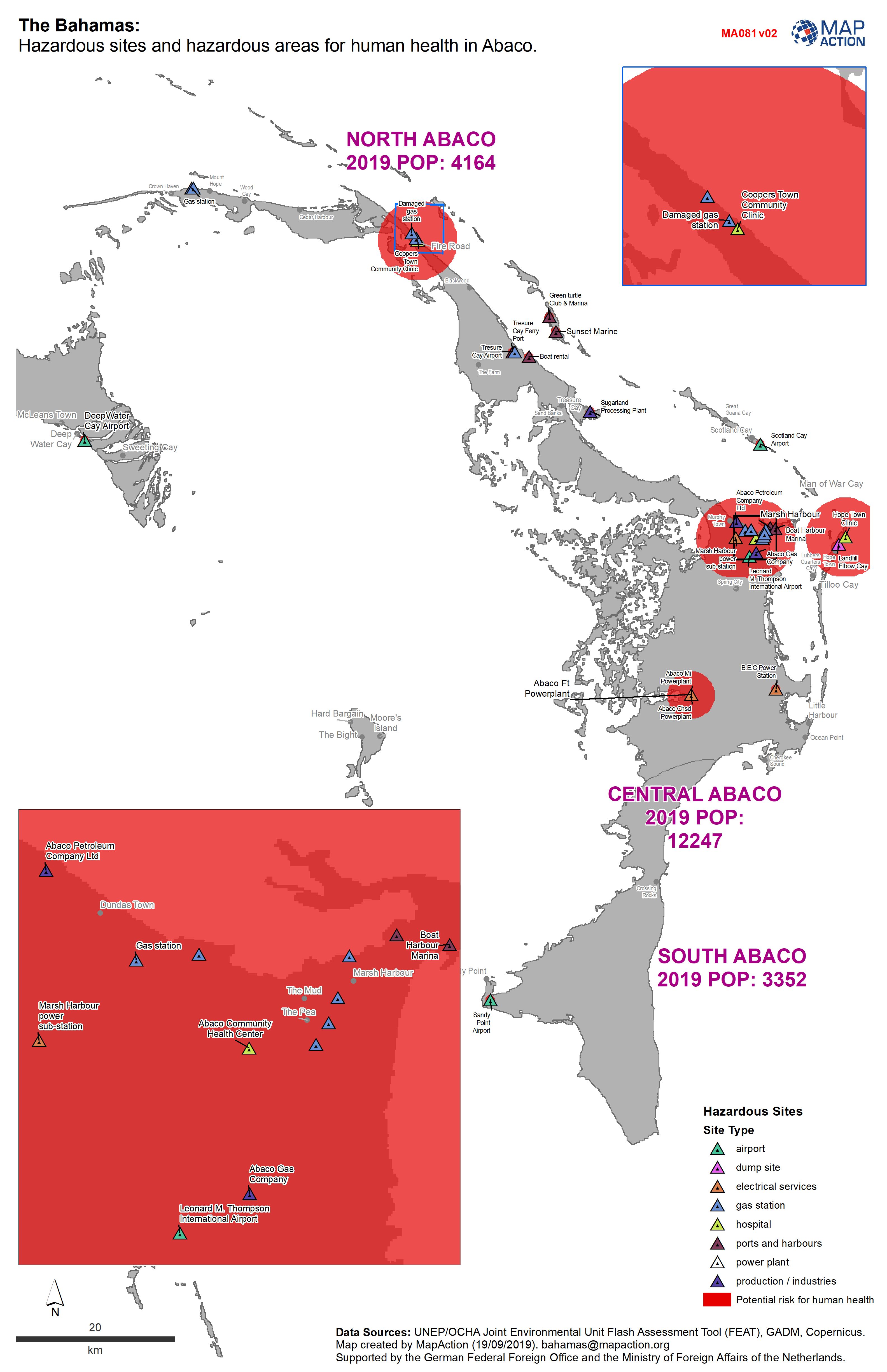
The Bahamas: Hazardous sites and hazardous areas for human health in Abaco.
Sites hazardous to human health in Abaco -
The Bahamas: Hazardous sites and hazardous zones for soil in Grand Bahama.
Hazardous sites and hazardous zones for soil -
The Bahamas: Hazardous sites and hazard zones for human health in Grand Bahama.
Hazardous sites and hazardous zones for human health.