Datasets
-

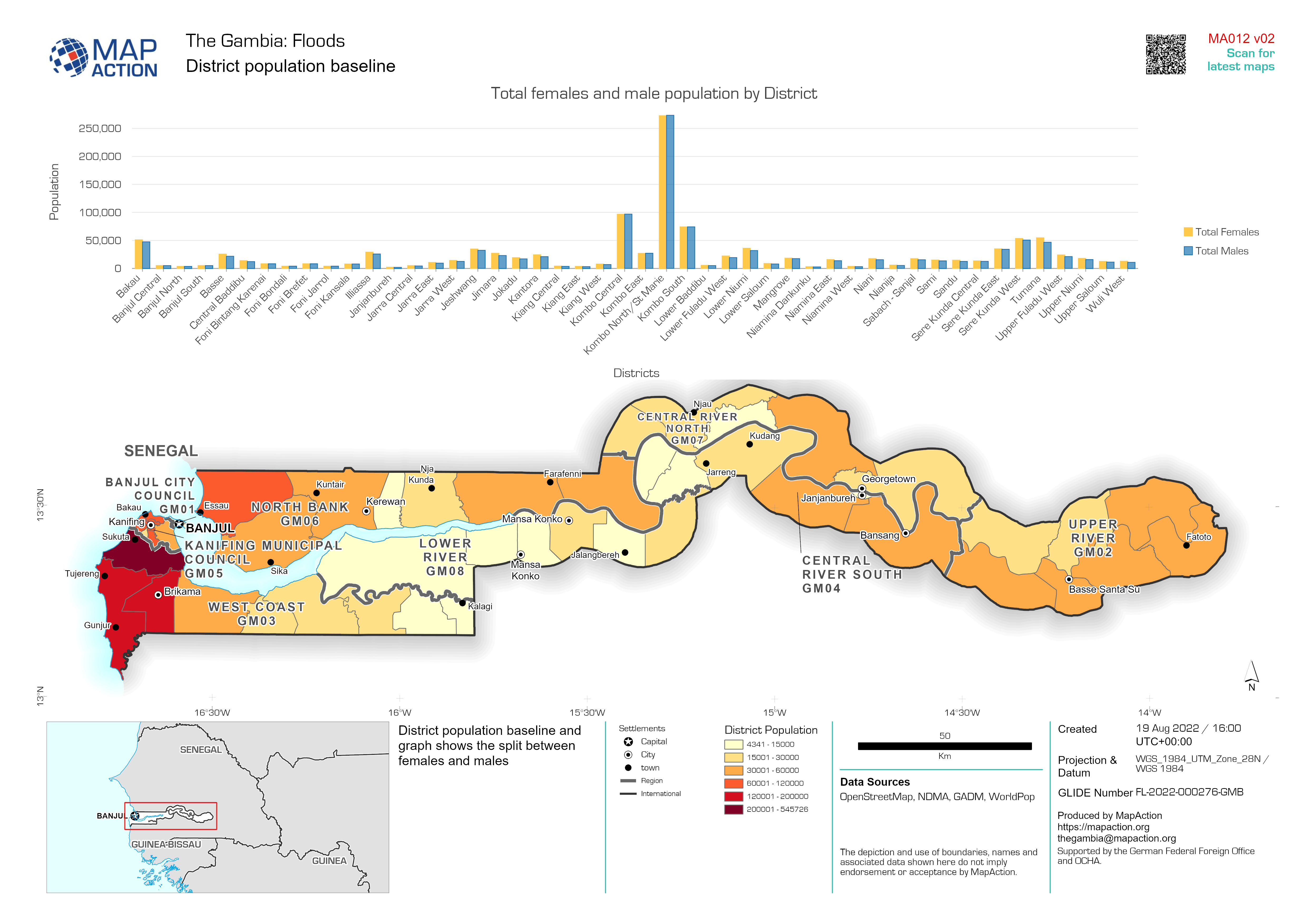
District population baseline
District population baseline and graph shows the split between females and males -

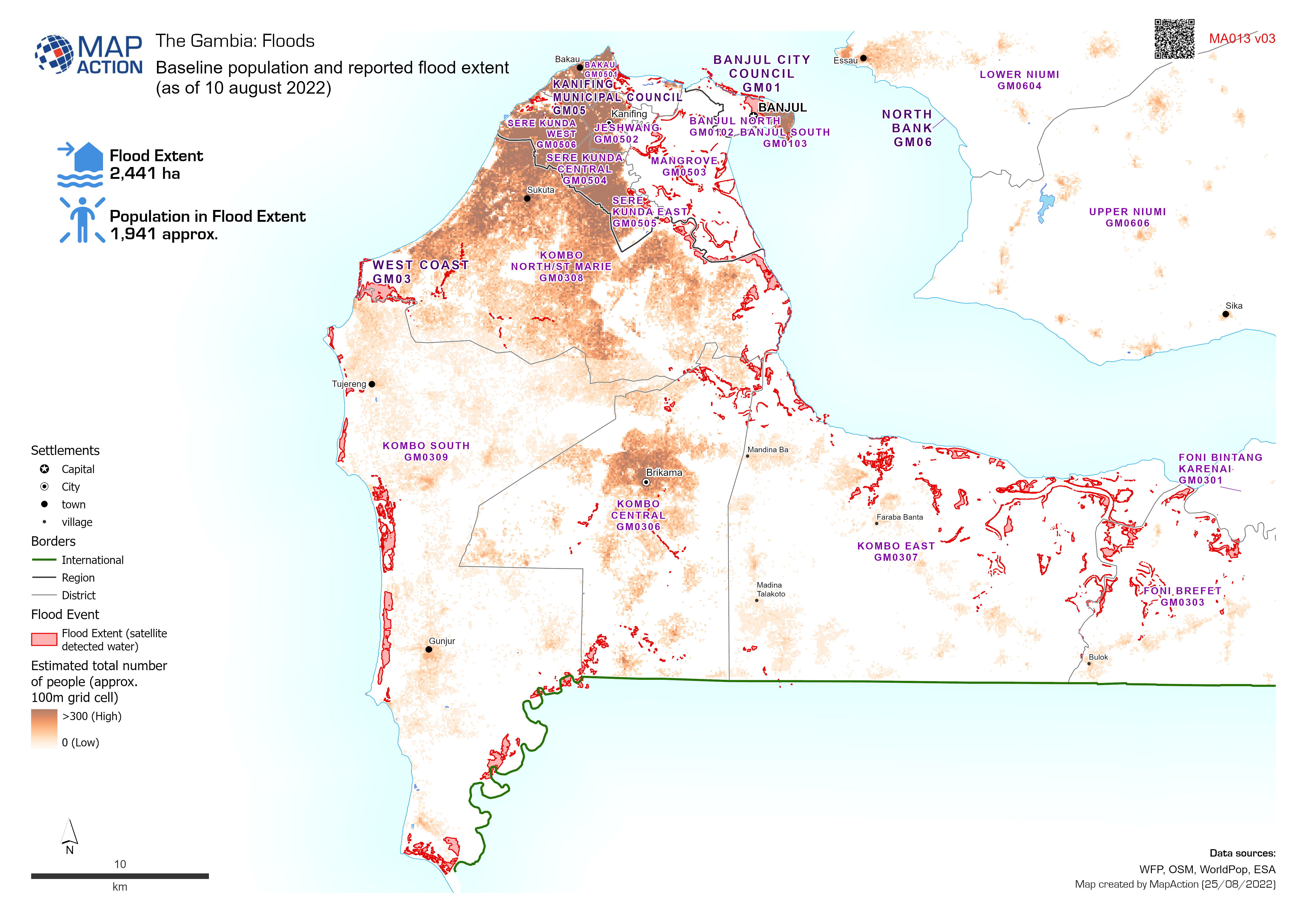
Baseline population and reported flood extent
Baseline population and reported flood extent as of 10 august 2022 -

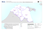
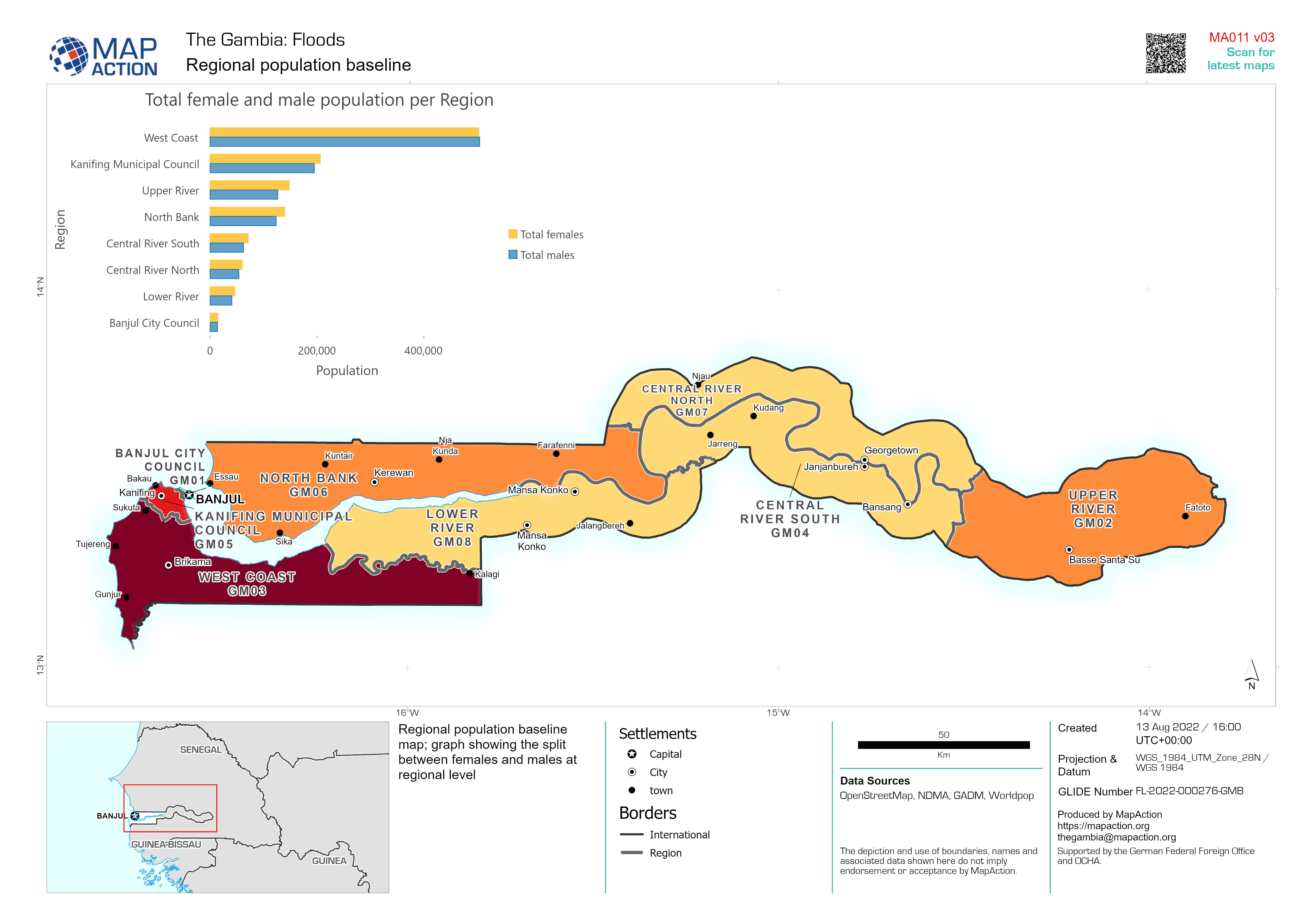
Regional population baseline
Regional population baseline map; graph showing the split between females and males at regional level -

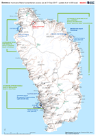
Caribbean Hurricane Maria Stormtrack (as of 22 Sept 2017; 06:00 AST)
Map showing the track of Hurricane Maria over the Caribbean, their windspeed estimate and forecast path -
Dominica: Hurricane Maria humanitarian access (as at 21 Sep 2017 - update 4 a...
Map of humanitarian access, as reported to the EOC in Roseau up to 14.00 local time on 21 September. This map will change frequently as access conditions change and more... -

Caribbean Hurricane Maria Stormtrack (as of 21 Sept 2017; 18:00 AST)
Map showing the track of Hurricane Maria over the Caribbean, their windspeed estimate and forecast path -
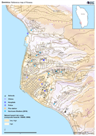
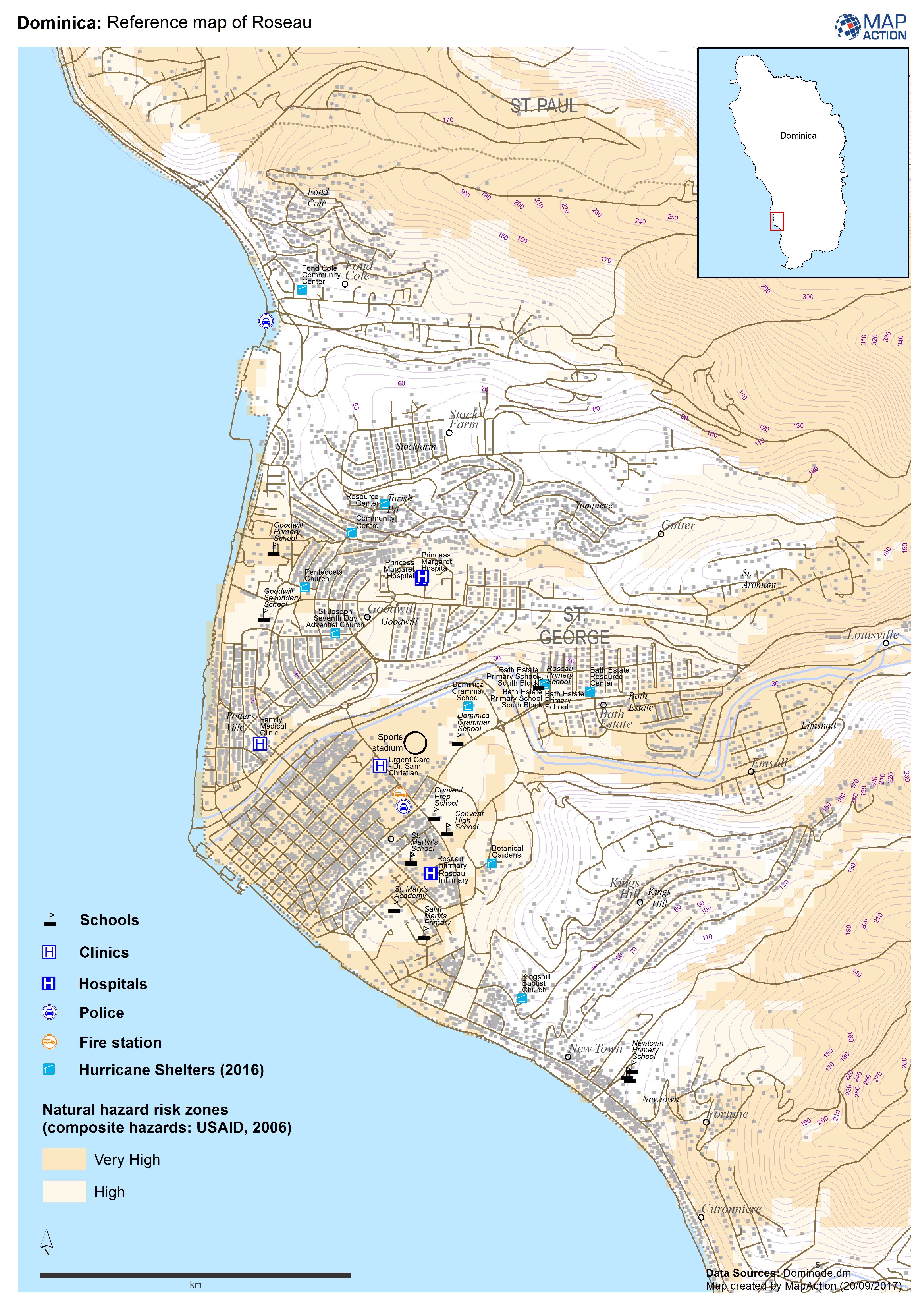
Dominica: Reference map of Roseau
Reference map of Roseau, Dominica. Known locations of hurricane shelters also shown (NB may not be fully up to date).