-
-
-
-

-

-

-

-
-

-
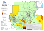
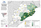
Sudan:Estimated Food Insecurity Oct-Dec 2013
Map shows estimated food insecurity for flood affected regions using the Integrated Phase Classification (IPC) scale from FEWS -

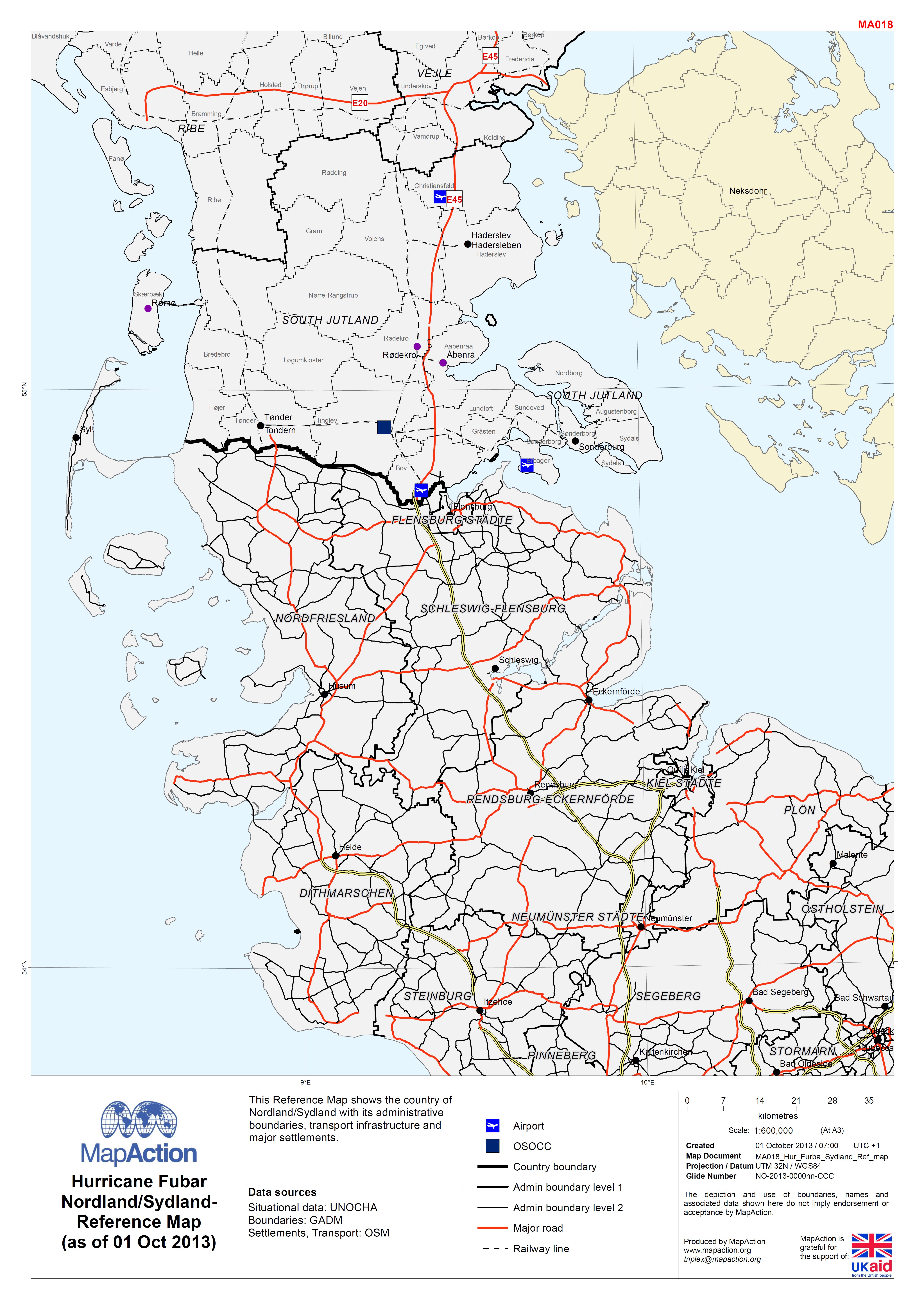
EXERCISE: Hurricane Fubar Nordland/Sydland- Reference Map (as of 01 Oct 2013)
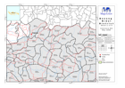
This Reference Map shows the country of Nordland/Sydland with its administrative boundaries, transport infrastructure and major settlements. -

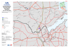
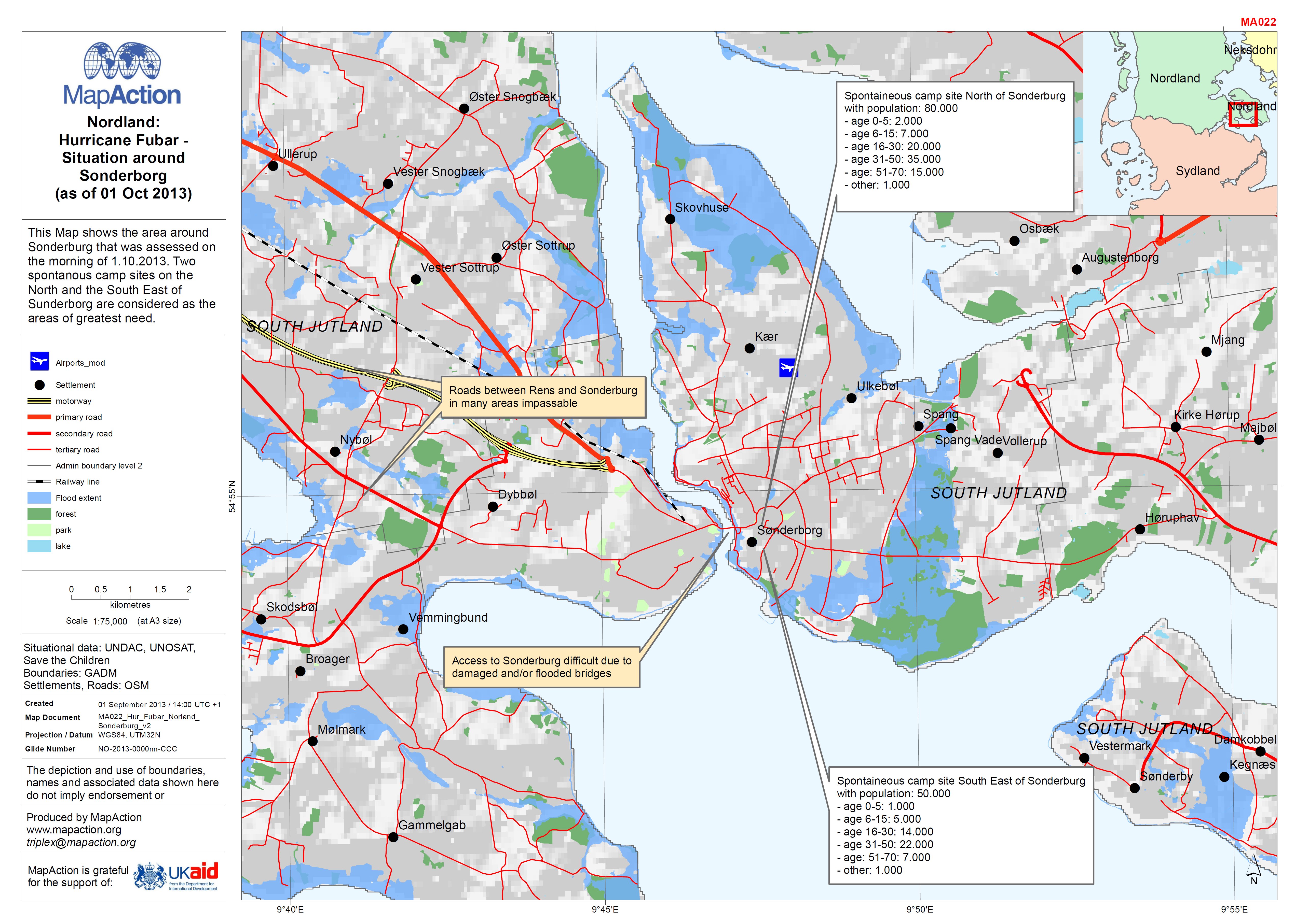
EXERCISE: Nordland: Hurricane Fubar - Situation around Sonderborg (as of 01 O...
This Map shows the area around Sonderburg that was assessed on the morning of 1.10.2013. Two spontanous camp sites on the North and the South East of Sunderborg are considered... -
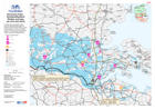
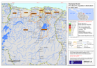
EXERCISE: Hurricane Fubar - Nordland/Sydland Shelter overview (as of 01 Oct 2...
This map shows the general situation overview including the likely area to be flooded as well as number of IDPs in camps on the morning of 1.10.2013. The Camp location are only... -
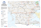
EXERCISE: Nordland/Sydland: Hurricane Fubar - Area OSOCC Flensburg (as of 01 ...
This Map shows the area between the OSOCC and Flensburg. -

EXERCISE: Hurricane Fubar - Nordland/Sydland Assessment Results (as of 01 Oct...
This Map shows the general situation overview including the likely area to be flooded and some of the results from the assessments on the morning of 01.10.2013. -

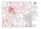
EXERCISE: Nordland: Hurricane Fubar - Medical Facilities (as of 30 Sept 2013)
This Map shows the southern part of Nordland and its medical facilities.Operational status has not been validated. -

EXERCISE: Nordland: Hurricane Fubar - possible impact of oil spill (as of 30 ...
This Map shows the country of Nordland and Neksdohr with the location and impact of the oil spill. It also shows basic situational data and roads. -
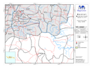
EXERCISE - Nordland: Hurricane Fubar - Assessment locations (as of 30 Sept 2013)
This Map shows the 6 locations to be assessed on the morning of 1.10.2013. The priority areas 1 - 6 were identified by the NEMA. Locations 1 and 3 are airport. Their status and... -

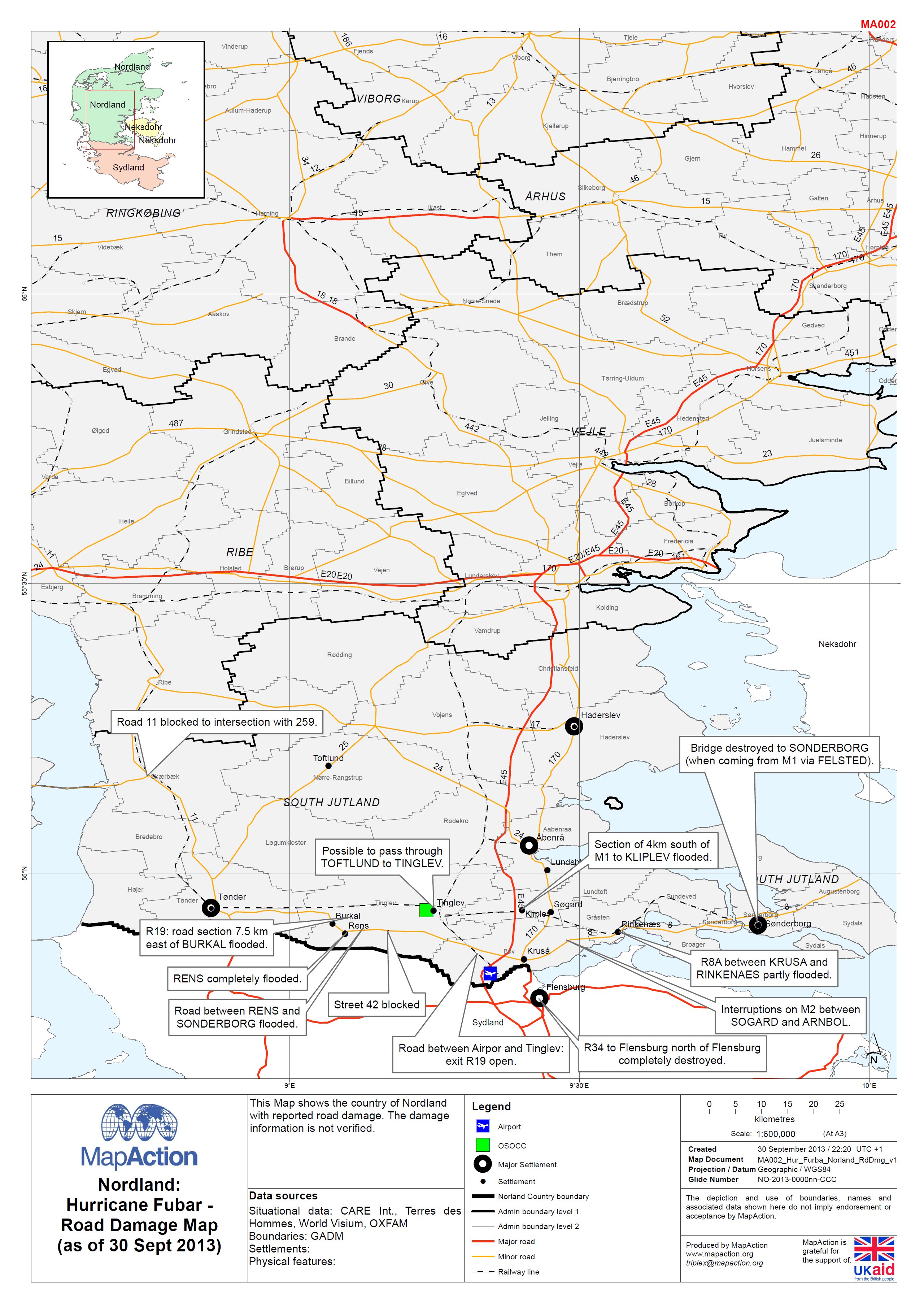
EXERCISE - Norldand: Hurricane FUBAR - Road Damage Map (as of 30 Sept 2013)
This map shows the country of Nordland with reported road damage. The damage information is not verified. -
ndia: Tropical Cyclone Phailin - Reported affected population (as at 28 Oct 2...
Map shows data for districts in Odisha state, plus one district of Andhra Preadesh. Figures are shown for percentages of district populations as reported by Government (taking...