-
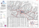
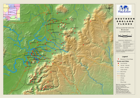
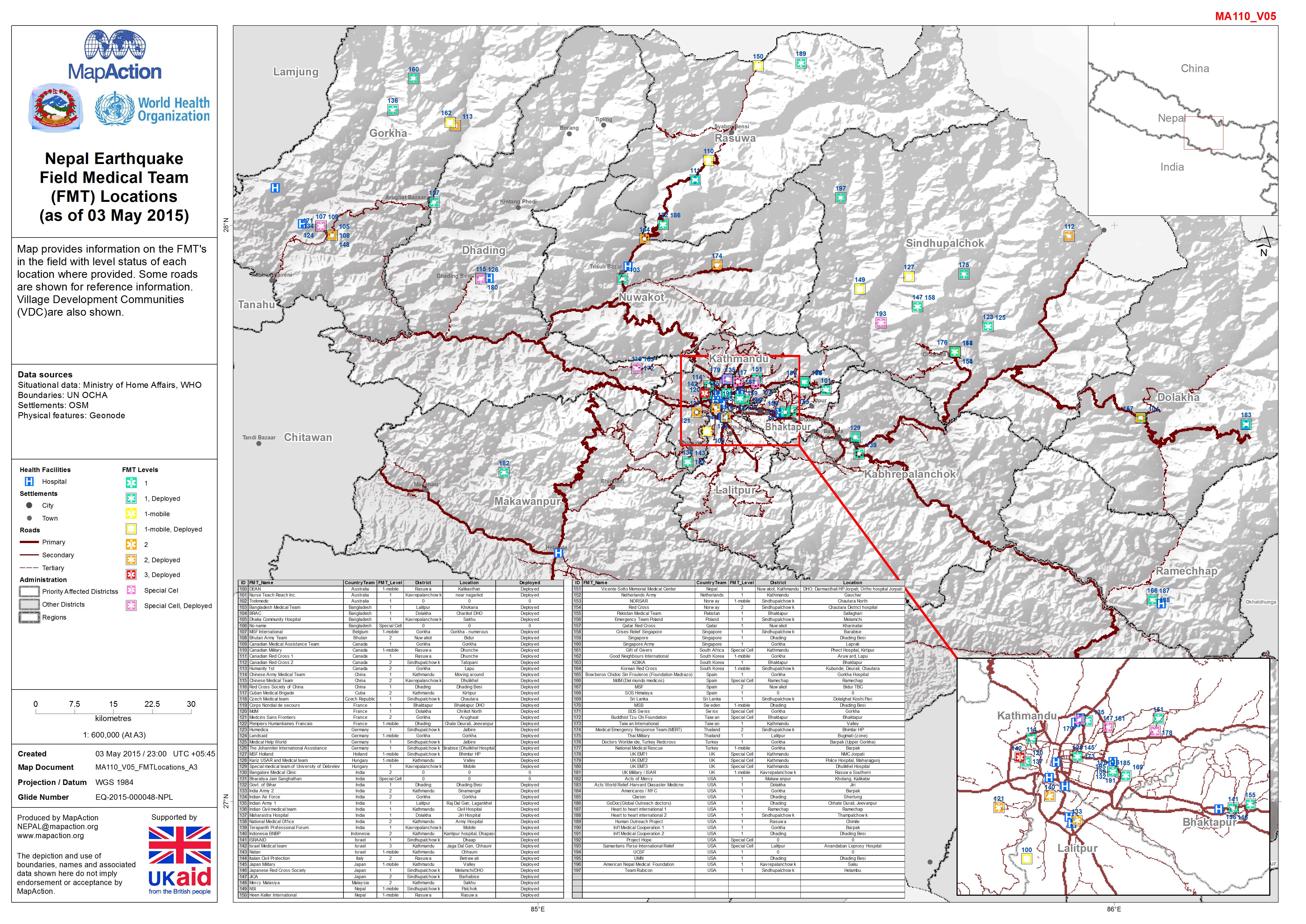
Nepal: Earthquake - Field Medical Team (FMT) Locations (as of 03 May 2015)
Map provides information on the FMT's in the field with level status of each location where provided. Some roads are shown for reference information. Village Development... -
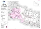
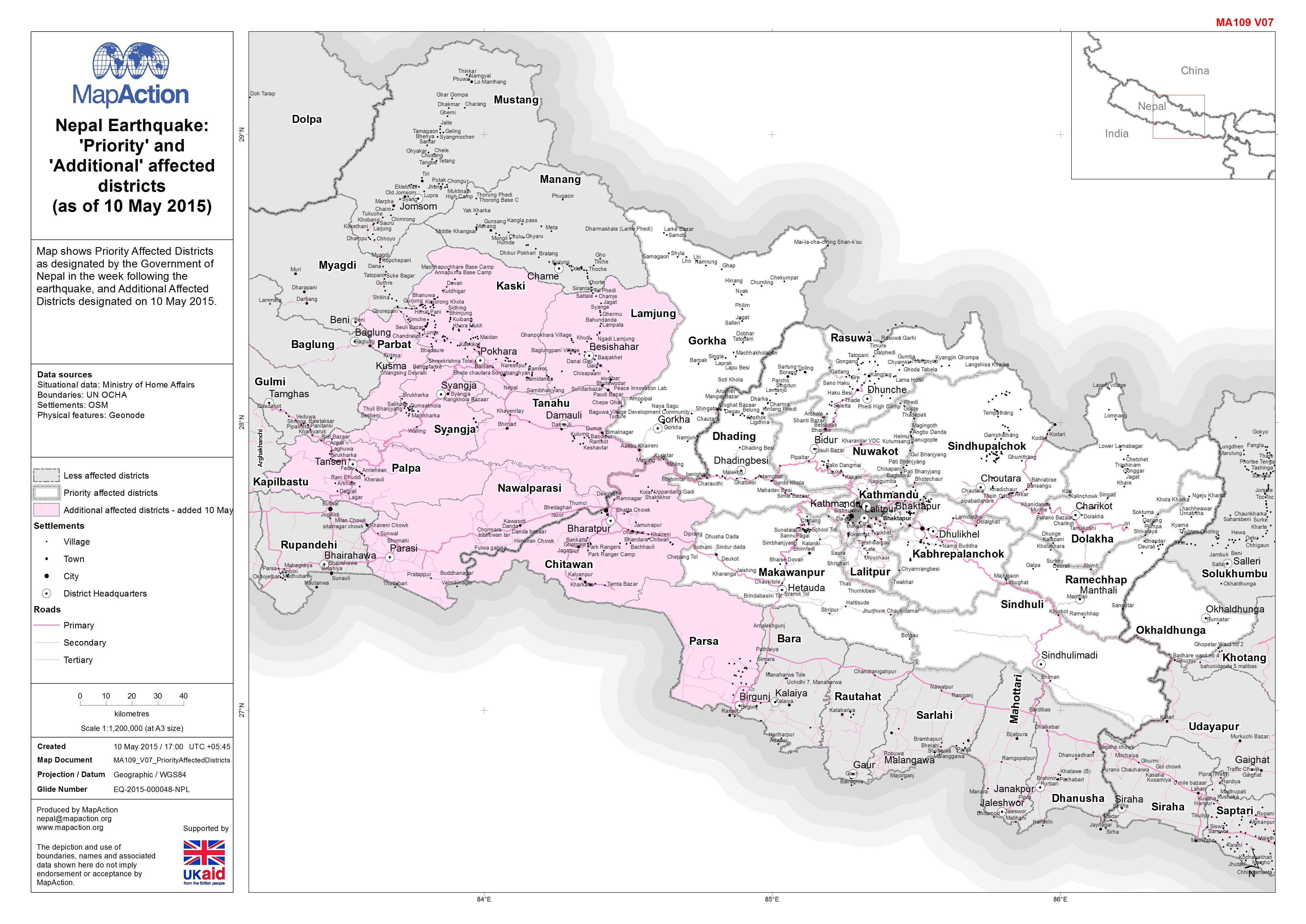
Nepal: Earthquake - 'Priority' and 'Additional' affected districts (as of 10 ...
Map shows Priority Affected Districts as designated by the Government of Nepal in the week following the earthquake, and Additional Affected Districts designated on 10 May 2015. -
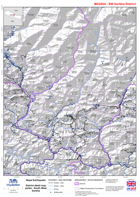
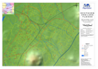
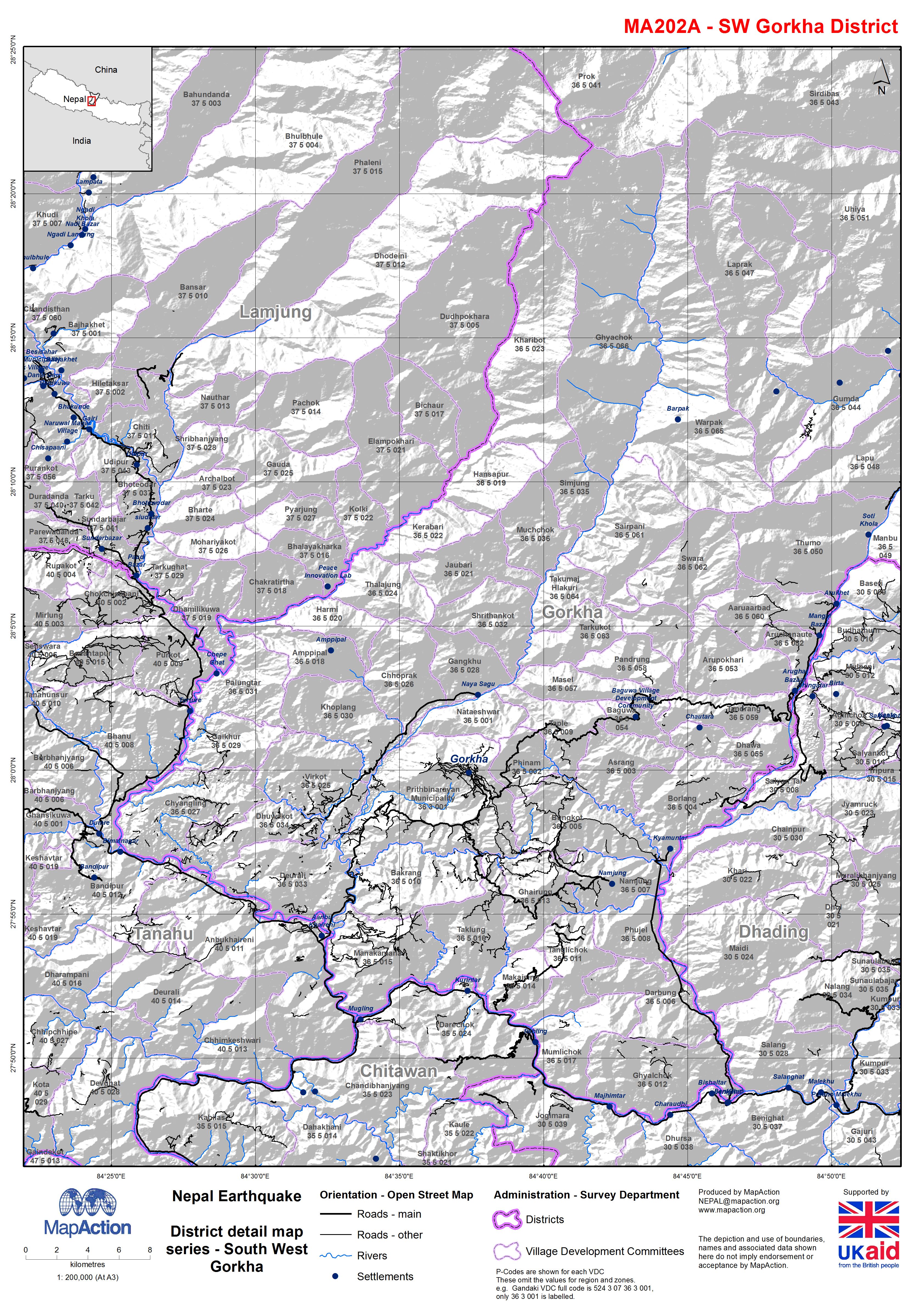
Nepal: Earthquake - District detail map series - South West Gorkha
Map shows the terrain, roads, rivers and settlements. -

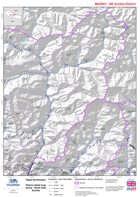
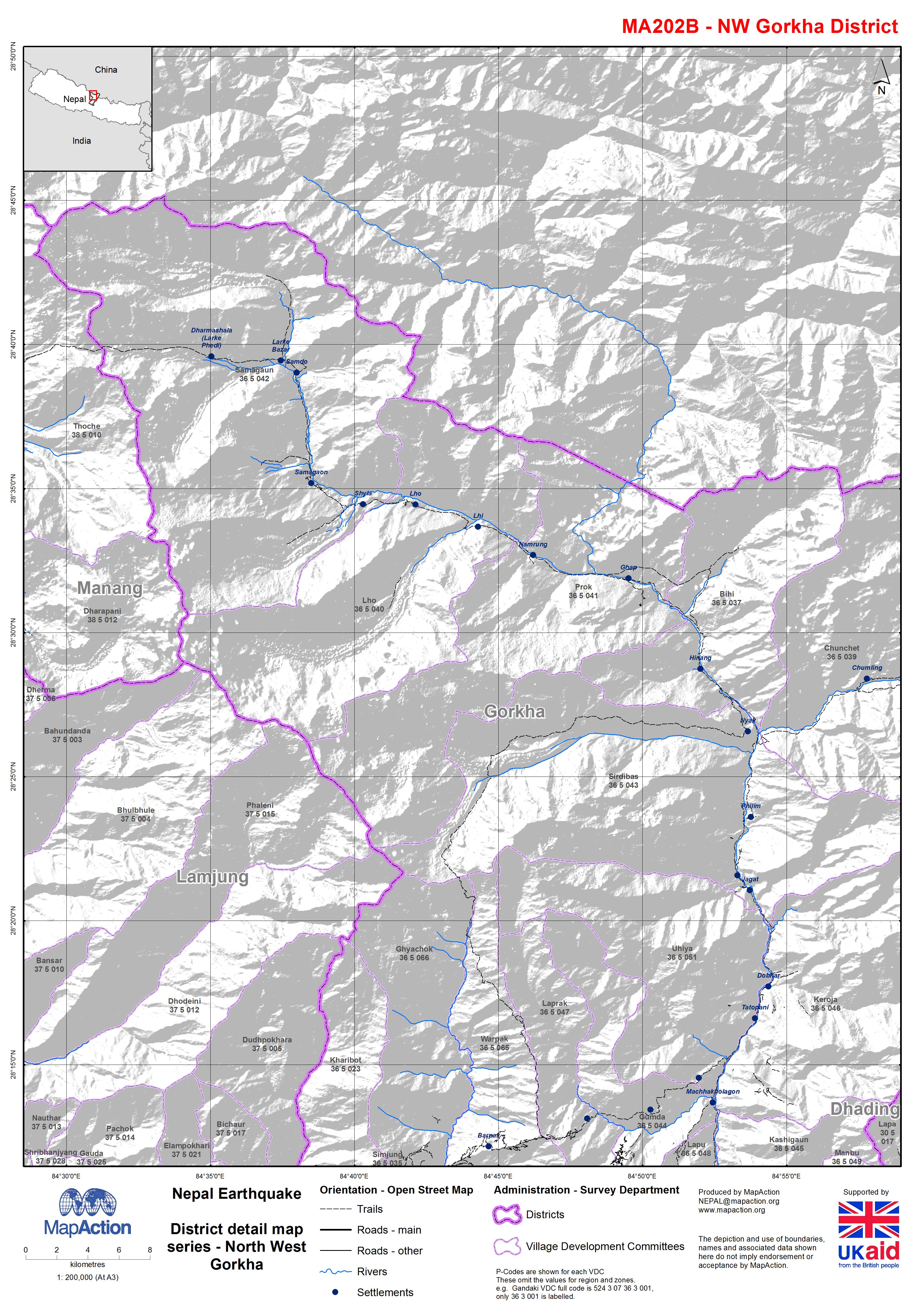
Nepal: Earthquake - District detail map series - North West Gorkha
Map shows the terrain, roads, rivers and settlements. -
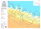
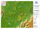
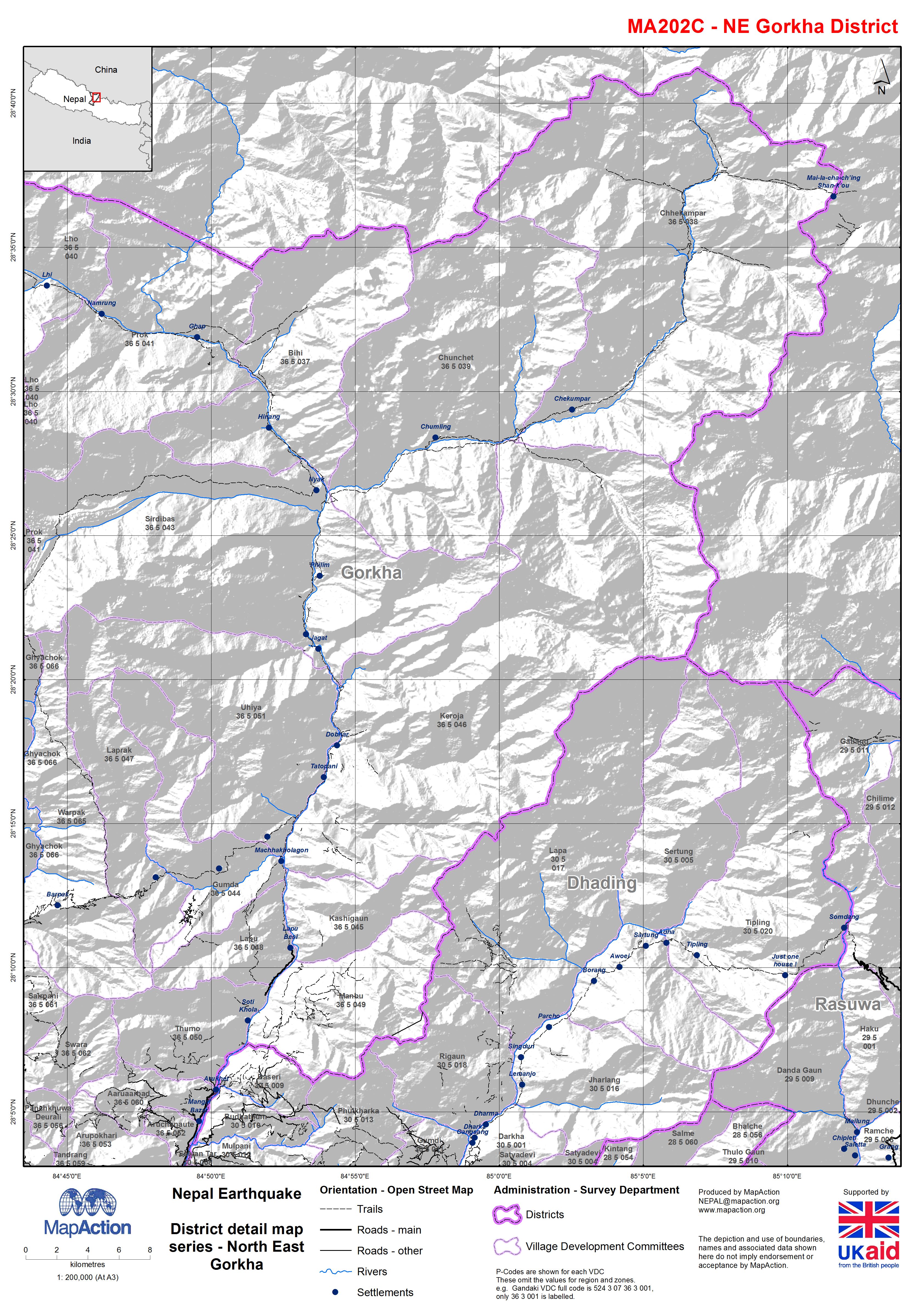
Nepal: Earthquake - District detail map series - North East Gorkha
Map shows the terrain, roads, rivers and settlements. -
Nepal: Earthquake - Winterisation planning: mean January temperature in prior...
Mean temperature of coldest month (January) in the priority affected districts of the April 2015 earthquake. Based on historical temperature data from BioClim. -
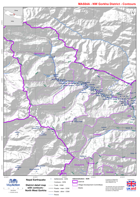
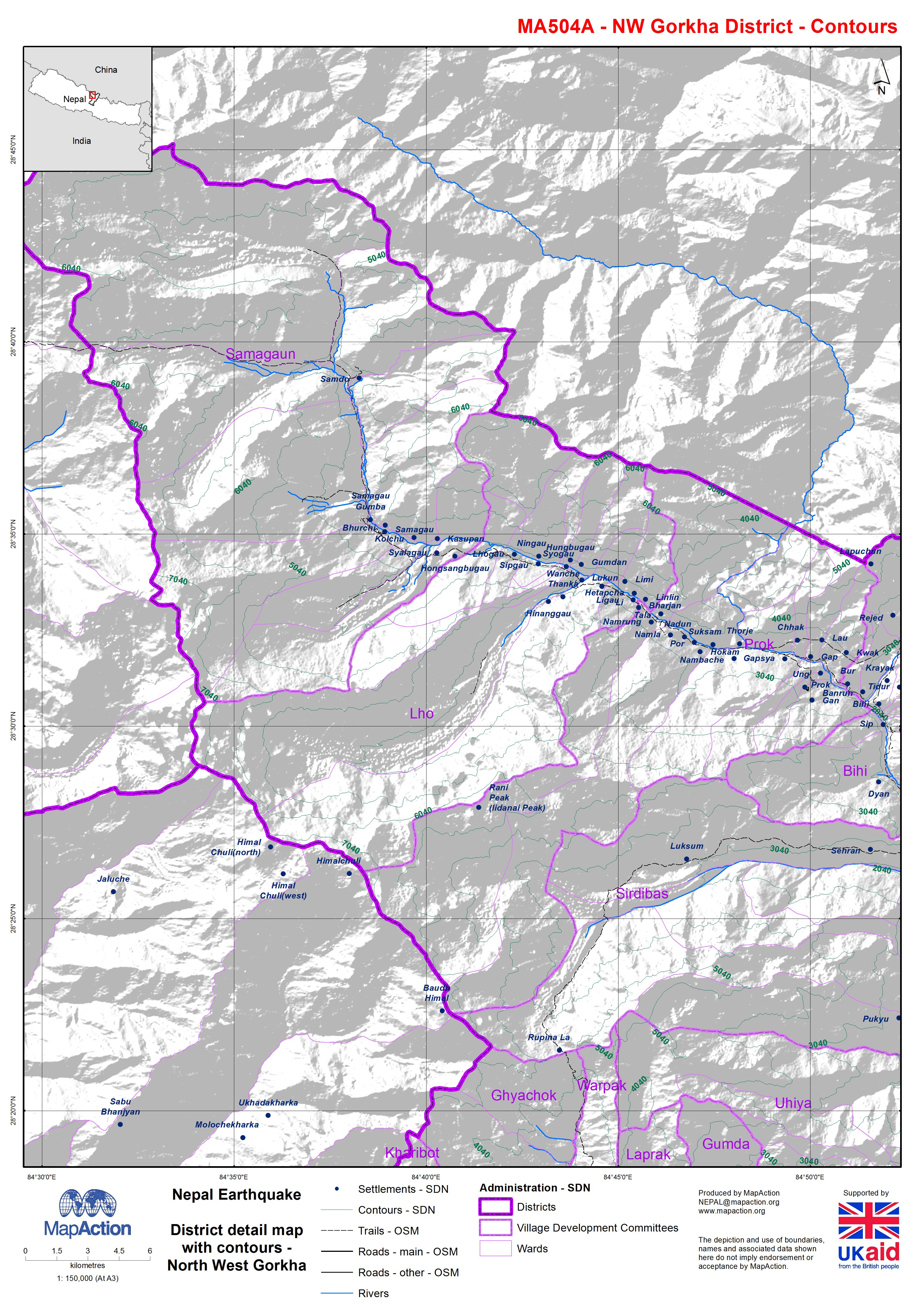
Nepal: Earthquake - District detail map with contours - North West Gorkha
Map shows the terrain, roads, rivers and settlements. -

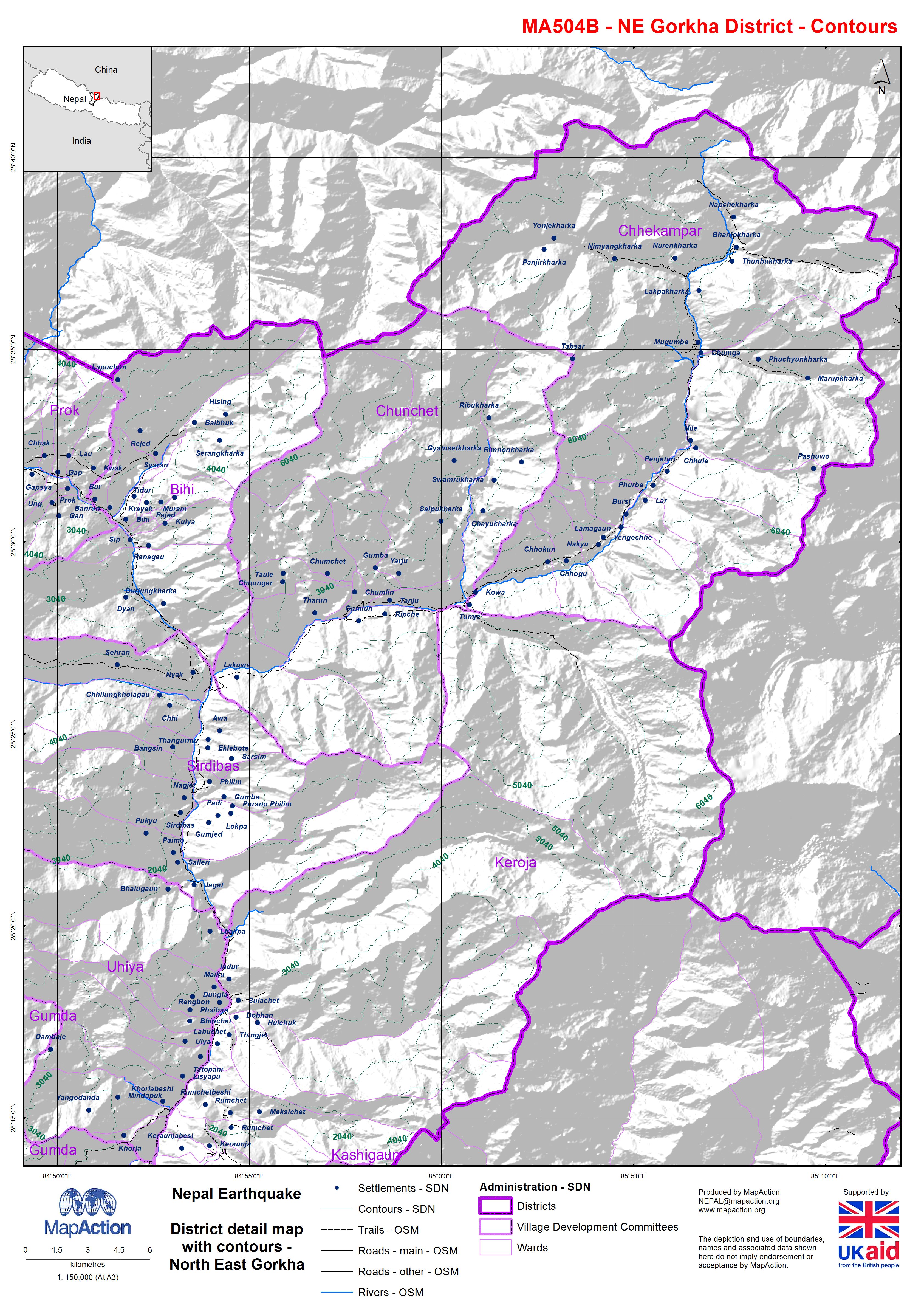
Nepal: Earthquake - District detail map with contours - North East Gorkha
Map shows the terrain, roads, rivers and settlements. -
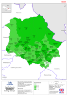
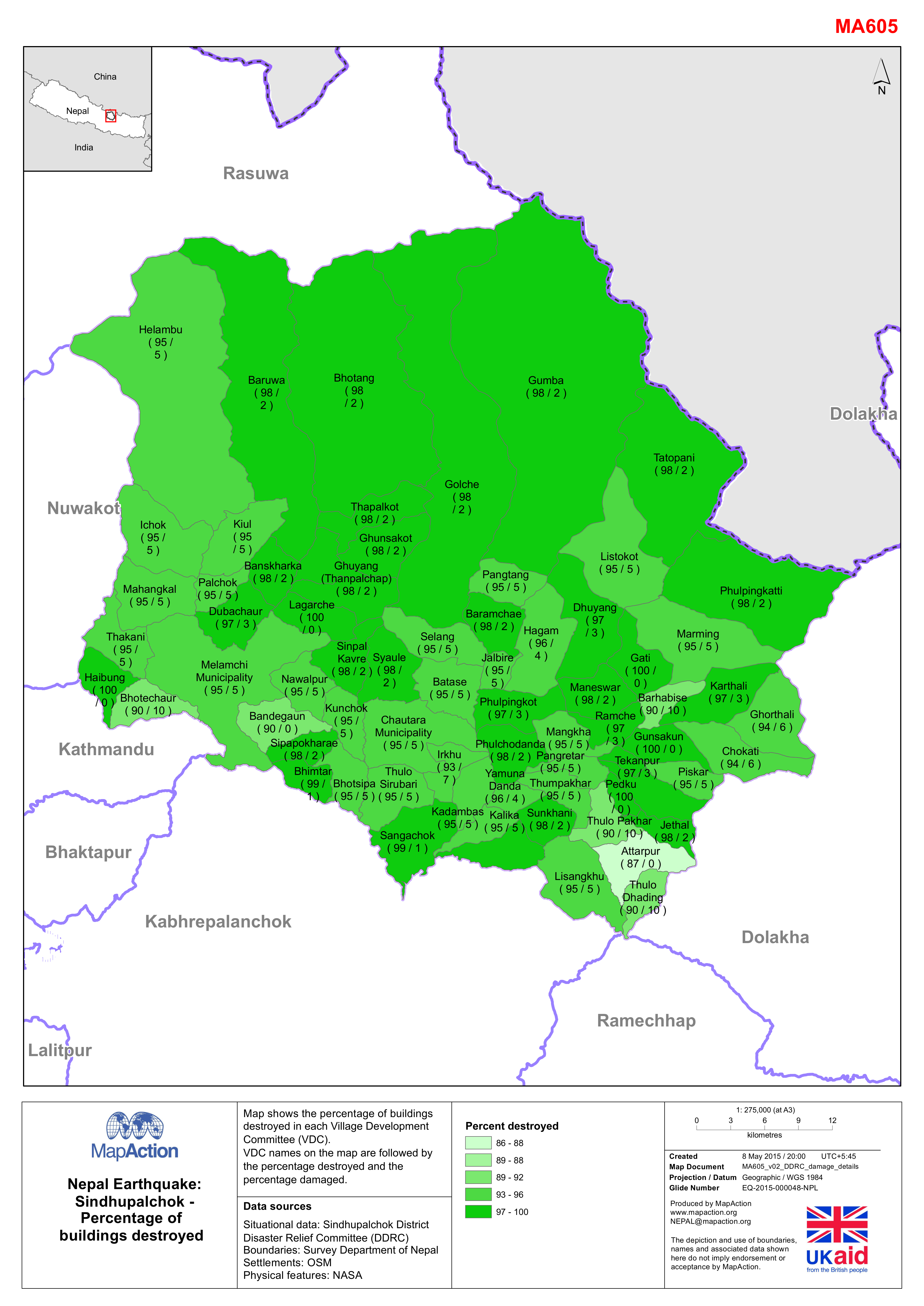
Nepal: Earthquake - Sindhupalchok - Percentage of destroyed buildings
Map shows the percentage of buildings destroyed in each Village Development Committee (VDC). The VDC names on the map are followed by the percentage destroyed and the percentage... -
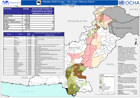
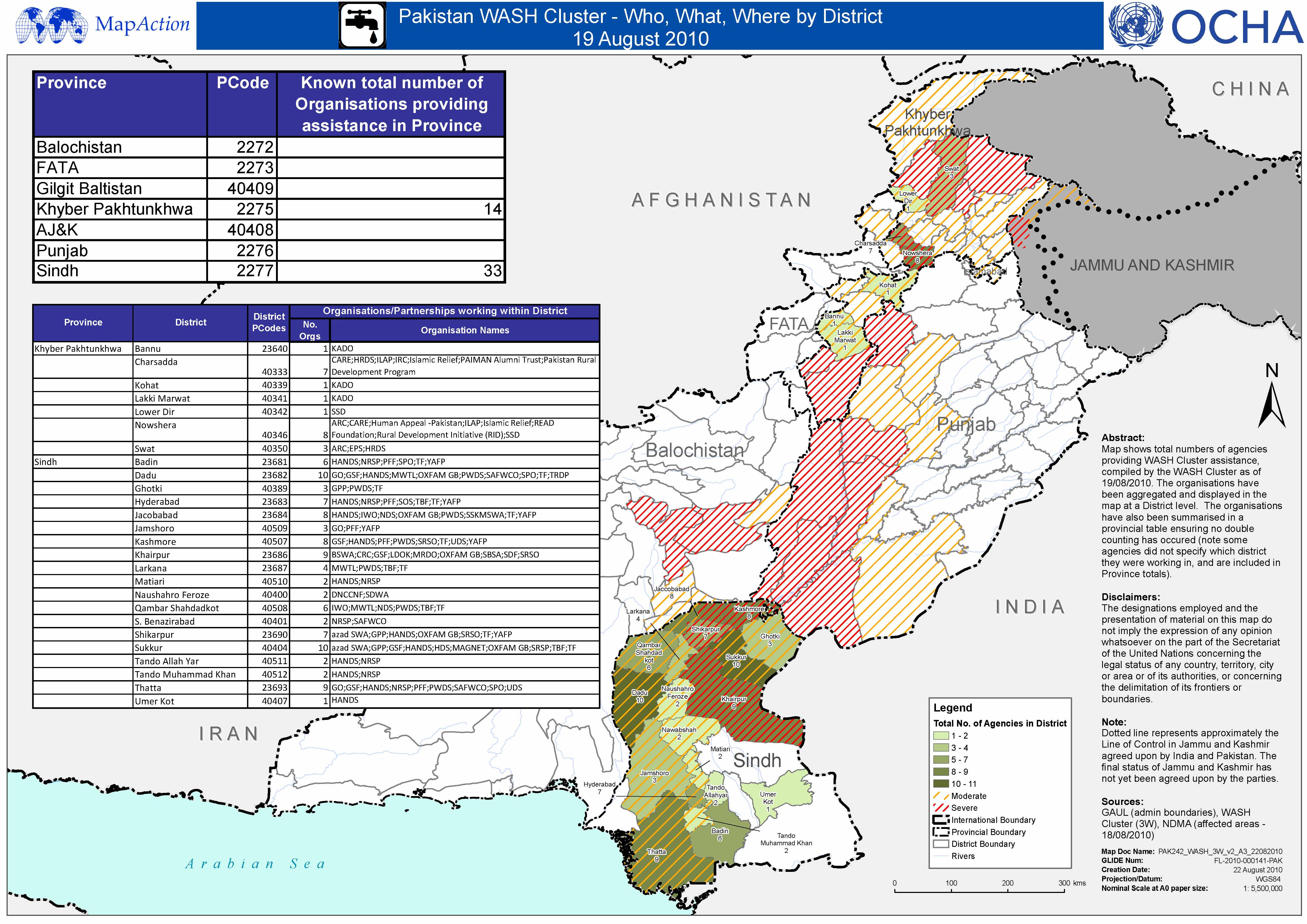
Pakistan WASH Cluster - Who, What, Where, by District - 19 August 2010
This dataset has no description
-

Pakistan Wash Cluster - Who, What, Where by District - 19 August 2010
This dataset has no description
-

Cape Verde - Fogo Island: Shelters location (as of 11 Dec 2014)
Map shows the shelter locations, evacuation points and critical points for lava flow. -
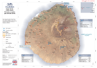
Cape Verde - Fogo Island: Volcanic eruption (as of 9 Dec 2014)
Map shows the extent of lava flows from satellite images on 8 Dec 2014. Evacuated population located in Monte Grande, Achada das Fumas and Mosteiros (UNDAC). -
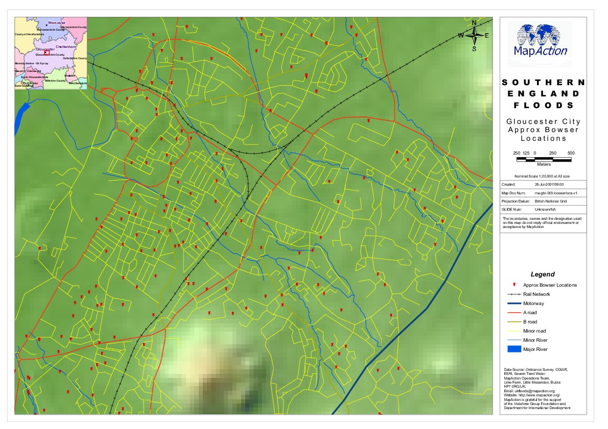
Southern England Floods - Gloucester City Approx Bowser Locations
This dataset has no description
-
-
-

-

Caprivi Region: Population Affected by Flooding and Total Population of Area
This dataset has no description
-

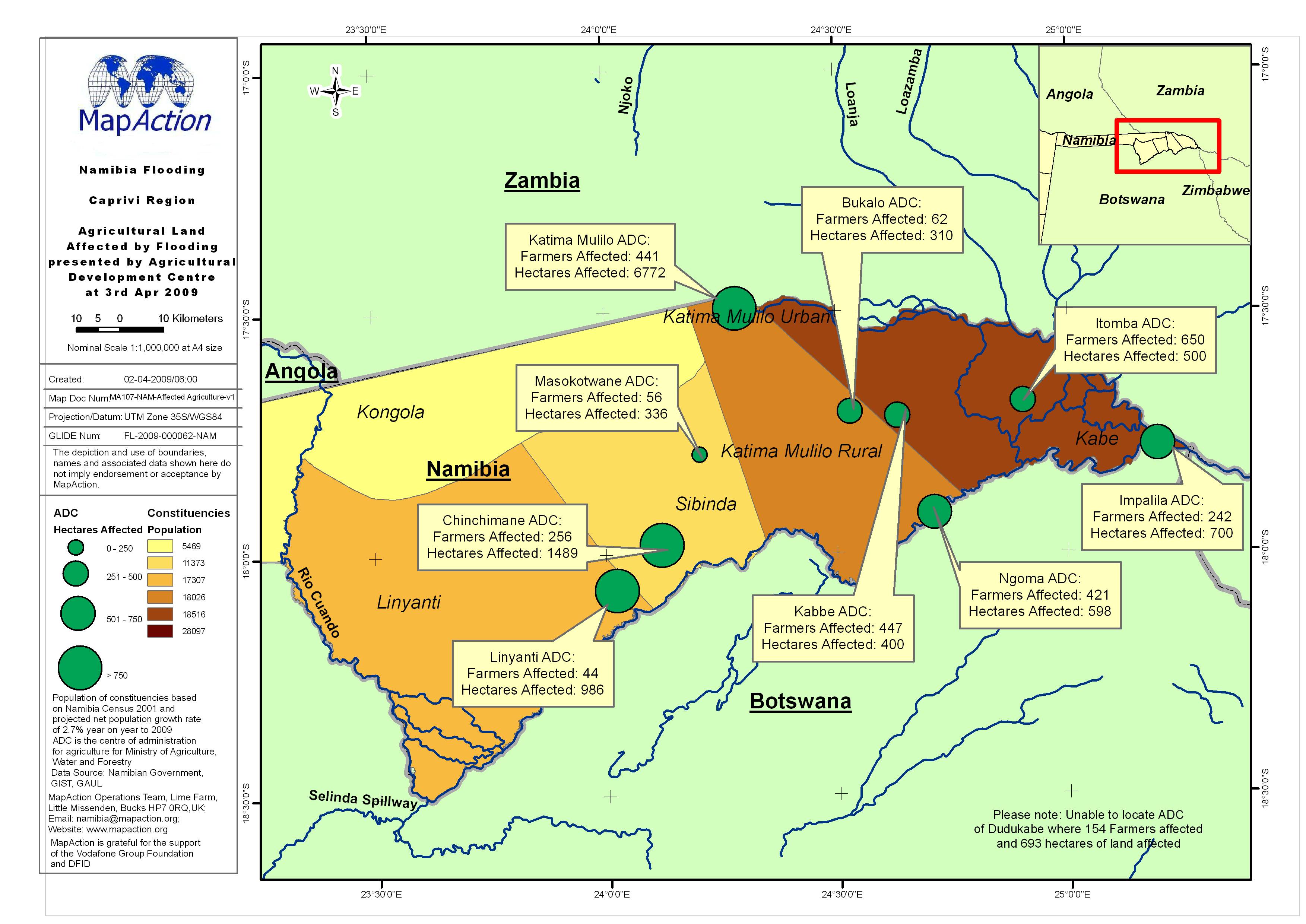
Caprivi Region - Agricultural Land Affected by Flooding, presented by Agricul...
This dataset has no description
-
