-

Honduras: Evacuated Persons and number of Evacuation Centres per Municipality...
Map shows evacuated persons and number of evacuation centres per Municipality (as at 19:00 on 23rd Nov 2020) -

Honduras: Humanitarian Presence Overview by Department (as at 1800 on 24th No...
Map shows the number of reported activities per Sector per Department in Honduras. Critical and High priority response areas are also shown. -

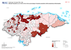
Honduras: Destroyed & Damaged Houses in each Municipality - Department (as at...
Honduras, Destroyed & Damaged Houses per Municipality as of 16:00 on 23rd Nov 2020 -
Honduras: Damaged Infrastructure in each Municipality - Department (as at 16:...
Honduras, Damaged Infrastructure as of 16:00 on 23rd Nov 2020 (Displayed per Admin 1 / Department) -
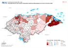
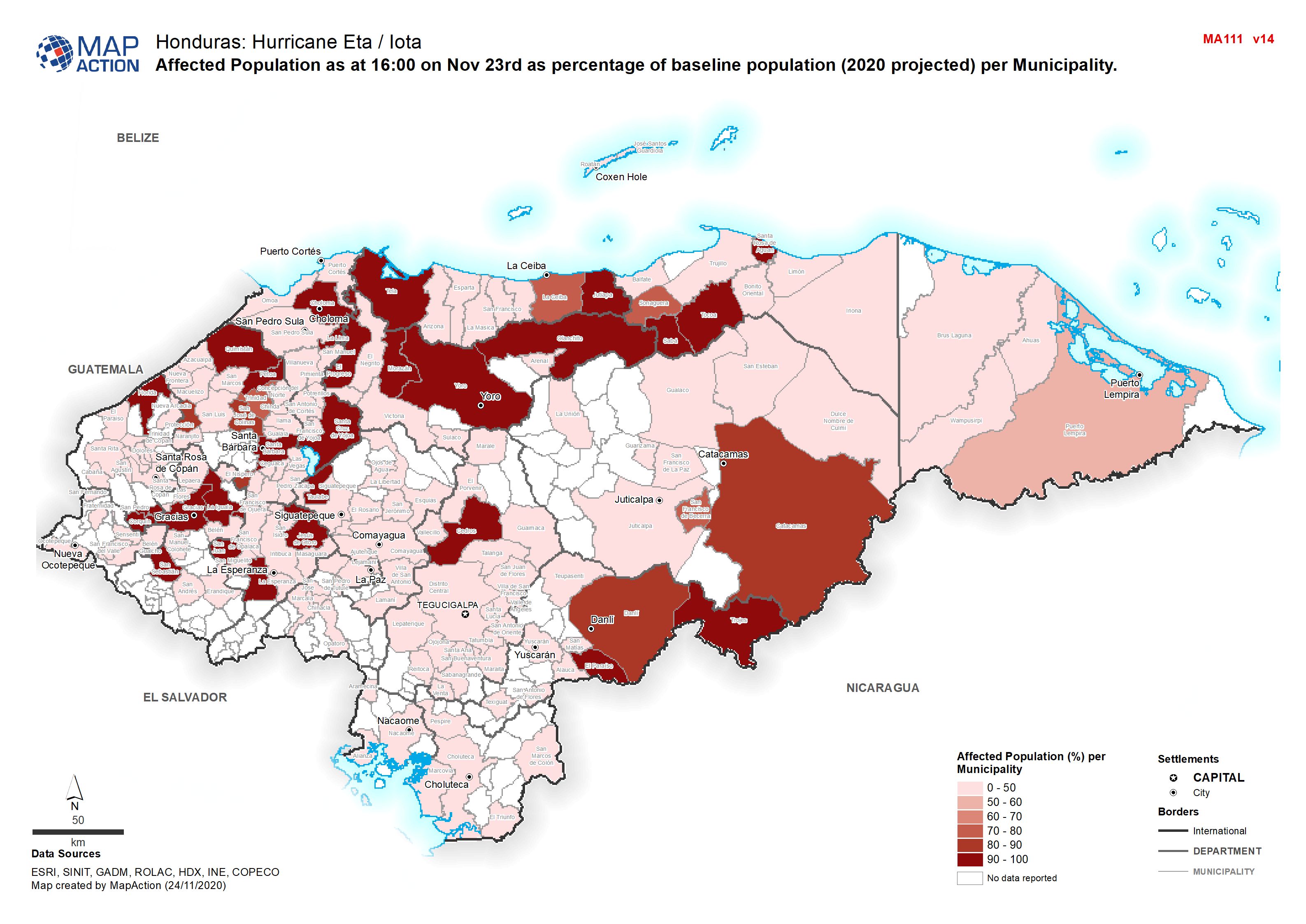
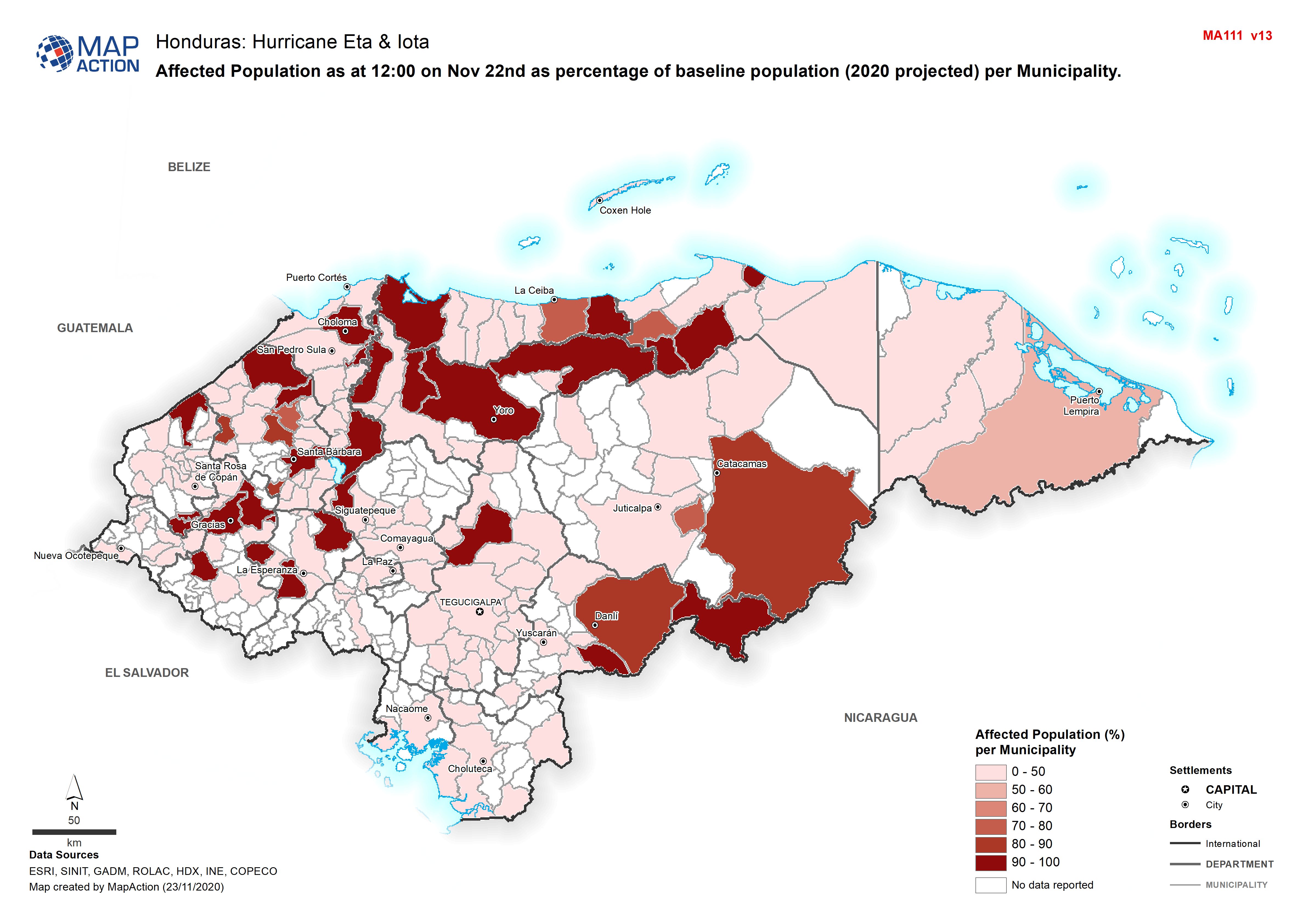
Honduras: Affected Population as at 16:00 on Nov 23rd as percentage of baseli...
Map shows affected population as at 16:00 on Nov 23rd as percentage of baseline population (2020 projected) per Municipality. -

Humanitarian Presence Overview by Department (as at 1800 on 23 Nov 2020)
Map shows the number of reported activities per Sector per Department in Honduras. Critical and High priority response areas are also shown. -
Honduras: Evacuated Persons and number of Evacuation Centres per Municipality...
Map shows evacuated persons and number of evacuation centres per Municipality (as at 16:00 on 23rd Nov 2020) -

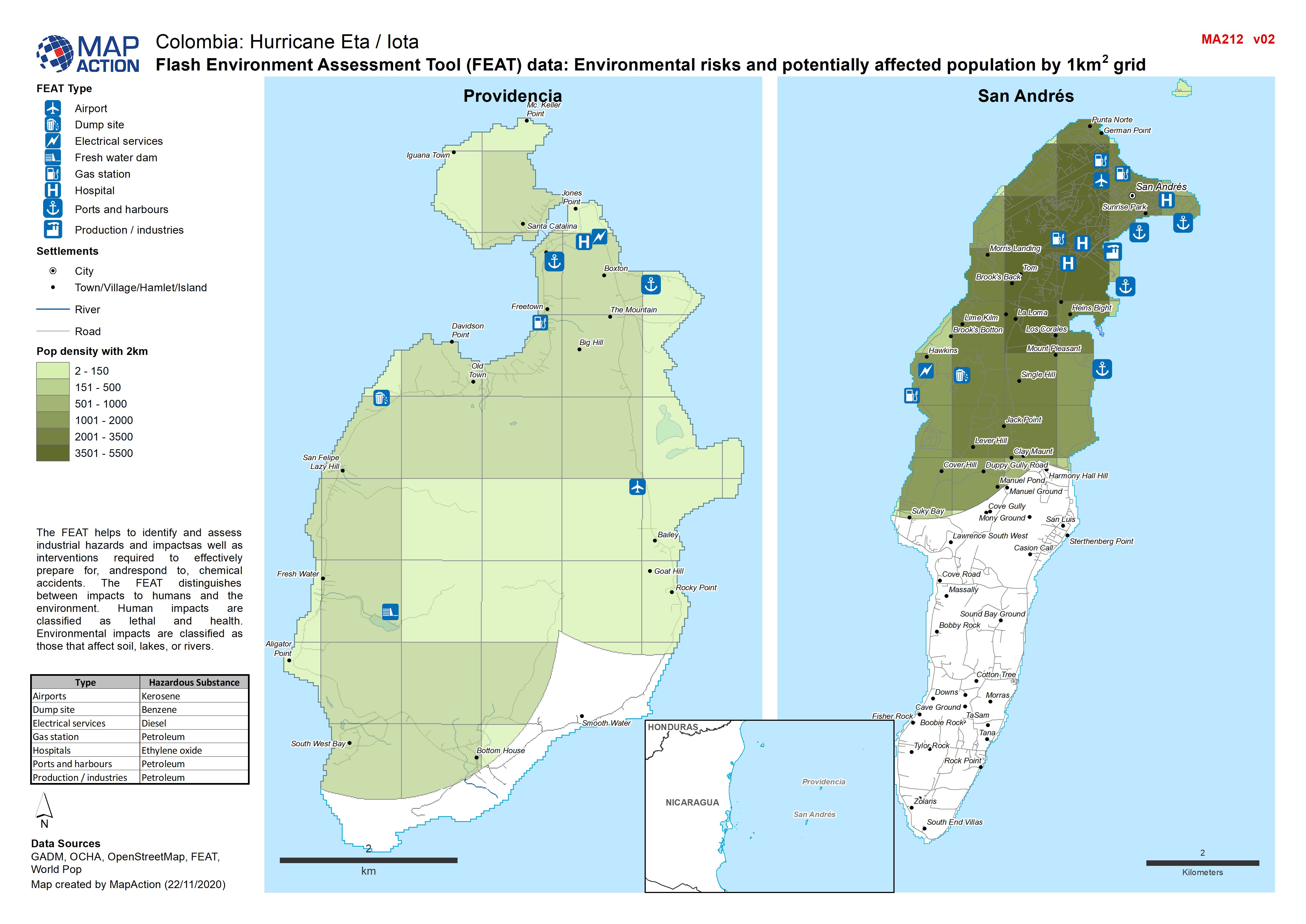
Colombia: Flash Environment Assessment Tool (FEAT) data, Environmental risks ...
Flash Environment Assessment Tool (FEAT) data: Overview of San Andrés and Providencia -
Colombia: Flash Environment Assessment Tool (FEAT) data: Overview of San Andr...
Flash Environment Assessment Tool (FEAT) data: Overview of San Andrés and Providencia -

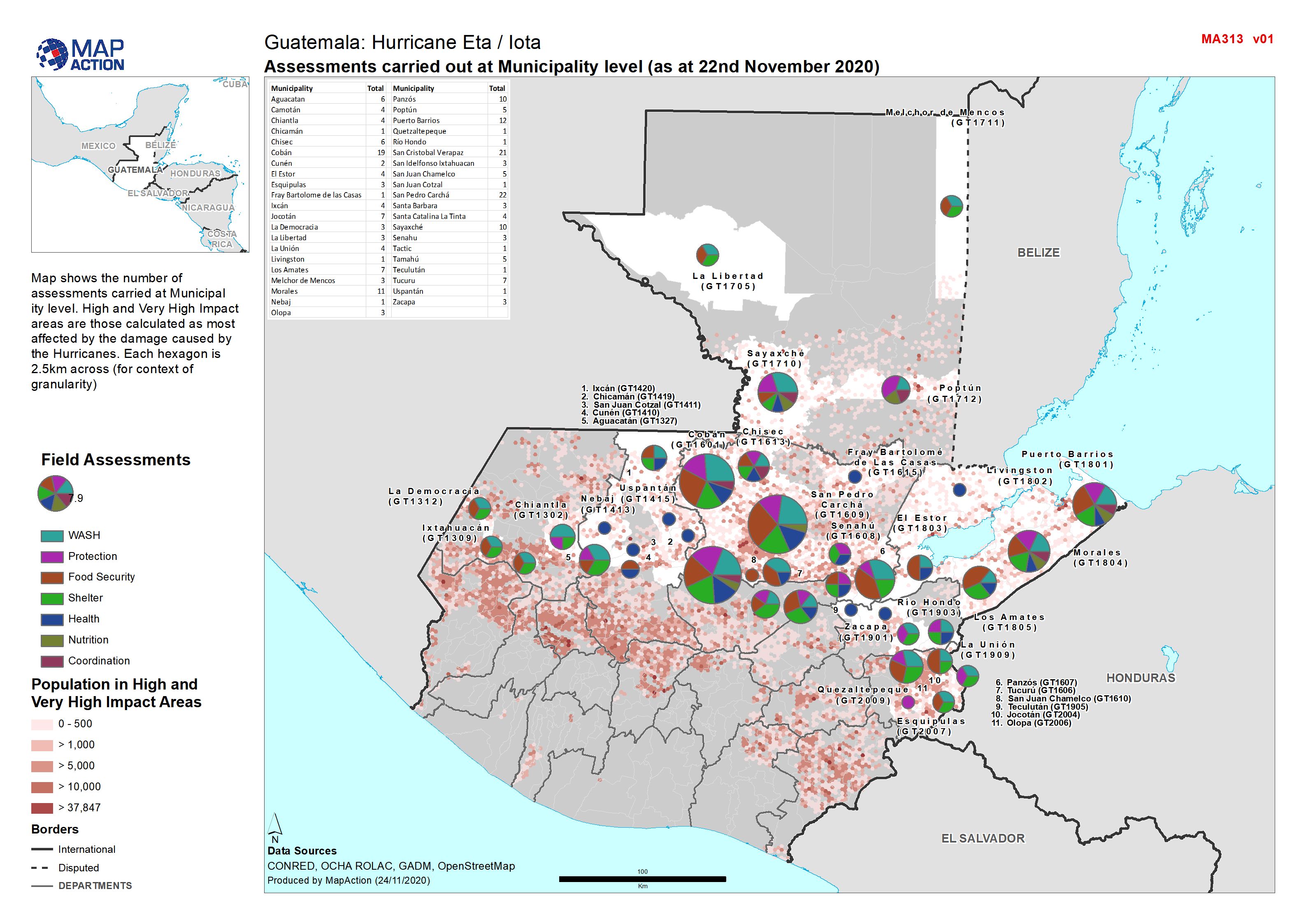
Assessments carried out at Municipality level (as at 22nd November 2020)
Map shows the number of assessments carried at Municipal ity level. High and Very High Impact areas are those calculated as most affected by the damage caused by the Hurricanes.... -

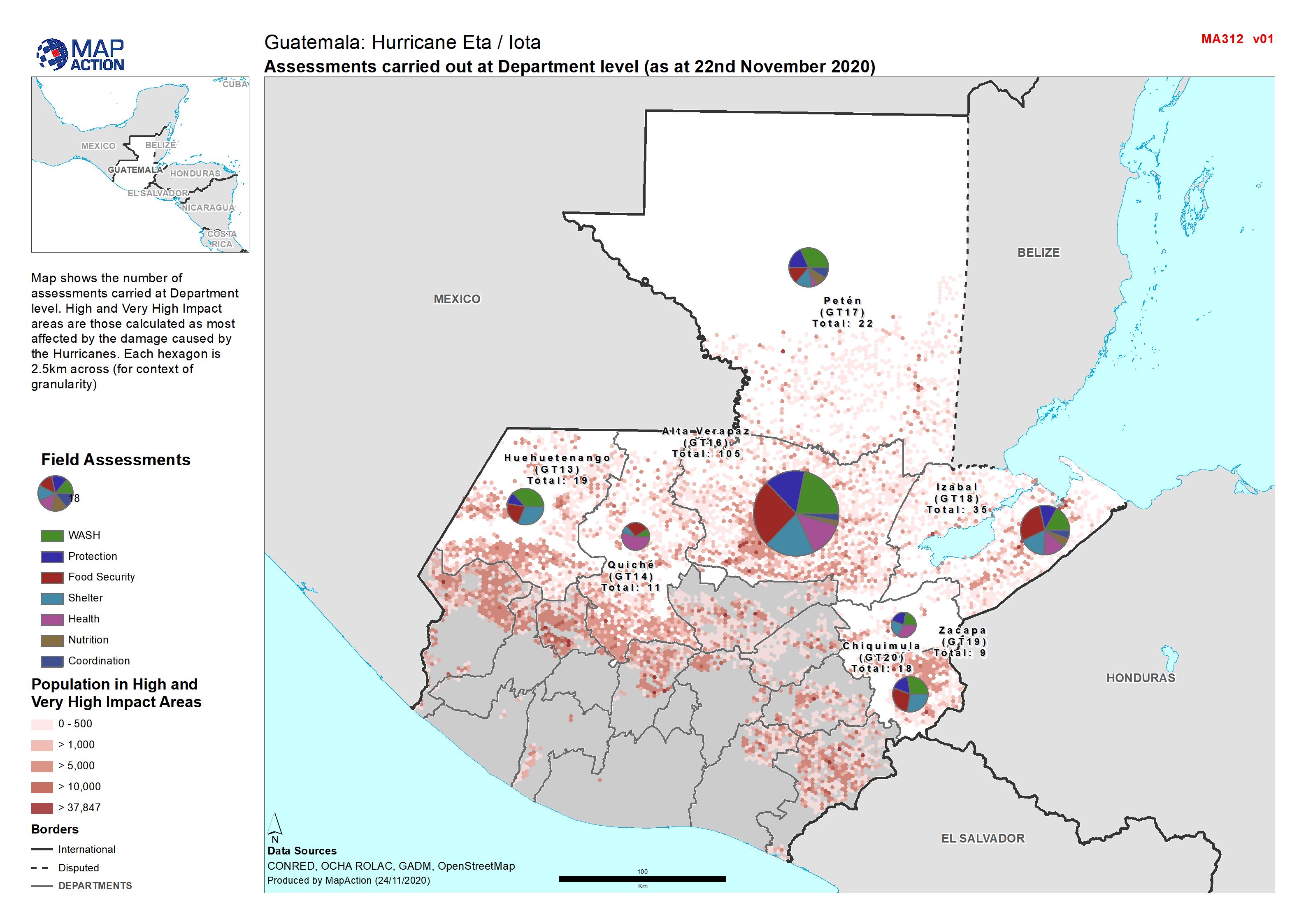
Guatemala: Assessments carried out at Department level (as at 22nd November 2...
Map shows the number of assessments carried at Department level. High and Very High Impact areas are those calculated as most affected by the damage caused by the Hurricanes.... -
Honduras: Damaged Infrastructure in each Municipality - Departments (as at 12...
Honduras, Damaged Infrastructure as of 12:00 on 22nd Nov 2020 (Displayed per Admin 1 / Department) -

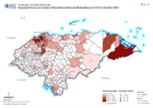
Honduras: Affected Population as at 12:00 on Nov 22nd as percentage of baseli...
Map shows affected population as at 12:00 on Nov 22nd as percentage of baseline population (2020 projected) per Municipality. -
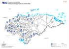
Honduras: Evacuated Persons and number of Evacuation Centres per Municipality...
Map shows evacuated persons and number of evacuation centres per Municipality (as at 12:00 on 22nd Nov 2020) -

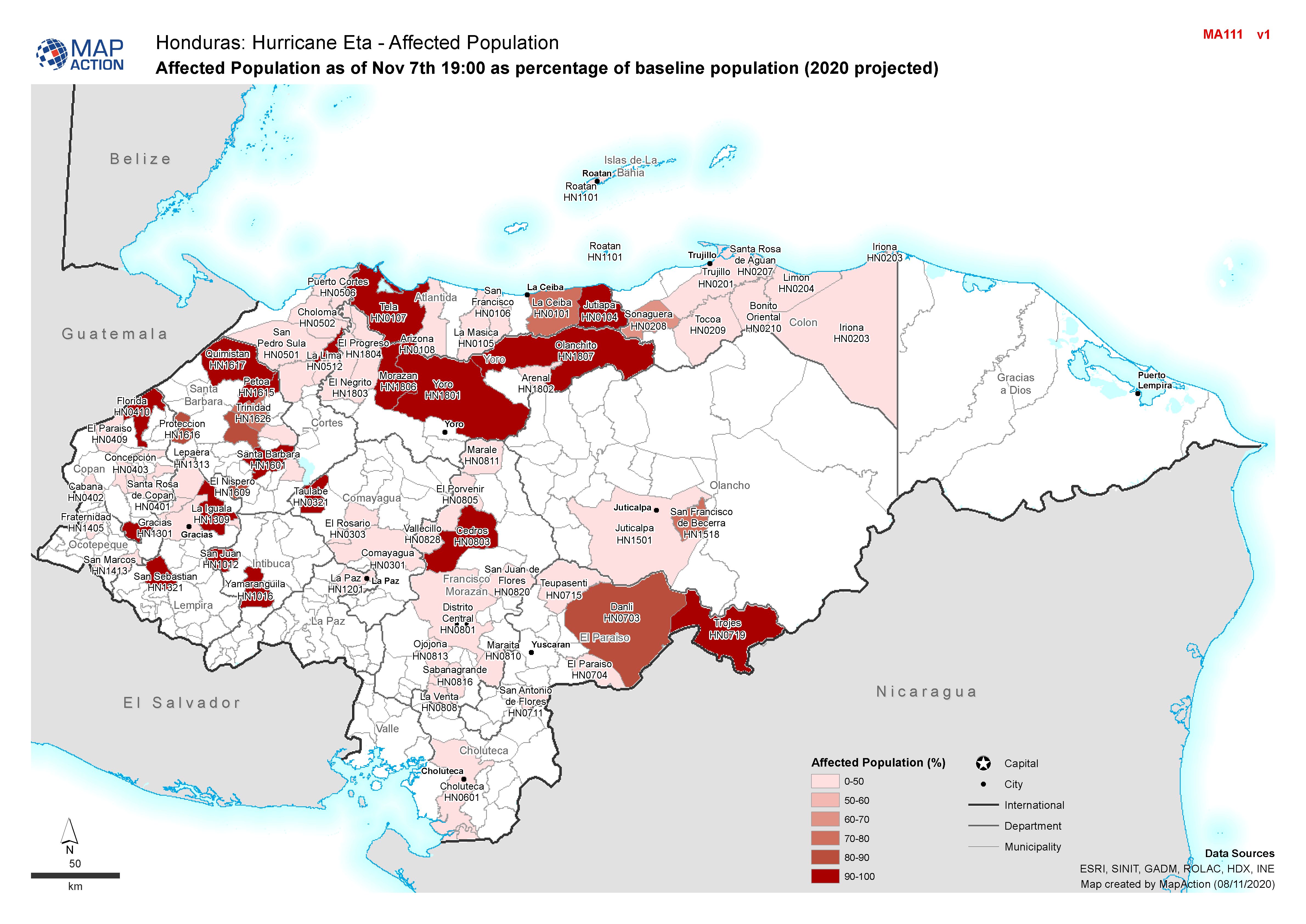
Honduras: Affected Population as of Nov 7th 19:00 as percentage of baseline p...
Affected Population (% of baseline population) for Honduras. -
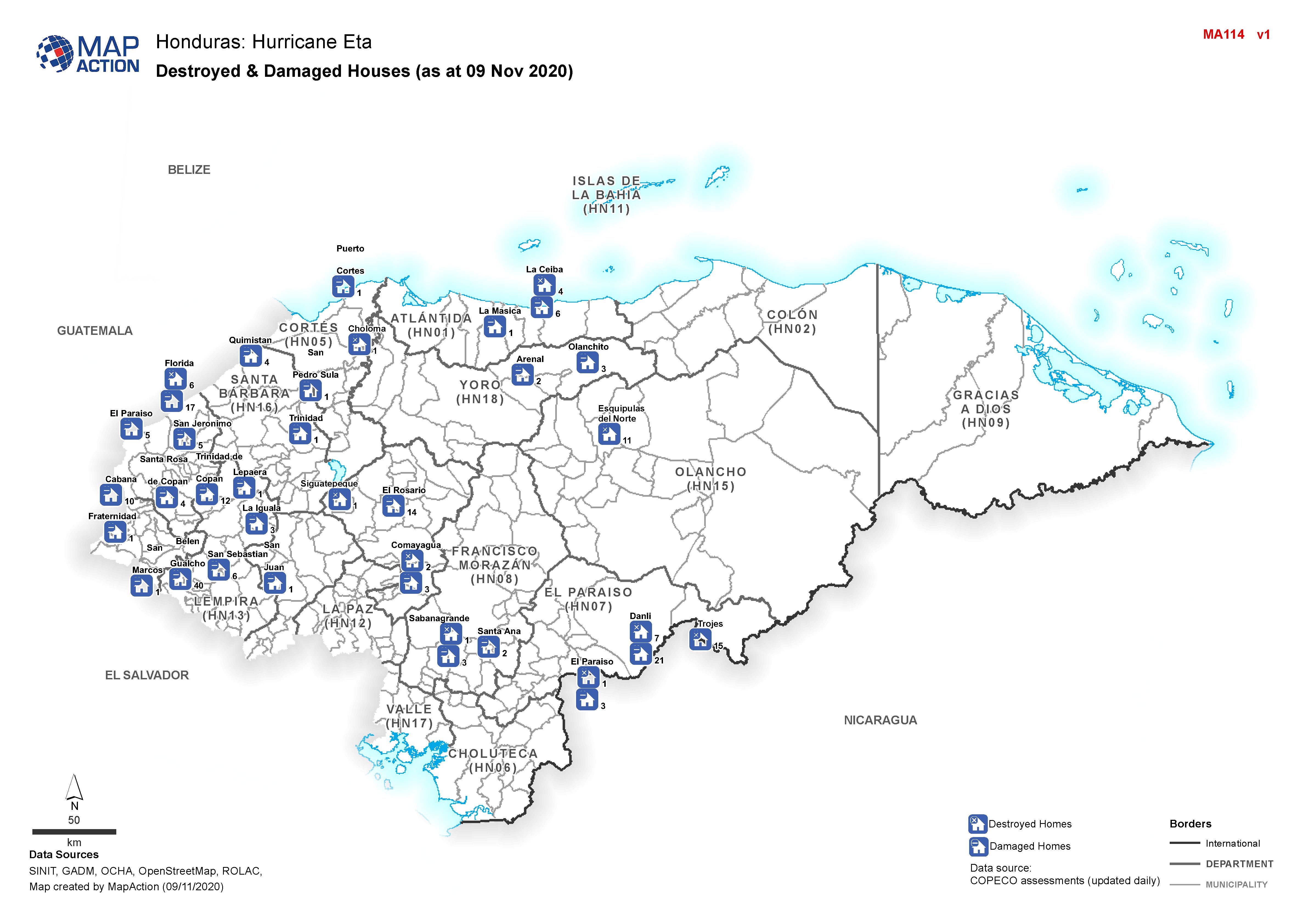
Honduras: Destroyed & Damaged Houses (as at 09 Nov 2020)
Honduras, Destroyed & Damaged Houses per Municipality as of 09th Nov 2020 -
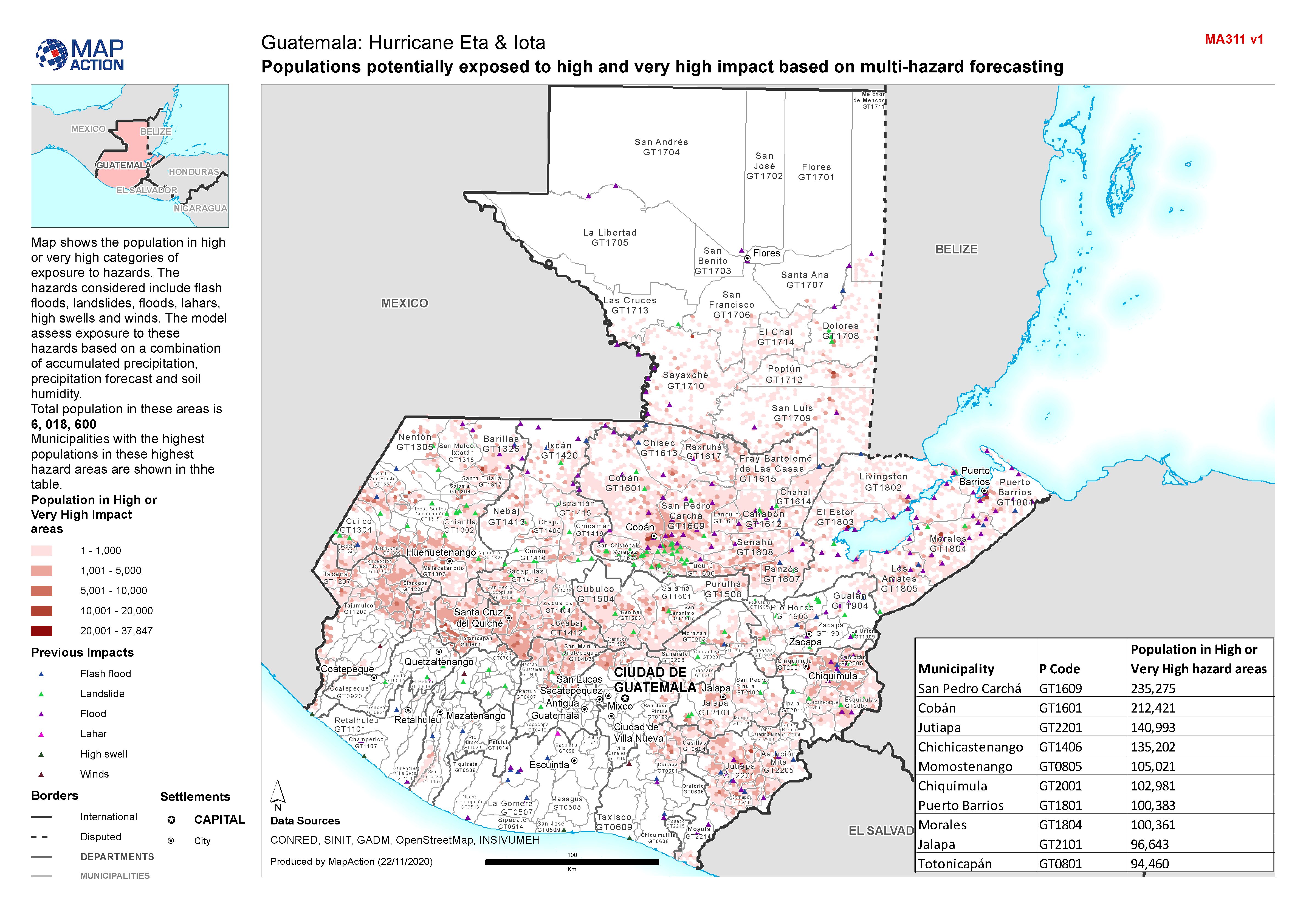
Guatemala: Populations potentially exposed to high and very high impact based...
Map shows the population in high or very high categories of exposure to hazards. The hazards considered include flash floods, landslides, floods, lahars, high swells and winds.... -
Honduras, Humanitarian Presence: Who is doing What in each Municipality in ea...
Map shows the number of reported activities per Sector, and who is delivering them, per Municipality, per Department in Honduras. Critical and High priority response areas and... -
Honduras, Humanitarian Presence: Who is doing What in Department (as at 21th ...
Map shows the number of reported activities per Sector, and who is delivering them, per Department in Honduras. Critical and High priority response areas and satellite derived...