-
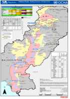
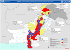
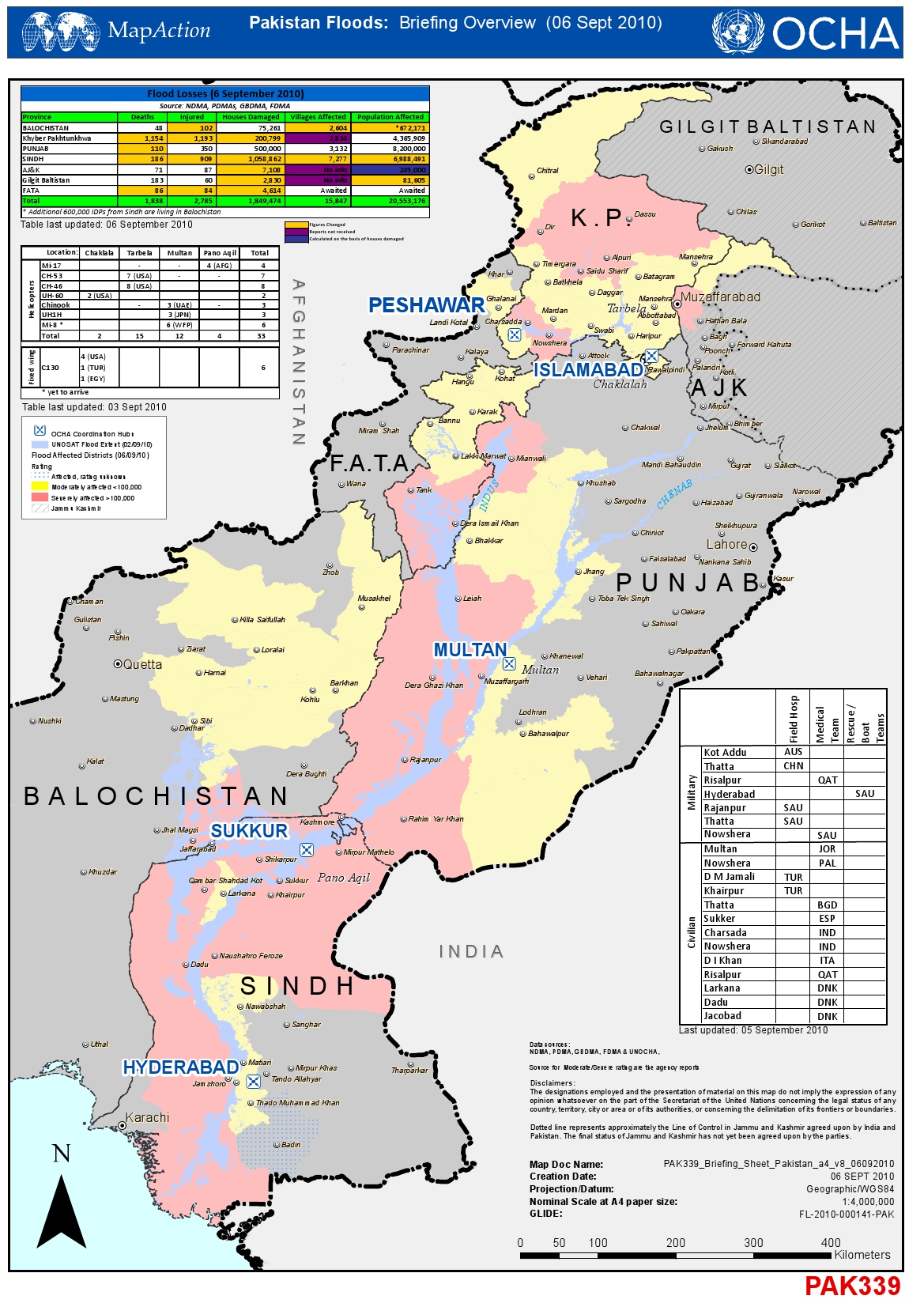
Pakistan Floods: Briefing Overview (6 Sept 2010)
Briefing Overview as of 06 Sept 2010 for A3 paper -

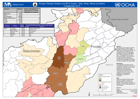
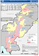
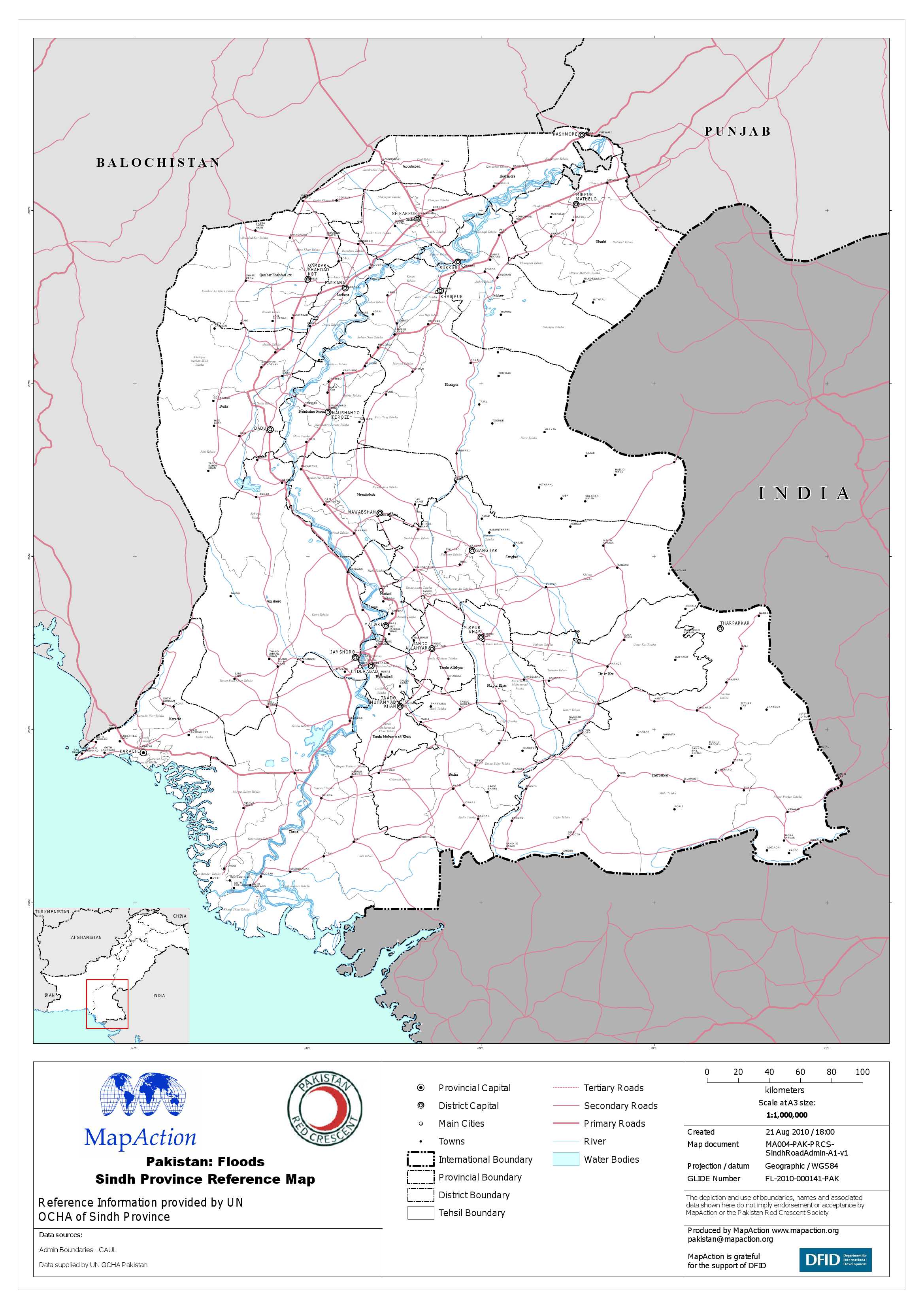
Pakistan: Sindh District - Situation Update (6 Sept 2010)
Situation in Sindh Province as of 06 September 2010 -

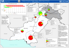
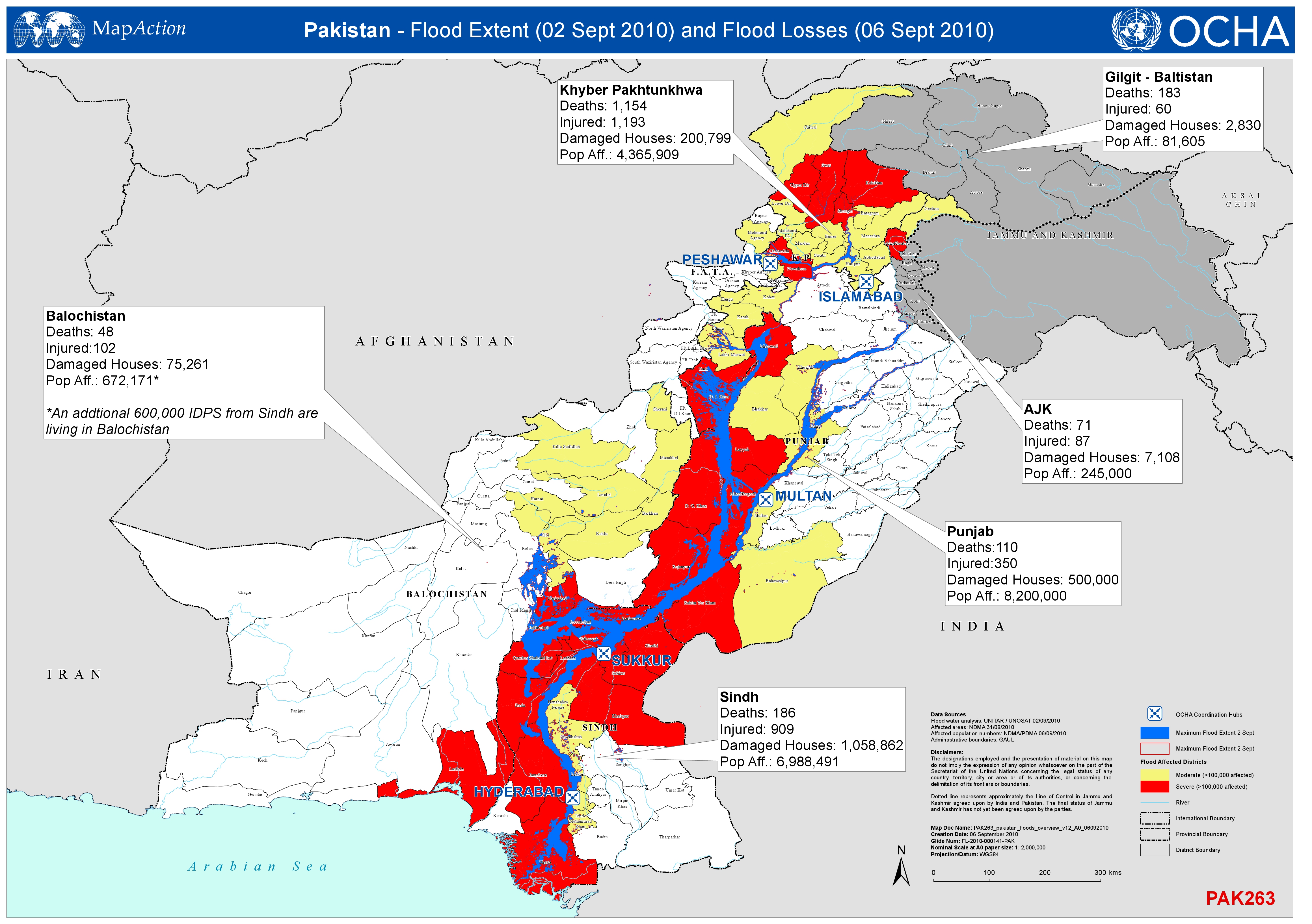
Pakistan - Flood Extent (2 Sept 2010) and Flood Losses (6 Sept 2010)
Shows the extent of the flood (2nd Sept 2010) and the numbers of deaths, injured persons, damaged houses and affected population by Province ( 6th Sept 2010). -

Pakistan: Kyber-Pakhtunkhwa - Flood Extent (2 Sep 2010) and Flood Affected Di...
This dataset has no description
-

Pakistan: Food Distribution (2 Sep 2010)
Map shows the numbers those in need of food assistance, by province, and the proportion of this need already provided for, that already scheduled, and the remaining gap. -
Punjab - UNDP Environmental Assessment Areas
UNEP Environmental Assessments from 22 August and the new assessments in four Thesils in Swat Province. -

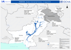
Indus Catchment River Flow Levels
Indus Catchment River Flow Levels as of 3 Sept 2010 from data from Pakistan Meteorological Department website -
Punjab Shelter and NFI Cluster - Who, What, Where by District
Map shows total numbers of agencies by District providing Shelter and NFI assistance in Punjab Province, compiled by the Shelter and NFI Cluster as of 02/09/2010, . -
-

Sindh Overview - Flood Extent and Situational Information
Shows the Maximum Flood Extent and Situational Information in Sindh Province as of 05 Sept 2010. -
Pakistan Floods Overview - Extent and Losses
Shows the extent of the flood (2nd Sept 2010) and the numbers of deaths, injured persons, damaged houses and affected population by Province (3rd Sept 2010). -

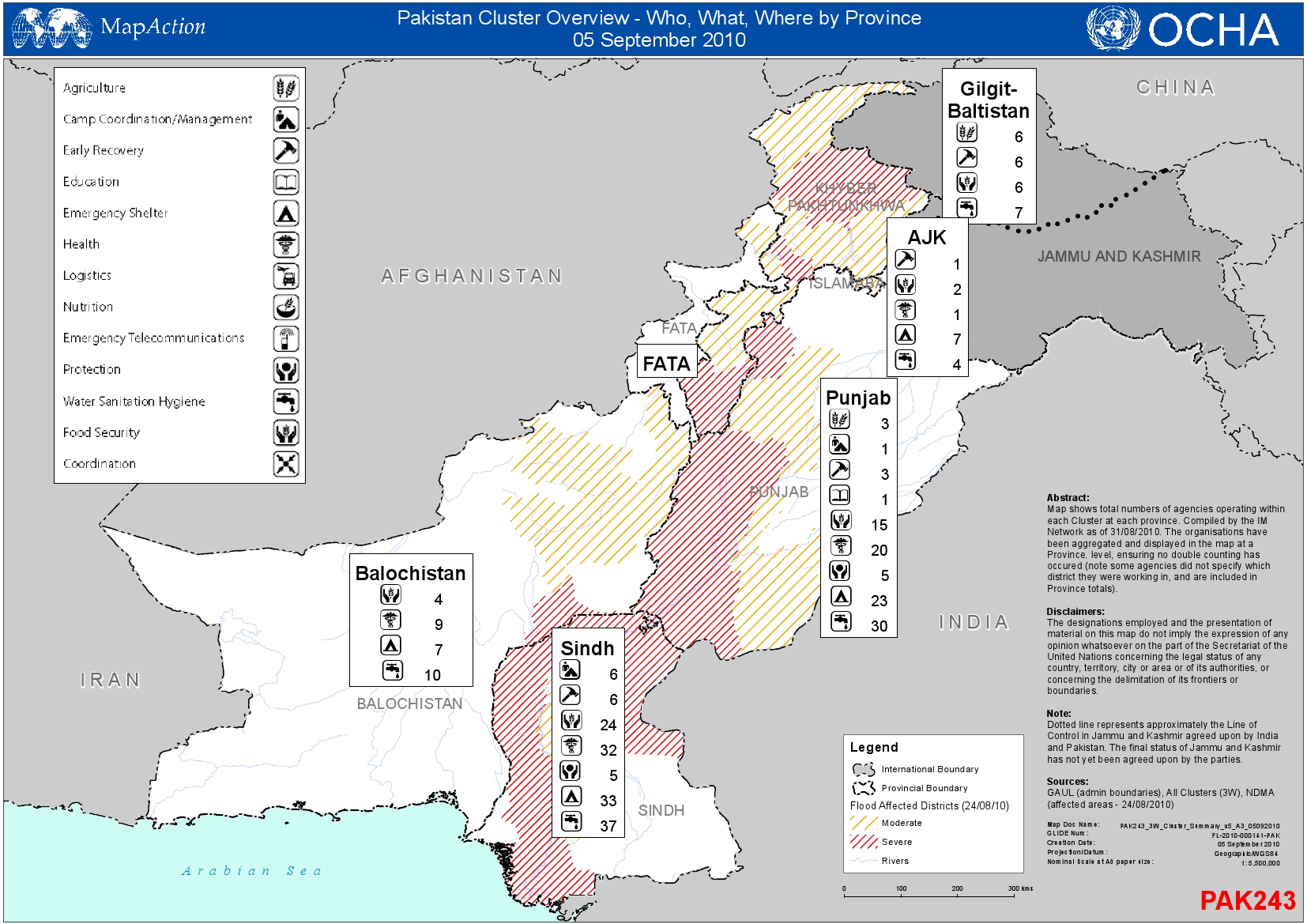
Pakistan Cluster Overview - Who, What, Where by Province
Map shows total numbers of agencies operating within each Cluster at each province. Compiled by the Information Management Network as of 31/08/2010. -
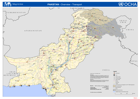
Pakistan: Transport Reference Map
Pakistan's transport infrastructure: national road network, IATA airports, and sea ports, with districts for reference. -
-

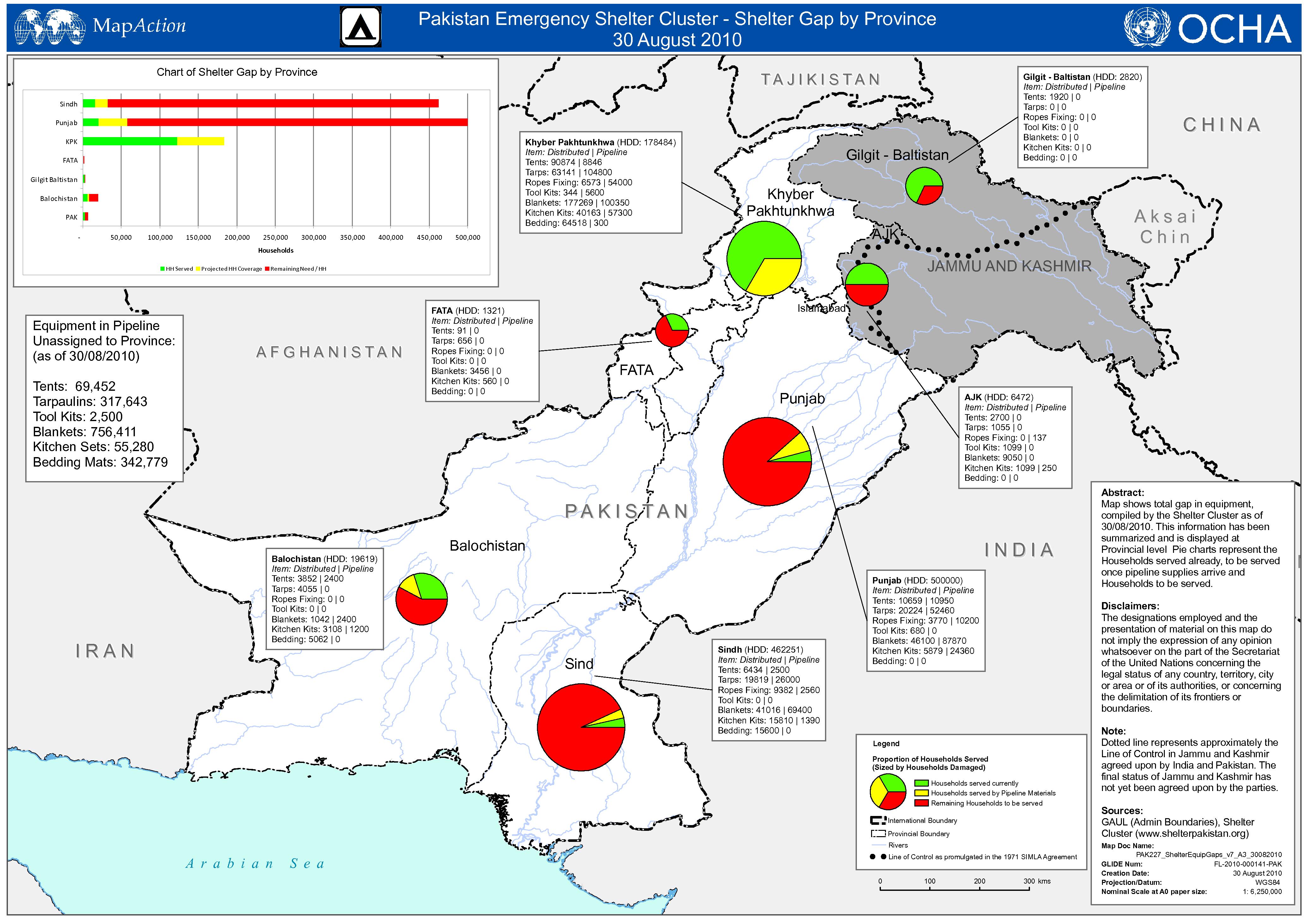
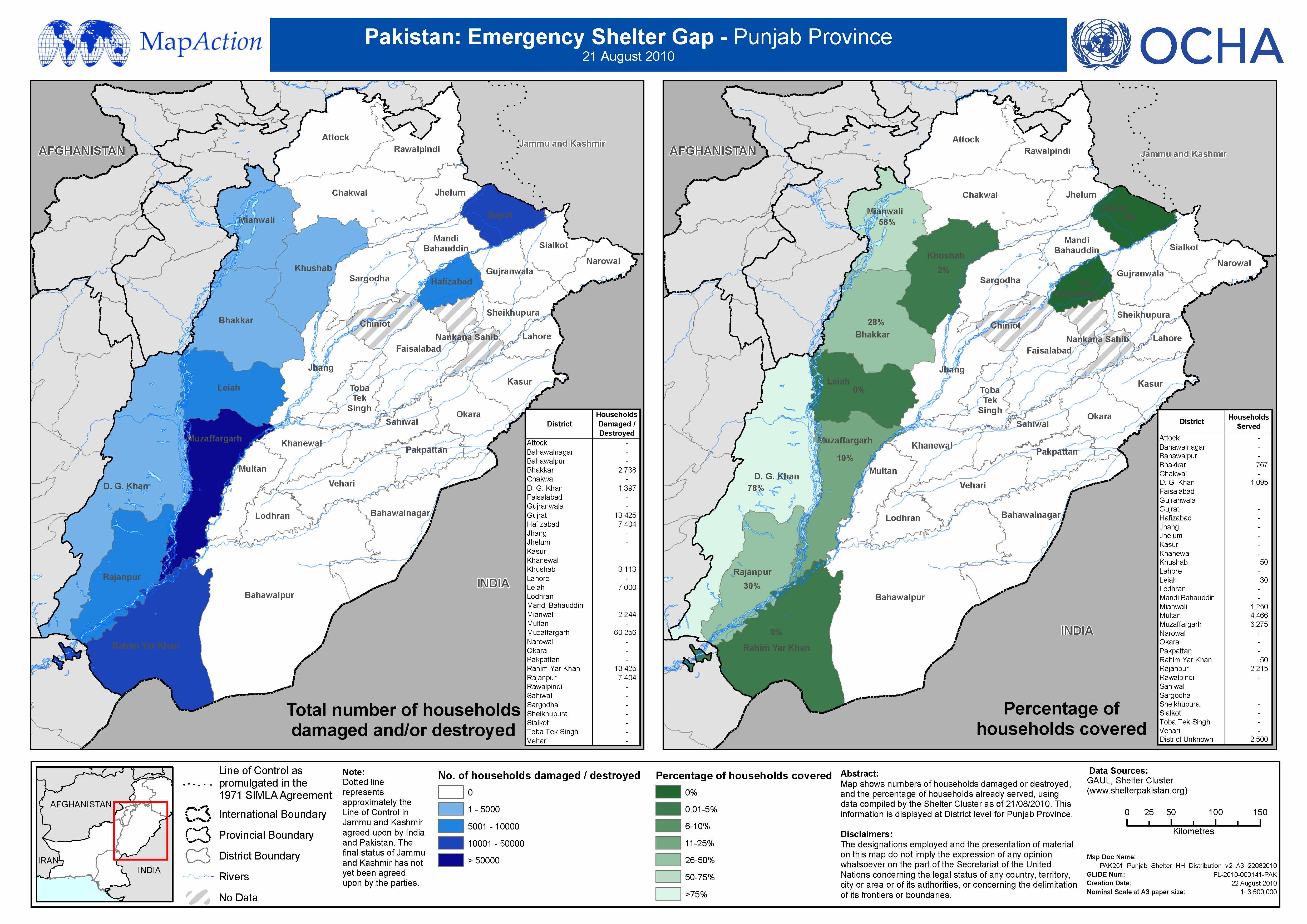
Pakistan Emergency Shelter Gap - Punjab Province - 21 August 2010
This dataset has no description
-
Pakistan - Situation Overview by Province - 21 August 2010
Map shows data of deaths, affected population, and damaged houses provided by the Provincial and National Disaster Management Authorities. (PDMA and NDMA). This information has... -
-

-

-
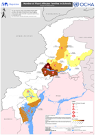
Number of Flood Affected Families in Schools - Khyber Pakhtunkhwa
This map shows the number of flood affected families settled in schools in the Khyber Pakhtunkhwa Province per district. The districts are shaded according to the number of...