-
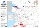
Albania: Flooding - Vehicle Assessment of Flood Area and Shkodër, 12-Jan-2010
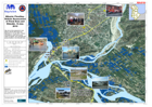
Map shows the assessment route taken by the EU-MIC team and MapAction on 12-Jan-2010. Photos were taken to verify some of the water boundaries, show damage and assess facilities... -
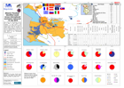
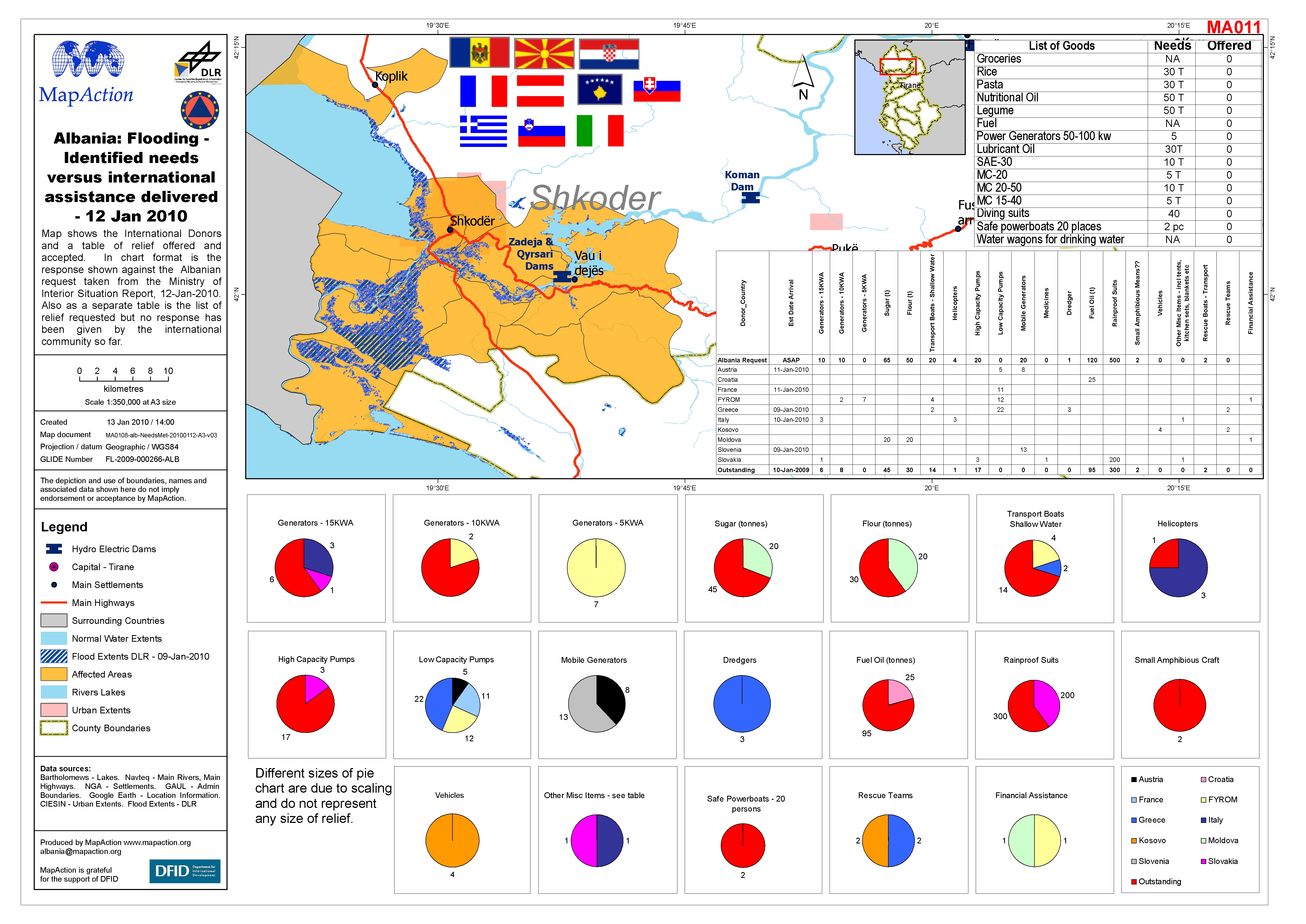
Albania: Flooding - Identified needs versus international assistance delivere...
Map shows the International Donors and a table of relief offered and accepted. In chart format is the response shown against the Albanian request taken from the Ministry of... -

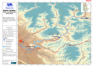
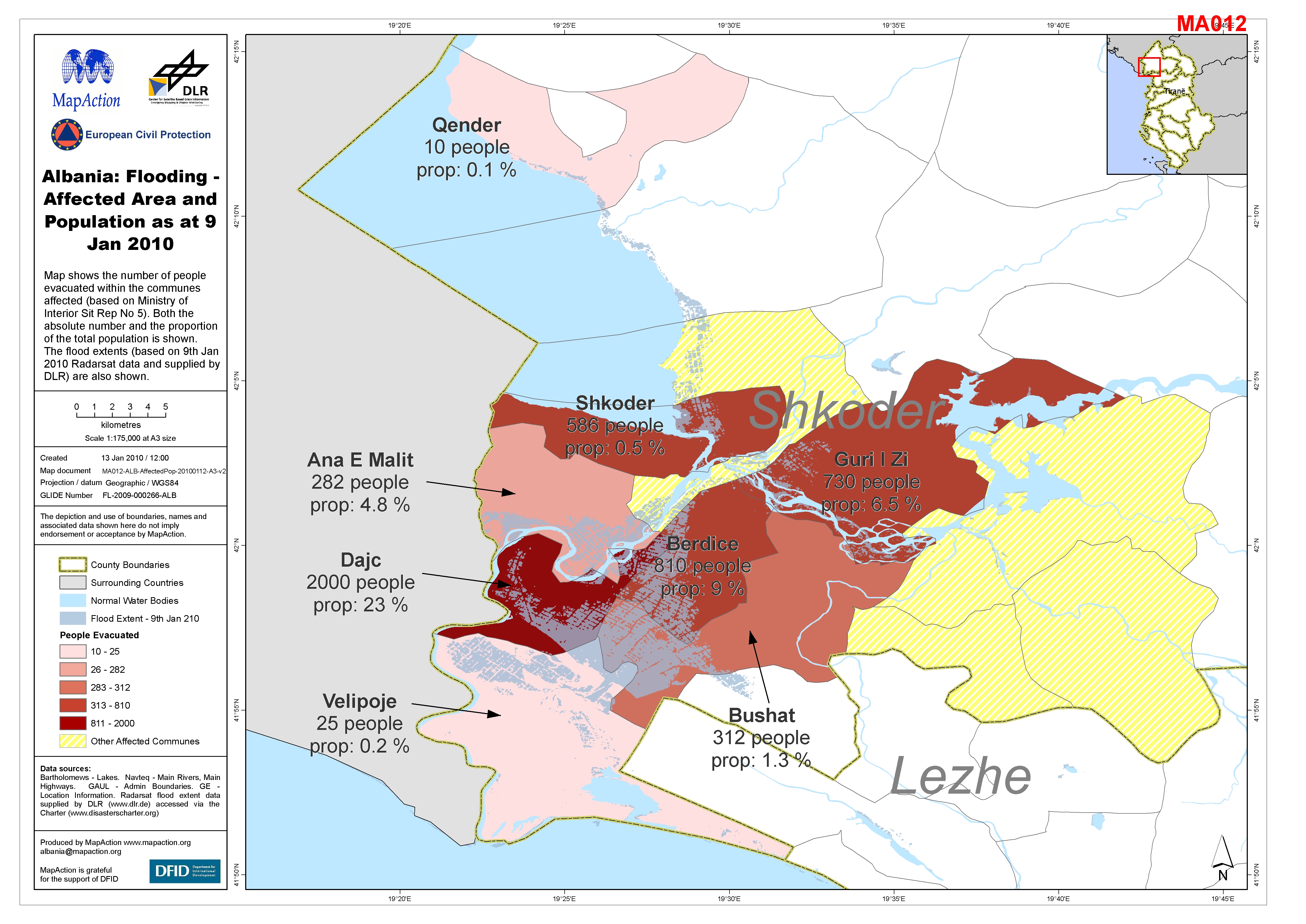
Albania: Flooding - Affected Area and Population as at 9 Jan 2010
Map shows the number of people evacuated within the communes affected (based on Ministry of Interior Sit Rep No 5). Both the absolute number and the proportion of the total... -
Albania: Flooding - Assessment Photos 10th Jan 2010
Map showsa selection of photos taken by the EU MIC assessment team, in the Shkodër area on 10th Jan 2010. The flood extent (derived from Radarsat) is shown. -
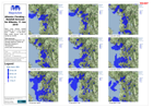
Albania: Flooding - Rainfall forecast for Albania, 11 Jan 2010
Each map shows rainfall predicted for a 3 hour period from 1400h, 11-Jan-2010. Map scale shows units of rainfall as mm/6h. -

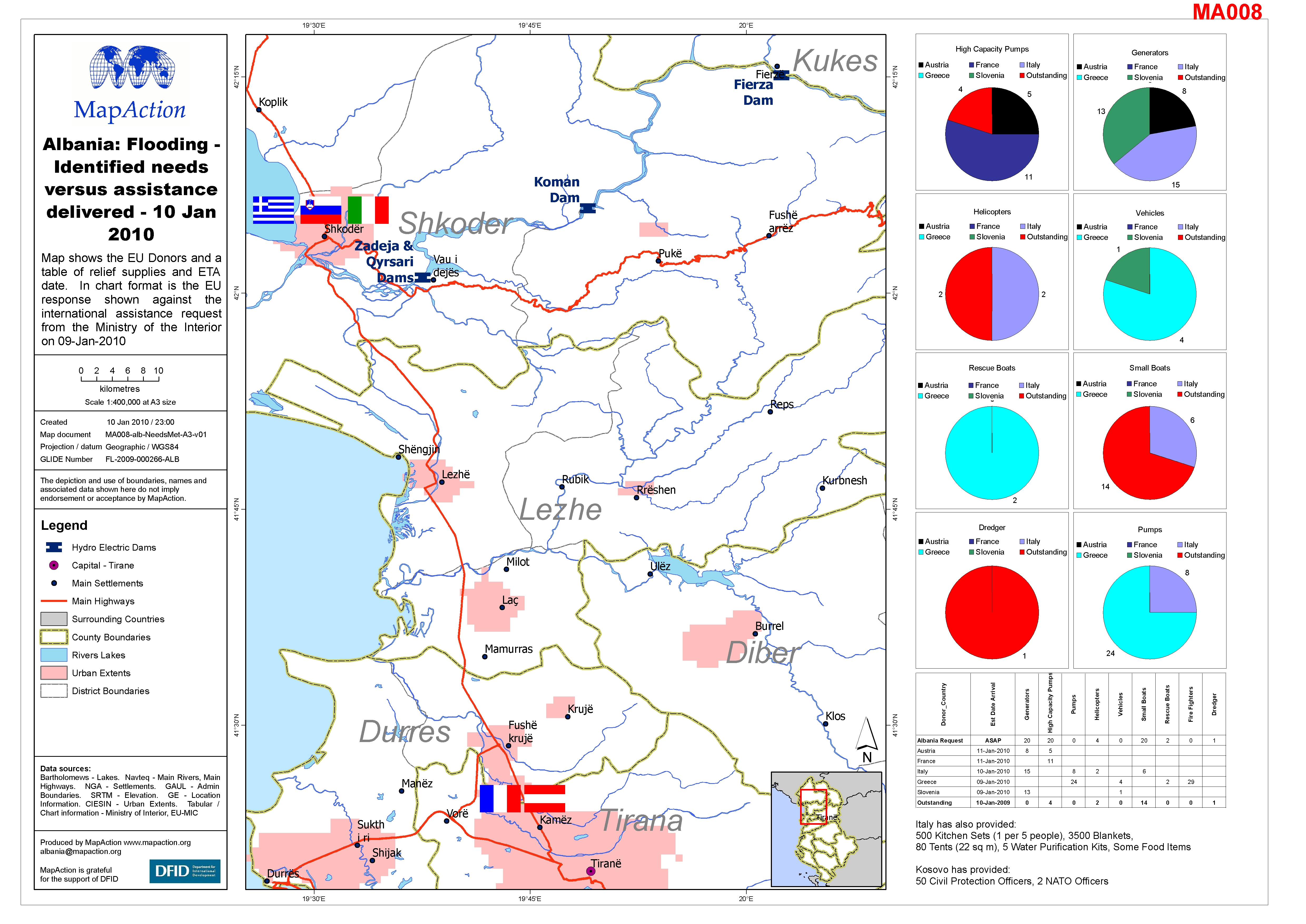
Albania: Flooding - Identified needs versus assistance delivered - 10 Jan 2010
Map shows the EU Donors and a table of relief supplies and ETA date. In chart format is the EU response shown against the international assistance request from the Ministry of... -
Albania: Flooding - Location of EU Member State Donor Relief - 10 Jan 2010
Map shows the EU Donors and a table of relief supplies and arrival date. -

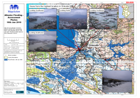
Albania: Flooding - Overview of North West Albania and Approximate AOI (as of...
Map shows the main hydro electric dams in the north west of the country, the main waterways and the urban extents. The map extends to Tirane as this is the capital and main... -
Albania: Flooding - Dam Locations on River Drin
Map shows the three main dams on the River Drin and surrounding elevation data for information. Only main rivers are shown. -

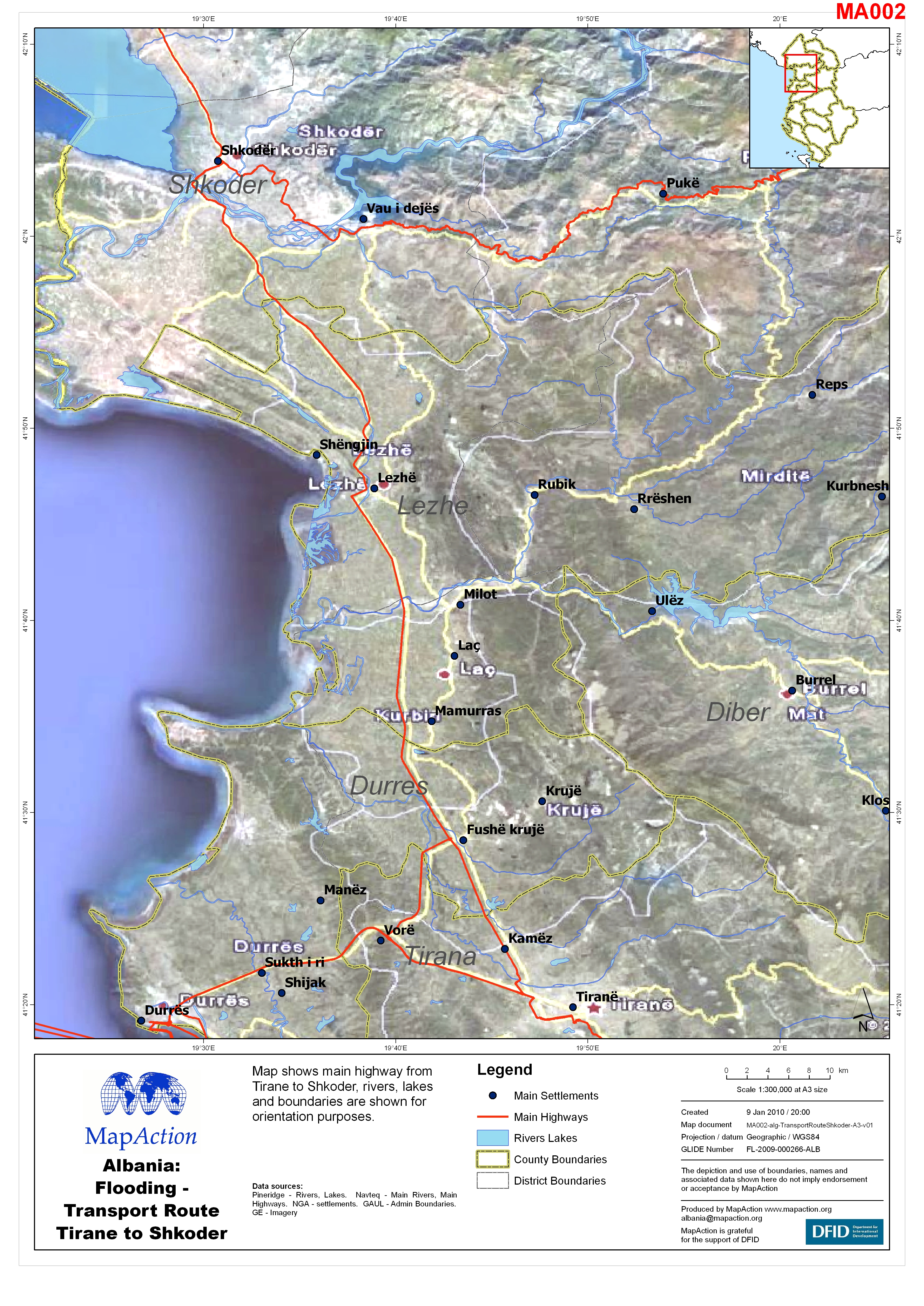
Albania: Flooding - Transport Route Tirane to Shkoder
Map shows main highway from Tirane to Shkoder, rivers, lakes and boundaries are shown for orientation purposes. -
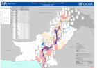
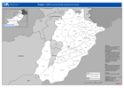
Pakistan: Cluster - Who, What, Where by Province (4 Sept 2010)
Total numbers of agencies operating within each Cluster at each district. Compiled by the PHF as of 2010-08-31 -
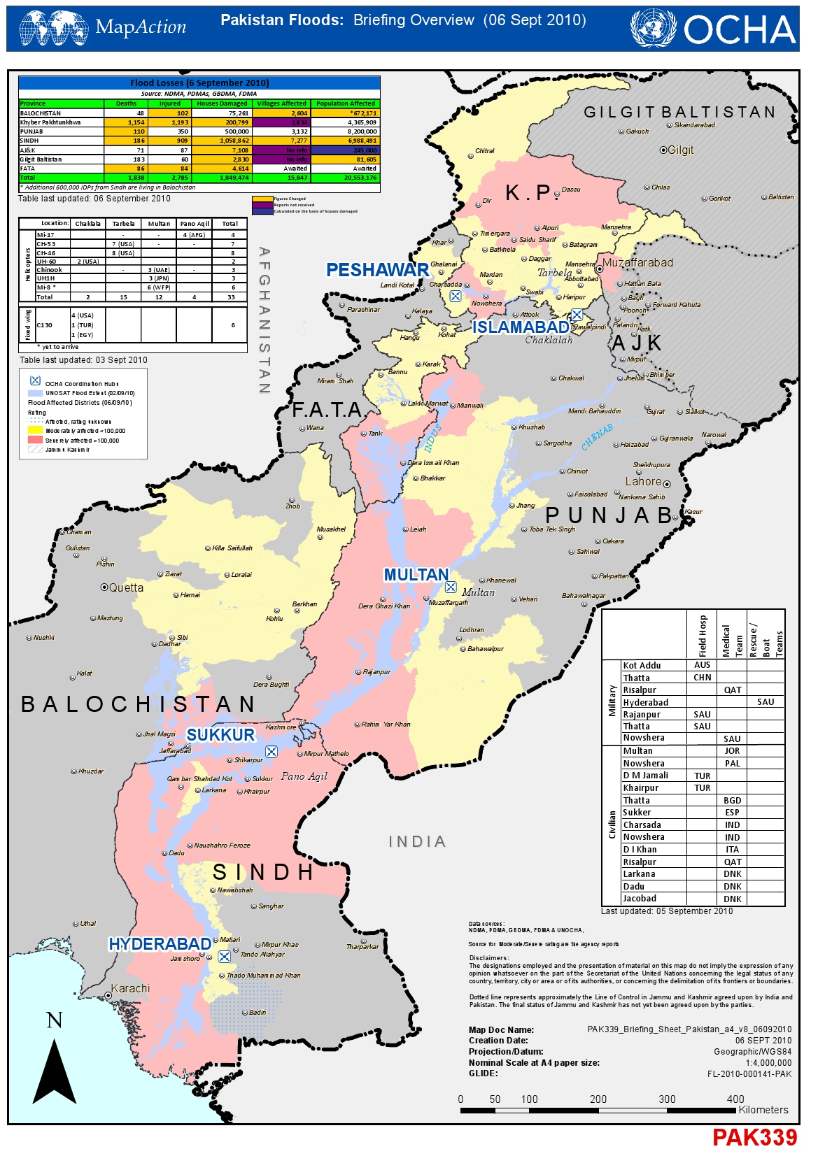
Pakistan Floods: Briefing Overview (6 Sept 2010)
Briefing Overview as of 06 Sept 2010 for A3 paper -

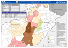
Pakistan: Sindh District - Situation Update (6 Sept 2010)
Situation in Sindh Province as of 06 September 2010 -

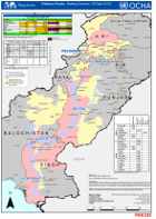
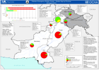
Pakistan - Flood Extent (2 Sept 2010) and Flood Losses (6 Sept 2010)
Shows the extent of the flood (2nd Sept 2010) and the numbers of deaths, injured persons, damaged houses and affected population by Province ( 6th Sept 2010). -

Pakistan: Kyber-Pakhtunkhwa - Flood Extent (2 Sep 2010) and Flood Affected Di...
This dataset has no description
-

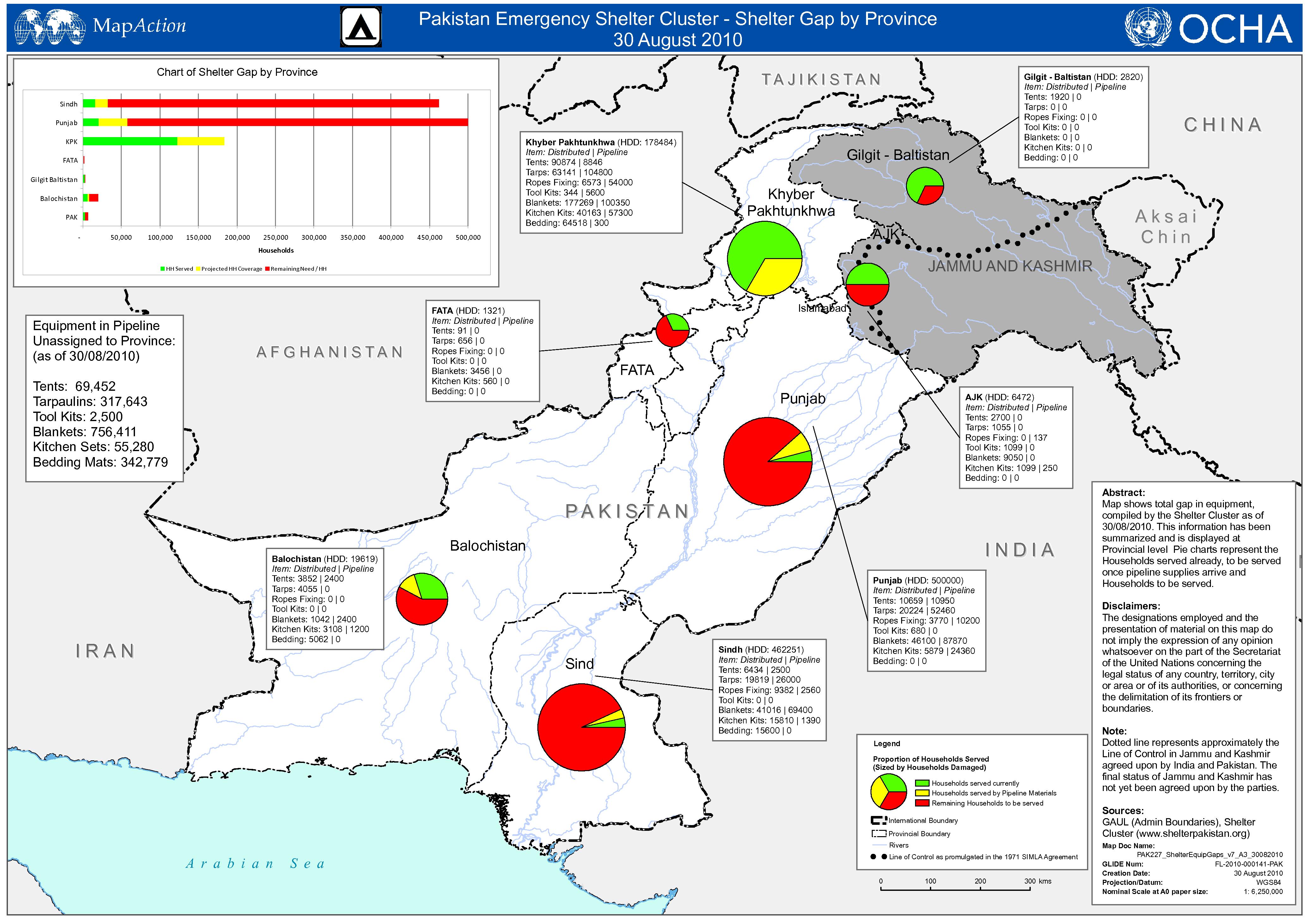
Pakistan: Food Distribution (2 Sep 2010)
Map shows the numbers those in need of food assistance, by province, and the proportion of this need already provided for, that already scheduled, and the remaining gap. -
Punjab - UNDP Environmental Assessment Areas
UNEP Environmental Assessments from 22 August and the new assessments in four Thesils in Swat Province. -

Indus Catchment River Flow Levels
Indus Catchment River Flow Levels as of 3 Sept 2010 from data from Pakistan Meteorological Department website -
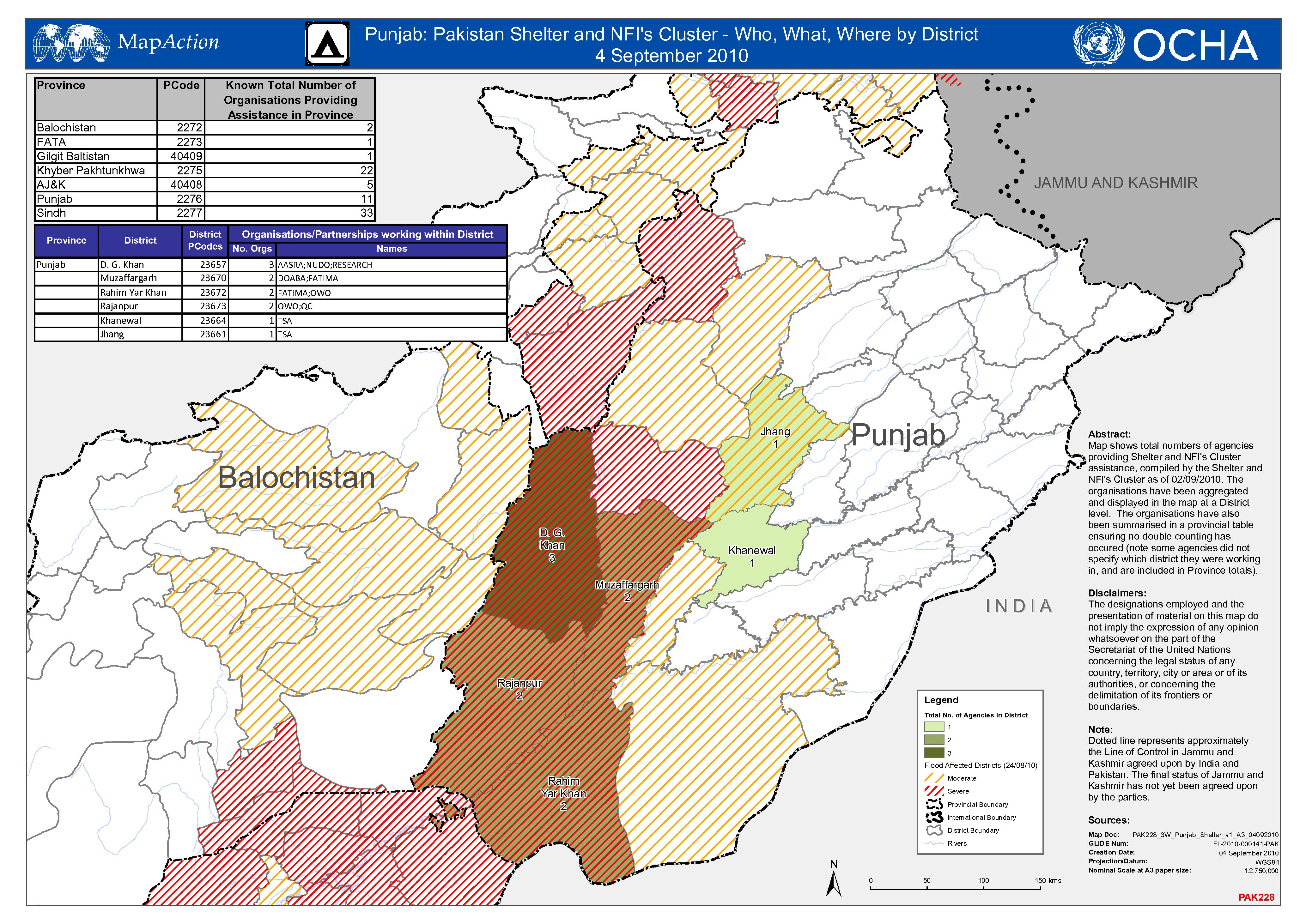
Punjab Shelter and NFI Cluster - Who, What, Where by District
Map shows total numbers of agencies by District providing Shelter and NFI assistance in Punjab Province, compiled by the Shelter and NFI Cluster as of 02/09/2010, . -