-

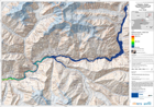
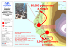
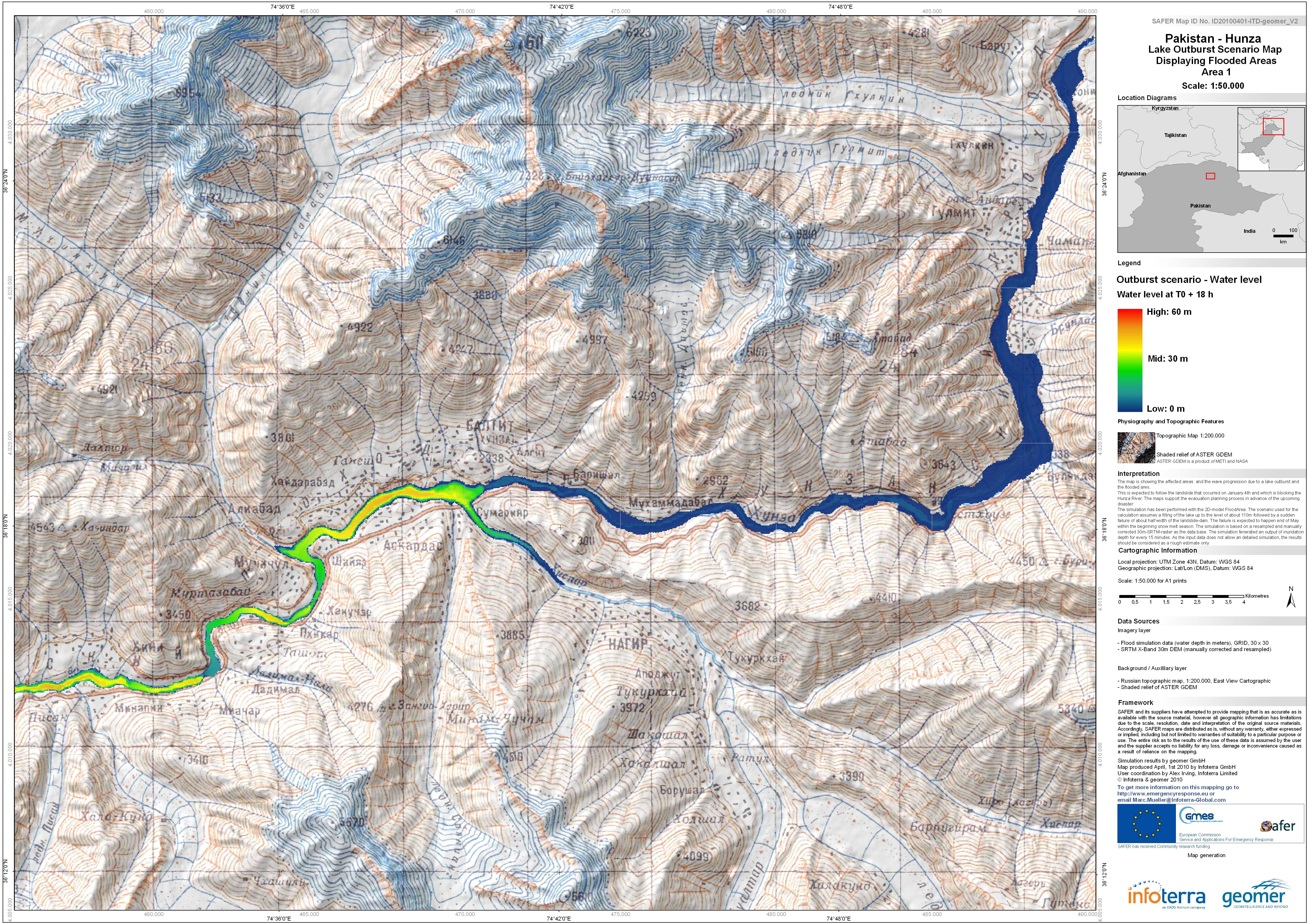
Pakistan - Hunza: Lake Outburst Scenario Map Displaying Flooded Areas. Area 1...
The map is showing the affected areas and the wave progression due to a lake outburst and flooded area.This is expected to follow the landslide that occured on January 4th and... -
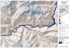
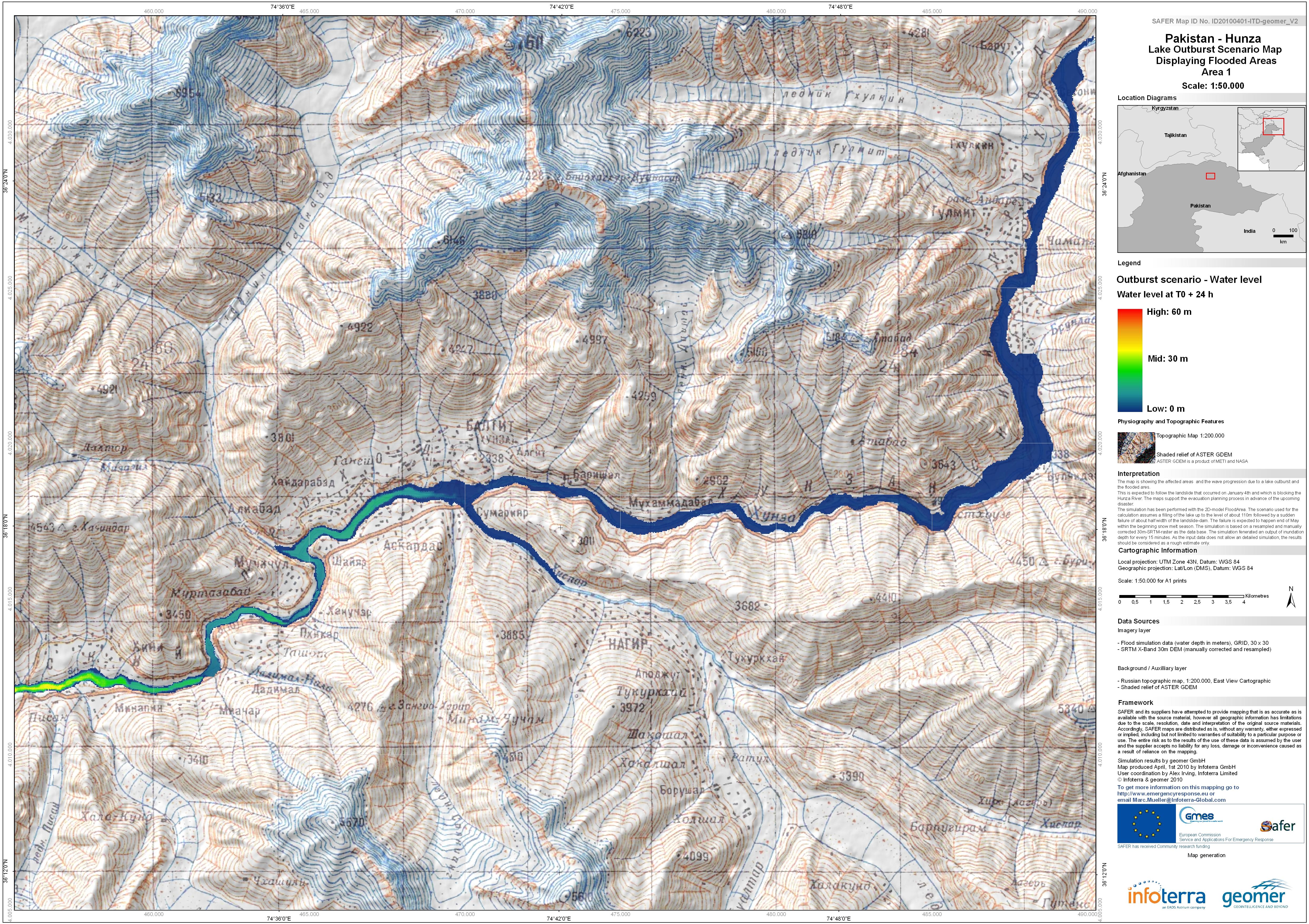
Pakistan - Hunza: Lake Outburst Scenario Map Displaying Flooded Areas. Area 1...
The map is showing the affected areas and the wave progression due to a lake outburst and flooded area.This is expected to follow the landslide that occured on January 4th and... -

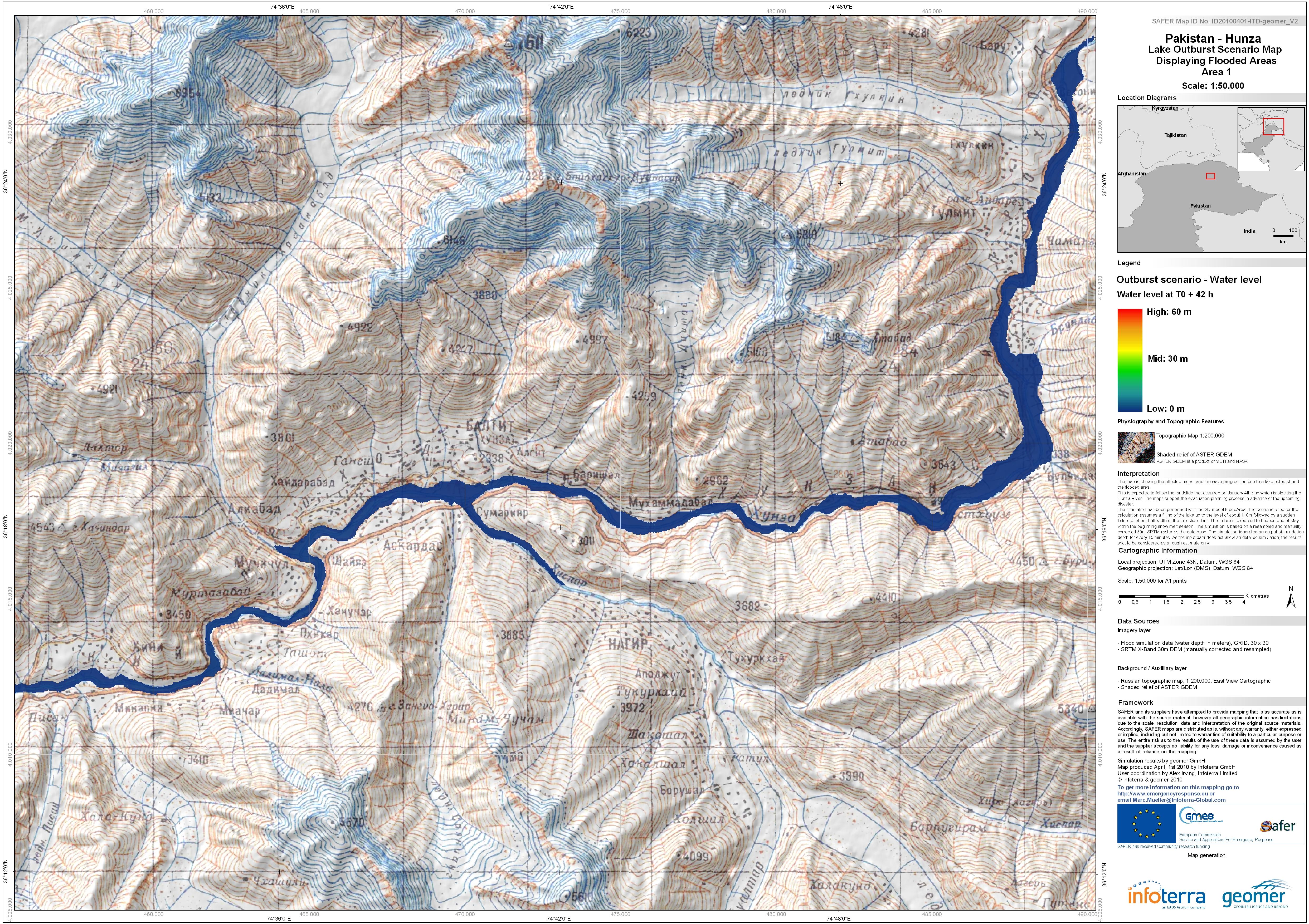
Pakistan - Hunza: Lake Outburst Scenario Map Displaying Flooded Areas. Area 1...
The map is showing the affected areas and the wave progression due to a lake outburst and flooded area.This is expected to follow the landslide that occured on January 4th and... -

Pakistan - Hunza: Lake Outburst Scenario Map Displaying Flooded Areas. Area 1...
The map is showing the affected areas and the wave progression due to a lake outburst and flooded area.This is expected to follow the landslide that occured on January 4th and... -
Pakistan - Hunza: Lake Outburst Scenario Map Displaying Flooded Areas. Area 1...
The map is showing the affected areas and the wave progression due to a lake outburst and flooded area.This is expected to follow the landslide that occured on January 4th and... -

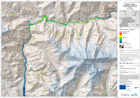
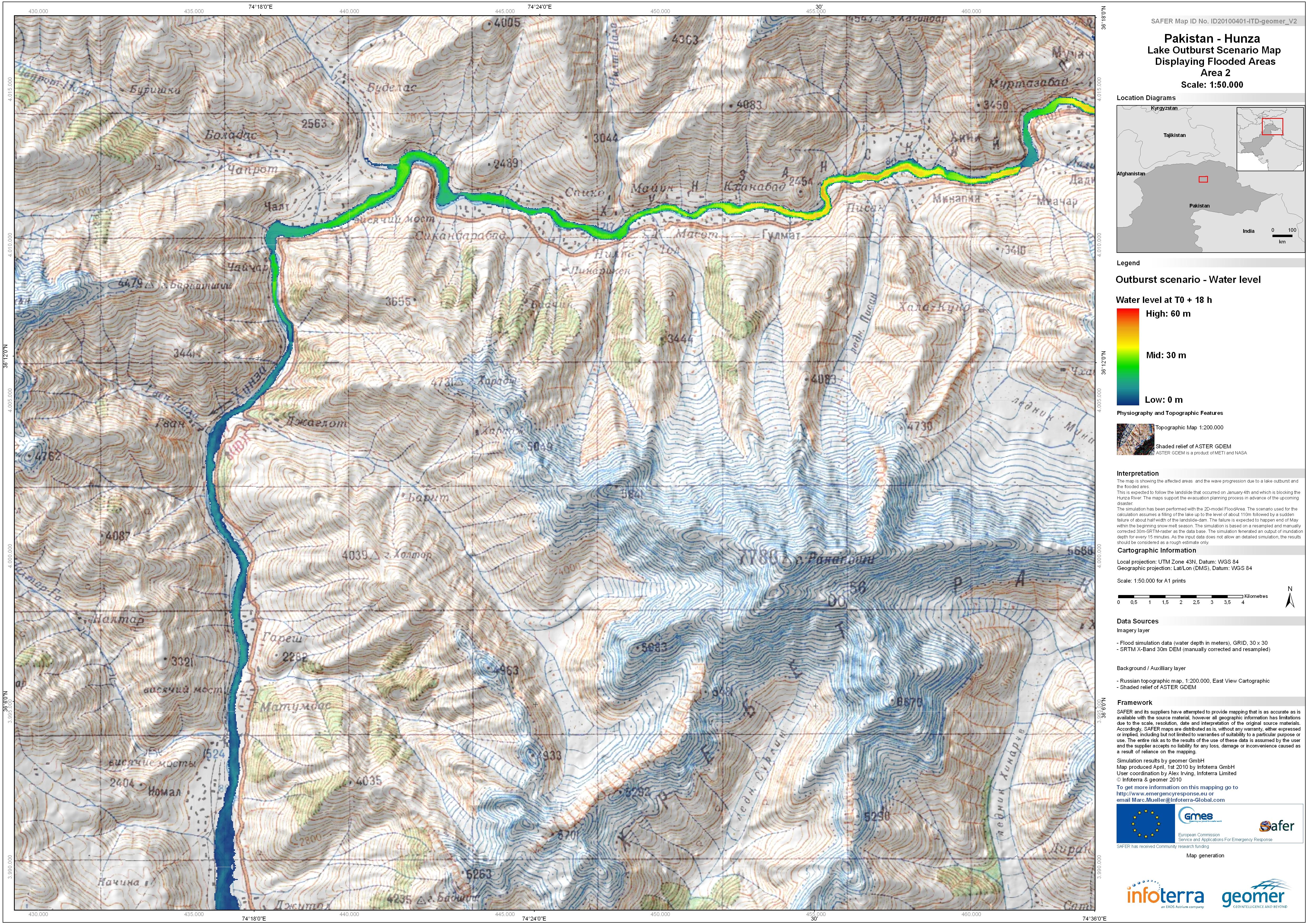
Pakistan - Hunza: Lake Outburst Scenario Map Displaying Flooded Areas. Area 2...
The map is showing the affected areas and the wave progression due to a lake outburst and flooded area.This is expected to follow the landslide that occured on January 4th and... -

Pakistan - Hunza: Lake Outburst Scenario Map Displaying Flooded Areas. Area 2...
The map is showing the affected areas and the wave progression due to a lake outburst and flooded area.This is expected to follow the landslide that occured on January 4th and... -

Pakistan - Hunza: Lake Outburst Scenario Map Displaying Flooded Areas. Area 2...
The map is showing the affected areas and the wave progression due to a lake outburst and flooded area.This is expected to follow the landslide that occured on January 4th and... -
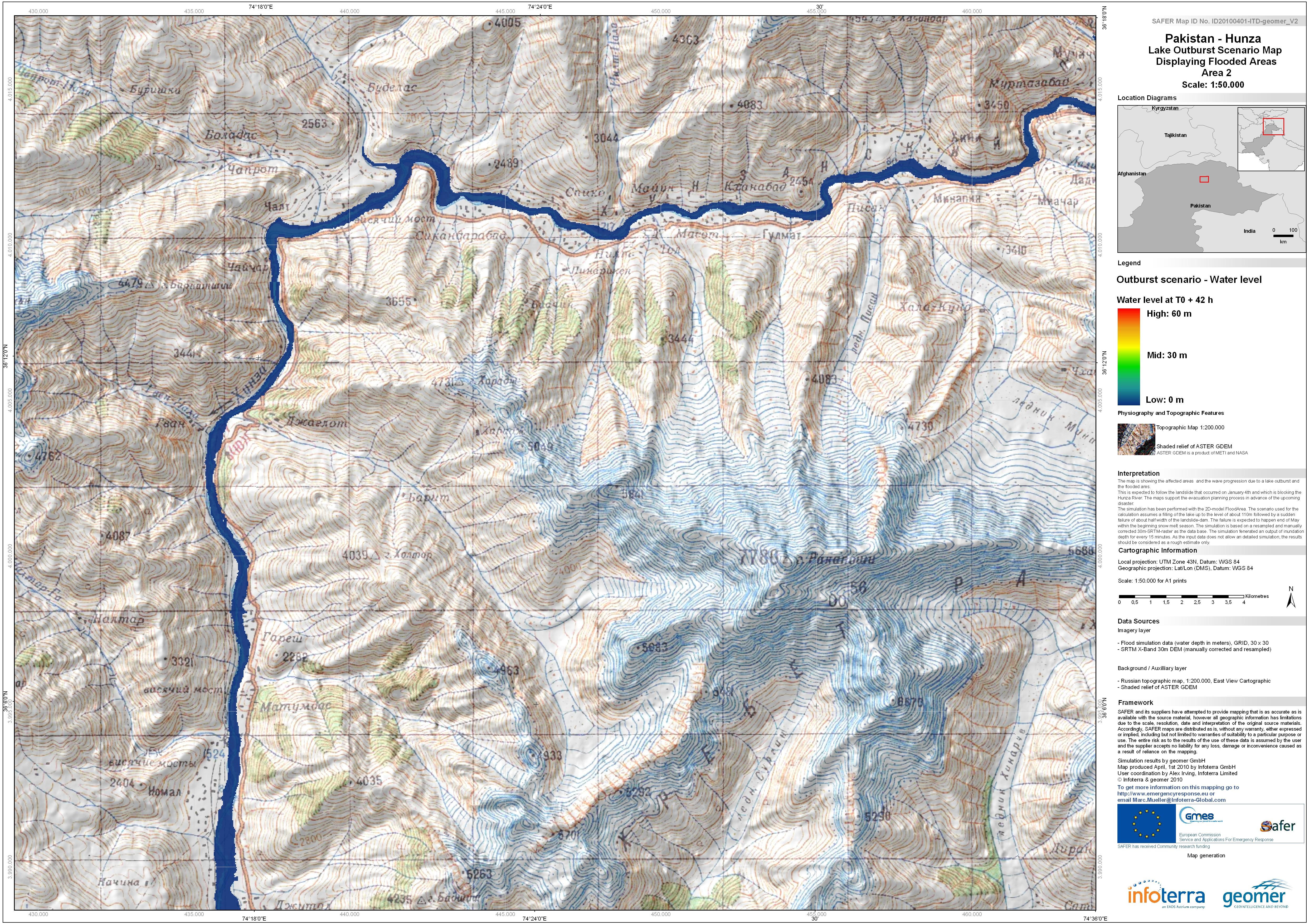
Pakistan - Hunza: Lake Outburst Scenario Map Displaying Flooded Areas. Area 2...
The map is showing the affected areas and the wave progression due to a lake outburst and flooded area.This is expected to follow the landslide that occured on January 4th and... -

Pakistan - Hunza: Lake Outburst Scenario Map Displaying Flooded Areas. Area 2...
The map is showing the affected areas and the wave progression due to a lake outburst and flooded area.This is expected to follow the landslide that occured on January 4th and... -

Pakistan - Hunza: Lake Outburst Scenario Map Displaying Flooded Areas. Area 2...
The map is showing the affected areas and the wave progression due to a lake outburst and flooded area.This is expected to follow the landslide that occured on January 4th and... -

Pakistan - Hunza: Lake Outburst Scenario Map Displaying Flooded Areas. Area 2...
The map is showing the affected areas and the wave progression due to a lake outburst and flooded area.This is expected to follow the landslide that occured on January 4th and... -

Pakistan - Hunza: Lake Outburst Scenario Map Displaying Flooded Areas. Area 2...
The map is showing the affected areas and the wave progression due to a lake outburst and flooded area.This is expected to follow the landslide that occured on January 4th and... -
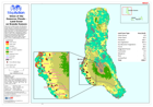
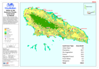
Union of the Comoros: Floods - Land Cover on Grande Comore
Land cover on Grande Comore. Showing affected villages. The data shown on this map were not created for the purposes of disaster response, and therefore should only be used as... -
Union of the Comoros: Floods - Land Cover on Moheli
Land cover on Moheli. Showing affected villages. The data shown on this map were not created for the purposes of disaster response, and therefore should only be used as an... -
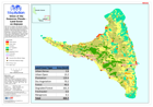
Union of the Comoros: Floods - Land Cover on Anjouan
Land cover on Anjouan. Showing affected villages. The data shown on this map were not created for the purposes of disaster response, and therefore should only be used as an... -
Union des Comores: inondations - Risques a cause des problemes d'eau
Map showing risks due to water problems, western side of Grande Comore Island (French). -

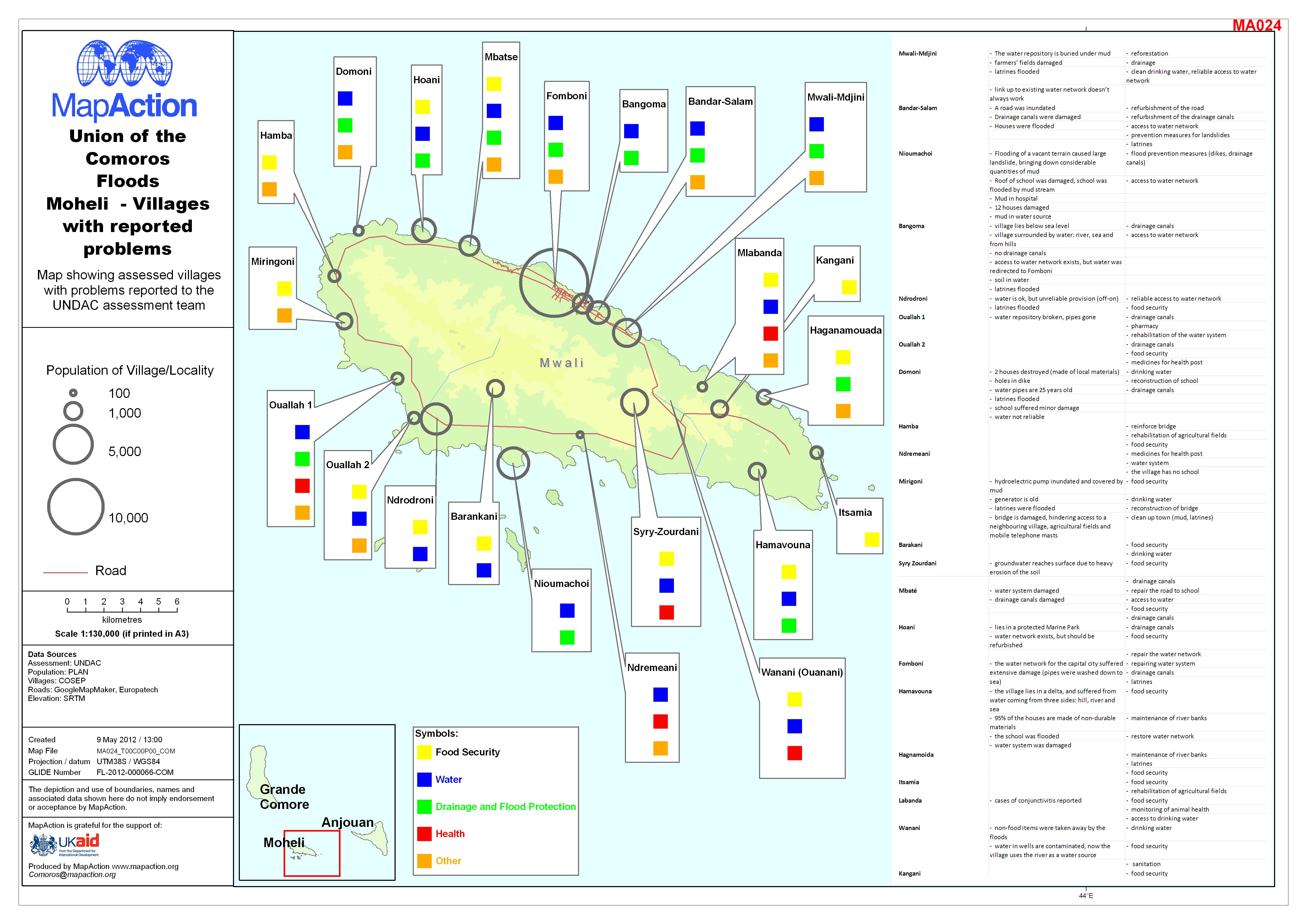
Union of the Comoros Floods Moheli - Villages with reported problems
Map showing reported problems in villages on Island of Moheli, Comoros. -

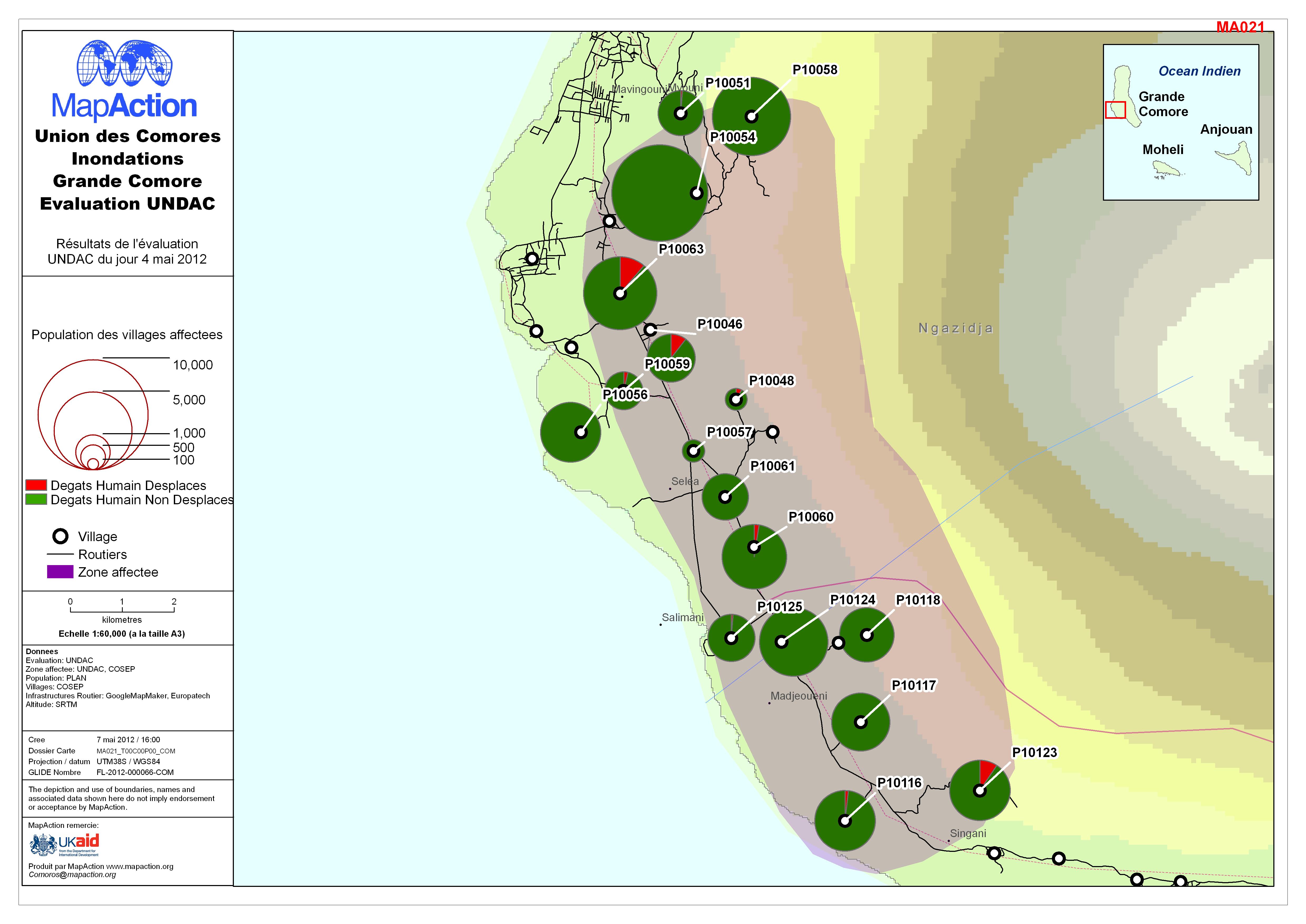
Union des Comores Inondations Grande Comore Evaluation UNDAC
UNDAC Assessment: Affected population on the western side of Grande Comore Island (in French) -
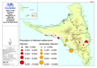
Union of the Comoros: Floods - Population of affected settlements on Anjouan ...
Map showing the population of affected settlements on Anjouan (as of 25 April 2012)