-

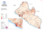
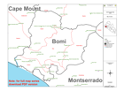
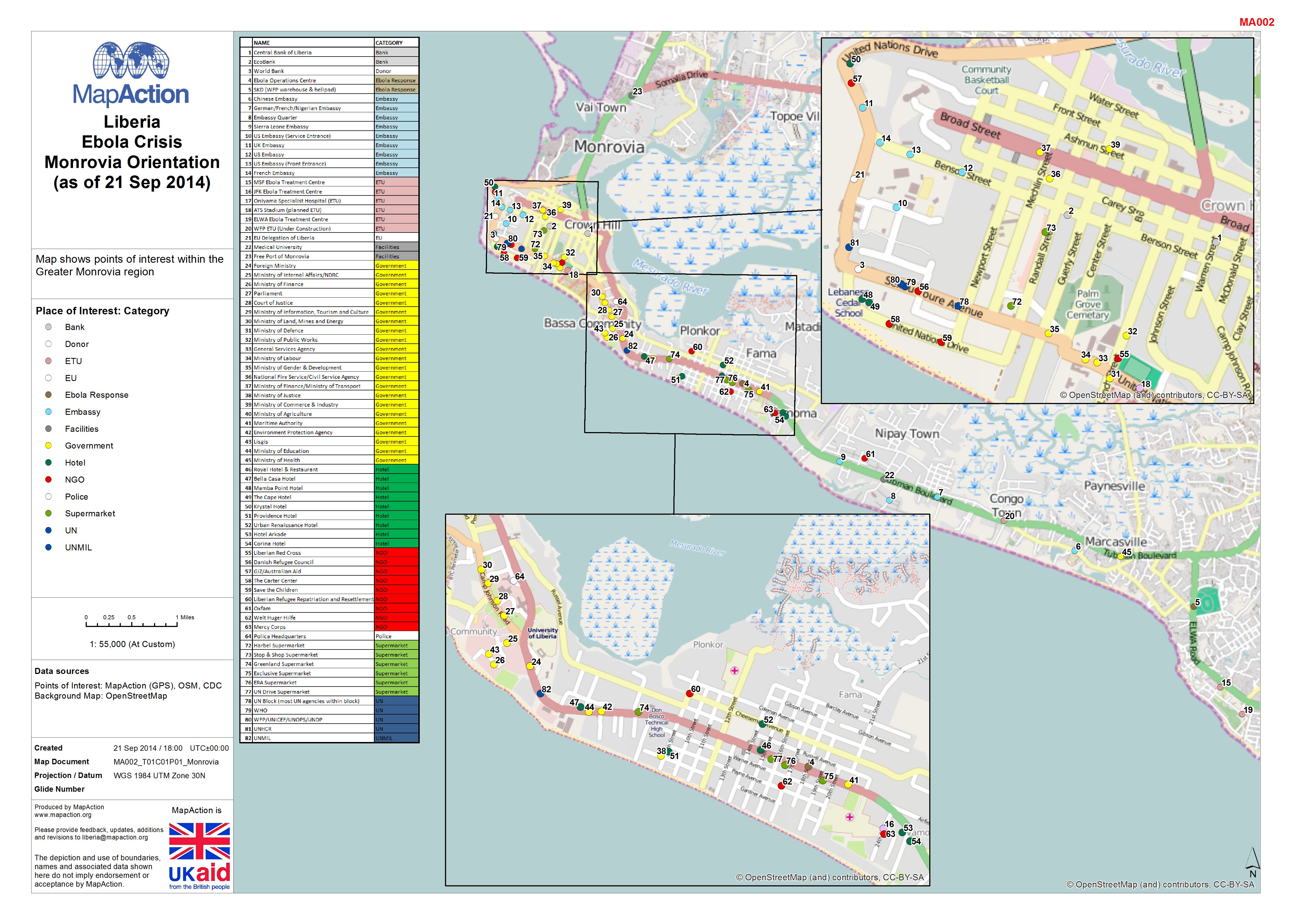
Liberia: Ebola Outbreak - Monrovia Orientation (as of 21 Sep 2014)
Map shows points of interest within the Greater Monrovia region -
Liberia: Ebola Outbreak - Radio Coverage and Population Density
Map shows the Radio Stations in operation across the country, also displayed is population density by District so shows areas potentially not covered. -

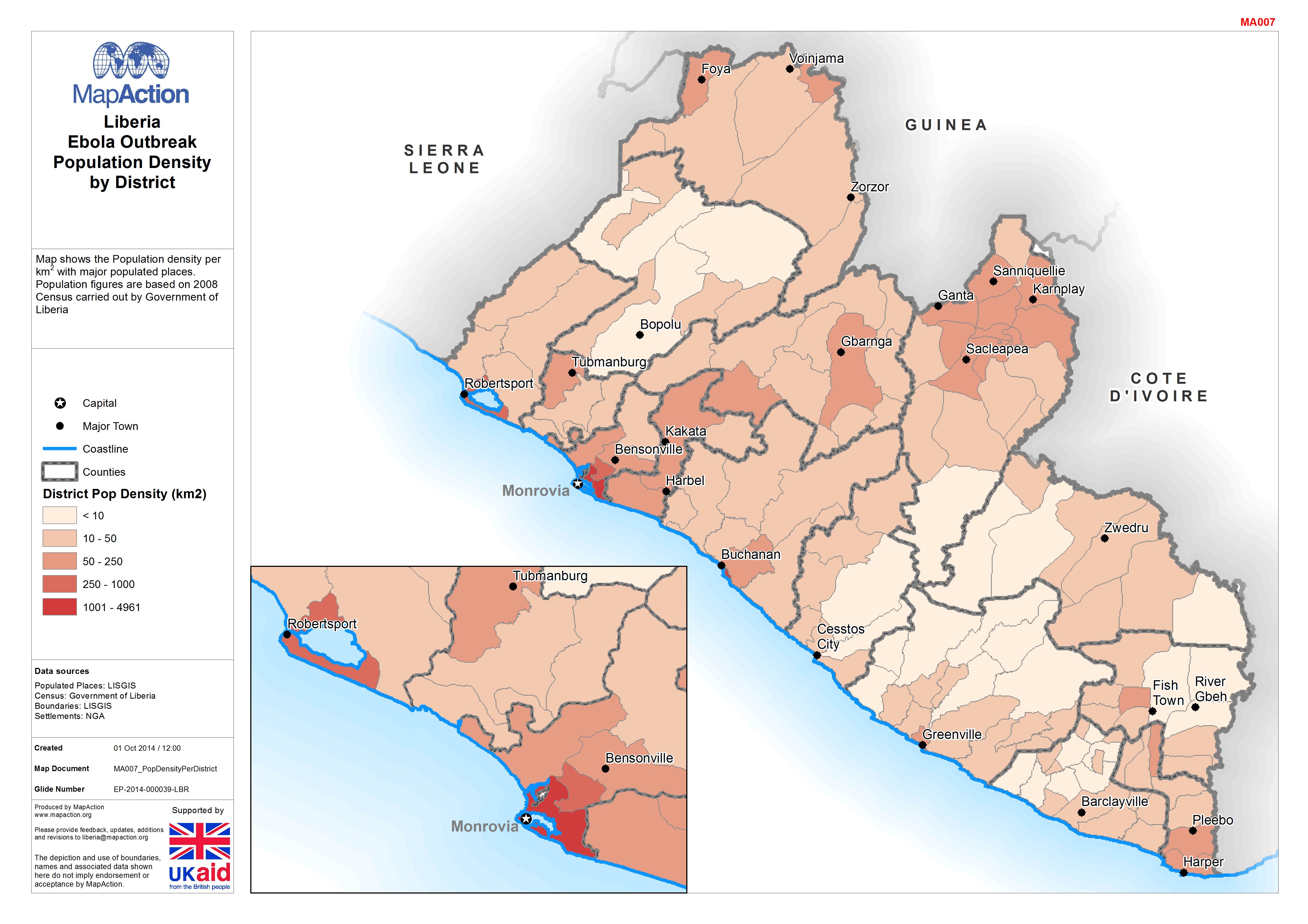
Liberia: Ebola Outbreak - Population Density by District
Map shows the Population density per km2 with major populated places. Population figures are based on 2008 Census carried out by Government of Liberia -
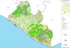
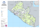
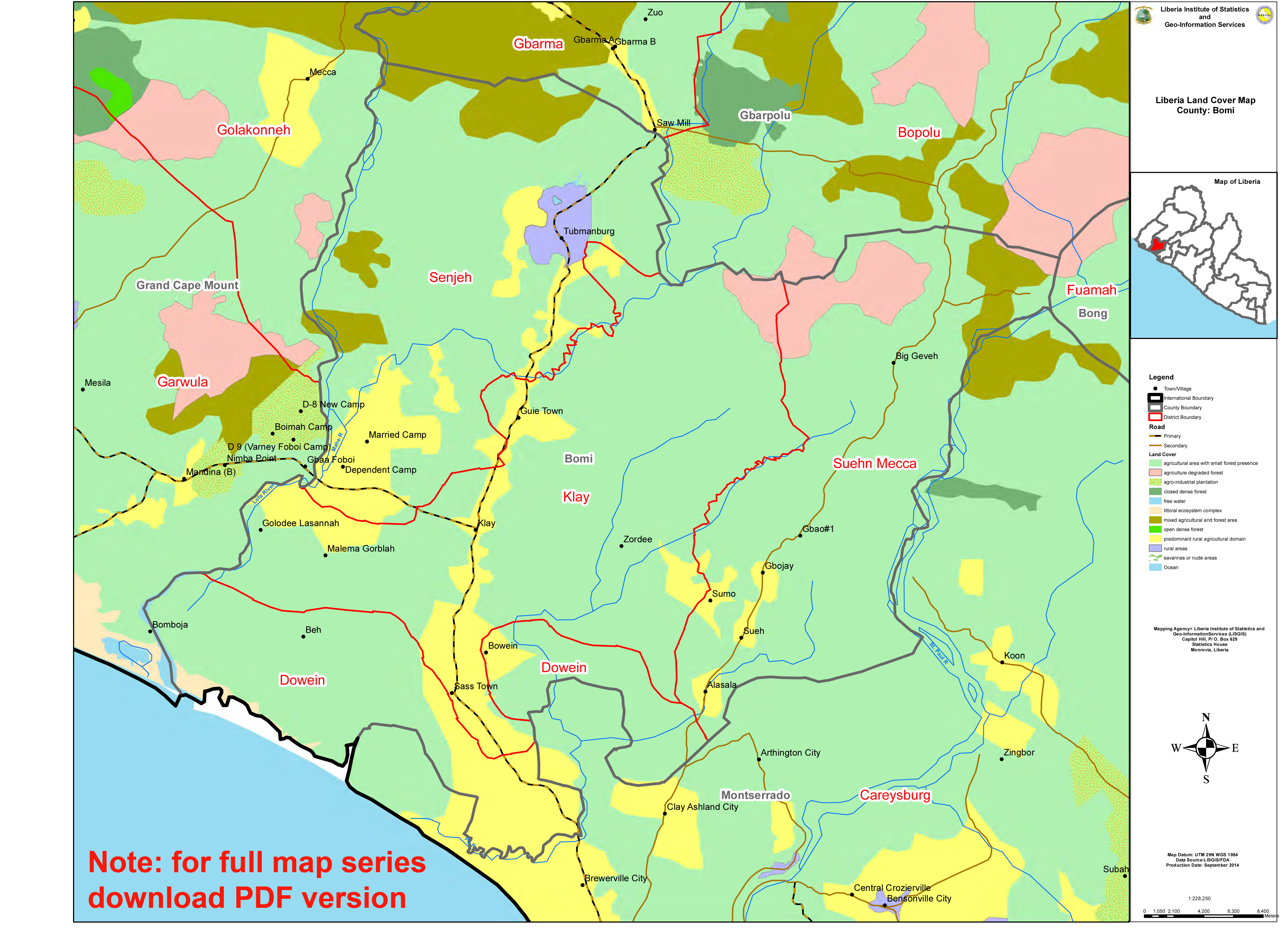
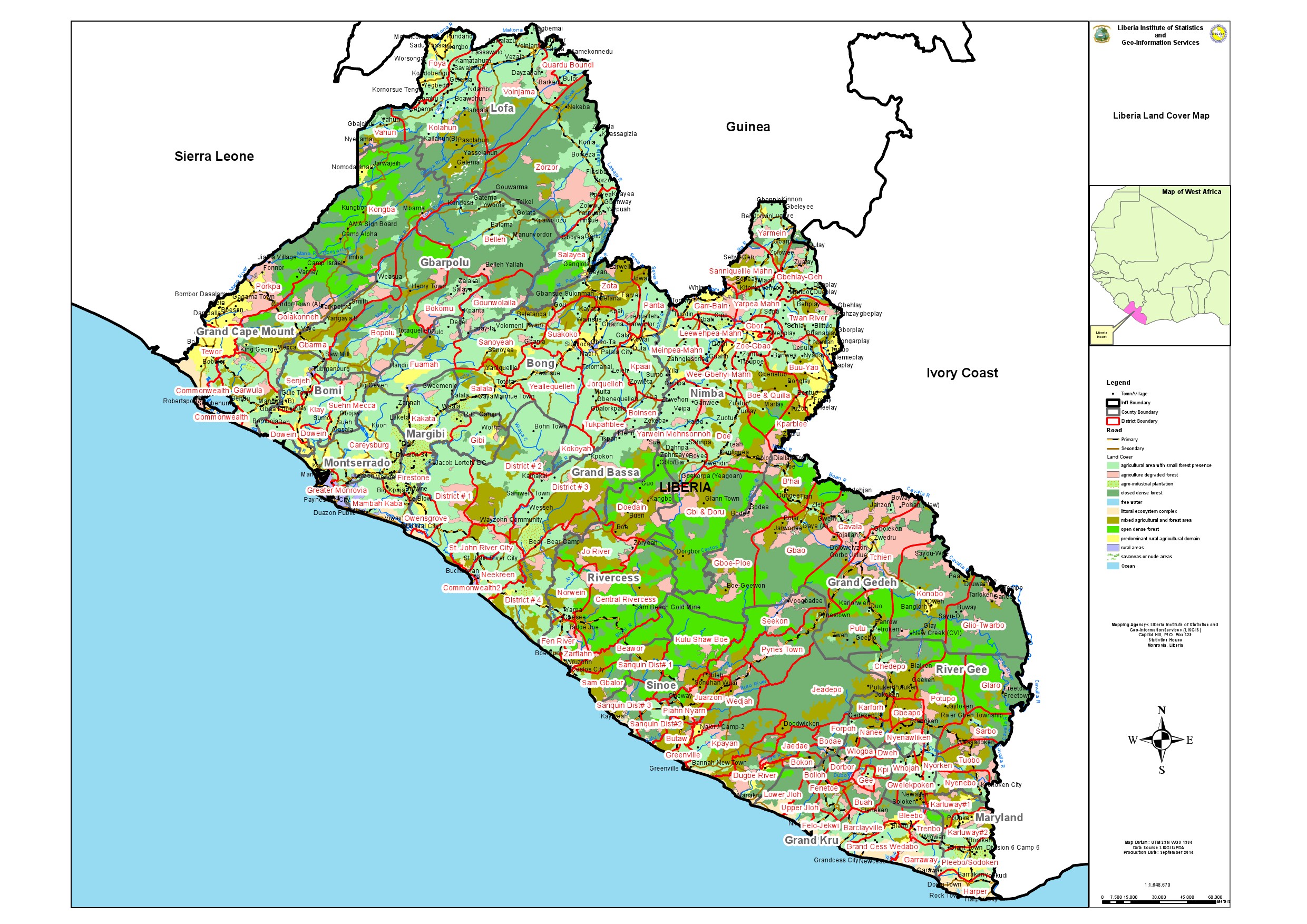
Liberia: Ebola Outbreak - Land Cover by County (A3)
Atlas of land cover by county. Produced by LISGIS -
-
-
Liberia: Ebola Outbreak - Health Facilities per County
Atlas of Health Facilities per County -

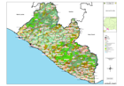
Liberia: Ebola Outbreak - Administration Boundaries per County
Atlas of Administration Boundaries per County produced by Liberia Institute of Statistics and Geo-information Services (LISGIS) -

Ebola Outbreak - Quality of Core Services: Laboratories (as of 15 Sept 2014)
Map shows the status/quality of laboratories as of 15 September (WHO/ OCHA), and Reported Cumulative Cases as of 10 September (WHO) by Administrative levels 1 or 2 . If your... -

Ebola Outbreak - Quality of Core Services: Referral Centres (as of 15 Sept 2014)
Map shows the status/quality of Referral Centres as of 15 September (WHO/ OCHA), and Reported Cumulative Cases as of 10 September (WHO) by Administrative levels 1 or 2 . If your... -
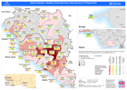
Ebola Outbreak - Quality of Core Services: Ebola Treatment Centres (as of 19 ...
Map shows the status/quality of of Emergency Treatment Centres as of 19 September (WHO/ OCHA), and Reported Cumulative Cases as of 10 September (WHO) by Administrative levels 1... -

Ebola Outbreak - Quality of Core Services: Safe Burial (as of 15 Sept 2014)
Map shows the status/quality of Safe Burial as of 15 September (WHO/ OCHA), and Reported Cumulative Cases as of 10 September (WHO) by Administrative levels 1 or 2 . If your... -
Ebola Outbreak - Quality of Core Services: Social Mobilisation (as of 15 Sept...
Map shows the status/quality of Social mobilisation as of 15th September, and Reported Cumulative Cases as of 1st September by Administrative levels 1 or 2 . If your... -

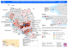
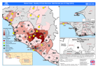
Ebola Outbreak - Humanitarian Presence (as of 17 Sept 2014)
This map shows the number of organisations (UN Agencies, NGO and states structures) working in regions affected by the Ebola outbreak (as of 17th September). -

Ebola Outbreak - Quality of Core Services: Sub-National Coordination (as of 1...
Map shows the status/quality of Sun-National Coordination as of 15 September (WHO/ OCHA), and Reported Cumulative Cases as of 10 September (WHO) by Administrative levels 1 or 2... -
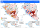
Ebola Outbreak - Quality of Core Services: Overview (as of 15 Sept 2014)
Map shows the status/quality of core services as of 15 September (WHO/ OCHA), and Reported Cumulative Cases as of 10 September (WHO) by Administrative levels 1 or 2. -

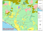
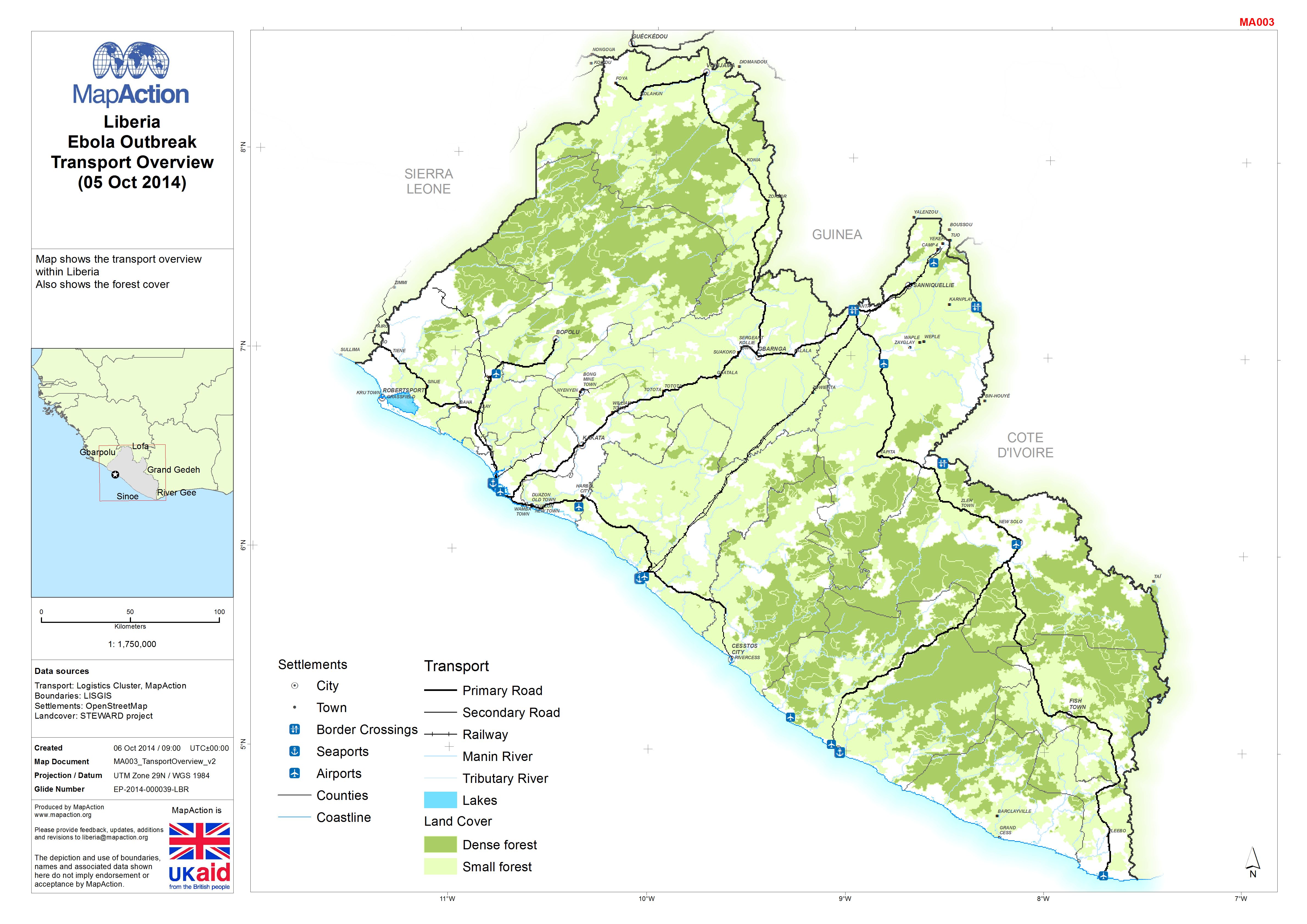
Liberia: Ebola Outbreak - Transport Overview(05 Oct 2014)
Map shows transport overview within Liberia. Also shows the forest cover. -
Liberia: Ebola Outbreak - Transport Overview(as of 22 Sep 2014)
Map shows the transport overview within Liberia. -
Ebola Outbreak - Quality of Core Services: Safe Burials (as of 3 Sept 2014)
Map shows the status/quality of Safe Burials as of 3rd September, and Reported Cumulative Cases as of 1st September by Administrative levels 1 or 2 . If your... -

Ebola Outbreak - Quality of Core Services: Social mobilisation (as of 3 Sept ...
Map shows the status/quality of Social mobilisation as of 3rd September, and Reported Cumulative Cases as of 1st September by Administrative levels 1 or 2 . If your...