-

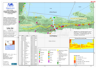
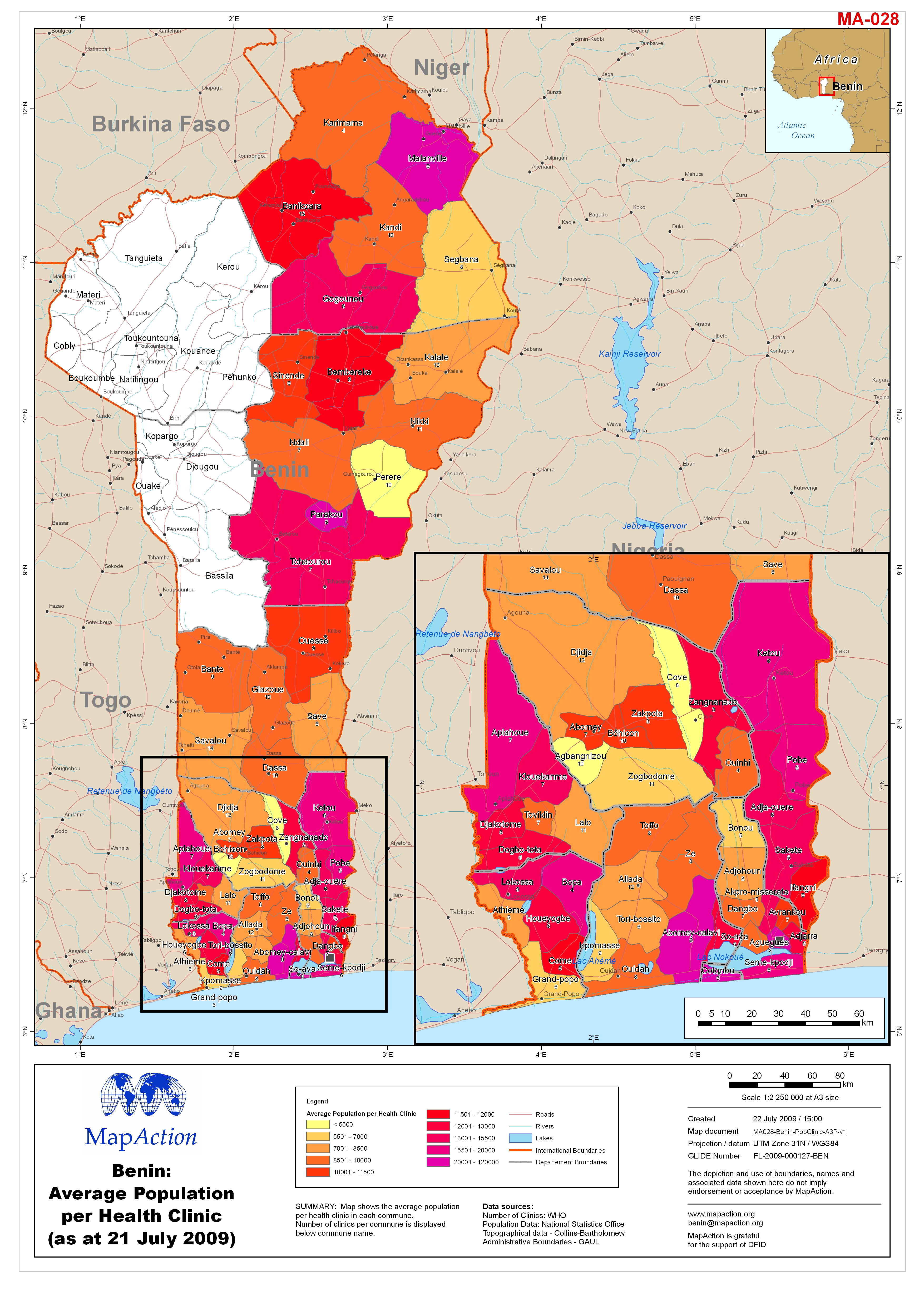
Benin: Average Population per Health Clinic (as at 21 July 2009)
Map shows the average population per health clinic in each commune. Mumber of clinics per commune is displayed below commune name. -

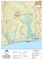
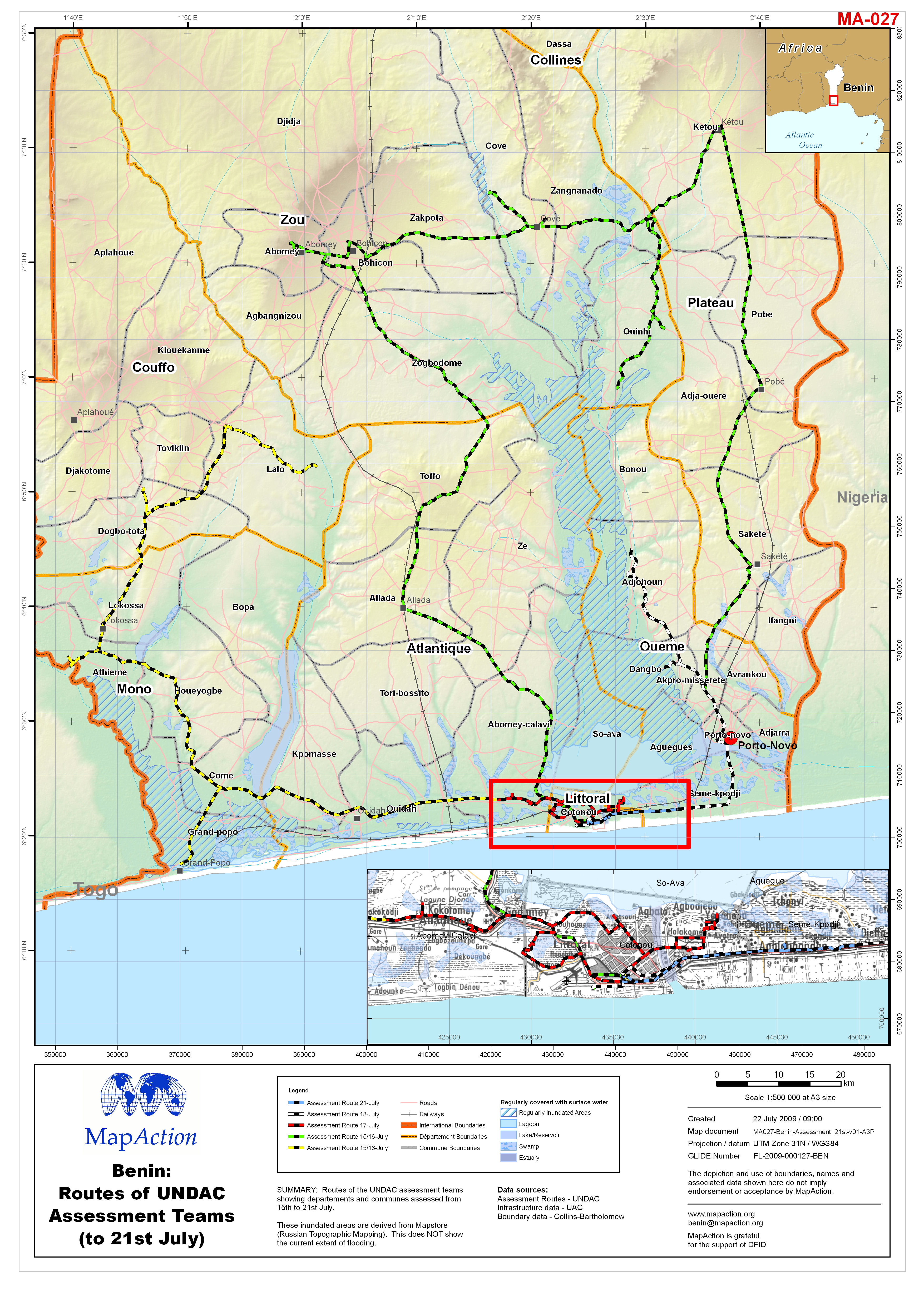
Benin: Routes of UNDAC Assessment Teams (to 21st July)
Routes of the UNDAC assessment teams showing departements and communes assessed from 15th to 21st July. These inundated areas are derived from Mapstore (Russian Topographic... -

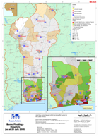
Benin: Flooding - Affected Communes (as at 20 July 2009)
Map shows the affected communes categorised by type of damage and assessment. -
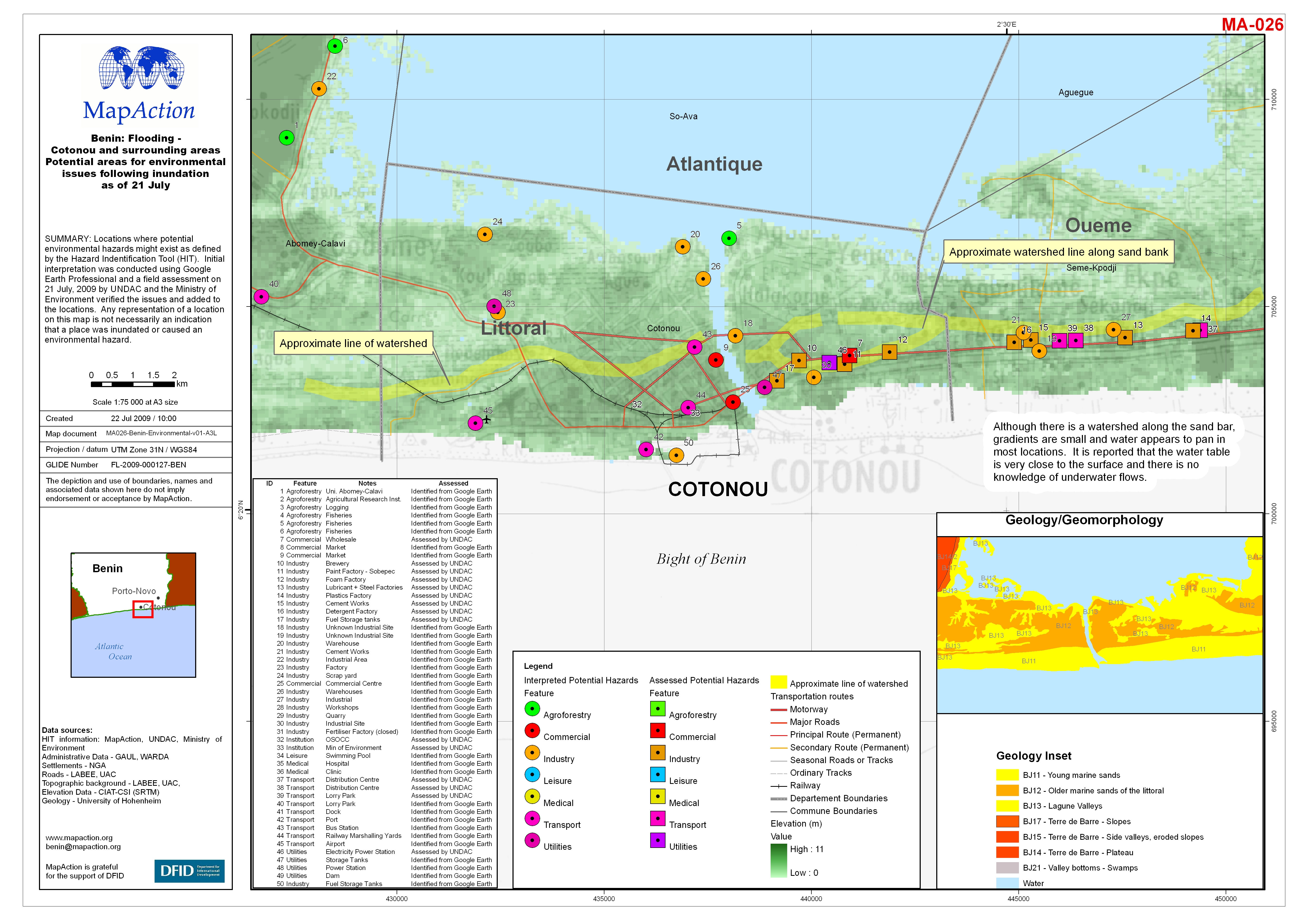
Benin: Flooding - Cotonou and surrounding areas Potential areas for environme...
Locations where potential environmental hazards might exist as defined by the Hazard Indentification Tool (HIT). Initial interpretation was conducted using Google Earth... -
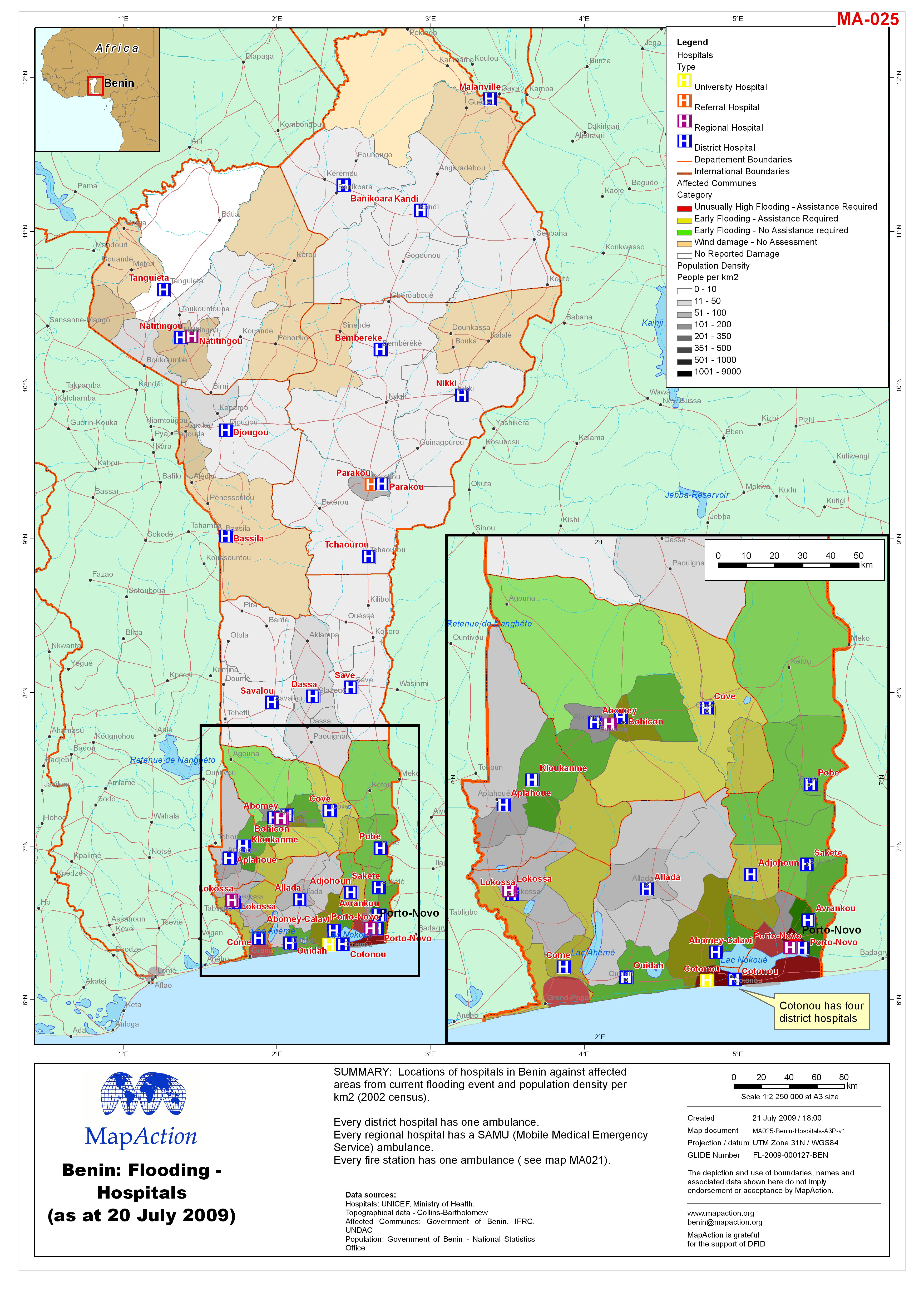
Benin: Flooding - Hospitals (as at 20 July 2009)
Locations of hospitals in Benin against affected areas from current flooding event and population density per km2 (2002 census). Every district hospital has one ambulance. -

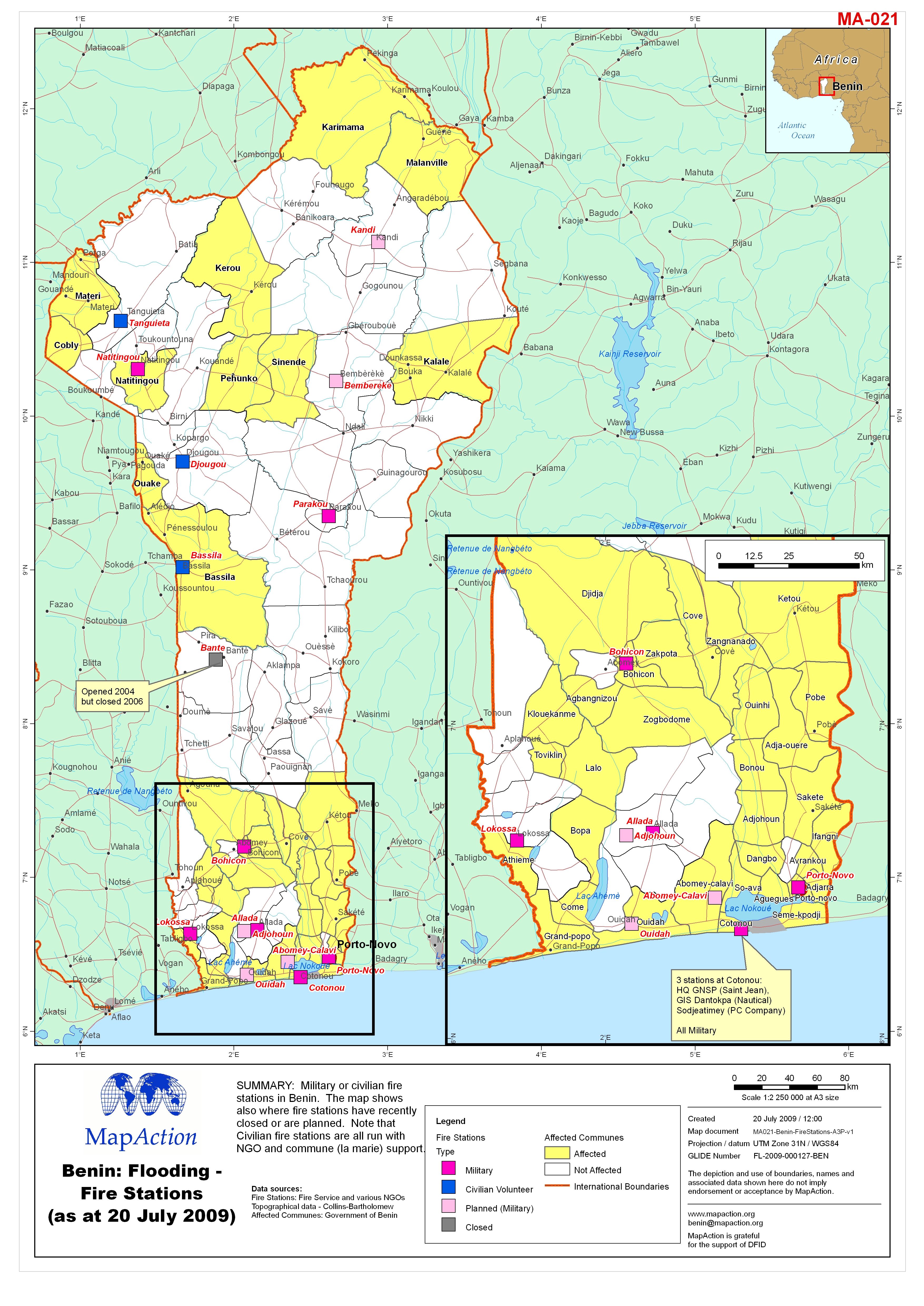
Benin: Flooding - Fire Stations (as at 20 July 2009)
Military or civilian fire stations in Benin. The map shows also where fire stations have recently closed or are planned. Note that Civilian fire stations are all run with NGO... -
Benin: Routes of UNDAC Assessment Teams (to 19th July)
Routes of the UNDAC assessment teams showing departments and communes assessed from 15th to 19th July. These inundated areas are derived from Mapstore (Russian Topographic... -

Benin: Flooding - Northern Benin Population Density (per km2) (data as at 2002)
Map shows population density, (population per km2); based on 2002 statistics. -

Benin: Flooding - Northern Oueme Departement orientation map
Orientation map displaying departements boundaries, settlements and UAC topographic background. The inundated areas are derived from Mapstore (Russian Topographic Mapping). This... -

Benin: Flooding - Southern Oueme Departement orientation map
Orientation map displaying departements boundaries, settlements and UAC topographic background. The inundated areas are derived from Mapstore (Russian Topographic Mapping). This... -

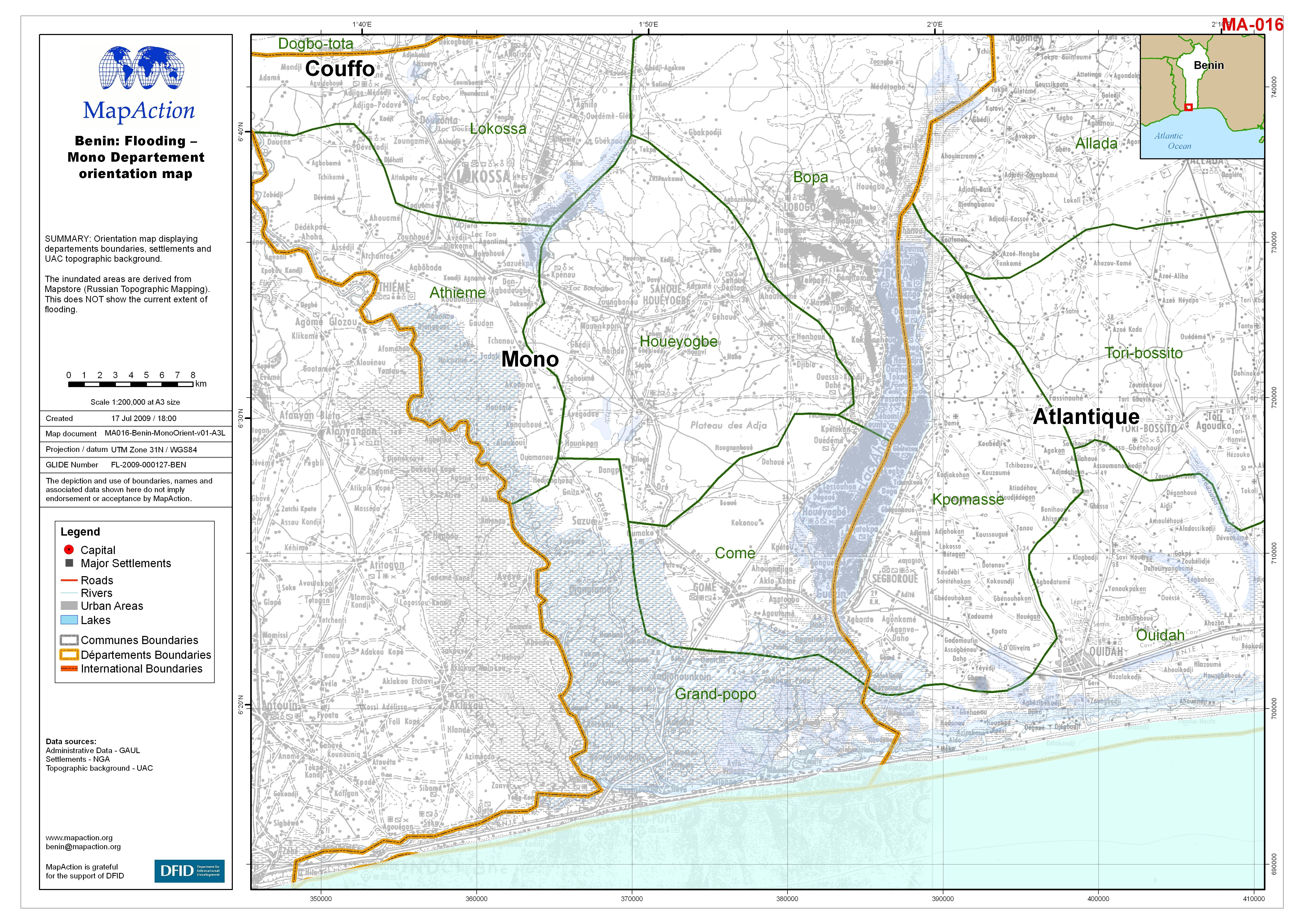
Benin: Flooding - Mono Departement orientation map
Orientation map displaying departements boundaries, settlements and UAC topographic background. The inundated areas are derived from Mapstore (Russian Topographic Mapping). This... -

Benin: Routes of UNDAC Assessment Teams (to 17th July)
Routes of the UNDAC assessment teams showing departments and communes assessed from 15th to 17th July. These inundated areas are derived from Mapstore (Russian Topographic... -
Benin: Flooding - Telephone Assessments conducted by CARE up to 16 July 2009
Telephone Assessments conducted by CARE up to 16th July, 2009. Map shows localities reporting various problems; Water, sanitation, infrastructure, health and food issues. In... -

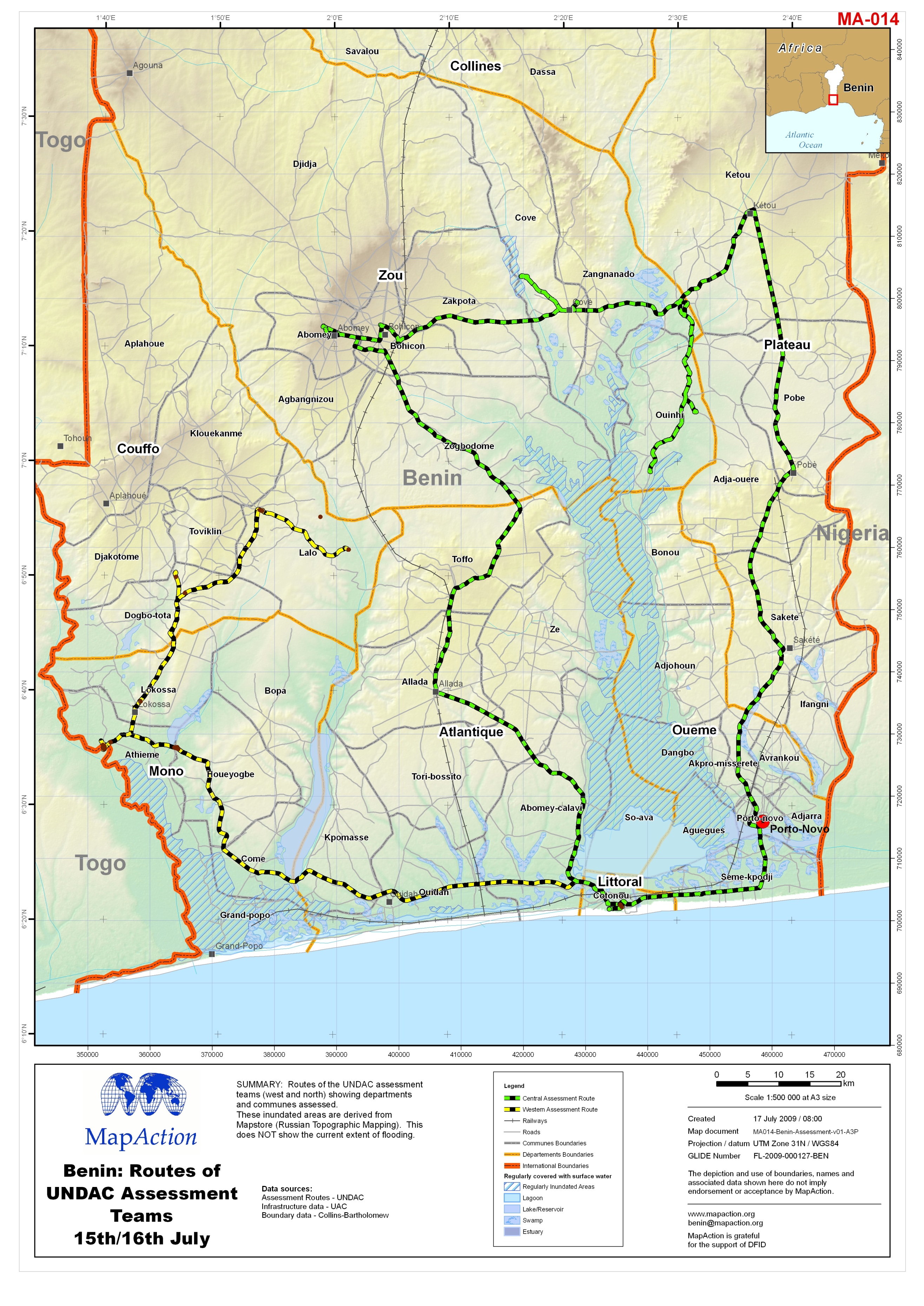
Benin: Routes of UNDAC Assessment Teams 15th/16th July
Routes of the UNDAC assessment teams (west and north) showing departments and communes assessed. These inundated areas are derived from Mapstore (Russian Topographic Mapping).... -

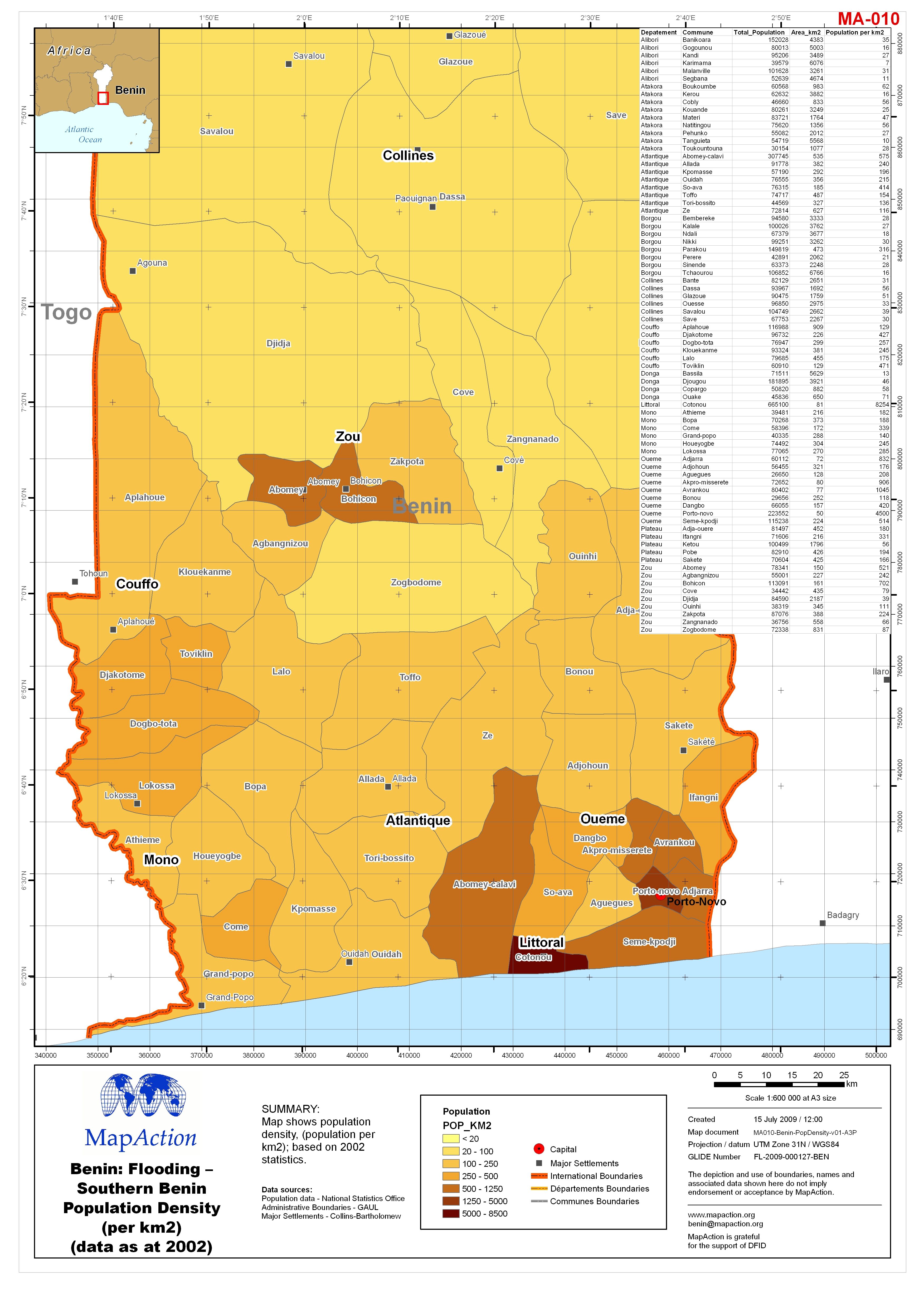
Benin: Flooding - Southern Benin Population Density (per km2) (data as at 2002)
Map shows population density, (population per km2); based on 2002 statistics. -

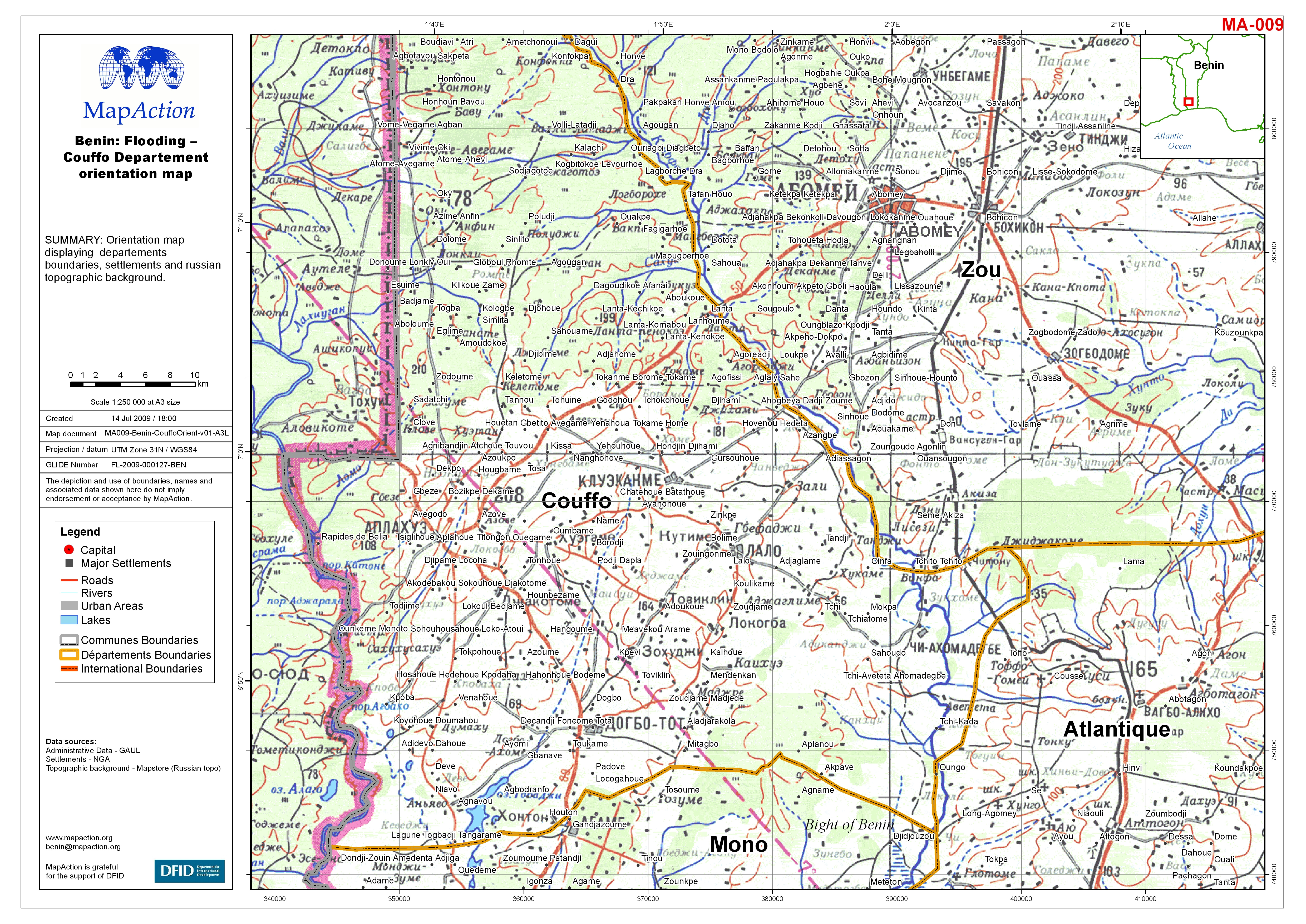
Benin: Flooding - Couffo Departement orientation map
Orientation map displaying departements boundaries, settlements and Russian topographic background. -
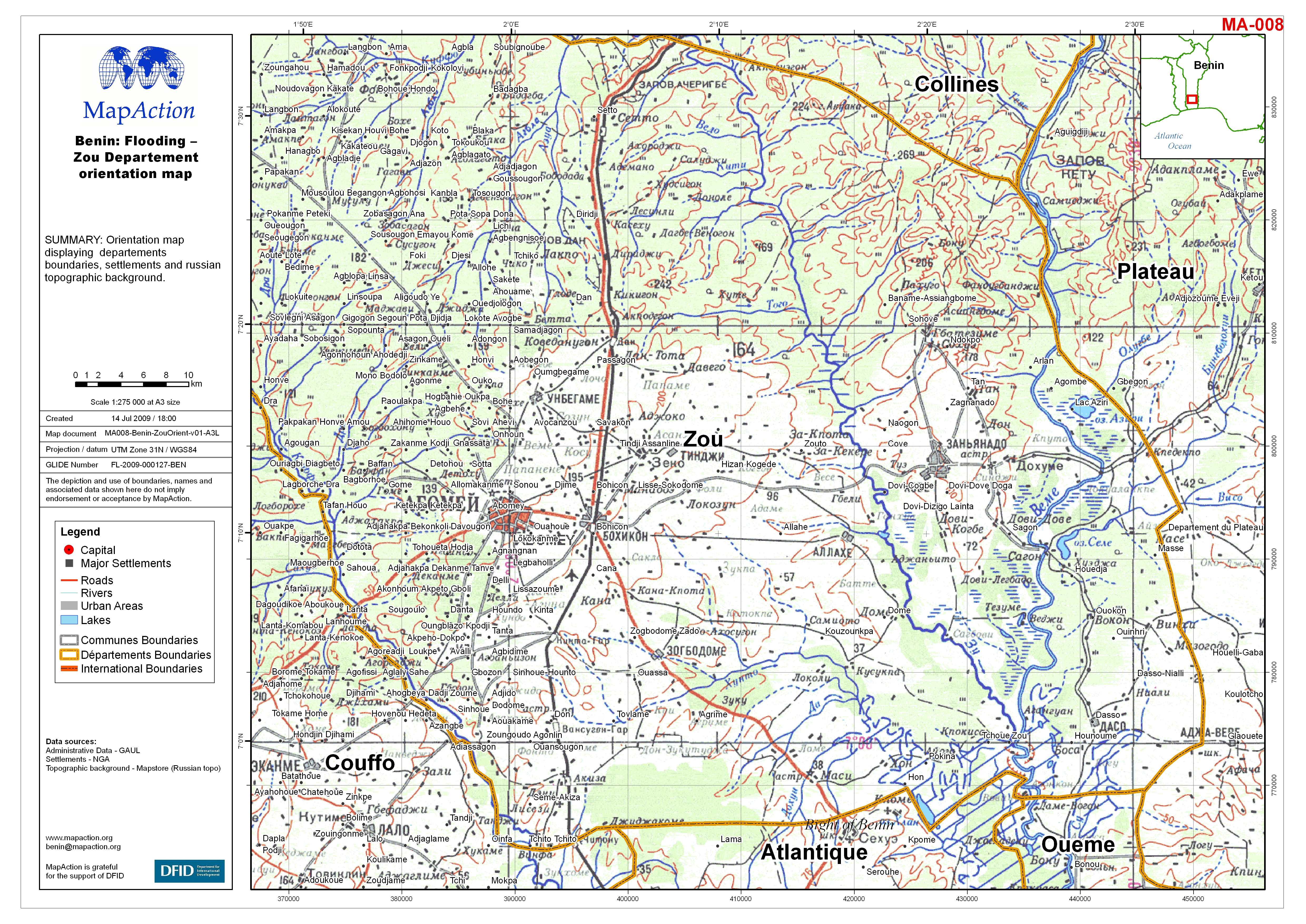
Benin: Flooding - Zou Departement orientation map
Orientation map displaying departements boundaries, settlements and Russian topographic background. -
Benin: Flooding - Littoral, Atlantique and Oueme Departements: Villages Asses...
Villages and other localities reported as assessed by Government of Benin by 8 July 2009, and International Federation for Red Cross and Red Crescent (IFRC) by 10 July 2008. Two... -

Benin: Flooding - Mono Departement orientation map
Orientation map displaying departements boundaries, settlements and russian topographic background. -

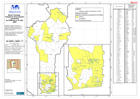
Benin: Flooding - Administrative Areas & Topography
This orientation map shows the administrative boundaries, to communes level, with a background of russian 1:500,000 topographic mapping.